Fiasco in the Farmer’s Field

So there we were, a whole bunch of storm chasers, stuck in the middle of a flooded field north of Roscoe, South Dakota. Why were we there? Believe me, it wasn’t for the beer.

It was Saturday evening, May 22, 2010. A few minutes earlier, caught down a dead-end road with a snake’s nest of tornadoes breathing down our neck, we had taken last-ditch, evasive action by bailing south down the fence line, and finally, cut off by standing water, out into the field until we could go no farther. Then we braced ourselves and rode out the storm.

It was the closest call I can imagine experiencing without going airborne. A funnel materialized right in our midst, barely missing one of the vehicles. Rear-flank downdraft winds in the neighborhood of 100 mph blasted us. But in the end the storm moved off, having destroyed an old barn north of where the road had dead-ended but leaving us none the worse.

Except that now we were stuck in a rain-soaked, flooded field. And a new set of problems began to emerge.

Most of the guys in the other vehicles were people whom I had never or only recently met, but whose names I was well acquainted with. Two of them, Bart Comstock and Mike Umscheid, became the heroes of the day–the only guys who managed to make it out of that morass with their vehicles and subsequently pushed themselves well beyond exhaustion to make sure that every last man-Jack of the rest of us was accounted for and found lodging for the night.

Now, I’ll be the first to say that I probably don’t have all the details straight. It was a complex scenario, and to this day I still don’t know who all was involved. To the best of my understanding, though, Bart notified local authorities that a bunch of chasers were stuck out in a field, and the authorities notified the property owner, and the property owner was majorly pissed.

Back in the field, the first news we got–in our vehicle, anyway–was that three tractors were on the way to pull us out. By this time, the sun had set and it was dark, with lightning from other storms in the area flickering all around. I didn’t relish the thought of spending the rest of the night out in the middle of nowhere, so I was glad to hear that help was on the way. But that hope soon got dashed when we learned that the farmer was mad as hell at us and had no intention of helping us out, or, for that matter, of letting us leave.

This just flat-out blew my mind. From my perspective at that point, the man had damn near gotten us killed by plowing over our escape route, and now he was angry at us for fleeing across his field in order to preserve our lives. What were we supposed to do, sit there and let the tornadoes hit us? If we hadn’t taken the action that we did, chances were good that we’d have wound up on his property anyway as a bunch of crumpled vehicles and injured or dead chasers. It amazed me that anyone would have such little regard for human lives.

Those were my thoughts at the time. In retrospect, I think the farmer simply didn’t understand what we had been up against, any more than I and my fellow chasers understood what he was up against. Seeing through another person’s eyes doesn’t come easily. We are hampered by the sheer force of our own perspective. We take limited information, process it through the filter of personal experience, and draw swift conclusions colored by self-interest without considering what other pieces of the puzzle may exist.

This particular puzzle was a large one and I’ll never know all the pieces that were involved. I just know there were a lot.

There were us chasers who, having survived the tornadoes, found that our ordeal was far from over. There was the farmer, who had just gotten word that a bunch of crazy storm chasers were stuck out in his field after driving across his newly planted wheat. There was a local sheriff with a lot on his plate after a large tornado had plowed through his area, who–partly due to an infuriating experience with a storm chaser earlier in the evening–used his authority in a way that, in my opinion, tarnished his badge.

There were also some drunken farmers who, as I understand it, tore an antenna off one of the chasers’ vehicles and tried to pick a fight with its owner. There were other locals who showed understanding, goodwill, and helpfulness toward both the farmer and the chasers. There was one from our number who got arrested on the pretext of a ridiculous charge, and there were the deputies who treated him with courtesy and interest during his brief detention at the Ipswich jail. There were lots of people, each with a story to tell and each bringing a unique point of view to the mix.

It’s never wise to jump to conclusions in such cases. It takes time for details to filter in and the big picture to emerge, or at least a better view of it than a person is likely to get at first glance.

Thanks to Bart and Mike, all of us eventually made it out of the field that night. We had to leave the vehicles behind, but there’s a point where nothing else can be done and all a body wants is to get some rest. Through a mix-up I won’t even try to explain, I wound up separated from my group and found myself trudging across the field with Ben Holcomb, Adam Lucio, and Danny Neal. Lugging as much of our belongings with us as we could, we walked along the fence line–now a slippery mud pit strewn with intermittent post holes–up to the road. A pickup truck was waiting there. We threw our stuff into the back and clambered aboard.

The driver of the truck turned out to be the land owner. Whatever his mood may have been, he was decent enough to give us a ride partway up the road. At that point, we were delayed by a bottleneck farther up, so we got a chance to talk with the farmer and with another of his neighbors who walked up to the vehicle.

Ben and Adam did a good job of engaging these guys. I was in no conversational mood myself, but I listened and heard enough to conclude that this had been a terrible spring for South Dakota farmers. A massive amount of El Nino rains had flooded large swaths of cropland, delaying or altogether scuttling planting in some sections. Considering how hard these folks work to make a living and what a tough deal this year was handing them, I began to understand something of how the land owner might have felt: a hellish winter, ruinous flooding, tornadoes blowing through and taking out the power grid, and now this–a bunch of crazy chasers stuck in his field after tearing through his wheat.

The farmer drove us partway back up CR 130, then left us to fend for ourselves. Fortunately, his neighbor in the pickup ahead of us was willing to give us a lift. He was a decent man, sympathetic toward both his fellow farmer and toward us. A storm spotter himself, he seemed to understand what we’d been up against. He told us that if it had been any other year, we’d have had no problem, but that this year, many side roads in the area were impassable due to the rain.

The man dropped Ben, Adam, Danny, and me off at a Shell station in Ipswich. Power was out in the town thanks to the tornadoes, which had taken down high-tension lines back down the road in Bowdle.

I had been in touch with one of my chase partners, Bill Oosterbaan, via cell phone, and I gave him another call to find out his status. He, his brother Tom, and Mike Kovalchick were all with Bart, who had run out of gas en route to Aberdeen. Like us, they were stranded. Fortunately, Mike Umscheid had gone to get gas for them, so it was just a matter of waiting till he returned. Then Bart would drop off my buddies at a hotel and come for us.

The time now was something like 1:00, and from the sound of it, we had a few hours to kill before Bart would show up. There was nothing to do but hunker down and wait. My legs were coated with mud from trying to push out Mike’s vehicle earlier in the evening, and my tennis shoes were little more than big, wet clumps of black clay. The other guys weren’t quite such a mess as I was, but they were wearing T-shirts and it was cold out.

It was at this point that the sheriff drove up to check us out. When he learned that we were some of the storm chasers who had gotten stuck in the field, he smiled one of those smiles that tells you the person behind it is not your friend. “I’ve been looking for you guys,” he said. “I need to see your driver’s licenses.”

(To be continued.)
Getting Set for a Backyard Chase

Last night’s bow echo certainly didn’t disappoint. I first spotted it in Wisconsin when it was a supercell putting down tornadoes near Milwaukee and thought, “That sucker is headed straight at us.” I watched as it hit Lake Michigan, maintaining rotation for a while but eventually morphing into a big bow echo. But what a bow echo! That northern book-end vortex really cranked as it moved inland and into the Kent County area. For a few scans of the radar, it looked like a small hurricane. Little wonder that it generated tornado warnings with a few reports of sightings by spotters and law enforcement.

But nasty a storm as it was, last night’s weather was probably just a prelude to what today, Wednesday, has in store. Veering surface winds taken into account, this could nevertheless be a tornado day for Michigan. The NAM shows a 70 knot 500 mb jet max blowing through the area, CAPE over 2,500, 70 degree dewpoints, and STPs to make a chaser happy.

Looks like it’ll be Kurt Hulst and me on this one. Bill is heading to Lansing to hang out with Ben Holcomb, and I think Mike Kovalchick is going to join them. That’s a good place to start. I’m not sure that I want to play quite so far east early in the game tomorrow, but I’m sure we’ll wind up well east of Lansing before the day is done. As of the 00Z run, it looks like the H5 will be nosing into West Michigan around 18Z, kissing an intensifying LLJ. Kurt and I had talked about setting up shop around I-96 and M-66. We’ll see what the 6Z run has to show us and play it from there.

At last, a Michigan chase with some real potential! And while I had guessed that storm motions would be in the neighborhood of 40 knots, the NAM decelerates them to a very manageable 25 knots. This could prove to be an interesting day, though I hope not a terribly impactful one. Southern Michigan has a lot of population centers, and I inevitably have mixed feelings whenever I see a big weather event shaping up for this area.

May 22, 2010, South Dakota Chase: On the Road

After catching breakfast in Chamberlain, South Dakota, we–Mike Kovalchick, Bill and Tom Oosterbaan, and I–are heading west along I-90. We have plenty of time to determine where we want to camp out this afternoon until storms start firing later today.

If you’ve kept track of the present weather system, then you know that it has had a number of serious detractors, the chief one being a nasty cap. To complicate things, the NAM and GFS were initially wildly at odds. But Thursday night the GFS began to agree with the NAM on opening up an uncapped corridor from Nebraska into South Dakota, and from there the model forecasts became progressively more promising. The SPC Day One Convective Outlook now shows a 10 percent  possibility of tornadoes extending from the Nebraska border north through the Dakotas. The hub of the activity will most likely be in South Dakota, which means that we are sitting in the catbird seat.

It feels great to finally get back out on the road and chase the Plains again. I’ve missed the big action so far this spring. This setup may not be the year’s big event, but it shows promise, and it coincides with a time when I’ve got the funds to go after it. Whether or not we see a tornado today–and tomorrow, and maybe Monday, as we follow this system’s evolution–we’ll at least see some nice storms. And, I might add, some beautiful countryside. It’s been a few years since I’ve been in South Dakota. It’s good to be back!

Another Lower Great Lakes Storm System

The eastern Great Lakes looks to be once again under the gun for severe weather, with a setup that looks reminiscent of last week’s, albeit with some variations. The low is weaker but there’s juicier moisture, helicities may integrate a little better with instability, and it seems to me that the 500 mb jet is better positioned. Once again, though, surface winds veer rapidly south of the warm front, so while the mechanism for another batch of supercells is in place, the tornado potential is less certain. The SPC convective outlook shows a 5% tornado risk. That seems about right, though maybe part of the area will get upgraded this afternoon.

After looking at the morning NAM and RUC, I once again like the area south of Toledo. Bowling Green was my initial target last week, and I’d pick it again this week if I wanted to drive that far. If I chase storms at all today, I may just wind up dropping south down 131 toward the warm front, depending.

By the way, I haven’t posted a thing about Monday’s tornado fest in Oklahoma and I probably should. I wasn’t there to experience it, but my buddies Kurt Hulst and Bill Oosterbaan teamed up for it, and Ben Holcomb made it down there as well, and everyone scored. Bill tells me that he and Kurt saw seven confirmed tornadoes.

Me, I watched the outbreak unfold on the radar and ate my heart out. It really was a heck of a thing to observe. The SRVs were jaw-dropping, and I saw one low-level Delta velocity of 177 knots. Those storms were the real deal, and a huge contingent of chasers was on them. Among the highlights was the Wakita, OK, multi-vortex that a number of chasers captured on video. The clips I’ve seen show what looks like a basketful of snakes dancing.

Unfortunately, five people died in the storms. If there’s anything positive that can be said about the loss of life, it’s that the paths of the storms through mostly rural areas no doubt kept casualties lower than they could have been. One supercell dropped tornadoes in Oklahoma City, and all it takes is one. But that’s better than multiple population centers getting hit by storms the intensity of Monday’s storms.

Monday’s Southern Plains Event

Lacking the cash to head west for tomorrow’s setup, the best I’m going to be able to do is gaze forlornly at the radar, gnash my teeth, and hope my buddies Bill, Kurt, and Mike are catching tornadoes and staying safe.

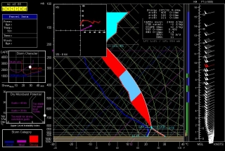
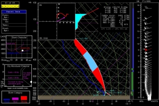
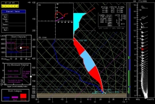
I’d be smart to not even look at the models, but a perverse part of human nature makes it hard for me not to. Out of curiosity, I’ve interrogated a few NAM 6Z forecast soundings from around southeast Kansas and northeast Oklahoma. I suppose the results are nothing new: plenty of moisture and CAPE, great shear and helicity, and a stout cap that lingers till evening, at which point the atmosphere looks primed for discrete, tornadic supercells to explode.

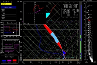
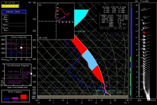
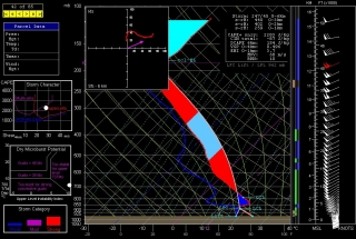
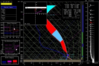
Most of the soundings shown here are for 23Z, but the one for Tulsa, shown above, is for 22Z, since the cap looks to minimize earlier there (21Z, not shown, also looks decent, with -46 J/kg CINH, up from -198 the previous hour). For KCNU (Chanute, KS), I’ve also shown the 00Z so you can compare the difference; and for Hutchinson, which at 525 1km SRH has the highest helicity value of the different soundings, and for Wichita, I’ve shown only the 00Z, since prior to that the cap looks pretty stout. Look below for all the soundings except Tulsa, and make sure you click on the images to enlarge them.

Beyond this, I’m not going to comment. To those who are out there on the Plains waiting for this setup to arrive and ripen, I wish you success and safety.

Chase Time! Bound for the Panhandle

Finally! First Great Plains storm chase of the year! As I write, Bill Oosterbaan, Mike Kovalchick, and I are headed west down I-70. In another 30 miles we’ll reach Kansas City; then it’s onward to Wichita, where we’ll overnight. Tomorrow morning we’ll take a look at the models, and then most likely make our way toward familiar territory in the northern Texas panhandle. It has been a couple years since I’ve been there; I can’t wait to see big storms moving over that landscape again.

I’m not going to write much tonight. I’m tired. Last night I got only got three or four hours of sleep, having stayed up till 3:00 a.m. to complete a writing project for a client. My updates will probably brief until I return Sunday. Tomorrow, Friday, and possibly Saturday will be pretty filled with chasing storms and all the pertaineth thereto. When I finally get back home, I hope to have a few great tornado and storm photos to share and an outstanding chase report to post. So stay tuned, campers. This is the first decent chase scenario of the year, and I am geeked to be going after it. Tornadoes, here I come!

45 Year Commemorative Event Planned for 1965 Palm Sunday Tornadoes

April 11 this year will mark the 45th anniversary of the second worst Midwestern tornado outbreak of modern times. The 1965 Palm Sunday Outbreak is noteworthy not so much for the number of tornadoes involved as for their violence and the number of fatalities they produced. Out of 38 “significant” (F2 or greater) tornadoes that occurred in six state over 11 hours, 19 were rated at F4 and two at F5. Going by NOAA’s death toll and adding to it one Iowa resident who died a month later from his injuries, 272 men, women, and children lost their lives in the storms.

One of the victims was Stevie Forsythe, the brother of my friend Debbie Forsythe-Watters. Debbie is the owner of a tornado memorial park that occupies the property where her childhood home in Dunlap, Indiana, just south of Elkhart, was swept away by F5 winds. To learn more about the park, check out my earlier post on the Dunlap tornado memorial, complete with photos.

Debbie is currently planning this year’s commemorative event, to be held on the date of the tornadoes: Sunday, April 11. If you take an interest in this historic and influential weather disaster, you may wish to attend the service. It will be held on the park grounds. The time has yet to be determined, but it will likely be in the late afternoon.

I will post more information as details are solidified.

RAOB and Other Weather Widgets

Some storm chasers pride themselves in being minimalists who have a knack for intercepting tornadoes without much in the way of gadgetry. Others are techies whose vehicles are tricked out with mobile weather stations and light bars. It’s all part of the culture of storm chasing, but the bottom line remains getting to the storms.

To my surprise, while I draw the line at gaudy externals, I’ve discovered that I lean toward the techie side. For me, storm chasing is a lot like fishing. Once you’ve bought your first rod and reel and gotten yourself a tackle box, you find that there’s no such thing as having enough lures, widgets, and whizbangs. You can take the parallels as deep as you want to. Radar software is your fish finder. F5 Data, Digital Atmosphere, and all the gazillion free, online weather maps from NOAA, UCAR, COD, TwisterData, and other sources are your topos. And so it goes.

A couple years ago I spent $300 on a Kestrel 4500 weather meter. It’s a compact little unit that I wear on a lanyard when I’m chasing. It weighs maybe twice as much as a bluebird feather, but it will give me temperature, dewpoint, wind speed, headwinds, crosswinds, wind direction, relative humidity, wet bulb temperature, barometric pressure, heat index, wind chill, altitude, and more, and will record trends of all of the above.

I use it mostly to measure the dewpoint and temperature.

Could I have gotten a different Kestrel model that would give me that same basic information for a third of the cost, minus all the other features that I rarely or never use? Heck yes. Nevertheless, I need to have the rest of that data handy. Why? Never mind. I just do, okay? I need it for the same reason that an elderly, retired CEO needs a Ferrari in order to drive 55 miles an hour for thirty miles in the passing lane of an interstate highway. I just never know when I might need the extra informational muscle–when, for instance, knowing the speed of crosswinds might become crucial for pinpointing storm initiation.

If I lived on the Great Plains, with Tornado Alley as my backyard, I might feel differently. But here in Michigan, I can’t afford to head out after every slight-risk day in Oklahoma. Selectivity is important. I guess that’s my rationale for my preoccupation with weather forecasting tools, along with a certain vicarious impulse that wants to at least be involved with the weather three states away even when I can’t chase it. Maybe I can’t always learn directly from the environment, but I can sharpen my skills in other ways.

Does having all this stuff make me a better storm chaser? No, of course not. Knowledge and experience are what make a good storm chaser, and no amount of technology can replace them. Put a $300 Loomis rod in the hands of a novice fisherman and chances are he’ll still come home empty-handed; put a cane pole in the hands of a bass master and he’ll return with a stringer full of fish. On the other hand, there’s something to be said for that same Loomis rod in the hands of a pro, and it’s not going to damage a beginner, even if he’s not capable of understanding and harnessing its full potential. Moreover, somewhere along the learning curve between rookie and veteran, the powers of the Loomis begin to become apparent and increasingly useful.

Now, I said all of that so I can brag to you about my latest addition to my forecasting tackle box: RAOB (RAwinsonde OBservation program). This neat little piece of software is to atmospheric soundings what LASIK is to eye glasses. The only thing I’ve seen that approaches it is the venerable BUFKIT, and in fact, the basic RAOB program is able to process BUFKIT data. But I find BUFKIT difficult to use to the point of impracticality, while RAOB is much easier in application, and, once you start adding on its various modules, it offers so much more.

RAOB is the world’s most powerful and innovative sounding software. Automatically decodes data from 35 different formats and plots data on 10 interactive displays including skew-Ts, hodographs, & cross-sections. Produces displays of over 100 atmospheric parameters including icing, turbulence, wind shear, clouds, inversions and much more. Its modular design permits tailored functionality to customers from 60 countries. Vista compatible.

–From the RAOB home page

The basic RAOB software arrived in my box a couple weeks ago courtesy of Weather Graphics. It cost me $99.95 and included everything needed to customize a graphic display of sounding data from all over the world.

I quickly realized, though, that in order to get the kind of information I want for storm chasing, I would also need to purchase the analytic module. Another $50 bought me the file, sent via email directly from RAOB. I downloaded it last night, and I have to say, I am absolutely thrilled with the information that is now at my disposal.

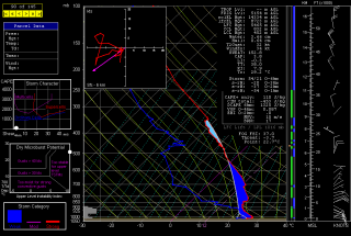
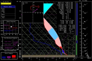
Here is an example of the RAOB display, including skew-T/log-P diagram with lifted parcel, cloud layers, hodograph, and tables containing ancillary information. Click on the image to enlarge it. The display shown is the severe weather mode, with the graphs on the left depicting storm character, dry microburst potential, and storm category. (UPDATE: Also see the more recent example at the end of this article.)

The sounding shown is the October 13, 2009, 12Z for Miami, Florida–a place that’s not exactly the Zion of storm chasing, but it will do for an example. Note that the negative area–that is, the CIN–is shaded in dark blue. The light blue shading depicts the region most conducive to hail formation. Both are among the many available functions of the analytic module.

The black background was my choice. RAOB is hugely customizable, and its impressive suite of modules lets you tailor-make a sounding program that will fit your needs beautifully. Storm chasers will want to start with the basic and analytic modules. With that setup, your $150 gets you a wealth of sounding data on an easy-to-use graphic interface. It’s probably all you’ll ever need and more–though if you’re like me, at some point you’ll no doubt want to add on the interactive and hodo module.

And the special data decoders module.

Oh yeah, and the turbulence and mountain wave module. Gotta have that one.

Why?

Never mind. You just do, okay?

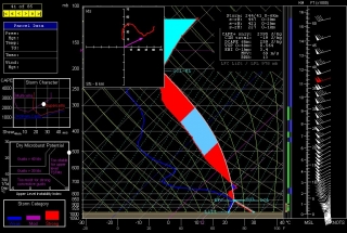
ADDENDUM: With a couple storm seasons gone by since I wrote the above review, I thought I’d update it with this more timely image. If you’re a storm chaser, you’ll probably find that what the atmosphere looked like in May in Enid, Oklahoma, is more relevant to your interest than what it looked like in Miami in October.

COD Severe Weather Symposium

The College of DuPage will host its fourth severe weather conference in Downer’s Grove, IL, on Thursday, November 5, through Saturday, November 7. At $220 a pop for non-students, it’s a pricey proposition. But considering its proximity, Great Lakes chasers may want to invest their shekels. I’ve attended two conferences hosted by Paul Sirvatka et al some years back, and they were very worthwhile. With its cast of preeminent presenters, and topics that include the preliminary findings of Vortex 2, this year promises to be particularly rewarding.

According to the FAQ on the symposium website, “This conference is intended to present the latest in severe weather meteorology to a diverse group of severe weather professionals and students. National conferences present some of this material but time contraints do not allow for a detailed look into the state of the science.”

In the words of COD:

The conference is intended for professional operational and research meteorologists, upper-level undergraduate and graduate students of atmospheric science, storm chasers, severe weather spotters and severe weather enthusiasts. We assume that attendees will have some understanding of severe weather meteorology in order to receive maximum benefit from the severe weather sessions. The focus of the conference is primarily on understanding the latest techniques for severe weather forecasting, the use of meso-scale and storm-scale modelling, physical processes leading to the development of supercells and tornadoes and the effective use of remote sensing in severe thunderstorm evolution and behavior.

This symposium will also highlight some of the preliminary results of VORTEX II.

Rooms at the DoubleTree Hotel and Suites, where the conference will be held, are available for $95 per night and will accommodate four persons.

So there you have it. If you can afford the hotel prices and the cost of the conference, which includes an evening banquet, then this is one event you’ll want to make. I’m contemplating my cash flow, holding my breath, and getting set to register.

Guest Blog: Storm Chaser Andrew Revering on How to Forecast Northwest Flow Events

Regarding tornado potential…with storms moving southeast or even south in some cases, you have to keep in mind that the storm-relative inflow will have to shift in order to maintain a good, dry updraft and support supercellular structure.

Welcome to the first guest post in my new, improved Stormhorn.com blog! I’m pleased to feature Andrew Revering sharing his insights on forecasting northwest flow chase scenarios. Northwest flow seldom produces severe weather; however, some noteworthy tornadoes have occurred in northwest flow. I’m delighted to have Andy share his knowledge about how to forecast the rare chaseworthy setups.

Andy is the proprietor of Convective Development, Inc., and the creator of the unique, enormously powerful F5 Data forecasting data feed and software. A meteorology student both privately and in educational institutions for his whole life, Andy has been a storm chaser for 15 years, four of which he served as a contract storm chaser for KSTP, an ABC-TV affiliate in Minneapolis. Andy started writing weather software in 1996 as a high school senior, developing such programs as AlertMe, APRWeather, WarnMe, StormGuide, AlertMe Pro, SkyConditions, and F5 Data. His current projects include F5 App, F5 Maps, and CellWarn.

During the nearly three years that I’ve used Andy’s F5 Data, I’ve been impressed not only with the power of the product, but also with the knowledge, friendliness, and helpfulness of its creator. Without further preamble, here he is, helping you to get a better handle on…

FORECASTING CHASEWORTHY NORTHWEST FLOW SCENARIOS
By Andrew Revering

The weather pattern known as northwest flow often means cold, stable air and clearing skies, since it comes in the wake of a large synoptic low that has just come through, cleaning the atmosphere of moisture and instability. However, on rare occasions northwest flow can produce very photogenic supercells and even tornadoes.

A northwest flow setup is normally undesirable for storm chasing because severe weather typically occurs in the warm sector before a synoptic system passes, with the jet coming in from the southwest. After the system passes, the shifting jet structure puts you into the northwest flow with limited moisture and instability. With desirable surface features now to your east, you will typically have scrubbed the atmosphere of any good moisture and instability, thereby preventing severe weather from occurring.

However, this is not always the case. A weak ridging pattern, for example, can also produce northwest flow, and it’s possible for weaker surface systems to traverse the flow, bringing in adequate moisture and instability to create a chaseworthy setup.

Regarding tornado potential, the concerns to look at from a forecasting perspective are the same you would consider with a typical deep trough/southwest or westerly flow scenario. Check for adequate deep shear and low-level shear (helicities, 1 km shear vectors, etcetera). You also want to look at the storm-relative inflow. However, with storms moving southeast or even south in some cases, you have to keep in mind that the storm-relative inflow will have to shift to maintain a good, dry updraft and support supercellular structure.

Keep in mind some basics. In order to sustain a single-cell or supercell structure, besides having decent deep-layer shear (40-plus knots at 6 km depth vector), you should also have the environmental wind directions blowing at an angle, with storm motion at roughly ninety degrees from the direction of the environmental winds.

For example, in a classic scenario, storms move due east, with surface winds moving from the south. This allows unstable, warm, moist air to enter the storm on the south side. The storm moves east because the upper-air steering winds are pushing it in that direction. Therefore, when the tower of the storm goes up it gets tilted downwind to the east of the updraft, and rain falls ahead of the storm.

That’s the key point here: rain falls ahead of the updraft. So when you have warm “feeder” air flowing toward the southern side of an eastbound storm, that air can enter the storm unobstructed by precipitation, thus allowing for warm, buoyant air to drive the updraft.

Conversely, if the surface winds came from the east of this same eastbound storm, you’d have storm-relative inflow at 180 degrees. This is BAD for a storm when it comes to producing a tornado, because the incoming air is encountering all of the cold outflow produced by the rain core. It cannot effectively get around this obstacle to feed the updraft. So two problems occur: 1) the warm environmental air gets blocked by the outflow; and 2) the inflow speed decreases, which in turn greatly decreases the low-level shear vector.

Think of it as an extreme. If outflow blocks the environmental winds completely you have zero knots of inflow air into the updraft, which becomes contaminated by the outflow.

In this scenario, the warm air still gets into the storm to feed it, but the storm becomes front-fed, with the warm inflow riding up over the cold outflow. It enters the storm at the mid levels, pushed there by the outflow/gust front, which creates a wedge and causes a shelf cloud to form. The storm then becomes outflow-dominant—linear, multicellular, or some other mode that is unfavorable for tornadoes.

To summarize, then, you need the environmental wind direction to be entering the storm at an angle between, say, 45 and 135 degrees of a storm’s motion to help the storm maintain a super-cellular shape (along with good deep-layer shear and other parameters).

Applying these general principles to a northwest flow event, if your storm motion is southeasterly, south-southeasterly, or southerly, you need storm-relative inflow to be west-southwesterly, westerly or possibly even easterly or east-northeasterly. Since the storm motion is usually going to be southeasterly, the westerly surface options are typically the better choice.

This seems illogical to most chasers. These are not the typical directions you would expect for good inflow; however, they can work well if you have enough instability, moisture, and other of the right ingredients.

When chasing northwest flow storms—or any storms—keep in mind that you want to be on the side of a storm where the environmental inflow is approaching the storm. In a classic setup with an eastbound storm and southerly surface winds, you would look for the updraft base on the south side of the storm (though that can vary from the southeast to southwest side of the storm as well). In a northwest flow scenario, if the surface winds are west-southwest, look for your updraft base on the west-southwest or west side of the storm if its moving south, south-southeast, or southeast. This arrangement can be disorienting to a chaser who doesn’t normally chase storms moving in these directions. In northwest flow, the south or east side of the storm will have few features and present what looks like an outflow-dominant storm, making it easy to miss the tornado on the other side.

Northwest flow storms can be good tornado producers for another reason that I haven’t mentioned yet: they typically bring in cool air in the mid levels. This cool air advection greatly increases instability provided there’s good moisture and instability at the surface. Getting the right surface conditions in place is difficult, but those conditions are the key factor in a good northwest flow setup. Surface moisture and instability combined with unusually cold temperatures in the mid levels can add up to decent instability overall.

Additionally, if the mid levels are cold enough—say, less than -16C at 500mb—you may get a ‘hybrid’ cold core setup to amplify the scenario. However it probably wouldn’t be a true cold core as defined by Jon Davies’ work, given the presence of northwest flow and the likely absence of a significant mid-level cyclone in the area.

Most northwest flow setups occur in June, July, and August, with the peak being in July. These three months account for 85 percent of northwest flow events as studied by Kelly et al, 1978. It is pretty evident that the delay in northwest flow setups during the severe season is due to the lack of adequate moisture in earlier months. In the summer you can get an adundance of moisture that lingers after the passage of a system, allowing for a northwest flow system or even a post-frontal storm or two.

Storm chasers often ignore northwest flow patterns because they typically mean few low pressure centers for convergence and moisture fetch. But while severe weather is rare with northwest flow, it can occur. So keep an eye out. You can easily miss a decent chase scenario by writing it off too quickly.