Stormhorn.com Returns: A Modest But Happy Summary of The Year’s Storm Chases

Wow! More than a year has passed since I’ve posted in this blog. So much has happened, some of which amounts to a veritable sea change in my life. But I’m not going to get into that here. Relevant for Stormhorn.com is this: the site’s URLs, which acquired an unwarranted and unwanted prefix when I was forced to switch from my superb but now defunct former webhost to Bluehost, are now fixed, and this blog is properly searchable and functional again.* Already, in just a couple days, I’ve seen three sales of my book The Giant Steps Scratchpad, and hopefully this site can once again gain some traction as both a jazz saxophone resource and a chronicle of my obsession with storm chasing.

As the dust began to settle from a painful but beneficial transition, I found myself with the wherewithal to finally chase a bit more productively and independently than I have in a long time. It felt wonderful—wonderful!—to hit the Great Plains again in a vehicle that is trustworthy, economical, and comfortable for driving long distances. Kansas, Nebraska, South Dakota—hello, old friends. It was so good to see you again at last, such a gift to drive your highways and take in your far-reaching landscapes . . . and yes, to exult in your storms, your wild convection that transforms your skies into battlegrounds of formidable beauty.

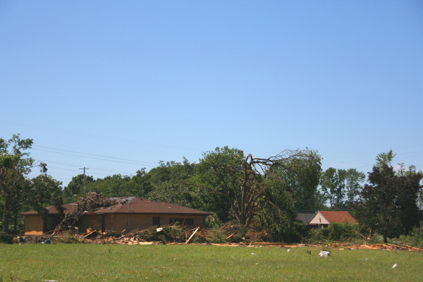
It is a long drive from Michigan to tornado alley, eight hundred miles or more just to get to the front door. Ironically, I could have spared myself most of my first trip. It landed me in Wichita overnight, then on to chase the next day in southwest Kansas and northeastward almost to Salina. No tornadoes, though. They were there, all right, but I was out of position and uninclined to punch through a bunch of high-precip, megahail crud along the warm front in order to intercept potent-looking (on the radar) but low-visibility mesocyclones. Two days later, though, on May 20 in northwest Indiana on my way back home, the warm front was exactly the place to be, and I filmed a small but beautiful tornado south of Wolcott. It was my one confirmed tornado of the year.

A few weeks later I hit the northern plains with my friend Jim Daniels, a retired meteorologist from Grand Junction, Colorado. It was his first chase, and for me, one of the blessings, besides the good fellowship and opportunity to build our new friendship, was introducing someone to chasing who already had his conceptual toolkit assembled. No need to explain how a thunderstorm works or how to interpret radar—Jim’s a pro; I just handed him my laptop, let him explore the tools, and we were ready to rumble.

Except—no tornadoes.

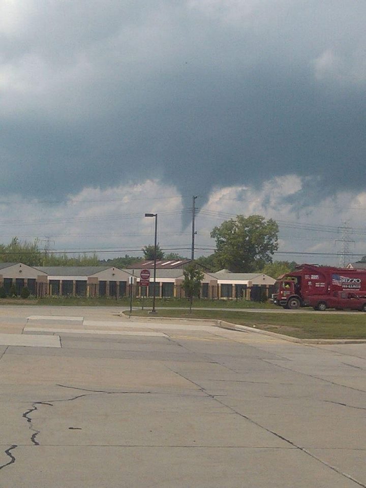
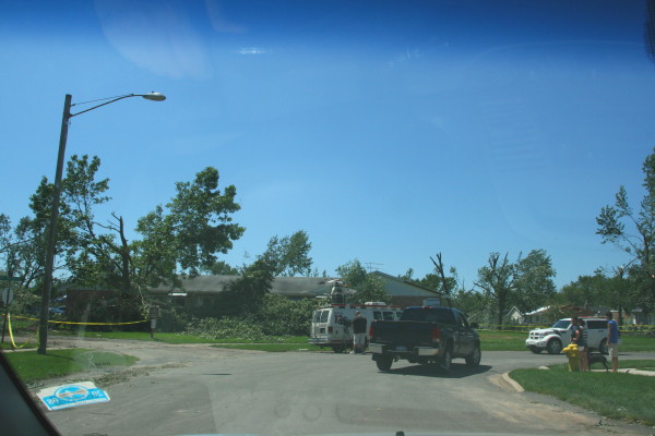
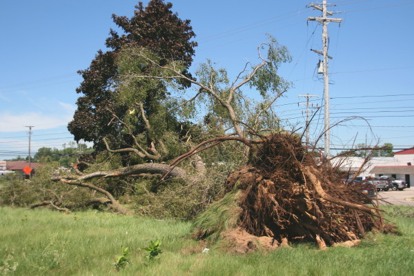
Then came August and a shot at severe weather right here in Michigan. I tagged along with a slow-moving, cyclic, lowtop supercell with classic features through the western thumb area of the state. It was nicely positioned as tail-end Charlie, sucking in the good energy unimpeded. A little more instability and it could have been a bruiser. As it was, it cycled down to the point where I thought it was toast, just a green blob on GR3, at which point, faced with a long drive home, I gave up the chase. Naturally the green blob powered back up and then spun up a weak twister ten or fifteen minutes later.

I didn’t mind missing the tornado. Well, not much. I had chased about fifty miles from Chesaning to south of Mayville, about two and a quarter hours, and gotten plenty of show for my money—rapidly rotating wall clouds, a funnel or two, and some really sweet structure of the kind you rarely see in Michigan. Then on the way back, as a cold front swept in, the sunset sky was spectacular.

Waterspout season has also come and gone, and I hit the lakeshore a number of times. One of those times was fruitful, and I captured some images of a couple picturesque waterspouts out at Holland Beach. They were all the more interesting because they occurred southwest of a clearly defined mesocyclone. But I’ll save that and a pic or two for a different post. It deserves a more detailed account, don’t you agree?

Stormhorn.com is about jazz saxophone and improvisation as well as storm chasing. So if jazz is your preferred topic, stay tuned. It’ll be comin’ at ya. Got a few patterns and licks to throw at you that I think you’ll enjoy.

That’s all for now. Stormhorn.com is back in the race.


____________________

* The one exception is the photo gallery. Photos in individual posts work fine, but the links on the photos page don’t work.

Also, formatting is messed up in the text of a lot of older posts. So I still have some issues to work through with BlueHost. I’ll probably have to pay to get the image gallery working right again; hopefully not so with the formatting stuff.

A Minnesota Dryline

Almost two months have elapsed since my last post. An entire winter is now nearly behind me, and with meteorological spring having sprung as of yesterday, my eyes turn once again to the coming storm season.

MN Dryline 5102011Going through my old radar images, I came upon this one. Click on it to enlarge it, then note the station obs and wind barbs on either side of that fine line west of Minneapolis. That sure looks like a dryline to me, but what’s it doing wandering around central Minnesota like a little lost orphan?

The Great Lakes are not the land of drylines, but we do get them occasionally, and as out in the Great Plains, they can serve as a forcing mechanism for severe weather. Notably, in the 1965 Palm Sunday Outbreak, what Theodore Fujita called a “dry cold front” featured prominently in his analysis of the synoptic conditions. Although Fujita called the air behind the front “cooler,” a look at the station observations reveals that what really characterized the difference on either side of the “front” wasn’t a rapid drop in air temperature but in dewpoints, and a change in wind direction, with surface winds veering abruptly from the south to the southwest.

The radar grab shows similar conditions on May 10, 2011, with supercells initiating along a line of strong convergence. Where the southernmost cell is just starting to fire, check out the obs on either side of the fine line. The temperature is the same, 90 F degrees, but the dewpoint drop is as much as 13 degrees. That may not be as radical as what you’ll find in the Texas panhandle, but in the Great Lakes, it’s an eye-opener.

There were tornadoes in eastern Minnesota on this day: May 10, 2011, SPC Storm Reports. The location of the three reports on the SPC graphic leads me to think that the cell I mentioned in the previous paragraph may have been the culprit. With dewpoints in the upper 60s to low 70s, it appears to have had plenty of juice to work with.

For a dryline to occur in the Great Lakes means that a system is potent enough to wrap in dry air this far east from the desert Southwest. That means that a lot of things have fallen into place to create a potentially tornadic setup, including not only an obvious lifting mechanism but also ample bulk shear and moisture, and southerly or southeasterly surface winds. In other words, here in my backyard, a dryline is a red flag that things are about to pop and a chase day is at hand.

An Interview with The Weather Channel

Henryville High SchoolYou’re looking at the Henryville, Indiana, high school, photographed from across the street on September 30, 2014. By all appearances, there’s nothing remarkable about it. But if you’re aware of its recent history, then you know differently. Two and a half years ago, on the evening of March 2, 2012, there wasn’t much left of this building or, for that matter, a good part of Henryville. Roaring out of the southern Indiana hills and across I-65 to the west shortly after three o’clock that afternoon, a large tornado inflicted EF-4 damage in this small community, leveling much of the school and residences east of it.

Like many a tornado-ravaged town, Henryville pulled together, took care of its own, and rebuilt. Today, the resilient spirit of its citizens shows not in any marks of the devastation that transpired there that afternoon but by the lack thereof. Where piles of Henryville Hillsidedebris once lay, new houses and commercial buildings have sprouted. The school is in full sway, with new buildings in place of the ones flattened by the storm. The only evidence I could see that Henryville is a tornado town–and the clue is noticeable, chiseled into the landscape–is a swath of shattered trees where the wind blasted the hillside east of the school. That memento left by the town’s dark visitor is not soon expunged.

On Tuesday the 30th, I made a side trip through Henryville on my way down to Clarksville, just north of the Ohio River from Louisville, Kentucky. I and my friend and long-time chase partner, Bill Oosterbaan, had been asked to do an interview with Karga 7, a production house for The Weather Channel, for a show spotlighting the Henryville tornado. A couple months ago, Nichole, a producer with Karga 7, contacted me to inquire about using my footage of the tornado, which Bill and I had caught at its formative and maturing stages north of Palmyra, Indiana. I directed her to my video broker, Kendra Reed of KDR Media, and Kendra negotiated agreements for Bill and me, and  now here I was, heading down I-65 toward Clarksville’s Clarion Hotel, where the interview was to be held.

I felt both pleased and nervous at the prospect of being featured on national media. I’m a low-key kind of guy, and while, as a professional wordsmith, I can communicate colorfully and descriptively when I need to, I’m not by nature a showcase personality. So I wasn’t sure what kind of interview material I’d make. Writing allows me to edit my words till they reflect my thoughts to my own satisfaction, but an interview doesn’t afford that luxury. I hoped to shed a realistic and positive light on storm chasing and chasers, neither of which I think the public understands very well; and I wanted to give a strong message for people to take personal responsibility for their own safety and that of their loved ones by paying close attention to severe weather forecasts and warnings and not depend on sirens.*

Nichole, her two camera persons, and the guy who greeted us at the door seemed like great people. They were professional, courteous, and enjoyable to work with. The actual interview lasted at least an hour and a half, and I think Bill and I did a good job answering the questions, playing off of and supplementing each other’s responses. In a couple instances, our answers differed. For instance, Nichole asked, “Did you know when you first saw it that this was a killer tornado?” I said no. We had caught the funnel at its inception and stayed with it through early maturity, and I felt comfortable saying it was a violent and potentially lethal tornado; however, “killer tornado” isn’t about storm strength but verified human impact, something quite different. All tornadoes have the potential to kill, but most don’t, and that includes the relatively few violent ones. Not until later would I learn of this storm’s heartbreaking toll on New Pekin, Henryville, and Marysville.

Bill said yes, but he had processed the question differently from me. He does business frequently in nearby Louisville and knows the area. He was aware of towns to the northeast that the tornado might impact, and he knew it could cross an interstate highway. Bill evidently felt comfortable with calling the tornado a killer at the onset, based on its violence. It boils down to a matter of how each of us interpreted the question. I think he and I would agree that neither of us knew what the storm was going to do, but we did know what it could do if it hit a community, and we very much hoped that wouldn’t happen.

Between Bill and me, I think we did a good job of communicating two messages: (1) the tension storm chasers experience between their passion for storms as the magnificent forces of nature they are versus the concern we feel for those who lie in harm’s way; and (2) the excellence and limitations of severe weather warnings, and the need for people to be proactive in safeguarding themselves against violent weather.  I hope those messages will come across clearly in our part of the TWC episode. We did our best, and from here, our content rests in the hands of the film editors. I look forward to seeing how it all turns out. Interview aside, the footage Bill and I got of the tornado was spectacular and affords a unique perspective of the tornado. I chalk that up to good forecasting, serendipity, and Bill’s knowledge of the area.

On March 2, 2012, Bill and I had been chasing together for sixteen years, beginning well before technology improved the odds of seeing tornadoes. We had logged thousands of miles, busted many a time, gradually improved our forecasting skills, seen some amazing storms, and had a blast overall. The thing that kept us going was, and remains, sheer love for the storms, not money or media attention. But it’s nice to think that a little of both has finally come our way. Many thanks to Kendra Reed for her invaluable role in negotiating with Karga 7. Kendra, you are the absolute best!

The show will air this coming spring, probably sometime in April.

__________

* Civil defense sirens are the least dependable of warnings. When tornado victims say they “had no warning,” what they often mean is that the sirens weren’t sounded. I’ll reiterate here what I said in the interview: don’t count on sirens. They may or may not sound, depending on the judgment of your local civil defense; and if they do sound, you might not hear them for various reasons. Sirens are of limited effectiveness, and to rely on them as your primary warning is to live in the last century and jeopardize your safety. Today’s warning system harnesses everything from local television to mobile phones to social media and more, and while it’s still possible for the occasional rogue tornado to slip in under the radar, the big storm systems such as the one on March 2, 2012, are invariably well-forecast and well-warned.

August Tornado in Macomb: A Lake Breeze Landspout

Monroe TornadoOn Wednesday afternoon, August 20, 2014, a small tornado spun up beneath a seemingly garden-variety summer thunderstorm and did EF0 damage in Lennox Township on the eastern side of the state. I first became aware of it courtesy of a Facebook post by fellow Michigan-based storm chaser C. J. Postal. He wrote, “I give up. You win, Michigan.” Underneath was a photo of  an unmistakable, nicely shaped funnel cruising over the treeline.

My first thought was, What does he mean? The photo couldn’t have been taken in Michigan. No way. It simply wasn’t tornado weather–no ripping jets, no curved hodographs, just weak westerly winds and, here on the west side of the state, beautiful, cloudless skies. Over on the east side, the radar showed just a scattering of small red zits around the thumb and down by Ann Arbor: bland, pulse-type storms capable of squeezing out a few bolts but certainly not a tornado.

Yet as you can see from the photo,* one of them did spin up a tube. The National Weather Service logged the following report.

A BRIEF EF0 TORNADO TOUCHED DOWN AROUND 204 PM ON PLACE ROAD BETWEEN 29 MILE AND 30 MILE ROAD IN LENOX TOWNSHIP. PATH LENGTH WAS ESTIMATED TO BE 0.25 MILES WITH A PATH
WIDTH OF 100 YARDS. WIND SPEEDS WERE ESTIMATED TO BE 75 MPH. FIRE OFFICIALS REPORTED SEVERAL TRAILERS BEING BLOWN OVER AS WELL AS A ROOF TO A GARAGE BEING TORN OFF.

What the heck happened?

Michigan happened.

Seriously. Not only does this state not get tornadoes when conditions look ripe for them, but it does get them when no one expects them. It happened a couple years ago in Dexter. It happened last month just a few miles from me in Cutlerville. And now, two days ago, it happened over near Macomb.

Wind profiles were unimpressive. Bulk shear was negligible. About the only things in place, as I recall, were adequate surface-based CAPE and moisture, but this was by no means supercell weather. “Severe” just wasn’t in the picture.

However, one easily overlooked element unique to the Great Lakes probably was present and might well have been the culprit. That ingredient? The onshore breeze blowing off of Lake St. Clair.

Twenty-six miles long and twenty-four miles wide, with 430 square miles of surface area, the lake is the largest body of water in the Great Lakes region after the Great Lakes themselves. It is easily large enough to generate its own lake breeze. On its western shore, that breeze is an easterly breeze which, backing against an overall westerly wind regime, can enhance low-level helicity or even produce it when none would otherwise exist.

That’s my theory, anyway, and I think it holds true not just for Lake St. Clare but even moreso for the western sides of Lakes Huron, Erie, and Michigan, where the lake breezes blow inland from the east. Storms moving into such an environment may, under the right conditions, get just the added low-level twist they need to turn an ordinary updraft into a tornado.

That, I believe, is what happened last Wednesday. The mechanism was probably that of a landspout. It certainly wasn’t that of a supercell thunderstorm. None of the storms I saw on the radar that day looked capable of producing a mesocyclone; they were non-severe little blips on the radar. But they were surface-based. And that combination of an updraft with preexisting vertical vorticity evidently did the trick.

I’ve seen enough other examples of storms in this state that went tornadic, or at least developed rotation, as they approached the eastern coastline to think that the lake breeze plays a role in a good percentage of cases. No doubt the same holds true for the northern Chicago area north up into Wisconsin inland from Lake Michigan.

What I’m saying may be nothing new to NWS meteorologists, but I don’t recall ever seeing it discussed. Then again, I rarely read KDTX’s forecast discussions, so maybe that’s why. I’m a KGRR man, but here in West Michigan, while our westerly lake breeze creates convergence, I doubt it contributes to helicity in the same way as the easterly breezes coming off of Lakes Huron, Erie, and St. Clare.

I’ve never seen the lake breeze’s possible role in storm rotation and tornadogenesis discussed to any great extent, and I think it merits recognition as a uniquely Great Lakes phenomenon. So I’m throwing it out here, with the caveat that I’m just an amateur forecaster, not a trained meteorologist. It would be great to get the thoughts of professional forecasters as well as other Great Lakes storm chasers who have considered how the easterly lake breeze may sometimes enhance storm severity.

———————-

* I would like to credit the photographer, but having exercised due diligence, I’m unable to locate that person. If you took the picture, or if you know who did and how I can reach them, please contact me.

July 6, 2014, Cutlerville Tornado

IMG_2742

Tornado damage southwest of Division and 54th St.

It is a weird feeling when a tornado strikes the neighborhood where you used to live, particularly when you weren’t expecting tornadoes at all that day. That’s how it was two-and-a-half weeks ago on Sunday, July 6. No one saw it coming–not anyone who lived in the stricken area, not the National Weather Service, not any Michigan-based storm chasers I know of, and certainly not me. All I thought was, “Dang, that’s some crazy lightning coming out of that cell to my northwest!” even as an after-dark tornado chugged its way from Byron Center across Cutlerville and Kentwood toward its last gasp near Breton Road south of 28th Street.

Turning onto Andover St. from Eastern Ave.

Turning onto Andover St. from Eastern Ave.

I’m writing about it only now because I’ve had my hands full with other things. It’s no longer news, but it certainly deserves some kind of writeup in this blog. After all, it was the most significant tornado to hit the Grand Rapids area in years, it caught the NWS by surprise, and it missed my old apartment by only a block. (Come to think of it, another tornado in 2006 also missed my present apartment by only a block, but I wasn’t around to see it. I was heading home from my previous day’s chase in Illinois. Lots of irony there, but I’ll leave it alone and stay on topic.)

The Storm

IMG_2743

Tree uprooted along Division Ave. south of 54th St.

It was evening, and I was parked by the railroad tracks out near Elmdale, practicing my saxophone–which, if you know me, you understand is a regular habit of mine. The heat and humidity of the day had built to a slow boil beneath a capped atmosphere, but it appeared that the cap was breaking. Through the haze, I could see what looked like mushy towers off to my north. Right around sunset, I saw lightning streak through a cloud bank moving in from the west and thought, Nice. Bring it on. With mid-level winds forecast to be weak, I wasn’t expecting more than garden-variety storms, but given this year’s largely stormless storm season here in Michigan, any kind of flash and boom would be welcome.

With my practice session not feeling particularly inspired, I decided to call it and head home. The storm didn’t appear to be moving fast–not surprising, given the weak steering winds–but just north of my path . . . wow, that lightning was ramping up something fierce. I contemplated intercepting the cell, which clearly was quite active, but I had neither my laptop and radar with me nor my camera, nor, frankly, much desire. Sometimes it’s nice to just sit at home and let a storm rumble overhead.

By the time I arrived in Caledonia, the cell was flickering like a strobe light, and for half a minute, with more lightning advancing from the west, I thought I would sit in the church parking lot on the west end of town and let myself get eaten. Then I thought, Nah. Slow-moving storm with a lot of precipitable water–I just wasn’t into getting drenched during the mad dash from my car to my apartment. Besides, something in me really wanted to take a gander at the radar.

Meso Kentwoo

Mesocyclone over Kentwood, Michigan.

Once inside, I fired up GR3. Base reflectivity showed an amorphous clump of cells surrounded by lots of green: pretty much the disorganized, high-precipitation mess I expected. Then, out of pure force of habit, I switched to storm-relative velocity. Hmmm . . . what was that? Weak rotation just west of the airport radar seven miles north of me? That seemed odd. Curious, I back up a scan, which showed that the rotation had been stronger over Kentwood a few minutes earlier (see image.) Time for a look at the VAD wind profile. Well, now: mid-level winds were stronger than I had expected, around 40 knots, with southerly winds veering nearly 90 degrees through the lowest 4,000 feet. That would explain that. Going by reflectivity only, I’d never have suspected, but there it was, a definite mesocylonic signature. What did the previous scan show?

Yikes. Really? There over South Division Street, sitting on top of Cutlerville–that was one potent-looking couplet.* Kind of scary, really. Surface-based CAPE was something like 2,000, and forecast low-level helicity was more than adequate, over 200 m2/s2 in the lowest kilometer. Still, reflectivity looked like crap, the storm was wrapped in rain and not even severe-warned, and besides, this was Michigan. And that was two scans ago; the rotation had weakened considerably as it approached the airport. That would be the end of things.

Supercell organizing near Ionia.

Supercell organizing near Ionia.

But it wasn’t. As the storms moved east, the low-level jet spiked considerably, and even the 500 mb wind got a brief burst of 50 kt. Over by Ionia, a cell began to organize, and this time there was no mistaking the telltale look of a supercell in the reflectivity product. KGRR issued a severe thunderstorm warning with mention of the possibility of a tornado.

A scan later, storm-relative velocity shows pronounced rotation. Base reflectivity (not shown) also showed a well-defined hook.

A scan later, storm-relative velocity shows pronounced rotation. Base reflectivity (not shown) also showed a well-defined hook.

There were in fact four tornadoes according to the SPC’s final tally. The last three off to the east were brief EF0s, but the first one, which had initially caught my attention, did high-end EF1 damage in Cutlerville and injured six people.

Damage in My Old Neighborhood

IMG_2745

This used to be a warehouse on the west side of Division Street.

After doing its worst damage on the west side of Division Street, the tornado moved northeast through my old neighborhood, Leisure Acres. The second photo at the top shows the view that greeted me as I turned off of Eastern Avenue onto Andover Street. Halfway down Andover, my old apartment was untouched, but just a block east (and no doubt to the south, though I didn’t look) was a trash heap: trees snapped and uprooted, big branches torn off, here and there part of a roof missing–all the signs of a weak tornado. But of course, weak is a relative word; a wind that can do that kind of damage is anything but weak, as those in its path would be quick to point out. Nevertheless, there’s a significant difference between a 100 mph wind that does mostly minor structural damage and a 180 mph wind that levels homes completely.

House on Andover St. with its roof and side ripped off.

House on Andover St. with its roof and side ripped off.

Half of the photos in this post were taken in the Leisure Acres neighborhood along my old street, Andover; the rest were taken on the west side of Division south of Fifty-Fourth Street. The damage on Andover was primarily tree damage, though that was obviously significant, and as you can see, homes didn’t escape unscathed. The worst appeared to have been the house shown to the right with part of its roof and side ripped out out by the wind.

I was told that much worse damage occurred to the west along Clay Avenue, and while I didn’t try to enter that area, a brief jaunt down Division Street revealed places where the damage was more intense. The most significant was what appeared to have been a large warehouse building that got completely destroyed–just a pile of blocks and steel beams, as you can see in the photos.

One good egg. He just showed up with his chainsaw, ready to help.

One good egg. He just showed up with his chainsaw, ready to help.

In the aftermath of severe weather events, communities tend to pull together and ordinary heroes emerge from outlying areas, bringing with them such skills as they possess and the desire to make life a little easier for those dealing with the destruction of their property. This man with the chainsaw was wandering along the street from house to house, inquiring whether anyone needed help sawing up downed trees. Giving what he had to offer. I asked his name and wrote it down, and now I’ve lost it. In the very slim chance that he should happen to read this article: Bravo, sir! Generously played.

“We Had No Warning”: The NWS’s Dilemma

Of course the NWS got hammered. “We had no warning,” storm victims said–and while most of the time that’s untrue, in this case they really had no warning. But before anyone makes the usual foolish comments about the NWS’s ineptitude and how they never get anything right–which is simply not the case–it would pay to understand a few things about tornadoes in Michigan.

Let’s start with this fact: The typical tornado-breeding systems of the kind that produce significant (EF2 and higher) tornadoes get forecast quite effectively here in West Michigan, as elsewhere in the country. Meteorologists are on top of such setups; they watch these systems develop days in advance and are most certainly monitoring each one closely as it arrives, with varying degrees of concern depending on its characteristics.

Nothing left but a pile of cement blocks, wood, and steel.

Nothing left but a pile of cement blocks, wood, and steel.

That leaves the atypical tornado-breeders: systems whose features wouldn’t automatically trigger alarm, whose storms may occasionally produce brief, weak tornadoes that spin up with little or no advance notice. Storms like these–often squall lines and sometimes, as in the case of July 6, unremarkable-looking rainy blobs–produce no persistent, telltale circulation in a storm’s mid-levels that a radar can detect twenty minutes before a tornado forms. Such storms are difficult to impossible to warn. In the case of a squall line, small circulations can hop around from scan to scan on the radar, now here and now there, and most of them never produce. The rare tornado that does occur can materialize between radar scans, which until very recently have taken four-and-a-half minutes to complete in severe weather mode. A lot can happen in that time, and on July 6, it did.

Without going into details that most of my readers are no doubt familiar with, the lads at KGRR deal with proportionately more of these atypical scenarios than forecasters west of the Mississippi. The difference between a Great Plains supercell and the kind of stuff we normally get in Michigan is substantial, and for forecasters here, that means fewer opportunities to look like heroes and plenty more situations in which they’re damned if they do and damned if they don’t. When they issue a warning and nothing happens–which is frequently the case with squall lines–the public accuses them of crying wolf; when they don’t issue a warning and a tornado pops up out of nowhere, the public thinks they’re idiots.

Debris festoons a tree and litters a yard on Andover St. a block from my old apartment.

Debris festoons a tree and litters a yard on Andover St. a block from my old apartment.

They are far from idiots. They are experts who deal with factors in the warning process that most people know nothing of. Their job is not an easy one, and anyone who believes he or she could do better is woefully ignorant of the complexities of severe weather and warnings. Think otherwise? Fine. Go ahead and spend a few weeks at the peak of severe storm season, trying to nail that volatile blob of Jell-O called the atmosphere to the wall. It’ll be an eye-opening experience as, equipped with state-of-the-art technology, you discover the difference between forecasting and fortune-telling.

Ironically, the Cutlerville tornado occurred shortly before KGRR was slated to implement the new SAILS update to their radar software. It’s amazing to see how drastically this software reduces scan times in severe mode–I now get level 3 downloads in as little as a minute and always substantially less than the nearly five minutes of pre-SAILS days. Had SAILS been operative on July 6, the tornado might well have been detected in enough time to issue a warning. Or not. Microscale conditions can change so rapidly that some tornadoes will still slip through the cracks. But the odds of detection have just improved significantly.

——————

* The image shows the meso over Kentwood. I have tried unsuccessfully to render the more vigorous Cutlerville scan on both level 2 and level 3 data from NCDC archives on GR2AE and GR3. After several hours of fiddling with the data files and consulting with chasers who are more technically gifted than I, I’ve concluded that I need to get some hands-on help figuring out how to use NCDC’s archived data. Sorry–I’ve done my best.

Storm Chasing: The Anthology: An Interview with Blake Naftel

Blake2Amid my collection of storm chasing videos is an old VHS titled A Spotter’s Guide to Michigan Convective Weather. Produced in 2000 by Blake Naftel in collaboration with the National Weather Service in Grand Rapids, the award-winning video is a vintage reflection of Blake’s dual passions for storm chasing and videography—a combination shared by countless chasers, but which in Blake’s case, having developed in a unique way at an opportune time, has forged a path that brings him today to the verge of a remarkable undertaking. But let me set the stage. . . .

Long past are the days when storm chasing was the little-known, eclectic pursuit of a handful of pioneering weather photographers and researchers crisscrossing the Great Plains. Today, hundreds of chasers routinely pound the roads of Tornado Alley, and more are entering the fray all the time, influenced by what they’ve seen on TV but lacking any awareness of where it came from.

Yet storm chasing has roots—deep roots, a legacy of personalities, events, and endeavors that deserves to be cherished but is in danger of being lost. The time to preserve that rich heritage is now, when most of those who have created it are still with us. Now is the time to honor the colorful history of storm chasing and connect it to today’s talented generation of younger chasers and weather scientists and the future which is theirs to shape.

That is the vision that drives Blake Naftel to produce Storm Chasing: The Anthology. It is unquestionably the most ambitious cultural and historical project ever to focus on storm chasing. Given the grassroots character of chasing, it is fitting that an effort of such a landmark nature should arise not out of some big commercial production house, but from one of our own. Someone who has storm chasing in his blood and cares about it deeply enough to portray it with honesty; better yet, to let those who have contributed to it do the portraying on their own terms.

There will be no scripting, no manufactured storyline. There will just be stories, told by those who have lived them, beginning with the very origins of storm chasing. There will be storms, of course—unadorned, historical storms as well as contemporary ones; storms you may have chased yourself as well as ones from decades past that you’ve only heard of and wished you could have experienced. There will be insights into the rise and development of tornado research. And there will be much more.

That is, provided Blake can pull off a venture of such magnitude. Those of us who know him think he can. He’s immensely talented as both a chaser and a cameraman with years of experience in TV journalism, he has a penchant for the truth, and he’s motivated by sheer love for his subject. The project is huge in scope and fraught with challenges. But Blake is embracing those challenges, and the result promises to be unlike anything else that has ever been attempted.

And with that, I’ll let Blake tell the rest of the story.

—————

Question: Let’s start with a bit of personal history, the stuff that has forged your path toward this project. What first got you started both as a storm chaser and as a professional cameraman?

Blake NaftelBlake: My interest in severe weather, meteorology, and storm chasing developed early, just before I turned five. I recall being exposed to The Wizard of Oz­­—specifically the tornado sequence—and more importantly, to the NOVA-WGBH documentary “Tornado,” which was first broadcast in November 1985. I was determined to record the program, but my family lacked a VHS VCR at that time. Fortunately, my uncle in Detroit had one, and just after Thanksgiving 1985, I had a copy of the broadcast. The following year, my parents purchased a VCR, and the tape was played extensively—to the point of memorization. The tape found its way to  friends’ homes, where instead of children’s cartoons, the sixty-minute program on tornadoes, storm chasing, and the Barneveld, Wisconsin, tragedy was required viewing.

Picking up on my interest in severe weather, my mom began telling me stories of the tornado she witnessed only a few years prior in Kalamazoo, Michigan, on May 13, 1980. Descriptions of the “twin tails” rotating around one another from her viewpoint at the Civic building in downtown Kalamazoo captivated me. The iconic Kalamazoo Gazette front-page newspaper photograph furthered my fascination, and soon I was checking out every book on tornadoes that I could locate at the Kalamazoo Public Library.

Later in the spring of 1986, my mom visited my godmother in Kansas City, Missouri, where, at the time, the National Severe Storms Forecast Center was located. She returned with numerous informative brochures and spotter’s guide material, which I instantly became hooked on. Additionally that year, Mom designed a flip book with illustrations of the progression of the events from May 13, 1980­—sunshine, clouds, greenish-grey skies, lightning, the tornado’s approach, its wrath—concluding with calm, blue, sunny skies. It depicted the day just as it had transpired. I still have this little book, entitled Tornado! (“For Blake, from Mom.”)

Zooming ahead about a decade, I began developing a great interest in cameras—specifically in motion picture cinematography, videography, and 35 mm photography. This was early in the Internet age, and multiple interests of mine were spanning territories that included affordable access to used camera equipment, fee-based and free weather data, and newsgroup networking with seasoned storm chasers and meteorologists across the United States and Canada (WX-TALK, WX-CHASE).

Upon receiving my driver’s license, I began to actually chase storms in 1996­‒97. My chasing at the time was all local, learn-as-you-go, with my knowledge of storm structure and my chase style informed by various storm chase highlight videos which I swapped with Bill Reid, Jim Leonard, Tim Marshall, Warren Faidley, Scott Woelm, Bruce D. Lee, Roger Edwards, and Rich Thompson, among others.

At this point, I also began experimenting with HTML design, early online video, and the development of a regional group of storm spotters and chasers who would gather video of severe weather events in Michigan for the purpose of SKYWARN spotter training. Eventually, after making contact with the National Weather Service in Grand Rapids, I created a statewide training video for storm spotters, developed though my early attempt at social networking and video sourcing. The now long-defunct website known as MSIT (Michigan Storm Intercept Team) was one of several web pages I created back then.

During the same period, I began an online business buying and selling used motion picture and video camera gear. By doing so, I acquired several different types of cameras, learned about them by trial and error, and frequently focused their lenses on the weather, nature, and people around me. This approach mixed in with a “vintage” look I was going for at the time, and it eventually became a style I utilize to this day.

Then in 1998, the event occurred that would lead me to a future career in photojournalism and TV. On June 11, I was storm chasing across north-central Indiana in Elkhart and Kosciusko counties. It was a very basic chase with paper maps, weather radio, black-and-white television tuned to local media for radar updates, and a general target area based on the parameters. It did not seem like a prime tornado day, although when I recall the dynamics of the system today, it now is very obvious. Long story short: I ended up successfully intercepting and documenting several brief tornadoes which struck south and northeast of Nappanee, Indiana, on SR 19. The chase had at least one nerve-wracking moment when my vehicle’s transmission temporarily gave out in the path of the oncoming tornado, which was less than a mile-and-a-half away. Fortunately the transmission kicked back into gear, allowing me a northern escape.

Once in a safe position, with SVHS camcorder tripoded, I filmed the wall cloud and its attendant weak tornadoes as they continued dipping down to the northeast. The following morning, I saw the amateur video of another tornado near Bristol, Indiana—which occurred prior to what I witnessed—showcased on the morning news on WSBT 22 and WNDU 16. Prompted by my growing interest in broadcast meteorology, TV news, and videography, I called WNDU and spoke to Mike Hoffman, the chief meteorologist, about my own video. He took great interest and asked if they could buy the video for their 11 p.m. newscast on June 12.

After another round of severe weather across the same region that day, I ended up meeting the station’s chief photographer in White Pigeon, Michigan. I gave him my original tape, and later that evening, my video of the Nappanee tornadic event appeared on WNDU’s newscast.

From that point, I began freelancing for local media and soon became  involved with the production side of local television. This eventually grew into my various incarnations as a photojournalist, reporter, weather producer, and technician in the years that followed.

Q: What were those early years like for you? With whom did you chase? How have your experiences and personal interests influenced your videographic approach, which goes beyond chronicling the storms to also documenting the human and historical sides of storm chasing?

B: My early years of storm chasing were very local, restricted to traveling through the western portions of lower Michigan, with occasional trips to northern and central Indiana. Typically, those early trips were either with high school friends or solo, utilizing my 1989 Ford Taurus wagon or a dilapidated 1978 Chevy van my friend Aaron Graham would occasionally drive. Fuel cost was still low, just 79 cents in 1997, so traveling at length to witness severe thunderstorms was not of great significance. Even back then, I was using multiple documentation formats, frequently hauling motion picture film, video, and still photography equipment together into the field just to chronicle everyday Michigan severe thunderstorms. For the more vivid events, I preferred to shoot silent Super 8 color movie film, whereas VHS/SVHS video was a near-constant format that seemed to be always rolling.

I was intrigued by tornadoes on film—namely, the early NOAA-produced films—versus video. The quality, grain, and occasional scratches and dust flecks produced by the projector created a look I was determined to capture. And I did, experimenting with different cameras, formats, and photographic styles. I didn’t confine myself to severe weather or storm chasing only; family events, pets, and the natural surroundings across my hometown area in Texas Township, Michigan, also provided a dynamic environment full of interesting subjects and colors. My subject range continued to expand as I became involved with broadcast photojournalism and developing my own shooting style. Again, it was all by trial and error.

My first chasing exposure to the Plains states was in 1999 and more expansively in 2000. Prior to this point, I had only lived vicariously through the videos of other chasers with whom I had networked through the Internet. Bill Reid, from the Los Angeles region, was one individual who had direct influence not only on my chase documentation style but also on my musical tastes at the time. Over the years, we swapped storm chase highlight videotapes and conversed online, and this eventually led to a distant friendship, which in turn opened the doors to my working for Tempest Tours, with Bill serving as tour director.

In 2001 I was invited to drive and help forecast for Storm Chasing Adventure Tours, run by Todd Thorn. By then I was twenty years old and attending college, and the appeal of having all my lodging and fuel costs paid for seemed too good to pass up. That experience involved a huge tour: three vans full of individuals from across the world as well as three media vehicles from The Weather Network, the Denver Post, and WKOW-TV in Madison, Wisconsin. It was an eye-opener for someone who had primarily chased solo or within small groups, and only locally, never throughout the Plains states. I don’t regret the experience whatsoever, but I chose not to drive for a second tour scheduled directly after the first. Tours can be exhausting, especially those with so many participants!

That year was also the first operational year of Tempest Tours, a company formed by documentary filmmaker Martin Lisius, who was good friends with Bill Reid. I had been in contact with Martin in previous years, ordering his Chasing the Wind, Chasers of Tornado Alley, and StormWatch productions. Out of the blue, Bill contacted me, inquiring about my interest in being a paid driver/guide for Tempest Tours the following year. I was both humbled and floored! I accepted the offer, and in May 2002, I began a five-year stint with Tempest. During that time, I developed many new friendships that would never have been possible without the flexibility that working for a storm chase tour company provided.

Concurrently, I was also working on my geography/GIS degree at Western Michigan University, and I found myself drawn intensely to the mecca of academic severe weather research and meteorology in Norman. The tours, based out of Oklahoma City, provided a wonderful gateway to interacting with other meteorologists and storm chasers who shared similar interests.

Due to the requirements of the broadcast news industry I was now working in, 2008 was my last year working in the storm chase tour circuit. The peak chase month of May is a “sweeps” period in newscasting, and vacation is rarely allowed. So the tours had to take a back seat. But the entire experience was fantastic, one that created friendships which continue to this day and left me with amazing images of visual water vapor, along with an enjoyment, courtesy of Bill Reid, of the musical artists Stan Ridgway and Klaus Nomi. It had been a remarkable, full, and deeply formative passage in my life—and I had it all documented extensively on videotape.

Q: On to your project. Describe Storm Chasing: The Anthology. What is it? How did you think of it? How is it different from other storm chasing videos and documentaries such as Discovery Channel’s Storm Chasers series, and what do you hope it will accomplish? Why is it important—and why now?

B: Storm Chasing: The Anthology developed out of an earlier, untitled project from the 2003‒2004 era which I had shelved. The first concept was a 60-minute documentary on the human element of storm chasing. At that point, I had accumulated hundreds of hours of my own storm chasing endeavors—as well as the people I had been chasing with at the time. Impromptu interviews from the field were gathered, but it was all very “reality TV” to me, and that was a style I was losing interest in.

Jump ahead ten years. Much had changed in the world of storm chasing. Several reality TV shows had transpired, including Storm Chasers, Tornado Road, and smaller spin-offs. I still had all of my original material sitting around in boxes, but had lost interest in doing the earlier concept. Then came the tragedy of May 31, 2013, in El Reno, Oklahoma, which affected the entire storm chasing community and touched me in a very personal way. That event served as the initial trigger for me to revisit my old project and envision a different and expanded approach to it, and it has given me the drive to complete it.

The idea is to present a complete (or as complete as possible) visual history of storm chasing culture. This grows out of the humanity aspect of the original concept, but instead of using a narrator, it will be told through the words, stories, and images of every storm chaser and meteorologist who participates, revealing the full, fascinating decade-by-decade evolution of storm chasing.

To date, the many documentaries and programs about storm chasing have focused on specific events, people, or scientific endeavors, with the 1978 documentary In Search of Tornadoes being the first widely broadcast feature on the subject. In contrast, Storm Chasing: The Anthology is comprehensive. It will serve as a sweeping visual history lesson and an archive of storm chasing culture. Through this project, I plan to preserve the legacy of past generations of the activity, connect that heritage to what chasing is today, and make the results available as an educational resource for present and aspiring meteorologists and severe weather enthusiasts.

In time, I hope to have this project serve as a visual thesis towards the development of a digital, cloud-based, multimedia archive of severe weather. This would be university-based and available as a research and reference resource. That is far down the line, but it was another trigger to doing this project. As individual meteorologists and storm chasers pass on, their collections of imagery and work run the risk of vanishing; the archive would answer that concern. Obviously, you cannot preserve everything, nor is that my intention. One can, however, preserve vast amounts of a subject, and I feel that now is the time to make a push toward that end.

Q: Who is Storm Chasing: The Anthology for? Primarily storm chasers? Or do you hope to reach a broader audience? How will this anthology benefit viewers?

B: This production is being created for anyone with an interest in history, severe weather research, meteorology, and the activity of storm chasing. Granted, the core audience is those who are, or have been, directly involved in storm chasing. The benefit to viewers will be a broad education on all aspects of storm chasing as an activity.

Initially, a condensed premiere version will be released, followed by a six-part anthology. The latter obviously may take far more work than I had initially thought, and at the moment, this is a completely independent effort—so I ask everyone to please bear with me. In terms of a broader audience, upon completion, I wish to make the anthology available to libraries and academic institutions. In time, I would love to present this program on a broadcast/web streaming platform—specifically, PBS. The film festival circuit will also be a part of the exposure to other individuals who would not normally have a direct interest in this subject. As for making the anthology available for individual purchase, that’s in the plans, but I’ll first need to take care of the necessary copyright and licensing requirements.

Q: This is obviously a huge undertaking, spanning roughly sixty years of storm chasing history. Given your talents, experience, and relationships with storm chasers from veterans to talented younger chasers, you seem uniquely qualified to make it happen. What have you already done, what do you still need to do, and how long do you think it will take?

B: So much has been accomplished already! A tremendous amount of video, film, and other material has been gathered over the past decade. But much remains to be done. The core of the project involves my completing fifty-plus interviews of individual storm chasers and meteorologists across thirty-one states and Ontario, Canada. The Kickstarter campaign is intended to defray my travel expenses. With that campaign now in its final week, concluding on July 25, I am still seeking additional funds to offset the combined 7 to 10 percent fee that Amazon and Kickstarter will take from the funding pool.

My next task is acquiring a vehicle for travel. I share a vehicle presently and will likely be renting one for the trip. I’m currently approaching local car dealerships and national rental vehicle agencies about sponsoring a car. One of these options will be secured in the next month.

I am also still deciding what format to shoot the interviews on. Presently I have the offer of older, loaned (fee-free) gear from friends, and that will likely be the route I take.

Once the interviews are complete, editing will be the monumental task on my mind, along with production design. I am confident that a condensed premiere version would be ready by the summer of 2015. And I earnestly hope to have the six-part anthology completed by October or November 2015 and available either as BluRay/DVD or as a digital download. There is the whole aspect of meeting the deadlines promised to backers of this project—so 2015 will be a very busy year for post-production!

I’m always eager for assistance and will likely be inquiring with local or regional production firms and/or academic institutions in order to complete the project in a timely manner.

Another big reality is securing an income—or multiple-income sources—locally or regionally while working on the post production phase of this project. Working independently, I’m taking a great risk, and I find that both exciting and unnerving. I’m leaving my full-time job at WWMT on August 22 to set out for the month or so it will take me to complete the interviews, and I have nothing official lined up upon my return. While I have requested an unpaid extended leave from the station, it is only a possible consideration. Moreover, the focus required for the editing phase of this project is immense, so if I could secure local part-time or freelance employment within the Grand Rapids area, that would work quite well. Although I cannot say what the future holds, doors continue to open in new directions for me each step of the way with this project, and I have faith that everything will work out.

Upon my return, hours upon hours of video will be ingested and logged. Not only so, but countless hours of B-roll video material dating back to David Hoadley’s earliest storm chasing movies will also need to be digitally archived. All the multimedia material I’ll be dealing with comprises well over 1,000 hours! Frankly, thinking about how to bring all of that together boggles my mind at the moment. This is all a real-time process, and that is one reason why I am choosing to release this as a six-part anthology.

I may need to seek out a production team to assist in the design and distribution of this project somewhere down the line. So let me reemphasize that while Storm Chasing: The Anthology is currently an independent effort, I am open to assistance from the outside, including collaboration with other filmmakers and producers.

Q: Who are some of your supporters? Do you have a projected release date?

B: The supporters of this project are far too numerous to list here. I am extremely thankful to everyone who has pitched in to help make this project move from a vision to a reality. The projected release of the premiere version is in the early fall of 2015. I hope to feature it in the Oklahoma City/Norman, Oklahoma region, potentially coordinating with the AMS or NWA conferences between September and October. No premiere location is official yet; that too remains on my vast to-do list.

As for the six-part anthology disc/digital download version, as I mentioned earlier, I plan to make it available by November 2015, barring any snags along the way.

Q: What are your needs? How can people help?

B: Full project details and proposed budget can be located via: https://stormchasinghistory.net. The ongoing Kickstarter campaign runs until July 25 at 11:10 a.m. ET.* While the $7,000 funding goal was met in twelve days, additional backing will only make this project better! Please continue spreading the word about this project through social media. And if you love a mix of history, storm chasing, and storytelling, then consider adding your financial support to create this anthology series. Any amount, large or small, makes a difference and is greatly appreciated.

Q: Anything else you’d like to say, Blake?

B: Thank you to everyone who has supported the development of Storm Chasing: The Anthology! This production would not be a reality without the collaboration, belief, and interest of others! I am eagerly looking forward to getting on the road with this project, and I will be providing field updates of my travels, once they commence, via Facebook, Twitter, and the stormchasinghistory.net homepage.

——————————-

* Blake’s Kickstarter campaign concluded at the time stated and was highly successful. He raised $10,200, well beyond his goal. Considering that the project will involve far more than travel expenses, those who contributed can consider their generosity well-placed.

How a Late-Season Storm Chase Nearly Ended in Tragedy

With this year’s severe weather season ramping up–as I write, Missouri and Arkansas are primed for supercells and tornadoes later today–I want to share the following with my fellow storm chasers. Many of you are people I know and care about, and some of you are quite close to me. I know some of the risks you take because I take them myself; we all do, to varying degrees. To my thinking, tornadoes are usually at the lower end of the risk spectrum. At the top is what happens on the road. That’s something over which we have considerable control, and with it, a responsibility for our own safety and the safety of others.

In a heartbeat, an exciting chase can turn into a second or two of horrified disbelief followed instantly by noise, violence, injury, and perhaps death. I know because I’ve lived it, and I hope no one else I know ever has to. That’s why I’m sharing the following account, written last December. Perhaps it’ll inspire you to exercise greater care and awareness on the road. Please take it to heart. I’d like it to be a long time before the next set of initials gets outlined on the radar by Spotter Network icons—and when that day does arrive, I don’t want those initials to be yours.

——————————-

Saturday, December 7, 2013.

A short while ago, I was lying on my side on the living room couch, giving Lisa’s cat a full-body rubdown and listening to her purr. Siam is one of the sweetest, best-behaved little creatures you could hope for, affectionate and enormously tactile. Being held and petted are things she takes for granted as her natural due, and she gets plenty of such treatment. So there was nothing remarkable that I should be stroking her soft, cream-and-chocolate fur.

And yet, there was everything remarkable about it. When you’ve nearly had your life suddenly snuffed out just before the holidays, the most commonplace act can strike you as extraordinary.

The fact that I am still here to pet this vibrant, blissfully thrumming little motor . . . that I am here to see Lisa smile, and to hear her laugh, and to look into her sparkling eyes as I hold her in my arms . . . that I am here to tell my dear eighty-eight-year-old mother and my sister, Diane, that I love them, and to share more beers with my friends, and to turn the ignition switch in my “new” used Toyota Camry which, as of yesterday evening, has replaced the one I lost three weeks ago . . . these things are remarkable. Never fool yourself into thinking that the simple and the everyday are anything less than a gift and a miracle.

Things could have turned out very differently. By now, my body could have been lowered into the cold earth, leaving my loved ones to face this Christmas with broken hearts instead of warmth and gladness. Instead, I am still here and blessed with,  surrounded by, reminders that the simple act of petting the cat, or lifting this mug of hot chocolate that Lisa whipped up for me a little while ago, or watching downy snowflakes dance in the air beyond my balcony slider, or even feeling the diminishing but still-present pain of a cracked sternum, is an extraordinary thing.

The Setup

On November 17, I was chasing storms in eastern Illinois and western Indiana with my friends Tom Oosterbaan, Rob Forry, and Shawn Kellogg. The occasion was an unusual late-season setup featuring a vigorous, negatively tilted trough digging into the Midwest. On its eastern side, a surface low was pulling in moisture-laden southerly winds from the Gulf of Mexico as it tracked northeast through the Great Lakes.

SPC Day 1 Convective Outlook, 13Z, November 17, 2013

SPC Day 1 Convective Outlook, 13Z, November 17, 2013

For a good week, I had been following the forecast models with both skepticism and growing excitement as they progressed from the meager CAPE one expects this time of year to unseasonably high instability, mid-60s dewpoints, and some truly rabid wind shear. On November 16, the Storm Prediction Center issued a moderate risk for its day 2 convective outlook, then upgraded it to a high risk on the morning of the 17th. The ingredients were falling into place for the kind of high-shear/low-CAPE tornado outbreak that is typical of the Great Lakes. It would culminate in the deadliest, most violent November outbreak on record.

The setup bore some disturbing similarities to the notorious April 11, 1965, Palm Sunday Outbreak. And it wasn’t happening in Oklahoma or Texas. For a change, it was all coming together in my backyard, so to speak. Chasers from all over the map had converged on Illinois and Indiana–hardly the heart of Tornado Alley, but the most chaseable terrain in the world when it does produce.

Although Rob was willing to drive his Jeep, I volunteered my 2002 Camry. I had acquired it last February, and it was in great shape and was a comfortable ride. At last I had a roadworthy vehicle, and having benefited so often from other chasers driving their vehicles, I was pleased to be able to provide the transportation for a change.

We left Grand Rapids around 8:00 a.m. and met briefly for breakfast with Bill Oosterbaan and Kim Howell down at Kim’s house in Niles. Kim had prepared a generous spread for us (Kim, you’re the swellest!), but we were in a rush and had to just wolf it down, then Rain-X our windshields and hit the road. We did, however, make time to do one last thing before we took off. Joining hands, all six of us prayed, asking the Lord’s protection for us and for those in the areas that would be impacted by the storms. I believe that prayer was providential. None of us in my vehicle had an inkling of what lay in store for us a few hours later.

The Chase

November 17 6Z NAM hodograph for NW IN, forecast hour 18Z

November 17 6Z NAM hodograph for NW IN, forecast hour 18Z

Our target was northwest Indiana around Rensselaer, where the 500 mb jet max looked to nose in over substantial low-level instability. With storm motions forecast at 60 knots (see NAMM hodograph–click to enlarge), the storms would be rocketships, and it seemed that our best bet would be to set up east of them, watch the radar, and then jockey into position and hope for the best.

I wish we had stuck with that plan. But the big, discrete supercell which proved to be the day’s main player showed strong, persistent circulation, dropping a string of strong to violent tornadoes–including the deadly Washington, Illinois, EF-4– on its journey northeast from Peoria toward Chicago. Bill and Kim decided to go for that one and wound up intercepting a rain-wrapped tornado.

On our part, the storm looked mighty tempting, but we chose to let it go, not wanting to chase it in urban territory. That left us with the other storms which were approaching from the southwest, and we made the mistake of heading out to meet them rather than letting them come to us. It was a defensible decision: the storms were beginning to congeal into a line, and we wanted to catch them while they were still reasonably discrete. As it turned out, we’d have done fine had we simply exercised patience. But instead, we headed west into Illinois, then dropped south and ultimately wound up backpedaling east back across the border to intercept an HP supercell that was showing rotation on the radar.

Rob was driving and I was sitting in the front passenger seat with my laptop on my lap, monitoring the radar and navigating. I’ve mentioned that Illinois and Indiana easily comprise some of the best chase territory anywhere. Their flat, wide-open stretches of agricultural land let you see for miles, and their regular grids of paved country roads make for easy driving. Even the wet gravel roads are generally far easier going than the slippery gumbo out west. You just can’t ask for a better road network or better topography.

Southwest of the town of Oxford, Indiana, our storm appeared to crap out on us on the radar. The echo weakened, and while the storm just to the southwest was tornado-warned, the base reflectivity suggested a comma-head on a small bow echo, not a supercell. That was the last radar scan we got before we lost Internet connection. And storms can reorganize rapidly, and–well, ours did. Shortly after, an inflow jet shot across the road in front of us from the south and then rapidly enveloped us. What the . . . ? Rob rolled down the window, and we could hear a roar to the north. What was causing it? An updraft region had to be over there. But it was wrapped in precipitation, and telltale storm features were utterly lacking. Yet logic told me that somewhere within that bland-looking sky, a mesocyclone was buried, possibly even a tornado. At the very least, some kind of high-wind event had to be taking place nearby.

Not only so, but a dark shadow was moving along to our south, heading tangentially in front of us. Tornado? Just a darker cloud in that unremarkable sky? Impossible to tell. I shot some video, hoping that the camera would reveal features that my naked eye couldn’t discern, but there was no such luck. All it gave me was my sole record of our chase that day.

A look at the reflectivity on Rob’s cell phone app a couple minutes later revealed that our storm, which had appeared weak and disorganized in the previous scan, had in fact morphed into an embedded supercell. We had been on the southern end of the hook.

As we headed into Oxford, we began to see signs of significant wind damage–nothing tornadic, just straight-line, but still a handful for the residents of that town to have to clean up.

We were losing our storm, and once we were on the other side of Oxford, Rob picked up the pace. By then, though, I think our chase was effectively over. The storms were beyond us and moving too fast for us to catch up.

The Crash

Not quite two miles east of Oxford, the road we were on, eastbound SR 352, intersects northbound US 52. We were traveling at a good clip–too fast for conditions, as I know Rob will agree.

Ahead of us lay a hillock where a railroad track crossed the road. It was a blind rise that blocked our view of the other side. Rob slowed down for the tracks, but we were still probably doing 40 mph when we crested them and got our first glimpse of what lay beyond. To our horror, a stop sign and a divided highway were situated downslope no more than 200 feet away and probably closer. And to make matters worse, a vehicle was pulling out of a service road on the right into our lane. Rob swerved and braked instantly, but the pavement was wet, we were heading downhill, my nearly new all-weather tires failed to grab, and we skidded into and across the southbound lane on a collision course with a northbound van.

I remember watching the grill of the other vehicle looming toward me. The next instant, there was a bang, and our vehicle careened across the rest of the lane and came to a stop on the far side of the highway. I don’t remember the airbags deploying, but they did, and no doubt they saved Rob and me from serious injury.

For a second, the four of us sat there, stunned. Then we piled out of the vehicle. As I stood up, I could tell that something was wrong with my chest. While I don’t recall its happening, presumably the airbag had driven my laptop into my ribcage. At the moment, I was experiencing only discomfort, but I knew that I had been injured, and it was only a matter of time before the pain would set in. In that expectation, I was not disappointed.

My Camry after the Crash

My Camry after the Crash

The point of impact for the two vehicles had been headlight-to-headlight at right angles, my Camry’s right headlight connecting with the van’s left headlight.

I won’t go into all the details from here. I will just say that we and the people in the van were very, very blessed. God preserved us, sparing us any real harm, and Shawn pointed out that the prayer we had prayed before we left had been no mistake. What went wrong was obvious, but there was also much that went right, more than we had any reason to expect. It was amazing that we had made it unscathed across the southbound lane in the first place. And the angle of collision couldn’t have been more merciful. Just a second faster or slower for either vehicle would have resulted in a T-bone and almost certainly in serious injuries or fatalities. It was a busy highway; had a semi been coming . . . I don’t even want to think of it.

Huge thanks to fellow chaser Eric Treece, who gave Shawn, Rob, and me a ride back up to I-94, where Rob’s wife picked us up; to Bill Oosterbaan, who came to help and to retrieve his brother, Tom; and to Holly Forry for dropping what she was doing in order to make the long trip out and then drive her husband, Shawn, and me all back to my apartment.

Above all, thank you, Father, for sparing us. Thank you for protecting the innocents in that other vehicle, and thank you for protecting us. Thank you that this Thanksgiving, we have all had much to be thankful for, and that this Christmas, we all will celebrate the birth of your Son, Jesus, once again with our families, as we have done for so many years and hopefully will do for many more.

Accident Corner

About the intersection where our accident occurred: If you go there, you will see that the setup is an accident waiting to happen, and many accidents have in fact occurred there. At least, that is what we were told by both the sheriff and one of the ambulance drivers. I don’t recall seeing a “Stop Ahead” sign, and the other guys maintain there was no warning. Logic tells me that surely there had to have been one, but all I remember seeing was a yellow RR crossing sign as we approached the tracks. That was it.

The tracks were at the top of a rise, and only upon crossing them do you see the stop sign, the side road, and the highway down below. The proximity of the intersection to the tracks comes as a shock (unless, of course, you live in the area), and you’ve got little room to respond. In other words, it’s a horrible setup that is perfectly engineered to catch motorists off-guard. It’s lethal in wet weather and has got to be a terror in the winter. According to one of the guys, the sheriff had mentioned that his department had been after the county to improve the intersection because of the danger it posed, but so far the county had done nothing about it.

So I can’t be too hard on us. But I can’t be too easy, either. We were going too fast for conditions, and I wish I had told Rob to slow down; it was my car and my responsibility to say something. I’m so glad everyone came out of it okay. Banged up and hurting, definitely, but  no one in our vehicle or the other one sustained serious injuries or went away in an ambulance. I thank God, most sincerely, that all of us experienced the very best possible outcome of a very bad scenario.

A Word to the Wise (and the Not-So-Wise)

Now, here is what I want to say to all of my fellow chasers: It could have been worse, and it could have been you.

Watch your driving.

My main fear in storm chasing has never been the storms. It has been hydroplaning or otherwise losing control of the vehicle on wet pavement. It is the thing that happens to people who think it won’t happen to them.

I consider myself a cautious driver. Next to some of you, I come across as the little old guy wearing the brown suit and hat who putters along at 45 miles an hour down the Interstate. However, most of the time, I’ve been a passenger, not the one who has driven on chases, and over the years, I have witnessed driving habits that frankly have scared the crap out of me: Chasers rocketing along at 80 miles an hour down wet, curvy, hilly, unfamiliar backroads. Drivers multitasking with cell phones, laptops, and so forth. I can say something about these things to the guy behind the wheel, but that’s the extent of it. I can’t control another person’s behavior. The only thing I can control is whom I  get into a vehicle with. And that decision is one I will be taking very seriously in the future, because the attitude that person has toward safety can have huge implications for me, those who love me, other passengers, and other motorists who share the same road. Sitting in the passenger seat three weeks ago, I took the main force of the collision, and never again do I want to go through the pain I’ve experienced these last few weeks as a result. And never again do I want to put Lisa through the shock and fear of that awful afternoon, let alone something far worse.

Some of you take huge risks both with the storms and with your driving. And yes, I know: You’re big boys and girls and it’s your decision. It’s a matter of personal choice. Rah, rah and a fist bump for rugged individualism. We’ve all heard it. It’s like a mantra among today’s chasers.

But when something serious happens to you, trust me, you’ll be singing another tune. Because you don’t really know the the implications of your choices until one of them blasts past your bulletproof attitude and inserts itself into your life with jarring and possibly irrevocable immediacy. There goes the storm you were chasing, receding to the east. But what has just happened to you–that may never go away.

Most of you are in your twenties and early thirties. Lots of life still ahead of you. Many chases still in store for you. Don’t blow it. Because if you wind up in a wheelchair for the rest of your life, the best of your chases will leave you with just a handful of memories and decades of wishing you’d been wiser in the way you went about doing things.

Am I saying you shouldn’t take risks? Of course not. Everything worth doing involves some kind of risk. You can’t truly live without risking. But there is a difference between taking judicious and necessary risks versus taking irresponsible, selfish, and totally avoidable risks. Risks that could get you killed. Risks that could get your chase partner killed and leave you haunted with guilt the rest of your life. Risks that could leave you or someone else paralyzed. Risks that could devastate those you’ve left behind–your spouse or significant other, your children, your parents, your siblings, your friends.

The people you say you love and care about.

Other people and their families.

It ain’t all about you.

When I arrived home at 11:30 that night, Lisa greeted me at the door. I’d never seen her act the way she did–one minute laughing, the next minute crying. Gently, she helped me remove my shirt, a painful operation. We stood in the bathroom in front of the mirror. I was pretty banged up. She kept touching me and kissing my shoulders. She laid her head on my shoulder, closed her eyes, and smiled, and I looked in the mirror and smiled back at her from the glass. My woman. “You’re here with me now,” she said. “That’s all that matters. You’re here with me now.”

I knew then just how much she really loves me, how much I mean to her. I can say, in all truthfulness, that it was worth the loss of my car to experience how much closer the accident has drawn us since that awful day. We almost lost each other. But we didn’t. And during the course of my healing, she has taken care of me beautifully. We have laughed (Ouch! It hurts to laugh!), and had deep, heartfelt conversations, and walked with each other through yet one more stretch of deep water. God has brought us through, and as I emerge on the other side, it is with the certainty that he has given me a truly wonderful, beautiful woman who loves me with all her heart. I have much to be grateful for.

To sum it up for you, my fellow chasers: Chase with passion. But also chase responsibly, with wisdom and an awareness of just how vulnerable you are. Because you are vulnerable. And I think that many of you don’t understand what that means. You say that you do, but do you really? Your life truly is a vapor, as passing as those towers of convection which seem so indomitable in the moment but vanish within hours. Today’s chase will be only a memory tomorrow. Chase in a way that does not become a lifetime of regret, whether for you or those who love you.


February 20: The “Everything” Storm System

February 20 2014 Davenport I find this screenshot of the Davenport, Iowa, radar fascinating for its variety. Captured at roughly quarter to five in the afternoon eastern time, it shows just about every conceivable kind of Midwestern weather in operation simultaneously. Tornadoes and funnel clouds. Squall line with embedded supercells. High winds. Hail. Flooding. Snow. Fog. Have I missed anything? If weather systems were baked goods, this one would be an Everything Bagel.*

As I write, the squall line stretches from eastern Indiana all the way down to south central Louisiana and out into the Gulf of Mexico, and it is progressing eastward, continuing to generate high winds, tornado warnings, and flash floods. All in all, quite an active day for this waning February, particularly considering how far north convective weather has occurred. In the face of this winter’s record-breaking snow and cold, today has been a potent harbinger of what this spring, when it finally arrives, may hold. Even here in Caledonia, we got a few rumbles of thunder, though nothing like what folks a few hundred miles south of us have experienced.

The irony of it is, after this, it’s back to winter again. Serious, snowy, cold winter, with no sign of a letup anytime soon. Eventually, of course, the arctic air will retreat, but not without a fight. Today was just a promissory note, a down-payment, on things to come. I’m in no hurry to collect. In fact, I’d just as soon get dumped on–seriously dumped on–just to see how much more snow we can squeeze out of this winter before a warmer pattern sets in. We’ve already experienced unreal; let’s shoot for insane. We’ve come this far, so what the heck, let’s do this thing right.

But then–let’s have spring. I’m lightning-starved and thunder-hungry.

—————————–

* That is one of the worst analogies I’ve ever come up with, but I don’t care. Well, I care enough to write this footnote, but that’s all.

Henryville Tornado: Some Video Captures from the Storm’s Early Stages

This year, 2013, has once again been lousy for me from a storm chasing perspective. My two forays out to Oklahoma and Kansas yielded nothing in terms of tornadoes. Some cool gustnadoes, but that’s it, unless you count a glimpse of a decaying tube so fleeting that it’s barely worth mentioning. My best chase of the year was right here in Michigan. And my worst was unquestionably on November 17 down in Indiana, when a road accident claimed my beloved Toyota Camry.

So since I have nothing to show for this season, I thought I would grab a few stills from my video of the March 2, 2012, Henryville, Indiana, tornado, just to remind myself that I’ve actually had some decent chases. The shots, arranged sequentially, show the tornado from where Bill and I first glimpsed it shortly after touchdown as we were approaching Palmyra from the south, to its intensifying and mature stages north of town, where it tore across SR 135, ripping up a 12′ x 12′ chunk of asphalt in the process, and then raged northeastward toward New Pekin and then its deadly visitation on Henryville.

These are just video grabs, and our vehicle was moving at a good clip as I shot the footage, so the images are by no means tack-sharp. But they still give a pretty good feel of a memorable chase. They’re arranged in proper sequence, so you can see the variations the tornado went through on its way to becoming a raging EF-4 monster.

I intend to add a few more images, but the eleven I’ve included here are most of the show and plenty enough to tell the story. (I don’t know why the one showing the power flash turned out so small; I plan to replace it with a larger image.)

Waterspout Season Opens Today on Lake Michigan

When I saw the clouds this afternoon, I couldn’t help but wonder. Lisa and I were catching a late lunch–or an early dinner, take your pick–at the Fire Rock Grille, and I was staring out the window over the golf course at low-topped convective towers to my northwest. The sky had that look about it that spoke of stripped-out moisture and cold mid-level temperatures, as you begin to expect around this time of year, and I thought, “If those towers were over Lake Michigan, there’d be a waterspout hanging from one of them.”

My first successful waterspout chase last year led me to believe that when conditions are right for spouts–when cold air moving over warm lake waters creates steep low-level lapse rates and enough vorticity is present to get stretched by an updraft–then the main thing to do is get one’s butt down to the lakeshore and look for convective bands. Maybe I’m being overly simplistic; regardless, September 22, 2012, made me a believer in the feasibility of viewing Lake Michigan waterspouts. I even managed to get some shaky but very cool video that day of a spout making landfall about one hundred yards north of me.

My instincts today proved right, but the action occurred on the other side of the pond, where some spectacular photos and video came from lucky beachcombers in Kenosha, Wisconsin. I normally avoid embedding YouTube videos in my posts because I never know how long one will remain viable, but I’m displaying this one by Jeff Magno because I find it particularly intriguing.

Not only is the distant spout massive at this point, but look at how the mist rising off of the sidewalk in the foreground forms a tracer for the surface winds. The mist rushes southward, consistent with today’s northerly flow, but where it rises, you can see it begin to move lakeward. It dissipates far too quickly to tell much of a story, but it leads me to speculate about the low-level vertical vorticity that may have been available to produce the spouts.

But then, what do I know about these things? I’m just a happy observer when I get the chance to be one–which, as it turns out, may be tomorrow morning. Got a hot tip on that, so I’m setting my clock and planning to wake up early, and tonight I will dream of near-shore convection.