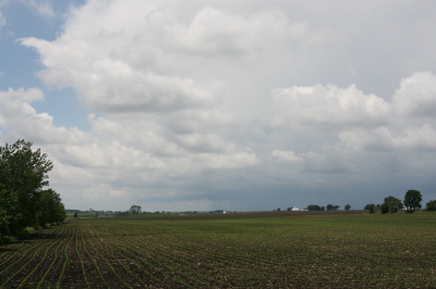
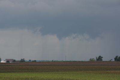
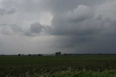
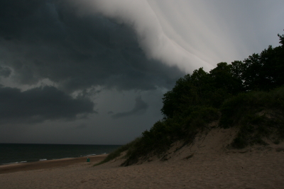
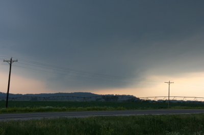
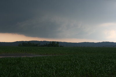
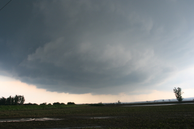
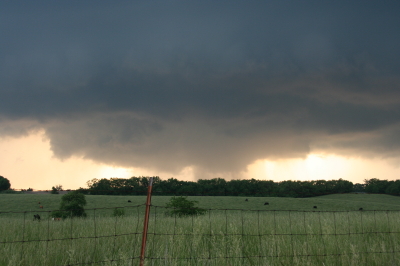
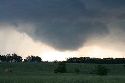
May 28, 2013, Tornadic Supercell by Grand Ledge, Michigan

Tornado season is now long past, and the sting of missing great storms either through bad targeting or having to head home one and two days before two major events has eased. Maybe next year will be better. Besides, the show’s not over till the snows fly.

Meanwhile, I’m looking back to my most interesting chase of the year, documented by the video at the bottom of this post. Ironically, I logged around 6,000 miles to and from Oklahoma and Kansas with little to show for it, while my humble backyard of Michigan gave me an enjoyable and productive bit of action.

On May 28, a warm front lifted up through lower Michigan, ushering in decent moisture and instability along with a good boundary for them to work their mojo with. The thing that seemed to be missing was adequate shear for storm organization–but I ignored conditions farther east of me. I just didn’t take the setup seriously enough, and when Kyle Underwood, the WOOD TV8 meteorologist, inquired which of the TV8 chasers planned to head out, I said that I didn’t see much potential. If something came my way, I would grab it, but otherwise, I didn’t want to waste gas. That was understandable: money was tight, and I planned to chase in Kansas the next day. Still, geeze, what an idiot (me, not Kyle).

Let us pause momentarily while I give myself a retroactive dope slap. I have come to a conclusion: in Michigan, when a warm front shows up with good CAPE present and any kind of bulk shear to speak of, even anemic bulk shear, chase the front. Never mind what the models have to say about storm-relative helicity; helicity will take care of itself if a storm manages to organize in the vicinity of the frontal boundary. Just get out there and chase the stupid front. Particularly farther to the east. Storms in Michigan often have a way of intensifying and organizing near and east of I-69 and, north of Lansing, US-127.

That was the case on this day. My first clue was when I glanced at the radar later and noticed that Kurt Hulst was on a storm off to the southeast. Kurt knows what he’s doing, and the storm looked decent–in fact, it was tornado-warned. Okay, I thought, I missed that one. Probably it’ll be the only one. So I sat tight and watched the radar as other storms formed. They looked like a convective mess to my west, but they clearly were moving into a better environment as they progressed east. Finally, I’d had enough. I grabbed my laptop and cameras and headed out.

I locked onto the most intense-looking cell in my vicinity and tracked with it toward Portland. But another was following on its heels, and given the way that the storms were behaving, I thought I’d be better off dropping the one I was on and letting the new one come to me. Presumably, it would get its crap together on the way, and that is what happened.

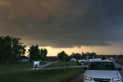
As it approached Grand Ledge just west of Lansing, this storm developed a most amazing streamer of scud sucking into its updraft base from the east. It appeared to originate near ground level–hard to tell with trees constantly interrupting the view–and rocketed toward the storm, leaving no doubt that this storm had impressive inflow.

Driving into Grand Ledge, I found myself under the area of rotation, with crazy, low cloud motions. Turning around, I headed back north and parked by the airport, then watched and filmed as the storm headed east into Lansing. It looked very close to spinning up a tornado; in the video, you can see it trying hard, and eventually it succeeded.

But I had to drop the chase. My friend Steve Barclift and I planned to chase the next day in Kansas, and I had to meet him so we could hit the road for the long drive west. As it turned out, the storm I was on provided a better show than anything we saw along the dryline. My buddy Rob Forry managed to catch this storm at its tornadic phase and got some nice video.

My original hi-def shows the motion of the inflow streamer nicely as I enter Grand Ledge. Regrettable, this YouTube clip doesn’t render the details as well, but you’ll at least get a feel for the motion. The storm was an interesting one and fun to chase. It would be nice to get another one like it. It’s only August, so the door is far from closed.
Great Lakes Waterspout Season Is at Hand

Now is the time of year when waterspouts start putting in an appearance on the Great Lakes. I had largely forgotten about spouts until a few days ago when my friend and fellow weather weenie Mike Kovalchick mentioned them in an email. Bing! A light blinked on in my head: That’s right! Waterspouts!

I’ve never seen a waterspout. But then, until last year about this time with my buddy Kurt Hulst, I’d never made a point of going out after them. Kurt and I busted that day, but maybe this year I’ll get lucky, provided I increase my chances by taking more opportunities to chase spouts.

I have zero experience forecasting waterspouts. Thankfully, there’s a snappy little graph called the Waterspout Nomogram that simplifies the process. Developed by Wade Szilagyi of the Meteorological Service of Canada, the Waterspout Nomogram provides a quick visual aid for determining when certain critical parameters are in place for four different classifications of waterspout: tornadic, upper low, land breeze, and winter.

The tornadic variety is self-explanatory, and any storm chaser with some experience making his or her own forecasts should have a good feel for when that kind of waterspout is likely. Mike favors the 500 mb cold-core, closed low setup, which to my thinking may be a variant of the first in producing low-top supercells. The remaining two, land breeze and winter, seem to involve different dynamics. For all the waterspout categories, one of the constraints is that for spouts to occur, winds at 850 mbs have to be less than 40 knots, something I find particularly interesting in the case of supercell-based waterspouts.

In any event, I’m hoping that this year is my year to finally witness a spout or two. Michigan chasers and weather weenies, it’s time to pay attention to the marine forecasts. The “second season” can include action right along the lakeshore even when nothing’s popping anywhere else. Make sure you bring your shotgun just in case a waterspout gets too close for comfort (written with a wink and a grin).

Getting Set for a Backyard Chase

Last night’s bow echo certainly didn’t disappoint. I first spotted it in Wisconsin when it was a supercell putting down tornadoes near Milwaukee and thought, “That sucker is headed straight at us.” I watched as it hit Lake Michigan, maintaining rotation for a while but eventually morphing into a big bow echo. But what a bow echo! That northern book-end vortex really cranked as it moved inland and into the Kent County area. For a few scans of the radar, it looked like a small hurricane. Little wonder that it generated tornado warnings with a few reports of sightings by spotters and law enforcement.

But nasty a storm as it was, last night’s weather was probably just a prelude to what today, Wednesday, has in store. Veering surface winds taken into account, this could nevertheless be a tornado day for Michigan. The NAM shows a 70 knot 500 mb jet max blowing through the area, CAPE over 2,500, 70 degree dewpoints, and STPs to make a chaser happy.

Looks like it’ll be Kurt Hulst and me on this one. Bill is heading to Lansing to hang out with Ben Holcomb, and I think Mike Kovalchick is going to join them. That’s a good place to start. I’m not sure that I want to play quite so far east early in the game tomorrow, but I’m sure we’ll wind up well east of Lansing before the day is done. As of the 00Z run, it looks like the H5 will be nosing into West Michigan around 18Z, kissing an intensifying LLJ. Kurt and I had talked about setting up shop around I-96 and M-66. We’ll see what the 6Z run has to show us and play it from there.

At last, a Michigan chase with some real potential! And while I had guessed that storm motions would be in the neighborhood of 40 knots, the NAM decelerates them to a very manageable 25 knots. This could prove to be an interesting day, though I hope not a terribly impactful one. Southern Michigan has a lot of population centers, and I inevitably have mixed feelings whenever I see a big weather event shaping up for this area.

First Supercell of 2010 in Michigan

Michigan’s first supercell of the year rolled through southern Michigan this morning, prompting our state’s first tornado warning for 2010. The cell was a sweet little tail-end Charlie that showed bursts of decent rotation and triggered a series of TVSs. It is presently getting set to exit the state near Mount Clemens, leaving behind it a series of hail reports up to an inch but nothing more. It’s what one would expect given the cool temperatures, low dewpoints, and weak-to-borderline low-level helicity.

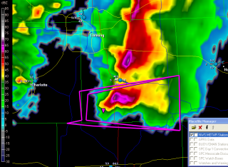
Here’s a GR3 radar grab of the storm as it was crossing US 127 south of Mason; click on it to enlarge it. A scan or two prior the cell had a nice hook to it, and you can still see the suggestion of a weak echo region with inflow coming in from the east.

Caledonia got nailed by the northern part of the line earlier. At 10:20 a.m., the sky was as dark as a black cat’s belly and the parking lot lights were on. There were one-inch hail reports in the area; my friend Kurt Hulst called to tell me that he had gotten marbles over at his apartment and wondered whether any of that had come my way. It hadn’t, but we got a truly massive downpour, really something to see. It’s going to bring a lot of green to an already nicely greening landscape.

More storms in the forecast for today. Yeah! Bring ’em on!

VORTEX 2 in Northwest Missouri

After years of planning and digging for research dollars, VORTEX 2 finally hit the pavement this spring, only to be met with a severe weather famine. It had to have been heartbreaking for the team, watching that merciless, unending ridge stretch from day to day and week to week, knowing that the clock was ticking on their window for gathering data.

Thankfully, tornadic storms hit the Plains before the window closed, and the team got what they needed. I wish it had gone as well for me. My tally for this season has been one tornado. But I did at least get the compensation of catching some nice storms with cool structure, including the June 7 supercell in northwest Missouri that every chaser in the country seemed to be after–including, of course, the VORTEX 2 armada.

Just for kicks, here is a shot of one of the DOW trucks–the new one with the square radar rig. I believe I took this shot south of Forest City. The DOW is parked to the left in the photo, and I’m looking at it head-on. Viewed from that angle, the radar unit looks like the front end of a tractor trailer.

One of the DOW (Doppler On Wheels) trucks collecting data.

One of the DOW (Doppler On Wheels) trucks collecting data.

Sure does bring back memories. I hope I’ll get a chance to make a few more before the chase year closes. Prime storm season is over, but it’s still a long time yet before the snows fly.

Blue Sky Bust in Iowa, But a New Chase Day in the Midwest

Thanks to a merciless cap, action in Iowa didn’t start yesterday until shortly before dark, and it never came close to living up to its potential. The RUC majorly underforecast convective inhibition, resulting in a lot of broken chasers’ hearts around Waterloo, mine included.

Storms finally did fire to the east, and a beautiful supercell crossed the Mississippi River after dark at Prairie du Chien, Wisconsin, where Bill and I have overnighted. We wound up on another cell that slowly organized and went supercellular, following in the first storm’s track. There were a number of storms in a cluster that showed rotation, but none of them put down tornadoes.

Today’s event looks to be widespread, and Michigan could very possibly see some action. But Bill and I are looking toward western Illinois. Galesburg presently looks good, or maybe Davenport. The storms are already getting their acts together. Time to sign off, check out of this hotel, and get on the road.

June 8: Mini-Supercell in Northern Illinois and Severe Squall Line on the Lake Michigan Shoreline

This is really part two of the previous post. After chasing a potent, monster hailer of a supercell north of Saint Joseph, Missouri, I overnighted at a hotel outside of Des Moines, Iowa. When I stepped outside the next morning, the air was much cooler and drier, a stable atmosphere that wouldn’t produce so much as a sneeze, let alone a tornado.

But I knew that the SPC had outlooked the area to my east across northern Illinois, and for several days I myself had been eyeballing my home state of Michigan, where the NAM-WRF had been consistently indicating the possibility of tornadoes. With a little luck, I hoped to make it back in time to chase whatever convection might pop up along the warm front.

As I approached Davenport, I observedĀ  towering cumulus muscling up through the troposphere. However, I didn’t pay them any attention–that is, until Bill Oosterbaan called to inform me that the SPC had just issued a mesoscale discussion for the area just east of me. Even as we talked, I noticed a lowering on a cumulus tower a mile or two to my northeast. When it continued to develop, I decided to investigate. Leaving I-80, I parked across from a truck stop at the Atkinson exit to watch.

The next cell to my west quickly grabbed my attention. It had a nice rain-free base, and as I watched, scud began to form and ascend in an obvious updraft, coalescing into a small, ragged wall cloud. Grabbing my camera and getting out of my car, I noticed right away that the air was very different from back in Des Moines–considerably warmer and with plenty of moisture. The wall cloud fell apart before I could get a pic, but the overall structure remained interesting.

A mini-supercell approaches Atkinson, Illinois, just north of I-80.

A mini-supercell approaches Atkinson, Illinois, just north of I-80.

More brief, non-rotating wall clouds formed and dissipated one by one, so I figured I’d head north of town and observe. With surface winds veering and the overall flow unidirectional, I had no expectation of seeing tornadoes, but the mini-supercell made for some fun and interesting viewing.

Ragged, non-rotating wall cloud.

Ragged, non-rotating wall cloud.

Distant wall cloud and back side of main updraft tower.

Distant wall cloud and glimpse of updraft tower.

I was tempted to follow the storm, but decided it was a red herring. If at all possible, I wanted to make it back to Michigan in enough time to chase the setup there, and that left me no time to play around on the western Illinois backroads. So I headed back to I-80 and busted east.

The first Michigan supercell fired up earlier than I’d hoped, and I bit my lip as I followed its progress on GR3 and watched it hit Lansing. If only I had driven east last night for two more hours, or left in the morning two hours earlier… But the previous day’s chase had left me exhausted. And you know, one of the downsides of being a Michigan-based storm chaser is, you just don’t have very high expectations when it comes to your home state. I mean, it’s Michigan. Home of convective table scraps, squall lines, and embedded supercells that don’t produce squat.

As it was, I watched several more storms fire up and develop rotation along the warm front that stretched across mid-Michigan. I was making decent progress and still had hopes of catching up with some of the southernmost cells. But by the time I crossed the state line, the action all had shifted well to the east, and it became clear that I wasn’t going to see any of it.

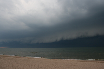
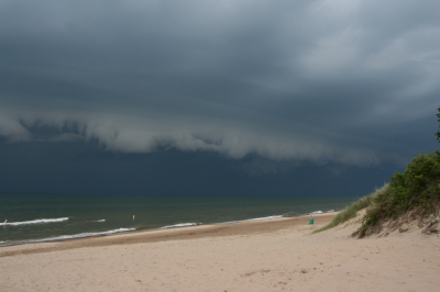
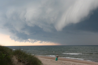
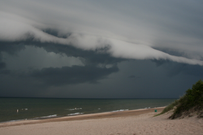
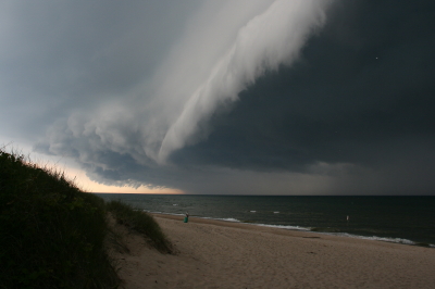
Instead, taking fellow chaser Mike Kovalchick’s suggestion, I headed toward the lakeshore at Allegan Beach to intercept a short but potent squall line. I’m glad I did. The backdrop of Lake Michigan and its dunescapes lends a breathtaking drama to incoming storms. The following photos depict the progress of the arcus cloud moving in across the waters. What these images can’t convey is the full, awe-inspiring sweep of cloud, big lake, and shoreline; of the solemn foreboding of some great event about to unleash itself upon a landscape cloaked in storm shadow; of the shelf cloud moving silently overhead like the furrowed eyebrow of a dark, scowling giant; and of sand spray blowing and trees thrashing in the wind as the gust front arrived.

I’ll let the photos tell their story as best they can, and leave the rest to your imagination.

An arcus cloud advances toward the Lake Michigan shoreline at Allegan Beach.

An arcus cloud advances toward the Lake Michigan shoreline at Allegan Beach.

View to the north.

View to the north.

Looking south...the storm closes in.

Looking south...the storm closes in.

Looking north...closer still.

Looking north...closer still.

Almost overhead.

Almost overhead.

One last shot to the north, then it's time to make a dash for the car.

One last shot to the north, then it's time to make a dash for the car.

June 7 Northwest Missouri Supercell

Now that I’ve had a chance to rest up and catch up after Sunday’s chase in northwest Missouri, it’s time to do a writeup. I’ll summarize by saying that there were no tornadoes, but there was some great structure along with hail the size and disposition of wild boars.

My plan was to hook up with Bill, Kurt, and Tom, who had headed west a day ahead of me in anticipation of chaseworthy storms. Unfortunately, a stout cap quashed an otherwise potent setup, and the guys–along with lots of other storm chasers–endured a blue sky bust. Like I told Bill, they needed me out there with them to erode the lid for them.

I left around 10:00 Saturday night and drove as far as Davenport, Iowa, where I overnighted. The next day, I hightailed it for Topeka, Kansas. Bad route choices delayed my arrival, and storms had already initiated by the time I got within the vicinity. But that actually simplified my choice. Rather than heading into Kansas, I worked my way north of Saint Joseph, Missouri, along I-29, then hit the backroads to intercept a supercell that was making its way across the border near Rulo, Kansas.

Parking my car outside of Big Lake, Missouri, I set up shop and got some nice photos as the storm moved in. The base was lowering and developing a rotating wall cloud. Here is what the storm looked like when I took my first shot.

Wall Cloud at Big Lake, Missouri, June 7, 2009

Wall cloud at Big Lake, Missouri, June 7, 2009.

The cloud was southwest of me and moving eastward, which meant that I could expect plenty of rain and probably a good clobbering by hail. In a little while, sure enough, golfballs began to fall all around me. No rain, just sizeable hail. The cloud at this point was directly to my south and looked like this:

Wall cloud passing to the south.

Wall cloud passing to the south.

It was time to vamoose, and none too soon. The advance guard of a veritable armada of storm chasers was driving by. I pulled in behind the DOW (Doppler On Wheels) and other Vortex 2 vehicles and followed them toward Forest City. By the time I reached SR111 and began heading south, I had pulled ahead of the circulation. I wanted a few photos of the wall cloud advancing directly toward me, so I found a place to pull aside. Opening the car door, I stepped out into some ripping inflow and snapped a few shots.

Wall cloud approaching SR 111 north of Forest City.

Wall cloud approaching SR 111 north of Forest City.

I missed the really big, gorilla hail that some chasers encounterd, but the occasional baseball size was big enough for me. Somehow I escaped getting hit by the larger chunks, though one of them hit my roof squarely with a loud whack. I still haven’t checked to see whether there’s a dent.

Eventually I caught up with the guys at the I-29 overpass, where a zillion other chasers were also parked. Seems like everybody and his dog’s first cousin was on this storm. If I ever get rich enough to purchase a dedicated chasemobile, it won’t be an SUV or a TIV-style monstrosity. It’ll be a concession van with a fold-out bar.

Anyway, Bill, Tom, and Kurt forged ahead and I followed them for a ways, but eventually opted for a more southern route when they headed north toward Union Star. I figured they’d be hitting heavy precip and probably some nasty hail, and I wanted to stay on the south edge of the updraft, which was heading east by southeast. Here are a couple photos from what was, from my vantage point, one of the more promising episodes in the life of the storm.

Wall cloud with clear slot wrapping in.

Wall cloud with clear slot wrapping in.

Possible funnel cloud trying to develop.

Possible funnel cloud trying to develop.

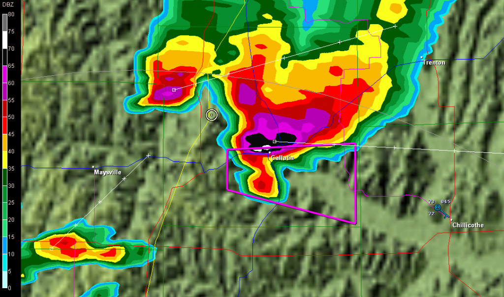
I believe the above shots were taken near Amity. From there, I headed east through Maysville and Weatherby, and across I-35 to just west of Altamont. There, I decided to end the chase and start heading home. The storm at that point was heading into Gallatin and was showing one of the best reflectivity echoes of its career on GR3.

Base reflectivity showing tornado-warned storm approaching Gallatin.

Base reflectivity showing tornado-warned storm approaching Gallatin.

But darkness was closing in, and I had no desire to chase this storm at night through the hinterlands of northwest Missouri. At that point, I was thinking about overnighting in Des Moines, and I had miles to go before I slept.

Remembering the Parkersburg/Hazleton Tornadoes

One year ago today, the second EF5 tornado in the history of the new Enhanced Fujita Scale rating system descended on Parkersburg, Iowa, and obliterated the southern third of the town. I and fellow storm chasers Bill and Tom Oosterbaan and Jason Harris could see the intense rotation moving over Parkersburg on GR3 as we stairstepped southeast from the northern edge of the cell, heading for an intercept. There’s a certain sense of disbelief when you see something like that, a feeling of, Naah, it can’t be as bad as it looks.

But it was. A few miles farther down the road, with the rotation still at least ten miles to our west, debris–some of it fairly large–began to fall from the sky. That was when we knew for sure. Something terrible had happened. Even with pieces of sheet metal clanging down onto the pavement in front of us, I had a hard time believing that a tornado disaster had just occurred, but I think we all felt a certain sober awareness that a community had been hit.

We intercepted the storm near Fairbank, where the NWS indicates that the Parkersburg tornado occluded. Parking on a sideroad, we watched as a large, new wall cloud formed and moved directly toward us. Warning an Amish family who was standing in their yard, watching, to take shelter, we scooted south and then east, watching as the wall cloud lowered and kicked up a ton of dust. A second, enormous tornado had formed, barely discernible through the haze. We tracked with it to the east as it headed on a collision course for Hazleton, mercifully grazing the southern edge of that town. Had it hit head-on, I suspect that the Hazleton tornado’s EF3 rating would have been higher.

It’s hard to believe that a whole year has passed since that event and the several days of Great Plains action that preceded it. What a difference between then and now, with a nasty ridge casting a pall on this May’s peak chase season.

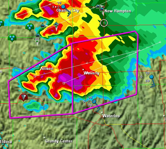
In remembrance of the Parkersburg/Hazleton tornadoes, I’m including a couple visuals. The first is a radar grab of the supercell as it moved out of Parkersburg. The tornado icon is a storm report from the town, just minutes old. You can see our GPS position marked by a circle with a dot in the middle of it on the northeast edge of the storm

The Parkersburg, Iowa, tornadic supercell.

The Parkersburg, Iowa, tornadic supercell.

The second is this YouTube link to my video of the Hazleton tornado. My videography may not be the best in the world, but I think you’ll get a sense of the intensity this storm evoked. It was my first really big tornado, and it was close.

I doubt this year has anything in store for usĀ  like what we saw that day. But who knows? I’m not ready to write off this chase season yet–though I certainly hope it doesn’t hold a catastrophe like the Parkersburg tornado.

Video of May 13 Edina Tornado

My tornado videos to date aren’t of the best quality, but I’ve decided to put my footage of Wednesday’s tornadic supercell up on YouTube anyway. It’s not the greatest, but it’s not terrible, either, and it does provide a record of the storm from our vantage point on SR15, approximately two miles north of Edina, Missouri, that other storm chasers may find of interest.

Please note that I do know the difference between a beavertail and a tail cloud–I just got my terminology turned around. Also my sense of direction, in saying “counterclockwise” when I meant “clockwise.”

Nuff said. Hope you enjoy the video.