Lightning Storm over Caledonia

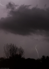
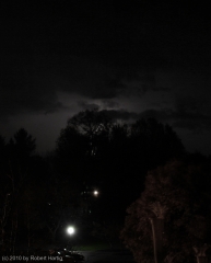
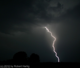
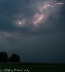
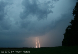
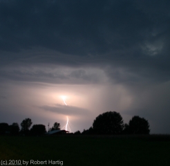
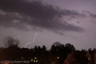
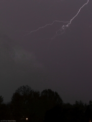
The day after my October 23 chase out in northwest Missouri and southwest Iowa, thunderstorms blew across West Michigan. Watching the MCS move in on my radar, I decided to try my hand at a few lightning photographs. I had learned a few essential tips since my last attempt, and this looked like a fantastic opportunity to see what kind of a difference they made.

.

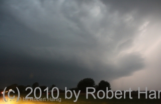
The photos shown here were shot from the balcony of my apartment in Caledonia. Click on them to enlarge them. They may not be National Geographic quality, but they’re not bad. Fact is, one of my photos that night was my best lightning shot ever. Unfortunately, I accidentally erased it only minutes after I took it. You could hear my screams of anguish and bonking of my head against the wall all the way to Sam’s Joint.

What you see on this page are just compensation prizes. They’ll do, though. They’re mementos of what was probably the last lightning any of us around here will see this until next spring. Snow is in the forecast a few days hence, and with two months before it officially starts, the long winter is already winding up the mainspring and getting set to unleash.
Intense Autumn Storm System Arrives Tomorrow in the Great Lakes

I’m not going to try to be particularly clever in writing this post. Instead, I’m going to throw a bunch of weather maps and a few soundings at you and let them tell the story.

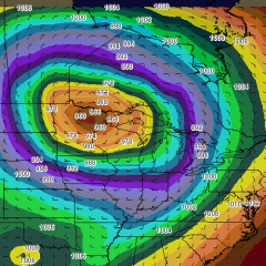
I will say that the weather system that is shaping up for late tonight on into Wednesday for the Great Lakes has the potential to be of historic proportions. In terms of sea level pressure, I’ve seen a number of comparisons to the great Armistice Day Storm of November 11, 1940. However, there are two significant differences: this storm is a bit earlier in the year, and the forecast pressure has been consistently and significantly deeper. The Armistice Day storm dropped to 979 millibars; this one may be in the 960s. In other words, we may see a record-setting barometric pressure with this system.

The bottom line is, this thing will be a wind machine like few we’ve ever seen. Here’s the current forecast discussion from the weather forecast office in Grand Rapids, Michigan.

LOW PRESSURE IN THE SOUTHERN PLAINS WILL RACE NWD AND PHASE WITH A
LOW OVER THE DAKOTAS AND RAPIDLY DEEPEN AS THE UPPER TROUGH DIGS
ACROSS THE UPPER MS VALLEY. THIS WILL LEAD TO VERY STRONG DYNAMICS
ALONG THE TRAILING COLD FRONT LATE TONIGHT. EXPECT STRONG TO SEVERE
STORMS TO DEVELOP ALONG THE FRONT AND RACE EAST. A 70KT LLJ AND
115KTS AT H5 INDICATE IT WON/T TAKE MUCH TO GET SVR WINDS WITH THIS
LINE OF STORMS LATE TONIGHT. A VERY STRONG PRESSURE COUPLET...ON THE
ORDER OF 6MB/3 HRS WILL FOLLOW THE COLD FRONT. THIS WILL LEAD TO
STRONG WINDS DEVELOPING BEHIND THE FRONT. BUFKIT WIND PROFILES SHOW
MIXING INTO THE 55-60KT LAYER AT 2K FT. IT IS LOOKING INCREASINGLY
LIKELY THAT WE/LL SEE SUSTAINED WINDS AROUND 35 MPH AND WIND GUSTS
OVER 50...AND CLOSER TO 60 ALONG THE LAKE SHORE. AS SUCH WE EXPANDED
THE HIGH WIND WATCH TO COVER THE ENTIRE CWA.

WINDS WILL DECREASE TUESDAY NIGHT AS MIXING WANES...BUT WILL
INCREASE CONSIDERABLY AGAIN WEDNESDAY. THIS IS A SLOW MOVING STORM
THAT WILL RESULT IN A PROLONGED WIND EVENT FOR THE CWA.

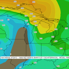
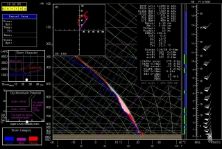
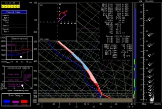
I’m not going to add a lot to that, but I do want to mention the possibility of tornadoes during a brief window of time. Hodographs preceding the front curve nicely, with 1 km storm-relative helicity exceeding 300 showing on this morning’s 6Z NAM sounding for Grand Rapids at 17Z tomorrow afternoon. If enough instability develops–and with winds like the ones we’re looking at, it won’t take much–then we could certainly see some spin-ups as the squall line blows through. And if there’s enough clearing to allow discrete storms to fire ahead of the front, chances for tornadoes increase all the more.

With storms rocketing along to the northeast at over 60 miles an hour, the thought of chasing them is laughable. Anyone out to intercept them will have to watch the radar, position as strategically as possible, and then hope for the best. Serendipity will be the name of the game. That game could begin as early as noon here in Michigan, and it looks to be over before 5:00 p.m.

Not the wind, though. That’ll be hanging around for a while.  Batten down the hatches, campers–we are in for one heck of a blast.

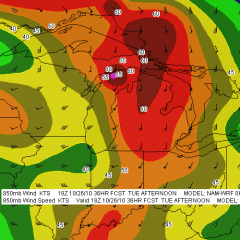
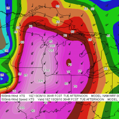
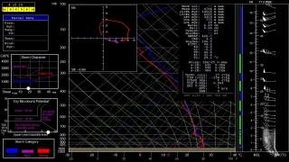
Without further ado, here are some weather maps and NAM forecast soundings from this morning’s 6Z run. Click on the images to enlarge them. Just look at that surface low! Pretty jaw-dropping, I’d say.

Forecast maps for 18Z Tuesday, October 26, 2010


Soundings

Grand Rapids, MI (forecast hour 17Z)

South Bend, IN (forecast hour 16Z)

Muncie, IN (forecast hour 17Z)

Late October Chase Bust

After 1,200 miles and a busted chase in northern Missouri and southwest Iowa, I returned home at 2:30 in the morning. Why on earth, you may wonder, would I travel all that way to watch storms that never did more than produce weak wall clouds and a bit of hail? What madness possessed me and my chase partner, Bill Oosterbaan, to go storm chasing this late in the year anyway?

For one thing, the setup actually looked promising on paper. You can read all about it in my previous post, but the long and short of it was, the right ingredients looked to be in

place. For another thing, look: it’s the end of October, and in view of the fact that I’m probably not going to see another chaseworthy setup within a day’s drive for the next four or five months, I’ll take what I can get. I grasped at a slimmer straw than yesterday’s for my first chase of 2010, and now, at the end of the year, it was nice just to get out, hit the open road one last time with my long-time chase buddy, Bill, and take whatever came our way.

I might add that, had we actually gotten a tornado or two, Bill and I would have looked like storm chasing geniuses, the guys who score on a day when other chasers stay home. Talk about my status as a chaser going up! “How did you know?” everyone would ask. I’d just smile sagely. “Instinct,” I’d reply. “You get to where you can just sense it in your gut.”

Excuse me, I seem to have been dreaming. As I was about to say, dropping south out of Des Moines down I-35, we headed toward a small convective cluster in northwest Missouri near Maryville that was trying to get going south of a weak warm front. The shear was present to help these storms organize and you could see them doing their best, but  evidently the instability

just wasn’t enough to really inspire them. Firing toward the end of peak heating with rapidly waning insolation, the storms may have choked off the CAPE with their own shadows. Maybe a little more moisture would have done the trick, maybe a little better heating, but whatever the case, the storms never offered much more than some weak wall clouds and a bit of hail.

Our first storm actually looked promising for a minute, exhibiting a decent wall cloud that

looked like it actually might intensify. But that never happened. What we were left with for our long drive was an enjoyable afternoon and evening roaming through the hilly, autumnal landscape of Missouri and Iowa, doing one of the things we both love best–following the sky, chasing the clouds.

Sandhill Cranes

The GFS continues to show hopeless ridging throughout most of October. I hardly pay any attention to the long-range forecast models these days, just mention this as a note of idle interest. A trough does finally seem to shape up around 300 hours out per the 6Z run, and it could make life interesting within reach of Great Lakes storm chasers on the 27th and/or 28th. But I don’t have the heart to wishcast that far out; I just don’t believe it’ll happen..

As for the saxophone, I’m extremely pleased with my personal progress. But while I’ve been practicing a lot, my sessions have involved material I’ve already covered in previous posts, and I’d imagine the results interest me far more than they would you.

Lacking anything of great import to write about concerning either jazz saxophone or storm chasing, my radar is scanning for a topic that’s at least conceivably related to either of those two interests. Yesterday’s earthquake in Norman, Oklahoma, would do well except I wasn’t there. I hear it was a loud one, but I’ll leave the reportage to those who actually experienced the shakeup. As for me, I need something closer to home. Like sandhill cranes.

Here in Michigan, now into November is the time of year when the cranes congregate in great numbers in suitable locations that offer nearby sources of both food and cover. Sometime next month they’ll take off for warmer climes in southeastern Georgia and Florida. Meanwhile, this ridging that has quashed the so-called “second season” for storm chasers has provided glorious weather for the sandhill cranes and sandhill crane watchers. The Baker Sanctuary northeast of Battle Creek and the Phyllis Haehnle Memorial Sanctuary near Jackson are well-known staging areas for massive numbers of the birds. However, I’m fortunate to have a location much closer by where over 100 cranes hang out, foraging in a field across the road from a marsh where they shelter for the evening.

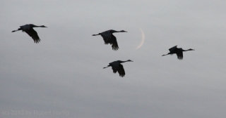
Mom and I went out there Sunday evening. It was a blessing to spend the time with my sweet 85-year-old mother, watching the sandhills feed; listening to their captivating, ratcheting calls; witnessing their sporadic, comical, hopping dances; and waiting for them to take off and fly overhead en-masse into the marsh at sundown. Here are a few photos for you to enjoy.

A Real Michigan Squall Line

Man, what a great storm we got last night here in Caledonia! Though actually, I can’t say exactly how it was in Caledonia because I was in my car tracking with the squall line, belting eastward down 100th St in a frenzied attempt to catch up with and outpace the gust front.

I didn’t succeed. Just west of Alden Nash Avenue, a large tree blocked both lanes of the road. Pulling into a driveway, I phoned in a report to KGRR, then managed to squeeze around the treetop and continue on.

Just south of Alto on Alden Nash, traffic was stopped where another large tree had fallen. I turned around and headed east on 76th St only to encounter yet another good sized tree lying on the road. I slid past this one as well, and then, after phoning in another report, completed the big block back into Alto and fueled up at the gas station.

At this point, I had my buddy Bill Oosterbaan on the phone. He was down in Tennessee, but he was following the storm on radar. Since I was chasing sans laptop, I wondered where the line was now located. With I-96 just a couple miles north of me, I had a half-cocked notion that I might still have a chance of catching up with the front of the storm once I hit the Interstate. But Bill informed me that the storm was already halfway to Lansing.

No real surprise there, but nevertheless, nuts. End of chase. Still, there was plenty of lightning crawling the clouds to enjoy. So with my fuel tank replenished, I caught 68th St east and soon found myself once again having to grease my way past a downed tree. Nasty, scraping sound–ugh!

My thoughts turned to Ben Holcomb. Oh, he’d be having a picnic with this system, I thought. Why he ever left this storm chaser’s paradise called Michigan for Oklahoma City I’ll just never understand. Might as well rub some salt into the wound. So I gave him a call, and he told me that he, like Bill, had been tracking the storm front on radar. He informed me that he’d observed base level winds of 88.5 knots on GR2AE. Over 100 mph! Zounds! That, if you please, is one sweet little zephyr. I doubt winds reached quite that speed anywhere on the ground, but we most certainly got one heck of a blow. I’ve encountered my share of trees blocking roads, but I’ve never had my progress consistently blocked by them. Driving through the Alto area last night was like navigating a maze and hitting dead end after dead end.

More weather is on the way later today as a warm front lifts north through Michigan. With 0-6km shear around 55 knots forecast, things could once again get interesting.

Warmest West Michigan Summer in 55 Years

This summer of 2010 has been the warmest summer in West Michigan since 1955, according to WOOD TV meteorologist Bill Steffen. Temperatures in the 90s have predominated, with dewpoints in the upper 70s,  and Lake Michigan water temps–in the mid 70s this morning–have been as high as 80 degrees. That’s like swimming in bathwater, and I’m not even referring to the lake–I’m talking about just stepping outdoors.

We made it as high as 93 degrees yesterday, and it looks like hot temperatures are going to hang around for a few more days until a weak cold front modifies things a bit and hopefully brings a few storms to make life interesting. I’m all for hot and sticky under the right circumstances, but a glance at RAOB model soundings for RUC and NAM shows utterly placid conditions. Winds at 500 millibars are doddering along at a geriatric 10-15 knots, and the rest of the atmosphere is keeping pretty much the same pace.

The great storms of May and June are so far past that they seem like ancient history. Who all besides me is ready for a nice, deep trough to come sweeping across our area? Patience, patience, lads and lasses. The fall season is coming. This stifling heat and humidity will soon get stirred up with episodes of cooler air sweeping in from Canada, and the weather machine will kick into gear once again. Then we can all fire up our laptops and Rain-X our windshields for one last blast before the snows fly.

Great Lakes Waterspout Season Is at Hand

Now is the time of year when waterspouts start putting in an appearance on the Great Lakes. I had largely forgotten about spouts until a few days ago when my friend and fellow weather weenie Mike Kovalchick mentioned them in an email. Bing! A light blinked on in my head: That’s right! Waterspouts!

I’ve never seen a waterspout. But then, until last year about this time with my buddy Kurt Hulst, I’d never made a point of going out after them. Kurt and I busted that day, but maybe this year I’ll get lucky, provided I increase my chances by taking more opportunities to chase spouts.

I have zero experience forecasting waterspouts. Thankfully, there’s a snappy little graph called the Waterspout Nomogram that simplifies the process. Developed by Wade Szilagyi of the Meteorological Service of Canada, the Waterspout Nomogram provides a quick visual aid for determining when certain critical parameters are in place for four different classifications of waterspout: tornadic, upper low, land breeze, and winter.

The tornadic variety is self-explanatory, and any storm chaser with some experience making his or her own forecasts should have a good feel for when that kind of waterspout is likely. Mike favors the 500 mb cold-core, closed low setup, which to my thinking may be a variant of the first in producing low-top supercells. The remaining two, land breeze and winter, seem to involve different dynamics. For all the waterspout categories, one of the constraints is that for spouts to occur, winds at 850 mbs have to be less than 40 knots, something I find particularly interesting in the case of supercell-based waterspouts.

In any event, I’m hoping that this year is my year to finally witness a spout or two. Michigan chasers and weather weenies, it’s time to pay attention to the marine forecasts. The “second season” can include action right along the lakeshore even when nothing’s popping anywhere else. Make sure you bring your shotgun just in case a waterspout gets too close for comfort (written with a wink and a grin).

Oldies But Goodies

Sorry–I seem to have let an entire week slip by without posting. Many bloggers have a knack for slapping out short, cogent posts in 15 minutes or so, but that’s not a gift of mine. Just about every post takes me several hours to write, particularly the ones that include musical exercises. So when I have other things packing my schedule, the prospect of sitting down and creating a post can seem daunting.

That has been the case this week. Could be a streak of just plain old laziness somewhere in the mix, too, but mainly, these past few days have been busy ones. My brothers Pat and Terry arrived for a two-week visit Monday, so family has been a priority. And work still goes on, regardless–gotta make a living.

Today my bros, my sister, Diane, and I headed to Newaygo, rented some kayaks, plopped them into the Muskegon River, and spent the afternoon taking a delightful 6-mile drift with the current. The Muskegon is a surpassingly beautiful stretch of water. I saw three bald eagles soaring overhead, slews of large turtles sunning themselves on logs, several kingfishers, a green heron, and brilliant red cardinal flowers rimming the banks in swampy areas. Altogether it was a most satisfying day.

But of course, as I said, I haven’t had time to write. So I figured that instead, I’d refer you to a couple of links to archived articles. The first is one I wrote one year ago, titled “Will I Ever Become a Good Jazz Improviser?” The second article is for storm chasers by guest poster Andrew Revering of Convective Development, Inc., on how to forecast severe weather during northwest flow.

I hope you enjoy the articles, and will find your journey back to last August’s posts profitable and refreshing. As for me, I’m tired. It has been a long day, it’s now after midnight, and I’m going to bed. G’night!

July 22 West Michigan Supercell and Lightning Fest

I haven’t seen a storm like last night’s storm in Michigan in a long, long time. Man, what a beauty!

Non-stop lightning, much of it appearing to be positive strokes that lasted for seconds at a time, along with a veritable feast of anvil crawlers, made for a photographic smorgasbord. Plus, the storm structure–as much of it as I could make out at night, illuminated by the incessant lightning–was truly impressive. If only the storm had arrived an hour earlier, when there was enough light to really see the thing!

I had just finished doing a couple of interviews down in Dunlap, Indiana, for the book I’m writing on the 1965 Palm Sunday Tornadoes. My meetings

required me to forgo chasing a supercell that moved through the Battle Creek area as the warm front lifted northward, and I was curious to find out what had happened with it. Pulling into a parking lot, I fired up my computer, opened GR3, and gaped. A line of supercells was advancing across Lake Michigan from Wisconsin. The first one in the line looked great–SRV showed definite rotation–and, headed on an ESE trajectory, the storm was poised to make landfall around Saugatuck. Winds there were almost straight easterly, and they were beautifully backed across most of lower Michigan. Hmmm…what did the VAD wind profile look like at Grand Rapids? Dang, sweet! How the heck did that kind of setup wind up in Michigan?

The storms weren’t moving terribly fast, around 25 knots. Could I make it in time? I was bloody well going to try. There was no denying the rush of adrenaline now galvanizing me, thrusting me into chase mode. I hit US 20 and headed west past South Bend, where the highway merged into US 31 north.

I still had a good 40 miles to go by the time I connected with I-196 near Benton Harbor. I wasn’t sure whether I’d catch the storm by the time it made landfall. Maybe I’d be better off playing more to the east. But I decided to take my chances, and that turned out to be the right move. I couldn’t have timed it better.

As I approached M-89, the eastern part of the storm had made landfall, but the radar showed the rotation still out over Lake Michigan. It wouldn’t be there for long, though, and, having shifted its trajectory south of Douglas, it was now heading straight at me.

Bingo! This was exactly what I’d been hoping for. Leaving the Interstate, I headed east along M-89 and found a nice, open field a mile down the road, just west of 66th Street, 4 miles south of Douglas and 4 miles west of Fennville. Then, turning my car around to face the incoming storm, I parked and grabbed my camera out of the back seat.

The lightning in this beast requires superlatives to describe it. There seemed to be a never-ending supply of high-voltage CGs, delivered with the unbridled, over-the-top enthusiasm of a 4th of July fireworks finale and accompanied by the incessant grumbling of thunder. There were times, as the lightning cells moved past me and surrounded me, when I felt like I was sitting inside an immense flashbulb–a flashbulb that kept firing again, and again, and again. Oh, man, what an extravaganza of pure, searing power and beauty! I’ve done my best to capture it, but my skills as a lightning photographer fall far short of what this storm had to offer. Now, my buddy Kurt Hulst, he’s Da Man when it comes to getting fantastic lightning shots, and I know he got some last night. Me, I seem to have a problem getting a good, crisp focus at night, but I try.

By and by, the flickerings began to illuminate a cloud feature I’d been looking for: a hint of a beavertail off to my northwest. It’s location confirmed what the radar was telling me: the storm’s mesocyclone was moving straight at me. I was in a perfect location–and all this time, standing out in the field near my car, I had yet to feel so much as a drop of rain.

The mosquitoes were thick and nasty, and I was getting eaten alive, but viewing at my position was excellent. Farther east, I’d be getting into thick woods, and since the storm wasn’t exactly rocketing along, I stayed put until the meso got too close for me to be able to distinguish its features. Then I moseyed east a few miles.

I parked again for a few minutes at 63rd Street and noted that what had begun as a stubby beavertail had rapidly grown into an enormous inflow stinger. To my northwest, I could see what appeared to be a large, low wall cloud–hard to determine exactly what it was or what it was doing at night, but it looked convincing enough that I called it in to KGRR.

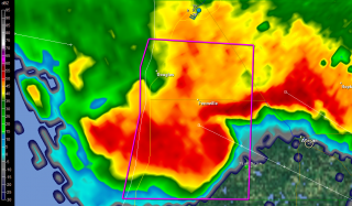
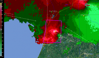
I tracked just ahead of this storm all the way to Plainwell. M-89 proved to be a perfect route, angling southeast along roughly the same path that the storm was taking. On the outskirts of Allegan, I stopped long enough to grab a few radar images. On this page, you can see a nice vault on the base reflectivity, and pronounced rotation on the storm relative velocity. (The circle just southeast of the town center marks my location. Ignore the marker with my name farther to the southwest on SRV; it’s old, an archive from when I dropped off of Spotter Network.)

A little farther down the road, I pulled aside again where a large, open stretch afforded good viewing. The mesocyclone was clearly visible, with a formidable-looking flange on the north side, nice striations, and an impressive inflow band circling in overhead. I hung out at that location until the lightning drew too close for comfort, then hopped back into my car and continued east.

At Plainwell, I dropped south on US 131 past the Kalamazoo exit, caught M-43 west for a mile or so, then parked in a parking lot and let the storm’s southernmost edge blow past me. The storm was still tornado-warned, but the radar indicated that it was weakening–cloud tops lower, VIL not as robust. North of me, just on the other side of M-43, a sheet of rain cascaded out of the wind-blown darkness into the luminous orange domain of the street lamps. Within half a minute, it was upon me, and for a short while, I sat and enjoyed the blast of downdraft and deluge. The rain that I had managed to elude all night had finally caught up with me.

Finally, as the storm bowed out on its journey eastward, I drove back to US 131 and headed for home. I stopped again for a while at the Martin exit, long enough to see what would become of another supercell that was moving inland from the Lake. It, too, quickly bowed out, but, in keeping with the tone of the day, it lit the after-midnight sky with a bombardment of lightning.

It was good to finally pull into my parking lot, climb the stairs to my apartment, and step inside. It had been one heck of a day, and I was ready to call it a good one and hit the sack.

As nasty a storm as it was, why didn’t the Allegan County supercell drop tornadoes? The storm earlier in the afternoon had produced at least one tornado near the Battle Creek airport; why not this one too? After all, it and

its compatriots had peppered Wisconsin with tornadoes prior to crossing the Lake and heading for West Michigan. All I can surmise is, CAPE was an issue. Winds certainly appeared favorable for tornadoes, and F5 mesoanalysis indicated 1 km helicities ranging from 150-250 across the area as late as 1:00 a.m. The RUC model sounding for KGRR maybe overdoes helicity, but it’s interesting to see what it says about instability. All I can think is that daytime CAPE–whatever it may have been; I never took the time to find out–petered out after sundown, and the shear alone wasn’t enough to spin up tornadoes. That’s my guess as a non-meteorologist, and I’m ready to get other insights and opinions from more knowledgeable heads than mine.

Whatever the case, last night’s was one heckuva storm, and the kind of chase I don’t get to enjoy too often in Michigan. It was nice to finally get such a great opportunity.

An Independence Day Double-Header: Summer Weather Is Here

It’s July 4, Independence Day. Happy Birthday, America! For all the problems that face you, you’re still the best in so many, many ways. One of those ways, which may seem trite to anyone but a storm chaser, is your spring weather, which draws chasers like a powerful lodestone not only from the all over the country, but also from the four corners of the world.

no images were found

This has been an incredible spring stormwise, but its zenith appears to have finally passed for everywhere but the northern plains. And right now, even those don’t look particularly promising. That’s okay. I think that even the most hardcore chasers have gotten their fill this year and are pleased to set aside their laptops and break out their barbecue grills.

Now is the time for Great Lakes chasers to set their sights on the kind of weather our region specializes in, which is to say, pop-up thunderstorms and

no images were found

squall lines. The former are pretty and entertaining. The latter can be particularly dramatic when viewed from the eastern shore of Lake Michigan, sweeping in across the water like immense, dark frowns on the edge of a cold front. If you enjoy lightning photography, the lakeshore is a splendid place to get dramatic and unobstructed shots. Not that I can speak with great authority, since so far my own lightning pictures haven’t been all that spectacular. But that’s the fault of the photographer, not the storms.

The images on this page are from previous years. So far this year I’ve been occupied mainly with supercells and tornadoes, but I’m ready to make the shift to more garden variety storms, which may not pack the same adrenaline punch but lack for nothing in beauty and drama.

July 4th is a date that cold fronts seem to write into their planners. I’ve seen a good number of fireworks displays in West Michigan get trounced by a glowering arcus cloud moving in over the festivities. But tonight looks promising for Independence Day events. Storms are on the way, but they should hold off till well after the party’s over.  That means we’ll get two shows–the traditional pyrotechnics with all the boom, pop, and glittering, multicolored flowers filling the sky; and later, an electrical extravaganza, courtesy of a weak cold front. A Fourth of July double-header: what could be finer than that?