Dixie Alley Lights Up

Severe storms have been pushing through Dixie Alley this afternoon and evening, fed by dewpoints in the mid 60s to lower 70s and propped by bulk shear in the 60-70kt range. The action has been largely in Louisiana, where tornado warnings have been ongoing for several hours and tornado damage has been reported northwest of Atlanta.

Typical of southeastern storms, these ones look pretty HP-ish, real drenchers. They’ve waned in intensity from earlier, but they’re still dangerous storms, and one of themĀ  in East Carroll County is presently tornado-warned.

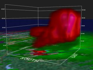
Here’s a GR2AE volume scan from the Shreveport radar depicting storm-relative velocity at 2107Z. Click on the image to enlarge it. You can see a pronounced couplet, indicating strong base-level rotation. I believe this was in fact the storm responsible for the tornado report, although two others in the same region displayed potent mesocyclones. More tornado reports may turn up from that part of Louisiana before the night is through.
Late-November Severe Weather Outbreak In Progress

Now here’s something you don’ see very often on November 22 in the Great Lakes: supercells cruising across northern Illinois. I’d be very happy to be on either the one northwest of Toulon or the one northwest of Princeton. The storms are extending along the cold front northeast on into Wisconsin.

Whoops! The one down by Toulon is now tornado-warned. Imagine that! Here are some radar grabs. Click on them to enlarge.

And with that, I’m signing off.

July 22 West Michigan Supercell and Lightning Fest

I haven’t seen a storm like last night’s storm in Michigan in a long, long time. Man, what a beauty!

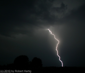
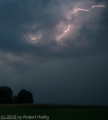
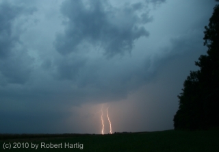
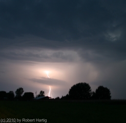
Non-stop lightning, much of it appearing to be positive strokes that lasted for seconds at a time, along with a veritable feast of anvil crawlers, made for a photographic smorgasbord. Plus, the storm structure–as much of it as I could make out at night, illuminated by the incessant lightning–was truly impressive. If only the storm had arrived an hour earlier, when there was enough light to really see the thing!

I had just finished doing a couple of interviews down in Dunlap, Indiana, for the book I’m writing on the 1965 Palm Sunday Tornadoes. My meetings

required me to forgo chasing a supercell that moved through the Battle Creek area as the warm front lifted northward, and I was curious to find out what had happened with it. Pulling into a parking lot, I fired up my computer, opened GR3, and gaped. A line of supercells was advancing across Lake Michigan from Wisconsin. The first one in the line looked great–SRV showed definite rotation–and, headed on an ESE trajectory, the storm was poised to make landfall around Saugatuck. Winds there were almost straight easterly, and they were beautifully backed across most of lower Michigan. Hmmm…what did the VAD wind profile look like at Grand Rapids? Dang, sweet! How the heck did that kind of setup wind up in Michigan?

The storms weren’t moving terribly fast, around 25 knots. Could I make it in time? I was bloody well going to try. There was no denying the rush of adrenaline now galvanizing me, thrusting me into chase mode. I hit US 20 and headed west past South Bend, where the highway merged into US 31 north.

I still had a good 40 miles to go by the time I connected with I-196 near Benton Harbor. I wasn’t sure whether I’d catch the storm by the time it made landfall. Maybe I’d be better off playing more to the east. But I decided to take my chances, and that turned out to be the right move. I couldn’t have timed it better.

As I approached M-89, the eastern part of the storm had made landfall, but the radar showed the rotation still out over Lake Michigan. It wouldn’t be there for long, though, and, having shifted its trajectory south of Douglas, it was now heading straight at me.

Bingo! This was exactly what I’d been hoping for. Leaving the Interstate, I headed east along M-89 and found a nice, open field a mile down the road, just west of 66th Street, 4 miles south of Douglas and 4 miles west of Fennville. Then, turning my car around to face the incoming storm, I parked and grabbed my camera out of the back seat.

The lightning in this beast requires superlatives to describe it. There seemed to be a never-ending supply of high-voltage CGs, delivered with the unbridled, over-the-top enthusiasm of a 4th of July fireworks finale and accompanied by the incessant grumbling of thunder. There were times, as the lightning cells moved past me and surrounded me, when I felt like I was sitting inside an immense flashbulb–a flashbulb that kept firing again, and again, and again. Oh, man, what an extravaganza of pure, searing power and beauty! I’ve done my best to capture it, but my skills as a lightning photographer fall far short of what this storm had to offer. Now, my buddy Kurt Hulst, he’s Da Man when it comes to getting fantastic lightning shots, and I know he got some last night. Me, I seem to have a problem getting a good, crisp focus at night, but I try.

By and by, the flickerings began to illuminate a cloud feature I’d been looking for: a hint of a beavertail off to my northwest. It’s location confirmed what the radar was telling me: the storm’s mesocyclone was moving straight at me. I was in a perfect location–and all this time, standing out in the field near my car, I had yet to feel so much as a drop of rain.

The mosquitoes were thick and nasty, and I was getting eaten alive, but viewing at my position was excellent. Farther east, I’d be getting into thick woods, and since the storm wasn’t exactly rocketing along, I stayed put until the meso got too close for me to be able to distinguish its features. Then I moseyed east a few miles.

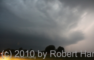
I parked again for a few minutes at 63rd Street and noted that what had begun as a stubby beavertail had rapidly grown into an enormous inflow stinger. To my northwest, I could see what appeared to be a large, low wall cloud–hard to determine exactly what it was or what it was doing at night, but it looked convincing enough that I called it in to KGRR.

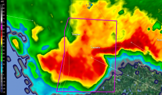
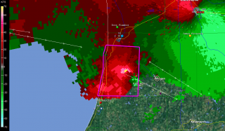
I tracked just ahead of this storm all the way to Plainwell. M-89 proved to be a perfect route, angling southeast along roughly the same path that the storm was taking. On the outskirts of Allegan, I stopped long enough to grab a few radar images. On this page, you can see a nice vault on the base reflectivity, and pronounced rotation on the storm relative velocity. (The circle just southeast of the town center marks my location. Ignore the marker with my name farther to the southwest on SRV; it’s old, an archive from when I dropped off of Spotter Network.)

A little farther down the road, I pulled aside again where a large, open stretch afforded good viewing. The mesocyclone was clearly visible, with a formidable-looking flange on the north side, nice striations, and an impressive inflow band circling in overhead. I hung out at that location until the lightning drew too close for comfort, then hopped back into my car and continued east.

At Plainwell, I dropped south on US 131 past the Kalamazoo exit, caught M-43 west for a mile or so, then parked in a parking lot and let the storm’s southernmost edge blow past me. The storm was still tornado-warned, but the radar indicated that it was weakening–cloud tops lower, VIL not as robust. North of me, just on the other side of M-43, a sheet of rain cascaded out of the wind-blown darkness into the luminous orange domain of the street lamps. Within half a minute, it was upon me, and for a short while, I sat and enjoyed the blast of downdraft and deluge. The rain that I had managed to elude all night had finally caught up with me.

Finally, as the storm bowed out on its journey eastward, I drove back to US 131 and headed for home. I stopped again for a while at the Martin exit, long enough to see what would become of another supercell that was moving inland from the Lake. It, too, quickly bowed out, but, in keeping with the tone of the day, it lit the after-midnight sky with a bombardment of lightning.

It was good to finally pull into my parking lot, climb the stairs to my apartment, and step inside. It had been one heck of a day, and I was ready to call it a good one and hit the sack.

As nasty a storm as it was, why didn’t the Allegan County supercell drop tornadoes? The storm earlier in the afternoon had produced at least one tornado near the Battle Creek airport; why not this one too? After all, it and

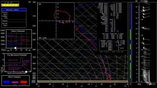
its compatriots had peppered Wisconsin with tornadoes prior to crossing the Lake and heading for West Michigan. All I can surmise is, CAPE was an issue. Winds certainly appeared favorable for tornadoes, and F5 mesoanalysis indicated 1 km helicities ranging from 150-250 across the area as late as 1:00 a.m. The RUC model sounding for KGRR maybe overdoes helicity, but it’s interesting to see what it says about instability. All I can think is that daytime CAPE–whatever it may have been; I never took the time to find out–petered out after sundown, and the shear alone wasn’t enough to spin up tornadoes. That’s my guess as a non-meteorologist, and I’m ready to get other insights and opinions from more knowledgeable heads than mine.

Whatever the case, last night’s was one heckuva storm, and the kind of chase I don’t get to enjoy too often in Michigan. It was nice to finally get such a great opportunity.

The Cap Won

I don’t know why so many storm chasers decided to chase in northern Missouri this last Monday. I could have told folks it had “cap bust” written all over it–didn’t fool me for a minute, as you can see by reading my post written the day before.

Ahem…right, so I got snookered too. The GFS was spot on about the cap, and the NAM way underforecast it. As a result, Missouri chasers wound up sitting under relentlessly empty skies waiting for convection to fire. It finally did in northeast Kansas–after dark. Storms ignited along a boundary (the warm front? ) and a couple went supercellular and even tornado-warned for a heartbeat before the cap re-exerted itself and squenched them.

The real action, ironically, took place in central Illinois and Indiana, well east of where most folks–including me–had expected. Supercells cut a swath along the warm front through Terre Haute, Indianopolis, and parts east and southeast into Kentucky, and a number of purple boxes lit up the radar screen. Nevertheless, SPC storm reports list only one confirmed tornado that touched down near Hillsboro, Illinois, northeast of Saint Louis.

Them’s the breaks. I didn’t chase that day, and I’m glad that I didn’t because I’d almost certainly have gotten skunked in Missouri when I could have driven straight south down US 41 to Terre Haute, not even having to mess with Chicago traffic, and waltzed on into the sweet zone.

Ah, well. I chased today–if chasing is what you can call a guaranteed grunge fest–down toward a warm front by the Michigan border. The trip was my compensation prize for not heading out when it really counted these past few days. The SPC had outlooked a five percent tornado risk this afternoon, and supercells were making their way northeast across Illinois toward Indiana. I figured that if they held together, I might catch them, but not surprisingly, they mushed out.

That was okay. I was chasing blind, with no radar and few expectations other than the hope that I’d at least see some lightning. I did, and called it good. The main storm season is still on the way, and there’s no need to fret over spilled milk when the cow is just priming its udder. It won’t be long now.