Warmest West Michigan Summer in 55 Years

This summer of 2010 has been the warmest summer in West Michigan since 1955, according to WOOD TV meteorologist Bill Steffen. Temperatures in the 90s have predominated, with dewpoints in the upper 70s,  and Lake Michigan water temps–in the mid 70s this morning–have been as high as 80 degrees. That’s like swimming in bathwater, and I’m not even referring to the lake–I’m talking about just stepping outdoors.

We made it as high as 93 degrees yesterday, and it looks like hot temperatures are going to hang around for a few more days until a weak cold front modifies things a bit and hopefully brings a few storms to make life interesting. I’m all for hot and sticky under the right circumstances, but a glance at RAOB model soundings for RUC and NAM shows utterly placid conditions. Winds at 500 millibars are doddering along at a geriatric 10-15 knots, and the rest of the atmosphere is keeping pretty much the same pace.

The great storms of May and June are so far past that they seem like ancient history. Who all besides me is ready for a nice, deep trough to come sweeping across our area? Patience, patience, lads and lasses. The fall season is coming. This stifling heat and humidity will soon get stirred up with episodes of cooler air sweeping in from Canada, and the weather machine will kick into gear once again. Then we can all fire up our laptops and Rain-X our windshields for one last blast before the snows fly.

August Reminiscences: My First Successful Storm Chase

Ah, August. In its own way, it’s a lot like February: a month whose respective season of the year has settled in and ripened into predictability. Upper winds are weak and storms are often the pop-up type, providing a quick flash-and-bang along with localized rainfall before fizzling out. Yet on the horizon, like the first cirrus wisps of a fast-moving cold front, you can see change coming.

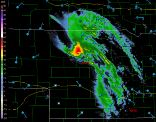
This morning I awakened to the distant grumble of thunder, and when I opened the drapes, the sky was an odd, fish-flesh paleness with darkness moving in. Oh, joy! Upon hearing me stir, Lisa stepped into the room with a smile and told me that a squall line was approaching. Now, that’s the way I like an August day to begin! I fired up the computer and consulted GR3. It was a skinny line, but the NWS was saying big things about it’s being quite the wind machine. Eight miles up the road, the KGRR station ob reported heavy rain; yet here in Caledonia, we got just a mild spray of precipitation, the lightning called it quits, and the line which had threatened to enter like a lion left like a lamb. Now it’s no longer even detectable on the radar.

More thunder is in the forecast for today, though, and for the next few days, as a weak warm front sloshes back and forth and as air mass storms generate more boundaries to fire up convection. It’ll be a bland but enjoyable show.

While my attitude toward August may seem patronizing, this month is capable of producing an occasional potent surprise. On August 24, 2007, I was sitting in the Hastings library when a line of storms formed just to the west and drifted directly overhead. I had my laptop with me with GR3 running, but my forecasting skills and overall experience were still pretty embryonic, and I dismissed some telltale signs, both radar and visual, because forecast models indicated a straight-line wind event.

The storms matured overhead, blasting Hastings with rain and lightning, and then moved to the east and steered an EF-3 tornado through the town of Potterville. I could have easily intercepted it if I had known what the heck I was doing. There it was, a perfect chase opportunity, gift-wrapped with a large ribbon and dropped smack into my lap, and I was too dumb to untie the bow. Aaargh! Four years later, I could still whap myself alongside the head.

But God showers his kindness even on the ignorant. My first successful chase was eleven years earlier, back in August of, I believe, 1996. I don’t remember the exact date, but I can assure you that in those days, cluelessness was a level of expertise I had yet to attain. However, I had at least learned a few things about storm structure and a few concepts such as shear and CAPE. So when the morning blossomed into an exceptionally sticky day–dewpoints had to have been in the mid-70s–and when I noticed clouds in the afternoon leaning over and curling at the tips, I sensed that something was up.

Around 4:30, I happened to glance out of one of the wrap-around windows at the place where I worked and did a double-take. A wall cloud was forming just a mile or so to my south. Hot dang! I watched it for a bit as it moved eastward, then decided to do something about it.

Leaving work early, I hopped into my little Nissan Sentra and blasted after the storm. I had no laptop, no radar, no weather radio, no experience, and very little knowledge. Instinctively I stayed to the south side of the storm. But as it neared Ionia, I could no longer make out cloud features. I wasn’t even certain that the storm still existed. I hit M-21 and traveled east a ways, then north, smack into the precip core. Yep, the storm was still there. But where was the wall cloud? Was there still a wall cloud?

Emerging from the rain, I headed back west, then south down M-66, effectively circling the supercell. As I approached Ionia from the north, the wall cloud came once again into view. Cool! The storm most definitely still had its teeth.

I tracked behind the storm down M-21, getting right to the rear edge of the circulation. Near Muir, a streak of white condensation shot suddenly out of the woods on the right side of the road half a mile in front of me. Was that a tornado? I wasn’t sure, but it looked mighty promising. Also a bit unnerving. I dropped back and put a little more distance between me and the updraft area.

A while later, somewhere in the open country around St. Johns, I parked and observed as the wall cloud reorganized east of me. While I didn’t realize it at the time, I was watching a classic supercell, as nicely structured and impressive as anything I’ve seen out in the Great Plains. It tightened up, with a nice inflow band feeding into it. Then, to my astonishment, a beautiful, slender white tube materialized underneath it a mile away. Extending fully to the ground, the ghost-like tube translated slowly to my right for a distance of probably no more than half a mile, then dissipated. I had just seen my first tornado!

At that point, the storm weakened. No doubt it was just pulsing, but I dropped it and headed for home. However, I soon discovered that another storm was right on the heels of the first one, making a beeline toward me down M-21.

What were the odds that it, too, would be a supercell? Plenty, of course, but to me at that time they seemed as remote as lightning striking twice in the same place. Nevertheless, something told me that I needed to exercise caution, a hunch that verified as I headed back into Muir. An evil-looking flying saucer meso was approaching the town. Hmmm…maybe it would be prudent of me to drop south.

A couple miles out of the path of the updraft, I parked, got out of the car, and stood on the roadside listening to the thunder grumble and watching as the mesocyclone drifted uneventfully over Muir and vanished off to the northeast. Then I climbed back into my vehicle and headed back to M-21, and west toward home.

I was stoked. I had witnessed my very first tornado! Wow! Thank you, Lord, thank you, thank you, thank you!

It was a milestone in my life so huge that hitting the deer just outside of Ada seemed like practically a non-event. Within a nanosecond, the yearling bounded out of the woods and into my path, driven by a powerful urge to bond with my radiator. Much to both of our chagrin, it succeeded.

But you know, I love a good story, and I recognized all the elements of a great one, a real red-letter day. Not only had I experienced my first successful storm chase, but to top it off, I had also collided with a whitetail and demolished my front end. It doesn’t get much better than that–or at least, it wouldn’t until fourteen years later on May 22, 2010, in South Dakota. That was the ultimate storm chasing experience. But that’s another story.

As for this story, all fun and excitement aside, I had learned a sobering lesson about the dangers of storm chasing. I had come face to face with the dark side of nature–with a force that, beautiful as it was, was also fearful, uncontrollable, and deadly, capable of wreaking havoc on a scale that beggars description. No question about it, deer are dangerous. I enjoy seeing them at a distance, just not up close.

Freak Tornado in Wisconsin

A weak cold front has slowly been working its way through Michigan today, with storms firing ahead of it in a very soupy warm sector. Ugh! With temperatures the past several days ranging from the upper 80s to 90 degrees and dewpoints as high as 73 here in Caledonia, it’s about time things cooled off and dried out a bit.

Unfortunately–or fortunately, depending on your point of view–all that lovely moisture has been wasted on insipid lapse rates and humdrum wind fields. What can you do with 500 mb winds of 25 knots or less? Answer: not much.

So what’s with that red dot in Wisconsin in yesterday’s storm reports? Not only did a tornado occur near the town of Cambria, but from the looks of the YouTube videos I saw, it was fairly impressive. Certainly those were more than momentary spin-ups which that Little Storm That Shouldn’t Have put down.

How on earth did it do that? There was nothing happening synoptically that suggested even a remote possibility of tornadoes. So when that puny cell across the lake from me went tornado-warned on GR3 yesterday, I just shrugged it off. Obviously a fluke, some weak Doppler-detected rotation, signifying nothing.

Just goes to show how Mother Nature can mess with your head. According to the NWS office in Milwaukee, that little stinker put down a tornado that lasted 14 minutes, traveled four miles, and did EF1 damage. The level 2 velocity couplet on it was unmistakable. Here’s the full writeup by KMKX, complete with radar images and a photo of the storm right after the tornado had lifted.

Storm chaser Scott Weberpal speculated on Stormtrack that there may have been some kind of interaction between an outflow boundary left by earlier convection. I can’t imagine any better explanation for why what should have been a pussycat of a pulse-type summer storm turned into a barn wrecker. Had the storm gone tornadic farther east, the lake breeze might have been suspect, but the cell was well inland from Lake Michigan.

Today I noticed a couple storms over in the Flint area displaying weak rotation on the radar, and one of them took on that telltale supercellular shape. Given the anemic upper winds, I’d normally have instantly written them off, but after yesterday…well, I watched and wondered, not expecting anything and therefore not disappointed when nothing happened, but still curious. What might happen if any cells firing in that vicinity moved into the Huron lake breeze zone, where the veering surface winds were liable to back?

As it turns out, the storms behaved the way you’d have expected them to given their environment. The last of the line is presently moving through southeast Michigan. But dewpoints are still in the low 70s, and a few popcorn cells are sprinkling the radar. Through my sliding glass door, I can see a big, mushy tower making its debut. Think I’ll grab my saxophone and camera and head out to get some practice in. With a little luck, maybe I’ll get a few lightning photos as a bonus.

An Independence Day Double-Header: Summer Weather Is Here

It’s July 4, Independence Day. Happy Birthday, America! For all the problems that face you, you’re still the best in so many, many ways. One of those ways, which may seem trite to anyone but a storm chaser, is your spring weather, which draws chasers like a powerful lodestone not only from the all over the country, but also from the four corners of the world.

no images were found

This has been an incredible spring stormwise, but its zenith appears to have finally passed for everywhere but the northern plains. And right now, even those don’t look particularly promising. That’s okay. I think that even the most hardcore chasers have gotten their fill this year and are pleased to set aside their laptops and break out their barbecue grills.

Now is the time for Great Lakes chasers to set their sights on the kind of weather our region specializes in, which is to say, pop-up thunderstorms and

no images were found

squall lines. The former are pretty and entertaining. The latter can be particularly dramatic when viewed from the eastern shore of Lake Michigan, sweeping in across the water like immense, dark frowns on the edge of a cold front. If you enjoy lightning photography, the lakeshore is a splendid place to get dramatic and unobstructed shots. Not that I can speak with great authority, since so far my own lightning pictures haven’t been all that spectacular. But that’s the fault of the photographer, not the storms.

The images on this page are from previous years. So far this year I’ve been occupied mainly with supercells and tornadoes, but I’m ready to make the shift to more garden variety storms, which may not pack the same adrenaline punch but lack for nothing in beauty and drama.

July 4th is a date that cold fronts seem to write into their planners. I’ve seen a good number of fireworks displays in West Michigan get trounced by a glowering arcus cloud moving in over the festivities. But tonight looks promising for Independence Day events. Storms are on the way, but they should hold off till well after the party’s over.  That means we’ll get two shows–the traditional pyrotechnics with all the boom, pop, and glittering, multicolored flowers filling the sky; and later, an electrical extravaganza, courtesy of a weak cold front. A Fourth of July double-header: what could be finer than that?

May 22, 2010, South Dakota Chase: On the Road

After catching breakfast in Chamberlain, South Dakota, we–Mike Kovalchick, Bill and Tom Oosterbaan, and I–are heading west along I-90. We have plenty of time to determine where we want to camp out this afternoon until storms start firing later today.

If you’ve kept track of the present weather system, then you know that it has had a number of serious detractors, the chief one being a nasty cap. To complicate things, the NAM and GFS were initially wildly at odds. But Thursday night the GFS began to agree with the NAM on opening up an uncapped corridor from Nebraska into South Dakota, and from there the model forecasts became progressively more promising. The SPC Day One Convective Outlook now shows a 10 percent  possibility of tornadoes extending from the Nebraska border north through the Dakotas. The hub of the activity will most likely be in South Dakota, which means that we are sitting in the catbird seat.

It feels great to finally get back out on the road and chase the Plains again. I’ve missed the big action so far this spring. This setup may not be the year’s big event, but it shows promise, and it coincides with a time when I’ve got the funds to go after it. Whether or not we see a tornado today–and tomorrow, and maybe Monday, as we follow this system’s evolution–we’ll at least see some nice storms. And, I might add, some beautiful countryside. It’s been a few years since I’ve been in South Dakota. It’s good to be back!

A Glance at Friday: Severe Weather in the Great Lakes

It now seems a sure bet that the eastern Great Lakes is due for a spate of severe weather. The SPC is presently making it out to be a linear event, as is typical of cold fronts sweeping through our region, but the wind profiles suggest the possibility of supercells and tornadoes.

If you go by the present, 12Z NAM run, central Ohio appears to be the sweet spot, with a variety of parameters converging over or near a bullseye of 2,000 j/kg SBCAPE. Here are a few maps for forecast hour 21Z to give you an idea. Click on the images to enlarge them. The first shows the aforementioned SBCAPE (shaded), sea level pressure (contours), and surface wind barbs. Not a bad bit of instability if this scenario pans out.

In the second image, you can see a nice overlay of 55-60 kt 500 mb winds (shaded) over 35-40 kt 850 mb winds (contours). The wind barbs are for the 850 mb level. The H5 winds veer still further to the west. I think it’s safe to say that shear won’t be an issue, and 1 km VGP, not shown, is as high as 0.4 in the area of heightened instability. Helicity maxes are well to the north, but I wonder what kind of effective SRH we’ll wind up with where it counts.

The third map shows a Theta-e lobe pushing up into northern Ohio with a surface lifted index between -4 and -6 perched squarely over the axis. That should get the job done.

In the last map, three different significant tornado parameters–the well-known STP, the APRWX tornado index, and the Stensrud tornado risk–all converge nicely over the same spot near Newark, Ohio. Three overlays can be a bit difficult to decipher, so let me help: the STP is shaded, the APRWX is tightly contoured like an onion, and the Stensrud has broader

contours, with its highest value circling the APRWX in a yellow ring.

All this to say, Friday may have some potential. I don’t get too excited about cold front events around here–not that we have many options in the Great Lakes, but a steady diet of squall lines has a way of lowering a person’s expectations. Of course, as soon as you let down your guard, along comes the exception to prove that storms in our area can and do deliver. Maybe this round will prove to one of those occasions. We’ll find out two days hence.

April 22-23 TX-OK-KS Storm Chase

As I begin this post, the first major tornado-producing storm system of 2010 is moving to the east after taking 10 lives in the South yesterday. Already a tornado-breeder, the system matured yesterday into a wide-scale outbreak driven by hefty bulk shear, massive low-level helicities in the order of 600 and above, and CAPE values up to 2,500. Yazoo City, MS, was hit hard by a powerful, rain-wrapped wedge. The verdict remains open as to whether this was a single, long-lived tornado that traveled as much as 200 miles, or one in a series, which seems likelier.

Sorry, I can’t offer a write-up on yesterday’s storms. I was home sleeping, and I have no regrets that I missed anything. With the models suggesting rain-wrapped, low-visibility tornadoes rocketing along at 50 mph or more; with the potential for hydroplaning while driving at gonzo speeds in order to keep on top of fast-moving, rapidly morphing storms and avoid having them get on top of us; and with the logistical madness of three sleep-deprived chasers–Bill Oosterbaan, Mike Kovalchick, and me–having to backtrack afterward to Saint Louis where my car was parked and then drive 450 miles back to Grand Rapids, the negatives of chasing this big, messy, and dangerous tornado outbreak seemed to easily outweigh the potential payoffs.

So Bill, who was determined to catch the action, made arrangements to hook up with Kurt Hulst and Bill’s brother, Tom Oosterbaan, in Illinois, and then he dropped Mike and me off at my car. The two of us headed home, and I can tell you, it felt mighty good to crawl under the covers upon my return and sleep until 1:00 in the afternoon. After talking with Tom yesterday evening, I’m glad I chose as I did.

I may have more thoughts to share about yesterday’s scenario, but I’ll save them for another post. The previous two days in Texas and Kansas deserve some attention in their own right, and not just as the prequel to the big, day 3

outbreak. They may have been a bust for me tornado-wise, but they were nevertheless the first decent system of the year and my first chase out on the Plains. It was a blessing to get out on the road once again and see the vast, textured expanses of the Texas and Oklahoma panhandles.

Naturally, the landscape included the TIV2, which at this point should be designated a mobile national monument of the Great Plains. Back in 2008 we had bumped into its predecessor in Nebraska; this Thursday, we pulled into a gas station in Pampa, gassed and Rain-Xed up, then drove around to the other side of the station, and surprise! There it was–the Tank and its entourage. Cool! Who can resist taking a few photos? Not me.

As for chasing storms, Thursday was a should’a. We should’a either listened to Mike and headed for western Kansas, where most of the tornadoes occurred later in the day, or else gone with Bill’s and my initial impulse to chase the bigger CAPE, albeit forecasted low helicities, near Childress, Texas. For that matter, if we had endured the initial grunge in Wheeler, or better yet, just parked along US 60 east of Pampa–in other words, if we had just sat and waited–we’d have been golden. Instead, we sacrificed an opportune position and went after some cells that fired to our northwest along the dryline. Doing so made a certain amount of sense, as those storms were already looking supercellular and were moving toward the warm front and better helicities, while the cells popping up to our south in advance of the dryline seemed to just sit there and languish. So after the northern storms we went.

Bad decision. One of the southern cells developed steam shortly after we made our move. We could still have turned around at that point, but we chose to commit to our decision and wound up betwixt and between the vortex breeding grounds to our south and north. As a result, we found ourselves looking forlornly at the radar as the southern cell shaped up beautifully and began churning out tornadoes, while our storms struggled valiantly but

never quite got their act together. If there’s a lesson to be learned, it’s that good things come to those who wait. And, I might add, that model SRH is nice if you can get it to cooperate, but it can be deceptive. Helicity is prone to change with the storm environment in ways that forecast models don’t anticipate. If CAPE and 0-6 km shear are sufficient, storms may just generate their own low-level helicity.

Anyway, we chased the dryline storms and busted. Our storms tried hard to tornado, but they just couldn’t quite manage to produce. So instead of the blue ribbon, we wound up with honorable mention: some decent structure, including cool-looking wall clouds, a few funnels, and–as tail-end Charlie went high-precip in the Oklahoma panhandle–a nice, banded-looking storm with a formidable shelf cloud.

As for Friday, we picked exactly the right target up in northeast Kansas along US 75 just south of the Nebraska border. We were smack in the axis of a nice moisture plume. But nothing happened. As the afternoon progressed, the cumulus field we were sitting under began to generate towering cumuli, but these turkey towered and busted against a mid-level cap that just wouldn’t erode. So that was that. Looks like a lot of other chasers got disappointed as well by the northern play. It happens. We finally cut our losses around 7 p.m. and headed back east toward Saint Louis and a band of storms that was moving toward I-70. Ironically, one of these produced a series of tornadoes. If Thursday had been a should’a, Friday was an if-only. If only we’d targeted northeast Missouri…but there had been no reason to do so that we could see.

Now another storm system looks to be moving into the Midwest later this coming week. The action could be closer to home, but I’ll think about that in a day or two. Right now, it’s time to make this post, rest up, and get on with the rest of life.

Remembering April 11, 1965: Highlights of the Palm Sunday Tornado Memorial Service

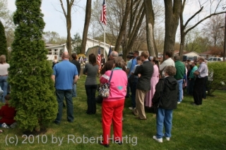
If you’ve been following this blog lately, then you’re well aware that yesterday was the 45th anniversary of the 1965 Palm Sunday Tornado Outbreak. The commemoration held at the Tornado Memorial Park in Dunlap, Indiana, came together beautifully thanks to the hard work of my friend Debbie Watters, who owns the park. To say that it was a memorable event understates some of the truly amazing things that transpired.

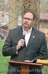
Dan McCarthy, the meteorologist in charge at KIND in Indianapolis, was the keynote speaker. Dan did a superb job describing the strides that severe weather forecasting and the warning system have taken since 1965, and explaining how the Palm Sunday Outbreak served as a catalyst for those changes. If there is any comfort to hearts that still ache over the loss of loved ones in the storms, Dan suggested that at least part of it may lie in knowing that a tornado catastrophe of such magnitude is unlikely to ever happen again.

Several other speakers followed Dan. Last of all was Debbie. I think one reason she does so well behind a microphone is that she pours her heart out toward her listeners. At a gathering of tornado survivors and their families, the needs may not be readily apparent; but Debbie, having lost her brother Stevie in the Dunlap F5, knows what lies below the surface. It had to have taken some courage to address the subject of survivor guilt as honestly and

straightforwardly as Debbie did, but it’s only in shining light on such a painful issue that its grip can perhaps be broken on people who, over four decades later, still wonder why they lived while their loved one died

At the end of the service, there was a balloon launch in loving memory of the Elkhart County tornado victims. It was a poignant moment, watching those bright, merry balloons soar skyward into the blue.

But it was the behind-the-scenes happenings, the interpersonal connections, that will live on in my mind. There were some heartwarming moments, and a few that were just plain incredible. Debbie had always wondered who the stranger was who saved her mother’s life after the tornado, and who sheltered the two of them in his car until an ambulance arrived. Yesterday, a woman introduced herself to Debbie as the man’s wife. You can imagine what a powerful meeting that was for both women.

Among the roughly 150 attendees, I was delighted to see Paul and Elizabeth Huffman. Paul is the retired Elkhart Truth photographer who took the famous image of twin funnels straddling US 33 south of Dunlap, destroying the Midway Trailer Court. That photo, one of six in a sequence, is arguably the most famous and dramatic tornado photograph of all time, and one that has inspired more than one young kid to pursue meteorology as a career.

Now in his eighties, Paul is a peppery and humorous personality, and his wife, Elizabeth, is a sweetheart. It was fascinating, in talking with them, to get insights into how things played out that day. Paul wasn’t even aware of the twin-funnel structure when he snapped the photo; in his viewfinder he saw just the rightmost funnel. It was only when the startling image of “The Twins” emerged in development that Paul realized he had captured something extraordinary on film.

I was particularly pleased when one of the speakers, Brian Beaver–an award-winning radio correspondent formerly with IPR–took time to publicly recognize Paul and honor him for his achievement.

My friend Pat Bowman and her brother John were also present. But of course they would be–Pat is integrally knit into these events. She and Deb are my two “tornado ladies,” dear to each other and to me. The way that the three of us connected is a pretty incredible story in its own right, and it all started with Pat. Actually, it started long before, with a newspaper account of a young couple’s tragic loss of their child, and of a small boy’s prayers for them in response. There is a reason that Pat is very special to me. But that story is for another time.

The last photo on this page is one I will always treasure. That’s Elizabeth and Paul Huffman on the left. Debbie is the blonde, and that’s Pat on the right. God gifts us with people, and it was a blessing to me to see these four together. The threads of events that connect them are intricate and remarkable, and I feel privileged to see the connections continue to unfold in their lives and in mine.

March 28 Tornadoes in the Southeast

An outbreak of severe thunderstorms spun off a series of damaging tornadoes in the Southeast earlier this evening. The SPC’s preliminary count shows eight tornado reports, seven in North Carolina and one in Florida.

Two trailer parks in Davidson County, North Carolina, sustained damage, with multiple injuries, and for Guilford County came this report:

GUILFORD COUNTY EMERGENCY MANAGER CONFIRMED 20 STURDY HOMES DAMAGED NORTH OF HIGH POINT. (RAH)

In all, this evening has been an active one weatherwise, with low-topped supercells rumbling across the hills and flatlands from Florida on up to Virginia. As I write, three tornado warnings are in effect, though at this point they’re all Doppler warned and I think the storms are done producing for the night.

Of course I’ve done my share of armchair chasing. Here are a couple radar grabs of two North Carolina supercells. The first image, taken at 9:30, shows base reflectivity, and the second, captured 24 minutes earlier at 9:06, shows storm relative velocity. Don’t ask me to explain the lag time, because I can’t–I didn’t realize so much time had elapsed between image grabs until I looked at the file details a while later. No biggie, though–this isn’t a research paper, and you get a good idea of the progression of the storms.

They weren’t big storms, but they sure packed a punch. For me, this spring thus far has been a demonstration of how you don’t need 60s dewpoints and

much CAPE at all in order to get tornadoes. Cold mid-level temps conspiring with  massive shear and hulking 1 km helicities can do a lot with dewpoints 55 degrees and even lower. Today’s 6 km shear has been in the order of 90 knots in places, with low-level helicities exceeding 400. That’ll get the job done, and evidently it did this evening.

Sea surface temperatures in the Gulf of Mexico remain cooler than normal, but with the GFS consistently wanting to bring in decent moisture–finally–into the Plains, and now with the NAM painting a similar picture, what could prove to be a very active tornado season may at last be stirring to life. Tonight may prove to have been a warning shot fired across the bow. Storm chasers, got your Rain-X ready?

45 Year Commemorative Event Planned for 1965 Palm Sunday Tornadoes

April 11 this year will mark the 45th anniversary of the second worst Midwestern tornado outbreak of modern times. The 1965 Palm Sunday Outbreak is noteworthy not so much for the number of tornadoes involved as for their violence and the number of fatalities they produced. Out of 38 “significant” (F2 or greater) tornadoes that occurred in six state over 11 hours, 19 were rated at F4 and two at F5. Going by NOAA’s death toll and adding to it one Iowa resident who died a month later from his injuries, 272 men, women, and children lost their lives in the storms.

One of the victims was Stevie Forsythe, the brother of my friend Debbie Forsythe-Watters. Debbie is the owner of a tornado memorial park that occupies the property where her childhood home in Dunlap, Indiana, just south of Elkhart, was swept away by F5 winds. To learn more about the park, check out my earlier post on the Dunlap tornado memorial, complete with photos.

Debbie is currently planning this year’s commemorative event, to be held on the date of the tornadoes: Sunday, April 11. If you take an interest in this historic and influential weather disaster, you may wish to attend the service. It will be held on the park grounds. The time has yet to be determined, but it will likely be in the late afternoon.

I will post more information as details are solidified.