RAOB and Other Weather Widgets

Some storm chasers pride themselves in being minimalists who have a knack for intercepting tornadoes without much in the way of gadgetry. Others are techies whose vehicles are tricked out with mobile weather stations and light bars. It’s all part of the culture of storm chasing, but the bottom line remains getting to the storms.

To my surprise, while I draw the line at gaudy externals, I’ve discovered that I lean toward the techie side. For me, storm chasing is a lot like fishing. Once you’ve bought your first rod and reel and gotten yourself a tackle box, you find that there’s no such thing as having enough lures, widgets, and whizbangs. You can take the parallels as deep as you want to. Radar software is your fish finder. F5 Data, Digital Atmosphere, and all the gazillion free, online weather maps from NOAA, UCAR, COD, TwisterData, and other sources are your topos. And so it goes.

A couple years ago I spent $300 on a Kestrel 4500 weather meter. It’s a compact little unit that I wear on a lanyard when I’m chasing. It weighs maybe twice as much as a bluebird feather, but it will give me temperature, dewpoint, wind speed, headwinds, crosswinds, wind direction, relative humidity, wet bulb temperature, barometric pressure, heat index, wind chill, altitude, and more, and will record trends of all of the above.

I use it mostly to measure the dewpoint and temperature.

Could I have gotten a different Kestrel model that would give me that same basic information for a third of the cost, minus all the other features that I rarely or never use? Heck yes. Nevertheless, I need to have the rest of that data handy. Why? Never mind. I just do, okay? I need it for the same reason that an elderly, retired CEO needs a Ferrari in order to drive 55 miles an hour for thirty miles in the passing lane of an interstate highway. I just never know when I might need the extra informational muscle–when, for instance, knowing the speed of crosswinds might become crucial for pinpointing storm initiation.

If I lived on the Great Plains, with Tornado Alley as my backyard, I might feel differently. But here in Michigan, I can’t afford to head out after every slight-risk day in Oklahoma. Selectivity is important. I guess that’s my rationale for my preoccupation with weather forecasting tools, along with a certain vicarious impulse that wants to at least be involved with the weather three states away even when I can’t chase it. Maybe I can’t always learn directly from the environment, but I can sharpen my skills in other ways.

Does having all this stuff make me a better storm chaser? No, of course not. Knowledge and experience are what make a good storm chaser, and no amount of technology can replace them. Put a $300 Loomis rod in the hands of a novice fisherman and chances are he’ll still come home empty-handed; put a cane pole in the hands of a bass master and he’ll return with a stringer full of fish. On the other hand, there’s something to be said for that same Loomis rod in the hands of a pro, and it’s not going to damage a beginner, even if he’s not capable of understanding and harnessing its full potential. Moreover, somewhere along the learning curve between rookie and veteran, the powers of the Loomis begin to become apparent and increasingly useful.

Now, I said all of that so I can brag to you about my latest addition to my forecasting tackle box: RAOB (RAwinsonde OBservation program). This neat little piece of software is to atmospheric soundings what LASIK is to eye glasses. The only thing I’ve seen that approaches it is the venerable BUFKIT, and in fact, the basic RAOB program is able to process BUFKIT data. But I find BUFKIT difficult to use to the point of impracticality, while RAOB is much easier in application, and, once you start adding on its various modules, it offers so much more.

RAOB is the world’s most powerful and innovative sounding software. Automatically decodes data from 35 different formats and plots data on 10 interactive displays including skew-Ts, hodographs, & cross-sections. Produces displays of over 100 atmospheric parameters including icing, turbulence, wind shear, clouds, inversions and much more. Its modular design permits tailored functionality to customers from 60 countries. Vista compatible.

–From the RAOB home page

The basic RAOB software arrived in my box a couple weeks ago courtesy of Weather Graphics. It cost me $99.95 and included everything needed to customize a graphic display of sounding data from all over the world.

I quickly realized, though, that in order to get the kind of information I want for storm chasing, I would also need to purchase the analytic module. Another $50 bought me the file, sent via email directly from RAOB. I downloaded it last night, and I have to say, I am absolutely thrilled with the information that is now at my disposal.

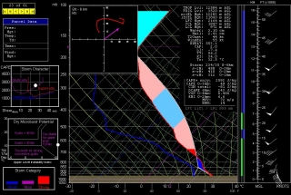
Here is an example of the RAOB display, including skew-T/log-P diagram with lifted parcel, cloud layers, hodograph, and tables containing ancillary information. Click on the image to enlarge it. The display shown is the severe weather mode, with the graphs on the left depicting storm character, dry microburst potential, and storm category. (UPDATE: Also see the more recent example at the end of this article.)

The sounding shown is the October 13, 2009, 12Z for Miami, Florida–a place that’s not exactly the Zion of storm chasing, but it will do for an example. Note that the negative area–that is, the CIN–is shaded in dark blue. The light blue shading depicts the region most conducive to hail formation. Both are among the many available functions of the analytic module.

The black background was my choice. RAOB is hugely customizable, and its impressive suite of modules lets you tailor-make a sounding program that will fit your needs beautifully. Storm chasers will want to start with the basic and analytic modules. With that setup, your $150 gets you a wealth of sounding data on an easy-to-use graphic interface. It’s probably all you’ll ever need and more–though if you’re like me, at some point you’ll no doubt want to add on the interactive and hodo module.

And the special data decoders module.

Oh yeah, and the turbulence and mountain wave module. Gotta have that one.

Why?

Never mind. You just do, okay?

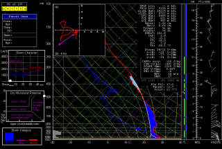
ADDENDUM: With a couple storm seasons gone by since I wrote the above review, I thought I’d update it with this more timely image. If you’re a storm chaser, you’ll probably find that what the atmosphere looked like in May in Enid, Oklahoma, is more relevant to your interest than what it looked like in Miami in October.
Storms Next Week: Is There Hope?

I love this balmy, blue fall weather. But down inside me, not too far from the surface, convective starvation is gnawing away. Does 2009 have a “second season” in store? Judging by this year’s insipid, ridge-robbed primary storm season, there’s reason to wonder, but I sure hope so.

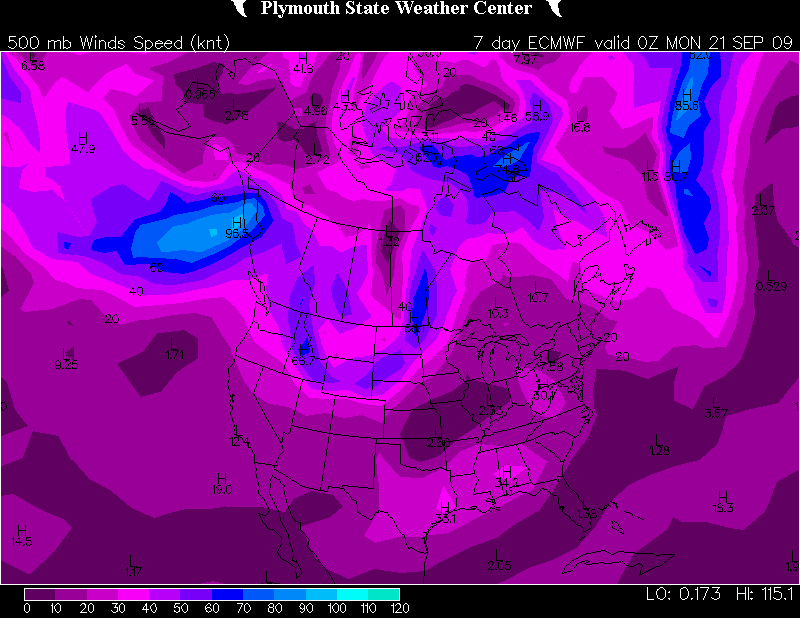
There may be a flicker of hope for a week from now, at least if you go by the ECMWF.

090914162010

ECMWF 500 mb winds for Sunday night.

As for the GFS…mmmph.  More zonal flow, though the sea level pressure map suggests a hint of troughing for the northern CONUS. Not anything to pique one’s interest, though. And here’s the SPC’s 4-8 day outlook:

VALID 171200Z - 221200Z

   ...DISCUSSION...
   GENERALLY BENIGN CONDITIONS -- WITH RESPECT TO THE POTENTIAL FOR A
   SUBSTANTIAL SEVERE EVENT -- ARE FORECAST THROUGH DAY 5-6 /I.E. FRI.
   AND SAT. SEPT. 18-19/...AFTER WHICH SOME FAIRLY SUBSTANTIAL MODEL
   DIFFERENCES BECOME APPARENT BETWEEN THE GFS AND ECMWF.  THOUGH SOME
   HINTS THAT SEVERE POTENTIAL COULD INCREASE FROM DAY 6
   ONWARD...CONFIDENCE REMAINS QUITE LOW ATTM.  UNTIL THEN...SEVERE
   POTENTIAL APPEARS LIMITED AT BEST...AS SLOWLY PROGRESSIVE PATTERN
   ALOFT KEEPS THE MUCH OF THE U.S. UNDER THE INFLUENCE OF LONGWAVE
   MEAN RIDGING.  GIVEN THE LACK OF APPRECIABLE SEVERE POTENTIAL DURING
   THE FIRST HALF OF THE PERIOD...AND LACK OF CONFIDENCE IN MODEL
   GUIDANCE BEYOND...NO SEVERE THREAT AREAS WILL BE HIGHLIGHTED THIS
   FORECAST.

I’m rooting for the Euro. It sure would be nice to see some storms. Any kind of storms. Just some decent lightning would be much appreciated right about now.

As I’ve said more than once this year, I’m crossing my fingers but I’m sure not holding my breath.

August 20 Tornadoes in Canada

Yesterday’s storms marched across West Michigan pretty uneventfully, but as they moved east, they grew fangs. Moving into better helicity and shear, they began to develop supercellular characteristics from around Saginaw down into Ohio. It was interesting to track them on the radar, but I had no idea what was coming as they moved into Canada.

KDTX showed some small but nicely shaped and very suspect-looking cells moving out over Lake Huron. Evidently a few of them meant business. Tornadoes began dropping in Ontario, with the area around Toronto getting slammed, and with one fatality recorded in the town of Durham.

Here’s a video of the strong tornado that hit Vaughan, just north of Toronto. Looks like the person who posted on YouTube lifted the footage off of the news. I looked for other footage, but while there’s plenty out there, much of it isn’t of very good quality. This is some of the best I could find. There is presently one pretty dramatic, close-range clip of the Durham tornado which a young woman shot with the video cam on her cell phone, but I’m not confident that the link will last very long. Maybe this one won’t either, but I’m crossing my fingers and hoping it does.

August Lightning

Kurt Hulst and I got together to chase a little lightning last Sunday, August 9.  With dewpoints in the low to mid 70s, temps in the low 90s, and CAPE around 3,000, there was plenty enough gas in the convective tank. Borderline bulk shear and unidirectional winds meant that tornadoes wouldn’t be the order du jour, but it was nice to just get out and watch some storms.

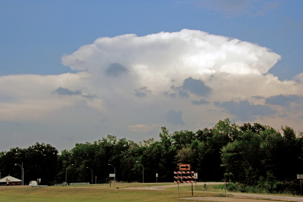
Strong thunderstorm south of Lansing.

Strong thunderstorm near Lansing.

Strangely, even though Kurt and I both knew that it probably didn’t make much difference where we went, north or south–there were a lot of storms to choose from–we had a hard time choosing where we wanted to go. I guess there’s always something that lurks in the back of my head that thinks, I know there won’t be any tornadoes, but just in case, where would one be likeliest to form? It’s dumb, but it’s what goes on in my head and probably what goes on in Kurt’s too, and it tends to needlessly complicate simple choices.

Anyway, we opted to head north and wound up near Saint Johns, where we parked and let a gust front munch us with high winds, spotty but heavy rain, and infrequent lightning.

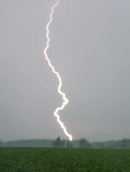
A lightning bolt strikes outside of Saint Johns, Michigan.

A lightning bolt strikes outside of Saint Johns, Michigan.

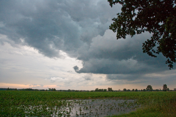
Evening colors tinge receding storm clouds.

Evening colors tinge receding storm clouds.

Afterward, we dropped south on I-69 to Charlotte and caught another cell moving in. Kurt got at least one nice lightning shot. I didn’t get anything at that location, but I didn’t mind. The sunset was extraordinarily beautiful, with melon-colored light filtering through wandering rainshafts and turning the sky to a patchwork of clouds, some catching the sunset rays and others concealing them, like a wardrobe filled with glowing garments and gray rags.

Later that night, a second batch of storms blew through Caledonia, and these ones were most sincere. The lightning was nonstop, but the time was late, I was in bed, and I decided to forgo trying to shoot lightning from my balcony and simply lie there and enjoy the show.

Year of the Cap Bust

I guess I’m just a slow learner when it comes to technical stuff that involves linear thinking. Sooner or later, though, if I stick with something long enough, I usually emerge more knowledgeable for having done so. Nowhere has this been more true than in storm chasing, an activity which obviously depends heavily on figuring out if and where there will be decent storms to chase.

Seems like I’m constantly being confronted with some new aspect of the atmosphere that I haven’t factored into my forecasting, or that I haven’t factored in as effectively as I needed to. The upside of that, though, is that I wouldn’t even be aware of what I don’t know if I hadn’t learned enough to at least recognize my areas of ignorance. If my forecasts aren’t as expert as those of a trained meteorologist, they’re nonetheless a seven-league bound beyond when I was just beginning to grapple with all those arcane terms and acronyms of convective weather such as SBCAPE, CIN, 0-6km bulk shear, LIs, helicity, and lapse rates, and when the only thing I could do with a skew-T or a hodograph was shake my head in bewilderment.

This has been the year of discovering the 700 mb/12C limit. By “discovering,” I mean through empirical experience, and by “empirical experience,” I mean cap busts. Of course, I’ve endured plenty of cap busts in my development as a storm chaser; I just didn’t understand exactly what was going on, or why the high risk area I was sitting in was producing nothing more than smug blue skies rather than carnivorous supercells.

One memorable day in Iowa drove home the lesson perfectly. MLCIN was supposed to erode by later in the afternoon, and it got to a point where it was eroding, at least according the RUC. With SBCAPE at some ridiculous figure like 7,000 j/kg, I figured that at some point a convective tower would punch through the cap and go absolutely gonzo. Instead, the clouds kept firing up into the nicely sheared environment and then dying, firing and dying, firing and dying. The reason? A 700 mb temperature of around 14C, possibly considerably higher. Lesson learned: it doesn’t much matter what the models have to say about the CIN eroding when you’ve got mid-level temperatures like that.

I experienced another cap bust yesterday, though I can’t feel too bad about it since I had no compelling reason to head out in the first place, the conditions were so marginal. It was interesting to notice that in this situation, the circumstances were reversed: RUC showing my area under very breakable 700 mb temps of around 10C, but with MLCIN creating some concern. However, the CIN appeared to be eroding, and when an SPC mesoscale discussion spotlighted the area I was in, I started feeling happy about having made the drive down to west-central Illinois.

But the CIN started building back in, and by 00Z I found myself socked in under values around -300 j/kg. Not much a parcel of air can do with that, I guess, no matter how big the CAPE is. I turned around and headed home.

A paper by Bunker, Wetencamp, and Schild of the NWS in Rapid City, South Dakota, explores the ins and outs of the 700 mb/12C limit and concludes that it has a limited, conditional application. However, as my buddy Mike Kovalchick pointed out to me, the paper also reveals that only 5 percent of tornadoes within the study period formed when H7 temps exceeded 12C, and virtually no violent (EF4 and EF5) tornadoes occurred above that threshold.

So for practical use in storm chasing, the 12C limit appears to be a very useful rule of thumb. The issue for me then becomes a matter of refining my ability to know when cold air advection will lower the 700 mb temps. But that’s a subject for another blog. I’m tired of thinking. It’s time to go meet my buddy Dewey down in Plainwell and grab a brew at Arie’s. Ciao!

VORTEX 2 in Northwest Missouri

After years of planning and digging for research dollars, VORTEX 2 finally hit the pavement this spring, only to be met with a severe weather famine. It had to have been heartbreaking for the team, watching that merciless, unending ridge stretch from day to day and week to week, knowing that the clock was ticking on their window for gathering data.

Thankfully, tornadic storms hit the Plains before the window closed, and the team got what they needed. I wish it had gone as well for me. My tally for this season has been one tornado. But I did at least get the compensation of catching some nice storms with cool structure, including the June 7 supercell in northwest Missouri that every chaser in the country seemed to be after–including, of course, the VORTEX 2 armada.

Just for kicks, here is a shot of one of the DOW trucks–the new one with the square radar rig. I believe I took this shot south of Forest City. The DOW is parked to the left in the photo, and I’m looking at it head-on. Viewed from that angle, the radar unit looks like the front end of a tractor trailer.

One of the DOW (Doppler On Wheels) trucks collecting data.

One of the DOW (Doppler On Wheels) trucks collecting data.

Sure does bring back memories. I hope I’ll get a chance to make a few more before the chase year closes. Prime storm season is over, but it’s still a long time yet before the snows fly.

The Lake Breeze Zone and Severe Weather

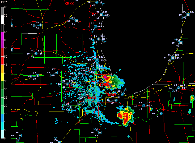
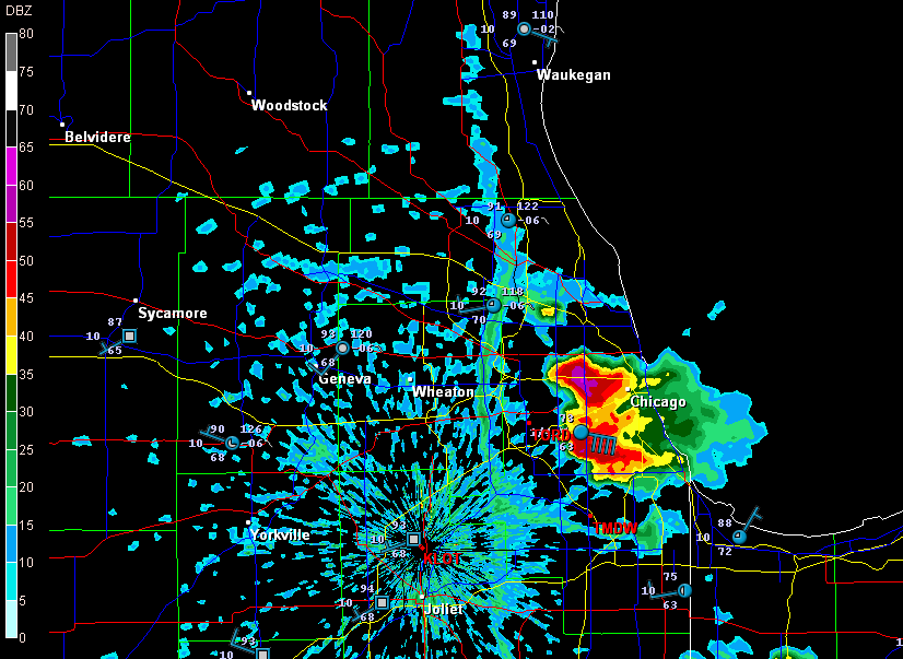
Earlier today, I opened up GR3 just out of curiosity and noticed some blobs of convection along the Lake Michigan shore by Chicago. Here are a couple radar grabs.

lake-breeze

lake-breeze1

These images interest me for several reasons, all of which have to do with a Great Lakes phenomenon called the lake breeze zone. The lake breeze zone is not a fixed area. Its boundaries are atmospheric, not geographic.

And boundaries truly are what it’s all about. Probably the most immediately noticeable feature on these radar images, besides the obvious storms, is the north-south boundary set up by the onshore breeze. It’s a great point of convergence where overall westerly surface winds butt up against backing winds from off the big lake. You can see how outflow from the storms that have fired up within the lake breeze zone interacts with the lake breeze boundary.

Another less immediately obvious by-product of the lake breeze zone is helicity. Notice how the wind barbs farther inland are all westerly, but inside the lake breeze zone, they’re easterly. Now, I’m no expert on this stuff, but I know enough to recognize the potential for localized helicity to occur even when the large-scale flow is unidirectional. During the day, strong thunderstorms can go tornadic when they encounter a backing onshore breeze near Chicago, along the Wisconsin shoreline, and along the Lake Huron and Lake Erie shores of eastern Michigan. The same can happen in the evening along Michigan’s western coast as the land cools and an offshore breeze prevails. Many times I’ve noticed the NAM and RUC showing a small sigtor centerered over Berrien County when there are no sigtors anywhere else in the region, and I’m sure this phenomenon is largely due to the lake breeze in that area.

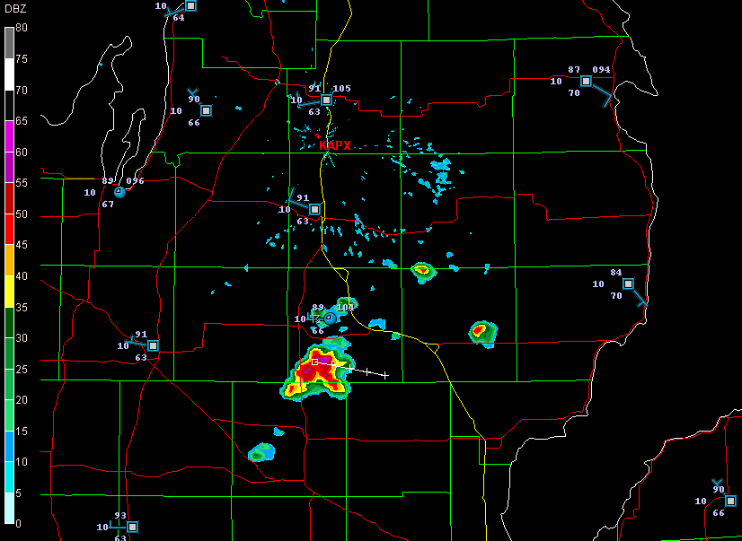
Right now I see storms firing up farther north around Gladwin and Roscommon.

storms

A glance at the Gaylord VWP shows west winds neatly stacked from the surface on up. But look at the METARs along Lake Huron. Without much in the way of bulk shear, the storms are subsevere, just little popcorn cells. But it will nevertheless be interesting to see what comes of them as they work their way into those backed shoreline winds. You just never know.

Blue Sky Bust in Iowa, But a New Chase Day in the Midwest

Thanks to a merciless cap, action in Iowa didn’t start yesterday until shortly before dark, and it never came close to living up to its potential. The RUC majorly underforecast convective inhibition, resulting in a lot of broken chasers’ hearts around Waterloo, mine included.

Storms finally did fire to the east, and a beautiful supercell crossed the Mississippi River after dark at Prairie du Chien, Wisconsin, where Bill and I have overnighted. We wound up on another cell that slowly organized and went supercellular, following in the first storm’s track. There were a number of storms in a cluster that showed rotation, but none of them put down tornadoes.

Today’s event looks to be widespread, and Michigan could very possibly see some action. But Bill and I are looking toward western Illinois. Galesburg presently looks good, or maybe Davenport. The storms are already getting their acts together. Time to sign off, check out of this hotel, and get on the road.

June 8: Mini-Supercell in Northern Illinois and Severe Squall Line on the Lake Michigan Shoreline

This is really part two of the previous post. After chasing a potent, monster hailer of a supercell north of Saint Joseph, Missouri, I overnighted at a hotel outside of Des Moines, Iowa. When I stepped outside the next morning, the air was much cooler and drier, a stable atmosphere that wouldn’t produce so much as a sneeze, let alone a tornado.

But I knew that the SPC had outlooked the area to my east across northern Illinois, and for several days I myself had been eyeballing my home state of Michigan, where the NAM-WRF had been consistently indicating the possibility of tornadoes. With a little luck, I hoped to make it back in time to chase whatever convection might pop up along the warm front.

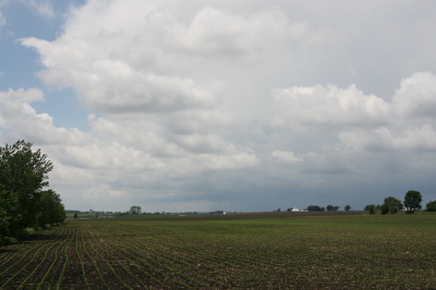
As I approached Davenport, I observed  towering cumulus muscling up through the troposphere. However, I didn’t pay them any attention–that is, until Bill Oosterbaan called to inform me that the SPC had just issued a mesoscale discussion for the area just east of me. Even as we talked, I noticed a lowering on a cumulus tower a mile or two to my northeast. When it continued to develop, I decided to investigate. Leaving I-80, I parked across from a truck stop at the Atkinson exit to watch.

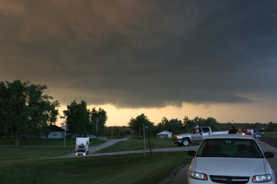
The next cell to my west quickly grabbed my attention. It had a nice rain-free base, and as I watched, scud began to form and ascend in an obvious updraft, coalescing into a small, ragged wall cloud. Grabbing my camera and getting out of my car, I noticed right away that the air was very different from back in Des Moines–considerably warmer and with plenty of moisture. The wall cloud fell apart before I could get a pic, but the overall structure remained interesting.

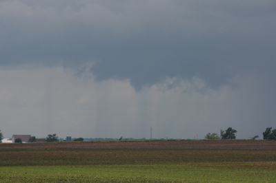
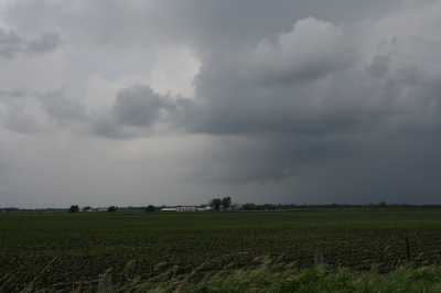
A mini-supercell approaches Atkinson, Illinois, just north of I-80.

A mini-supercell approaches Atkinson, Illinois, just north of I-80.

More brief, non-rotating wall clouds formed and dissipated one by one, so I figured I’d head north of town and observe. With surface winds veering and the overall flow unidirectional, I had no expectation of seeing tornadoes, but the mini-supercell made for some fun and interesting viewing.

Ragged, non-rotating wall cloud.

Ragged, non-rotating wall cloud.

Distant wall cloud and back side of main updraft tower.

Distant wall cloud and glimpse of updraft tower.

I was tempted to follow the storm, but decided it was a red herring. If at all possible, I wanted to make it back to Michigan in enough time to chase the setup there, and that left me no time to play around on the western Illinois backroads. So I headed back to I-80 and busted east.

The first Michigan supercell fired up earlier than I’d hoped, and I bit my lip as I followed its progress on GR3 and watched it hit Lansing. If only I had driven east last night for two more hours, or left in the morning two hours earlier… But the previous day’s chase had left me exhausted. And you know, one of the downsides of being a Michigan-based storm chaser is, you just don’t have very high expectations when it comes to your home state. I mean, it’s Michigan. Home of convective table scraps, squall lines, and embedded supercells that don’t produce squat.

As it was, I watched several more storms fire up and develop rotation along the warm front that stretched across mid-Michigan. I was making decent progress and still had hopes of catching up with some of the southernmost cells. But by the time I crossed the state line, the action all had shifted well to the east, and it became clear that I wasn’t going to see any of it.

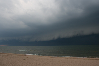
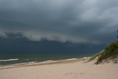
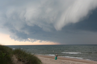
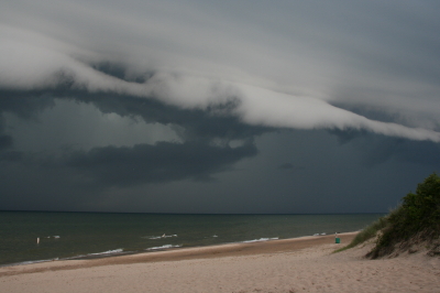
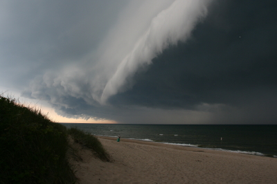
Instead, taking fellow chaser Mike Kovalchick’s suggestion, I headed toward the lakeshore at Allegan Beach to intercept a short but potent squall line. I’m glad I did. The backdrop of Lake Michigan and its dunescapes lends a breathtaking drama to incoming storms. The following photos depict the progress of the arcus cloud moving in across the waters. What these images can’t convey is the full, awe-inspiring sweep of cloud, big lake, and shoreline; of the solemn foreboding of some great event about to unleash itself upon a landscape cloaked in storm shadow; of the shelf cloud moving silently overhead like the furrowed eyebrow of a dark, scowling giant; and of sand spray blowing and trees thrashing in the wind as the gust front arrived.

I’ll let the photos tell their story as best they can, and leave the rest to your imagination.

An arcus cloud advances toward the Lake Michigan shoreline at Allegan Beach.

An arcus cloud advances toward the Lake Michigan shoreline at Allegan Beach.

View to the north.

View to the north.

Looking south...the storm closes in.

Looking south...the storm closes in.

Looking north...closer still.

Looking north...closer still.

Almost overhead.

Almost overhead.

One last shot to the north, then it's time to make a dash for the car.

One last shot to the north, then it's time to make a dash for the car.

June 7 Northwest Missouri Supercell

Now that I’ve had a chance to rest up and catch up after Sunday’s chase in northwest Missouri, it’s time to do a writeup. I’ll summarize by saying that there were no tornadoes, but there was some great structure along with hail the size and disposition of wild boars.

My plan was to hook up with Bill, Kurt, and Tom, who had headed west a day ahead of me in anticipation of chaseworthy storms. Unfortunately, a stout cap quashed an otherwise potent setup, and the guys–along with lots of other storm chasers–endured a blue sky bust. Like I told Bill, they needed me out there with them to erode the lid for them.

I left around 10:00 Saturday night and drove as far as Davenport, Iowa, where I overnighted. The next day, I hightailed it for Topeka, Kansas. Bad route choices delayed my arrival, and storms had already initiated by the time I got within the vicinity. But that actually simplified my choice. Rather than heading into Kansas, I worked my way north of Saint Joseph, Missouri, along I-29, then hit the backroads to intercept a supercell that was making its way across the border near Rulo, Kansas.

Parking my car outside of Big Lake, Missouri, I set up shop and got some nice photos as the storm moved in. The base was lowering and developing a rotating wall cloud. Here is what the storm looked like when I took my first shot.

Wall Cloud at Big Lake, Missouri, June 7, 2009

Wall cloud at Big Lake, Missouri, June 7, 2009.

The cloud was southwest of me and moving eastward, which meant that I could expect plenty of rain and probably a good clobbering by hail. In a little while, sure enough, golfballs began to fall all around me. No rain, just sizeable hail. The cloud at this point was directly to my south and looked like this:

Wall cloud passing to the south.

Wall cloud passing to the south.

It was time to vamoose, and none too soon. The advance guard of a veritable armada of storm chasers was driving by. I pulled in behind the DOW (Doppler On Wheels) and other Vortex 2 vehicles and followed them toward Forest City. By the time I reached SR111 and began heading south, I had pulled ahead of the circulation. I wanted a few photos of the wall cloud advancing directly toward me, so I found a place to pull aside. Opening the car door, I stepped out into some ripping inflow and snapped a few shots.

Wall cloud approaching SR 111 north of Forest City.

Wall cloud approaching SR 111 north of Forest City.

I missed the really big, gorilla hail that some chasers encounterd, but the occasional baseball size was big enough for me. Somehow I escaped getting hit by the larger chunks, though one of them hit my roof squarely with a loud whack. I still haven’t checked to see whether there’s a dent.

Eventually I caught up with the guys at the I-29 overpass, where a zillion other chasers were also parked. Seems like everybody and his dog’s first cousin was on this storm. If I ever get rich enough to purchase a dedicated chasemobile, it won’t be an SUV or a TIV-style monstrosity. It’ll be a concession van with a fold-out bar.

Anyway, Bill, Tom, and Kurt forged ahead and I followed them for a ways, but eventually opted for a more southern route when they headed north toward Union Star. I figured they’d be hitting heavy precip and probably some nasty hail, and I wanted to stay on the south edge of the updraft, which was heading east by southeast. Here are a couple photos from what was, from my vantage point, one of the more promising episodes in the life of the storm.

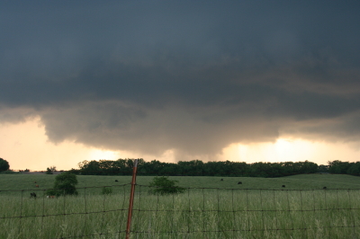
Wall cloud with clear slot wrapping in.

Wall cloud with clear slot wrapping in.

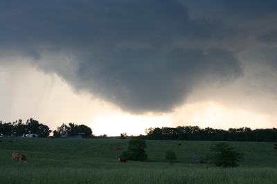
Possible funnel cloud trying to develop.

Possible funnel cloud trying to develop.

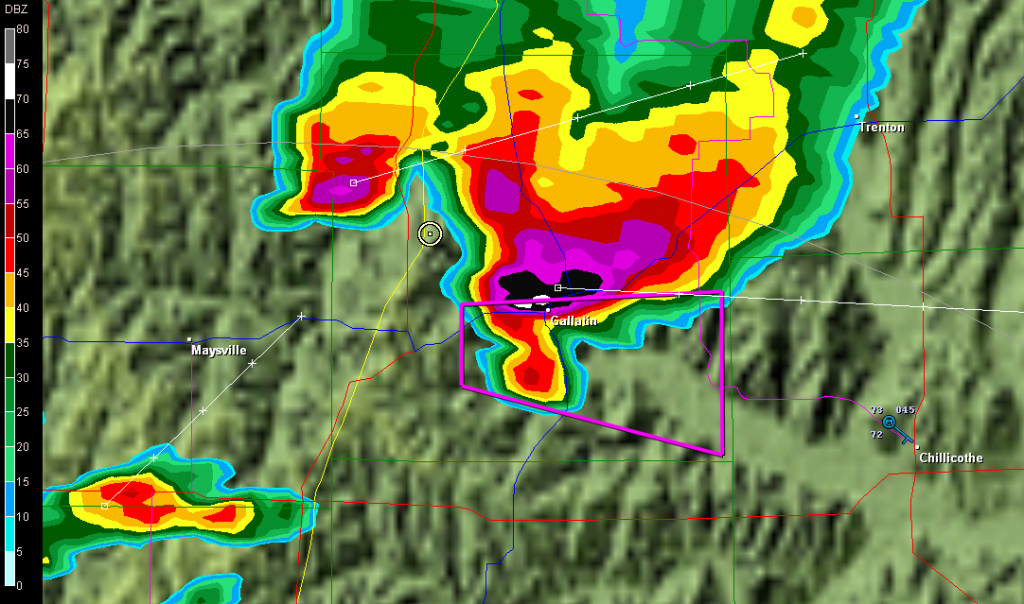
I believe the above shots were taken near Amity. From there, I headed east through Maysville and Weatherby, and across I-35 to just west of Altamont. There, I decided to end the chase and start heading home. The storm at that point was heading into Gallatin and was showing one of the best reflectivity echoes of its career on GR3.

Base reflectivity showing tornado-warned storm approaching Gallatin.

Base reflectivity showing tornado-warned storm approaching Gallatin.

But darkness was closing in, and I had no desire to chase this storm at night through the hinterlands of northwest Missouri. At that point, I was thinking about overnighting in Des Moines, and I had miles to go before I slept.