February 20: The “Everything” Storm System

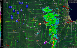
February 20 2014 Davenport I find this screenshot of the Davenport, Iowa, radar fascinating for its variety. Captured at roughly quarter to five in the afternoon eastern time, it shows just about every conceivable kind of Midwestern weather in operation simultaneously. Tornadoes and funnel clouds. Squall line with embedded supercells. High winds. Hail. Flooding. Snow. Fog. Have I missed anything? If weather systems were baked goods, this one would be an Everything Bagel.*

As I write, the squall line stretches from eastern Indiana all the way down to south central Louisiana and out into the Gulf of Mexico, and it is progressing eastward, continuing to generate high winds, tornado warnings, and flash floods. All in all, quite an active day for this waning February, particularly considering how far north convective weather has occurred. In the face of this winter’s record-breaking snow and cold, today has been a potent harbinger of what this spring, when it finally arrives, may hold. Even here in Caledonia, we got a few rumbles of thunder, though nothing like what folks a few hundred miles south of us have experienced.

The irony of it is, after this, it’s back to winter again. Serious, snowy, cold winter, with no sign of a letup anytime soon. Eventually, of course, the arctic air will retreat, but not without a fight. Today was just a promissory note, a down-payment, on things to come. I’m in no hurry to collect. In fact, I’d just as soon get dumped on–seriously dumped on–just to see how much more snow we can squeeze out of this winter before a warmer pattern sets in. We’ve already experienced unreal; let’s shoot for insane. We’ve come this far, so what the heck, let’s do this thing right.

But then–let’s have spring. I’m lightning-starved and thunder-hungry.

—————————–

* That is one of the worst analogies I’ve ever come up with, but I don’t care. Well, I care enough to write this footnote, but that’s all.
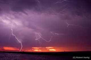
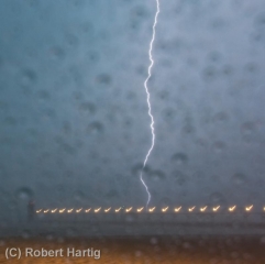
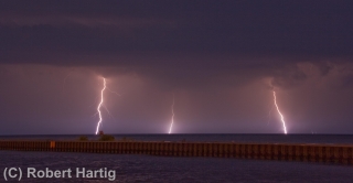
Lightning at the South Haven Pier

Yesterday’s slight risk for Michigan looked more impressive in the models than it did up close and personal. With dewpoints as high as a sultry 78 degrees Fahrenheit in Caledonia (courtesy of my Kestrel 4500 weather meter), MLCAPE upwards of 3,500 J/kg, and 40 knots at 500 millibars, the ingredients were all present for a decent severe weather event. Backing surface flow even suggested the possibility of tornadic spin-ups, though winds at the surface were weak.

For all that, the storms when they finally arrived were pretty garden variety, with one exception: the lightning was absolutely spectacular, a

nonstop flickerfest bristling with CGs. The lines rolled across Lake Michigan in two rounds. Thanks to some good input from Ben Holcomb, I chose to set up shop at the South Haven beach, a great strategic location, arriving there in plenty of time to intercept round one. Kurt Hulst met me there, and we got our live streams going and tripoded our cameras as the northern end of the line bore down on us.

It was too dark to see the shelf cloud very distinctly. I tried to capture it with my camcorder; I haven’t viewed the footage yet, so I don’t know how it turned out, but I soon realized that I’d be better off working with my still camera, which I got mounted right about the time that the gust front arrived. The rain was near-instantaneous, escalating within moments from errant droplets to a horizontal sheet, and I scurried back to my car while collapsing my tripod as fast as I could.

What a great light show! After a lot of teasers this year, I finally got a chance to get some good lightning shots, particularly as the storm moved off to the east. With CGs ripping through the air over South Haven, anvil crawlers lacing the sky overhead, and now and then a brilliant bolt tracing a path from the sky to the lake across the canvas of a molten sunset, yesterday evening was a lightning photographer’s dream. Kurt is a great hand in that regard, and he captured some fantastic images. But for once, even I managed to get some shots I’m pleased with. Here are some of my better ones. Click on them to enlarge them.

As the storm moved on, a good number of people returned to the beach with their cameras to capture the amazing sunset and the lightning display. Storm chasers aren’t the only ones with an eye for the drama that the sky provides!

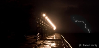
Some of my photos were taken later on, as the second line of storms was moving toward the shore. I’m particularly pleased with my shot of a lightning bolt off to the right of the pier; it’s a moody, mysterious image, and I intentionally left plenty of dark space at the bottom left.

I might add that the pics with raindrops all over the foreground were taken from my car during the height of the first storm. While I’d of course prefer nice, clear images, I don’t mind the drops. They lend a somewhat Impressionistic feel to the photos. At least, that’s what I tell myself.

My Great 1,600 Mile Chase Bust

Monday and Tuesday this week were the storm chase from hell. It you’re looking for a nice, upbeat post about chasing, you’d best skip this one. My feelings about my fiasco in Nebraska may have mellowed down enough for me not to unleash a full-bore rant anymore, but I’ve still got enough gunpowder left to blow off a few firecrackers. That’s the result when impediment piles upon impediment and frustration upon frustration.

With my sights Sunday night fixed on western Iowa and eastern Nebraska the next evening, I set my alarm clock for 4:30 a.m. and hit the sack. I was awakened by early morning light filtering through the window. Light? I glanced at the clock. It said 6:30. My alarm hadn’t sounded and I was running late.

Nuts. But okay, no problem. After a fast shower, I kissed Lisa good-bye, threw my gear into the car, and hit the road. I still had plenty of time to make

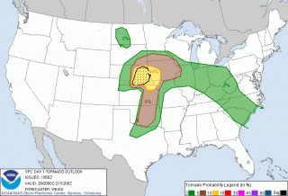
eastern Nebraska, and that was a good thing because the SPC had bumped the focal point for tornadoes west. No time to analyze models–I just had to trust the Norman weather pros and hope for the best. Off I went.

Thirty miles down the road in Zeeland I made a delightful discovery: I had left my debit card in my other pants pocket. This was the beginning of woes. Self-possessed person that I am, I responded calmly and maturely by protruding my eyeballs, depressurizing my feelings constructively using the special vocabulary that I reserve for just such occasions, and, a cat of nine tails not being handy, by rapidly banging my fist on the steering wheel in lieu of self-flagellation.

Retrieving my debit card meant losing over an hour. I now was pushing the envelope, but I could still make eastern Nebraska by late afternoon. This being probably my last crack at a good setup in a record storm season during which I’ve been miserably sidelined, I was determined to try. So off I went again.

I wasn’t far south of Holland, Michigan, when the disquiet in my stomach became a bubbling, and the bubbling escalated into the kind of tar-pit-like seething that tells you a quick trip to a bathroom will be required in the near future. Between southern Michigan and east of Chicago, I made three pit stops. Another 45 minutes, literally gone down the toilet before I finally popped some Immodium and put an end to the rumblings.

By the time I drew near to Omaha, the show was underway. A tornadic supercell was moving up out of Kansas into Nebraska toward the center of the surface low. My friend and long-time chase partner Bill Oosterbaan, who had called me as we both were initially approaching Zeeland and just as my debit card fiasco was commencing, was now far ahead of me and positioning himself for the next storm down. That storm went spectacularly tornadic and Bill got some great footage, probably the best he’s gotten so far.

But there was no way I could make it that far west in time to catch tornadoes. My show was clearly going to be the pair of cells to my southwest that were heading toward Lincoln. They were my one chance. But they were south of the warm front, and while surface winds were southeasterly, the storms were moving north-northeast. The low-level helicity required for tornadoes was lacking. My hope was that as the storms headed north they would tap into increasingly backed winds.

But all they did was backbuild and congeal into a nasty squall line. My hopes were still up as I approached Lincoln; however, as I finally drew near to the northernmost cell along US 77 west of Roca, I could see that I was screwed. The cells had congealed into a pile of linear junk. I had driven over 750 miles to chase a shelf cloud, and it wasn’t even a particularly photogenic shelf cloud. True, it had the local media in Omaha screaming about 75 mph winds and flash flooding, but I’ve seen plenty better right here in Michigan. Linear mess-oscale convective systems are our state storm.

No point in prolonging the pain. I started heading home, my idea being to get far enough east that I’d have time to chew on the system’s leftovers back in Michigan the next day. Bill had business in Iowa and was overnighting at the Hilton in Marshalltown, so I bunked with him there. He’d gotten four tornadoes in Polk County, and we reviewed his footage. Very nice stuff! He’d gotten close enough to a large tornado to capture the roar. Here’s his YouTube clip.

Sigh. So near and yet so far. An arcus cloud isn’t much of a compensation prize compared to a tornado. Of course there was still tomorrow back home. A warm front looked poised to drape right across Grand Rapids with SBCAPE in the order of 4,500 J/kg–an optimal setup for Michigan, except that the models consistently depicted the 500 mb jet hanging back just to the west in northern Illinois and Wisconsin.

Bill and I in fact hooked up again the next day after his business meeting and briefly discussed chasing the low in Wisconsin. But that area is some of the worst chase terrain imaginable, so we scrapped the idea and went our ways.

Somewhere around Davenport, out of idle curiosity, I checked out the SPC’s mesoanalysis graphics and noticed that the mid-level energy appeared to be nudging eastward toward Michigan. Hmmm…maybe there might be a bit of a show after all. I gave Kurt Hulst a call. He had hung back in town and was planning to chase today, not expecting much but thinking that the big CAPE could compensate somewhat for poor upper air support. I agreed, particularly now that it looked like 500 mb and higher winds might reach the threshold for storm organization.

Later VAD wind profiles at GRR showed nice veering with height along with 30 kt winds at 18,000 feet. Not a setup to die for, but it might just work. And it did. A beautiful supercell fired up along the warm front, and Kurt was on it in a heartbeat. He got in some nice chasing on several storms, witnessed rotating wall clouds and a funnel extending halfway down, and did some call-ins for WOOD TV8. Good work, Kurt!

As for me, I got delayed by a traffic bottleneck in Joliet, Illinois, and attempting to find a detour proved to be a huge, time-consuming mistake. I finally arrived in Michigan in time to chase storms, but not the ones on the warm front. Once again I had to settle for what I could get as I belted east down I-94 and punched through the line near Marshall. By then the mid-level winds had backed off and I was left with the usual, disorganized Michigan crap-ola. There was a lot of that, though. The warm sector was remarkably juicy, and more storms kept popping up behind the main line.

Heading back through Battle Creek, I parked in a lot across from the old Kellogg Museum and watched a couple of cells south and west of me detonate their munitions. I’ll say this: The lightning this day was intense, lots of brilliant, high-voltage positive strokes, many of which struck close by. It was an impressive, beautiful, and exciting pyrotechnic display.

But now that it’s all behind me, my tornado tally for this year remains zero. Between Monday and Tuesday I drove over 1,600 miles and blew through around $200 worth of gas to see nothing that I couldn’t have seen by simply sitting in my apartment and looking out the window. It’s frankly a bit humiliating, considering what a benchmark season this has been for storm chasers. Family comes first, though, and tight finances in a rotten economy have been a potent regulator. Sometimes all a body can do is choose his attitude. I confess that mine wasn’t all that great these last couple of days, but I talk with the Lord about such things. It’s the best I can do: put my feelings before Him honestly, then do what I can to adopt a more positive spirit and move on.

Still…it sure would be nice to see a tornado yet this year. Just one. I don’t think that’s too much to hope for. Sigh. Maybe this fall.

Severe Weather Potential Monday in the Western Great Lakes

A couple days ago, Lisa informed me that Dr. Greg Forbes was forecasting severe storms Monday in eastern Iowa and northern Illinois. I thought, hmmm…a bit far out to be definitive, but maybe I ought to take a look. I’ve been following the models since, and after this morning’s 6Z runs, it looks like Forbes is onto something.

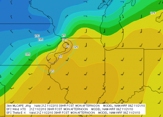
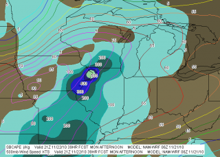
Both the NAM and GFS suggest that an area from far eastern Iowa through northern Illinois and southern Wisconsin may be under the gun in the afternoon or evening. Here are a couple of NAM maps that will give you an idea why (click on maps to enlarge). The bottom line is that a low pressure system is cranking unseasonably warm temperatures and dewpoints in the mid-50s or higher into the Great Lakes region. The potential exists for weak instability to coincide with stiff 850 and 500 mb jet cores.

The GFS paints a somewhat more aggressive picture than the NAM and wants to clip things along a few hours faster. If that pans out, then north-central Illinois and south-central Wisconsin may see the best play. But both models are calling for essentially the same thing. Note the bullseye of 500 SBCAPE and 75 J/kg 3km MLCAPE at Clinton, Iowa, coincident with a nose of Theta-E bulging into the area. The GFS depicts the same scenario, albeit at 18Z rather than 21Z.

Today, Sunday, temps are forecast to rise into the 50s here in Grand Rapids, and tomorrow they should make it into the low 60s along with a significant increase in moisture. We stand a chance for a few thunderstorms of our own, particularly when the cold front moves in Monday night. As the KGRR forecast discussion puts it, “GIVEN TEMPS IN THE LOWER 60S…IT MAY ACTUALLY FEEL A BIT HUMID MONDAY AFTERNOON. THE CURRENT MENTION OF SLGHT CHC TSRA STILL LOOKS GOOD.” The SPC day 2 outlook has even thrown in mention of isolated tornadoes from southern Michigan southward, but tomorrow’s models will give a better sense of whether that’s any real concern. Helicity should be adequate, but instability is weak, and a November night-time squall line in Michigan is not your typical tornado machine.

Right now, the bottom line looks like warmer-than-usual weather in our area today and especially tomorrow, with storms in the offing in northern Illinois and nearby areas. And behind that, setting the tone for Thanksgiving, colder weather. So enjoy this last spate of warmth, because winter is waiting in the wings.

Mid-40s and Rain: Enjoy It While You Can

Here it is, January 24, and are we residents of Michigan up to our waists in snow, fighting off polar bears and periodically detaching eight-inch snotsicles from our noses? Nooooo! We are staring out the window at a mostly snowless landscape drenched in rain as 45-degree temperatures and 40-degree dewpoints surge into the area in response to the low that’s presently centered just across Lake Michigan. KGRR even mentions the possibility of isolated thunderstorms south of I-96, and farther south, the SPC shows a 5 percent tornado outlook across parts of Alabama, Georgia, South Carolina, and Florida. The squall line that is presently moving through Alabama looks pretty robust, and Dixie Alley may be poised for another visitation.

As for my fellow Michiganians, if you prefer warmth and rain to cold and ice, then these present conditions are pure January bliss. But if you’re a snow person, don’t worry, you’ll get your way. This relatively warm stretch of weather we’ve been enjoying for the last week or so is about to come to an end. Snow is in the forecast for tonight, and from here on we begin our plunge back into the twenties. Who knows when we’ll reemerge?

I’m not counting on its being anytime soon. I haven’t looked at the GFS lately, but I don’t need to in order to get the picture. Snow, snow, and more snow. Cold, cold, and more cold. The Grand Rapids WFO calls for very winter-like temperatures in the 20s through Saturday, and I doubt that the days following will alter that picture much. So, Nanook, don’t put away your parka just yet. You’ll still have plenty of use for it between now and April.

June 8: Mini-Supercell in Northern Illinois and Severe Squall Line on the Lake Michigan Shoreline

This is really part two of the previous post. After chasing a potent, monster hailer of a supercell north of Saint Joseph, Missouri, I overnighted at a hotel outside of Des Moines, Iowa. When I stepped outside the next morning, the air was much cooler and drier, a stable atmosphere that wouldn’t produce so much as a sneeze, let alone a tornado.

But I knew that the SPC had outlooked the area to my east across northern Illinois, and for several days I myself had been eyeballing my home state of Michigan, where the NAM-WRF had been consistently indicating the possibility of tornadoes. With a little luck, I hoped to make it back in time to chase whatever convection might pop up along the warm front.

As I approached Davenport, I observed  towering cumulus muscling up through the troposphere. However, I didn’t pay them any attention–that is, until Bill Oosterbaan called to inform me that the SPC had just issued a mesoscale discussion for the area just east of me. Even as we talked, I noticed a lowering on a cumulus tower a mile or two to my northeast. When it continued to develop, I decided to investigate. Leaving I-80, I parked across from a truck stop at the Atkinson exit to watch.

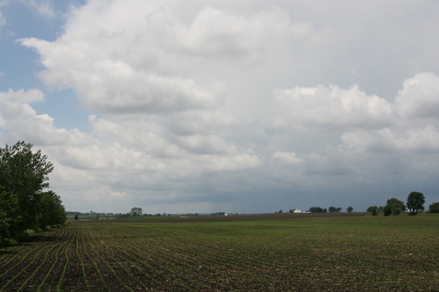
The next cell to my west quickly grabbed my attention. It had a nice rain-free base, and as I watched, scud began to form and ascend in an obvious updraft, coalescing into a small, ragged wall cloud. Grabbing my camera and getting out of my car, I noticed right away that the air was very different from back in Des Moines–considerably warmer and with plenty of moisture. The wall cloud fell apart before I could get a pic, but the overall structure remained interesting.

A mini-supercell approaches Atkinson, Illinois, just north of I-80.

A mini-supercell approaches Atkinson, Illinois, just north of I-80.

More brief, non-rotating wall clouds formed and dissipated one by one, so I figured I’d head north of town and observe. With surface winds veering and the overall flow unidirectional, I had no expectation of seeing tornadoes, but the mini-supercell made for some fun and interesting viewing.

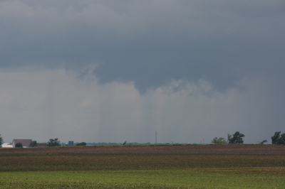
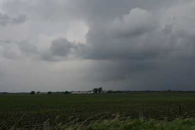
Ragged, non-rotating wall cloud.

Ragged, non-rotating wall cloud.

Distant wall cloud and back side of main updraft tower.

Distant wall cloud and glimpse of updraft tower.

I was tempted to follow the storm, but decided it was a red herring. If at all possible, I wanted to make it back to Michigan in enough time to chase the setup there, and that left me no time to play around on the western Illinois backroads. So I headed back to I-80 and busted east.

The first Michigan supercell fired up earlier than I’d hoped, and I bit my lip as I followed its progress on GR3 and watched it hit Lansing. If only I had driven east last night for two more hours, or left in the morning two hours earlier… But the previous day’s chase had left me exhausted. And you know, one of the downsides of being a Michigan-based storm chaser is, you just don’t have very high expectations when it comes to your home state. I mean, it’s Michigan. Home of convective table scraps, squall lines, and embedded supercells that don’t produce squat.

As it was, I watched several more storms fire up and develop rotation along the warm front that stretched across mid-Michigan. I was making decent progress and still had hopes of catching up with some of the southernmost cells. But by the time I crossed the state line, the action all had shifted well to the east, and it became clear that I wasn’t going to see any of it.

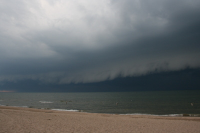
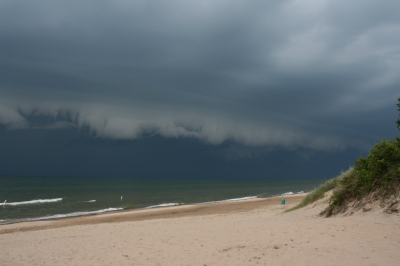
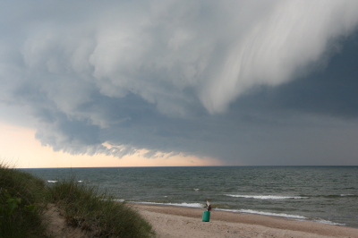
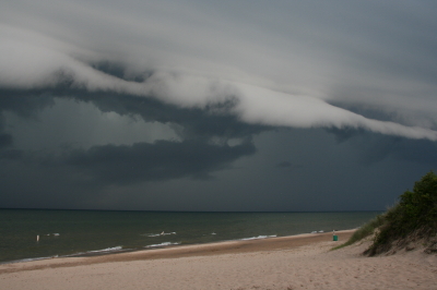
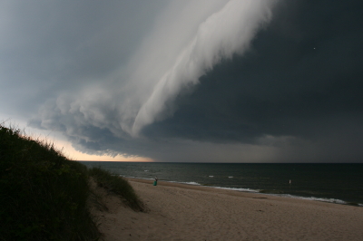
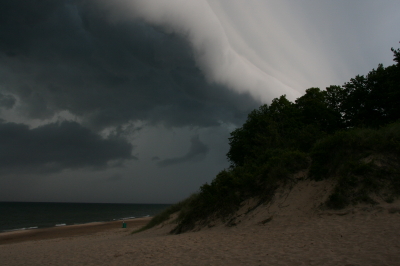
Instead, taking fellow chaser Mike Kovalchick’s suggestion, I headed toward the lakeshore at Allegan Beach to intercept a short but potent squall line. I’m glad I did. The backdrop of Lake Michigan and its dunescapes lends a breathtaking drama to incoming storms. The following photos depict the progress of the arcus cloud moving in across the waters. What these images can’t convey is the full, awe-inspiring sweep of cloud, big lake, and shoreline; of the solemn foreboding of some great event about to unleash itself upon a landscape cloaked in storm shadow; of the shelf cloud moving silently overhead like the furrowed eyebrow of a dark, scowling giant; and of sand spray blowing and trees thrashing in the wind as the gust front arrived.

I’ll let the photos tell their story as best they can, and leave the rest to your imagination.

An arcus cloud advances toward the Lake Michigan shoreline at Allegan Beach.

An arcus cloud advances toward the Lake Michigan shoreline at Allegan Beach.

View to the north.

View to the north.

Looking south...the storm closes in.

Looking south...the storm closes in.

Looking north...closer still.

Looking north...closer still.

Almost overhead.

Almost overhead.

One last shot to the north, then it's time to make a dash for the car.

One last shot to the north, then it's time to make a dash for the car.

Painted Trilliums and a Mid-Week Storm Chase

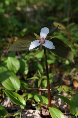
Painted Trillium

The painted trillium, trillium undulatum.

You’re looking at one of Michigan’s rarest wildflowers, the painted trillium.

With plans for a picnic in place and nothing but sunshine in the forecast for today, Lisa and I headed east with our cameras for a Michigan Nature Association preserve near Port Huron. The location is one of a handful where the painted trillium grows in this state, keeping company with the red trillium, which is also uncommon but far more widespread than its painted cousin.

Good luck finding this in the Michigan woods!

Good luck finding this in the Michigan woods!

Out east in the Appalachians, the painted trillium is fairly common. But in Michigan, if you ever catch a glimpse of this plant, count yourself fortunate indeed. The images in this post are a prize, and it was a double blessing that I got to share the experience of capturing them with Lisa, who loves the outdoors as much as I do.

But enough eye candy. Turning from wildflowers to weather, Wednesday looks to be shaping up as a chase day in Illinois. It’s nice to see the action coming close to home. The question right now isn’t whether there will be a severe outbreak, but where will be the optimal chances for tornadic activity. With a strong cold front moving in, a squall line seems inevitable. But with the winds veering strongly from the surface up to 500 millibars, hodographs are nicely curved and helicities ought to be formidable. Play the warm front? Maybe. It’ll certainly be a tempting target, within easy reach of Grand Rapids. But I want to see what happens with clearing. It would be nice to see a buildup of CAPE in northern Illinois.

Wait and see is the name of the game. Right now all eyes are on the NAM and GFS. But Wednesday morning will tell. I’m crossing my fingers and toes and hoping to see signs of clearing on the satellite.