A Glance at Friday: Severe Weather in the Great Lakes

It now seems a sure bet that the eastern Great Lakes is due for a spate of severe weather. The SPC is presently making it out to be a linear event, as is typical of cold fronts sweeping through our region, but the wind profiles suggest the possibility of supercells and tornadoes.

If you go by the present, 12Z NAM run, central Ohio appears to be the sweet spot, with a variety of parameters converging over or near a bullseye of 2,000 j/kg SBCAPE. Here are a few maps for forecast hour 21Z to give you an idea. Click on the images to enlarge them. The first shows the aforementioned SBCAPE (shaded), sea level pressure (contours), and surface wind barbs. Not a bad bit of instability if this scenario pans out.

In the second image, you can see a nice overlay of 55-60 kt 500 mb winds (shaded) over 35-40 kt 850 mb winds (contours). The wind barbs are for the 850 mb level. The H5 winds veer still further to the west. I think it’s safe to say that shear won’t be an issue, and 1 km VGP, not shown, is as high as 0.4 in the area of heightened instability. Helicity maxes are well to the north, but I wonder what kind of effective SRH we’ll wind up with where it counts.

The third map shows a Theta-e lobe pushing up into northern Ohio with a surface lifted index between -4 and -6 perched squarely over the axis. That should get the job done.

In the last map, three different significant tornado parameters–the well-known STP, the APRWX tornado index, and the Stensrud tornado risk–all converge nicely over the same spot near Newark, Ohio. Three overlays can be a bit difficult to decipher, so let me help: the STP is shaded, the APRWX is tightly contoured like an onion, and the Stensrud has broader

contours, with its highest value circling the APRWX in a yellow ring.

All this to say, Friday may have some potential. I don’t get too excited about cold front events around here–not that we have many options in the Great Lakes, but a steady diet of squall lines has a way of lowering a person’s expectations. Of course, as soon as you let down your guard, along comes the exception to prove that storms in our area can and do deliver. Maybe this round will prove to one of those occasions. We’ll find out two days hence.
Waking Up in Dallas

Morning. I’m still in bed, and from the next room, sounds of family are drifting through the door. I’m in Dallas with my sister Diane, visiting with my brother Brian, sister-in-law Cheryl, and little nephew Samuel. Since the last time I saw him, Sam has transitioned from babyhood to little-boyhood. He has acquired a vocabulary, a white baseball cap that it’s very important to wear (backwards or sideways, as is the custome), and a very cool train set that we played with last night.

My lady Lisa is holding down the fort back in Grand Rapids, where the weather is providing a much cooler contrast to the upper-90s heat that’s on the menu for this week here in north Texas. Chasing storms is of course out of the question. I’ve family to visit, a bit of work to do, and in any case, there are no storms. Summer has hit and the atmosphere is capped as tightly as an oil drum. On Stormtrack, chasers are bidding the 2009 chase season adieu. I note that the SPC has outlooked days 5-6, but they’re not using the kind of language that gets me very excited.

I’m keeping this short. I can hear the sound of forks clicking on breakfast plates. It’s time to shower up and get myself going.

June 8: Mini-Supercell in Northern Illinois and Severe Squall Line on the Lake Michigan Shoreline

This is really part two of the previous post. After chasing a potent, monster hailer of a supercell north of Saint Joseph, Missouri, I overnighted at a hotel outside of Des Moines, Iowa. When I stepped outside the next morning, the air was much cooler and drier, a stable atmosphere that wouldn’t produce so much as a sneeze, let alone a tornado.

But I knew that the SPC had outlooked the area to my east across northern Illinois, and for several days I myself had been eyeballing my home state of Michigan, where the NAM-WRF had been consistently indicating the possibility of tornadoes. With a little luck, I hoped to make it back in time to chase whatever convection might pop up along the warm front.

As I approached Davenport, I observed  towering cumulus muscling up through the troposphere. However, I didn’t pay them any attention–that is, until Bill Oosterbaan called to inform me that the SPC had just issued a mesoscale discussion for the area just east of me. Even as we talked, I noticed a lowering on a cumulus tower a mile or two to my northeast. When it continued to develop, I decided to investigate. Leaving I-80, I parked across from a truck stop at the Atkinson exit to watch.

The next cell to my west quickly grabbed my attention. It had a nice rain-free base, and as I watched, scud began to form and ascend in an obvious updraft, coalescing into a small, ragged wall cloud. Grabbing my camera and getting out of my car, I noticed right away that the air was very different from back in Des Moines–considerably warmer and with plenty of moisture. The wall cloud fell apart before I could get a pic, but the overall structure remained interesting.

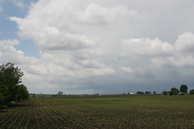
A mini-supercell approaches Atkinson, Illinois, just north of I-80.

A mini-supercell approaches Atkinson, Illinois, just north of I-80.

More brief, non-rotating wall clouds formed and dissipated one by one, so I figured I’d head north of town and observe. With surface winds veering and the overall flow unidirectional, I had no expectation of seeing tornadoes, but the mini-supercell made for some fun and interesting viewing.

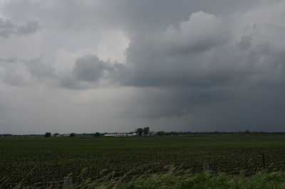
Ragged, non-rotating wall cloud.

Ragged, non-rotating wall cloud.

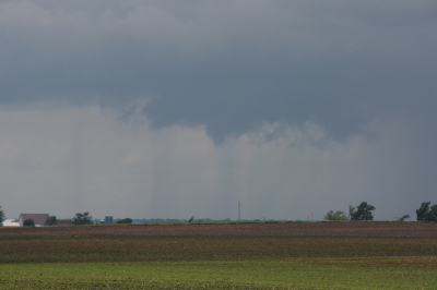
Distant wall cloud and back side of main updraft tower.

Distant wall cloud and glimpse of updraft tower.

I was tempted to follow the storm, but decided it was a red herring. If at all possible, I wanted to make it back to Michigan in enough time to chase the setup there, and that left me no time to play around on the western Illinois backroads. So I headed back to I-80 and busted east.

The first Michigan supercell fired up earlier than I’d hoped, and I bit my lip as I followed its progress on GR3 and watched it hit Lansing. If only I had driven east last night for two more hours, or left in the morning two hours earlier… But the previous day’s chase had left me exhausted. And you know, one of the downsides of being a Michigan-based storm chaser is, you just don’t have very high expectations when it comes to your home state. I mean, it’s Michigan. Home of convective table scraps, squall lines, and embedded supercells that don’t produce squat.

As it was, I watched several more storms fire up and develop rotation along the warm front that stretched across mid-Michigan. I was making decent progress and still had hopes of catching up with some of the southernmost cells. But by the time I crossed the state line, the action all had shifted well to the east, and it became clear that I wasn’t going to see any of it.

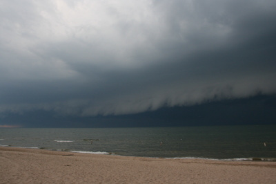
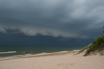
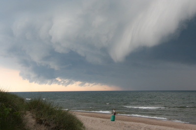
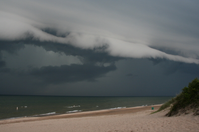
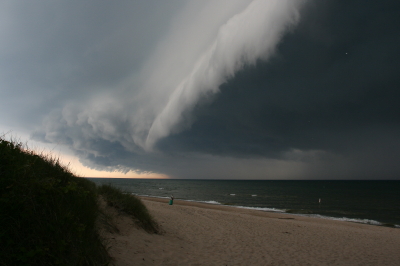
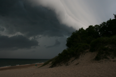
Instead, taking fellow chaser Mike Kovalchick’s suggestion, I headed toward the lakeshore at Allegan Beach to intercept a short but potent squall line. I’m glad I did. The backdrop of Lake Michigan and its dunescapes lends a breathtaking drama to incoming storms. The following photos depict the progress of the arcus cloud moving in across the waters. What these images can’t convey is the full, awe-inspiring sweep of cloud, big lake, and shoreline; of the solemn foreboding of some great event about to unleash itself upon a landscape cloaked in storm shadow; of the shelf cloud moving silently overhead like the furrowed eyebrow of a dark, scowling giant; and of sand spray blowing and trees thrashing in the wind as the gust front arrived.

I’ll let the photos tell their story as best they can, and leave the rest to your imagination.

An arcus cloud advances toward the Lake Michigan shoreline at Allegan Beach.

An arcus cloud advances toward the Lake Michigan shoreline at Allegan Beach.

View to the north.

View to the north.

Looking south...the storm closes in.

Looking south...the storm closes in.

Looking north...closer still.

Looking north...closer still.

Almost overhead.

Almost overhead.

One last shot to the north, then it's time to make a dash for the car.

One last shot to the north, then it's time to make a dash for the car.

What a Blast! Playing Sax with Francesca at the Grand Rapids Festival

What fun it was to play with Francesca Amari this afternoon at the 2009 Grand Rapids Festival of the Arts! And how nice to finally NOT get rained and hailed out. High clouds moved in, thickened and threatened and lenta somewhat somber feeling, but never produced so much as a solitary raindrop.

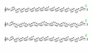
We played at the main stage by the massive, bright orange Alexander Calder stabile, “La Grande Vitesse,” which is the massive and graceful icon of Grand Rapids. Our 45-minute set included tunes from Francesca’s DVD Better Days, plus jazz standards such as “Fly Me to the Moon” and my own feature tune, “My Funny Valentine.” Our bass player, Dave DeVos, had another gig at the festival and was much missed. But Wright McCargar did a stellar job filling in the bottom end, a job no keyboard player relishes because of the limitations it imposes, but which serves when there’s no bassist.

I was pleased to see my mother and sister, Diane,  out there in the audience. It’s such a blessing to have their support.

So…now the festival is behind me, and I’m preparing myself to head for Nebraska in pursuit of storms. Looks like fellow Michigan storm chaser Mike Kovalchick will be joining me. We’ve got a long drive ahead of us. Sometime tomorrow, we’ll hook up Bill, Tom, Kurt, and a friend of Bill’s. The last time I chased was May 13. I am ready and raring, and I hope the weather roars. The SPC shows a 30 percent area in tomorrow’s outlook, mostly in Iowa.  The 18Z NAM suggests a more western play, but maybe that’ll change.

Right now, storms look like they may have initiated northwest of Des Moines, but what I’m seeing doesn’t look like much–yet. I’m about ready to reboot GR3 and take another look. The guys drove all night to make the play today. I hope they score big. But I have an idea that tomorrow is going to be the main act. And then there’s Monday. I’ll be really curious to see whether the Great Lakes gets the kind of weather the NAM has been suggesting.

The Tornado Fest That Wasn’t

Now that Sunday’s brouhaha in Tornado Alley is over and done, the big question seems to be, where were all the tornadoes? The turnout was there, the fans were waiting, but besides the rope and the wedge/multivortex/stovepipe that my buddies Bill and Tom witnessed near Crawford, Oklahoma, in company with a multitude of other chasers, there just wasn’t anything to make postcards out of. The big show never showed. Even the lone supercell that wandered north out of Texas into Oklahoma’s higher helicities never produced, despite its lack of competition. Oh, there were a couple of twisters in Kansas, and with a tally of four, Iowa had the most reports of all. Ironically,  it wasn’t even in the PDS high risk area.

This is by no means to criticize the crew at the SPC; those are some highly adept meteorological minds, the finest in the world. No, it’s just to muse at the vagaries of the weather. Rudimentary as my own forecasting skills are, I’ve nevertheless come to realize that no matter how good a forecaster one becomes, the weather is still the weather. Capricious. Subject to subtleties that no one gives weight to until after the fact. The butterfly beats its wings and a tornado fires up in Texas–or a seemingly volatile setup falls apart.

Judging from the YouTube videos and the photos posted on Stormtrack, a lot of people managed to be in the right place at the right time for the one storm in Oklahoma that did produce a couple very photogenic tornadoes. But the event was a far cry from high-risk mayhem.

Guess I can’t feel bad about that, since I was sitting at home nursing a chest cold while my mates were out there roaming the Plains. The cold now seems finally poised to start breaking up, and hopefully in another day or two I’ll feel halfway human again. It’s just as well that I get this nonsense out of the way now, so I’m up to snuff physically in a couple weeks when my buds and I head out to the Alley for an extended tour. I hope that by then, there won’t be any lack of the right ingredients in the atmospheric brew to make the trip worthwhile.

Moderate Risk in West Oklahoma and Texas

My buddies Bill and Tom Oosterbaan and Derek Mohr are heading for today’s sweet zone out in western Oklahoma. The Storm Prediction Center has placed the area under a moderate risk, with an indication of strong tornadoes. No doubt. With CAPE exceeding 2,000 and decent helicity and upper-level support increasing by 0Z, all the ingredients will be there. I’d imagine the guys will be playing the triple point per the SPC, where helicity will be maximized. Should be quite the caravan out there today. A person with a popcorn truck and GR3 could make a killing on a chase day.

Farther north, back here in Michigan, we’re sitting under our first light risk day of the year. As I write, it’s approaching 11 a.m. and the temperature is already in the upper 70s with dewpoints tapping on 60 degrees. But the forecast soundings look miserable, with adequate bulk shear but squat in the way of directional turning and some truly weird-looking hodographs. The sounding for 21Z out in the east central Texas panhandle, on the other hand, out around Mobeetie and Wheeler, looks great.

Sigh.

Well, we’ve got rain outside. Big drops.

At least “the kids”–my collection of carnivorous plants–will be happy. I just potted my three latest arrivals: a parrot pitcher plant, a maroon-throat variety of the pale pitcher plant, and the Gulf variety of the sweet pitcher plant. They’re sitting out on the deck along with the rest of my little family, soaking in the warmer temperatures, humidity, ambient light, and now the precip. It’s a fine day for the plants here in Michigan, and a good one as well for writers and jazz musicians if not storm chasers.

Time to fire up the radar and see what’s on the way.

Convective Inhibition: SBCINH vs MLCINH

Some months back, I wrote a review of F5 Data, a powerful weather forecasting tool that aggregates a remarkably exhaustive array of atmospheric data–including over 160 different maps and a number of proprietary indices–for both professional and non-professional use. Designed by storm chaser and meteorologist Andrew Revering, F5 Data truly is a Swiss Army Knife for storm chasers, and thanks to Andy’s dedication to his product, it just keeps getting better and better.

My own effectiveness in using this potent tool continues to grow in tandem with my development as an amateur forecaster. Today I encountered a phenomenon that has puzzled me before, and this time I decided to ask Andy about it on his Convective Development forum. His insights were so helpful that, with his permission, I thought I’d share the thread with those of you who are fellow storm chasers. If you, like me, have struggled with the whole issue of CINH and of figuring out whether and where capping is likely to be a problem, then I hope you’ll find this material as informative as I did.

With that little introduction, here is the thread from Andy’s forum, beginning with…

My Question

SBCINH vs MLCINH

I’m looking at the latest GFS run (6Z) for Saturday at 21Z and see a number of parameters suggesting a hot spot around and west of Topeka. But when I factor in convective inhibition, I get either a highly capped environment or an uncapped environment depending on whether I go by MLCINH or SBCINH. I note that the model sounding for that hour and for 0Z shows minimal capping, which seems to favor the surface-based parameter.

From what I’ve seen, SBCINH often paints a much more conservative picture of inhibition, while MLCINH will show major capping in the same general area. How can I get the best use out of these two options when they often paint a very different picture?

Andy’s Answer

This is a great question, and very well worded… I guess I should expect that from a wordsmith!

SB *anything* is calculated using a surface-based parcel. ML *anything* is calculated using a mixed layer parcel. It is done by mixing the lowest 100mb temperature and lowest 100mb dew points and using those values as if those values were the surface conditions, and then raising from those values.

This is why when you look at a sounding it looks to favor the SB CIN because the parcel trace on those soundings is always raised from the surface. If you were to ‘average’ or mix the lowest 100mb temperatures by simply finding the section of the temperature line that is 100mb thick at the bottom of the sounding, and find the middle of that line (average value) and see what that temperature is, and then go to the surface and find where that temperature would be on the sounding at the surface, and raise the parcel from there (after doing the same thing with the dewpoint temperature) then you will have the ML Parcel trace and would then have MLCIN and MLCAPE to look at in the sounding.

A drastic difference in capping from SBCIN to MLCIN indicates that there is a drastic difference in values just above the surface that are causing this inconsistency. So when the parcel is mixed it washes out the uncapped air you get from the surface value.

We have different ways of looking at these values with different parcel traces because quite frankly, we never know where this parcel is going to be raised from. The same idea is why we have Lifted Index and Showalter Index. ITs the same index, but Showalter uses the values at 850mb and pretends thats the surface, while Lifted Index uses the surface as the surface.

We just never know where the parcel is going to raise from.

It seems to be consensus that ML-anything is typically the favored parcel trace. This means smaller CAPE and bigger CIN usually.

I have stuck strictly to my APRWX CAP index for years now because it considers both of these, as well as the temperature at 850mb, 700mb, and temperatures at heights from the surface up to 3000m, cap strength/lid strength index, as well as some other things when looking at capping. It seems to perform very well.

To summarize though… capping is a bear. If anything is out of line, you’ll easily get capped. So what I do is look at every capping parameter I can, and if *anything* is suggesting it being capped, then plan for it to be capped during that time period.

Now to confuse the situation even more, keep in mind that capping only means that you won’t get a storm to take in parcels from the suggested parcel trace location… IE.. from the surface. You can be well capped and have elevated storms above the cap. However for them to be severe you tend to need ‘other’ parameters in place, such as very moist air at 850mb (say 12c dew), some strong winds at that level, etc. to feed the storm.

Another map that is neat to look at for capping is the LFC-LCL depth. You may be capped, but want to be in position where the cap is ‘weakest’ and may have the best chances at breaking… with this map you get into your area of interest and then look at this map and find where the LFC-LCL depth is ‘smallest’.

For a capped severe situation, this usually means high values with a donut hole of smaller values in the middle. This is a great indication that the cap would break most easily in the middle of that donut.

This map (in a different, but similar form) can be seen on the SPC Mesoanalysis web site as LFC-LCL Relative Humidity. Its the same idea, but on their map you want high humidity values for weakening cap indication.

——————

So there you have it–Andy’s manifesto on capping. It’s a gnarly subject but an important one, the difference between explosive convection and a blue-sky bust. There’s a lot more to it than looking at a single parameter on the SPC’s Mesoanalysis Graphics site. If nothing else, this discussion has brought me a step or two closer to knowing how to use the ever-increasing kinds of forecasting tools that are available.