Looking Down to Dixie

This bright morning sun streaming through the sliding door of my balcony is blinding. At quarter-to-ten on the day before Thanksgiving, it shines low over the southeast horizon directly onto my face, forcing me to write with my left eye shut. That is not an altogether satisfying modus operandi, but I don’t feel like closing the blinds or wearing a … well, what the hell, why not wear a hat? I’ve just put on my trusty Tilley. Problem solved, though Lisa will probably look at me oddly when she steps into the room.

Here in West Michigan, we’re moving into high pressure and a warming trend through the holiday. But “warm” is a relative word which in this case means not terribly cold–rather nice, really–but don’t plan on wearing a T-shirt.

Hundreds of miles to my south, though, warm means warm. Warm enough to get the job done for convective weather. From now through April, Dixie Alley once again becomes the star of the show. The trough moving in for the weekend offers a good example of why.

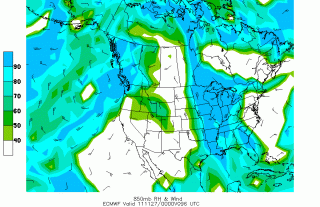
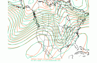
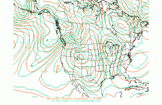
It’s a deep trough, and a surface low up in the Great Lakes looks to wick up enough moisture into the Southeast to stoke the storm machine. I’ve included a couple of the latest 00Z Euro/GFS comparisons plus Euro 850 mb relative humidity to give you a sense of what’s shaping up for 96 hours

(click on images to enlarge them). The GFS is predictably faster than the ECMWF, but both are pointing to the same overall scenario, with the trough eventually pinching off into a closed low.

Cloud cover presently looks like it will be rampant, minimizing instability. Still, given some ripping bulk shear, this system is something to keep an eye on as it evolves, particularly if you live in Dixie Alley.

That’s all for now. The sun has moved and is no longer blinding me. Time to get on with the rest of this day. May you and yours enjoy a happy and blessed Thanksgiving!
Storm Chasing in Illinois on Wednesday

The formidable system that ground out large, violent tornadoes in Kansas, Oklahoma, and Texas on Tuesday will move east on Wednesday to bring another round of severe weather to southeast

Missouri, Illinois, and Indiana. And finally–finally!–I’m in a position to do some storm chasing. Financial constraints have majorly crimped my expeditions so far this season, but no way am I missing tomorrow.

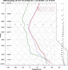
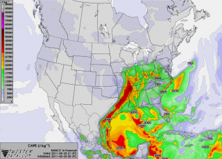
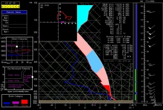
Based on Tuesday morning’s NAM run, I’d been eyeballing Effingham, Illinois, as a preliminary target for trolling the I-70 corridor. The sounding for that area looked mighty pretty, as you can plainly see.

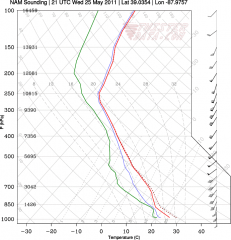
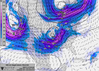
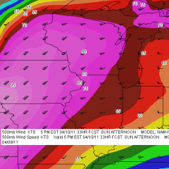
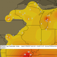
Now, however, with the 00Z runs in, I’m inclined to shift farther east near Terre Haute. Here’s another model sounding, courtesy of TwisterData, for near Oblong, Illinois. Maybe not quite as sexily backed at the surface as the Effingham sounding, but with stronger low-level winds and definitely quite functional. Maps of 500 mb winds and SBCAPE (see below) paint in a little more detail and suggest that near the Illinois/Indiana border is a good choice.

Tomorrow morning’s data will tell all. Meanwhile, it’s time for me to get my ugly-rest. I am so excited about the prospect of finally getting out and feeling the moisture, watching cumulus towers erupt and organize into glowering supercells, and hopefully videotaping some tornadoes out on the flat, wide-open Illinois prairie! A good night’s sleep and then I’m off in the morning.
How It Feels to Not Be Chasing

Right now my buddies are out west chasing this latest storm system. I’m not with them because I can’t afford it. Money has been extremely tight and what I take in has got to go toward paying the bills and putting food on the table for Lisa and me. That’s the reality of life. I’ve been on a couple of unproductive chases so far this year, and now that a decent system is finally in play out west, I’ve got to pass it up. I can’t even chase what promises to be a fabulous day today in Illinois. Once again I’ll be picking over the scraps later on here in Michigan. It’ll be nice to get some lightning, but it just isn’t the same.

Armchair chasers are typically regarded as off on the sidelines of storm chasing. But there’s a difference when you’ve been in the game and find yourself benched. You know what you’re missing. You’ve been looking forward to it all year with intense eagerness, like a kid looks forward to Christmas. So when you can’t do a thing about it unless it lands right in your lap–which in Michigan, land of cold fronts and veered surface winds, doesn’t happen often–it is extremely frustrating. SDS is one thing, but this is something else.

Armchair chasing? Nuts. I get to where I don’t even want to go near a radar. But I do anyway. I can’t seem to help myself. I want to see what’s happening with my friends, what storms they’re on. I look at the forecast models, too, hoping against hope that they’ll stop sticking their stupid tongues out at me and smile at me for once.

Today the RUC actually seems to do so. Here’s the 10Z KGRR sounding for 23Z this evening. Not bad. I just wish I believed that those surface winds and helicities were accurate, but I don’t, not with other models (NAM, GFS, and SREF) shouting them down. Besides, the HRRR composite reflectivity hates me. I can’t stand looking at it. Again, though, as with the radar, I do anyway. Storms progged to fire in northern Illinois and even south along the Michigan border…all I’d have to do is hop in my car, head west along I-80 and maybe down toward Peoria, or even just 80 miles south down US 131 toward the state line as a compensation prize, and I’d be in the sweet zone. But it ain’t gonna happen.

Rant, rant, rant. On this date last year I was on the most unforgettable chase of my life in northern South Dakota. Today, I wish this present system would just get on with it and get it over with so I can forget about weather, forget about the fact that I call myself a storm chaser when I’m not chasing storms. What a laugh. True, I’ll be chasing this evening locally for the first time for WOOD TV8. That I can at least afford, and it’s a nice way to work with the storms that we do get and possibly provide a bit of public service. But I don’t have high expectations. That’s a good thing here in populous West Michigan, but it doesn’t satisfy a convective jones. I just hope this season doesn’t drift into the summer pattern before I can get out and see at least one good tornadic supercell.

Okay, enough of this self-indulgent, babyish whining. I just had to get it out of my system, because in all seriousness, missing out on the action bothers me a lot, an awful lot, more than I can describe. It’s an absolutely miserable feeling. But it’s how things are, and life goes on.

Good luck out there in the Plains, Bill, Tom, and Mike–and Ben and Nick, though I know you guys are chasing separately. I hope you bag some great tornadoes today and over the next few days. As for me, it’s time to shower up, head to church, and remind myself that there’s more to life than this.

Quick Summary of Wednesday’s and Thursday’s Chases

Five days and nearly 3,000 miles later, I’m back from out west. This storm system proved to be a disappointment, but it did have its moments. Bill Oosterbaan and I intercepted a nice low-topped supercell in northeast Kansas on Wednesday night, and it’s possible that we witnessed a brief tornado. I need to scrutinize the brief footage I got of the storm feature in question. What was unmistakable was the broader circulation of the storm. It seemed weird to be chasing a north-moving storm with inflow from the northeast, but that’s how it was with storms that moved along a warm front–apparently across it–near a low center with a 500 mb closed low in the vicinity.

Yesterday was a more typical setup. We targeted the Muskogee, Oklahoma, area, which the SREF and RUC pointed to as offering the best overlay of instability and mid-level support, with the H5 jet core nosing into the region.

We were right on the first storms as they initiated, but they were feeble things that just couldn’t seem to get their acts together. With a long drive home lying ahead of us, we concluded to start heading north and settle for a nice lightning show on the way home.

But our prospects improved as the 500 mb jet began to strengthen. A couple of cells to our west and northwest intensified and began to take on a telltale appearance on the radar. A handful of scans later, rotation started to manifest on SRV. By this time we were on US 59 north of the Grand Lake of the Cherokee, east of Vinita and directly in the path of the southernmost cell. At a side road, we pulled aside and I tripoded my camcorder and videotaped some nice storm features: pronounced beaver tail, tail cloud, a nasty-looking wall cloud, and a wet RFD notch.

Beginning as a classic supercell, the storm looked for a while like a tornado breeder. But after predictably morphing into an HP, it eventually lined out and got absorbed into the wad of convection springing up to its south. Lack of adequate helicity is probably what kept this and other storms non-tornadic. METARs showed backed surface winds in the vicinity of the storms, but from what I observed, surface inflow was non-existent to weak. Hodograph curvature doesn’t matter much if boundary layer wind speeds are puny.

I have a few photos to process that I’ll slap up in a day or two, possibly along with a radar grab or two. Right now, though, I’ve got some work I need to accomplish before the work week ends, so here’s where I sign off.

April 10, 2011, Upper Midwest Chase Shaping Up

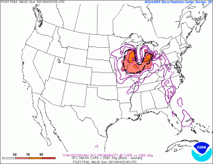
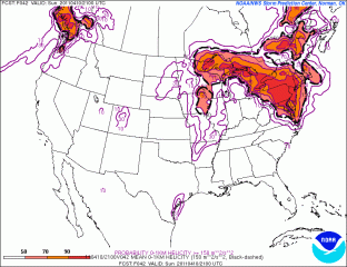
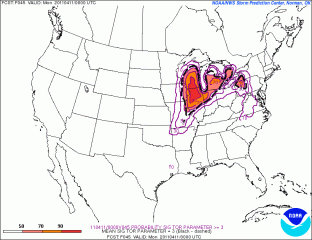
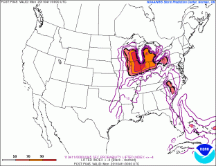
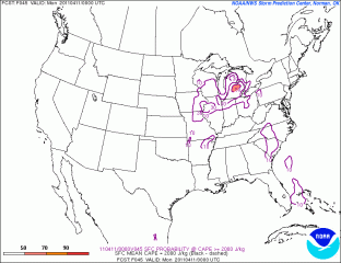
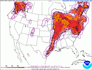
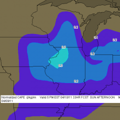
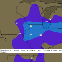
Tomorrow looks to be a big severe weather day in the upper Midwest and Great Lakes. It will also be my first storm chase of 2011, and with departure time less than 24 hours away, I’ve been scrutinizing the forecast maps, mainly the SREF and NAM.

Whew! There are some formidable parameters coming into place for southeast Minnesota, northeast Iowa, much of Wisconsin, and northern Illinois. The SPC has outlooked this area for a moderate risk, with a mentioned of strong, long-lived tornadoes, and it’s not hard to see why. The one thing that bothers me is the marginally veered ambient surface winds overlaid by 500 mb winds from the southwest. Backing shows up way to the north in Wisconsin, in horrible territory for chasing.

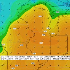
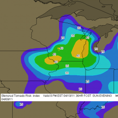
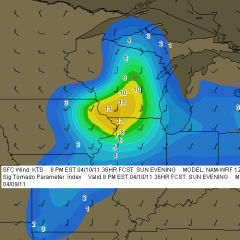
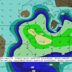
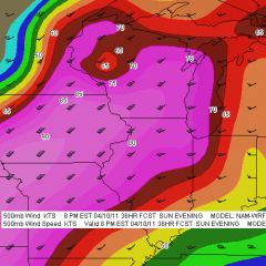
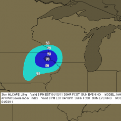
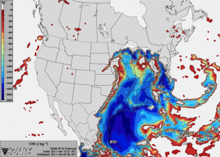
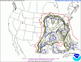
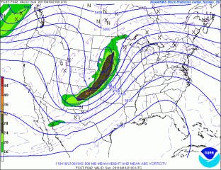
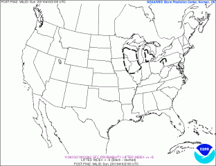
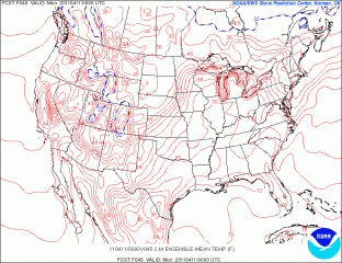
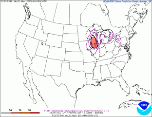
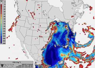
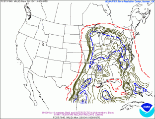
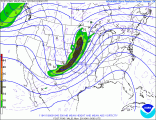
So my present choice for a target is Dubuque, Iowa. According to the NAM, the jet core is aimed in that direction. CINH wants to erode there, MLCAPE looks great, there’s a nearby 3 km MLCAPE max of 75 J/kg (forecast soundings may show better than that–haven’t looked yet), and…well, look down below at the maps I’ve been perusing and judge for yourself. There are a lot of them. In many cases, I’ve shown both 21Z and 00Z so you can see the progression of dynamics.

With height falls and vorticity moving in from the northwest, it may take a bit of will power not to get lured in that direction where the first storms will likely fire in Minnesota and start putting down tornadoes. They’ll be rocketing northeast along the warm front into rough territory, and patience will be the key to remaining in an area where the roads are decent and the prospects of seeing tornadoes instead of trees is better. I think our best play will be from northeast Iowa through northern Illinois. But I’ve got three other team mates with a vote, and I’m not the guy who’s driving. Plus, the best dynamics may have changed by tomorrow. This post just lays out what I’m seeing right now.

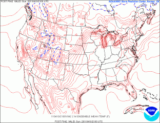
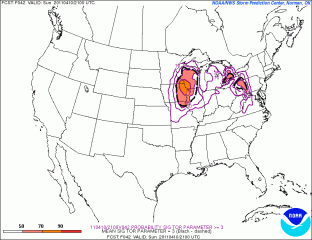
And now I give you the maps I’ve been looking at. Click on them to enlarge them. Please forgive the lack of organization. I added the 12Z F5 NAM maps to the gallery after I processed the others,  which makes for a lot of maps. I just don’t want to take the time to get them all in order. The SREF maps are no doubt already dated as I hit the publish button, and I think it’s important for me to keep the data as current as I can. I figure that if you’re savvy enough to make sense of these models, then you’re smart enough to know how to compare them!

Good luck and safe chasing to all of you who head out tomorrow.

Sunday Thunder in Michigan

For a brief couple of runs Thursday I had vague hopes for an accessible warm front chase on Monday. But that evening’s 00z GFS brought me back to reality, and ensuing runs of the NAM and GFS have painted a blander, cold front scenario for Michigan. As an amateur, decent but still quite formative forecaster rather than a professional meteorologist, I have the freedom to speculate and dream a little on this blog, with the understanding that five days out is fuzzy territory, often more wishcasting than forecasting.

With models coming together three days ahead, I think it’s safe to say that there ain’t nothin’ gonna happen around here on Monday. By then the system will have moved through with zilch to work with in the way of instability, and we’ll start seeing its chillier back end. I’m consigning myself to the compensation prize of a possible bit of thunder around here Sunday night, maybe very early Monday morning, as the cold front moves through. I’ll take that. This early in the season, it’ll be good just to see a little lightning. For that matter, it always is. Storms don’t have to be severe in order to be exciting, beautiful, and worth enjoying.

Looking ahead, more activity could be shaping up for the middle of next week. The Gulf is doing business and the time has come for me to follow the forecast models more closely.

“Tornado Alley” Chaser Party

Saturday in Chicago was possibly the best inauguration of a new chase season that I’ve experienced. A little time to take in some of the Museum of Science and Industry; then watch Sean Casey’s long-awaited new Imax film, Tornado Alley; then head over to Skip Talbot’s place and hang out with fellow chasers and watch storm chasing videos…what could be better?

It was good to reconnect with Michigan native Ben Holcomb, whom I hadn’t

seen since he moved to Oklahoma City last year; with fellow Michiganites Nick Nolte and B. B. and L. B. LaForce; and with Scott Bennet, Adam Lucio, and Danny Neal, comrades in arms along with Ben from the infamous Field Fiasco of May 22 in South Dakota. Plus, it was a pleasure to finally be able to meet some people whom I’ve known of for a long time, including Skip Talbot, who hosted the fete.

My buddy Bill Oosterbaan and I left Grand Rapids for Chicago around 10 a.m. Saturday and arrived at the museum with time to spare. Fifty or sixty miles down the road, I realized that I had left behind a couple 4-packs of barley wine which I had bought exclusively for the occasion. It was a minor downside to a great trip. Drat! Now I guess it’s up to Lisa and me to drink all that barley wine–an onerous task, to be sure, but we’ll manage it. In fact, we’ve already whittled away the workload by half, and I’m contemplating a bottle tonight after I’ve finished writing this post.

Watching tornado videos and hanging out with chasers has got me hankering to see some storms. It won’t be much longer now! And this year I’ve got everything I need to kick things up a notch or two with a great new camcorder and live streaming video. Wednesday I meet with one of the Channel 8 meteorologists to discuss doing some media chasing–connection courtesy of Ben Holcomb. Thanks, Ben!

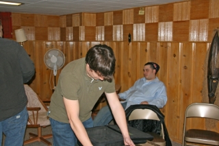
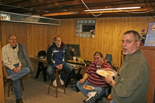
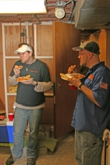
But back to the party, here are a few photos. If you were there and don’t see yourself here, sorry–I didn’t intentionally leave you out. I just didn’t get everyone, and these shots are merely representative.

Skip, thanks to you and Jenny for opening your home to us. To everyone else: great seeing you, and I look forward to crossing paths with you again at the edge of the meso.

New Years Eve Severe Weather

new-years-eveHere’s something you don’t see very often on the morning of December 31. (Click on thumbnail to enlarge it.) It’s 10 a.m. and for the last half-hour I’ve been watching lightning flicker outside my window and listening to thunder rumble.

But that’s nothing compared to what’s going on farther south. Already three fatalities have been reported in Arkansas, and tornado warned storms are scraping across the region. As I write, there are two strong SRV couplets in Missouri southwest of Waynesville and west of Houston–potent little supercells fueled by dewpoints in the upper 50s. It’s new-years-eve-mo-srvcertainly not what you’d expect this time of year, but this event has been shaping up for several days.

I’ve got a gig this evening–it’s New Years, after all–so my extent of involvement in this weather scenario will be to watch it unfold to the south of me on radar and enjoy its occasional outbursts of lightning and thunder here in my own Michigan backyard. Later today Louisiana and Mississippi could get hammered, but right now the action is farther north, where buckets of shear are organizing the storms and driving them along at 50 new-years-eve-mo-refmiles an hour. If that little bugger south of Waynesville holds together, Rolla is going to get whacked within the next half hour.

Enough writing. I’m going to upload some radar images for this post and then watch this event unfold.

Dixie Alley Severe Update: Yazoo City

Unbelievable. Yazoo City, Mississippi, which sustained a massive and deadly EF-4 tornado back on April 24 of this year, got hit by another tornado just a couple hours ago. A tornado warning issued at 8:18 CST reads as follows:

AT 816 PM CST…LOCAL LAW ENFORCEMENT REPORTED DAMAGE FROM A TORNADO
JUST PASSING THROUGH THE CITY. THIS TORNADO WAS LOCATED 6 MILES
SOUTH OF EDEN MOVING NORTHEAST AT 50 MPH.

A line of tornadic supercells continue to rake across Mississippi. As I write, at 9:19 CST, the most robust circulation is west of Raymond; however, weaker circulation is passing just to the north of Port Gibson. Oops, new scan in, and that circulation appears to have intensified. And there are other tornado-warned storms in progress as well.

This will be a nasty night for Dixie Alley dwellers. I’ll have more to write tomorrow, along with a couple volume scans to share from GR2AE. Let’s hope and pray that no fatalities result from this round of severe weather. Night time storms are killers.

Late-November Severe Weather Outbreak In Progress

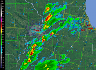
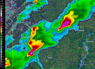
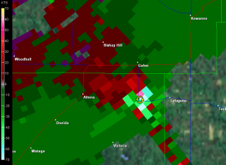
Now here’s something you don’ see very often on November 22 in the Great Lakes: supercells cruising across northern Illinois. I’d be very happy to be on either the one northwest of Toulon or the one northwest of Princeton. The storms are extending along the cold front northeast on into Wisconsin.

Whoops! The one down by Toulon is now tornado-warned. Imagine that! Here are some radar grabs. Click on them to enlarge.

And with that, I’m signing off.