PubCrawler.com: A Guide for Storm Chasers Looking for Great Beer on the Great Plains

Next time I’m in Hays, Kansas, I hope to sample the India Pale Ale at the Lb. Brewing Company. Here’s what one reviewer had to say:

A very impressive establishment and such a nice draw (pun intended) for a town like Hays. I would highly recommend this pub to anyone looking for the best beer and food around. Gerald and his wife are to be commended for running an outstanding operation. The beer was fresh and it’s hard to believe that they can keep over 6 different types of beer flowing in a place like Hays. I tried the Pale Ale, the IPA, and the stout. All were top-notch but the IPA in the large Lb glass was simply outstanding! This is a unique but yummy IPA (hops were not as strong as traditional IPA and color was darker too). Great crafting here!

I had no idea such an establishment existed in Hays. For that matter, a nagging question these past couple of years has been, where can I go to get a decent beer in Tornado Alley?

It turns out that there are more options than I realized. Thanks to my sweetheart, Lisa–who knows that my love for fine ales runs, if not a close second to my passion for storm chasing, certainly no more than a stone’s throw away–I am now aware of an online resource that can help craft brewaphiles slake their thirst all across the nation, including places in the American heartland that I’d never have expected.

If you, like me, like to crown a successful chase with something more than a Bud with your steak, then check out this link to PubCrawler.com and bookmark it. Lisa forwarded it to me, and I quickly concluded that it’s a goldmine for road warriors who love beer. You’ll be delighted with what you find. No need for me to say more since the site is self-explanatory. You can thank me later.
How Will El Nino Affect the Tornado Season in 2010?

Have you wondered what ramifications this present El Nino has for the 2010 tornado season? I have. At first I was excited to think of all that winter precip bringing relief to the parched South, removing drought from the equation and enhancing the moisture fetch in the spring. Now, however, I’m wondering whether that advantage won’t be offset by other concerns.

Not being a climatologist, or even modestly astute in matters of climatology, the best I can do is speculate, and my speculation is probably fraught with misinformation (aka bullcrap). Nevertheless, after looking at the Climate Prediction Center’s December 21 update of their ENSO report, I can’t help trying to make some sense of it as it pertains to storm chasing.

The report makes it clear that the present El Nino is intensifying, with sea surface temperatures (SSTs) now averaging 1.2 C above normal in the eastern Pacific.

no images were found

The six charts on page 28 of the report depicting projected sea surface temperatures caught my eye. I’ve included them here. Click on the image on the right to enlarge it.

As you read the charts, notice the following:
* Panels 3 and 4 (March-May and April-June) show above-average SSTs in the eastern Pacific, pooling significantly off of Baja.
* Slightly lower-than-average SSTs preside in most of the GOM.
* Panel 5 (May-July) shows warmer temperatures finally moving toward the coast of the GOM.
* With the June-August map, the GOM seems to be in good shape, and the SST anomaly off of Baja appears to be modifying.

What I make of this picture is that subtropical moisture from the southwest (i.e. the subtropical jet) may play a bigger-than-usual role in the springtime weather, while Gulf moisture return may be delayed. That’s not a very promising scenario for this coming storm season.

Again, I am NOT a climatologist, and all of the above is just my clumsy attempt to piece together stuff I’m aware of but don’t really understand. So chances are good that my reasoning is out in left field, and if that’s the case, then more knowledgeable heads than mine are free to correct me. I’m not attempting to make a long-term prognosis here so much as I’m simply processing information, trying to understand the big picture.

I’ve already posted on this topic in Stormtrack, in the hope of generating some discussion and gaining insight into the matter. If I glean some gems of wisdom, then a follow-up post here on Stormhorn.com  may be in order. For that matter, if you’ve got a better handle on the picture than I do, then please comment here and and set me straight. Believe me, I won’t mind being wrong.

Highlights from the 2009 COD Severe Weather Conference

Paul Sirvatka of COD, conference organizer

Paul Sirvatka of COD, conference organizer

The 2009 College of DuPage Severe Weather Symposium is now behind me, and in the light of it, it seems a bit weird to think that the day after, I headed over to my buddy Bill’s to watch the next episode of the Storm Chasers series on Discovery Channel. It feels like two different worlds, like boarding a bus in Grand Rapids and getting off on Mars. But the difference is superficial, a matter of editorial slant; the raw material remains the same, and however it gets spun on television, it’s nevertheless the stuff of research. In reality, people really, truly are going out there and surrounding supercells with an armada of mobile radars and other devices, including manned probe vehicles, all in the interest of collecting data that can increase our understanding of, in a nutshell, what makes tornadoes happen.

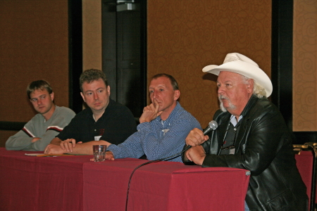
The conference featured some of the most knowledgeable and revered names in severe weather research, operational forecasting, and storm chasing: Eric Rasmussen. Chuck Doswell. Roger Edwards. Roger Wakimoto. Josh Wurman. The list goes on, but the point is, a lot of very knowledgeable heads were present in the Double Tree Hotel’s conference room this past week, and some of the insights they shared were fascinating.

Taylor and Carlsen of Environment Canada

Taylor and Carlsen of Environment Canada

Some of the coolest stuff didn’t even come out of the United States. Neil Taylor and Dave Carlsen of Environment Canada shared a photogrammetric analysis of the Elie, Manitoba, F5 tornado, and preliminary findings from the 2008 UNSTABLE team’s exploration of a well-known but hitherto unresearched dryline phenomenon in Alberta. The latter featured EC’s own mobile mesonet, complete with a Doppler-equipped airlplane.

Here are just a few, representative snapshots of the many other topical materials covered:

* Adam Houston talked about the effects of entrainment on unstable parcels, and suggested that the important issue for storm formation isn’t whether a parcel is merely unstable, but whether it is “supercritical”–i.e., possesses enough CAPE to overcome the effect of entrainment.

Eric Rasmussen

Eric Rasmussen

* Eric Rasmussen shared some of the prelimary findings of VORTEX2, describing the interaction of the RFD with horizontal vortex rings in tornadogenesis.

* Roger Edwards discussed the forecast funnel and the pros and cons of numerical models in operational forecasting.

* Al Pietrycha offered an operational forecasting perspective on non-mesocyclone tornadoes, and more specifically, on landspouts.

* For his dinner presentation Saturday night, Chuck Doswell gave an overview of the history of severe weather forecasting and research, and shared his outlook on things to come.

The shape of the future was in fact a topic of concern for a number of the speakers, notably Doswell and Edwards. Amid the influx of information from the research community on misocyclones, vorticity arches, moisture

Roger Edwards

Roger Edwards

convergence, and so on, those on the operational side focused on a more pragmatic matter: the widespread over-reliance on numerical models versus hand analysis.

Will forecast models replace human forecasters? According to Doswell and Edwards, yes, at least for most forecasting scenarios. Edwards emphasized that when it comes to severe weather events–the most difficult to forecast, and the costliest in terms of lives and property–humans will still play an important role. But both men deplored the degree to which forecasters have abdicated hand analysis to the models, which continue to make advances in accuracy at the expense of human development. In a word, the attention and the money are being invested in building better technology, not better forecasters.

Doswell’s message to meteorology students was blunt: either soak in as much information as possible, and commit to becoming experts at hand analysis and motivated self-educators, or else find a different career. Chuck, who is not known for being shy about sharing his viewpoints, wasn’t being nasty, just extremely forthright.

Chuck Doswell speaks

Chuck Doswell speaks

The mets from Environment Canada, Carlsen and Taylor, were clearly shocked to learn how dependent United States WFOs have become on forecast models. The Canadian meteorologists take hand analysis as a given part of their jobs, and couldn’t imagine not rolling up their sleeves and interacting with the surface and upper-level charts firsthand.

If there was a primary take-away value for me from this conference, I guess that’s it: the importance of getting my arms around hand analysis. Practically speaking, while I found the other material fascinating and enriching, much of it was not particularly applicable to my needs as a storm chaser. The first priority is to get to the right storms. Everything else falls into place from there.

Guest Blog: Storm Chaser Andrew Revering on How to Forecast Northwest Flow Events

Regarding tornado potential…with storms moving southeast or even south in some cases, you have to keep in mind that the storm-relative inflow will have to shift in order to maintain a good, dry updraft and support supercellular structure.

Welcome to the first guest post in my new, improved Stormhorn.com blog! I’m pleased to feature Andrew Revering sharing his insights on forecasting northwest flow chase scenarios. Northwest flow seldom produces severe weather; however, some noteworthy tornadoes have occurred in northwest flow. I’m delighted to have Andy share his knowledge about how to forecast the rare chaseworthy setups.

Andy is the proprietor of Convective Development, Inc., and the creator of the unique, enormously powerful F5 Data forecasting data feed and software. A meteorology student both privately and in educational institutions for his whole life, Andy has been a storm chaser for 15 years, four of which he served as a contract storm chaser for KSTP, an ABC-TV affiliate in Minneapolis. Andy started writing weather software in 1996 as a high school senior, developing such programs as AlertMe, APRWeather, WarnMe, StormGuide, AlertMe Pro, SkyConditions, and F5 Data. His current projects include F5 App, F5 Maps, and CellWarn.

During the nearly three years that I’ve used Andy’s F5 Data, I’ve been impressed not only with the power of the product, but also with the knowledge, friendliness, and helpfulness of its creator. Without further preamble, here he is, helping you to get a better handle on…

FORECASTING CHASEWORTHY NORTHWEST FLOW SCENARIOS
By Andrew Revering

The weather pattern known as northwest flow often means cold, stable air and clearing skies, since it comes in the wake of a large synoptic low that has just come through, cleaning the atmosphere of moisture and instability. However, on rare occasions northwest flow can produce very photogenic supercells and even tornadoes.

A northwest flow setup is normally undesirable for storm chasing because severe weather typically occurs in the warm sector before a synoptic system passes, with the jet coming in from the southwest. After the system passes, the shifting jet structure puts you into the northwest flow with limited moisture and instability. With desirable surface features now to your east, you will typically have scrubbed the atmosphere of any good moisture and instability, thereby preventing severe weather from occurring.

However, this is not always the case. A weak ridging pattern, for example, can also produce northwest flow, and it’s possible for weaker surface systems to traverse the flow, bringing in adequate moisture and instability to create a chaseworthy setup.

Regarding tornado potential, the concerns to look at from a forecasting perspective are the same you would consider with a typical deep trough/southwest or westerly flow scenario. Check for adequate deep shear and low-level shear (helicities, 1 km shear vectors, etcetera). You also want to look at the storm-relative inflow. However, with storms moving southeast or even south in some cases, you have to keep in mind that the storm-relative inflow will have to shift to maintain a good, dry updraft and support supercellular structure.

Keep in mind some basics. In order to sustain a single-cell or supercell structure, besides having decent deep-layer shear (40-plus knots at 6 km depth vector), you should also have the environmental wind directions blowing at an angle, with storm motion at roughly ninety degrees from the direction of the environmental winds.

For example, in a classic scenario, storms move due east, with surface winds moving from the south. This allows unstable, warm, moist air to enter the storm on the south side. The storm moves east because the upper-air steering winds are pushing it in that direction. Therefore, when the tower of the storm goes up it gets tilted downwind to the east of the updraft, and rain falls ahead of the storm.

That’s the key point here: rain falls ahead of the updraft. So when you have warm “feeder” air flowing toward the southern side of an eastbound storm, that air can enter the storm unobstructed by precipitation, thus allowing for warm, buoyant air to drive the updraft.

Conversely, if the surface winds came from the east of this same eastbound storm, you’d have storm-relative inflow at 180 degrees. This is BAD for a storm when it comes to producing a tornado, because the incoming air is encountering all of the cold outflow produced by the rain core. It cannot effectively get around this obstacle to feed the updraft. So two problems occur: 1) the warm environmental air gets blocked by the outflow; and 2) the inflow speed decreases, which in turn greatly decreases the low-level shear vector.

Think of it as an extreme. If outflow blocks the environmental winds completely you have zero knots of inflow air into the updraft, which becomes contaminated by the outflow.

In this scenario, the warm air still gets into the storm to feed it, but the storm becomes front-fed, with the warm inflow riding up over the cold outflow. It enters the storm at the mid levels, pushed there by the outflow/gust front, which creates a wedge and causes a shelf cloud to form. The storm then becomes outflow-dominant—linear, multicellular, or some other mode that is unfavorable for tornadoes.

To summarize, then, you need the environmental wind direction to be entering the storm at an angle between, say, 45 and 135 degrees of a storm’s motion to help the storm maintain a super-cellular shape (along with good deep-layer shear and other parameters).

Applying these general principles to a northwest flow event, if your storm motion is southeasterly, south-southeasterly, or southerly, you need storm-relative inflow to be west-southwesterly, westerly or possibly even easterly or east-northeasterly. Since the storm motion is usually going to be southeasterly, the westerly surface options are typically the better choice.

This seems illogical to most chasers. These are not the typical directions you would expect for good inflow; however, they can work well if you have enough instability, moisture, and other of the right ingredients.

When chasing northwest flow storms—or any storms—keep in mind that you want to be on the side of a storm where the environmental inflow is approaching the storm. In a classic setup with an eastbound storm and southerly surface winds, you would look for the updraft base on the south side of the storm (though that can vary from the southeast to southwest side of the storm as well). In a northwest flow scenario, if the surface winds are west-southwest, look for your updraft base on the west-southwest or west side of the storm if its moving south, south-southeast, or southeast. This arrangement can be disorienting to a chaser who doesn’t normally chase storms moving in these directions. In northwest flow, the south or east side of the storm will have few features and present what looks like an outflow-dominant storm, making it easy to miss the tornado on the other side.

Northwest flow storms can be good tornado producers for another reason that I haven’t mentioned yet: they typically bring in cool air in the mid levels. This cool air advection greatly increases instability provided there’s good moisture and instability at the surface. Getting the right surface conditions in place is difficult, but those conditions are the key factor in a good northwest flow setup. Surface moisture and instability combined with unusually cold temperatures in the mid levels can add up to decent instability overall.

Additionally, if the mid levels are cold enough—say, less than -16C at 500mb—you may get a ‘hybrid’ cold core setup to amplify the scenario. However it probably wouldn’t be a true cold core as defined by Jon Davies’ work, given the presence of northwest flow and the likely absence of a significant mid-level cyclone in the area.

Most northwest flow setups occur in June, July, and August, with the peak being in July. These three months account for 85 percent of northwest flow events as studied by Kelly et al, 1978. It is pretty evident that the delay in northwest flow setups during the severe season is due to the lack of adequate moisture in earlier months. In the summer you can get an adundance of moisture that lingers after the passage of a system, allowing for a northwest flow system or even a post-frontal storm or two.

Storm chasers often ignore northwest flow patterns because they typically mean few low pressure centers for convergence and moisture fetch. But while severe weather is rare with northwest flow, it can occur. So keep an eye out. You can easily miss a decent chase scenario by writing it off too quickly.

Introducing…THE NEW THEME!

IT’S HERE!

The long-awaited face lift for Stormhorn.com has arrived at last!

Yaaaaaaaayyyyyyyy!!!!!!!!!!

Thanks to the creativity, coding expertise, online marketing savvy, and hard work of my beautiful and brilliant (and thoroughly geeky) lady friend, Lisa, my blog has acquired not only an all-new look, but greater flexibility and immensely expanded capabilities. Lisa built this new theme for me from scratch. It will take time for me to learn how to exploit all of its many features, and there may be a few bugs to work through in the process. So be patient. New pages will be added, and sundry plug-ins and widgets affixed.

Just as it stands, though, I’m extremely excited about the new format, and I hope you’ll like it, too. Please feel free to share your feedback with me.

And allow me to give Lisa a plug. If you’re looking for help with website design, programming, custom themes, WordPress, social network marketing, or anything computer- or Internet-related, do yourself a big favor and contact Lis. She is the proprietor of Studio 727 Ltd., and she’s extremely knowledgeable. Better still, she’s capable of communicating in plain words with those of us who aren’t all that technically savvy. In fact, that’s part of her mission: to help make life easier for us ordinary mortals who rely on computers and the Internet but struggle with all the technical gobbledegook.

If you have a project or could use a sharp but down-to-earth consultant, shoot Lis an email at lisa@studio727ltd.com. You can thank me later for recommending her to you.

With the new theme now installed, I’m finally ready to move on an idea I’ve been cultivating for a while now. I’m excited to start bringing you periodic guest articles from the worlds of jazz and storm chasing. My lineup is already forming, and I think you’ll like what you find. I haven’t yet decided how often I’ll feature guest bloggers. Obviously, their availability will be a big determinant.

For now, I’m extremely pleased to say that the first guest blog is already written, and it’s excellent. Storm chaser Andrew Revering, weather forecasting software designer and proprietor of Convective Development, Inc., has done a stellar job of sharing his insights on northwest flow events. I plan to publish his article later this week, so stay tuned. And for my jazz readers, I anticipate having something for you as well before long, so don’t worry. You won’t be neglected, I promise!

That’s it for now. If you’ve enjoyed my blog to this point, then I trust you’ll like the new Stormhorn.com all the more as it continues to develop. Again, please feel free to share your thoughts.

–Bob

The 2009 Storm Season: A Good One or a Bad One?

Reading a thread in Stormtrack, I came upon a comment in which the poster briefly griped about how the 2009 storm chasing season had been a lousy one for him. In the post that followed, another member mentioned that it wasn’t fair to blame the weather for one’s personal lack of scalps when the season itself had been pretty solid. The context was lighthearted, though I read enough pointedness to the second comment that it made me stop and think.

The first commenter never said there weren’t plenty of tornadoes; he just said that he’d had a lousy season. My own season hasn’t been that hot either. For the thousands of miles I’ve driven, I’ve only got one tornado to show for it–at least, one that I’m certain of. Sure, I’ve witnessed some beautiful structure and gotten beaned by some big hail in northwest Missouri, but this year has been nothing like 2008.

Am I blaming the weather? No. Those who were in a position to chase all the slight risk day in the Great Plains, from the southern plains to the Canadian border, had plenty of opportunities and did great. But me, I live in Michigan. Much as I’d like to be out there chasing slight risk days in Kansas, Nebraska, Colorado, and the Dakotas, logistically it’s just not feasible for me to do so. I’ve got a livelihood to earn, and gas and lodging cost money.

Add to that the fact that I made at least one poor judgment call that took me and my buddy south when we should have gone north, and I’ve had what amounts to a mediocre to poor storm chasing season. If I lived in the heart of Tornado Alley, I think I’d have enjoyed a much better one. But where I live, I have things to factor into my chase/don’t chase decisions that wouldn’t be as much of a concern if I lived in, say, Oklahoma City or Topeka, Kansas.

That’s not the weather’s fault. It’s just a matter of geography and personal circumstances. If I were to blame the weather for anything, it would be for putting in a substandard performance so far in the central Great Lakes, an area that never fares as well as the plains states to begin with. But of course, it’s pointless to blame the weather for anything, period. Weather isn’t an ethical entity–it just does what it does, and those of us who chase after it have to make our judgment calls the best we know how.

Living in Michigan, I’d be a fool to go after synoptic setups that I’d be an equal fool to pass up if I lived in Kansas instead. That’s the reality, at least for me, though I think I’m by no means alone.

So no, this hasn’t been a bad season for chase weather, not at all. But if you’re me, it hasn’t been a very good season for getting to much of the action.

Maybe the secondary season this fall will create a few more opportunities. I hope so. Give me another setup like October 18, 2007, and I’ll be a happy man.

Year of the Cap Bust

I guess I’m just a slow learner when it comes to technical stuff that involves linear thinking. Sooner or later, though, if I stick with something long enough, I usually emerge more knowledgeable for having done so. Nowhere has this been more true than in storm chasing, an activity which obviously depends heavily on figuring out if and where there will be decent storms to chase.

Seems like I’m constantly being confronted with some new aspect of the atmosphere that I haven’t factored into my forecasting, or that I haven’t factored in as effectively as I needed to. The upside of that, though, is that I wouldn’t even be aware of what I don’t know if I hadn’t learned enough to at least recognize my areas of ignorance. If my forecasts aren’t as expert as those of a trained meteorologist, they’re nonetheless a seven-league bound beyond when I was just beginning to grapple with all those arcane terms and acronyms of convective weather such as SBCAPE, CIN, 0-6km bulk shear, LIs, helicity, and lapse rates, and when the only thing I could do with a skew-T or a hodograph was shake my head in bewilderment.

This has been the year of discovering the 700 mb/12C limit. By “discovering,” I mean through empirical experience, and by “empirical experience,” I mean cap busts. Of course, I’ve endured plenty of cap busts in my development as a storm chaser; I just didn’t understand exactly what was going on, or why the high risk area I was sitting in was producing nothing more than smug blue skies rather than carnivorous supercells.

One memorable day in Iowa drove home the lesson perfectly. MLCIN was supposed to erode by later in the afternoon, and it got to a point where it was eroding, at least according the RUC. With SBCAPE at some ridiculous figure like 7,000 j/kg, I figured that at some point a convective tower would punch through the cap and go absolutely gonzo. Instead, the clouds kept firing up into the nicely sheared environment and then dying, firing and dying, firing and dying. The reason? A 700 mb temperature of around 14C, possibly considerably higher. Lesson learned: it doesn’t much matter what the models have to say about the CIN eroding when you’ve got mid-level temperatures like that.

I experienced another cap bust yesterday, though I can’t feel too bad about it since I had no compelling reason to head out in the first place, the conditions were so marginal. It was interesting to notice that in this situation, the circumstances were reversed: RUC showing my area under very breakable 700 mb temps of around 10C, but with MLCIN creating some concern. However, the CIN appeared to be eroding, and when an SPC mesoscale discussion spotlighted the area I was in, I started feeling happy about having made the drive down to west-central Illinois.

But the CIN started building back in, and by 00Z I found myself socked in under values around -300 j/kg. Not much a parcel of air can do with that, I guess, no matter how big the CAPE is. I turned around and headed home.

A paper by Bunker, Wetencamp, and Schild of the NWS in Rapid City, South Dakota, explores the ins and outs of the 700 mb/12C limit and concludes that it has a limited, conditional application. However, as my buddy Mike Kovalchick pointed out to me, the paper also reveals that only 5 percent of tornadoes within the study period formed when H7 temps exceeded 12C, and virtually no violent (EF4 and EF5) tornadoes occurred above that threshold.

So for practical use in storm chasing, the 12C limit appears to be a very useful rule of thumb. The issue for me then becomes a matter of refining my ability to know when cold air advection will lower the 700 mb temps. But that’s a subject for another blog. I’m tired of thinking. It’s time to go meet my buddy Dewey down in Plainwell and grab a brew at Arie’s. Ciao!

Changes Coming to Stormhorn Blog

Greetings, friends and readers of Stormhorn.com!

I want to fill you in on some changes that are in the works for this blog. They’re not here yet, but they are impending, and I anticipate that they will help take the blog, and eventually its parent Stormhorn website, to the next level.

At the moment, the most significant change in the works is a brand-new, custom theme. My lady friend, Lisa, who is absolutely brilliant at website development, online marketing, and all things computer, has been beavering away steadily at the new version. When it is done, this blog will have a new look and much greater versatility. I’m excited about what Lisa has got planned, and I can’t wait to roll it out once it’s ready, see how you like it, and get your feedback.

Concurrent with the new theme, I’ve been thinking about adding an extra element of interest by featuring guest bloggers from time to time. They will be from the worlds of both music and storm chasing. I like the idea of offering you insights and perspectives besides just my own, and I hope that doing so will provide an added value for my readers as well as a positive experience for my contributors.

About my Jazz Improvisation E-BooK: While this project has been on the back burner for a while, I do anticipate picking it back up at some point. I’ve already got several installments written; however,  because I tend to be pretty thorough, each lesson takes me considerable time to develop, and with other more pressing matters to deal with, I just haven’t had time or focus for the e-book. Stay tuned, though, because it is by no means a dead project. As this blog and website continue to develop step by step, I will at some point get the e-book back on track.

So, there you have it: changes are coming to Stormhorn.com, and the first of them is right around the corner. Meanwhile, I’ll continue to post with the existing format, which has served me well thus far. I hope you’ve enjoyed your visits here, and that you’ll enjoy them even more as this blog enters an exciting new phase.

Heading for an Iowa Chase

As I write, I’m heading west down I-80 with my storm chasing buddy Bill Oosterbaan. Our target: Waterloo, Iowa. The 9Z RUC shows a nice convergence of 850 and 500 mb jets overspreading massive CAPE by 21Z, with a robust 200 mb jet nosing in. Progged surface winds could be better, but skew-Ts still show nice veering with height, and storm relative inflow is majorly backed.

Oh, yeah…and we’re looking at dewpoints of 75 degrees and higher, with dewpoint depressions around 5 degrees. LCLs should be so low we may have to tunnel underground to find the cloud bases.

The SPC has hatched out this area for tornadoes. No surprise. After a relatively modest season, we may be on the verge of a significant outbreak. It’s a bit sobering to think that Parkersburg, Iowa, could get slammed again. I expect we’ll see a PDS statement at some point today, and I wonder whether the outlook won’t get bumped from a moderate risk to a high risk as well.

Tomorrow also looks to be a hugely active day, and the latest SREF places a sigtor in Michigan. So stay tuned. I’m sure there will be more to come.

Chicken Soup for the Solo

The meds that the doc prescribed for me seem to finally be working their mojo. I’m still coughing, but it’s no longer a painful cough, and yesterday’s feverishness has passed. Today I went out and bought a bunch of Amish chicken and a whole passel of assorted veggies and rice, and I made up a huge potful of chicken soup. I’ve heard more than one person tell me that the old wive’s tale is true: homemade chicken soup has a wholesome, curative property. I believe it. People breathing their last gasp have been known to revive at a mere whiff of my chicken soup.

Anyway, it’s been a week since I’ve played my horn, and in the interrim, I’ve felt so lousy that I haven’t even thought about it. As for storm chasing, ha. Good thing I didn’t go down to Tornado Alley last weekend with Bill and Tom–not only would I have been miserable, but by now they would be, too.

Storms have been lighting up the Plains pretty much all week. My friend Kurt Hulst was out in Oklahoma yesterday with his pal Nick, and he posted some nice pics on his blog. I’m assuming he caught the supercells in northern Texas earlier today as well. Can’t wait to see those photos.

Of course, I’ve been out of the action. Out of practice on my sax, out of the picture for chasing storms. In another couple of days, though, I should be ready to rumble. I just hope the weather feels the same way. My head is finally back on my shoulders only barely enough that I might start giving a rip about the forecast models, and maybe even be able to make some sense out of them again.

Enough for now. Tornadoes can wait. Right now, a bowlful of chicken soup is calling my name. If I eat enough, I might find myself in good enough shape by tomorrow to blow a few notes on my saxophone. Chicken soup for the solo. I like that idea.