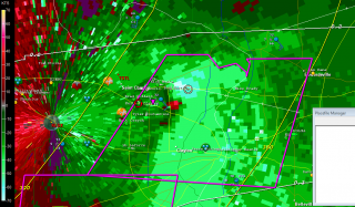
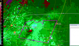
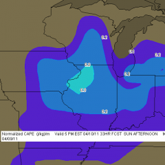
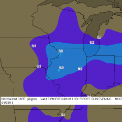
April 22, 2011, Saint Louis “Good Friday” Tornado

Saint Louis, Missouri, has been hit a number of times  by tornadoes over the years, most notably on May 27, 1896, when a violent tornado claimed 255 lives. Last Friday my friends Bill Oosterbaan, Kurt Hulst, Mike Kovalchik, and I witnessed the first EF4 tornado to strike the metro area in 44 years.

I use the word “witnessed” loosely as we really didn’t see much of anything. Bill observed wrapping rain curtains just to our west, Kurt and Mike saw a couple power flashes, and I captured a feature on video that may have been the funnel cloud, but mostly what we saw was a whole lot of blowing rain and brilliant, nonstop lightning. Judging from the lack of any other videos that show a clearly defined tornado, our experience was typical. If anyone was in a good position to see the condensation funnel, it was us, and perhaps we would have seen it had the storm struck an hour earlier. But I suspect the thing was too rain-wrapped for good viewing even in broad daylight.

The storm initiated southeast of Kansas City near the triple point of an advancing low. Poised at the northernmost end a broken line that backbuilt southwest  into Oklahoma, the incipient cell split and the right split grazed eastward along a warm front draped over the I-70 corridor.

We first intercepted the storm south of Columbia outside the town of Ashland. At that point it was getting its act together and was already tornado warned. The sirens sounded right next to us as we stood and filmed, but the storm had a ways to go before it finally went tornadic. Where we stood southeast of the updraft base, the air was dead calm–not even a breath of inflow, nothing but the year’s first mosquitoes to remind us that spring was well underway south of our home state of Michigan.

Keeping up with this storm would likely have been much easier had we not chosen to head back to I-70, where eastbound slowdowns hung us up and golfball hail on the north end of the supercell clobbered us. The storm organized beautifully for a while on the radar, but there wasn’t a thing we could do about it with traffic crawling along. Thanks to Bill’s great driving, we eventually did get clear, but by then the storm appeared to have turned to junk.

Just goes to show how deceptive appearances can be. Shortly after we had written the storm off, the radio announced the first reports of tornado damage in New Melle, and from then on, the reports continued. As fellow Michigan-based storm chaser L. B. LaForce put it, “I got a good look at the base just south of Innsbrook and it looked like crap. It tightened up shortly thereafter.”

Indeed it did, as strong and continuing radar couplets bore out. Dropping south on US 40 to get a better view of the storm, we parked by a cemetery and  finally got a good look at the action area to our southwest. Against the dirty orange backlight of the fading sunset, a conveyor of low clouds flowed from the north into an area of murky blackness bristling with lightning. Unquestionably this beast  meant business and intended to transact it along the worst possible path: right through the heart of  northern Saint Louis.

Along its 22-mile path, the tornado inflicted its most widely reported damage at the Lambert–Saint Louis International Airport. It’s a miracle that no one was killed or seriously injured at this location. That may very well include us. We had exited I-70 in order to get a look at the storm, or at least try to, and by the time we were back on the highway the radar showed that we had compromised our safety and needed to git, fast. It was at this point that Bill thought he saw the rain curtains swirling, and Kurt and Mike observed what looked like power flashes. Hard to say, given the intensity of the lightning. What’s certain is that we missed the tornado by the skin of our teeth, because the radio announced only minutes later that Lambert Field had been hit. The bear had been breathing down our necks. Funny thing is, I’ve driven through much worse conditions at night. But conditions can change in a heartbeat, and in this case they wouldn’t have changed for the better.

The seriousness of the damage inflicted by this tornado didn’t sink in until a while later when reports, photos, and YouTube videos began to filter in. EF4 damage occurred about a mile-and-a-half west of the airport. At Lambert, the damage was rated EF2 and resulted in closure of the airport. A photo of a passenger bus hoisted up onto the roof of an airport building demonstrated the power of the winds.

The Saint Louis NWS report on this event lists two tornadoes, the first a brief EF1 that did damage in New Melle, followed by the long-track, EF4 monster that chewed through Saint Louis proper, beginning along Creve Coeur Mill Road near Griers Lane and dissipating across the Mississippi River south of I-270 and west of Pontoon Beach, Illinois.

Why did the storm wait until it was just west of Saint Louis to begin spinning up tornadoes? The best explanation I’ve heard is one that was offered on Stormtrack. Evidently the warm front had moved north of I-70 on its western side, where the low initially lifted through Kansas City. But farther east, the front sagged southward through Saint Louis, backing the surface winds. The storm, moving eastward through the warm sector just south of the warm front toward an inevitable intersection, finally interacted with the front itself and began to ingest the enhanced helicities. Suddenly, boom! Tornadoes.

Farther east into Illinois, although it continued to be tornado warned, the storm gradually weakened and lined out, leaving Bill, Kurt, Mike, and me to enjoy a spectacular light show for much of the ride home. I finally clambered into bed around 5:00 a.m.

The stormy weather continues unabated down south. As I write, Bill is chasing down in Arkansas north of Little Rock. Judging by his position on Spotter Network, it looks like he may have bagged a tornado. Guess I’ll find out in a while. I wish I was there too, but this week is spoken for. I have a gig tomorrow afternoon, and then Mom goes in for knee surgery on Wednesday. So I won’t be chasing through the weekend. After that, we’ll see what the weather holds. This has become an active April, and now we’re coming up on May. I can’t wait to hit the road again!
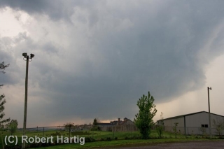
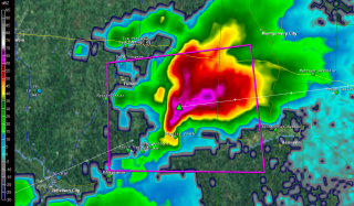
April 14-16 Southeast Tornado Outbreak: Thoughts and Images

There are times when the sight of a high risk sickens rather than excites me, and Saturday was one of those days. It’s one thing when severe storms occur in the Great Plains where the population is sparse, but when a swarm of tornadoes roars across an area punctuated with cities and towns, all I can think is, “Oh no. All those people!” Such was the case with last week’s horrendous three-day tornado outbreak across the South and East.

The outbreak commenced Thursday in Oklahoma, Kansas, and Arkansas, with a preliminary figure of 27 tornadoes reported.* The action ramped up Friday in Louisiana, Kentucky, Missouri, Illinois, Mississippi, Alabama, and Georgia, with an initial tally of 120 tornadoes. Day three was the worst of all, with yet another 120 reported tornadoes slashing across the populous, densely forested Southeast and East from South Carolina to as far north as Pennsylvania. Hardest hit was North Carolina, where large and powerful tornadoes ripped through Raleigh and other communities. Twenty-two lives were lost, 11 of them when a three-quarter-mile-wide, EF3 monster carved a 19-mile path across Bertie County. Another six died in Virginia. And in its previous two days, the outbreak claimed seven lives in Arkansas, seven in Alabama, two in Oklahoma, and one in Mississippi.

In all, Saturday’s tornadoes were North Carolina’s most lethal since 1984, when 42 died. And regionally, Friday and Saturday were the worst tornado outbreak in the Southeast since the Super Tuesday Outbreak of February 5–6, 2008, when 87 tornadoes killed 57 people in four Dixie Alley states.

But my point in writing this article isn’t to provide yet another news story on the disaster. Rather, it’s to share my feelings as I watched it unfold. With some truly amazing video coming in from chasers in Oklahoma, the first day was fascinating. Day two, watching tornadic supercells crawl across Mississippi and Alabama on the radar was unnerving; I hoped nothing bad would happen down there in the South, but I knew better. On day three, when I saw the high risk go up in North Carolina, my heart sank.

When it comes to armchair chasing, I’m moderate in my habits. If I can’t actually be out chasing, I often opt for a more constructive use of my time than watching the radar and gnawing my knuckles. This time, though, I couldn’t help watching. At first the line of storms looked mean but not terribly alarming. As the storms headed east, though, they began to organize and strengthen, and circulations began to show on radar. Strong circulations, a whole line of them, stretching from northern South Carolina up into Maryland and Virginia. And the tornado reports began filtering in. These storms didn’t merely appear to be impacting towns–they were.

I watched one monster chew through Raleigh, thinking, “No way!” Then came the videos on YouTube, one of them by chasers at unnervinglyclose range, and I knew. No one was dodging the bullet this time. Neighborhoods were being pulverized and people were dying.

With fiscal conservatives recently wanting to slash the budget of the National Weather Service, all one has to do is witness a scenario like last weekend’s in order to realize the supreme lunacy of such a move. Tornado season is just getting started. More is on the way. Bad as last week was, we could yet see worse. How smart is it to pull the rug out from under our national weather warning system at precisely the time of year when its optimal service is most needed?

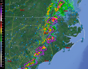
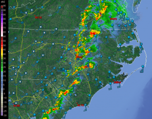
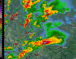
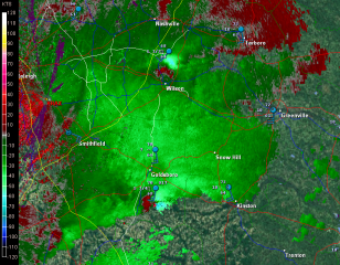
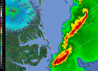
But I digress. Here are a few GR2AE radar grabs of the North Carolina supercells. Storm motions were to the northeast. The rest tells its own story if you know what you’re looking at.

First, here’s are a couple macroscopic views.

Next, I’ve zoomed in on the Raleigh radar to  cross-check reflectivity and storm-relative velocity on a couple supercells.

The final image was taken after the storms had moved out to sea. It shows a couple of northern line-end vortices that I found interesting and thought you might too.

____________________
* All numbers reflect preliminary reports at the time of this post’s publication. Final statistics will likely be different.

Tornado Video Resembles Paul Huffman’s Famous Twin-Funnels Photo from the 1965 Palm Sunday Outbreak

On April 11, 1965, Elkhart Truth photographer Paul Huffman parked his vehicle by the side of US 33 northwest of Goshen, Indiana, and began snapping pictures of a tornado passing within a half-mile of him. One of those images, captured as the twister was in the process of devastating the Midway Trailer Park, became what is probably the most famous tornado photograph ever taken, and the icon of the nation’s second deadliest large-scale tornado outbreak. Paul’s image of twin funnels straddling the highway is instantly recognizable to anyone familiar with the 1965 Palm Sunday Outbreak.

Like countless weather weenies, I’ve been fascinated with Paul’s photo. As a storm chaser, I’m familiar with multiple-vortex tornadoes. Today meteorologists understand that they’re fairly common. Yet multiple vortices take all shapes, sizes, and behaviors, and I’ve always been on the lookout for something that seemed to approximate what was probably happening in Paul’s photograph (really his series of photographs depicting a single funnel undergoing vortex breakdown into the infamous “twins”).

Just a few minutes ago, I came across a new YouTube video that is the closest I’ve ever seen to what the Midway tornado–and very likely the one that hit Dunlap 45 minutes later–may have been like. I don’t normally feature YouTube videos in this blog because I hate discovering that the video I had included in a post a year ago no longer exists. But besides being truly impressive, this clip is just too strikingly reminiscent of Paul’s historic photo to pass by.

The video was shot just yesterday in southeast Oklahoma by storm chasers Marc Austin, Robert McIntyre, and Gabe Garfield. At 1:08 into their clip, you can see two large twin funnels embedded in the parent circulation. It’s a spectacular display, and my hat is off to these guys for catching the storm of the day. Tragically, the tornado killed at least one person and caused significant damage in the towns of Tushka and Atoka.

The system that produced the Tushka/Atoka tornado and a number of others yesterday is moving east today. Mississippi and Alabama lie within a moderate risk, with a good possibility of strong to violent tornadoes. The storms are ongoing this morning as I write, and a whole day lies ahead of them for moisture and instability to build across Dixie Alley. It’s not a pleasant prospect. Let’s hope that the damage will be minimal and no more lives will be lost.

Jazz Sax Friday at The Seasonal Grille

With the advent of storm season, I’ve been so preoccupied with severe weather that I’ve let my jazz saxophone posts slide. But the jazz musician in me is still very much alive, and I’ll be kicking out the jams this Friday evening in downtown Hastings. Did I mention that besides playing the sax, I’ve added vocals to my tool kit? Yes, I can sing! And having finally gathered the courage to do so, I’m finding that people like my voice.

The Seasonal Grille is the venue. I’ve played there once before. It’s a wonderful new restaurant, all ambience, featuring gourmet Italian food impeccably prepared by Justin Straube, the owner and head chef, at prices that are almost ridiculously affordable. Really, it’s one of the best dining deals you’ll find in these parts, and the setting is enhanced by a beautiful bar. I’ll be playing there from 6:00–9:00 p.m. with West Michigan keyboard veteran Bob “Gus” VanStee, so you can pleasure not only your taste buds but your ears as well.

I might add that Bob and I will be fitting into the larger tapestry of the annual Hastings Jazz Festival. It’s a weekend of urban music in an unexpected and very cool small-town setting. I love how this modestly sized community halfway between Grand Rapids and Battle Creek has embraced the American art form known as jazz! Kudos to Justin for supporting the music at his restaurant. It’s a perfect fit. The Seasonal Grille is the kind of place that’s tailor made for live jazz.

So ink this Friday into your planner. Here are the details:

The Seasonal Grille

150 W State St, Hastings, MI 49058

Friday, April 15

6:00–9:00 p.m.

(269) 948-9222

Highway Work during Tornado Watches and Warnings

Last Sunday, April 10, 2011, while chasing storms across central Wisconsin on a moderate risk day, my three teammates and I found ourselves stranded in a traffic bottleneck on eastbound I-90 just west of Oakdale. Ordinarily I would have viewed the situation as merely an inconvenience, but with a tornado-warned supercell bearing down on us, and with the radar showing pronounced rotation making a beeline for our location, the matter elicited somewhat greater concern. We could see what appeared to be the mesocyclone advancing over the hilltops. But we couldn’t do a thing about it, nor could any of the several hundred other vehicles that were backed up for a mile or two in both directions, courtesy of the Wisconsin Department of Transportation.

Fortunately, nothing tragic happened. But it could have. The storm wasn’t merely Doppler-warned–it produced a number of tornadoes. We encountered some of its handiwork later on in Arkdale, consisting of a good quarter-mile-wide swath of shredded trees and badly damaged houses. Had the storm gone tornadic a few miles prior, it would have gobbled up helpless motorists like a giant Pac Man in an M&M plant.

What highway department contractor made the outrageous decision to hold up traffic in a way that put hundreds of people directly in harm’s way with no escape? The storms didn’t form in an information vacuum. Three days prior, the Storm Prediction Center had already outlooked the area as a moderate risk. Forecasters had been consistently harping about the possibility of strong, long-lived tornadoes. The weather was hardly a surprise that caught road repair team leaders unaware. So my inevitable conclusion is that some boneheaded foreman was so hell-bent on getting the job done at all costs that he or she willfully exposed hundreds of drivers to a potentially deadly weather event.

Such action is worse than irresponsible; it borders on criminal. I do not want the highway department making dispassionate decisions that risk my life and a multitude of others on behalf of a DOT schedule. How much time would have been lost rather than saved had the worst happened and the focus shifted from road work to emergency response? With scores of crumpled vehicles strewn along the highway and scattered across the field, how would the Department of Transportation have explained a common-sense-be-damned approach that resulted in multiple deaths and injuries?

The incident I’ve cited is just one of innumerable highway closures that occur all across the Midwest due to road work that continues despite tornado watches and warnings. It’s not the first time I’ve encountered the practice, just the most infuriating, and yes, the scariest because of the immediacy of the storm. I doubt anything I say here is going to change the mindset responsible for such scenarios, but it deserves to be called out for its life-endangering lunacy, and this is as good a place as any to do so. It’s my blog, and right now I feel like using it to rant.

WisDOT, what on earth were you thinking, assuming that you were thinking at all? Get a clue: Public safety trumps your deadlines. Evidently someone in your ranks felt differently last Sunday, choosing to put hundreds of motorists in jeopardy rather than suspend road work on account of a tornado warning. Does that kind of decision accurately reflect your policy? If so, then those of you in charge ought to be flogged at noon in the middle of the town square.

However, a more constructive alternative would be for you to re-examine your guidelines for road work during severe weather, and to make whatever changes are necessary in order to put the public’s interests ahead of your own.

April 10, 2011, Upper Midwest Chase Shaping Up

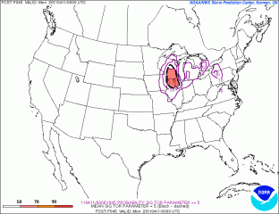
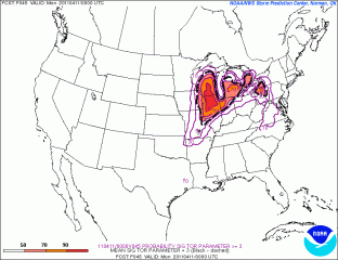
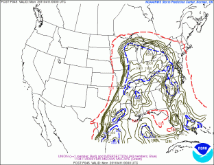
Tomorrow looks to be a big severe weather day in the upper Midwest and Great Lakes. It will also be my first storm chase of 2011, and with departure time less than 24 hours away, I’ve been scrutinizing the forecast maps, mainly the SREF and NAM.

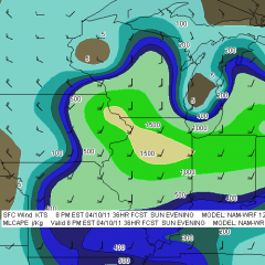
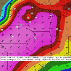
Whew! There are some formidable parameters coming into place for southeast Minnesota, northeast Iowa, much of Wisconsin, and northern Illinois. The SPC has outlooked this area for a moderate risk, with a mentioned of strong, long-lived tornadoes, and it’s not hard to see why. The one thing that bothers me is the marginally veered ambient surface winds overlaid by 500 mb winds from the southwest. Backing shows up way to the north in Wisconsin, in horrible territory for chasing.

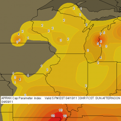
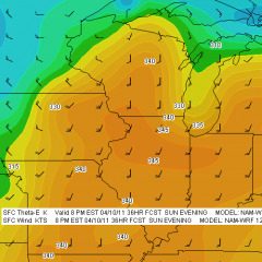
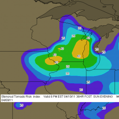
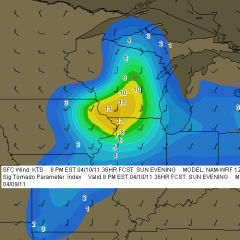
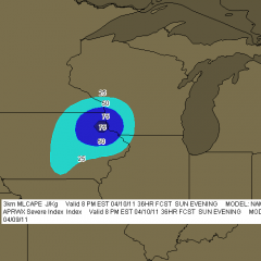
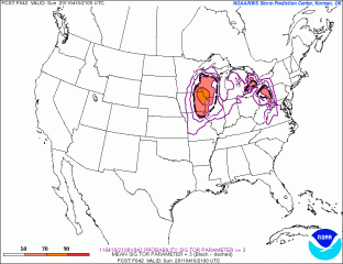
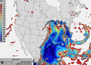
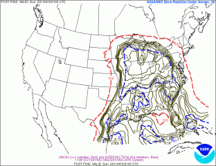
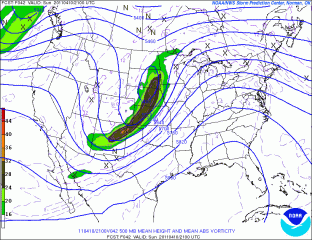
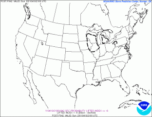
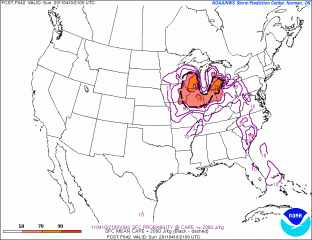
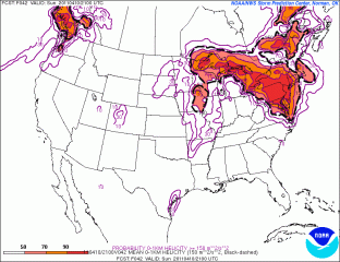
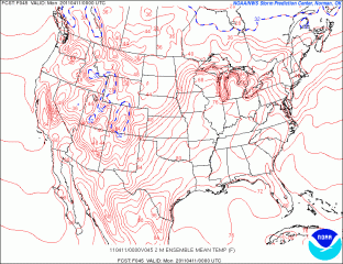
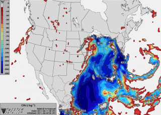
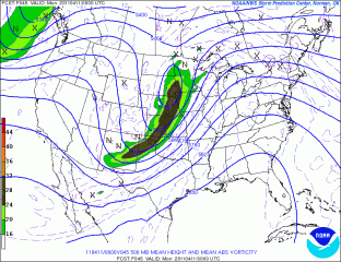
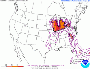
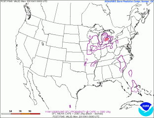
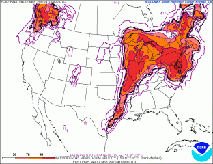
So my present choice for a target is Dubuque, Iowa. According to the NAM, the jet core is aimed in that direction. CINH wants to erode there, MLCAPE looks great, there’s a nearby 3 km MLCAPE max of 75 J/kg (forecast soundings may show better than that–haven’t looked yet), and…well, look down below at the maps I’ve been perusing and judge for yourself. There are a lot of them. In many cases, I’ve shown both 21Z and 00Z so you can see the progression of dynamics.

With height falls and vorticity moving in from the northwest, it may take a bit of will power not to get lured in that direction where the first storms will likely fire in Minnesota and start putting down tornadoes. They’ll be rocketing northeast along the warm front into rough territory, and patience will be the key to remaining in an area where the roads are decent and the prospects of seeing tornadoes instead of trees is better. I think our best play will be from northeast Iowa through northern Illinois. But I’ve got three other team mates with a vote, and I’m not the guy who’s driving. Plus, the best dynamics may have changed by tomorrow. This post just lays out what I’m seeing right now.

And now I give you the maps I’ve been looking at. Click on them to enlarge them. Please forgive the lack of organization. I added the 12Z F5 NAM maps to the gallery after I processed the others,  which makes for a lot of maps. I just don’t want to take the time to get them all in order. The SREF maps are no doubt already dated as I hit the publish button, and I think it’s important for me to keep the data as current as I can. I figure that if you’re savvy enough to make sense of these models, then you’re smart enough to know how to compare them!

Good luck and safe chasing to all of you who head out tomorrow.

Potential Chase Day on Sunday

With an active weather week underway across the CONUS, I’m casting my eyes on Sunday for a possible first excursion chasing storms this year. The GFS and ECMWF both paint a potent system moving through the Plains and Midwest. The GFS is typically the faster of the two solutions, but timing aside, both models agree that things are going pop weatherwise.

Much as I’d like to chase out west Saturday, I can’t, so I’ll leave analyzing the weather for that day to those who can take advantage of it. But Sunday looks poised to deliver the package to my backyard. I have a very large, multi-state backyard when it comes to chasing storm, and right now the prospects for something within a day’s reach seem pretty decent.

I don’t have time right now to include forecast maps, and anyway, we’re still talking six days out, so it’s pointless getting deep into things just yet. But stay tuned. I’ll pin up some maps and soundings as the weekend draws closer. Looks like I got my CTV and iMap live streaming video up and running just in time!

Sunday Thunder in Michigan

For a brief couple of runs Thursday I had vague hopes for an accessible warm front chase on Monday. But that evening’s 00z GFS brought me back to reality, and ensuing runs of the NAM and GFS have painted a blander, cold front scenario for Michigan. As an amateur, decent but still quite formative forecaster rather than a professional meteorologist, I have the freedom to speculate and dream a little on this blog, with the understanding that five days out is fuzzy territory, often more wishcasting than forecasting.

With models coming together three days ahead, I think it’s safe to say that there ain’t nothin’ gonna happen around here on Monday. By then the system will have moved through with zilch to work with in the way of instability, and we’ll start seeing its chillier back end. I’m consigning myself to the compensation prize of a possible bit of thunder around here Sunday night, maybe very early Monday morning, as the cold front moves through. I’ll take that. This early in the season, it’ll be good just to see a little lightning. For that matter, it always is. Storms don’t have to be severe in order to be exciting, beautiful, and worth enjoying.

Looking ahead, more activity could be shaping up for the middle of next week. The Gulf is doing business and the time has come for me to follow the forecast models more closely.

Eyeballing Monday for Severe Weather

Thursday Night

If the GFS is in the ballpark, then Monday by the Michigan border could be a chase day. Things may look better elsewhere in the country, but I have to stay local this coming week and take what I can get. I’m not going to slap up a bunch of weather maps right now because it’s too early to be definitive and too late at night for me to want to get very involved. The NAM will kick in tomorrow, and then things will become more interesting as I compare notes with it, the GFS, and the Euro.

Right now, though, the GFS is calling for a warm front laying down by the Indiana/Michigan border, with a surface low just to the west inducing strongly backed winds in the vicinity of the boundary. A stiff H5 jet core blows directly overhead, with shear to spare. SBCAPE of 1,000 J/kg-plus will be right in the neighborhood. The wild card looks to be whether sufficient moisture and instability will make it close enough to the boundary for helicity to do its thing.

The SPC’s current long-range outlook for Monday puts all of the action well to the south, from central Illinois and Indiana down to Dixie Alley. But I’m thinking that there’s a chance for tornadoes much closer to home. Not that I’m betting on it, but I am most definitely going to be keeping a close eye on the forecast models to see how they trend over the weekend.

Update: Ugh!

As of this Friday morning, the last two runs of the GFS and now the NAM are painting a very different scenario around here from what I’ve described above. Monday’s outlook for this neck of the woods look good for storms, but with the winds unidirectional from the southwest the setup appears to be quite linear. The warm front looks to lift up into Michigan and there’s bound to be some backing of winds along that boundary, but whether they can hook up with surface-based instability is the question, and the cold front will be breathing down their neck, rocketing in and shoveling up the moisture en masse.

I should mention that this is the more hopeful picture per the NAM, which places the triple point in southwest Michigan by 18z. The faster GFS has blasted the cold front through by that time, with the low center well to the north, and the Euro is uncharacteristically even more aggressive. I had read that it and the GFS were in good agreement previously, but I don’t see that reflected here.

That’s as of the 6z GFS and NAM runs. The picture has changed, but chances are it’ll change again. The only thing to do is sit back, watch this pot bubble, and see what comes of it.

Backing Winds: Really Necessary for Tornadoes?

That’s right, fellow storm chasers, you read my headline right. I’m about to raise a few eyebrows by tossing out the possibility that backing winds–or, more precisely, what we normally consider to be backing winds as depicted on forecast maps–aren’t always vital to tornadic storms.* This isn’t speculation as much as it is observation. Over the years I’ve seen a number of tornadic events develop in the midst of southwest surface flow, enough to think that the absence of southeasterly winds on the forecast map isn’t always a deal breaker.

What is indispensable are the conditions that southeasterly boundary layer winds tend to create. I’m thinking of ample deep-layer moisture and sufficient low-level storm-relative helicity. Those are what count. If they are present, it doesn’t much matter which way the wind blows from our perspective. The atmosphere sees things differently and doesn’t care what we think. It just does what it does.

Let me quickly say, I’m a huge fan of southeasterly surface winds. I love to see them on forecast maps. And I’m aware that winds can back locally in ways that the maps don’t portray. What I’m really talking about here is forecasting using the tools we have to work with, which continue to improve. Until last year, for instance, I’d never heard of the HRRR. It’s a marvel. But generally speaking, in contemplating the prospects for a chase day we’re still dealing with pretty broad brush strokes, and the farther we live from Tornado Alley, the better we need to be at determining how those strokes will play out.

A Regional Thing?

In writing about forecasting matters, I still feel very much like a neophyte who may be getting into matters that are over my head. I’m no Jon Davies or Chuck Doswell. I’m not even a meteorology student. But you know the old saying about fools, angels, and where they tread.

My sense of things is that as we move east of the Mississippi, southeasterly surface winds become less important for moisture fetch–and, I might add, southwesterly 850s aren’t such a terrible thing. Why? For one thing, moisture sources in the Gulf of Mexico no longer lie to the southeast, but to the south, and even to the southwest in eastern parts of the CONUS. Also important, the desert southwest isn’t nearly so proximate an influence. Thus, H85 winds that would kill a setup with dry air advection in Oklahoma can carry moisture up into Illinois and Indiana. Moreover, that moisture is apt to follow a curvy path–one that can, for instance, take it first northwest from the Gulf, then north, then northeast up into the Great Lakes.

All that to say that the trajectory of moisture transport can look different in different parts of the country.

As for helicity, does it really matter whether you’ve got southeasterly, or even southerly, surface winds as long as 0-1km SRH is in the neighborhood of 150 or greater? Years of reading convective outlooks leads me to believe that the SPC doesn’t think so.  What I’m saying here is no doubt old hat to them. But it may seem a bit out of the box to at least some storm chasers, particularly those whose thinking has been conditioned by setups in the southern and central Great Plains. The whole concept of storm-relative helicity suggests that the term backing is, well, relative, a matter of how winds relate to a storm as it moves, not to the compass. That’s why right-turners produce. A few days ago in Pennsylvania, overall storm motion was consistent with unidirectional winds from the west; yet a rogue supercell deviated to the right and spun up a tornado near Greensburg.

A Few Examples

Seeing is believing. Here are a few maps that show surface conditions around the time of tornado incidents east of the Mississippi.

july-13-2004-roanoke-ilThe July 12, 2004, Roanoke, Illinois, tornado is an example of a classic northwest flow event. Rated F4, the tornado was large, long-lived, and not the first violent tornado to occur in northwest flow during the warm season in Illinois. Four years earlier, the disastrous 1990 Plainfield F5 was fueled by massive CAPE amid northwest flow.

june-5-2010-elmwood-iljune-5-ilx-pm-soundingThe June 5, 2010, central Illinois outbreak was a sort of quasi northwest flow situation. Mid-level winds were predominantly westerly with just a slight northerly component to them. The surface and 850 winds were unquestionably veered. Besides the surface map, I’ve also included the ILX 00z sounding, which preceded tornadogenesis by roughly an hour.

august-24-2007-pottervillepotterville-500mb-12zFinally, the Potterville, Michigan, tornado practically dropped in my lap, but I ignored what the radar was showing me because I was too dumb to believe my eyes even when the dynamics were plainly visible in the clouds right over my head. This was not a northwest flow event; in fact, as you can see by comparing the surface and 500mb maps, it looked to be unidirectional from the southwest, with directional shear increasing as the trough moved east and mid-level winds became more westerly.

You can find plenty more examples besides these, I’m sure. My point is simply this: Don’t be too quick to write off a synoptic setup because of veered surface winds in the forecast, particularly east of the Mississippi. If moisture is in place and there’s reason to hope for adequate SRH, then it can pay to take a deeper look. Things could pop. They’ve done so before and they’ll do so again.

_______________

* ADDENDUM, March 3, 2013: The term “backing” has a couple of different applications. I used it a bit naively in the title and copy to mean southeasterly surface winds, which is the meaning by which I first came to understand the word. That becomes apparent quickly  in the article, but it bears explaining. If I were writing this  post today, I’d simply say “southeasterly” and erase any uncertainty of what I meant.