A Beautiful Day in Michigan

IT’SSPRINGIT’SSPRINGIT’SSPRING!!!

It’s SPRIIIIIIIINNNNGGGGG!!!!!

Okay, maybe it’s not quite spring officially–still another five days before the vernal equinox–but when I see skunk cabbages blooming in the swamps, then as far as I’m concerned, spring has arrived. Everything else is just a formality.
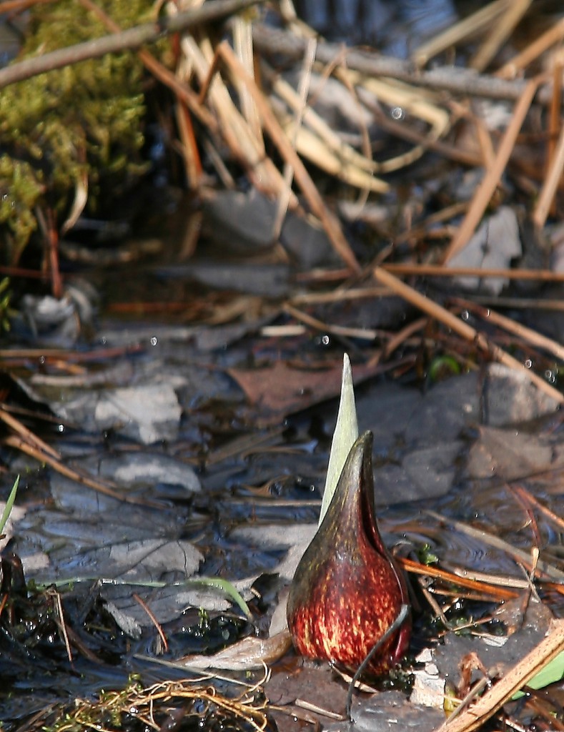
Skunk cabbage, earliest of the Michigan wildflowers

Skunk cabbage, earliest of the Michigan wildflowers.

With its odd-looking purple cowl shielding a flower spathe within, the skunk cabbage is nothing you’d want to put in a pot on the windowsill, but it’s nevertheless one of my favorite wildflowers. It’s a quirky little plant with plenty of character, plucky enough to lead the procession of the spring wildflowers in Michigan.

I came upon the one above while hiking a wetland trail in Yankee Springs the other day. The afternoon was beautiful, a bit chilly but on the leading edge of a warming trend that will put the temperatures into the fifties by today and as high as sixty degrees by Tuesday.

On a broad, blue day filled with the promise of warmer seasons to come, even last year’s vanishing remnants were transfigured by the sun. A bough of old beech leaves hung like Japanese lanterns in a shaft of sunlight.
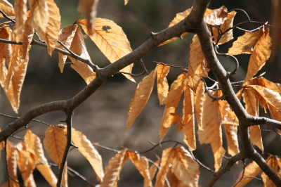
Old beech tree leaves catch the sunlight.

Old beech tree leaves catch the sun.

Of course “the kids”–my collection of carnivorous plants–are out on the deck. I removed them from the refrigerator three weeks ago to boot them out of hibernation, and they have responded with a vigorous rush of flowers and leaves. The Venus flytraps are now open for business, and the Sarracenia oreophila isn’t far behind, with an exuberant array of young traps already ten inches tall and nearing the point when they’ll pop open.

White mold wiped out most of my flytrap seedlings during the winter, but a good hundred or so have survived. It’ll be interesting to see how much they increase in size this growing season.

All that to say…YAHOO!!! It’s SPRIIINNNGGG!!! Maybe not by the calendar, not quite yet, but don’t tell that to the robins because they don’t care, and neither do I. Just take a walk in the woods and you’ll know. Spring is here at last.
First Storm Chase, 2009

What a memorable way to kick off storm season 2009! Yesterday, I chased supercells in Kansas with my buddy, Bill Oosterbaan, and today we attended Tim Vasquez’s severe weather forecasting workshop in Norman, Oklahoma. I’m writing this post from a Best Western Hotel maybe a mile north of where the 1999 Moore tornado crossed I-35. All in all, not a bad past couple of days for a lad from Michigan.

Yesterday’s chase began with a visit to Picher, Oklahoma. The southern portion of this tiny town got wiped out last spring by an EF-4 tornado. Today, a year later, that desolate landscape shows scant chance of recovery. It’s a sobering place to visit.

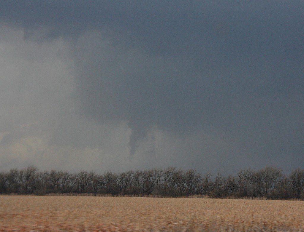
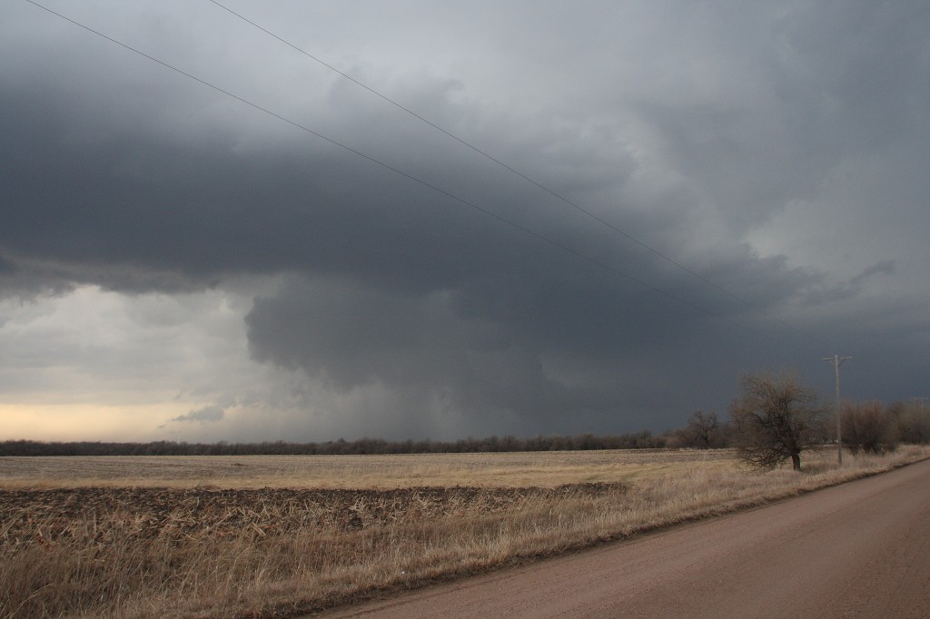
But that’s another story for a different post. Right now, I just want to share a couple images from yesterday’s chase. The moisture was marginal, with dewpoints averaging around 55 degrees up toward the warm front north of Wichita. That’s where we headed, in search of the better helicities. A lot of folks questioned the setup, but it produced. The storm we intercepted put out four tornadoes, though those occurred before we caught up with it. We still saw some nice structure, including a nice wall cloud and a funnel. Check ’em out.

Funnel Cloud

Funnel Cloud

Nice Structure!

Nice Structure!

Severe Weather Forecasting Workshop and Southern Plains Drought

It’s Thursday, and I’m in Louisville, Kentucky, with my buddy Bill. He’s got business here, and I’m taking care of business here on my laptop, and then we head to Norman, Oklahoma, for a severe weather forecasting workshop with Tim Vasquez. At times like this, I’m grateful for the freedom and mobility that come with being a freelance writer. As long as there’s work for me to do, I can do it pretty much anywhere provided I have my laptop and Internet access.

I’ve been hoping to catch a little early-season convective excitement this Saturday. Not sure that’s going to happen, though. The wild card seems to be moisture, but capping may also be a problem. It would be a shame to make the journey to Oklahoma and not see a little decent, Great Plains weather. Of course, that’s not the focus of the trip–the forecasting workshop is–but still, a supercell or two would be nice. Unfortunately, it looks like a cold front will provide the lift that finally busts the cap, and that suggests “linear.”

Sunday is the workshop, so I don’t much care what the weather does that day. I’ll be in class.

Monday may offer another crack at things, and it may be our best opportunity. It’s too far out to say (for that matter, Saturday is still a bit too far off yet to feel either good or bad about it), but assuming that the southern Plains at least get a bit of rain to relieve their dry spell and give the ground a good soaking, moisture may not be the question mark that it is for Saturday’s setup.

Frankly, the current forecast discussion on Stormtrack is the first time I’ve given serious thought to the effect of soil conditions on convection. I had always thought of ground moisture and evapotranspiration as just enhancements to the return flow, not potential deal-breakers. To my mind, a nice, deep low pulling in rich dewpoints from the Gulf of Mexico would more than compensate for dry regional conditions. But more than one seasoned Great Plains storm chaser has looked at the current drought conditions in Texas and Oklahoma and opined skeptically about the chances for 2009 being a good chase year in the West unless the region sees some rain.

Ah, well. The season hasn’t even begun yet, so I’ll take what I can get and hope for better as we move into May and June. Right now, it’s nice to simply see the sun shine, feel fifty-degree temperatures, and know that winter is drawing to a close.

Monte Montgomery Concert Tomorrow Night

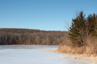
Whew, I have let waaaay too much time elapse since the last time I posted an entry in this blog. Let me mollify you with a nice, bright, sunny image from this cold, early March day. The following photo is one of a number that I took out at Pickerel Lake near Grattan Township in east-central Kent County. It’s a beautiful area, and with spring rapidly rolling in, today was a great day to capture the beauty of the icy landscape while I still can.

Pickerel Lake

Pickerel Lake

Cold as this day has been, there’s no question that warmer weather is moving in. By Thursday, temperatures here in the Grand Rapids area should be in the forties. But I won’t be here. I’ll be with my storm chasing buddy Bill down in Louisville, Kentucky, where he’ll be meeting with some of his clients while I do my own business on my laptop. Then from Louisville, we head out to Norman, Oklahoma, for an all-day severe weather forecasting workshop with Tim Vasquez on Sunday. I’m really looking forward to it!

On the way out there, I hope to catch some early season action. The GFS is calling for a low to be positioned in Colorado or somewhere out there, and with a little luck, we’ll see the right combination of moisture, lift, and kinematics to make life interesting somewhere between Louisville and Norman. Arkansas looks likely. We’ll see.

More immediately, and on the musical side of things, tomorrow night is the Monte Montgomery concert at the Intersection in downtown Grand Rapids. The concert got rescheduled from its original date last September due to illness, and now the time has arrived.

I’ll be playing with the Ed Englerth band as the opening act for Monte.  We rehearsed last night and sounded tight, and today I took my horn to the shop and got a leak tightened down, so all in all, I feel good about playing tomorrow.

If you’re in the neighborhood, come on out to the concert. Ed’s material is strong, and if you’ve never heard Monte, prepare to be stunned. The man is a brilliant guitar player, rated one of the all-time top 50 by Guitar Player magazine. The show starts at 7:00 p.m. Admission is $10 (cheap!),  and worth every penny. See my events calendar for more details.

Storms of 2008 DVD

I just received my new Storms of 2008 DVD in the mail a couple days ago, and I have to say, it’s fabulous! Having been thoroughly smitten with its predecessor, Storms of 2007, featuring its remarkable coverage of the historical Greensburg, Kansas, EF5 tornado, I was skeptical that any subsequent effort could live up to such high standards. But I have to say, this latest in the celebrated “Storms of…” series has more than met the challenge. Simply put, this is a stellar work, and if you’re at all a fan of storm chasing, you need to buy it, period.

And when you make your purchase, know that your $24.95 goes directly to helping disaster victims across the United States. The “Storms of…” series is an organized effort on the part of the storm chasing community to make a tangible difference in the lives of people who have been directly affected by severe weather and other natural disasters.

Judging by the remarkable footage in this DVD–often sublime and at times mind-boggling–you’d never guess that it is a grassroots effort. Yet, as with all the videos in the “Storms of…” series, Storms of 2008 is strictly a product of the storm chasing community. As such, it is a tour de force of the remarkable talent pool within that community. Videographers, meteorologists, seasoned storm chasers, gifted amateurs…all these and others besides have worked hard and long to produce a world-class video and a true labor of love.

The history-making Super Tuesday Tornado Outbreak that scoured Dixie Alley on February 5…the late-May tube-fest that blotted SPC storm reports with red for the better part of a week…the beautiful Dighton wall cloud…the Quinter EF4 duo…the tragic Parkersburg, Iowa, EF5…they’re all here plus a whole lot more, complete with synoptic analyses and topnotch narration.

Am I saying that you have absolutely gotta, gotta, gotta purchase this exceptional DVD? Yup, that’s what I’m saying. Just do it, okay? You can thank me later for being so pushy. Your money will help to make a real difference in people’s lives, and trust me, you’ll love what you get in return. Storms of 2008 is the definitive anthology of last year’s convective Armageddon in the United States. Buy here. Or visit the Storms of 2008 website to obtain more information and view a video trailer.

To the devoted cast of producers, editors, and engineers who faced the challenges and frustrations of making Storms of 2008 happen–BRAVO! And thanks!

Of Sunset Calendars and Skunk Cabbage

February. Ah, February. From the beginning to the end of this month, we gain an hour and twelve minutes of daylight here in Caledonia, Michigan. That’s thirty-seven minutes in the morning and thirty-five minutes in the evening. Sunset on the 28th will be at 6:31p.m. I call that a pretty good deal, and I’m pleased to see warmer temperatures this weekend giving us a taste, however temporary, of longer, pleasanter days to come.

It’s amazing how much the sunrise/sunset times vary from north to south and east to west in a single state. I won’t cite examples, but if you’re curious enough to find out for yourself, here’s a link to the U.S. Naval Observatory chart to help you do so. Time is stated in military format for the time zone of the particular town you choose, whether EST for Shamokin, Pennsylvania, or MT for Denver, Colorado.

Anyway…the days really are getting longer. Believe it or not, the beginning of the spring wildflower parade isn’t all that far away. It starts subtly, though, and humbly, with the lowly skunk cabbage. I love this odd-looking little plant that sends up its mottled, marroon-and-green hoods in the swamps, often amid melting drifts of snow. Smell a broken piece from any part of the plant and the aroma of burnt rubber and raw onions will quickly tell you that the name skunk cabbage is an apt one. But the plant is nonetheless one of my favorites, both because of its quirky nature and because it is a true harbinger of spring.

As is true of most people, there’s far more to the skunk cabbage than meets the eye. In fact, I smell a post coming up for a future WaterlandLiving blog. Can’t wait to see this pioneer of the wildflowers start putting in its appearance, possibly as early as the end of this month and certainly by mid-March. Once I spot the skunk cabbage, I know that spring is underway at last. And I’m ready for spring, aren’t you?

Lake Michigan Ice Formations

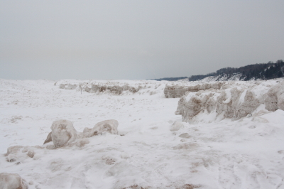
Ice Formations Along the Coastline

Ice Formations Along the Coastline

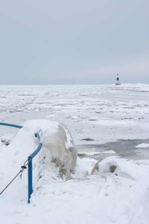
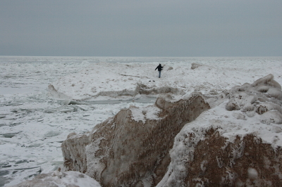
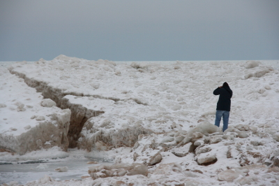
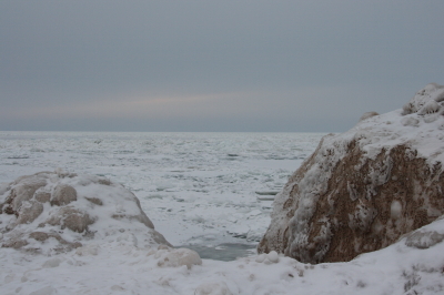
These past few days have been busy ones, but yesterday I took time to head out to Lake Michigan with my friend and fellow storm chaser Kurt Hulst to photograph the ice formations. They’re spectacular. If you’ve never heard of them, let alone seen them, I can assure you that you’re missing something. Ice forms all along the Great Lakes shores, but I have a hunch that the formations along the west coast of Lake Michigan are particularly scenic for the same reason that the sand dunes are: they’re a product of the prevailing winds that blow across the lake, whipping waves and spray across vast stretches to create, layer by layer, fantastic frozen sculptures of  ice, sand, and snow. A more austere landscape you can’t hope to find this side of the Arctic Circle–otherworldly, almost alien in its frigid beauty.

I’m not going to write much about the ice formations here because I want to save my creative juices for my next installment on the WaterlandLiving blog this Friday. But I am going to share a few images to give you a taste of one of the upsides of winter in Michigan. And be sure to check out Kurt’s site, too; he’s a great photographer, and I’m sure he’ll have some very cool (pun totally intended) shots of his own on display.

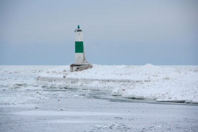
Lighthouse

Lighthouse

Lighthouse, Holland State Park

Lighthouse, Holland State Park

Kurt Out On the Ice

Kurt Out On the Ice

Crack in the Ice

Crack in the Ice

Lake Ice

Lake Ice

Colder Than a Teacher’s Wit

For whatever reason, the above title just got hold of me, and it”s not going to let go until I do something with it. So here it is in print. Now it”s yours to deal with.

I will say that a few of the teachers I had back in my grade school days did have some pretty cold wits. Mrs. Flikkema could freeze you solid at thirty paces with a sarcastic remark. It”s hard to write a 500-word essay when your fingers are numb to the bone.

But I digress from my objective, which is not to write a lot of words, but to share more pictures from yesterday, plus a couple from today.

Qualitatively, the two days have been very similar, which is to say, just a couple notches above the point where molecules cease to move. Temperatures this cold make for very interesting pictures, and very interesting experiences taking pictures. Earlier, while snapping sunset photos out at Sessions Lake in Ionia Counta, I was distracted by a sudden, tinkling sound. My left earlobe had crystallized, broken off, and shattered into tiny pieces on the ground by my feet.

Okay, that didn”t really happen, but it could have happened. Enough on that subject. Here are some photos.

Super-Cooled Outdoor Photography

Today has been brutally cold, but I returned triumphant from my photographic field trip. Something about not merely chilly, but truly marrow-freezing, weather changes the way things look outdoors.

I’ve already written a previous long post here today, and I’ve done plenty of other writing besides, so I’m not in the mood for many words. I just wanted to share with you one of the shots I took today, by way of giving you a sample. I’ll be posting more tomorrow, and you can also see a few images on the WaterlandLiving blog once Dave has got my Friday entry posted.

A Cold Day in Caledonia, or, The Irony of Virtual Storm Chasing in January

Whoo-WEEE, is it cold outside! Nine degrees, the KGRR METAR says, but I think the gents at our local WFO are being optimistic. It”s cold enough to make a snowman ask for a down jacket. Cold enough to crystallize a penguin”s nuts. (Did I just say that?) Cold enough to make a summer home in Antarctica sound good. Cold enough to…okay, okay, I”ll stop. Put down that gun. But we are talking one significantly frosty day here in beautiful Caledonia, Michigan, folks, a real booger-freezer if ever there was one.

Tomorrow the temperature is progged to rocket back up to a balmy ten degrees. That”s an improvement, though not one that inclines me to slip on a T-shirt. Saturday, however, the warming trend kicks in full force, and we”ll all be sweating to a downright tropical nineteen degrees. So you can see that there”s light at the end of the tunnel.

I’m going out with my camera in a bit to capture some shots for Dave VanderVeen”s WaterlandLiving blog. I”m not sure what there is to see in weather like this, or how brave I feel about venturing very far out in it. I do have one, um, cool idea, though, so I guess we’ll see. It may get scuttled by lake effect snow. We”re supposed to get a ton of that. But right now the sun is shining. That”s today for you: sunshine, snow, sunshine, snow, back and forth, sloshing around in an atmosphere that feels like the last Fahrenheit has been sucked right out of it. And now, as I look out the window, I see that the wind is starting to kick in. How much more interesting can things get?

What”s particularly ironic is, I”m currently working through Chase Case #8 on Stormtrack, and while all of the other participants are playing to the south on this particular virtual synoptic setup, I”m sitting right here in Caledonia under a moderate risk, waiting for either a model update or for tornadic thunderstorms to fire. Sixties dewpoints, temps in the seventies, nice backing winds…mmmm-hmmm, right. If there”s a solitary dewpoint out there right now, it”s freezing its little buns off.

But I can dream. In fact, right about now, that”s my only option as a storm chaser.

Just wait till May, though. Just wait till May.