“Giant Steps” E-Book: Taking a Step Back in Order to Step Forward

Here’s an update on my book of “Giant Steps” licks and patterns.

By now I had hoped to have it available for purchase online as an e-book. However, after getting feedback from a couple friends whose wisdom and musical expertise I highly respect, I’ve decided to take a little more time to do the job right.

Initially, the idea of simply scanning my handwritten practice book appealed to me. I liked the homespun, pencil-and-staff-paper feel. Nothing fancy, just solid practice material that will help jazz musicians get a firm handle on Coltrane changes. For that reason, I had titled the book–and still plan to title it–“The Giant Steps Scratch Pad.”

But there are limitations to the approach I’ve described. For one thing, legibility is an issue in some parts of the scanned material. In the process of copying all of my handwritten material, the scanner was also picking up on smudges and erasures, and it was failing to clearly copy some of the lighter print. After taking up pencil and eraser and editing several pages for better effect, and doing a bit of clean-up work with PhotoShop as well, the result is acceptable. Frankly, I kinda like it, and part of me wants to offer it as is. But I can do better.

So I’m going to get the material properly notated using transcription software. Not only will the finished result look much more polished, but I will be able to offer it for the entire suite of C, Bb, Eb, and bass clef instruments. The scanned approach doesn’t offer that flexibility; I had written the patterns for my own instrument, the Eb alto sax, and the book was what it was.

Taking to heart the advice I’ve gotten, then, I’m taking a step back in order to take “Giant Steps” forward. Hopefully the delay won’t be a long one. I’m eager to get the book published. I just want to make sure it’s everything it can be right out of the starting gate.

So keep your eyes peeled for further developments. The hard, creative work is already done. I just need to explore my options, then take the best one and git ‘er done.

–Bob

Back Yard Chase with Possible Wall Cloud

I hadn’t planned to chase storms today, but Kurt Hulst made me an offer too good to turn down, and off we went. For all the hoopla, with a tornado watch covering most of Indiana and Ohio and a 10 percent tornado risk outlined in exactly the same area south of the Michigan border as last week, the storms nevertheless turned out to be pretty garden variety.

In fact, nothing materialized south of us where we expected it to. Instead, Kurt and I got pleasantly surprised when a couple of cells fired up to our west near Plainwell and almost immediately took on supercellular characteristics. A southwest-northeast-oriented outflow boundary was working its way east, and it provided convergence that fired up a slowly growing line of storms in the weakly unstable warm sector.

We locked onto a promising-looking cell in central Michigan whose top, at between 40-45,000 feet, was the highest of the day. Base level SRV showed on-again/off-again weak circulation for this storm, and reflectivity had it

hooking nicely at different times. It was no monster supercell, but it had its moments. I took photos of a nice lowering while parked just south of the intersection of R Drive and 23 Mile Road 12 miles south of Charlotte. I’d call the feature a wall cloud. While I couldn’t verify rotation, the vertical motion and the position of the lowering just south of the rain shaft under the updraft base were pretty suggestive.

What you see was as good as it got. I reported the lowering to KGRR after taking the photos, but the storm began to crap out on us even as I was talking with the meteorologist. We dropped it a few minutes later and headed south to catch a new, developing cell. We’d probably have done better to stick with what we had, as it appeared to strengthen again briefly on radar while the new one went linear right away.

Chases in Michigan more often than not prove to be just entertaining diversions–fun, but it ain’t Kansas, Toto. This one fit that description. It was good to get out with Kurt, and also good to get home without having spent too many miles chasing nothing of any consequence.

Another Lower Great Lakes Storm System

The eastern Great Lakes looks to be once again under the gun for severe weather, with a setup that looks reminiscent of last week’s, albeit with some variations. The low is weaker but there’s juicier moisture, helicities may integrate a little better with instability, and it seems to me that the 500 mb jet is better positioned. Once again, though, surface winds veer rapidly south of the warm front, so while the mechanism for another batch of supercells is in place, the tornado potential is less certain. The SPC convective outlook shows a 5% tornado risk. That seems about right, though maybe part of the area will get upgraded this afternoon.

After looking at the morning NAM and RUC, I once again like the area south of Toledo. Bowling Green was my initial target last week, and I’d pick it again this week if I wanted to drive that far. If I chase storms at all today, I may just wind up dropping south down 131 toward the warm front, depending.

By the way, I haven’t posted a thing about Monday’s tornado fest in Oklahoma and I probably should. I wasn’t there to experience it, but my buddies Kurt Hulst and Bill Oosterbaan teamed up for it, and Ben Holcomb made it down there as well, and everyone scored. Bill tells me that he and Kurt saw seven confirmed tornadoes.

Me, I watched the outbreak unfold on the radar and ate my heart out. It really was a heck of a thing to observe. The SRVs were jaw-dropping, and I saw one low-level Delta velocity of 177 knots. Those storms were the real deal, and a huge contingent of chasers was on them. Among the highlights was the Wakita, OK, multi-vortex that a number of chasers captured on video. The clips I’ve seen show what looks like a basketful of snakes dancing.

Unfortunately, five people died in the storms. If there’s anything positive that can be said about the loss of life, it’s that the paths of the storms through mostly rural areas no doubt kept casualties lower than they could have been. One supercell dropped tornadoes in Oklahoma City, and all it takes is one. But that’s better than multiple population centers getting hit by storms the intensity of Monday’s storms.

Giant Steps E-Book Update

Last week I announced the upcoming release of an e-book filled with licks and patterns designed to help jazz musicians  improvise on the famous John Coltrane tune “Giant Steps.”

As is true of just about any big endeavor that’s worth doing, though, this one is taking a little longer than I’d anticipated. Much of the reason for that is due to touch-up work I needed to do after scanning all my handwritten material. And of course I needed to design a cover. Now I’m seeking a few endorsements, and I still need to set up an online store.

So I thought I’d give you a quick update just to reassure you that this ebook is moving along. If you’re interested in getting hold of a practical, hands-on book you can take with you into the woodshed and emerge better equipped to tackle those gnarly “Giant Steps” changes, then keep watching this blog for further announcements. I won’t keep you waiting very long–promise!

Monday’s Southern Plains Event

Lacking the cash to head west for tomorrow’s setup, the best I’m going to be able to do is gaze forlornly at the radar, gnash my teeth, and hope my buddies Bill, Kurt, and Mike are catching tornadoes and staying safe.

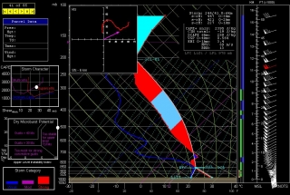
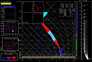
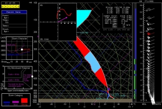
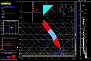
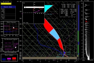
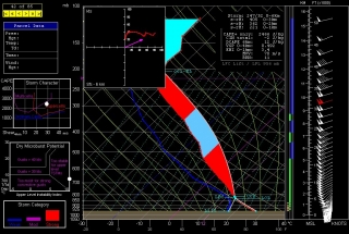
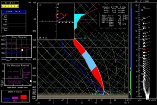
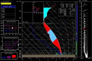
I’d be smart to not even look at the models, but a perverse part of human nature makes it hard for me not to. Out of curiosity, I’ve interrogated a few NAM 6Z forecast soundings from around southeast Kansas and northeast Oklahoma. I suppose the results are nothing new: plenty of moisture and CAPE, great shear and helicity, and a stout cap that lingers till evening, at which point the atmosphere looks primed for discrete, tornadic supercells to explode.

Most of the soundings shown here are for 23Z, but the one for Tulsa, shown above, is for 22Z, since the cap looks to minimize earlier there (21Z, not shown, also looks decent, with -46 J/kg CINH, up from -198 the previous hour). For KCNU (Chanute, KS), I’ve also shown the 00Z so you can compare the difference; and for Hutchinson, which at 525 1km SRH has the highest helicity value of the different soundings, and for Wichita, I’ve shown only the 00Z, since prior to that the cap looks pretty stout. Look below for all the soundings except Tulsa, and make sure you click on the images to enlarge them.

Beyond this, I’m not going to comment. To those who are out there on the Plains waiting for this setup to arrive and ripen, I wish you success and safety.

May 7, 2010, Northwest Ohio Supercells

Yesterday’s outbreak of supercells in the southeastern Great Lakes was no tornado breeder, but it made for an enjoyable chase. I left Caledonia around 10:30 with Bowling Green in mind as a target, noting that the SPC had outlooked a narrow, northern swath of northeast Indiana and northern Ohio with a 10 percent tornado risk.

I wound up rendezvousing with my long-time chase buddy Bill Oosterbaan in Ashton, Indiana, where Mike Kovalchick also joined us. (Note to self: that Baptist church parking lot on the west edge of town has a fantastic hilltop view to the west.) We dropped south to Waterloo, where I parked my car at a convenience store, then hopped in Bill’s vehicle, and we headed east, watching as a cumulus field began forming overhead. The warm front was moving in, and when we left Ashton, the chilly temps were already rising and bringing the dewpoints with them.

Farther to the east, we hooked up with Ben and Mike Holcomb, and CMU meteorology students Aric Cylkowski and Cort Scholten. Our contingent of four vehicles at the Sonic drive-in made up what was probably the first chaser convergence that Bryan, Ohio, has ever experienced, and probably the last.

From there, we dropped south toward the warm front, which had stalled over the area. Temps had been in the lower 70s in Bryan, with east-northeasterly winds and dewpoints around 59 degrees; farther down the road, at our new location in a parking lot next to a cemetery, we gained another degree of dewpoint and the surface winds veered. On the radar, one discrete cell to our southwest began to take on supercellular  characteristics. We decided to intercept it, and the chase was on.

But another cell formed southwest of our storm, and in its tail-end position, it rapidly evolved into the main player of the day. So we left the storm we were on and headed toward the new one, which was hooking nicely. A couple miles south of the town of Paulding, we encountered one of the most flat-out beautiful hailstorms I’ve ever seen. It moved toward us in shifting, pearly strands across the fields. I tinkered frantically with the settings on my camera in order to get a fast enough shutter speed for snapping pics from our moving vehicle–there was no shoulder to the road, and no stopping–but by the time I finally had what I needed and Bill had found a turn-off, the amazing nuances and texture of the hail shaft had blended into a homogeneous sheet (click image to enlarge). I took a couple quick photos which nowhere near capture the essence of what we had seen just a minute or two prior; then, with maybe thirty seconds to spare from getting cored, we beat a hasty retreat.

Out in the field just to our southwest, we could see a crapload of dust being kicked up by the rear flank downdraft. We pulled aside and let it pass 100 feet or so in front of us. In the photo, notice how the dust fills the ditch to the right. I’ve read some discussions about the wisdom of the longstanding advice to abandon one’s car during a tornado and seek shelter in a ditch. Maybe that’s a best option in a worst-case scenario, but judging from the photo, it looks to me like the wind is doing a pretty good job of invading the ditch. Depending on the depth of a given ditch, tornado-force winds could conceivably just scoop a person up and launch them into the main air stream.

But I digress. The hail and RFD were the highlights of the day. From then on, it truly was a storm chase, and a futile one. With the storm rocketing to the east-northeast at 70 mph, we had a choice of barreling eastward and losing the storm to the north, or northward and watching it vanish to the east. We pursued it longer than we should have, but we had a fun time of it. The roads in that part of Ohio are great, the countryside is flat and open, and overall, the territory is fabulous for chasing. But when storms are moving at such breakneck speeds, the best road grids in the country–and these probably qualify–can’t compensate.

I managed to get a few shots of a cool, bell-shaped wall cloud as the storm moved away from us. Eventually, though, we called the chase off and started on our way back. West of Paulding, we encountered significant wind damage–large trees snapped off at their bases and pieces of outbuildings scattered across the fields at a couple farms. Could have been weak tornado damage, but it was likelier the work of straight-line winds.

I should probably mention the rope funnel that hung down from a small storm as we headed back toward Waterloo. Okay, it wasn’t really a funnel, just evidence of what wishful thinking can do with a snaky-looking cloud.

Back in Waterloo, I picked up my car, hit I-69 north, and headed home.

I noticed that Illinois-based storm chaser Adam Lucio was also on these storms, and appreciated his Facebook comment that you don’t need tornadoes in order to have an enjoyable chase. I wholeheartedly agree. Yesterday was a great chase, particularly for the Great Lakes, and that hail shaft near Paulding alone made my day.

Of course, everyone has been rumbling about the big event shaping up for Monday in the Plains. Wish I could go, but it’s not in the budget. Best wishes to everyone who heads out. Stay safe, get good photos and video, and have fun.

A Glance at Friday: Severe Weather in the Great Lakes

It now seems a sure bet that the eastern Great Lakes is due for a spate of severe weather. The SPC is presently making it out to be a linear event, as is typical of cold fronts sweeping through our region, but the wind profiles suggest the possibility of supercells and tornadoes.

If you go by the present, 12Z NAM run, central Ohio appears to be the sweet spot, with a variety of parameters converging over or near a bullseye of 2,000 j/kg SBCAPE. Here are a few maps for forecast hour 21Z to give you an idea. Click on the images to enlarge them. The first shows the aforementioned SBCAPE (shaded), sea level pressure (contours), and surface wind barbs. Not a bad bit of instability if this scenario pans out.

In the second image, you can see a nice overlay of 55-60 kt 500 mb winds (shaded) over 35-40 kt 850 mb winds (contours). The wind barbs are for the 850 mb level. The H5 winds veer still further to the west. I think it’s safe to say that shear won’t be an issue, and 1 km VGP, not shown, is as high as 0.4 in the area of heightened instability. Helicity maxes are well to the north, but I wonder what kind of effective SRH we’ll wind up with where it counts.

The third map shows a Theta-e lobe pushing up into northern Ohio with a surface lifted index between -4 and -6 perched squarely over the axis. That should get the job done.

In the last map, three different significant tornado parameters–the well-known STP, the APRWX tornado index, and the Stensrud tornado risk–all converge nicely over the same spot near Newark, Ohio. Three overlays can be a bit difficult to decipher, so let me help: the STP is shaded, the APRWX is tightly contoured like an onion, and the Stensrud has broader

contours, with its highest value circling the APRWX in a yellow ring.

All this to say, Friday may have some potential. I don’t get too excited about cold front events around here–not that we have many options in the Great Lakes, but a steady diet of squall lines has a way of lowering a person’s expectations. Of course, as soon as you let down your guard, along comes the exception to prove that storms in our area can and do deliver. Maybe this round will prove to one of those occasions. We’ll find out two days hence.

Giant Steps E-Book Soon to Be Released

If you want to bone up on the theory behind John Goltrane’s landmark tune “Giant Steps,” you’ll find plenty of information online as well as in print. But when it comes to actually cultivating the chops it takes to play “Giant Steps,” you may have a tougher time finding material.  Could be that I’m uninformed, but I just haven’t seen much in the way of practice resources for Coltrane changes.

So I’ve decided to share my personal material. Years ago, I went through a period when I steeped myself in “Giant Steps,” and during that time, I started writing down licks and patterns for  “Giant Steps” in a music notebook.  Today, after supplementing the stuff I had already written with some new material, including licks using the augmented scale, I completed the front matter and introduction.

All that remains to be done now is to register the copyright and set up an online store on Stormhorn.com. The e-book’s title is  “The Giant Steps Scratch Pad.” It will be the first product I’ve created and sold on this site, and I feel excited about offering it to you.

If you want to view a sample page (and cop some free licks), click here. Otherwise, stay tuned. I expect to have “The Giant Steps Scratch Pad” available for purchase soon, and will announce its publication upon release.

Shakin’ the Shack: A Dave Koz Alto Sax Solo Transcription, Part 1

Saxophonist Dave Koz is, pardon my French, a bitch. Man, can that guy play the alto sax! I just got a reminder of how good he is after listening to a YouTube cut of his tune “Shakin’ the Shack” from off of his “Lucky Man” CD.

I bought the CD years ago and was so enamored with Koz’s electrifying, hard-bop approach to smooth jazz that I transcribed a couple of his solos. I thought I had lost those transcriptions long ago, but guess what surfaced the other day while I was sifting through some old music charts I had written? That’s right: my transcription of Dave Koz playing his solo on “Shakin’ the Shack.”

Well…at least part of the solo. Evidently I never completed the transcription, which is really a shame, because this first section is just the preamble. Dave is a fabulous musical storyteller, and his solo really starts cooking in the section that follows, building momentum and tremendous excitement in ashakin-the-shack_dave-koz-solo joyous musical romp that makes me want to laugh and shout and dance and do other things most unbecoming of a 54-year-old white, Germanic male.

I regret that I can’t offer you the full transcription of Dave’s solo, but such as I have, I share with you now. Click on the thumbnail to enlarge it.

If you’ve never heard “Shakin’ the Shack,” I strongly encourage you to give it a listen so you can hear how the solo actually sounds in its musical context. For that matter, do yourself a biiiiiig favor and buy the entire “Lucky Man” CD. It’s beautifully produced and bubbling over with  joie de vivre–traveling music of the first order, perfect for putting a smile on your face when you’re out on the open road.

Sax ‘n Wedge: A Life Goal

This last week I was so preoccupied with chasing storms that I hardly blogged at all. When I did, naturally it was about weather. Jazz, music, and the saxophone have languished in the background, at least blogically speaking.

Not, however, in practice. When I headed out west for some dryline action, my horn went with me. It always does. My chase partners know that when I head for any chase over a day in duration, the sax is as much a part of my travel gear as my suitcase, laptop, and camera. Some folks toss a baseball or football while waiting for storm initiation; I practice my saxophone. Any time is a good time to get in a few licks.

I have several reasons for bringing my horn along on chases, all of them having to do with eventualities. The most likely scenario is, as I’ve just said, that I’ll get a chance to woodshed my instrument. Far less likely–but still, ya never know–is the possibility of winding up in some restaurant where a band is playing, and it’s the kind of band that makes me wish I could sit in for a tune or two. Like I said, unlikely; most Great Plains towns aren’t exactly jazz hotbeds. Still, as I learned back in the Boy Scouts, it pays to be prepared.

My main reason for taking my saxophone with me on storm chases, though, is because of a particular life goal of mine: I want to get a good photo, or maybe some video, or even both, of me jamming on my sax while a monster wedge churns away in the distance. For that matter, I’ll settle for just a nice, photogenic tornado of any shape or size. I just want some kind of visual record that captures the raison d’etre of Stormhorn and the essence of who I am as a storm chaser and jazz saxophonist.

Assuming that a storm is moving slowly enough to make a photo shoot practical, my preparations once towers start muscling up are:

* Rain-X windows

* Remove camera from case and make sure it’s ready for action

* Get tripod out of trunk

* Assemble saxophone

Just a handy checklist. Reasonable enough, wouldn’t you say?

So cross your fingers for me, or better still, pray. This season could be the one where I fulfill an ambition and get some very cool photos to show for it.

I’m a maniac, you say? Of course I am. A maniac is just someone with a different kind of dream.