Storm Chasing: The Anthology: An Interview with Blake Naftel

Blake2Amid my collection of storm chasing videos is an old VHS titled A Spotter’s Guide to Michigan Convective Weather. Produced in 2000 by Blake Naftel in collaboration with the National Weather Service in Grand Rapids, the award-winning video is a vintage reflection of Blake’s dual passions for storm chasing and videography—a combination shared by countless chasers, but which in Blake’s case, having developed in a unique way at an opportune time, has forged a path that brings him today to the verge of a remarkable undertaking. But let me set the stage. . . .

Long past are the days when storm chasing was the little-known, eclectic pursuit of a handful of pioneering weather photographers and researchers crisscrossing the Great Plains. Today, hundreds of chasers routinely pound the roads of Tornado Alley, and more are entering the fray all the time, influenced by what they’ve seen on TV but lacking any awareness of where it came from.

Yet storm chasing has roots—deep roots, a legacy of personalities, events, and endeavors that deserves to be cherished but is in danger of being lost. The time to preserve that rich heritage is now, when most of those who have created it are still with us. Now is the time to honor the colorful history of storm chasing and connect it to today’s talented generation of younger chasers and weather scientists and the future which is theirs to shape.

That is the vision that drives Blake Naftel to produce Storm Chasing: The Anthology. It is unquestionably the most ambitious cultural and historical project ever to focus on storm chasing. Given the grassroots character of chasing, it is fitting that an effort of such a landmark nature should arise not out of some big commercial production house, but from one of our own. Someone who has storm chasing in his blood and cares about it deeply enough to portray it with honesty; better yet, to let those who have contributed to it do the portraying on their own terms.

There will be no scripting, no manufactured storyline. There will just be stories, told by those who have lived them, beginning with the very origins of storm chasing. There will be storms, of course—unadorned, historical storms as well as contemporary ones; storms you may have chased yourself as well as ones from decades past that you’ve only heard of and wished you could have experienced. There will be insights into the rise and development of tornado research. And there will be much more.

That is, provided Blake can pull off a venture of such magnitude. Those of us who know him think he can. He’s immensely talented as both a chaser and a cameraman with years of experience in TV journalism, he has a penchant for the truth, and he’s motivated by sheer love for his subject. The project is huge in scope and fraught with challenges. But Blake is embracing those challenges, and the result promises to be unlike anything else that has ever been attempted.

And with that, I’ll let Blake tell the rest of the story.

—————

Question: Let’s start with a bit of personal history, the stuff that has forged your path toward this project. What first got you started both as a storm chaser and as a professional cameraman?
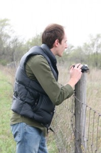
Blake NaftelBlake: My interest in severe weather, meteorology, and storm chasing developed early, just before I turned five. I recall being exposed to The Wizard of Oz­­—specifically the tornado sequence—and more importantly, to the NOVA-WGBH documentary “Tornado,” which was first broadcast in November 1985. I was determined to record the program, but my family lacked a VHS VCR at that time. Fortunately, my uncle in Detroit had one, and just after Thanksgiving 1985, I had a copy of the broadcast. The following year, my parents purchased a VCR, and the tape was played extensively—to the point of memorization. The tape found its way to  friends’ homes, where instead of children’s cartoons, the sixty-minute program on tornadoes, storm chasing, and the Barneveld, Wisconsin, tragedy was required viewing.

Picking up on my interest in severe weather, my mom began telling me stories of the tornado she witnessed only a few years prior in Kalamazoo, Michigan, on May 13, 1980. Descriptions of the “twin tails” rotating around one another from her viewpoint at the Civic building in downtown Kalamazoo captivated me. The iconic Kalamazoo Gazette front-page newspaper photograph furthered my fascination, and soon I was checking out every book on tornadoes that I could locate at the Kalamazoo Public Library.

Later in the spring of 1986, my mom visited my godmother in Kansas City, Missouri, where, at the time, the National Severe Storms Forecast Center was located. She returned with numerous informative brochures and spotter’s guide material, which I instantly became hooked on. Additionally that year, Mom designed a flip book with illustrations of the progression of the events from May 13, 1980­—sunshine, clouds, greenish-grey skies, lightning, the tornado’s approach, its wrath—concluding with calm, blue, sunny skies. It depicted the day just as it had transpired. I still have this little book, entitled Tornado! (“For Blake, from Mom.”)

Zooming ahead about a decade, I began developing a great interest in cameras—specifically in motion picture cinematography, videography, and 35 mm photography. This was early in the Internet age, and multiple interests of mine were spanning territories that included affordable access to used camera equipment, fee-based and free weather data, and newsgroup networking with seasoned storm chasers and meteorologists across the United States and Canada (WX-TALK, WX-CHASE).

Upon receiving my driver’s license, I began to actually chase storms in 1996­‒97. My chasing at the time was all local, learn-as-you-go, with my knowledge of storm structure and my chase style informed by various storm chase highlight videos which I swapped with Bill Reid, Jim Leonard, Tim Marshall, Warren Faidley, Scott Woelm, Bruce D. Lee, Roger Edwards, and Rich Thompson, among others.

At this point, I also began experimenting with HTML design, early online video, and the development of a regional group of storm spotters and chasers who would gather video of severe weather events in Michigan for the purpose of SKYWARN spotter training. Eventually, after making contact with the National Weather Service in Grand Rapids, I created a statewide training video for storm spotters, developed though my early attempt at social networking and video sourcing. The now long-defunct website known as MSIT (Michigan Storm Intercept Team) was one of several web pages I created back then.

During the same period, I began an online business buying and selling used motion picture and video camera gear. By doing so, I acquired several different types of cameras, learned about them by trial and error, and frequently focused their lenses on the weather, nature, and people around me. This approach mixed in with a “vintage” look I was going for at the time, and it eventually became a style I utilize to this day.

Then in 1998, the event occurred that would lead me to a future career in photojournalism and TV. On June 11, I was storm chasing across north-central Indiana in Elkhart and Kosciusko counties. It was a very basic chase with paper maps, weather radio, black-and-white television tuned to local media for radar updates, and a general target area based on the parameters. It did not seem like a prime tornado day, although when I recall the dynamics of the system today, it now is very obvious. Long story short: I ended up successfully intercepting and documenting several brief tornadoes which struck south and northeast of Nappanee, Indiana, on SR 19. The chase had at least one nerve-wracking moment when my vehicle’s transmission temporarily gave out in the path of the oncoming tornado, which was less than a mile-and-a-half away. Fortunately the transmission kicked back into gear, allowing me a northern escape.

Once in a safe position, with SVHS camcorder tripoded, I filmed the wall cloud and its attendant weak tornadoes as they continued dipping down to the northeast. The following morning, I saw the amateur video of another tornado near Bristol, Indiana—which occurred prior to what I witnessed—showcased on the morning news on WSBT 22 and WNDU 16. Prompted by my growing interest in broadcast meteorology, TV news, and videography, I called WNDU and spoke to Mike Hoffman, the chief meteorologist, about my own video. He took great interest and asked if they could buy the video for their 11 p.m. newscast on June 12.

After another round of severe weather across the same region that day, I ended up meeting the station’s chief photographer in White Pigeon, Michigan. I gave him my original tape, and later that evening, my video of the Nappanee tornadic event appeared on WNDU’s newscast.

From that point, I began freelancing for local media and soon became  involved with the production side of local television. This eventually grew into my various incarnations as a photojournalist, reporter, weather producer, and technician in the years that followed.

Q: What were those early years like for you? With whom did you chase? How have your experiences and personal interests influenced your videographic approach, which goes beyond chronicling the storms to also documenting the human and historical sides of storm chasing?

B: My early years of storm chasing were very local, restricted to traveling through the western portions of lower Michigan, with occasional trips to northern and central Indiana. Typically, those early trips were either with high school friends or solo, utilizing my 1989 Ford Taurus wagon or a dilapidated 1978 Chevy van my friend Aaron Graham would occasionally drive. Fuel cost was still low, just 79 cents in 1997, so traveling at length to witness severe thunderstorms was not of great significance. Even back then, I was using multiple documentation formats, frequently hauling motion picture film, video, and still photography equipment together into the field just to chronicle everyday Michigan severe thunderstorms. For the more vivid events, I preferred to shoot silent Super 8 color movie film, whereas VHS/SVHS video was a near-constant format that seemed to be always rolling.

I was intrigued by tornadoes on film—namely, the early NOAA-produced films—versus video. The quality, grain, and occasional scratches and dust flecks produced by the projector created a look I was determined to capture. And I did, experimenting with different cameras, formats, and photographic styles. I didn’t confine myself to severe weather or storm chasing only; family events, pets, and the natural surroundings across my hometown area in Texas Township, Michigan, also provided a dynamic environment full of interesting subjects and colors. My subject range continued to expand as I became involved with broadcast photojournalism and developing my own shooting style. Again, it was all by trial and error.

My first chasing exposure to the Plains states was in 1999 and more expansively in 2000. Prior to this point, I had only lived vicariously through the videos of other chasers with whom I had networked through the Internet. Bill Reid, from the Los Angeles region, was one individual who had direct influence not only on my chase documentation style but also on my musical tastes at the time. Over the years, we swapped storm chase highlight videotapes and conversed online, and this eventually led to a distant friendship, which in turn opened the doors to my working for Tempest Tours, with Bill serving as tour director.

In 2001 I was invited to drive and help forecast for Storm Chasing Adventure Tours, run by Todd Thorn. By then I was twenty years old and attending college, and the appeal of having all my lodging and fuel costs paid for seemed too good to pass up. That experience involved a huge tour: three vans full of individuals from across the world as well as three media vehicles from The Weather Network, the Denver Post, and WKOW-TV in Madison, Wisconsin. It was an eye-opener for someone who had primarily chased solo or within small groups, and only locally, never throughout the Plains states. I don’t regret the experience whatsoever, but I chose not to drive for a second tour scheduled directly after the first. Tours can be exhausting, especially those with so many participants!

That year was also the first operational year of Tempest Tours, a company formed by documentary filmmaker Martin Lisius, who was good friends with Bill Reid. I had been in contact with Martin in previous years, ordering his Chasing the Wind, Chasers of Tornado Alley, and StormWatch productions. Out of the blue, Bill contacted me, inquiring about my interest in being a paid driver/guide for Tempest Tours the following year. I was both humbled and floored! I accepted the offer, and in May 2002, I began a five-year stint with Tempest. During that time, I developed many new friendships that would never have been possible without the flexibility that working for a storm chase tour company provided.

Concurrently, I was also working on my geography/GIS degree at Western Michigan University, and I found myself drawn intensely to the mecca of academic severe weather research and meteorology in Norman. The tours, based out of Oklahoma City, provided a wonderful gateway to interacting with other meteorologists and storm chasers who shared similar interests.

Due to the requirements of the broadcast news industry I was now working in, 2008 was my last year working in the storm chase tour circuit. The peak chase month of May is a “sweeps” period in newscasting, and vacation is rarely allowed. So the tours had to take a back seat. But the entire experience was fantastic, one that created friendships which continue to this day and left me with amazing images of visual water vapor, along with an enjoyment, courtesy of Bill Reid, of the musical artists Stan Ridgway and Klaus Nomi. It had been a remarkable, full, and deeply formative passage in my life—and I had it all documented extensively on videotape.

Q: On to your project. Describe Storm Chasing: The Anthology. What is it? How did you think of it? How is it different from other storm chasing videos and documentaries such as Discovery Channel’s Storm Chasers series, and what do you hope it will accomplish? Why is it important—and why now?

B: Storm Chasing: The Anthology developed out of an earlier, untitled project from the 2003‒2004 era which I had shelved. The first concept was a 60-minute documentary on the human element of storm chasing. At that point, I had accumulated hundreds of hours of my own storm chasing endeavors—as well as the people I had been chasing with at the time. Impromptu interviews from the field were gathered, but it was all very “reality TV” to me, and that was a style I was losing interest in.

Jump ahead ten years. Much had changed in the world of storm chasing. Several reality TV shows had transpired, including Storm Chasers, Tornado Road, and smaller spin-offs. I still had all of my original material sitting around in boxes, but had lost interest in doing the earlier concept. Then came the tragedy of May 31, 2013, in El Reno, Oklahoma, which affected the entire storm chasing community and touched me in a very personal way. That event served as the initial trigger for me to revisit my old project and envision a different and expanded approach to it, and it has given me the drive to complete it.

The idea is to present a complete (or as complete as possible) visual history of storm chasing culture. This grows out of the humanity aspect of the original concept, but instead of using a narrator, it will be told through the words, stories, and images of every storm chaser and meteorologist who participates, revealing the full, fascinating decade-by-decade evolution of storm chasing.

To date, the many documentaries and programs about storm chasing have focused on specific events, people, or scientific endeavors, with the 1978 documentary In Search of Tornadoes being the first widely broadcast feature on the subject. In contrast, Storm Chasing: The Anthology is comprehensive. It will serve as a sweeping visual history lesson and an archive of storm chasing culture. Through this project, I plan to preserve the legacy of past generations of the activity, connect that heritage to what chasing is today, and make the results available as an educational resource for present and aspiring meteorologists and severe weather enthusiasts.

In time, I hope to have this project serve as a visual thesis towards the development of a digital, cloud-based, multimedia archive of severe weather. This would be university-based and available as a research and reference resource. That is far down the line, but it was another trigger to doing this project. As individual meteorologists and storm chasers pass on, their collections of imagery and work run the risk of vanishing; the archive would answer that concern. Obviously, you cannot preserve everything, nor is that my intention. One can, however, preserve vast amounts of a subject, and I feel that now is the time to make a push toward that end.

Q: Who is Storm Chasing: The Anthology for? Primarily storm chasers? Or do you hope to reach a broader audience? How will this anthology benefit viewers?

B: This production is being created for anyone with an interest in history, severe weather research, meteorology, and the activity of storm chasing. Granted, the core audience is those who are, or have been, directly involved in storm chasing. The benefit to viewers will be a broad education on all aspects of storm chasing as an activity.

Initially, a condensed premiere version will be released, followed by a six-part anthology. The latter obviously may take far more work than I had initially thought, and at the moment, this is a completely independent effort—so I ask everyone to please bear with me. In terms of a broader audience, upon completion, I wish to make the anthology available to libraries and academic institutions. In time, I would love to present this program on a broadcast/web streaming platform—specifically, PBS. The film festival circuit will also be a part of the exposure to other individuals who would not normally have a direct interest in this subject. As for making the anthology available for individual purchase, that’s in the plans, but I’ll first need to take care of the necessary copyright and licensing requirements.

Q: This is obviously a huge undertaking, spanning roughly sixty years of storm chasing history. Given your talents, experience, and relationships with storm chasers from veterans to talented younger chasers, you seem uniquely qualified to make it happen. What have you already done, what do you still need to do, and how long do you think it will take?

B: So much has been accomplished already! A tremendous amount of video, film, and other material has been gathered over the past decade. But much remains to be done. The core of the project involves my completing fifty-plus interviews of individual storm chasers and meteorologists across thirty-one states and Ontario, Canada. The Kickstarter campaign is intended to defray my travel expenses. With that campaign now in its final week, concluding on July 25, I am still seeking additional funds to offset the combined 7 to 10 percent fee that Amazon and Kickstarter will take from the funding pool.

My next task is acquiring a vehicle for travel. I share a vehicle presently and will likely be renting one for the trip. I’m currently approaching local car dealerships and national rental vehicle agencies about sponsoring a car. One of these options will be secured in the next month.

I am also still deciding what format to shoot the interviews on. Presently I have the offer of older, loaned (fee-free) gear from friends, and that will likely be the route I take.

Once the interviews are complete, editing will be the monumental task on my mind, along with production design. I am confident that a condensed premiere version would be ready by the summer of 2015. And I earnestly hope to have the six-part anthology completed by October or November 2015 and available either as BluRay/DVD or as a digital download. There is the whole aspect of meeting the deadlines promised to backers of this project—so 2015 will be a very busy year for post-production!

I’m always eager for assistance and will likely be inquiring with local or regional production firms and/or academic institutions in order to complete the project in a timely manner.

Another big reality is securing an income—or multiple-income sources—locally or regionally while working on the post production phase of this project. Working independently, I’m taking a great risk, and I find that both exciting and unnerving. I’m leaving my full-time job at WWMT on August 22 to set out for the month or so it will take me to complete the interviews, and I have nothing official lined up upon my return. While I have requested an unpaid extended leave from the station, it is only a possible consideration. Moreover, the focus required for the editing phase of this project is immense, so if I could secure local part-time or freelance employment within the Grand Rapids area, that would work quite well. Although I cannot say what the future holds, doors continue to open in new directions for me each step of the way with this project, and I have faith that everything will work out.

Upon my return, hours upon hours of video will be ingested and logged. Not only so, but countless hours of B-roll video material dating back to David Hoadley’s earliest storm chasing movies will also need to be digitally archived. All the multimedia material I’ll be dealing with comprises well over 1,000 hours! Frankly, thinking about how to bring all of that together boggles my mind at the moment. This is all a real-time process, and that is one reason why I am choosing to release this as a six-part anthology.

I may need to seek out a production team to assist in the design and distribution of this project somewhere down the line. So let me reemphasize that while Storm Chasing: The Anthology is currently an independent effort, I am open to assistance from the outside, including collaboration with other filmmakers and producers.

Q: Who are some of your supporters? Do you have a projected release date?

B: The supporters of this project are far too numerous to list here. I am extremely thankful to everyone who has pitched in to help make this project move from a vision to a reality. The projected release of the premiere version is in the early fall of 2015. I hope to feature it in the Oklahoma City/Norman, Oklahoma region, potentially coordinating with the AMS or NWA conferences between September and October. No premiere location is official yet; that too remains on my vast to-do list.

As for the six-part anthology disc/digital download version, as I mentioned earlier, I plan to make it available by November 2015, barring any snags along the way.

Q: What are your needs? How can people help?

B: Full project details and proposed budget can be located via: https://stormchasinghistory.net. The ongoing Kickstarter campaign runs until July 25 at 11:10 a.m. ET.* While the $7,000 funding goal was met in twelve days, additional backing will only make this project better! Please continue spreading the word about this project through social media. And if you love a mix of history, storm chasing, and storytelling, then consider adding your financial support to create this anthology series. Any amount, large or small, makes a difference and is greatly appreciated.

Q: Anything else you’d like to say, Blake?

B: Thank you to everyone who has supported the development of Storm Chasing: The Anthology! This production would not be a reality without the collaboration, belief, and interest of others! I am eagerly looking forward to getting on the road with this project, and I will be providing field updates of my travels, once they commence, via Facebook, Twitter, and the stormchasinghistory.net homepage.

——————————-

* Blake’s Kickstarter campaign concluded at the time stated and was highly successful. He raised $10,200, well beyond his goal. Considering that the project will involve far more than travel expenses, those who contributed can consider their generosity well-placed.
February 20: The “Everything” Storm System

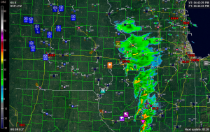
February 20 2014 Davenport I find this screenshot of the Davenport, Iowa, radar fascinating for its variety. Captured at roughly quarter to five in the afternoon eastern time, it shows just about every conceivable kind of Midwestern weather in operation simultaneously. Tornadoes and funnel clouds. Squall line with embedded supercells. High winds. Hail. Flooding. Snow. Fog. Have I missed anything? If weather systems were baked goods, this one would be an Everything Bagel.*

As I write, the squall line stretches from eastern Indiana all the way down to south central Louisiana and out into the Gulf of Mexico, and it is progressing eastward, continuing to generate high winds, tornado warnings, and flash floods. All in all, quite an active day for this waning February, particularly considering how far north convective weather has occurred. In the face of this winter’s record-breaking snow and cold, today has been a potent harbinger of what this spring, when it finally arrives, may hold. Even here in Caledonia, we got a few rumbles of thunder, though nothing like what folks a few hundred miles south of us have experienced.

The irony of it is, after this, it’s back to winter again. Serious, snowy, cold winter, with no sign of a letup anytime soon. Eventually, of course, the arctic air will retreat, but not without a fight. Today was just a promissory note, a down-payment, on things to come. I’m in no hurry to collect. In fact, I’d just as soon get dumped on–seriously dumped on–just to see how much more snow we can squeeze out of this winter before a warmer pattern sets in. We’ve already experienced unreal; let’s shoot for insane. We’ve come this far, so what the heck, let’s do this thing right.

But then–let’s have spring. I’m lightning-starved and thunder-hungry.

—————————–

* That is one of the worst analogies I’ve ever come up with, but I don’t care. Well, I care enough to write this footnote, but that’s all.

Enter March: No Repeat of 2012

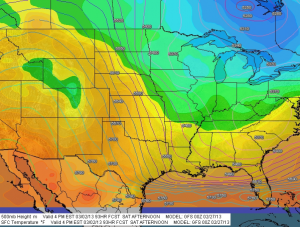
March 2 2013 GFSMarch 2013 won’t be making anything like last year’s brutal grand entry. For residents of the Ohio valley, that is a good thing. On March 2 a year ago, unseasonably springlike conditions fostered an outbreak of tornadoes, including the violent Henryville, Indiana, tornado that my friend Bill Oosterbaan and I intercepted north of Palmyra.

This March’s arrival portends nothing like that. One look at the map (click to enlarge) will show you that conditions are quite different from last year. The model is today’s (February 27, 2013) 00Z run showing the 500 mb heights and surface temperatures for March 2 at 21Z. With a ridge dominating the western half of the CONUS and cold Canadian air sitting atop the Great Lakes, the picture doesn’t even remotely resemble the 2012 scenario that sent storm chasers scrambling for their gear. A few days prior to the event–that is, right about now–we were casting anxious eyes on the embryonic system with the sense that northern Dixie Alley was in for it.

I’m frankly glad that a cooler, more quiescent opener is in store for the 2013 meteorological spring. I will be pleased to get more snow, and I hope the Midwest and Great Plains get a few more good, solid dumpings before storm season arrives in earnest. Storm chasing aside, the more moisture, the better for regions that have languished under severe drought. As inconvenient as the recent blizzard was for west Texas, I’ll bet the folks in Amarillo were mighty glad to get that much snow. I hope they get more, or just water in abundance in whatever form it takes.

This March may be entering on the cold side, at least here in Michigan, but that’s okay. It is March, the month of transition. I’m equipped with a “new” used car, a 2002 Toyota Camry that is drum tight and ready to take me wherever I need to go in order to see tornadoes. It won’t be long now. See y’all under the meso!

Saying Good-Bye to July

Looks like I almost let July slip by without making a single post.

Almost.

I just haven’t felt inspired to write in this blog lately. Weatherwise, what’s to say?

Right–the drought. Frankly, I haven’t felt like writing about the drought. We all know how horrible it has been: day after day and week after week of relentless, rainless heat. No doubt that’s newsworthy, but I’ll let the news media tackle it. From my perspective, it discomforts me, it annoys me, it inconveniences me, and certainly it concerns me, as it should anyone living in the continental United States. To say it has been disastrous is putting it accurately. But while I suppose this drought is severe weather in its own way, it doesn’t interest me the way that a thunderstorm does. Mostly, it’s something I wish would go away, a sentiment shared by millions of Americans roasting in the Midwestern heat.

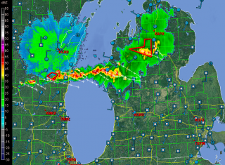
Fortunately, it won’t be here forever, and lately the pattern around the Great Lakes has seemed to be nudging slowly but progressively toward a stormier one. As I write, the radar screen for Michigan looks like this (click on image to enlarge it).

I like that: a cold front dropping out of the northwest bringing a nice line of storms and a good dousing of much-needed rain.

Shifting gears to music, there’s not much to say on that topic either. Of course I’ve been staying on top of my instrument, but that’s par for the course. My woodshedding on “Giant Steps” and “Confirmation” continues, along with “Ornithology,” and I’m getting to where I’m starting to shred the bejeebers out of those tunes. But, mmm, yeah, okay, so what. Where do I go from here?

The studio, I think. It’s about time I finally recorded my efforts, put something down for ears besides mine to listen to. Otherwise, why am I bothering with all this practicing of tunes that no one is ever going to call for on a gig? Folks want “Satin Doll,” not Coltrane changes. Still, somewhere out there I think there are people who will take an interest. So I need to get with my buddy Ed Englerth in his Blueside Down Studios and make some noise.

‘Scuze me if I sound a bit cranky. At 56 years of age, I’m rapidly approaching full curmudgeonhood and I am getting in practice for it. The lack of heavy convection and lack of gigs combined is assisting the effort. But a shift in either aspect of that equation will restore my humor and give me something to write about.

No, that’s not right–there’s always something to write about. What I need is something I feel like writing about. Maybe later tonight will do the trick, when that storm line which is presently 50 miles to my north moves in. Hmmm … the cell that is just making landfall near Pentwater is packing straighline winds of nearly 70 knots. That’ll create some interest for folks south of town.

Now to close up shop and see what kind of action we get around here a few hours hence. If it’s nothing more than a good dumping of rain, I’ll be more than happy. But I’m betting it’ll come with a spark and a growl.

April 13-14 Oklahoma-Kansas Chase

This post is long overdue, but there has been no helping the time lapse between my first Great Plains chase of the year on April 13-14 and tonight, when I’m finally setting the highlights of those days briefly in print. The reason is that, upon my return home, I immediately succumbed to the worst case of acute bronchitis I’ve ever experienced. It was characterized by constant, deep, wrenching, non-productive coughing; a chronic sore throat; a fever that topped 102 degrees; an ear infection; laryngitis; plugged-up sinuses; and if I’ve missed anything else, let me just sum it all up by saying that I was in neither the condition nor the mood to do any film editing or writing, or much of anything except to attach my face to a vaporizer and to suck down Jell-O, chicken soup, sports drinks, ginger tea, and enough fluids overall to qualify me as a human aquarium.

Today, though, I am definitely on the mend, and it’s high time I got this report written. Tomorrow looks to be another big day in eastern Kansas, so I need to write before anything I have to say about an event from two weeks ago gets swallowed up in the latest round of wedges.

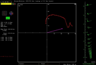
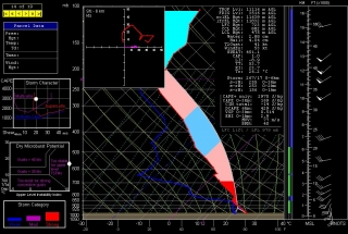
And it does look there could be some wedges. Look at this NAM skew-T and hodograph for Chanute, Kansas, at 00Z. (Thanks, Ben Holcomb, for tipping me off to Chanute!) With 1km and 3km SRH at 290 and 461 m2/s2 respectively and a nice, fat low-level CAPE, that’s the broth for some violent

tornadoes. I expect that part of the area that the SPC has categorized as a light risk for tomorrow will be upgraded.

But I’m chasing rabbits. Getting back to the topic of this post: With conditions coming together for two or three days of severe weather in tornado alley from April 13-15, Bill Oosterbaan and I headed for Oklahoma in company with two new chaser friends. Rob Forry is a fellow chaser from the other side of Michigan who had yet to experience a Great Plains chase; and Steve Barclift is an editor friend of mine who, I discovered, shares my keen interest in severe weather and had been wanting to get a feel for storm chasing.

We arrived in Norman, Oklahoma, late in the morning on Friday the 13th. Dropping off our travel bags at the apartment of Ben Holcomb, who was graciously putting us up for the night later on, we promptly headed out for the chase.

We encountered our first storm of the day not far from Chickasha. Not being the superstitious type, I have no qualms about chasing storms on Friday the 13th; still, this storm gave us a shake when it led us back to Norman and spun a tornado within a mile of Ben’s apartment. We pulled out of chase mode long enough to make sure that Ben’s place was okay. Then we headed southwest a second time, this time plunging beyond Chickasha toward Boone and Meers, and thence into the heart of the Wichita Mountains. There, we positioned ourselves on the southeast flank of a tornadic supercell as it advanced slowly over the ragged landscape.

We may have witnessed a tornado at this point, but my video provides no conclusive evidence, just strong suggestions. Tornado or not, though, to stand in the inflow of that massive, beautifully crafted supercell and watch it spew lightning from its charcoal interior as it dragged across those prehistoric peaks was reward enough. No more need be said, nor shall be, since Friday was simply a scenic prelude to the action up in Kansas the following day.

Saturday, April 14, dawned on a large high-risk region that ranged from most of central and eastern Nebraska south through central Kansas and down into much of central Oklahoma. With impressive upper- and mid-level jets overlaying the region, bulk shear was beyond adequate, as was instability. The ingredients were all there. Today, it seemed, would be one of those days when anyone who chased–and there were lots of chasers prowling the prairies on this day–would see a tornado.

In practice, though, it wasn’t quite that easy. Our plan was to drift up I-35 and then head west toward a likely looking storm. Not a very sophisticated approach, but it seemed likely to work, and in fact it did. We weren’t far across the Kansas border when we decided to turn west, and in a while we encountered our first supercell of the day, and with it, our first tornado. The cone spun at a good distance, probably five miles or more away. Looking at my video clip, I’m satisfied that it was indeed a tornado–even at that distance, the outline is distinct and separate from the storm’s rain shaft.

We stuck with our storm as it sailed north-northeastward, but it seemed to be having a hard time establishing itself beyond its first tornadic salvo. Still we stayed with it, hoping it would organize into a rumbling monster. But it continued to attenuate into a skinny, sorry-looking mongrel, so we finally dropped it for a more promising-looking storm to its south.

I remember saying at the time, “Dropping this storm [which I was in favor of doing] could be a really good decision. Then again, the storm could reorganize in half an hour and start putting down hoses.” Of course, the latter is what happened. Half an hour or forty-five minutes later, the storm we had put behind us had morphed into a supercell that, from the looks of it on radar, clearly wasn’t fooling around, and it went on to produce a string of tornadoes.

But by then we were committed to the storm to its south, a deceptively imposing-looking beast that washed out on us as we tangled with it and ultimately disappeared completely from the radar screen. Long before that happened, we wisely abandoned it for the next storm down the line, and as the saying goes, the third time was a charm. Just drawing closer to the storm environment, we could tell that this storm was of a different caliber. There was more lightning. The inflow was strong. The thing just felt tornadic. And it was.

From here on, I’ll let my video clip tell the story. It chronicles our chase from near Pretty Prairie, where we encountered our first tornado with this storm at close range with rain bands wrapping toward us, on north-northeastward toward Lost Springs and Delavan. The latter, night-time portion of the video is best viewed in dim light.

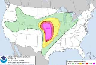
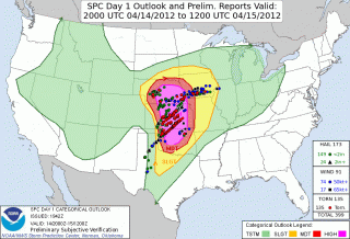
On a side note, the SPC did a great job of forecasting this widespread outbreak, as you can see from this verification of the outlooked areas with confirmed tornadoes. One thing that puzzles me is why they showed a 45 percent hatched area for Nebraska, when from what I recall, the NAM and RUC didn’t appear at all bullish for a northern play. At the time, I figured that those SPC guys must have known something that the models weren’t revealing, but in fact the majority of tornadoes occurred southward in Kansas. If anyone from the SPC happens to read this, I’d welcome your comments on the thinking behind the enhanced focus on Nebraska over regions southward.

We overnighted east of Kansas City, and the following day found us chasing a warm-front scenario in south central Minnesota. The setup this day was utterly unlike the previous day. In fact, with the surface low nearly collocated with a closed 500 mb low to our west, we were dealing with what seemed like a quasi-cold-core setup. The storms, low-topped supercells, formed in convective “streets” that moved nearly straight northward, each street progressively kicking off new convection to its east where outflow presumably converged with strong southeasterly surface winds. Tornado reports occurred to the north, along or just past the warm front, where winds backed strongly.

The setup was an interesting one particularly in that tornadoes were reported on the cold side of the front, which cooled markedly within a matter of a few miles. This seemed counterintuitive: what kind of surface instability was available in such an environment? I recalled my chase with Kurt Hulst and Dave Diehl back in February, 2006, when we watched a storm on the far eastern side of a cold core drop a tornado several miles to our south. Where we stood, the air was so cold that I could see my breath; yet across the distant treeline, an unmistakable tornado was spinning and doing damage in a small town east of Kansas City.

As for this present date, while the four of us didn’t see a tornado on April 15, we did see the most wildly circulating wall cloud I’ve ever laid eyes on. The motion in the thing was unreal, something I attribute to the storm’s crossing the warm front and encountering a radical backing of winds.

Inevitably, we found ourselves in Minneapolis, at which point we left chase mode and headed for home. The first few coughs that would rapidly blossom into the debilitating bronchitis I mentioned at the start of this post were just getting hold of me. The following day would mark the beginning of a miserable two weeks. I’m just glad the virus held off till I got home.

Now I’m almost recovered–not in enough time for what looks to be a lively day in Kansas tomorrow, but certainly for the next round after.

For another perspective and some absolutely stunning videos of the Kansas outbreak of April 14, visit my friend Kurt Hulst’s blogsite, Midwest Chasers.

How It Feels to Not Be Chasing

Right now my buddies are out west chasing this latest storm system. I’m not with them because I can’t afford it. Money has been extremely tight and what I take in has got to go toward paying the bills and putting food on the table for Lisa and me. That’s the reality of life. I’ve been on a couple of unproductive chases so far this year, and now that a decent system is finally in play out west, I’ve got to pass it up. I can’t even chase what promises to be a fabulous day today in Illinois. Once again I’ll be picking over the scraps later on here in Michigan. It’ll be nice to get some lightning, but it just isn’t the same.

Armchair chasers are typically regarded as off on the sidelines of storm chasing. But there’s a difference when you’ve been in the game and find yourself benched. You know what you’re missing. You’ve been looking forward to it all year with intense eagerness, like a kid looks forward to Christmas. So when you can’t do a thing about it unless it lands right in your lap–which in Michigan, land of cold fronts and veered surface winds, doesn’t happen often–it is extremely frustrating. SDS is one thing, but this is something else.

Armchair chasing? Nuts. I get to where I don’t even want to go near a radar. But I do anyway. I can’t seem to help myself. I want to see what’s happening with my friends, what storms they’re on. I look at the forecast models, too, hoping against hope that they’ll stop sticking their stupid tongues out at me and smile at me for once.

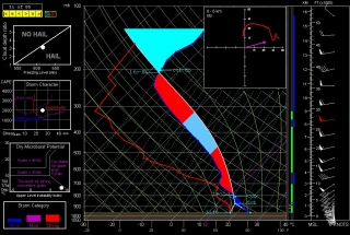
Today the RUC actually seems to do so. Here’s the 10Z KGRR sounding for 23Z this evening. Not bad. I just wish I believed that those surface winds and helicities were accurate, but I don’t, not with other models (NAM, GFS, and SREF) shouting them down. Besides, the HRRR composite reflectivity hates me. I can’t stand looking at it. Again, though, as with the radar, I do anyway. Storms progged to fire in northern Illinois and even south along the Michigan border…all I’d have to do is hop in my car, head west along I-80 and maybe down toward Peoria, or even just 80 miles south down US 131 toward the state line as a compensation prize, and I’d be in the sweet zone. But it ain’t gonna happen.

Rant, rant, rant. On this date last year I was on the most unforgettable chase of my life in northern South Dakota. Today, I wish this present system would just get on with it and get it over with so I can forget about weather, forget about the fact that I call myself a storm chaser when I’m not chasing storms. What a laugh. True, I’ll be chasing this evening locally for the first time for WOOD TV8. That I can at least afford, and it’s a nice way to work with the storms that we do get and possibly provide a bit of public service. But I don’t have high expectations. That’s a good thing here in populous West Michigan, but it doesn’t satisfy a convective jones. I just hope this season doesn’t drift into the summer pattern before I can get out and see at least one good tornadic supercell.

Okay, enough of this self-indulgent, babyish whining. I just had to get it out of my system, because in all seriousness, missing out on the action bothers me a lot, an awful lot, more than I can describe. It’s an absolutely miserable feeling. But it’s how things are, and life goes on.

Good luck out there in the Plains, Bill, Tom, and Mike–and Ben and Nick, though I know you guys are chasing separately. I hope you bag some great tornadoes today and over the next few days. As for me, it’s time to shower up, head to church, and remind myself that there’s more to life than this.

First Great Plains Chase of 2011 This Wednesday

At last, the setup I’ve been waiting for–one that warrants dipping into my tight finances in order to make the 1,000-mile drive to the Southern Plains. To date, this present system has been a miserable disconnect between upper-level support and instability, with a nasty cap clamping down on the whole shebang. Last night it managed to cough up a solitary tornado in South Dakota. That was it. I’m not sure what today holds, but I haven’t seen anything to excite me about it or tomorrow.

But Wednesday…ah, now we’re talking! The SPC places a large section of the Great Plains under a slight risk, and their discussions have been fairly bullish about the potential for a wide-scale event. At first I couldn’t see why. My mistake–I was looking at the NAM, which with straight southerly H5 winds has not provided the best PR for Wednesday’s setup. But once I glommed the GFS, I got a whole ‘nother picture, one which the SREF and Euro corroborated.

That was last night. I haven’t looked at today’s SREF, and the new ECMWF gives me a slight pause as its now somewhat negative tilt has slightly backed the mid-levels from the previous run. But only slightly. The H5 winds still have a nice southwesterly flow, and taking the three models together, everything you could ask for is lining up beautifully for tornadoes in the plains.

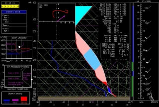
The event promises to be widespread, with a robust dryline stretching from a triple point in southwest Kansas south through Oklahoma and Texas. Positioned near a dryline bulge, Enid, Oklahoma has drawn my attention for the last couple of GFS runs. Check out this model sounding for 00Z and tell me what’s not to like about it. Everything is there, including a voluptuous hodograph and 1 km SRH in excess of 300 m^2/s^2.

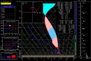
Other places in the region also look good, though. Farther south in Texas, Wichita Falls shows potential. Helicity isn’t as persuasive as Enid, but the CAPE tops 3,000 J/kg and there’s less

convective inhibition. Here’s the sounding for you to compare with Enid.

I haven’t been as drawn to Kansas so far, but with the triple point perched there, storms are bound to fire up just fine in the Sunflower State. The details will work themselves out between now and Wednesday evening. Significantly, the tyrannical cap of the previous few days no longer appears to be an issue.

The bottom line is–it’s time to head West! This evening I’m taking off for the plains with my long-time chase buddy Bill. At last! Time to sample what the dryline has to offer, and–now that I’m equipped with a great HD camcorder–finally get some quality footage of a tornado or two.

There’s no place like the Great Plains! YeeeeHAW!!!!!

Highway Work during Tornado Watches and Warnings

Last Sunday, April 10, 2011, while chasing storms across central Wisconsin on a moderate risk day, my three teammates and I found ourselves stranded in a traffic bottleneck on eastbound I-90 just west of Oakdale. Ordinarily I would have viewed the situation as merely an inconvenience, but with a tornado-warned supercell bearing down on us, and with the radar showing pronounced rotation making a beeline for our location, the matter elicited somewhat greater concern. We could see what appeared to be the mesocyclone advancing over the hilltops. But we couldn’t do a thing about it, nor could any of the several hundred other vehicles that were backed up for a mile or two in both directions, courtesy of the Wisconsin Department of Transportation.

Fortunately, nothing tragic happened. But it could have. The storm wasn’t merely Doppler-warned–it produced a number of tornadoes. We encountered some of its handiwork later on in Arkdale, consisting of a good quarter-mile-wide swath of shredded trees and badly damaged houses. Had the storm gone tornadic a few miles prior, it would have gobbled up helpless motorists like a giant Pac Man in an M&M plant.

What highway department contractor made the outrageous decision to hold up traffic in a way that put hundreds of people directly in harm’s way with no escape? The storms didn’t form in an information vacuum. Three days prior, the Storm Prediction Center had already outlooked the area as a moderate risk. Forecasters had been consistently harping about the possibility of strong, long-lived tornadoes. The weather was hardly a surprise that caught road repair team leaders unaware. So my inevitable conclusion is that some boneheaded foreman was so hell-bent on getting the job done at all costs that he or she willfully exposed hundreds of drivers to a potentially deadly weather event.

Such action is worse than irresponsible; it borders on criminal. I do not want the highway department making dispassionate decisions that risk my life and a multitude of others on behalf of a DOT schedule. How much time would have been lost rather than saved had the worst happened and the focus shifted from road work to emergency response? With scores of crumpled vehicles strewn along the highway and scattered across the field, how would the Department of Transportation have explained a common-sense-be-damned approach that resulted in multiple deaths and injuries?

The incident I’ve cited is just one of innumerable highway closures that occur all across the Midwest due to road work that continues despite tornado watches and warnings. It’s not the first time I’ve encountered the practice, just the most infuriating, and yes, the scariest because of the immediacy of the storm. I doubt anything I say here is going to change the mindset responsible for such scenarios, but it deserves to be called out for its life-endangering lunacy, and this is as good a place as any to do so. It’s my blog, and right now I feel like using it to rant.

WisDOT, what on earth were you thinking, assuming that you were thinking at all? Get a clue: Public safety trumps your deadlines. Evidently someone in your ranks felt differently last Sunday, choosing to put hundreds of motorists in jeopardy rather than suspend road work on account of a tornado warning. Does that kind of decision accurately reflect your policy? If so, then those of you in charge ought to be flogged at noon in the middle of the town square.

However, a more constructive alternative would be for you to re-examine your guidelines for road work during severe weather, and to make whatever changes are necessary in order to put the public’s interests ahead of your own.

Eyeballing Monday for Severe Weather

Thursday Night

If the GFS is in the ballpark, then Monday by the Michigan border could be a chase day. Things may look better elsewhere in the country, but I have to stay local this coming week and take what I can get. I’m not going to slap up a bunch of weather maps right now because it’s too early to be definitive and too late at night for me to want to get very involved. The NAM will kick in tomorrow, and then things will become more interesting as I compare notes with it, the GFS, and the Euro.

Right now, though, the GFS is calling for a warm front laying down by the Indiana/Michigan border, with a surface low just to the west inducing strongly backed winds in the vicinity of the boundary. A stiff H5 jet core blows directly overhead, with shear to spare. SBCAPE of 1,000 J/kg-plus will be right in the neighborhood. The wild card looks to be whether sufficient moisture and instability will make it close enough to the boundary for helicity to do its thing.

The SPC’s current long-range outlook for Monday puts all of the action well to the south, from central Illinois and Indiana down to Dixie Alley. But I’m thinking that there’s a chance for tornadoes much closer to home. Not that I’m betting on it, but I am most definitely going to be keeping a close eye on the forecast models to see how they trend over the weekend.

Update: Ugh!

As of this Friday morning, the last two runs of the GFS and now the NAM are painting a very different scenario around here from what I’ve described above. Monday’s outlook for this neck of the woods look good for storms, but with the winds unidirectional from the southwest the setup appears to be quite linear. The warm front looks to lift up into Michigan and there’s bound to be some backing of winds along that boundary, but whether they can hook up with surface-based instability is the question, and the cold front will be breathing down their neck, rocketing in and shoveling up the moisture en masse.

I should mention that this is the more hopeful picture per the NAM, which places the triple point in southwest Michigan by 18z. The faster GFS has blasted the cold front through by that time, with the low center well to the north, and the Euro is uncharacteristically even more aggressive. I had read that it and the GFS were in good agreement previously, but I don’t see that reflected here.

That’s as of the 6z GFS and NAM runs. The picture has changed, but chances are it’ll change again. The only thing to do is sit back, watch this pot bubble, and see what comes of it.

Guest Post: Roger Edwards Looks at the High Cost of Indiscriminate Budget Slashing in Public Safety

Roger Edwards is a great guy–a Dallas Cowboy fan, family man, writer, photographer, and down-to-earth Renaissance man. He’s also a name anyone involved in storm chasing is either quite familiar with or else ought to be. When the man talks about severe weather, his words pack the clout of not only a veteran chaser, but also one of today’s foremost authorities on his subject.

With his wife, Elke, Roger maintains an engaging online presence in their blogs Stormeyes and Weather or Not, as well as in the scholarly Electronic Journal of Severe Storms Meteorology. Besides being a prominent weather scientist and forecasting expert, Roger is also a deep thinker and a superb writer whose passion for the world around him colors his words. I’m delighted and honored to feature him as my guest. Given free rein to expound on whatever topic was hot upon him, Roger took a direction I didn’t expect. His message is a timely one that speaks not only to all those of us who, like Roger, “feast on the smorgasbord of atmospheric violence,” but also to everyone–and “everyone” here means everyone–who is impacted by services of our government that are essential to public safety and health.

There, Roger–how’s that for an introduction? Now I’ll shut up and let you take the microphone.

Protection of Life and Property: The Necessary Government Role

By Roger Edwards

I am writing not as a government employee tasked with protection of life and property through severe storm forecasts. Nor am I writing as a member of an employees’ union that is publicizing the most draconian possibilities, as whispered to them by an inner sanctum of upper management (who, unlike the union, can’t legally lobby).

Instead, I type on my own behalf as a taxpayer and private citizen who just happens to be intimately familiar on a personal level with the front-line impacts of some asinine and infantile political posturing that’s happening right now in Washington, DC.

Disagreement on how to finish paying for the rest of this fiscal year threatens either a shutdown of “non-essentials” or a budget that slices the daylights out of many that are both essential and not. “Essential” means law enforcement, military, utilities, storm forecasting, air-traffic control, prisons, border patrol, and other such activities that directly affect public safety and that aren’t necessarily 9-to-5 day jobs. Essential employees are not paid during a shutdown, but are required to report to work as “emergency” personnel. I am included in that, as part of a 24/7/365 storm-forecasting group.

The most extreme budget scenarios for the rest of fiscal 2011 (through October) could result in rolling closure of both warning offices and national forecasting centers, along with unpaid furloughs lasting weeks at a time. That would be insane, headed into both peak tornado and hurricane seasons. What a crappy, backhanded “reward” for the dedication and effort that severe weather and hurricane forecasters devote every day and night…all day, all night. (Don’t worry, I never would resort to faking illness like those lying liars in Wisconsin…I actually am honest, and care too much about my duty!)

Politicians of both parties, in their zeal (and however noble the principles) are ignorantly unaware of the truth that not all government is equally useful, and that the most valuable and necessary government functions are those that protect life and property…period! In any democratic (lower-case “d”) system, all else is secondary to public safety as a responsibility of a government.

Here’s the ugly reality: Those life-saving functions that mean the most are typically small and focused, scattered and buried throughout numerous much bigger agencies full of bloat. In the tangled mess of government bureaucracy, the needed is interwoven with the unneeded, the important with the optional, the efficient with the wasteful–sometimes very tightly! You can argue that it’s partly by design, in order to use the lifesaving functions as human shields against elimination of the wasteful rubbish. I’ll fully grant that it could be a valid argument and a tactic used by some politicians to protect sacred pork.

But it’s still reality. To remove the unnecessary areas in shrinking big government is a good thing, done very selectively. But most elected officials don’t understand this and try to engage in shortsighted slashing that throws babies out with bathwater.

Meanwhile, as in the current standoff over a looming “shutdown,” those government employees engaged in protection of life and property are used as pawns for show. It’s a dirty, rotten, slimy game of political brinkmanship brought about by the shortsighted spending practices of Congresses and administrations of both parties, past and present.

Such childish foolishness, purely for the sake of posturing, cuts the meat and bone under the fat. It’s happened before, it’s nothing new, and it’s ridiculous. The strategy: Threaten to cut the visible, necessary stuff–like storm forecasting, air-traffic control, meat inspection, border security, law enforcement, anti-terror and such–to cover for fiscal irresponsibility on the unnecessary rubbish. It is a time-honed ploy, definitely bad for the country, and speaks to the immaturity and ignorance of politicians in general.

Does fiscal austerity need to happen? Absolutely! Liberals as a whole, and fiscally liberal Republicans, cannot bury their heads in the sand anymore and ignore the national debt. Think of the less-than-worst scenarios that may result as short-term pain for long-term gain.

Public debt is out of control. That’s an overwhelming national consensus. We all need to make sacrifices to cover for past and current fiscal irresponsibility by politicians of all parties. I support smart, targeted cutting of government, starting with the fat.

Notice that I have not complained about the salary freeze, which includes my own. It’s only fair that all government employees sacrifice some. If I now can’t buy a new violin for my daughter in orchestra because the family budget needs to be tightened, because it’s better for the country…it’s unfortunate, but that’s life. Others are far worse off!

Answer this, however: Do politicians have a history of smart, targeted streamlining of swollen government? Do politicians have a track record of taking intelligent, careful time and consideration, or do they instead resort to short-fused, publicity-grabbing, slash-and-burn, one-size-fits-all grandstanding?

To answer that, watch the news and read the stories today, where Democrats blame Republicans, Republicans are blaming Democrats and each other, and back-and-forth grandstanding commands the press. Then think back to past government “shutdowns” such as that at the end of 1995 and early 1996, or 1990 (each of which happened since I’ve been involved). Republicans or Democrats in the Presidency, Republicans or Democrats in Congress, none are blameless in the sort of showboating and lack of foresight that allows the federal budget sickness to get this far.

I’m here to tell you that life-saving functions must not be chopped. That includes storm forecasting.

Consider both sides of this coin.

Five cents. This gleaming little Jefferson is about how much NOAA (which includes the National Weather Service) costs each of us taxpayers each day. Some of that involves all the people and machines that enable forecasts of both dangerous and calm weather. Some of NOAA admittedly involves top-heavy layers of management and bureaucracy above the front-line workers. Much of those are glad-handing, paper-pushing, suit-and-tie roles that I see as not absolutely necessary, and that could and should be trimmed. Yet when those very bureaucrats are ordered to make recommendations for cuts, do you think they will be targeting their own jobs? If you do, I’ve got land about a hundred miles south of New Orleans to sell you.

Life-saving nickels are being swept off the pavement right in front of an out-of-control dump truck overflowing with borrowed zillion-dollar bills, representing entitlements and other giant-scale spending that needs to be braked first. Politicians generally don’t have the courage to do that, nor the understanding to thoughtfully focus merit-based cuts elsewhere. The chopping devolves into a blind, mindless, one-size-fits-all exercise; hence, we must take the bad with the good, the inefficient with the necessary, hoping someone with patience and courage eventually conducts a long, careful, well-informed, and elaborate trim inside each bureaucracy with a very fine and efficient surgical knife.

Ask yourself something more: Are national and local severe storm outlooks, tornado watches and warnings, hurricane watches and warnings, winter storm watches and warnings, and every other daily forecast, worth five cents? You decide. And if you say yes, tell your elected officials in no uncertain terms.

===== Roger Edwards =====
American taxpayer and
severe weather scientist