Harlem.org: Jazz History at the Click of a Mouse

Last week, my lady Lisa sent me a link to a very cool website called harlem.org, which invites viewers to “explore jazz history through one photograph.”

Now, the photo in question, taken by Esquire camera man Art Kane, is one I had seen before, and is in fact quite famous. Featuring a veritable who’s who of jazz history, all gathered together on the steps and sidewalk outside an apartment in Harlem, the picture is utterly remarkable. Count Basie, Lester Young, Coleman Hawkins, Dizzie Gillespie, Marian McPartland, Milt Hinton, Mary Lou Williams, Thelonius Monk, Sonny Rollins, Maxine Sullivan, Stuff Smith, Oscar Pettiford…all there, along with many others, fifty-seven in all. The patriarchs and the young lions, side by side.

Still more amazing, however, is how harlem.org has utilized this photo to give you quick, biographical insights into everyone who appears in it. Just mouse over the photo to a general area of interest, click, and that section of the photo is enlarged. Now mouse one by one over the musicians in the enlargement and their names appear in a pop-up balloon. And here’s where it gets good: when you click on a particular musician, a larger window pops up containing a photo and information about him or her.

What I’ve described is just a thumbnail sketch of what the site has to offer. If you’re at all interested in the history of jazz, this website is a must. It’s worth visiting just to see the photo alone, but I promise you, you’ll find much more of value besides.
Waking Up in Dallas

Morning. I’m still in bed, and from the next room, sounds of family are drifting through the door. I’m in Dallas with my sister Diane, visiting with my brother Brian, sister-in-law Cheryl, and little nephew Samuel. Since the last time I saw him, Sam has transitioned from babyhood to little-boyhood. He has acquired a vocabulary, a white baseball cap that it’s very important to wear (backwards or sideways, as is the custome), and a very cool train set that we played with last night.

My lady Lisa is holding down the fort back in Grand Rapids, where the weather is providing a much cooler contrast to the upper-90s heat that’s on the menu for this week here in north Texas. Chasing storms is of course out of the question. I’ve family to visit, a bit of work to do, and in any case, there are no storms. Summer has hit and the atmosphere is capped as tightly as an oil drum. On Stormtrack, chasers are bidding the 2009 chase season adieu. I note that the SPC has outlooked days 5-6, but they’re not using the kind of language that gets me very excited.

I’m keeping this short. I can hear the sound of forks clicking on breakfast plates. It’s time to shower up and get myself going.

Sax on the Beach

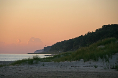
Looking north along the Lake Michigan coast at sunset.

Looking north along the Lake Michigan coast at sunset.

Sax anywhere is great, but sax on the beach is fantastic.

Take a Squeegee to your naughty mind. I’m talking about playing the saxophone, thank you, and about one of the places where I particularly enjoy playing it. There’s something very special about heading out to the lakeshore and practicing my saxophone accompanied by the sound of the waves and the cry of the seagulls.

If you follow the jazz side of this blog, then you know that I love to play my horn outdoors. My practice habits are fairly eccentric in that regard. Many years of apartment dwelling, which include neighbors whom I haven”t wished to disturb, have taught me that my woodshed is wherever I choose to make it. The state parks. The cow pasture at the edge of town. Most often my own car, parked by the railroad tracks out in the countryside.

But there’s no place quite like the shores of Lake Michigan.

It’s been a long time since I’ve taken my horn out there, but yesterday provided a reminder of what I’ve been missing. Regretfully, I didn’t have my saxophone with me, but I did have my sweetheart and best friend, Lisa. From our little outing in Muskegon State Park, I thought I’d share a few images with you of…

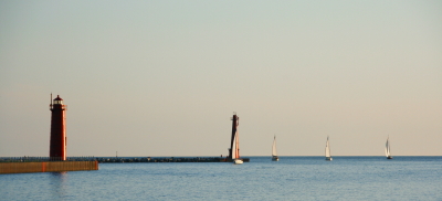
sailboats out on the waters…

sailboats1

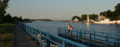
…the north boardwalk along the Muskegon channel…

muskegonboardwalk

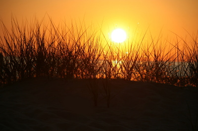
…dune grass silhoutted by the setting sun…

marramsilhouette

As for the great sand dunes that are one of the hallmarks of this beautiful state, I’ve already given you a glimpse of them up at the top of the page, but the really imposing dunes lie in the northern and southern ends of the Lower Peninsula. Perhaps in another post I’ll include some shots of Sleeping Bear, Warren Dunes, P. J. Hoffmaster Park, and Nordhouse dunes–vast tracts of sand, marram grass, and wooded dunes that reflect the wild beauty of the Michigan outdoors. It is a wide open sublimity that speaks to something deep inside me, and that has colored the music I play for many years.

One of these days soon, I will visit the lakeshore again–this time with my saxophone, to serenade the gulls, the waves, the far-stretching sands, and the setting sun.

The Loudest Sax Player Ever

My friend and fellow musician Dave DeVos once told me, “You are the loudest sax player I’ve ever known.”

His words weren’t a compliment, just a statement of fact tinged with a slight mix of incredulity and annoyance. I’m a very loud sax player, much louder than I realize. As the old cliche says, I don’t know my own strength.

Of course I can play softly, but soft is not my default mode. Part of that is attributable to my horn, which is an old Conn 6M “Ladyface” that is very good at translating the air I move through it into immense volume levels. Another part is due to my mouthpiece, a Jody Jazz classic #8. But I think the main reason I’m a loud player is directly linked to the guy behind the horn. I just seem to have a knack for massive sound output.

I wasn’t always a loud player. I entered my freshman year in college a quiet young saxophonist. My sound at the time was styled after Tom Strang, a local alto man who owned a jazz bar in Ada called the Foxhead Inn. Tom had a smooth, mellow sound, very pleasing to the ears. He was not a loud sax player.

As an early influence, Tom’s tone pointed me toward a somewhat Desmondesque approach, not exactly the kind of robust Cannonball sound that could melt the wax in a listener’s ears at 100 feet. It was more a kind of foofy-foof-foof tone–subdued and, I thought, pleasantly sophisticated.

It was this mellow, sedate sound that I brought with me to the student big band at Aquinas College, where I sat under the august directorship of jazz professor Bruce Early. I was assigned to the first alto chair, and my lack of experience was such that I felt eminently qualified to fill the position. Clearly word of my abilities on the sax had preceded me, and Bruce had simply placed me where he knew I belonged. First chair. It was inevitable.

I’ll never forget my first awakening to the possibility that maybe I wasn’t all that and a supersized order of fries. The band was playing through some tune I’ve long since forgotten, and in the middle of the chart there was space for an alto solo. Cool. A chance for me to show my stuff, give Bruce a taste of my chops. I launched into the solo. Foofy-foof-foof, I played, subtly, while the rhythm section whanged away.

Bruce stared at me. “Play louder,” he said.

Ah. Louder. Okay then. Foof-foof-foofy-foof! I declared, in a volume that could almost be heard from ten feet away.

Bruce’s stare became a glare. “Louder!” he barked.

My gosh, what did this guy want? Here I was, foofing as loudly as ever I had foofed, and Bruce was calling for more.

I returned his glare with a desperate glance.

Foof? I played. Foofy-foof!

I was trying, but I quickly trended toward the softer, cocktail lounge volume that I was used to.

That did it for Bruce. “BLOW!!!!” he yelled. “For crying out loud, BLOOOWWWWW!!!!!!”

Some of the more seasoned musicians snickered, and my face went red as a beet. Hell’s bells. Fine, if it was volume Bruce wanted, I’d give him volume. And I did. I had a lot to learn about embouchure and tone production, but at that point I instinctively dipped into the raw essentials, filled my lungs with air, and blew my ever-loving cheeks off.

From that time on, while Bruce yelled at me for any number of things, my volume level wasn’t among them. He never again complained that I was playing too softly. Nor has anyone else, for that matter. Not ever. I’ve played with highly amplified blues bands and church worship teams and outblown them without using a microphone. I’ve been asked plenty of times to turn it down a bit, please. But no one has ever come to me and said, “Could you play louder? I can barely hear you.”

Just ask Dave. He’ll be glad to tell you, as soon as his ears stop ringing.

June 19 Central Illinois and Indiana Storm Chase

Approaching our storm from the north near Normal, Illinois.

Approaching the storm of the day south of Normal, Illinois.

After Iowa’s blue-sky bust on June 18, yesterday provided some welcome and much-needed activity. Between illness and May’s ridge of steel, my chase expeditions this year have been limited. The Edina, Missouri, tornado of May 13 has been my only tornado to date for 2009. Yesterday did nothing to improve that statistic, but it did offer a vigorous, classic supercell with some great structure that ensured my 1,650-mile, two-day chase with my buddy Bill Oosterbaan wasn’t a complete washout.

For that matter, storms did finally fire in eastern Iowa, and while Bill and I were too late to catch the big mutha that slammed Prairie du Chien (Ben Holcomb, if you happen to read this, great job on tracking that beast into the hills and jungles of Wisconsin!), we did manage to latch onto the one that followed in its footsteps. But I’m no fan of night time chasing and neither is Bill, and knowing the kind of topography that lay to our east once we crossed the river, we dropped our chase at Prairie du Chien and found ourselves a hotel.

After a decent breakfast yesterday morning, we were on the road by noon and headed south. The SPC showed a moderate risk for a large area extending from Iowa and Missouri east across the corn belt and Great Lakes. With a continuation of yesterday’s huge CAPE and good bulk shear, a widespread severe weather outbreak seemed like a sure bet. However, veering surface winds and unidirectional flow seemed to put the kibosh on chances for tornadoes in all but a few areas to the east, where helicities improved, particularly around 21Z.

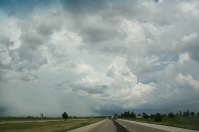
As we approached Davenport, Iowa, heading south, we could see towers muscling up along an east-west boundary that transected Illinois south of the I-80 corridor. Catching I-80 east, we could see new cells firing up farther to the south on GR3. With a Kankakee target in the back of our minds, we decided to drop toward Normal on I-39.

By the time we drew near the town, the northernmost storm was showing rotation on the radar. The tower was just to our west, and as we proceeded down the highway, the updraft base came into view, dominated by a well-developed wall cloud.

Wall cloud on northernmost storm.

Wall cloud on northernmost storm.

We headed for an intercept, tracking with the storm until it began to degrade. Meanwhile, another cell to the south was strengthening and beginning to exhibit distinct rotation on SRV, so with the storm we were on mushing out, we abandoned it in favor of the second, rapidly intensifying supercell.

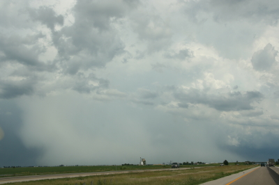
One heckuva hail shaft or what?

One heckuva hail shaft or what?

This bad boy had an impressive hail shaft, if hail is what we were actually seeing. Maybe it was just plain old rain with a bit of hail mixed in. The reason I wonder is because of the paucity of hail reports. We got tapped a bit as we closed in, but mostly we just encountered buckets of rain. Whatever the case, the updraft tower with the sunlit precip column was a beautiful sight.

Second storm showing hail shaft and updraft tower.

Second storm showing sunlit precip core and updraft tower.

After working our way south of the storm’s rear flank, we proceeded east and finally gained some good, clear views of the business end. Tracking with it from near Urbana through Homer, Fairmount, and Westville toward the Indiana border, we were in a good position to enjoy the structure as the storm went through several cycles.

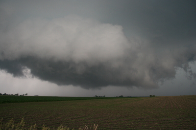
Rotating wall cloud.

Rotating wall cloud.

Just east of Homer, the wall cloud tightened and I could see rapidly circulating cloud tags descending toward the ground. We pulled over to watch. The rotation wasn’t far away–maybe a quarter of a mile–and it appeared to be moving toward us. This was strange as we were southwest of the wall cloud, but you can’t argue with a developing tornado. With the updraft approaching to within a couple hundred yards of us, Bill seemed intent on analyzing why the storm was acting so peculiarly, while I favored beating a hasty retreat and working out the behavioral aspects of storm circulation from a somewhat greater distance. Storm chasing sure has its interesting moments.

No tornado materialized, the storm headed east, and we continued on with it. I noticed a couple of tornado reports from around Fairmount and Westville, but while I suppose it’s possible that there was a brief spinup or two, Bill and I never saw an actual tornado. We did witness a few times when the wall cloud began to torque  pretty intensely, and I sure wouldn’t have wanted to be directly below it.

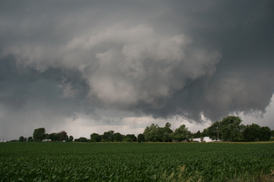
The whitish wall cloud is half a mile from us and rotating vigorously.

The whitish wall cloud is half a mile from us and rotating vigorously.

Possibly a funnel cloud at this point.

Possibly a funnel cloud at this point.

But from the time we first intercepted it to the point where it finally began to fizzle 120 miles later west of Crawfordsville, Indiana, the storm was outflow-dominant. Never once did we enounter surface inflow, though above ground level, I’m sure inflow was strong. In Bill’s words, the circulation kept reaching toward the ground, looking for something to grab onto, but it never could manage to root and produce a tornado. If we’d had backing winds…if the helicities had been there…I’m sure the storm would have been a potent tornado breeder. It never got its act together in that regard, but I doubt the communities in its path felt terribly disappointed, and from my perspective, the storm provided an interesting chase with some very nice moments.

Last gasp: wall cloud at US 41 west of Crawfordsville, Indiana, shortly before the storm began to collapse.

Last gasp: wall cloud at US 41 west of Crawfordsville, Indiana, shortly before the storm began to collapse.

For sheer structure, the “Danville supercell” was interesting and photogenic, with some nice RFD slots wrapping in, and, toward the end of the storm’s career, with a classic, stack-of-plates mesocyclone that was as nice as anything I’ve ever seen. (Sorry, no photos–the ones I have didn’t turn out well.)

One downside to this chase–and it is a big one–is that somewhere between Homer and US 41, I lost my camcorder. It wasn’t a pricey camcorder; it was a used Sony that I bought from my friend and fellow storm chaser Kurt Hulst. But it has done me good service over the past year, and I hate to think that it is presently sitting out there by the side of some Illinois backroad. What’s even worse is, my video of this chase is in it.

The drive back to Grand Rapids was a long one. I arrived at my apartment around 2:30 a.m. and collapsed. The chase was fun and I think I needed it, but it’s good to be back home with the love of my life, Lisa, whose bright eyes and beautiful smile warm my heart wherever I travel.

Heading for an Iowa Chase

As I write, I’m heading west down I-80 with my storm chasing buddy Bill Oosterbaan. Our target: Waterloo, Iowa. The 9Z RUC shows a nice convergence of 850 and 500 mb jets overspreading massive CAPE by 21Z, with a robust 200 mb jet nosing in. Progged surface winds could be better, but skew-Ts still show nice veering with height, and storm relative inflow is majorly backed.

Oh, yeah…and we’re looking at dewpoints of 75 degrees and higher, with dewpoint depressions around 5 degrees. LCLs should be so low we may have to tunnel underground to find the cloud bases.

The SPC has hatched out this area for tornadoes. No surprise. After a relatively modest season, we may be on the verge of a significant outbreak. It’s a bit sobering to think that Parkersburg, Iowa, could get slammed again. I expect we’ll see a PDS statement at some point today, and I wonder whether the outlook won’t get bumped from a moderate risk to a high risk as well.

Tomorrow also looks to be a hugely active day, and the latest SREF places a sigtor in Michigan. So stay tuned. I’m sure there will be more to come.

June 8: Mini-Supercell in Northern Illinois and Severe Squall Line on the Lake Michigan Shoreline

This is really part two of the previous post. After chasing a potent, monster hailer of a supercell north of Saint Joseph, Missouri, I overnighted at a hotel outside of Des Moines, Iowa. When I stepped outside the next morning, the air was much cooler and drier, a stable atmosphere that wouldn’t produce so much as a sneeze, let alone a tornado.

But I knew that the SPC had outlooked the area to my east across northern Illinois, and for several days I myself had been eyeballing my home state of Michigan, where the NAM-WRF had been consistently indicating the possibility of tornadoes. With a little luck, I hoped to make it back in time to chase whatever convection might pop up along the warm front.

As I approached Davenport, I observed  towering cumulus muscling up through the troposphere. However, I didn’t pay them any attention–that is, until Bill Oosterbaan called to inform me that the SPC had just issued a mesoscale discussion for the area just east of me. Even as we talked, I noticed a lowering on a cumulus tower a mile or two to my northeast. When it continued to develop, I decided to investigate. Leaving I-80, I parked across from a truck stop at the Atkinson exit to watch.

The next cell to my west quickly grabbed my attention. It had a nice rain-free base, and as I watched, scud began to form and ascend in an obvious updraft, coalescing into a small, ragged wall cloud. Grabbing my camera and getting out of my car, I noticed right away that the air was very different from back in Des Moines–considerably warmer and with plenty of moisture. The wall cloud fell apart before I could get a pic, but the overall structure remained interesting.

A mini-supercell approaches Atkinson, Illinois, just north of I-80.

A mini-supercell approaches Atkinson, Illinois, just north of I-80.

More brief, non-rotating wall clouds formed and dissipated one by one, so I figured I’d head north of town and observe. With surface winds veering and the overall flow unidirectional, I had no expectation of seeing tornadoes, but the mini-supercell made for some fun and interesting viewing.

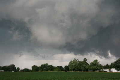
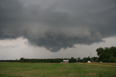
Ragged, non-rotating wall cloud.

Ragged, non-rotating wall cloud.

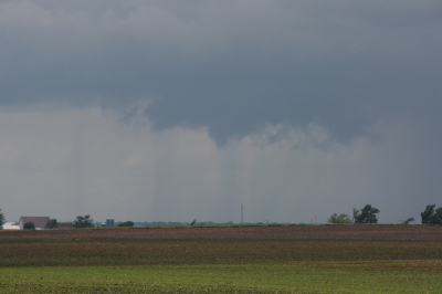
Distant wall cloud and back side of main updraft tower.

Distant wall cloud and glimpse of updraft tower.

I was tempted to follow the storm, but decided it was a red herring. If at all possible, I wanted to make it back to Michigan in enough time to chase the setup there, and that left me no time to play around on the western Illinois backroads. So I headed back to I-80 and busted east.

The first Michigan supercell fired up earlier than I’d hoped, and I bit my lip as I followed its progress on GR3 and watched it hit Lansing. If only I had driven east last night for two more hours, or left in the morning two hours earlier… But the previous day’s chase had left me exhausted. And you know, one of the downsides of being a Michigan-based storm chaser is, you just don’t have very high expectations when it comes to your home state. I mean, it’s Michigan. Home of convective table scraps, squall lines, and embedded supercells that don’t produce squat.

As it was, I watched several more storms fire up and develop rotation along the warm front that stretched across mid-Michigan. I was making decent progress and still had hopes of catching up with some of the southernmost cells. But by the time I crossed the state line, the action all had shifted well to the east, and it became clear that I wasn’t going to see any of it.

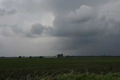
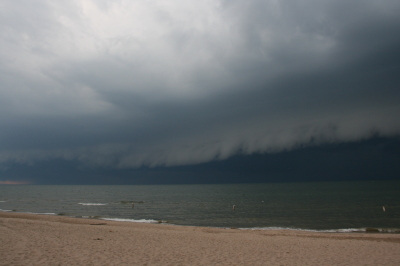
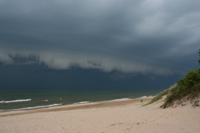
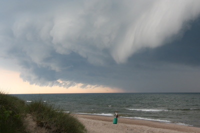
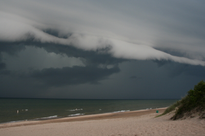
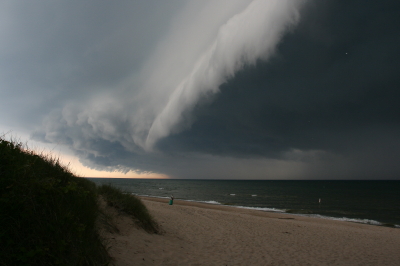
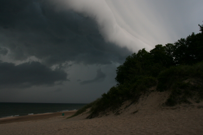
Instead, taking fellow chaser Mike Kovalchick’s suggestion, I headed toward the lakeshore at Allegan Beach to intercept a short but potent squall line. I’m glad I did. The backdrop of Lake Michigan and its dunescapes lends a breathtaking drama to incoming storms. The following photos depict the progress of the arcus cloud moving in across the waters. What these images can’t convey is the full, awe-inspiring sweep of cloud, big lake, and shoreline; of the solemn foreboding of some great event about to unleash itself upon a landscape cloaked in storm shadow; of the shelf cloud moving silently overhead like the furrowed eyebrow of a dark, scowling giant; and of sand spray blowing and trees thrashing in the wind as the gust front arrived.

I’ll let the photos tell their story as best they can, and leave the rest to your imagination.

An arcus cloud advances toward the Lake Michigan shoreline at Allegan Beach.

An arcus cloud advances toward the Lake Michigan shoreline at Allegan Beach.

View to the north.

View to the north.

Looking south...the storm closes in.

Looking south...the storm closes in.

Looking north...closer still.

Looking north...closer still.

Almost overhead.

Almost overhead.

One last shot to the north, then it's time to make a dash for the car.

One last shot to the north, then it's time to make a dash for the car.

Francesca and Friends at Grand Rapids Festival of the Arts

Next weekend the annual Grand Rapids Festival of the Arts will draw several hundred thousand people from Friday evening through Sunday afternoon. The festival, now over thirty years old, is one of West Michigan’s most popular springtime events–an amalgam of literature, art, dance, music, and ethnic food, with the operative word being variety.

On Saturday, June 6, I will be playing sax with Francesca and Friends on the Calder Stage from 3:15 to 4:00 p.m. If you follow this blog, then you’re familiar with Francesca Amari. She’s a stellar performer who covers the spectrum from jazz standards to pop to show tunes, and a lovely friend. It’s always a pleasure and privilege to share the stage with her as a side man, and it will be very cool to have the band featured on the festival’s main stage.

Obviously, I want to be in prime playing shape. I hope to spend some serious time this week practicing my horn after having been away from it for several weeks. A truly nasty bronchitis put me out of commission, and I’m still suffering from an irritating dry cough that feels as if a little gremlin were sitting inside me, tickling my lungs with a feather. The doc finally prescribed an inhaler for me Thursday to help me get past this thing, and I’ve spent some time getting reacquainted with my saxophone. Feels so good!

While time away from the woodshed unquestionably has a deleterious effect on one’s technique, I’ve found that it often frees up creativity. I don’t know why this is–I just know that it’s not a bad thing to take a break from my horn every now and then. I lose something, but I also gain something. And I’m not the only musician who has experienced this phenomenon.

Anyway, I’m back to my patterns, scales, licks, and interval studies. It’s nice to hit them afresh. What’s already there comes back quickly, and it has the advantage of feeling new.

But about the festival. Come on out and get an earful of Francesca and Friends, not to mention the many other sights, sounds, and savory tastes of Festival 2009. It’s a great way to spend a June afternoon in West Michigan.

Tribute to a Storm Chasing Partner

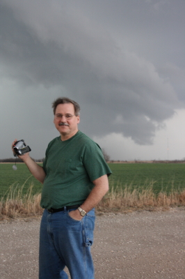
Wild Bill Oosterbaan, Chase Partner Extraordinaire

Wild Bill Oosterbaan, Chase Partner Extraordinaire

I contemplated cropping the above image to achieve a better visual balance. Then I thought, nah. For one thing, what’s the point of trying to balance the photo of a character who’s as wildly off kilter as Bill. For another, and all kidding aside, I’d have to trim out a good portion of the storm clouds. And that would be like trimming out the very essence of Bill Oosterbaan. You see, clouds like those are Bill’s passion. They’re what first brought us together thirteen years ago, and they’ve been propelling us across the miles ever since in search of convective mayhem.

Bill is my chase partner. Of course, I chase with some other great friends and storm chasers as well, but Bill…well, I’ve just covered more miles with him by far, paid more dues, experienced more busted chases, learned more about weather, and yes, seen more tornadoes and beautiful storms, than with anyone else. This post is my tribute to my fellow chaser, comrade in convection, and good friend of over a decade.

Bill and I are very different temperaments. Conduct a Meyers-Briggs personality profile of each of us and your first conclusion probably wouldn’t be that we ought to get in a car together and travel 1,000-plus miles at a stretch in search of intense, potentially lethal weather. But we’ve survived both the storms and each other, and learned quite a bit in the process. And, I might add, we’ve had a heckuva lot of fun.

I first met Bill back in 1996. That was the year I also conducted my first successful storm chase right here in Michigan. I had already done a chase or two with Bill and his brother, Tom, but on that sticky August day, the two of them were out on the golf course. So when a supercell fired up and formed a wall cloud right outside the window where I worked, I drove solo across the Kent and Ionia County countryside and scored a slim, elegant tube tornado north of Saint Johns.

On my chases since then, though, I’ve rarely been without Bill. So our development as storm chasers has followed a very similar track. I saw my first Great Plains tornado with Bill. In 2005 we chased the record-breaking Six State Supercell together from west of Columbia, Missouri, all the way back to Michigan. On two separate occasions, we’ve witnessed nighttime tornadoes strike large towns. Our technology has advanced from a miniature TV and stop-offs at airports  and libraries in order to access radar data, to laptops equipped with all the tools known and loved by storm chasers today. We’ve even figured out how to use most of the stuff. Our forecasting skills have grown from those early days of trying to decode the arcane language of SPC discussions, to making our own forecasts with increasing success.

Lately my laptop of four years has been giving me fits. This is  nothing new, but it has gotten to the point where I’ve finally ordered a new one from Dell. It’s a heavy-duty toughbook that’s made to take punishment, perfect for the road. Bill sees  in it the end of an era. He says he’s going to miss watching my eyes bulge and the veins pop out in my neck. I hate to deprive him of such a simple pleasure; it’s a small thing, and it causes him so much joy. On the other hand, I think he’ll agree that there’s a lot to be said for having a computer that doesn’t crash when we need it most. Typically that happens while we’re in pursuit of some rain-wrapped meso with who knows what lurking in its interior.

I look forward to tracking down plenty more mesos with my friend and long-time chase partner. Many more storms, countless more hours on the road, and yes, more arguments with the ornery cuss. Because the storms are what it’s about for both of us, and I think we’ve learned–and will continue to learn–plenty from each other about chasing them. Our respect for one another is mutual, as is our love for the wild, untamed beauty of Big Weather. When Bill and I talk, it’s mainly about storms. We never get bored. For us, talking about the weather is far from trivial conversation. There’s always something new to learn, something fresh to discover.

That’s why I refuse to trim those storm clouds out of the picture up above. To lessen their presence would be to lessen the story they tell about the man standing in front of them. They’re a vital part of Bill. So let the clouds remain and let the picture look a bit unbalanced. After all, Bill’s a storm chaser. What kind of balance do you expect out of a guy who hunts tornadoes?

Bill, mi amigo, it sure has been a blast. Here’s to you. Here’s to shared experiences, to the thousands of miles we’ve driven, and to the thousands we’ve yet to drive. Here’s to the the Lord who has kept us safe and blessed us with success.

And, as always, here’s to the storms.

Remembering May 3, 1999

View from the balcony.

View from the balcony.

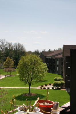
Looking at my recent posts, it dawns on me that it has been a while since I brightened things up with a few photos. The above is a purely gratuitious shot of my small apartment complex in Caledonia, Michigan, taken from my balcony. In the foreground, you can see some of The Kids–that is, my carnivorous plants. They’re long and lank right now from being forced to gather what sun they’ve been able to sitting indoors by the sliding door. April’s temperature fluctuations have permitted only occasional forays outside, but I think that at this point they’re there to stay. Now the bright, direct sun can do its work, strengthening their stems so that in another month or two, new leaves on the pitcher plants should stand up straight and tall.

Actually, the Sarracenia oreophila has already been doing just fine in that regard. Once I took it out of refrigeration, it wasted no time sending up a fine crop of stout, trumpet-shaped leaves. Unfortunately, hornets are drawn to the taller pitcher plants like crazy, and they don’t take kindly to being trapped in them. I’ve had to tape several of the oreo leaves after they collapsed due to hornets chewing holes through the sides in order to escape. I’ve got to believe that hornets aren’t the normal fare for Sarracenias in the wild. My plants occupy a habitat three stories above ground level, not exactly the same kind of ecosystem as an Alabama mountain bog or a southern savannah.

Anyway, as you can see from the photo, today is gorgeous here in Michigan, with temps in the upper sixties–on the cool side of warm. A body can wear shorts or jeans, a T-shirt or a long-sleeve; either works perfectly on a day like today. Me, I’m in shorts. I have no plans to go anywhere, since I’m still a bit wheezy from my cold, but it’s nice to just sit here and look out the window at blue sky, white blossoms, and tress leafing out.

Ironically, this picture-perfect May day is the tenth anniversary of the 1999 Oklahoma Tornado Outbreak. On this date, the infamous Moore/Bridge Creek Tornado tore a path from west of Amber to Midwest City, taking 36 lives and becoming the last tornado to be rated an F5 under the original, now passe Fujita scale. A wind max in this tornado of 301 mph, give or take 20 mph, recorded by the Doppler on Wheels (DOW) remains the fastest tornado wind ever measured to date, placing the Bridge Creek tornado at the upper end of even the most extreme tornadoes. Powerful as it was, another monstrous tornado which plowed through the town of Mulhall that same day may have been even stronger.

It’s hard to fathom winds of that velocity. It’s faster than most BB guns. To help you visualize such a wind speed, if a piece of lumber was blowing at you at 301 mph from a house disintegrating 450 feet away, you’d have approximately one second to duck. Granted, the DOW reading was 105 feet above ground, and the surface winds were likely to have been somewhat slower. But I doubt that information would have been very reassuring to residents of Bridge Creek that day as they watched the storm bearing down on them.

What a cheery thought. I think I’ll return to today’s bright sunshine and enjoy it. Storm season is at hand, my cold is on its way out, and I hope to get out to the Plains in another couple of weeks and chase some supercells. But for now, it’s May 3 and the day is beautiful here in Michigan. Who could ask for more?