 The cloud tops are up to 20,000 feet here in Caledonia, and about two minutes ago the first impressively bright flash of lightning lit the blizzard swirling around my apartment. Thundersnow! Rare, but not unexpected tonight, and now that it has arrived, I’m continuing to see sporadic flickers of lightning. That initial one was a doozy, though, and all I can think is, Cool! How often does one get to hear thunder rumble through the teeth of a February blizzard?
Man, is it blowing out there!
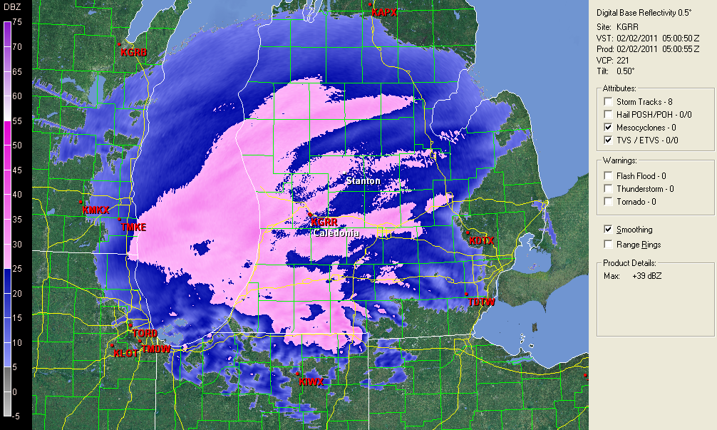
All eyes have been on this winter storm for the past several days, watching it move from forecast models into reality. Now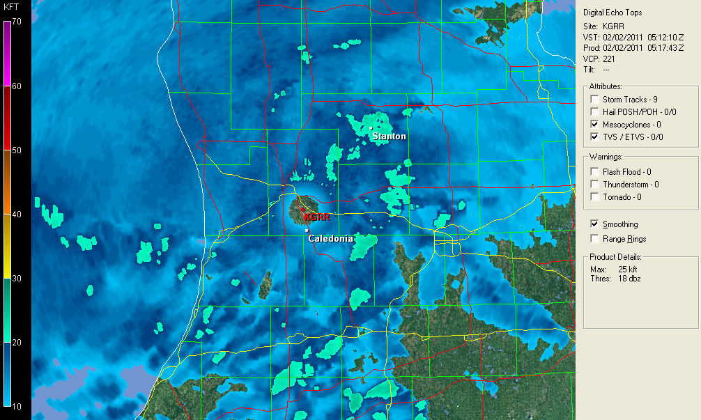 here it is, and it is a humdinger. Anywhere from a minimum of 12 up to 16 inches of snow is predicted to dump on our area, and south of us it only gets worse. Pink is the color that indicates heavy snowfall on my radar color table, and I don’t recall ever seeing such a large expanse of it covering my screen before. Between now and sometime tomorrow morning is when the heaviest snowfall is supposed to occur, and looking outside my window at the maelstrom swirling dimly out of the midnight sky, I see nothing to contradict that prognosis.
 Ah! Another flash of lightning and another rumble of thunder! This is nice. Imagine that–me, an avowed snow grinch, enjoying a blizzard! But I have to say, this storm appears to be living up to all expectations. I honestly don’t recall that I’ve ever experienced thundersnow before, so I’m really pleased to be getting such a novel form of entertainment.
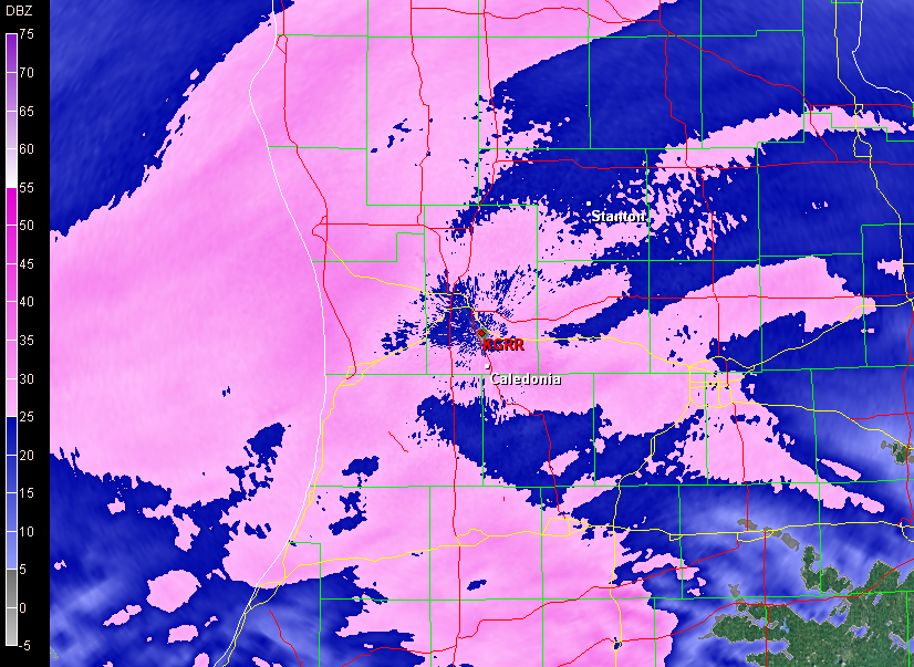
The three fairly recent radar grabs and the water vapor image on this page will give you an idea of what a truly wild evening this is. Click on the images to enlarge them. The first and third are basic winter reflectively images, with the latter offering a more zoomed-in look at southern Michigan. Look at all that pink! Interrogating a few of the deeper hues has given me reads of nearly 40 Dbz, and that’s nothing compared to elsewhere, and perhaps to what yet lies in store for us.
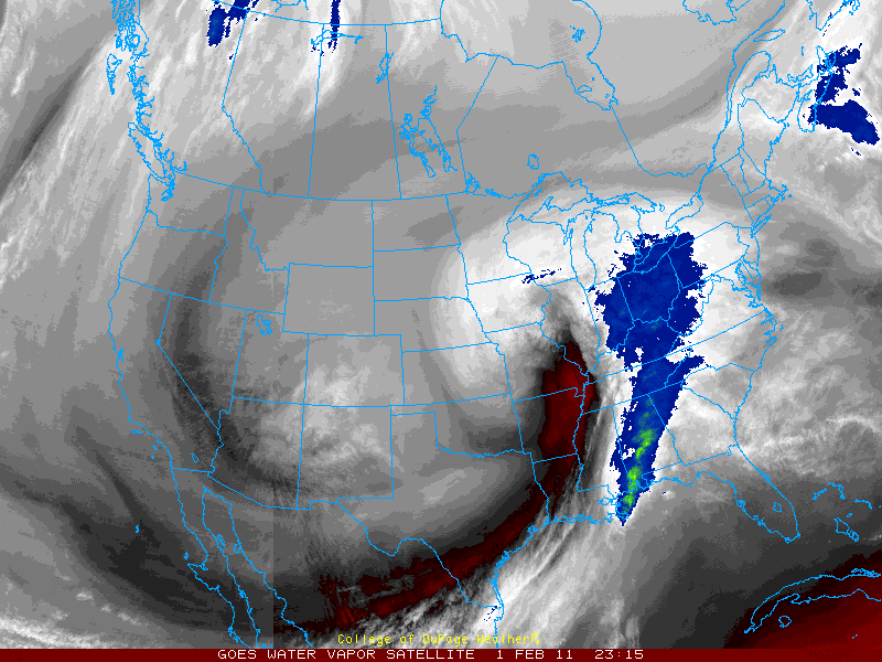 As for the second screen, that shows cloud tops. The teal colored blobs indicate tops of 20,000 feet or greater, where thundersnow is likeliest to occur. And the fourth image depicting water vapor gives a macro view of what the entire system looks like as an immense entity sweeping eastward, with the dry slot punching upward into Illinois.
This may be one for the history books. I’m glad I stocked up on groceries, because I doubt I’ll be venturing out tomorrow. I doubt anyone will be. I’m certain that all the schools will be closed, and quite possibly many businesses as well. It will be a good day to hunker down and feel grateful for being indoors.
Zang! Another bright flash. I just got a phone call from my friend Brad Dawson, who lives down near Gun Lake. He tells me that a big tower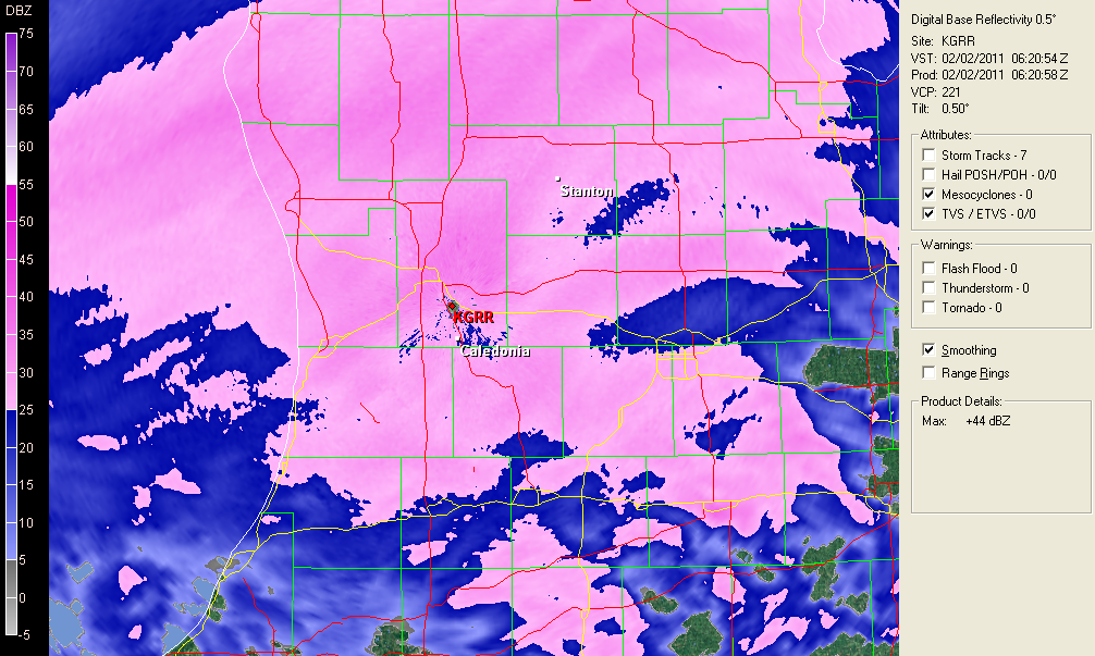 500 feet from his house is getting continually struck. That has to be an experience, and from the looks of things, it’s apt to be one that continues through the night. Lacking any similar tall objects here, the lightning isn’t as constant, but it continues to flicker, and the storm itself is intensifying. What the heck–here’s one last image: a current radar scan. I just got a reading of 43.5 Dbz in one of the darker blobs of pink!
This is one howler of a winter storm system. But I’m done watching it for now. It’ll still be here in the morning. Time for me to hit the sack and enjoy the light show for a while before I fade out. Good night!


