May 29, 2011, Battle Creek Straight-Line Winds

The summary follow-up to  my previous post is, I busted with L. B. LaForce during last Wednesday’s high-risk day in Illinois. Tornadoes occurred that day, but overall the scenario was a disappointing one for us. If anything, it was a lesson to trust my initial gut instinct, which told me to stick close to Indiana, where a moisture plume and 500 mb jet were moving in. Nice, discrete supercells eventually fired up south of Indianapolis while L. B. and I putzed around fruitlessly with the crapvection northeast of Saint Louis. And that’s all I’ll say about that–not that I couldn’t say more, but I want to talk about yesterday’s far more potent event in southern Michigan.

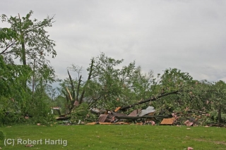
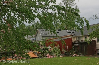
You don’t need a tornado in order to make a neighborhood look like one went through it. That axiom was amply demonstrated yesterday in Calhoun County, where straight-line winds wrought havoc the likes of which I don’t recall having ever seen here in Michigan. We’ve had a couple doozey derechoes over the past few decades, but I don’t think they created such intense damage on as widespread a scale as what I witnessed yesterday. Northeast of Helmer Brook Road and Columbia Avenue in Battle Creek, across from the airport, the neighborhood looked like it had been fed through a massive shredder. We’re talking hundreds of large trees uprooted or simply snapped, roofs ripped off of buildings, walls caved in, road signs blown down, trees festooned with pink insulation and pieces of sheet metal, yards littered with debris, power lines down everywhere…it was just unbelievable. Not in the EF-3 or EF -4 league, maybe, but nothing to make light of.

Yesterday was the first decent setup to visit Michigan so far this year. Of course I went chasing, not expecting to see tornadoes–although that possibility did exist–but hoping to catch whatever kind of action evolved out of the storms as they forged eastward. It being my first time doing live-streaming video and phone-ins for WOOD TV 8 made things all the more interesting. As it turns out, I was in the right place at the right time.

When I first intercepted the storms by the Martin exit on US 131, I wasn’t sure they would amount to much.  Huh, no worries there. As I drove east and south to reposition myself after my initial encounter, the storms intensified and a tornado warning went up for Kalamazoo County just to my south.

Dropping down into Richland, I got slammed with heavy, driving rain. The leading edge of the storm had caught up with me. I wanted to get ahead of it and then proceed south toward the direction of the rotation that had been reported in Kalamazoo. Fortunately, M-89 was right at hand, and I belted east on it toward Battle Creek.

On the west side of Battle Creek, I turned south on M-37, known locally as Helmer Brook Road. GR3 radar indicated that I was just grazing the northern edge of a couplet of intense winds. It didn’t look to me like rotation; more likely divergence, a downburst. As I continued south down Helmer Brook toward the airport, the west winds intensified suddenly and dramatically, lashing a Niagara of rain and mist in front of me and rendering visibility near-zero. I wasn’t frightened, but I probably should have been. Glancing at my laptop, I noticed that a TVS and meso marker had popped up on the radar–smack on top of my GPS marker.

Great, just great. So that couplet I thought was a downburst had rotation in it of some kind. Well, there was nothing I could do but proceed slowly and cautiously and hope that the wind didn’t suddenly shift. It didn’t, and as I drew closer to the airport, it started to ease up, visibility improved and the storm moved off to the east.

That was when I began to see damage. In the cemetery across from the airport, trees were down. Big trees, and lots of them. Blown down. Snapped off. I grabbed my camcorder and started videotaping. But the full effects of the wind didn’t become apparent until I turned east onto Columbia Avenue near the Meijer store.

My first thought was that a tornado had indeed gone through the area. But with most of the trees pointing consistently in a northeasterly direction, the most logical culprit was powerful straight-line winds. Parking near a newly roofless oil change business, I proceeded to shoot video and snap photos. I’ll let the following images tell the rest of the story.
Tornado in Greensburg, Pennsylvania

With sunshine and cold temperatures forecast through Monday and beyond here in West Michigan, I’d say we’re in the process of becoming nicely ridged. The GFS and NAM agree on a little trough digging into the southern plains on Saturday, with a surface low just southeast of the trough axis fetching moisture up into Dixie Alley. Shear is ample, as you’d expect this time of year, so maybe the South will see some organized storms. But up here in the north, none of that matters. Chilly and uneventful are the words for us this next week or so.

So it’s nice to know that chasers got in a little early play Tuesday in Iowa. The Storm Prediction Center shows 18 tornado reports, including the photogenic Creston tornado: a beautiful, sunlit tube that a number of chasers captured on camera and video. That had to have been a sight to see, and I congratulate those of you who witnessed it.

The big surprise came a day later, though, yesterday in Greensburg. No, not Greensburg, Kansas; Greensburg, Pennsylvania, 25 miles southeast of Pittsburgh. Who would have expected a tornado out there in March in hill country? True, the SPC had issued a moderate risk for the east, but that was considerably farther south, and the affected area was teetering on the very edge of a light risk. The bulk shear certainly was capable of producing supercells, but I figured they’d just be hailers. I had written off the setup as a straight-line wind event.

Yet a supercell drifting across the jumbled terrain of southwest Pennsylvania exhibited a pronounced mesocyclone that culminated in the Greensburg tornado–this in an environment where temperature and moisture that seemed inadequate to begin with dropped rapidly over the course of just a few miles. Lapse rates had to have been steep in order to sustain the storm in those conditions.

As near as I can judge, the Pennsylvania supercell appeared to drift along some kind of warm frontal boundary, with just enough moisture and heat to sustain it and enough helicity to produce a tornado. VAD wind profiles at KPBZ were straight from the west at all levels; farther east-northeast, however, at KCXX, backing surface winds veered rapidly with height, providing decent low-level torque.

But that was, I believe, in colder air. It strikes me as a pretty delicate balance that sustained the Pennsylvania supercell. Greensburg is located in the Allegheny Plateau in the foothills of the Appalachian Mountains, so perhaps the terrain may have influenced local boundary-layer winds enough to produce the Greensburg tornado. I can only speculate. The Plateau overall is mountainous, but when I look at photos of Greensburg, the town appears to be situated in a fairly level area. What the case is five miles southwest in Hempfield Township, where tornado damage was reported along Route 136, may be a different matter. I don’t know the area. However, the highway map shows curvy roads consistent with a rugged landscape.

It’s fun to think about when there’s no other weather to contemplate, which right now there isn’t. But it’s on the way. It’s spring, the sun is higher, the Gulf is setting up shop, and Storm Season 2011 is moving in.

ADDENDUM: Having looked at a few videos of the tornado in Hempfield since I made this post, I’m inclined to think that terrain wasn’t a factor. Looks like the right ingredients just came together on the mesoscale level. Interesting storm!

Chasing the Great Lakes Superbomb of 2010

Until early yesterday morning, I was pretty certain that I wasn’t going to be chasing yesterday’s squall line associated with the record-breaking low pressure system that’s moving across the Great Lakes. With storms ripping along at 60 knots, what kind of chasing is a person going to do?

Then came the 7:00 a.m. phone call from my chase partner, Bill Oosterbaan, informing me that the Storm Prediction Center had issued a high risk for the area just across the border in Indiana and Ohio. With the rapidly advancing cold front still west of Chicago, we’d have ample time to position ourselves more optimally. This would be an early-day storm chase. It would also almost surely be our last chase for the next four or five months. What did we have to lose?

I hooked up with Bill at the gas station at 100th St. and US-131, and off we went. The storms had moved into Chicago by then, and as we dropped south, it became apparent that we would also need to break east and then stairstep down into Ohio, buying time in order to let the line develop with daytime heating. Satellite showed some clearing in Ohio,

suggesting a better chance for instability to build. Catching I-94 in Kalamazoo, we headed east toward I-75, with the Findlay area as our target.

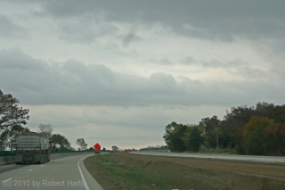
Off to the northwest in Minnesota, the low was deepening toward an unprecedented sub-955 millibar level, sucking in winds from hundreds of miles around like the vortex in an enormous bathtub drain. Transverse rolls of stratocumulus streamed overhead toward the north, indicating substantial wind shear. (Click on image to enlarge.)

By the time we crossed the border into Ohio, tornado reports were already coming in from the west as the squall line intensified. Soon much of the line was tornado warned. However, while the warnings were no doubt a godsend for a few communities that sustained tornado damage yesterday, they weren’t much help to Bill and me. Chasing a squall line is different from chasing discrete supercells.

We had in fact hoped that a few discrete cells would fire ahead of the line. But the forecast CAPE never materialized to make that happen, and we were left with just the line. In that widely forced environment, tornadoes were likely to occur as quick, rain-wrapped spinups rather than as the products of long-lived mesocyclones. Even with GR3, the likelihood of our intercepting a tornado would require a high degree of luck. It was harder to identify areas of circulation with certainty; I found myself using base velocity as much as storm relative velocity on the radar, and comparing suspect areas not with easy-to-see hook echoes in the reflectivity mode, but with kinks in the line. It was pretty much a game of meteorological “Pin the Tail on the Donkey.”

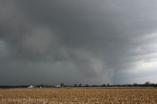
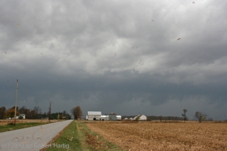
North of Kenton, we headed west and got our first view of the squall line. For all the hooplah that had preceded the thing, it didn’t appear very impressive. Just your average storm front–much windier than most, but also a bit anemic-looking compared to some of the shelf clouds I’ve seen. Still, it was a lovely sight, watching those glowering clouds grope their way across the late-October farmlands.

.

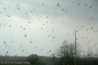
Neither of us was quite ready to end the chase, so with the storm rapidly closing in, we scrambled back into the car and stairstepped to the southeast in the hope of intercepting a likely-looking reflectivity knot that had gone tornado-warned. It was fun playing tag with the storm, driving through swirls of leaves spun up by the outflow. But there really wasn’t much incentive for us to continue the game indefinitely. Eventually we turned back west and drove into the mouth of the beast.

For a few minutes, we got socked with torrential rain and some impressive blasts of wind (and, I should add, absolutely no lightning or thunder whatever). Then it was over. Time to head home.

In Kenton, we grabbed dinner at a small restaurant. Then we headed toward Cridersville, 28 miles straight to the west next to I-75, where there had been a report of “major structural damage” from a tornado. The report was accurate. A small but effective tornado had torn through the community, uprooting and snapping off large trees, taking off roofs, and demolishing at least one garage that I could see. Of course we couldn’t get into the heart of the damage path, but a few passing glimpses suggested that some of the damage may have been fairly severe.

As I said at the beginning, this chase will likely have been my last of the year. I never know for sure until the snows fly, but it seems like a pretty safe bet that I won’t be heading out again after storms until March or April. It’s hard to call this chase a bust since our expectations weren’t all that high to begin with. Plus, tornadoes or no tornadoes, it was an opportunity to engage with a historical weather system. Like other significant weather events such as the Armistice Day Storm and the 1974 Super Outbreak, this one will be given a name in the annals of meteorology. Me, I’m calling it the Great Lakes Superbomb of 2010. In a number of ways, it hasn’t proved to be as impactful as was forecast, but it’s not over yet. And regardless, I’m glad I got the chance to get out and enjoy a final taste of synoptic mayhem.