A Stormy Evening in Stanton

Last weekend my best male friend, Dewey (aka Duane, aka The Scurvy Rascal), and I headed up to a hunting camp in the backwoods of Kalkaska, Michigan, for a weekend retreat. It was a time of refreshing for both of us: a time of reconnecting and confirming our friendship after a season, for each of us, of being hammered on by life; a time of drinking good craft beer and Scotch whiskey, and eating steaks cooked over an open fire; a time of hunting, and shooting clays, and blasting away with assorted pistols, including my favorite, a model 1911 .45; and a time of prayer, and reading the Bible, and talking about our passion for God, our beloved women, and life in general. A good, good time.

I drove up to Dewey’s home in Stanton Thursday evening. My laptop came with me, but I had suspended my data account with Verizon, and for some reason I was unable to access Duane’s router. With storms in the forecast, naturally I wanted to know what the radar had to show. So Dewey pulled up KGRR on his laptop, and Bingo! A nice line was moving toward Stanton and looked to arrive within a half-hour.

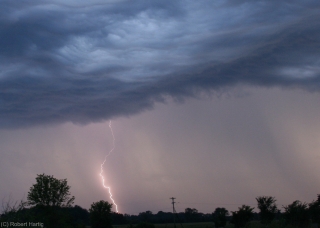
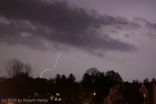
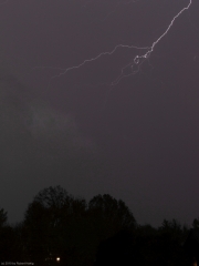
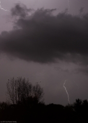
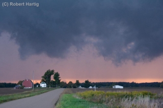
What the heck. I hopped in my car and took off, intent on finding a picturesque sweep of open landscape where I could watch the storm move in. As you can tell from the images on this page, I found one.

The storm was not nearly as formidable as it looks. It provided a nice bit of wind and a brief downpour; mostly, though, it was beautiful and offered a treat for the eyes. The setting sun filtered in low behind the cloud base, shining its rose-colored light through a curtain of rain and illuminating the backsides of gray, steamy towers.

But why am I talking like this? Here, see for yourself. The photos are in sequence; click on them to enlarge them, and enjoy the view.
September 3, 2011, Outflow Boundaries

Yesterday morning my friend Kurt Hulst called to say, “Grab your camera. There’s a great shelf cloud coming your way. It passed my location before I could get a picture.”

Okay, then. My apartment faces east, and all I could see was blue sky. Not even a hint that a storm might be approaching from the west, and usually one gets at least some kind of a clue. But I snatched up my camera and car keys regardless and headed outside.

Yes, there it was–a hazy arcus cloud moving my way from the west and northwest. I hopped in my car, with the intention of finding a better view for taking photographs than my parking lot afforded. But the cloud was moving faster than I realized, and by the time I reached 108th Street, it was almost on top of me. So, with the wind kicking up flurries of leaves in front of me, I headed east, thinking to put a little distance between the shelf cloud and me.

Several miles down the road, I turned north, parked by a buffalo farm, stepped out of my car to get a look, and realized immediately that my cause was lost. The cloud was right overhead. It had to have been moving at least 60 mph. So much for weather photos. Within seconds, I was looking at the backside of the arcus, and it wasn’t particularly photogenic.

For that matter, there wasn’t much to it. No ensuing rain, no lightning, no thunder, no storm at all, just blue skies. I can’t speak for other parts of the country, but here in Michigan it is an odd thing to observe an impressive-looking shelf cloud with absolutely nothing behind it! The cloud evidently had formed as the isolated effect of cold outflow from dissipated storms back in Wisconsin, in conjunction with a closer, severe-warned MCS to the north. Back at home, I could see the outflow boundary arching southwest all the way down into Indiana and moving rapidly east.

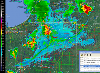
Yesterday seemed to be the day for such phenomenon to be clearly defined on the radar. Later in the afternoon, GR3 showed a similarly highly distinct outflow boundary down in northern Indiana. The source of this one was easy

to see: storms to its northwest and north. It looked pretty vigorous, and I wondered if it was putting on a show similar to what I had witnessed.

As an item of curiosity and an example of a highly defined outflow boundary–I suppose you could call it a runaway gust front–I captured a screen shot. Click on the image to enlarge it.

August 23 Lightning over Caledonia

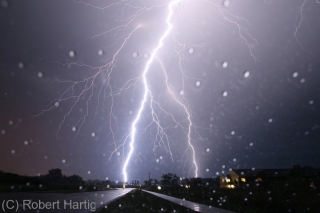
Last night brought a nice electrical display to the Michigan skies, and my little town of Caledonia was smack in the center of the action.

Today looks to present still more possibilities. With a cold front sweeping in to kick up around 3,000 J/kg CAPE in the presence of 45 knots 0-6 km shear and adequate low-level helicity, southern Michigan is outlooked for a 5 percent tornado risk. It had to happen sometime. Looks like today could be play day for my area on toward the southeast part of the state.

But that’s for later this afternoon, and this post is about last night with its lightning extravaganza. I had initially set up shop in a parking on the edge of town off of 100th Street, but when the action appeared to be migrating south of me, I dropped down six miles to Middleville. Eventually I wound up

back in Caledonia just a couple hundred yards from where I had initially positioned myself. That’s where I got the dramatic shot of the big bolt at the top of this post, as well as the rest of the night-time photos.

For that matter, the earlier photos were also taken in Caledonia. The color in those photos is pretty true. I was captivated by the bluish hue and undulating, textured look of the clouds. Really beautiful, and quite something to see.

Low-Topped Supercell Images from Last Wednesday

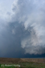
Last Wednesday, May 11, in northwest Kansas was a bust chase as far as tornadoes were concerned. But the prairie sky offers compensations that are blue-ribbon prizes in their own right if you’ve got an eye for beauty.

Here are some shots of a couple of low-topped supercells taken in the Atwood/Oberlin area. These storms dumped some marble-sized hail and exhibited visible, though not strong, rotation. They were lovely to behold, sculptures of moisture shaped by the wind and lit by the light of the waning evening. Atmospheric dramas such as these are the true panorama of the Great Plains. Like a run-on sentence, the treeless landscape stretches off into limitless sameness, leaving the sky to provide punctuation, energy, and color.

Lightning Storm over Caledonia

The day after my October 23 chase out in northwest Missouri and southwest Iowa, thunderstorms blew across West Michigan. Watching the MCS move in on my radar, I decided to try my hand at a few lightning photographs. I had learned a few essential tips since my last attempt, and this looked like a fantastic opportunity to see what kind of a difference they made.

.

The photos shown here were shot from the balcony of my apartment in Caledonia. Click on them to enlarge them. They may not be National Geographic quality, but they’re not bad. Fact is, one of my photos that night was my best lightning shot ever. Unfortunately, I accidentally erased it only minutes after I took it. You could hear my screams of anguish and bonking of my head against the wall all the way to Sam’s Joint.

What you see on this page are just compensation prizes. They’ll do, though. They’re mementos of what was probably the last lightning any of us around here will see this until next spring. Snow is in the forecast a few days hence, and with two months before it officially starts, the long winter is already winding up the mainspring and getting set to unleash.

The Lake Breeze Zone and Severe Weather

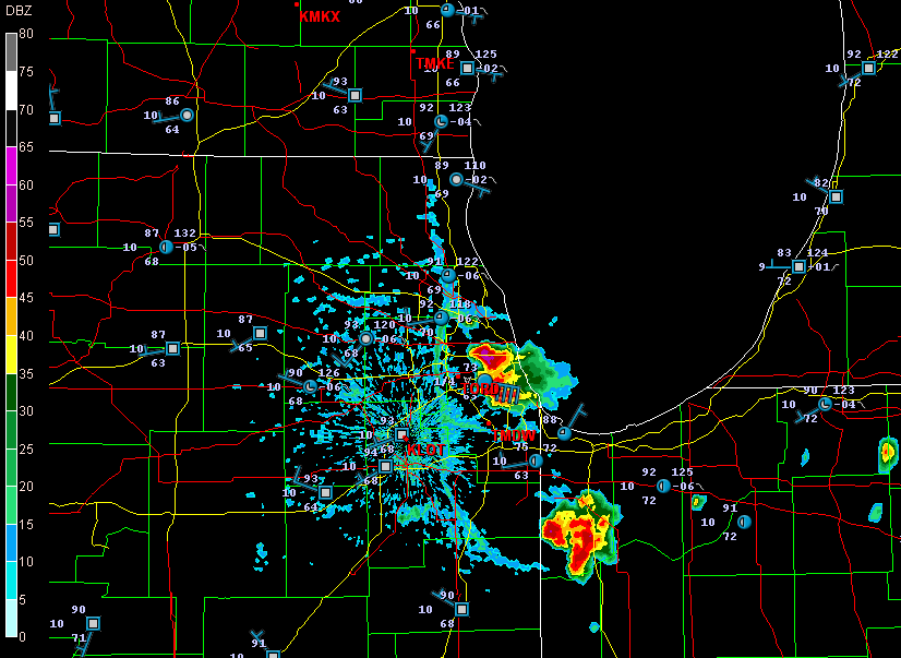
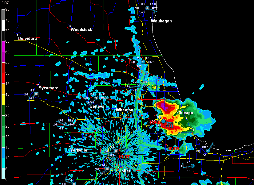
Earlier today, I opened up GR3 just out of curiosity and noticed some blobs of convection along the Lake Michigan shore by Chicago. Here are a couple radar grabs.

lake-breeze

lake-breeze1

These images interest me for several reasons, all of which have to do with a Great Lakes phenomenon called the lake breeze zone. The lake breeze zone is not a fixed area. Its boundaries are atmospheric, not geographic.

And boundaries truly are what it’s all about. Probably the most immediately noticeable feature on these radar images, besides the obvious storms, is the north-south boundary set up by the onshore breeze. It’s a great point of convergence where overall westerly surface winds butt up against backing winds from off the big lake. You can see how outflow from the storms that have fired up within the lake breeze zone interacts with the lake breeze boundary.

Another less immediately obvious by-product of the lake breeze zone is helicity. Notice how the wind barbs farther inland are all westerly, but inside the lake breeze zone, they’re easterly. Now, I’m no expert on this stuff, but I know enough to recognize the potential for localized helicity to occur even when the large-scale flow is unidirectional. During the day, strong thunderstorms can go tornadic when they encounter a backing onshore breeze near Chicago, along the Wisconsin shoreline, and along the Lake Huron and Lake Erie shores of eastern Michigan. The same can happen in the evening along Michigan’s western coast as the land cools and an offshore breeze prevails. Many times I’ve noticed the NAM and RUC showing a small sigtor centerered over Berrien County when there are no sigtors anywhere else in the region, and I’m sure this phenomenon is largely due to the lake breeze in that area.

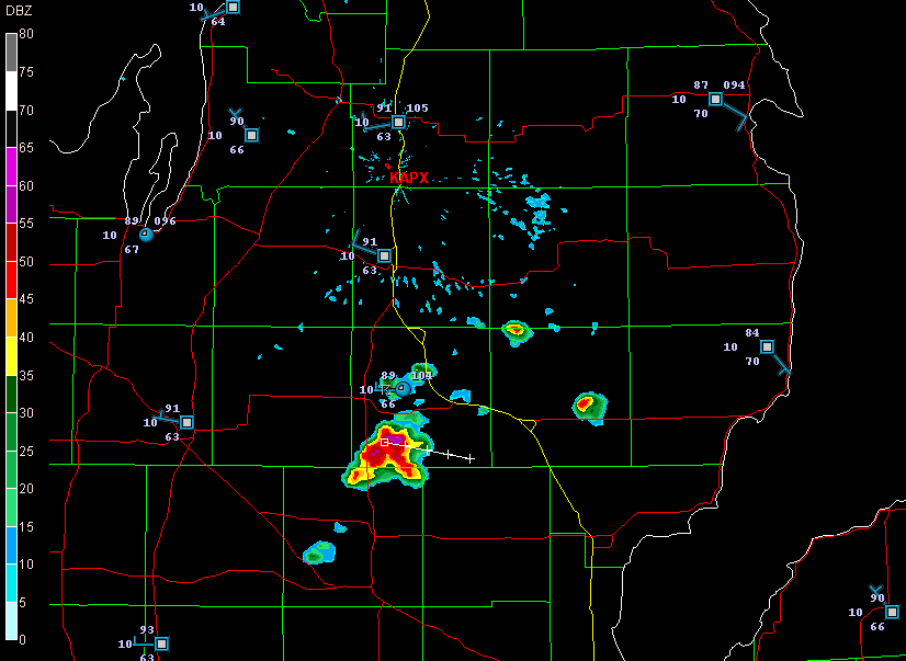
Right now I see storms firing up farther north around Gladwin and Roscommon.

storms

A glance at the Gaylord VWP shows west winds neatly stacked from the surface on up. But look at the METARs along Lake Huron. Without much in the way of bulk shear, the storms are subsevere, just little popcorn cells. But it will nevertheless be interesting to see what comes of them as they work their way into those backed shoreline winds. You just never know.