The 2009 Storm Season: A Good One or a Bad One?

Reading a thread in Stormtrack, I came upon a comment in which the poster briefly griped about how the 2009 storm chasing season had been a lousy one for him. In the post that followed, another member mentioned that it wasn’t fair to blame the weather for one’s personal lack of scalps when the season itself had been pretty solid. The context was lighthearted, though I read enough pointedness to the second comment that it made me stop and think.

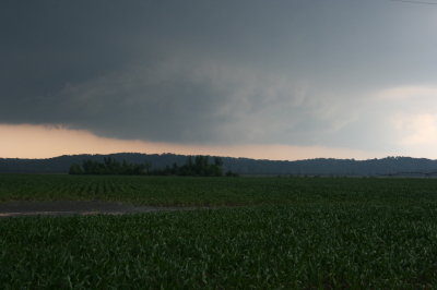
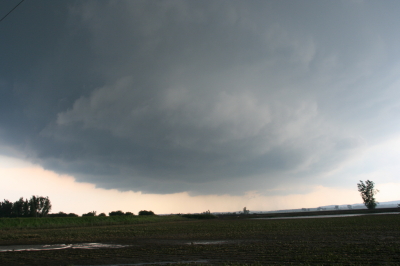
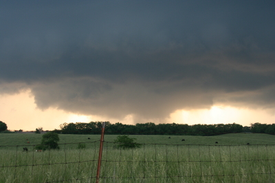
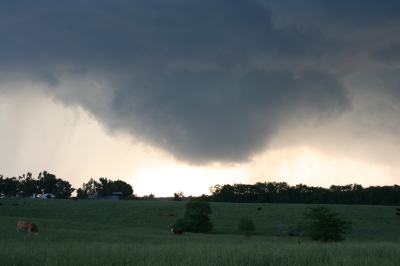
The first commenter never said there weren’t plenty of tornadoes; he just said that he’d had a lousy season. My own season hasn’t been that hot either. For the thousands of miles I’ve driven, I’ve only got one tornado to show for it–at least, one that I’m certain of. Sure, I’ve witnessed some beautiful structure and gotten beaned by some big hail in northwest Missouri, but this year has been nothing like 2008.

Am I blaming the weather? No. Those who were in a position to chase all the slight risk day in the Great Plains, from the southern plains to the Canadian border, had plenty of opportunities and did great. But me, I live in Michigan. Much as I’d like to be out there chasing slight risk days in Kansas, Nebraska, Colorado, and the Dakotas, logistically it’s just not feasible for me to do so. I’ve got a livelihood to earn, and gas and lodging cost money.

Add to that the fact that I made at least one poor judgment call that took me and my buddy south when we should have gone north, and I’ve had what amounts to a mediocre to poor storm chasing season. If I lived in the heart of Tornado Alley, I think I’d have enjoyed a much better one. But where I live, I have things to factor into my chase/don’t chase decisions that wouldn’t be as much of a concern if I lived in, say, Oklahoma City or Topeka, Kansas.

That’s not the weather’s fault. It’s just a matter of geography and personal circumstances. If I were to blame the weather for anything, it would be for putting in a substandard performance so far in the central Great Lakes, an area that never fares as well as the plains states to begin with. But of course, it’s pointless to blame the weather for anything, period. Weather isn’t an ethical entity–it just does what it does, and those of us who chase after it have to make our judgment calls the best we know how.

Living in Michigan, I’d be a fool to go after synoptic setups that I’d be an equal fool to pass up if I lived in Kansas instead. That’s the reality, at least for me, though I think I’m by no means alone.

So no, this hasn’t been a bad season for chase weather, not at all. But if you’re me, it hasn’t been a very good season for getting to much of the action.

Maybe the secondary season this fall will create a few more opportunities. I hope so. Give me another setup like October 18, 2007, and I’ll be a happy man.
Changes Coming to Stormhorn Blog

Greetings, friends and readers of Stormhorn.com!

I want to fill you in on some changes that are in the works for this blog. They’re not here yet, but they are impending, and I anticipate that they will help take the blog, and eventually its parent Stormhorn website, to the next level.

At the moment, the most significant change in the works is a brand-new, custom theme. My lady friend, Lisa, who is absolutely brilliant at website development, online marketing, and all things computer, has been beavering away steadily at the new version. When it is done, this blog will have a new look and much greater versatility. I’m excited about what Lisa has got planned, and I can’t wait to roll it out once it’s ready, see how you like it, and get your feedback.

Concurrent with the new theme, I’ve been thinking about adding an extra element of interest by featuring guest bloggers from time to time. They will be from the worlds of both music and storm chasing. I like the idea of offering you insights and perspectives besides just my own, and I hope that doing so will provide an added value for my readers as well as a positive experience for my contributors.

About my Jazz Improvisation E-BooK: While this project has been on the back burner for a while, I do anticipate picking it back up at some point. I’ve already got several installments written; however,  because I tend to be pretty thorough, each lesson takes me considerable time to develop, and with other more pressing matters to deal with, I just haven’t had time or focus for the e-book. Stay tuned, though, because it is by no means a dead project. As this blog and website continue to develop step by step, I will at some point get the e-book back on track.

So, there you have it: changes are coming to Stormhorn.com, and the first of them is right around the corner. Meanwhile, I’ll continue to post with the existing format, which has served me well thus far. I hope you’ve enjoyed your visits here, and that you’ll enjoy them even more as this blog enters an exciting new phase.

Heading for an Iowa Chase

As I write, I’m heading west down I-80 with my storm chasing buddy Bill Oosterbaan. Our target: Waterloo, Iowa. The 9Z RUC shows a nice convergence of 850 and 500 mb jets overspreading massive CAPE by 21Z, with a robust 200 mb jet nosing in. Progged surface winds could be better, but skew-Ts still show nice veering with height, and storm relative inflow is majorly backed.

Oh, yeah…and we’re looking at dewpoints of 75 degrees and higher, with dewpoint depressions around 5 degrees. LCLs should be so low we may have to tunnel underground to find the cloud bases.

The SPC has hatched out this area for tornadoes. No surprise. After a relatively modest season, we may be on the verge of a significant outbreak. It’s a bit sobering to think that Parkersburg, Iowa, could get slammed again. I expect we’ll see a PDS statement at some point today, and I wonder whether the outlook won’t get bumped from a moderate risk to a high risk as well.

Tomorrow also looks to be a hugely active day, and the latest SREF places a sigtor in Michigan. So stay tuned. I’m sure there will be more to come.

June 8: Mini-Supercell in Northern Illinois and Severe Squall Line on the Lake Michigan Shoreline

This is really part two of the previous post. After chasing a potent, monster hailer of a supercell north of Saint Joseph, Missouri, I overnighted at a hotel outside of Des Moines, Iowa. When I stepped outside the next morning, the air was much cooler and drier, a stable atmosphere that wouldn’t produce so much as a sneeze, let alone a tornado.

But I knew that the SPC had outlooked the area to my east across northern Illinois, and for several days I myself had been eyeballing my home state of Michigan, where the NAM-WRF had been consistently indicating the possibility of tornadoes. With a little luck, I hoped to make it back in time to chase whatever convection might pop up along the warm front.

As I approached Davenport, I observed  towering cumulus muscling up through the troposphere. However, I didn’t pay them any attention–that is, until Bill Oosterbaan called to inform me that the SPC had just issued a mesoscale discussion for the area just east of me. Even as we talked, I noticed a lowering on a cumulus tower a mile or two to my northeast. When it continued to develop, I decided to investigate. Leaving I-80, I parked across from a truck stop at the Atkinson exit to watch.

The next cell to my west quickly grabbed my attention. It had a nice rain-free base, and as I watched, scud began to form and ascend in an obvious updraft, coalescing into a small, ragged wall cloud. Grabbing my camera and getting out of my car, I noticed right away that the air was very different from back in Des Moines–considerably warmer and with plenty of moisture. The wall cloud fell apart before I could get a pic, but the overall structure remained interesting.

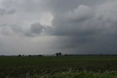
A mini-supercell approaches Atkinson, Illinois, just north of I-80.

A mini-supercell approaches Atkinson, Illinois, just north of I-80.

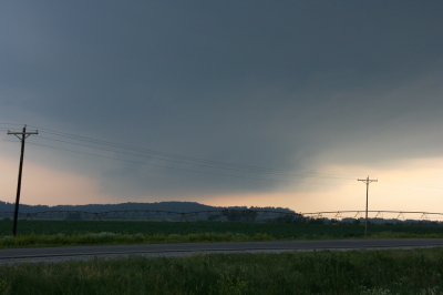
More brief, non-rotating wall clouds formed and dissipated one by one, so I figured I’d head north of town and observe. With surface winds veering and the overall flow unidirectional, I had no expectation of seeing tornadoes, but the mini-supercell made for some fun and interesting viewing.

Ragged, non-rotating wall cloud.

Ragged, non-rotating wall cloud.

Distant wall cloud and back side of main updraft tower.

Distant wall cloud and glimpse of updraft tower.

I was tempted to follow the storm, but decided it was a red herring. If at all possible, I wanted to make it back to Michigan in enough time to chase the setup there, and that left me no time to play around on the western Illinois backroads. So I headed back to I-80 and busted east.

The first Michigan supercell fired up earlier than I’d hoped, and I bit my lip as I followed its progress on GR3 and watched it hit Lansing. If only I had driven east last night for two more hours, or left in the morning two hours earlier… But the previous day’s chase had left me exhausted. And you know, one of the downsides of being a Michigan-based storm chaser is, you just don’t have very high expectations when it comes to your home state. I mean, it’s Michigan. Home of convective table scraps, squall lines, and embedded supercells that don’t produce squat.

As it was, I watched several more storms fire up and develop rotation along the warm front that stretched across mid-Michigan. I was making decent progress and still had hopes of catching up with some of the southernmost cells. But by the time I crossed the state line, the action all had shifted well to the east, and it became clear that I wasn’t going to see any of it.

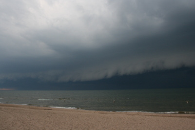
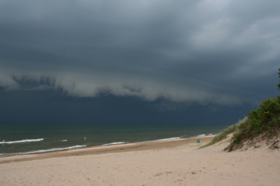
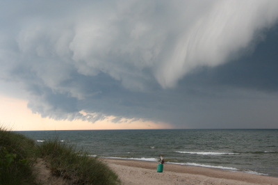
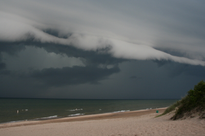
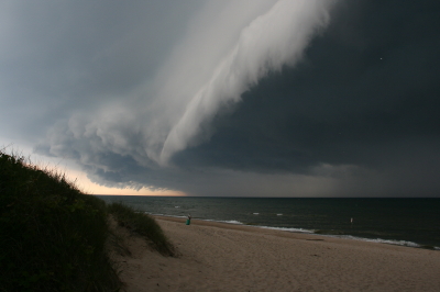
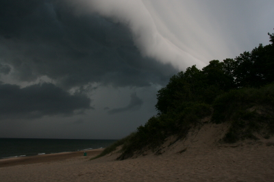
Instead, taking fellow chaser Mike Kovalchick’s suggestion, I headed toward the lakeshore at Allegan Beach to intercept a short but potent squall line. I’m glad I did. The backdrop of Lake Michigan and its dunescapes lends a breathtaking drama to incoming storms. The following photos depict the progress of the arcus cloud moving in across the waters. What these images can’t convey is the full, awe-inspiring sweep of cloud, big lake, and shoreline; of the solemn foreboding of some great event about to unleash itself upon a landscape cloaked in storm shadow; of the shelf cloud moving silently overhead like the furrowed eyebrow of a dark, scowling giant; and of sand spray blowing and trees thrashing in the wind as the gust front arrived.

I’ll let the photos tell their story as best they can, and leave the rest to your imagination.

An arcus cloud advances toward the Lake Michigan shoreline at Allegan Beach.

An arcus cloud advances toward the Lake Michigan shoreline at Allegan Beach.

View to the north.

View to the north.

Looking south...the storm closes in.

Looking south...the storm closes in.

Looking north...closer still.

Looking north...closer still.

Almost overhead.

Almost overhead.

One last shot to the north, then it's time to make a dash for the car.

One last shot to the north, then it's time to make a dash for the car.

June 7 Northwest Missouri Supercell

Now that I’ve had a chance to rest up and catch up after Sunday’s chase in northwest Missouri, it’s time to do a writeup. I’ll summarize by saying that there were no tornadoes, but there was some great structure along with hail the size and disposition of wild boars.

My plan was to hook up with Bill, Kurt, and Tom, who had headed west a day ahead of me in anticipation of chaseworthy storms. Unfortunately, a stout cap quashed an otherwise potent setup, and the guys–along with lots of other storm chasers–endured a blue sky bust. Like I told Bill, they needed me out there with them to erode the lid for them.

I left around 10:00 Saturday night and drove as far as Davenport, Iowa, where I overnighted. The next day, I hightailed it for Topeka, Kansas. Bad route choices delayed my arrival, and storms had already initiated by the time I got within the vicinity. But that actually simplified my choice. Rather than heading into Kansas, I worked my way north of Saint Joseph, Missouri, along I-29, then hit the backroads to intercept a supercell that was making its way across the border near Rulo, Kansas.

Parking my car outside of Big Lake, Missouri, I set up shop and got some nice photos as the storm moved in. The base was lowering and developing a rotating wall cloud. Here is what the storm looked like when I took my first shot.

Wall Cloud at Big Lake, Missouri, June 7, 2009

Wall cloud at Big Lake, Missouri, June 7, 2009.

The cloud was southwest of me and moving eastward, which meant that I could expect plenty of rain and probably a good clobbering by hail. In a little while, sure enough, golfballs began to fall all around me. No rain, just sizeable hail. The cloud at this point was directly to my south and looked like this:

Wall cloud passing to the south.

Wall cloud passing to the south.

It was time to vamoose, and none too soon. The advance guard of a veritable armada of storm chasers was driving by. I pulled in behind the DOW (Doppler On Wheels) and other Vortex 2 vehicles and followed them toward Forest City. By the time I reached SR111 and began heading south, I had pulled ahead of the circulation. I wanted a few photos of the wall cloud advancing directly toward me, so I found a place to pull aside. Opening the car door, I stepped out into some ripping inflow and snapped a few shots.

Wall cloud approaching SR 111 north of Forest City.

Wall cloud approaching SR 111 north of Forest City.

I missed the really big, gorilla hail that some chasers encounterd, but the occasional baseball size was big enough for me. Somehow I escaped getting hit by the larger chunks, though one of them hit my roof squarely with a loud whack. I still haven’t checked to see whether there’s a dent.

Eventually I caught up with the guys at the I-29 overpass, where a zillion other chasers were also parked. Seems like everybody and his dog’s first cousin was on this storm. If I ever get rich enough to purchase a dedicated chasemobile, it won’t be an SUV or a TIV-style monstrosity. It’ll be a concession van with a fold-out bar.

Anyway, Bill, Tom, and Kurt forged ahead and I followed them for a ways, but eventually opted for a more southern route when they headed north toward Union Star. I figured they’d be hitting heavy precip and probably some nasty hail, and I wanted to stay on the south edge of the updraft, which was heading east by southeast. Here are a couple photos from what was, from my vantage point, one of the more promising episodes in the life of the storm.

Wall cloud with clear slot wrapping in.

Wall cloud with clear slot wrapping in.

Possible funnel cloud trying to develop.

Possible funnel cloud trying to develop.

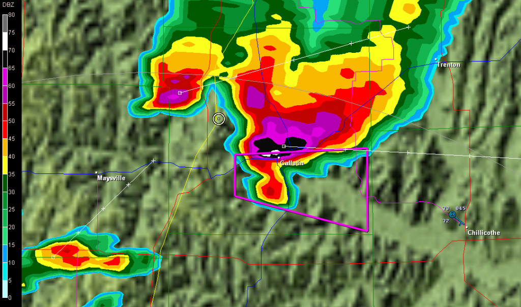
I believe the above shots were taken near Amity. From there, I headed east through Maysville and Weatherby, and across I-35 to just west of Altamont. There, I decided to end the chase and start heading home. The storm at that point was heading into Gallatin and was showing one of the best reflectivity echoes of its career on GR3.

Base reflectivity showing tornado-warned storm approaching Gallatin.

Base reflectivity showing tornado-warned storm approaching Gallatin.

But darkness was closing in, and I had no desire to chase this storm at night through the hinterlands of northwest Missouri. At that point, I was thinking about overnighting in Des Moines, and I had miles to go before I slept.

Getting a New Laptop

Last week my four-year-old laptop dissolved into a screenful of horizontal lines. It had been acting squirrely, and with the help and guidance of my ladyfriend Lisa, who is an absolute genius with computers and software, I had already had it partially apart for an inspection. It rewarded our efforts with a total freakout.

A day later, Lisa had the problem fixed. The laptop now seems to be behaving itself, at least so far. The problem may have been mismatched memory cards. Lisa removed one of the cards, and that may have done the trick. We’ll see. I’ve already seen the laptop behave itself beautifully for day after day on previous occasions, only to suddenly start behaving like it’s on drugs for no discernible reason. Sad to say, I just don’t trust it, nor does Lisa. And obviously, whether I’m writing copy for clients on the road or chasing storms, I’ve got to have a laptop I can depend on. It’s part of my livelihood as well as my safety net.

So I finally knuckled under and bought a Dell Latitude. And while I was at it, I bought the extra-tough E6400 ATG. That oughta last me for a while. Shock-resistant. Dust resistant. Moisture resistant. Faster than greased lightning on ExLax. And, I might add, pricey. But if it lasts me five years, I’ll be happy, and it sounds like it ought to.

Meanwhile, if it turns out that the mismatched memory chips were in fact the culprit, and that my old laptop behaves itself from here on, then it should serve as a great backup.

I hate to spend so much money for this new machine. But I’d hate even more to have my radar suddenly break up into a bunch of lines while I’m chasing a tornadic supercell in Kansas. And I have a feeling that this new laptop is going to be a dream. So I guess it’s money well spent. I can’t wait to find out.

Jazz and Storm Chasing: Facing the Trade-Offs

And so it begins in earnest. The 2009 Tornado Alley storm chasing season, that is. Me droogs Bill and Tom left today to chase this weekend’s opening action in Iowa, en route to the main play in the Oklahoma/Texas panhandle region. I couldn’t join them as I’ve got a couple of commitments, including a gig with Francesca Amari tomorrow night plus a search for new living accommodations.

Today’s setup out in Iowa was such that I did’t feel too much like I was missing out on something. The storms have turned out to be massive hail producers (LSR from five miles southwest of Greene: “All hail…very little rain falling”), but not a single tornado report have I seen, not in Iowa, not in Wisconsin, not in the entire CONUS.

Tomorrow and Sunday look to be a different matter, though, and I wish like anything I could be out there with the guys watching tubes drop. But as I’ve said, I’ve got commitments.

It’s funny how my two great passions–playing jazz and chasing storms–can conflict. But that’s how it is. You can’t chase storms when you’re on a gig, though ironically, sometimes the storms have come along and canceled the gig. Three years in a row, I got hailed out at the annual Grand Rapids Festival of the Arts. It doesn’t seem to matter who I’m playing with. I’m a freeking hail magnet, and in June or July, you book me for an outdoor event at your peril.

This year, I’ve actually adopted a policy of not accepting any gigs during the peak storm chasing months of May and June. That’s the time of year when the storm chaser in me outweighs the jazz musician. Tornado weather is seasonal in a way that jazz isn’t. Once those mid-levels heat up and the steep lapse rates of spring give way to summertime’s Cap of Doom, that’s all she wrote. I don’t have the time or money to chase the Canadian prairies. So I’ve got to grab my storm action when it’s prime time. This year, I hope to spend ten days or so in mid to late May out in Tornado Alley. I am looking forward to it so much I can practically taste it!

Meanwhile, Bill and Tom are out there headed for Oklahoma without me. Sniff! Ah, well. I hope those dirty dogs get skunked. No, wait…what I mean is, I hope my buddies see some really great tornadoes and get all kinds of cool footage that they can show me when they get back, causing me to grin in maniacal delight while dying inside.

Okay, let’s try that one more time. The compensation for not chasing is getting to do a gig at One Trick Pony in downtown Grand Rapids with Francesca, Dave, Wright, and Tommie–some truly fine musicians whom I absolutely love to play with. A Saturday night spent playing my sax is a Saturday night well spent, and I can’t wait to hit the stage with Francesca and Friends. If you happen to be in the vicinity, please drop on down to the Pony and give us a listen. You’ll like what you hear. The show starts at 8:00 and continues till 11:00.  Hope to see you there!

Highlights of the 1965 Palm Sunday Tornado Memorial in Bristol, Indiana

Yesterday I made the drive to the Elkhart County Historical Museum in Bristol, Indiana, to attend the forty-fourth memorial observance of the 1965 Palm Sunday Tornadoes. The occasion may have been low-key, but it was nevertheless remarkable. A couple of the factors that made it so were purely personal. I finally got to meet my long-distance friend and owner of the Tornado Memorial Park in nearby Dunlap, Debbie Watters. We’ve connected so well across the miles via email that when we finally got to talk person to person, it was as natural as if we’d hung out together forever. It was a double pleasure to meet her daughter and husband as well.

Then there was my other “tornado lady” friend, Pat McIntosh, who attended the meeting with her brother, John. What a sweetie! The three of us caught dinner afterward near Middlebury.

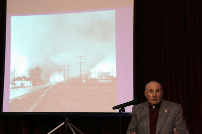
The stories and memories were amazing, and some quite touching and emotional. One huge highlight for me is captured in the photos below. In the first photo, the image shown on the projector screen depicts the notorious twin funnels that swept through the Midway Trailer Park south of Dunlap, Indiana. The image is one of the most famous tornado photographs ever taken, and the man standing next to it is the person who took it, retired Elkhart Truth newspaper photographer Paul Huffman.

Paul Huffman stands next to a projection of his Pulitzer Award-winning photo of the Midway twin funnels.

Paul Huffman stands next to a projection of his Pulitzer Award-winning photo of the Midway twin funnels.

Paul and his wife were traveling north on US 33 shortly after 6:00 p.m. on April 11, 1965, when they spotted the tornado moving in from the southwest. Stopping the car, Paul grabbed his camera and snapped a series of six dramatic photographs as the tornado morphed from a narrow funnel into the two-legged monster that devastated the hapless trailer court, then moved off to the northeast in a cloak of rain.

How fast was the tornado moving, I wanted to know. Fast, Paul said. Probably seventy miles an hour. How close was he, someone else asked. Around a quarter-mile. Were he and his wife at all close to the debris? An ironic smile. Yes, his wife replied, the two of them experienced some debris falling around them. Would a flattened automobile qualify?

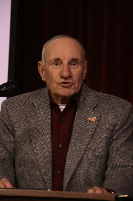
Paul Huffman speaks at the 2008 memorial observation of the 1965 Palm Sunday Tornadoes.

Paul Huffman speaks at the 2008 memorial observance of the 1965 Palm Sunday Tornadoes.

One powerful moment occurred after the event had officially ended and people were milling around the tables full of memorabilia. My friend Pat was showing me a photo Paul had taken during rescue operations at the trailer court. In the photo was a young Pat, laying on a stretcher. Over her hovered her husband, Bill. To the right stood a fireman.

As we looked at the photo, an elderly gentleman standing nearby named Dwight Kime said, “That fireman was my brother-in-law.” Dwight himself had been one of the rescue workers. As it turned out, he was the one who found Pat and Bill’s baby, Chris, amid the rubble–one of the youngest of the ten fatalities in the trailer court. Dwight was visibly moved as he came to understand that Pat had been the child’s mother. It has been forty-four years since that terrible evening, but the memories–and the hidden sadness–never fade. I am glad that Pat’s little boy was found and cared for in death by such a tenderhearted man as Dwight Kime. And I am just as glad that, after all these years, he and Pat got to meet and talk at last. That is God’s grace.

Elkhart County Historical Museum Remembers the 1965 Palm Sunday Tornadoes

My friend Debbie Watters, prorieter of the 1965 Palm Sunday Tornado Memorial Park in Dunlap, Indiana, sent me the following article from the Elkhart Truth newspaper:

It’s been almost 44 years since the Palm Sunday tornado tore through Elkhart County, killing dozens and injuring hundreds. It will be the focus of a special program at a local museum.
The Elkhart County Historical Museum is organizing a remembrance of the April 11, 1965, di saster. The memorial will be from 2 to 4 p.m. April 5 at the museum, 304. W. Vistula, Bristol.
Nicholas Hoffman, director and curator of the museum, said the tornado is an important part of local history.
“It was a really big occurrence that impacted many people,” Hoffman said.
Patrick Murphy, a meteorologist from the National Oceanic and Atmospheric Association, will talk about how tornadoes form and the factors that led to the 1965 tornado outbreak that spawned 40 tornadoes across the Midwest and left 271 people dead.
“We’re really excited to have NOAA participating in this event with us because they’re certainly the experts on these events,” Hoffman said.
A panel of survivors of the Palm Sunday tornado will take questions after Murphy’s presentation.
The panel will include John Clark, a retired Elkhart police officer, and Paul Huffman, the retired Elkhart Truth photographer who snapped the famous photo of the twin twisters.
“[Huffman] captured the horror of that day with one photograph,” said the curator.
There will be an open microphone portion for anyone interested in talking about the disaster.
The museum will also provide table space for collectors to display items they found in the wake of the tornado.
For more information call the museum at 848-4322.
Of course I plan on attending. My interest in the Palm Sunday Tornadoes extends back to my childhood, and in recent months it has become an area of increasing research. I am particularly excited to learn that Paul Huffman–whose photograph of the twin funnels striking the Midway Trailer Court, remains one of the most dramatic, all-time classic tornado photos ever taken–will be one of the panelists. That’s just my opinion, but I think that many severe weather meteorologists, tornado historians, and storm chasers will agree. Over the years I have viewed hundreds of tornado photos. I have seen some incredible images, ranging from the sublime to the scary, but nothing quite like that old black-and-white snapped over forty years ago by a young press photographer as he stood in the inbounds with his camera just a few hundred yards from mayhem, witnessing the last moments of a community.
I hope to get a chance to talk with Mr. Huffman. I also look forward to meeting Pat Murphy, lead forecaster for the Northern Indiana NWS. He and I have connected previously concerning the Palm Sunday Tornadoes, and have made plans to get together next week Sunday, April 11–the 44th anniversary of the outbreak–to trace the paths of some of the twisters. But that’s a separate story, and while this is an area of personal fascination for me, there’s also another, parallel motive which I’m hesitant to divulge just yet.
Stay tuned, though. You’ll be reading more about the 1965 Palm Sunday Tornadoes in this blog.
And on that note, I invite you to leave a comment if you experienced the Palm Sunday Tornadoes firsthand. If you are a storm survivor, or if you possess personal, unpublished photographs or old film footage of one of the actual tornadoes, I would love to hear from you.

WHOOPS!!! Growing Pains!

Guess what? I downloaded the latest WordPress upgrade (v. 2.7.1), and my header graphics disappeared. Poof!–like magic. Aaaall gone. The default header replaced the artsy design that Mitch and Karina had created for me, and the standard Kubrick theme now dominates.

I had actually planned to do a little theme shopping, but I delayed doing so for fear of encountering exactly this problem. I actually like the overall appearance better than what I had–but I want my old header graphics and photo back! So if the new look throws you, be assured it’s temporary, and will last only until I can get the old header and photo restored.