I’m not going to try to be particularly clever in writing this post. Instead, I’m going to throw a bunch of weather maps and a few soundings at you and let them tell the story.
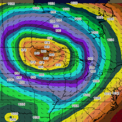
I will say that the weather system that is shaping up for late tonight on into Wednesday for the Great Lakes has the potential to be of historic proportions. In terms of sea level pressure, I’ve seen a number of comparisons to the great Armistice Day Storm of November 11, 1940. However, there are two significant differences: this storm is a bit earlier in the year, and the forecast pressure has been consistently and significantly deeper. The Armistice Day storm dropped to 979 millibars; this one may be in the 960s. In other words, we may see a record-setting barometric pressure with this system.
The bottom line is, this thing will be a wind machine like few we’ve ever seen. Here’s the current forecast discussion from the weather forecast office in Grand Rapids, Michigan.
LOW PRESSURE IN THE SOUTHERN PLAINS WILL RACE NWD AND PHASE WITH A
LOW OVER THE DAKOTAS AND RAPIDLY DEEPEN AS THE UPPER TROUGH DIGS
ACROSS THE UPPER MS VALLEY. THIS WILL LEAD TO VERY STRONG DYNAMICS
ALONG THE TRAILING COLD FRONT LATE TONIGHT. EXPECT STRONG TO SEVERE
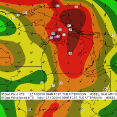
STORMS TO DEVELOP ALONG THE FRONT AND RACE EAST. A 70KT LLJ AND
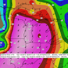
115KTS AT H5 INDICATE IT WON/T TAKE MUCH TO GET SVR WINDS WITH THIS
LINE OF STORMS LATE TONIGHT. A VERY STRONG PRESSURE COUPLET...ON THE
ORDER OF 6MB/3 HRS WILL FOLLOW THE COLD FRONT. THIS WILL LEAD TO
STRONG WINDS DEVELOPING BEHIND THE FRONT. BUFKIT WIND PROFILES SHOW
MIXING INTO THE 55-60KT LAYER AT 2K FT. IT IS LOOKING INCREASINGLY
LIKELY THAT WE/LL SEE SUSTAINED WINDS AROUND 35 MPH AND WIND GUSTS
OVER 50...AND CLOSER TO 60 ALONG THE LAKE SHORE. AS SUCH WE EXPANDED
THE HIGH WIND WATCH TO COVER THE ENTIRE CWA.

WINDS WILL DECREASE TUESDAY NIGHT AS MIXING WANES...BUT WILL
INCREASE CONSIDERABLY AGAIN WEDNESDAY. THIS IS A SLOW MOVING STORM
THAT WILL RESULT IN A PROLONGED WIND EVENT FOR THE CWA.
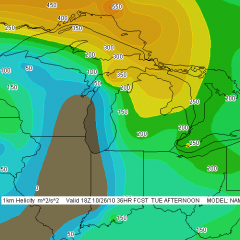
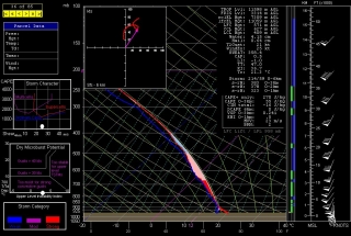
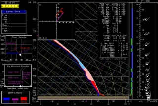
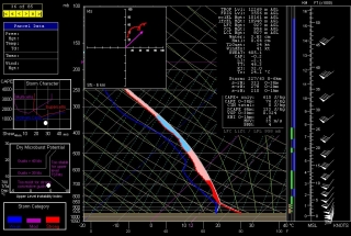
I’m not going to add a lot to that, but I do want to mention the possibility of tornadoes during a brief window of time. Hodographs preceding the front curve nicely, with 1 km storm-relative helicity exceeding 300 showing on this morning’s 6Z NAM sounding for Grand Rapids at 17Z tomorrow afternoon. If enough instability develops–and with winds like the ones we’re looking at, it won’t take much–then we could certainly see some spin-ups as the squall line blows through. And if there’s enough clearing to allow discrete storms to fire ahead of the front, chances for tornadoes increase all the more.
With storms rocketing along to the northeast at over 60 miles an hour, the thought of chasing them is laughable. Anyone out to intercept them will have to watch the radar, position as strategically as possible, and then hope for the best. Serendipity will be the name of the game. That game could begin as early as noon here in Michigan, and it looks to be over before 5:00 p.m.
Not the wind, though. That’ll be hanging around for a while. Batten down the hatches, campers–we are in for one heck of a blast.
Without further ado, here are some weather maps and NAM forecast soundings from this morning’s 6Z run. Click on the images to enlarge them. Just look at that surface low! Pretty jaw-dropping, I’d say.
Forecast maps for 18Z Tuesday, October 26, 2010
Soundings
Grand Rapids, MI (forecast hour 17Z)
South Bend, IN (forecast hour 16Z)
Muncie, IN (forecast hour 17Z)
