The Action Comes to Michigan

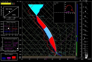
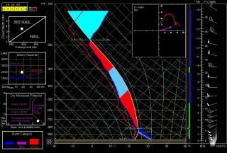
Curious about the SPC’s Day 2 convective outlook for Michigan, I ran a few forecast soundings. Good grief! I can’t remember when I’ve seen skew-Ts like these in Michigan. The one for Cadillac reminds me of June 5, 2010, in central Illinois, though I think the winds above 500 mbs were stronger in that event.

It’s late and I’m not about to write a lot. But I have a strong hunch that tomorrow early afternoon I’m going to be heading north on US 131. It’s rough chasing in that part of Michigan, but anywhere in this state is challenging, and we don’t see this kind of setup very often.
March 12, 2012, West Michigan Supercell

Well, what do you know! My purely speculative ruminations a few days ago on some possible upcoming severe weather materialized. The NAM, which was odd-man-out among the various forecast models, proved in the end to have the best handle on today’s setup in terms of moisture and instability. Those mid-50s dewpoints it kept promising actually showed up–I took a read of over 56 degrees in Portage on my Kestrel–and so did sufficient instability, courtesy of clearing that allowed the sun to work its mojo over West Michigan.

Here was the setup, in brief:

• A mid-level low over Wisconsin directing southwesterly upper flow over Michigan.

• Diffluence overspreading the lower part of the state.

• A 70-knot 500 mb jet max nuzzling into the area.

• Below it, 45-knot 850 mb winds continuing to strengthen.

• A clear slot moving in from Illinois, breaking up the overcast from earlier storms into a nice cumulus field with room for decent insolation.

• From those same earlier storms, wet ground that contributed to the boundary-layer moisture.

• Adequate instability. From the afternoon’s SPC mesoscale graphics, it looks like we saw upwards of 500 J/kg MLCAPE–in the early spring, sufficient to get the job done.

• Low-level helicity in the order of 200-250 m2/s2–easily enough for tornadoes, though none were reported.

I expected to leave my place in Caledonia and head south toward Kalamazoo around 3:00 p.m. However, clearing was moving into southwest Michigan so rapidly, with an attendant, juicy-looking cumulus field, that at 1:30 I could no longer sit still. I grabbed my gear, gassed up and Rain-Xed up, and hit the road.

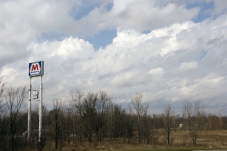
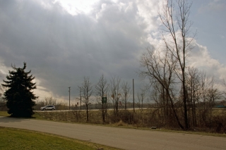
At the Marathon station on US-131 and 100th Street, I snapped a couple photos of the clouds while I waited for Tom Oosterbaan to arrive. In the topmost image, you can see how much shear was messing with the enhanced cumuli.

Once Tom arrived, we headed down US-131 toward Kalamazoo. On Center Avenue in Portage, south of I-94, we hooked up with Tom’s brother, Bill, and Dave Diehl. The four of us sat and waited, watching little storms on the radar pop along the lakeshore and head northeast and larger ones march across Grand Rapids and farther north.

Eventually, a vigorous cell that was moving in from around Benton Harbor continued to strengthen as it pulled closer to PawPaw. Cloud tops on this guy shot up rapidly as it moved toward us, and it began to take on that telltale supercellular look. This was our baby.

Bill took off west to intercept it directly in PawPaw. Tom and I headed north back up US-131, then caught M-43 west toward Bangor. A few miles down, a turbulent updraft base came into view. It was moving our way fast, and we decided that the better approach would be to jet back to 131, head north, and catch the storm as it approached and crossed the highway.

WOOD TV8 contacted me before we hit the exit ramp, and with my live stream going, a live phone-in underway, and an optimal view of a robust-looking wall cloud with a rather impressive tail cloud advancing from my west, pulling over onto the shoulder of the ramp seemed like my best move at that point. I did, and from what I hear, the live stream turned out really nicely on television.

As the wall cloud drew nearer, I took off once again, and we drew near to its southern edge as it crossed the highway, attended by a precip-filled RFD notch starting to wrap around it.

The storm was tearing along, and as it moved off to the northeast, I had a hunch that our day was over. We tried hard to catch up with the storm again, but it was moving too fast. Bill, on the other hand, had repositioned well off to the east and was in a prime location to intercept it. He did, and followed it a long way east. How he managed to keep up with it during its course through rural Barry County, which is some of the most unchaseable terrain imaginable, I’ll never know. (Actually, I probably do know–I’ve been on a lot of chases with Bill–but I ain’t divulging his secret, not me.)

After flirting briefly with another cell that blew toward us from Plainwell, Tom and I headed back toward 100th Street, where I dropped him off at his vehicle and then headed home.

This was a fun little local chase–less than 200 miles and nothing spectacular, but full of interest and a really nice way to kick off the spring storm season in West Michigan. Just for grins, here is a brief video clip of the wall cloud as it passed over US-131.