Highway Work during Tornado Watches and Warnings

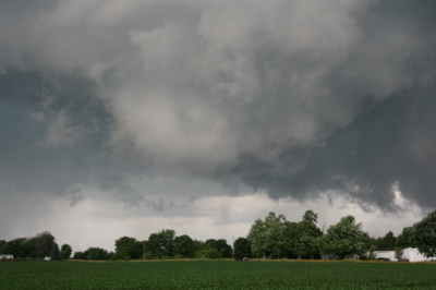
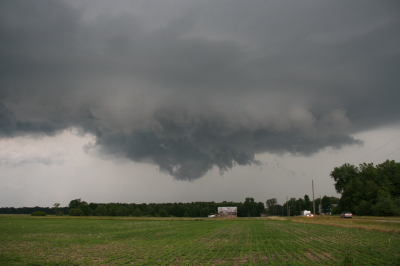
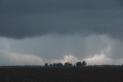
Last Sunday, April 10, 2011, while chasing storms across central Wisconsin on a moderate risk day, my three teammates and I found ourselves stranded in a traffic bottleneck on eastbound I-90 just west of Oakdale. Ordinarily I would have viewed the situation as merely an inconvenience, but with a tornado-warned supercell bearing down on us, and with the radar showing pronounced rotation making a beeline for our location, the matter elicited somewhat greater concern. We could see what appeared to be the mesocyclone advancing over the hilltops. But we couldn’t do a thing about it, nor could any of the several hundred other vehicles that were backed up for a mile or two in both directions, courtesy of the Wisconsin Department of Transportation.

Fortunately, nothing tragic happened. But it could have. The storm wasn’t merely Doppler-warned–it produced a number of tornadoes. We encountered some of its handiwork later on in Arkdale, consisting of a good quarter-mile-wide swath of shredded trees and badly damaged houses. Had the storm gone tornadic a few miles prior, it would have gobbled up helpless motorists like a giant Pac Man in an M&M plant.

What highway department contractor made the outrageous decision to hold up traffic in a way that put hundreds of people directly in harm’s way with no escape? The storms didn’t form in an information vacuum. Three days prior, the Storm Prediction Center had already outlooked the area as a moderate risk. Forecasters had been consistently harping about the possibility of strong, long-lived tornadoes. The weather was hardly a surprise that caught road repair team leaders unaware. So my inevitable conclusion is that some boneheaded foreman was so hell-bent on getting the job done at all costs that he or she willfully exposed hundreds of drivers to a potentially deadly weather event.

Such action is worse than irresponsible; it borders on criminal. I do not want the highway department making dispassionate decisions that risk my life and a multitude of others on behalf of a DOT schedule. How much time would have been lost rather than saved had the worst happened and the focus shifted from road work to emergency response? With scores of crumpled vehicles strewn along the highway and scattered across the field, how would the Department of Transportation have explained a common-sense-be-damned approach that resulted in multiple deaths and injuries?

The incident I’ve cited is just one of innumerable highway closures that occur all across the Midwest due to road work that continues despite tornado watches and warnings. It’s not the first time I’ve encountered the practice, just the most infuriating, and yes, the scariest because of the immediacy of the storm. I doubt anything I say here is going to change the mindset responsible for such scenarios, but it deserves to be called out for its life-endangering lunacy, and this is as good a place as any to do so. It’s my blog, and right now I feel like using it to rant.

WisDOT, what on earth were you thinking, assuming that you were thinking at all? Get a clue: Public safety trumps your deadlines. Evidently someone in your ranks felt differently last Sunday, choosing to put hundreds of motorists in jeopardy rather than suspend road work on account of a tornado warning. Does that kind of decision accurately reflect your policy? If so, then those of you in charge ought to be flogged at noon in the middle of the town square.

However, a more constructive alternative would be for you to re-examine your guidelines for road work during severe weather, and to make whatever changes are necessary in order to put the public’s interests ahead of your own.
June 19 Central Illinois and Indiana Storm Chase

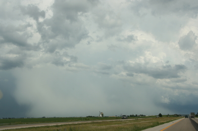
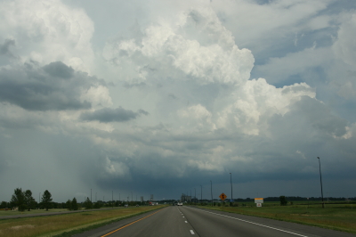
Approaching our storm from the north near Normal, Illinois.

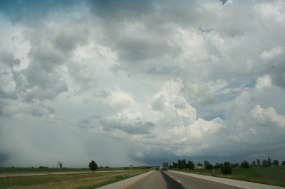
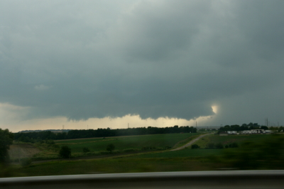
Approaching the storm of the day south of Normal, Illinois.

After Iowa’s blue-sky bust on June 18, yesterday provided some welcome and much-needed activity. Between illness and May’s ridge of steel, my chase expeditions this year have been limited. The Edina, Missouri, tornado of May 13 has been my only tornado to date for 2009. Yesterday did nothing to improve that statistic, but it did offer a vigorous, classic supercell with some great structure that ensured my 1,650-mile, two-day chase with my buddy Bill Oosterbaan wasn’t a complete washout.

For that matter, storms did finally fire in eastern Iowa, and while Bill and I were too late to catch the big mutha that slammed Prairie du Chien (Ben Holcomb, if you happen to read this, great job on tracking that beast into the hills and jungles of Wisconsin!), we did manage to latch onto the one that followed in its footsteps. But I’m no fan of night time chasing and neither is Bill, and knowing the kind of topography that lay to our east once we crossed the river, we dropped our chase at Prairie du Chien and found ourselves a hotel.

After a decent breakfast yesterday morning, we were on the road by noon and headed south. The SPC showed a moderate risk for a large area extending from Iowa and Missouri east across the corn belt and Great Lakes. With a continuation of yesterday’s huge CAPE and good bulk shear, a widespread severe weather outbreak seemed like a sure bet. However, veering surface winds and unidirectional flow seemed to put the kibosh on chances for tornadoes in all but a few areas to the east, where helicities improved, particularly around 21Z.

As we approached Davenport, Iowa, heading south, we could see towers muscling up along an east-west boundary that transected Illinois south of the I-80 corridor. Catching I-80 east, we could see new cells firing up farther to the south on GR3. With a Kankakee target in the back of our minds, we decided to drop toward Normal on I-39.

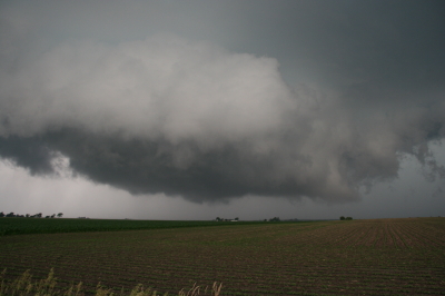
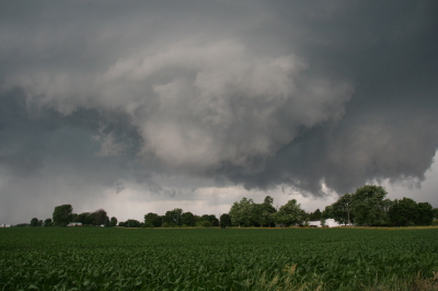
By the time we drew near the town, the northernmost storm was showing rotation on the radar. The tower was just to our west, and as we proceeded down the highway, the updraft base came into view, dominated by a well-developed wall cloud.

Wall cloud on northernmost storm.

Wall cloud on northernmost storm.

We headed for an intercept, tracking with the storm until it began to degrade. Meanwhile, another cell to the south was strengthening and beginning to exhibit distinct rotation on SRV, so with the storm we were on mushing out, we abandoned it in favor of the second, rapidly intensifying supercell.

One heckuva hail shaft or what?

One heckuva hail shaft or what?

This bad boy had an impressive hail shaft, if hail is what we were actually seeing. Maybe it was just plain old rain with a bit of hail mixed in. The reason I wonder is because of the paucity of hail reports. We got tapped a bit as we closed in, but mostly we just encountered buckets of rain. Whatever the case, the updraft tower with the sunlit precip column was a beautiful sight.

Second storm showing hail shaft and updraft tower.

Second storm showing sunlit precip core and updraft tower.

After working our way south of the storm’s rear flank, we proceeded east and finally gained some good, clear views of the business end. Tracking with it from near Urbana through Homer, Fairmount, and Westville toward the Indiana border, we were in a good position to enjoy the structure as the storm went through several cycles.

Rotating wall cloud.

Rotating wall cloud.

Just east of Homer, the wall cloud tightened and I could see rapidly circulating cloud tags descending toward the ground. We pulled over to watch. The rotation wasn’t far away–maybe a quarter of a mile–and it appeared to be moving toward us. This was strange as we were southwest of the wall cloud, but you can’t argue with a developing tornado. With the updraft approaching to within a couple hundred yards of us, Bill seemed intent on analyzing why the storm was acting so peculiarly, while I favored beating a hasty retreat and working out the behavioral aspects of storm circulation from a somewhat greater distance. Storm chasing sure has its interesting moments.

No tornado materialized, the storm headed east, and we continued on with it. I noticed a couple of tornado reports from around Fairmount and Westville, but while I suppose it’s possible that there was a brief spinup or two, Bill and I never saw an actual tornado. We did witness a few times when the wall cloud began to torque  pretty intensely, and I sure wouldn’t have wanted to be directly below it.

The whitish wall cloud is half a mile from us and rotating vigorously.

The whitish wall cloud is half a mile from us and rotating vigorously.

Possibly a funnel cloud at this point.

Possibly a funnel cloud at this point.

But from the time we first intercepted it to the point where it finally began to fizzle 120 miles later west of Crawfordsville, Indiana, the storm was outflow-dominant. Never once did we enounter surface inflow, though above ground level, I’m sure inflow was strong. In Bill’s words, the circulation kept reaching toward the ground, looking for something to grab onto, but it never could manage to root and produce a tornado. If we’d had backing winds…if the helicities had been there…I’m sure the storm would have been a potent tornado breeder. It never got its act together in that regard, but I doubt the communities in its path felt terribly disappointed, and from my perspective, the storm provided an interesting chase with some very nice moments.

Last gasp: wall cloud at US 41 west of Crawfordsville, Indiana, shortly before the storm began to collapse.

Last gasp: wall cloud at US 41 west of Crawfordsville, Indiana, shortly before the storm began to collapse.

For sheer structure, the “Danville supercell” was interesting and photogenic, with some nice RFD slots wrapping in, and, toward the end of the storm’s career, with a classic, stack-of-plates mesocyclone that was as nice as anything I’ve ever seen. (Sorry, no photos–the ones I have didn’t turn out well.)

One downside to this chase–and it is a big one–is that somewhere between Homer and US 41, I lost my camcorder. It wasn’t a pricey camcorder; it was a used Sony that I bought from my friend and fellow storm chaser Kurt Hulst. But it has done me good service over the past year, and I hate to think that it is presently sitting out there by the side of some Illinois backroad. What’s even worse is, my video of this chase is in it.

The drive back to Grand Rapids was a long one. I arrived at my apartment around 2:30 a.m. and collapsed. The chase was fun and I think I needed it, but it’s good to be back home with the love of my life, Lisa, whose bright eyes and beautiful smile warm my heart wherever I travel.

May 13 Tornado in Northern Missouri

Updraft Base

Updraft Base

This is the view that met us as we pulled off the road a couple miles north of Edina, Missouri, yesterday evening. “We” were Bill Oosterbaan, Derek Mohr, and me, and what we were looking at was the only supercell in Missouri on Wednesday, May 13, to produce a tornado–this despite a sizeable moderate risk that swept across most of Illinois and Missouri all the way down to Kansas and Oklahoma.

The storm was showing strong rotation, and had already put down a damaging tornado twenty miles to our west in Kirksville. We lost Internet connection as we approached the storm, but our last scan showed what appeared to be a storm merger with two distinct areas of rotation. The radar didn’t lie, and the proof of it provided an interesting scenario.

Wall Cloud Forming

Wall Cloud Forming

In the second image, you can see a ragged patch of scud ascending to the right and in front of the lowering in the background. This is the beginnings of what became an impressive wall cloud. Within a couple of minutes, the scud had matured into this…

Wall Cloud

Wall Cloud

The tail cloud to the right continued to grow to an astonishing length, displaying vigorous motion, feathering in rapidly toward the updraft. Meanwhile, a rain curtain began to wrap in from the south behind the wall cloud. This suggested a second mesocyclone following in the wake of the first area of rotation. I commented on this in the video I took of the storm, and my hunch soon proved true.

As the storm drew nearer, another prominent lowering began to emerge. It was exhibiting rapid motion, moreso than the more visually interesting wall cloud in the foreground. A tornado appeared immanent within this broad rotation, and in another minute multiple vortices were square dancing in the distance. One vortex soon tightened up and became dominant, fattening up into a nice hose. But the rain bands were starting to conceal the tornadic activity, and in a bit it was hard to tell exactly what was happening.

The storm quickly evolved into a nasty high precipitation beast, and from then on any tornadoes were effectively cloaked in rain.

Sorry, no stills of a well-formed tornado–I had set my camera down in favor of my video recorder–but I did manage to capture what looks to have been the beginnings of the multiple vortex phase.

Multiple Vortex Tornado

Multiple Vortex Tornado

No, you can’t see any visible touchdown in the photo, so maybe the circulation wasn’t tornadic at that moment.  If not, it was shortly after. I sure wouldn’t have wanted to be standing underneath it.

After the chase, Bill dropped Derek and me off where we had left our cars at the K-Mart in Springfield, Illinois. Then the three of us headed off in our respective directions–Bill toward Corydon, Indiana; Derek toward northern Michigan; and I back toward Grand Rapids. On my way home, I picked up fellow Michigan chasers Mike Kovalchick and Mike Bishop. They had experienced an automotive failure that took them out of the chase, forcing them to ditch their vehicle in Lincoln–truly a bummer. It was great to reconnect with Mike Kovalchick, and to meet Mike Bishop for the first time. Having a couple fellow storm chasers in the car sure made the long trip home seem shorter.

The day out chasing did me a world of good, but I need a good night’s sleep, and I have work to do tomorrow. By the time the next round of weather arrives, though, I should be primed and ready to go.

Moderate Risk in West Oklahoma and Texas

My buddies Bill and Tom Oosterbaan and Derek Mohr are heading for today’s sweet zone out in western Oklahoma. The Storm Prediction Center has placed the area under a moderate risk, with an indication of strong tornadoes. No doubt. With CAPE exceeding 2,000 and decent helicity and upper-level support increasing by 0Z, all the ingredients will be there. I’d imagine the guys will be playing the triple point per the SPC, where helicity will be maximized. Should be quite the caravan out there today. A person with a popcorn truck and GR3 could make a killing on a chase day.

Farther north, back here in Michigan, we’re sitting under our first light risk day of the year. As I write, it’s approaching 11 a.m. and the temperature is already in the upper 70s with dewpoints tapping on 60 degrees. But the forecast soundings look miserable, with adequate bulk shear but squat in the way of directional turning and some truly weird-looking hodographs. The sounding for 21Z out in the east central Texas panhandle, on the other hand, out around Mobeetie and Wheeler, looks great.

Sigh.

Well, we’ve got rain outside. Big drops.

At least “the kids”–my collection of carnivorous plants–will be happy. I just potted my three latest arrivals: a parrot pitcher plant, a maroon-throat variety of the pale pitcher plant, and the Gulf variety of the sweet pitcher plant. They’re sitting out on the deck along with the rest of my little family, soaking in the warmer temperatures, humidity, ambient light, and now the precip. It’s a fine day for the plants here in Michigan, and a good one as well for writers and jazz musicians if not storm chasers.

Time to fire up the radar and see what’s on the way.