Now that I’ve had a chance to rest up and catch up after Sunday’s chase in northwest Missouri, it’s time to do a writeup. I’ll summarize by saying that there were no tornadoes, but there was some great structure along with hail the size and disposition of wild boars.
My plan was to hook up with Bill, Kurt, and Tom, who had headed west a day ahead of me in anticipation of chaseworthy storms. Unfortunately, a stout cap quashed an otherwise potent setup, and the guys–along with lots of other storm chasers–endured a blue sky bust. Like I told Bill, they needed me out there with them to erode the lid for them.
I left around 10:00 Saturday night and drove as far as Davenport, Iowa, where I overnighted. The next day, I hightailed it for Topeka, Kansas. Bad route choices delayed my arrival, and storms had already initiated by the time I got within the vicinity. But that actually simplified my choice. Rather than heading into Kansas, I worked my way north of Saint Joseph, Missouri, along I-29, then hit the backroads to intercept a supercell that was making its way across the border near Rulo, Kansas.
Parking my car outside of Big Lake, Missouri, I set up shop and got some nice photos as the storm moved in. The base was lowering and developing a rotating wall cloud. Here is what the storm looked like when I took my first shot.
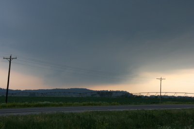
Wall cloud at Big Lake, Missouri, June 7, 2009.
The cloud was southwest of me and moving eastward, which meant that I could expect plenty of rain and probably a good clobbering by hail. In a little while, sure enough, golfballs began to fall all around me. No rain, just sizeable hail. The cloud at this point was directly to my south and looked like this:
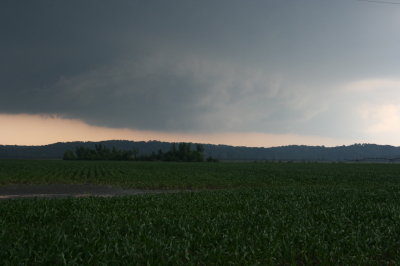
Wall cloud passing to the south.
It was time to vamoose, and none too soon. The advance guard of a veritable armada of storm chasers was driving by. I pulled in behind the DOW (Doppler On Wheels) and other Vortex 2 vehicles and followed them toward Forest City. By the time I reached SR111 and began heading south, I had pulled ahead of the circulation. I wanted a few photos of the wall cloud advancing directly toward me, so I found a place to pull aside. Opening the car door, I stepped out into some ripping inflow and snapped a few shots.
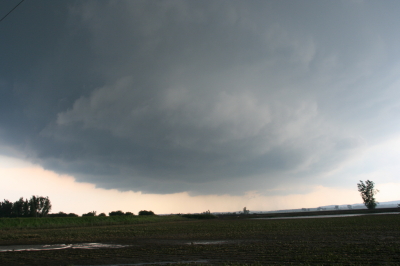
Wall cloud approaching SR 111 north of Forest City.
I missed the really big, gorilla hail that some chasers encounterd, but the occasional baseball size was big enough for me. Somehow I escaped getting hit by the larger chunks, though one of them hit my roof squarely with a loud whack. I still haven’t checked to see whether there’s a dent.
Eventually I caught up with the guys at the I-29 overpass, where a zillion other chasers were also parked. Seems like everybody and his dog’s first cousin was on this storm. If I ever get rich enough to purchase a dedicated chasemobile, it won’t be an SUV or a TIV-style monstrosity. It’ll be a concession van with a fold-out bar.
Anyway, Bill, Tom, and Kurt forged ahead and I followed them for a ways, but eventually opted for a more southern route when they headed north toward Union Star. I figured they’d be hitting heavy precip and probably some nasty hail, and I wanted to stay on the south edge of the updraft, which was heading east by southeast. Here are a couple photos from what was, from my vantage point, one of the more promising episodes in the life of the storm.
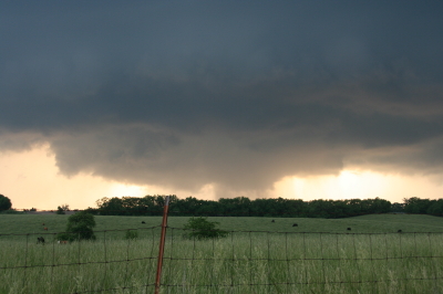
Wall cloud with clear slot wrapping in.
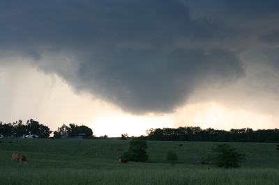
Possible funnel cloud trying to develop.
I believe the above shots were taken near Amity. From there, I headed east through Maysville and Weatherby, and across I-35 to just west of Altamont. There, I decided to end the chase and start heading home. The storm at that point was heading into Gallatin and was showing one of the best reflectivity echoes of its career on GR3.
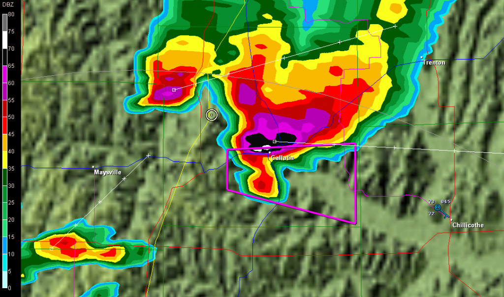
Base reflectivity showing tornado-warned storm approaching Gallatin.
But darkness was closing in, and I had no desire to chase this storm at night through the hinterlands of northwest Missouri. At that point, I was thinking about overnighting in Des Moines, and I had miles to go before I slept.

