This Evening the Sun Set Later

Today marked the turning point of sunset time.

Yesterday was the year’s earliest sunset; here in Hastings, Michigan, it occurred at thirty-eight seconds past 5:07. Henceforth, beginning this evening, sunset will occur later and later every day.

The change is incremental at first. Today the Sun set only a hair’s breadth later than yesterday. My sunrise/sunset chart still shows the same time, 5:07:38, but twilight lingered two seconds longer–hardly a noteworthy difference except that it’s the beginning of seasonal change. Meteorological winter is already underway; it began on December 1. Now we’re moving toward astronomical winter, and the changing of the guard has begun.

Winter solstice is still thirteen days away. On that date, December 21, the span between sunrise and sunset will be at its narrowest and daylight time at its shortest. But already the Sun will be setting later and later. On the 21st it will set at 5:11 in my town. However, until then it will also continue to rise later and in slightly broader increments, so that the gap between sunrise and sunset will keep narrowing from now till the 21st. After that, although the Sun will still rise earlier and earlier through January 2, it will do so by comparatively smaller increments, and the accelerating lateness of sunset time will begin to outstrip the braking lateness of the sunrise.

Sounds complicated, but it’s a simple concept, and if you saw it on a graph, you’d get it right away. In a nutshell, the days of the latest sunrise (January 2) and the earliest sunset (yesterday evening) are out of sync. December 21, winter solstice, is when those two times are closest; hence, it’s the “shortest day” of the year.
When the Apartment Shakes: The May 2, 2015, Michigan Earthquake

About twenty minutes after noon yesterday, as I was sitting in my couch, unperturbed as a turtle on tranquilizers, suddenly my apartment began to shake and rattle, and an indescribable sound filled my ears. My first thought was “What the . . . ? What the devil is my downstairs neighbor doing?” If he was rearranging furniture, then he was doing it with an earthmover.

The shaking continued for ten seconds, maybe fifteen. Then it quit, just like that.

It took me a few seconds to grasp the obvious: I think we’ve just had an earthquake.

That’s what it was: a 4.2-magnitude earthquake centered 3.5 miles below the earth’s surface about forty miles south of me near Galesburg, Michigan. If a 4.2 quake doesn’t sound impressive to those of you on the West Coast, it nevertheless was enough to generate interest around these parts. I myself was mildly surprised, or so I surmised from the fact that my eyeballs had protruded three inches from their sockets and required repositioning.

Somewhere in my reading on the event yesterday (I can’t relocate the source), I learned that, due to geological differences between the West Coast and the Midwest, quakes in this region tend to be shallower, but the energy they expend is often felt more intensely across a larger area. Yesterday’s quake might have rattled a few coffee cups in San Francisco, but here in West Michigan, it actually caused isolated instances of light structural damage: fractures in the outer walls of a few buildings, cracks in an asphalt parking lot, and fissures in the earth spewing magma as prehistoric reptiles emerged from subterranean caverns.*

Michigan is hardly the nation’s earthquake capitol. This isn’t a region thick with active faults. Still, we do get the very occasional rumble. The largest in Lower Michigan’s recent history was a 4.6-magnitude quake that occurred on August 10, 1947. Rated VI on the Modified Mercali Intensity scale (MMI), that one, also centered in roughly the same area as yesterday’s, brought down a few chimneys and did some other notable damage. By comparison, yesterday’s quake merited a V on the scale. The MMI scale describes a V thus: “Felt by nearly everyone; many awakened. Some dishes, windows broken. Unstable objects overturned. Pendulum clocks may stop.”

Yeah, that sounds about right. People felt this quake all across Lower Michigan, from Holland to Grand Rapids to Saginaw, and as far west as Chicago and as far east as northern Ohio. In other words, it was no small deal. Amazingly, it still escaped some people’s notice. Not mine, though. I’ve walked through a number of smaller quakes without ever knowing about them till later in the news, when I’d hear reports of so-and-so noticing the china rattling in their cabinet. I always felt a bit disappointed, robbed of an experience through failure to have a china cabinet on hand when I needed one. But as of yesterday, I can finally say that I’ve lived through an earthquake—the Great Galesburg Earthquake of 2015. “Great” is of course a relative term. If you live near the San Andreas Fault, yesterday’s episode would have seemed like a gnat fart. But it was pretty great for West Michigan. It caused no real harm, but it left plenty to talk about and a cool memory.


* Parts of this statement may require verification.


Thoughts on the I-94 Pileup near Kalamazoo

By now, the whole nation has viewed a blizzard of video clips of the massive and deadly 193-car/truck pileup on I-94 in Galesburg, Michigan, between Kalamazoo and Battle Creek. The incident occurred just forty miles straight south of where I live. Since I’m well-acquainted with both that highway and what yesterday’s weather was like, I’ll share a few thoughts.

First, winter storm warnings were in effect, and people were cautioned not to venture out if they didn’t have to. No one can say they weren’t warned; the NWS and media did their jobs. Moreover, some sections of highway were closed due to extreme driving conditions, something that just doesn’t happen in this state.

Second, and significantly, I-94 is a major east-west truck artery. Whenever I’m on it, I’m struck by the number of semis I see. There are a lot of them, considerably more than on I-196, I-96, and US-131. Of course, there are plenty of big rigs on those highways as well; there just seem to be more on I-94, to the point where I feel like truckers own that particular interstate. This is nothing against truckers and not some kind of moral issue; it’s just my observation. If an accident happens on that road, then if it doesn’t initiate with a semi, it can easily and almost immediately involve one .

Third, roads yesterday were extremely icy. On my drive to and from Caledonia to my part-time job in Hastings down M-37, a major secondary route, I averaged around 35 mph and often less. In open areas, the blowing wind created “road smoke,” and on the way back, trucks coming from the opposite direction blew up massive clouds of snow, creating temporary whiteouts. Trucks are really good at doing this, particularly during weather like yesterday’s, when extremely cold temperatures makes for fine snow rather than big, chunky flakes.

If the conditions on I-94 were anything like what I encountered on M-37, where people were driving at an appropriate speed for conditions, then I have to wonder what on earth folks were thinking to be clipping along at much faster speeds.

It’s rarely the weather conditions that get people in trouble; it’s how people respond to them—or more exactly, fail to respond. Unfortunately, responsible drivers suffer as well. You can be driving 30 mph, putting plenty of distance between yourself and the guy ahead of you so you can stop in time to avoid either rear-ending that person or going off the road, only to have the idiot behind you slam into you at 60 mph. I’m sure that scenario repeated itself multiple times yesterday.

Road conditions can change fast and catch you and other drivers unaware. Yesterday, M-37 through Caledonia wasn’t bad; a combination of road salt and local traffic had rendered much of the pavement wet rather than icy. But on the south end of town, beginning at 100th St., conditions changed abruptly from driveable to treacherous.

One fatality is a tragedy, but after watching video of the pileup as it occurred, I’m amazed and glad that more people didn’t die. In addition, twenty-three were injured, and again, that figure could easily have been higher. The bottom line is simple: Don’t drive too fast for road conditions, and sometimes don’t drive at all. I would add, avoid routes with heavy truck traffic such as I-94, as trucks can create whiteouts in their wake.

For outstanding, well-researched  insights and safety tips on winter driving, visit Dan Robinson’s website, Icy Road Safety.

September Gilds the Fenlands

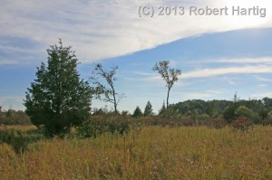
Upton Road Fen in northern Barry County, Michigan.

Upton Road Fen in northern Barry County, Michigan.

Three miles south of Middleville, Michigan, lies Upton Road Fen. That is the name I have given the place for convenience to provide some sense of location. In reality, the fen is nameless. Rarely do wetlands in Michigan have an actual place name, and in the case of this wetland, that is just as well, because the name “Upton Road” hardly does justice to either the magnificent sweep and diversity of the fen or the loveliness of the sandy forest trail that winds through archways of hardwood past the fen’s northern border.

A feather tamarack stands sentinel at the fen's northern border.

A feather tamarack stands sentinel at the fen’s northern border.

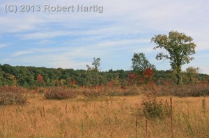
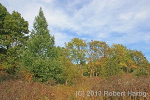
Prairie fens are a rare and unusual kind of alkaline wetland, rich in plant life, and Barry County is a bastion for these beautiful and fascinating ecosystems. Upton Road Fen may well be the largest of its kind in this part of the state. If not, it is certainly one of the larger ones, stretching three-quarters of a mile from corner to corner and encompassing a wide palette of fen habitats, from drier cinquefoil fields, to sedge meadows, to a wet, reedy seep, to a floating mat on the lowest, southeast end.  Pitcher plants grow here, and wild orchids, and blazing star, and deep blue fringed and bottle gentians. Tamaracks rub shoulders with red cedars, and here at the end of September, poison sumac shrubs dot the periphery of the fen, glowing incandescently like fiery rubies strung across a vast necklace where the wetland meets the woods.

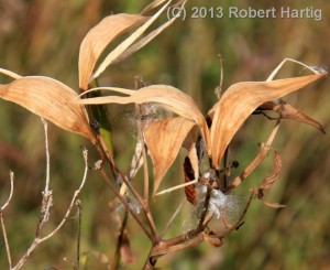
Unidentified seed pod. Any guesses?

Unidentified seed pod. Any guesses?

I have come here on this bright, late afternoon in search of gentians, and I am not disappointed. They are here, fully open, batting their fetching blue lashes at the slanting September sun. Little coquettes! Gentle, sweet wildflowers, flirty yet shy, like teenage girls just discovering their charms. I have intended to get photographs, but my camera’s battery is lower than I realized, and it dies on me after just a few landscape shots plus some odds-and-ends closeups. The latter include this old seed pod with one tufted seed still clinging gallantly to it. I don’t know what the plant is–it’s actually a shrub of some kind, and far be it from me to venture a guess as to its identity. I’m just not much of a shrub man.

I walk cautiously, keeping an eye out for massasaugas. In the many times I have visited this fen, I have never seen one, but I am told they are here and actually plentiful. I would love to see one, but not today–I left my heavy boots at home, and I wouldn’t care to have my first encounter with Michigan’s only rattlesnake result from my stepping on one with these old, threadbare athletic shoes I’m wearing.

Looking south across the long reaches of the fen.

Looking south across the long reaches of the fen.

Fortunately, my snakeless record remains pristine as I head back to the car. It has been an all-too-short visit on this radiant afternoon, but I have things to do and it is time to go. I am grateful, though, for these few minutes here, beyond the grasp of the frenzied world, where time slows down and invites me to do likewise long enough to see the smile of my Father. He is a loving Creator who has much reason to look upon these works of his hands–these golden fields, this sun-gilded fen stretching luminously beneath the September sky–and call all of it good. Yes, very good indeed.

An Interview with Wade Szilagyi, Director of the International Centre for Waterspout Research

It has been far too long since I’ve posted in this blog. Since my last post on my first-ever Lake Michigan waterspout intercept–and an amazing intercept it was, at that–waterspout season has come and gone, and Hurricane Sandy has wreaked damage of historical proportions on New York City and the New Jersey coastline. But, caught up in editing projects, I haven’t had much energy for writing my own stuff.

I have had a couple things up my sleeve, though, both musical and meteorological. This interview is one of them, and I think you will find it worth the wait. It features Wade Szilagyi, founder and director of the International Centre for Waterspout Research (ICWR) and developer of the Waterspout Nomogram and the Szilagyi Waterspout Index (SWI). Wade is not only at the cutting edge of waterspout research and forecasting, but he drives and defines much of it. I’m pleased and honored to have him as my guest.

Born in 1963 in Toronto, Ontario, Wade moved to Whitby in 1973, where he currently resides. He graduated in 1987 from the University of Toronto with a degree in atmospheric physics and was hired by the Canadian federal government as a meteorologist that same year. He worked as an operational meteorologist until 2001, when he moved into the National Service Operations Division as a national coordinator for program development and standards. Wade has published several articles and research papers on the topic of waterspouts and forecasting. He has also appeared on various media outlets discussing the topic of waterspouts, including interviews on The Weather Channel and Interlochen Public Radio and a writeup in Newsnet5.com.

Wade has two sons who are now in university. One is taking criminology and the other, mechanical engineering. Their father says, wryly, “I couldn’t convince them to go into weather!”

Wade likes to stay active. “I am very big on health and fitness,” he says. “I love to dance, bike, kayak, and power walk. I am a big believer in self-improvement and strive to be strong in mind, body, and soul.”

With that background on Wade the person, I now present to you Wade the waterspout researcher. I think you will find he has some fascinating things to say.

Question: Let’s start with the question that I’m sure is burning in everyone’s curiosity: How do you pronounce your last name? Give us the phonetic spelling.

Wade: Sa-la-gee

Q: Please tell us how you first became interested in meteorology.

W: It all started in grade eight science class. We were doing a unit on weather; however, the passion didn’t hit me until the end of the chapter. One of the chapter questions was to construct a weather observation table. My table consisted of weather parameters such as temperature, relative humidity, cloud cover, wind velocity, etc. I took weather readings and entered them in the table twice a day. I thought I would do this for a week; little did I know that it would last for five years!

Much came from those tables: graphs were produced, trends analyzed, and a climatology for my home town was initiated. This finally culminated with the entry of my project in the science fair in grade 13, for which I won second prize. I still remember teachers bringing their students past the displays. One teacher didn’t believe that I was dedicated enough to take weather readings twice a day every day for five years. He accused me of making the readings up. In my defense, I told him to talk to my teacher, who had known me for several years.

Q: You serve as director for the International Centre for Waterspout Research as well as with the Weather Office of Environment Canada. Please tell me a bit about your training and experience as a meteorologist.

W: The training as a meteorologist begins at university. There are different routes one can take in order to satisfy the requirements to become a federal government meteorologist. One must have a BSC degree in meteorology, atmospheric physics, or a combination of math and physics. I chose the atmospheric physics route. After graduating, I was hired by the federal government and took a mandatory year-long operational forecast training program. This is where one learns how to forecast the weather. After graduating, I was sent to the Toronto Weather Centre, where I remained for ten years. At this office I produced various forecast products such as aviation, public, marine, fire weather, and specialized products. Eleven years ago, I left the Weather Centre and went to the National Services Division, where I am a program manager for weather standards.

Q: One thing I immediately picked up on in talking with you is that you are utterly enamored with waterspouts! Clearly your knowledge of them has been fueled by genuine passion and fascination. When and how did waterspouts first capture your interest, and what has been your path as a foremost waterspout research scientist? Who has been influential along the way?

W: As with many discoveries in life, my interest in waterspouts came about by accident. Originally, I was investigating the phenomenon known as “arctic sea smoke.” This forms over open bodies of water at very cold air temperatures. Arctic sea smoke was a problem at one of our airports on Georgian Bay; it would frequently reduce the visibility near the runway.

I started looking into how to forecast arctic sea smoke. On days when arctic sea smoke occurred, I went down to Lake Ontario to gather data. By accident, I noticed several transient swirls forming in the sea smoke. These are called steam devils, and I quickly became interested in them. On one occasion I saw a huge steam devil. I called it a “winter waterspout.” It was at this point that my fascination with waterspouts began.

At the time, little was done in the way of waterspout forecasting. Weather centers would issue a Special Marine Warning (U.S.) or a Waterspout Advisory (Canada) only after a waterspout was sighted. On one midnight shift, I said to myself, “We are forecasters. We should be able to predict waterspouts.”

I began gathering meteorological data during waterspout events in order to develop a forecast technique. A couple of years later, the first version of the technique, the Szilagyi Waterspout Nomogram, was developed and used at the Weather Center in Toronto.

Over the years, as more data was gathered, the Nomogram was improved. Recently, I developed the Szilagyi Waterspout Index (SWI), which is based on the Nomogram. From the SWI, and with the help of my colleague, my dream of developing the world’s first operational waterspout forecast model was achieved during the summer of 2012. Waterspouts can now be predicted with confidence up to two days in advance!

The Nomogram and SWI are now used at weather centers around the Great Lakes and on both coasts of North America, and they are now being investigated in other parts of the world, especially Europe. During this period, I have written several articles and research papers and have given media interviews. I also formed the International Centre for Waterspout Research (ICWR) in 2008, which is a non-governmental organization comprised of research scientists, meteorologists, storm chasers, etc. from around the world who are interested in the field of waterspouts.

Regarding who has been influential along my waterspout research path, I would have to say Dr. Joseph Golden. Dr. Golden is considered the “father of waterspouts.” He spent most of his career studying waterspouts and how they form. I was honored to have met Dr. Golden at the Great Lakes Operational Meteorology Workshop in Traverse City, Michigan, back in the 1990s.

Frank Kieltyka, a meteorologist from the Cleveland Weather Office who conducted waterspout studies over Lake Erie, was also influential in the early days. Internationally, Dr. Alexander Keul, from the Vienna University of Technology, and Michalis Sioutas, from Meteorological Application Centre in Greece, inspired me to work on joint international research projects and to establish the International Centre for Waterspout Research.

Q: I first came across your name as the author of a brief 2009 paper titled A Waterspout Forecasting Technique. In it, you described four types of waterspouts—thunderstorm-related, upper low, land breeze, and winter—and offered three significant parameters for forecasting them. Presumably, thunderstorm-related waterspouts evolve through processes familiar to storm chasers. But the remaining three are less familiar. Would you briefly describe the conditions that produce them and what distinguishes them from each other? Do any of them have a land-based equivalent?

W: As a correction to the article, “thunderstorm-related” should be “severe weather.” Severe-weather-type waterspouts, like tornadoes over land, are associated with mesocyclones.

The other three types of waterspouts (upper low, land breeze, and winter) are categorized as fair-weather-type waterspouts. These form in a different manner than the severe-weather-type waterspouts. There are no mesocyclones associated with fair-weather-type waterspouts. In all three cases, circulation with fair-weather-type waterspouts starts at the surface of the water. As air rapidly moves upwards under the cloud, the circulation gets stretched upwards and forms a waterspout. What distinguishes the three fair-weather types is the weather pattern in which they form. Upper low waterspouts form under unstable conditions associated with what meteorologists call upper lows—large areas of cool, rotating air. Upper low waterspouts form any time of the day or night.

Land breeze waterspouts form along convergent lines called land breezes. Land breezes form overnight under light wind conditions as warm air rises over the water and is replaced by cooler air from the surrounding land. This cooler air converges along a line over the water, and it is along this line of converging air that rotation is initiated and waterspouts form. Land breezes last until early afternoon, at which time the waterspouts dissipate.

Winter waterspouts form when it is very cold and windy. This results in extremely unstable conditions over the water. However, winter waterspouts are rarely observed because lake effect snow obscures their presence.

The land-based equivalent of the three fair-weather-type waterspouts is a phenomenon known as the landspout. Landspouts form in a similar way as fair-weather-type waterspouts.

Q: You encapsulated the three chief parameters for forecasting waterspouts in the Szilagyi Waterspout Nomogram, which was the precursor to the Szilagyi Waterspout Index (SWI) and the ensuing colorized forecast maps for Great Lakes waterspouts. Those appear to be the first practical tools ever devised for forecasting spouts. Starting with the Nomogram, would you tell us how you developed them and exactly what they are? What improvements do you anticipate for the forecast maps?

W: Back in 1994, I started investigating what meteorological parameters correlated well during waterspout events. I wanted these parameters to be easy to calculate for forecasters. Three parameters satisfied these conditions of good correlation and easy use.* I then plotted these points and noticed that they formed a concentrated cluster on the graph. I enclosed the cluster with two lines. These lines are called the waterspout threshold lines. If a calculated point falls within them, waterspouts are likely. Outside the lines, waterspouts are not likely. This is what constitutes the Nomogram.

The Szilagyi Waterspout Index (SWI) is derived directly from the Nomogram. The purpose is to produce an index that can be used in computer algorithms to produce forecast maps of waterspout potential. The SWI ranges from -10 to +10. Waterspouts are likely for SWI ≥ 0. The new Experimental Waterspout Forecast System (EWFS) produces forecast values of SWI.

Improvements to the forecast maps produced by the EWFS are planned. These improvements include a higher model resolution, simplification of the display, and most importantly, the incorporation of surface convergence. Surface convergence is essential for waterspout formation.

Q: I understand that waterspout formation has five stages. Could you describe them? In a phone conversation, you mentioned to me that the presence of even a small funnel cloud means that a waterspout is already in progress, with circulation between the water surface and cloud base fully established. Most storm chasers are careful to distinguish between a funnel cloud and a tornado; they define a tornado by either the condensation funnel making full contact with the ground or else with visible rotation at ground level, typically verified by whirling dust or debris. How do you view this approach based on your experience with waterspouts?

W: Dr. Joseph Golden was the first to identify the five stages of a waterspout. These are:

1. Dark spot. A prominent circular, light-colored disk appears on the surface of the water, surrounded by a larger dark area of indeterminate shape and with diffused edges.

2. Spiral pattern. A pattern of light and dark-colored surface bands spiraling out from the dark spot which develops on the water surface.

3.Spray ring. A dense swirling ring of water spray appears around the dark spot with what appears to be an eye similar to that seen in hurricanes.

4. Mature vortex. The waterspout, now visible from water surface to the overhead cloud, achieves maximum organization and intensity. Its funnel often appears hollow, with a surrounding shell of turbulent condensate. The spray vortex can rise to a height of several hundred feet or more and often creates a visible wake and an associated wave train as it moves.

5. Decay. The funnel and spray vortex begin to dissipate as the inflow of warm air into the vortex weakens.

Regarding reporting either a waterspout or funnel cloud, the same procedure should be followed as with observations over the land. Evidence of a spray ring, or a fully condensed funnel reaching the surface of the water, should be visible before reporting it as a waterspout. If there is no spray ring visible because it is too far away to be viewed, and if the condensation funnel appears incomplete, then it should be called a funnel cloud.

Q: This year has been a record-breaker for waterspouts, bolstered by such landmark events as the September 21-24 Great Lakes outbreak. What has the ICWR gained, and what do you expect it to get, from this year? In your organization’s research overall, have you made any discoveries that have surprised you?

W: This year’s record-breaking waterspout numbers have resulted in tremendous media attention for the ICWR (e.g. The Weather Channel). This media attention has resulted in more individuals submitting waterspout reports on our website, which we display.These reports are also used to update and improve the nomogram.

A discovery that has surprised us at the ICWR is that the nomogram can be applied in other areas of the world, in particular over European waters. These observations were confirmed in a recent research paper.

Q: Speaking of the ICWR, how long has it been in existence? What led to its formation, and what is the story of its growth? What are some of its significant achievement? What are some things you’d like to see it accomplish within, say, the next five years, and who besides yourself are the players?

W: Founded in 2008 by me and two European colleagues, the ICWR is an independent non-governmental organization comprised of individuals from around the world who are interested in the field of waterspouts from a research, operational, and safety perspective. Originally conceived as a forum for researchers and meteorologists, the ICWR has now expanded interest and contribution from storm chasers, the media, marine and aviation communities, and from private individuals. The goals of the ICWR are as follows:

    • Foster the advancement of waterspout research and forecasting.
    • Provide an international forum for the exchange of information among researchers and meteorologists.
    • Facilitate the reporting of waterspouts from around the world from storm chasers and other interested individuals.
    • Promote, educate, and communicate to academic institutions, the media, marine and aviation communities, and private individuals.

Some of the achievements of the ICWR have been to jointly produce waterspout research papers. Another achievement has been the increase in public awareness of waterspouts around the world. Features on the ICWR web site called the “Live Waterspout Watch”, as well as the ICWR Facebook page have helped facilitate this public awareness.

Some projects that are currently being undertaken, and which I hope will be completed in the next five years, are the Global Waterspout Forecast System (GWFS), Global Waterspout Database (GWD), and Global Waterspout Watch Network (GWWN). The GWFS will produce waterspout potential maps for the entire globe. The GWD is a database containing waterspout events from around the world. The GWWN is a global network of waterspout spotters.

The ICWR is comprised of a director (me), as well as an executive committee. The executive committee has two representatives: Dr. Alexander Keul, from Salzburg University; and Michalis Siatous, meteorologist with the Greek Weather Service. The ICWR is also represented by a growing number of storm chasers, meteorologists, and research scientists.

Q: Are there any ways that storm chasers, weather observers, and other interested parties can participate in or otherwise assist the work of ICWR?

W: Yes. Storm chasers and weather observers can contact the ICWR and become part of the GWWN. Researchers and meteorologists can collaborate with the ICWR to produce joint research papers or develop forecast models.

Q: How many waterspout incidents have you personally witnessed? Are there any that stand out as particularly memorable for you?

W:I have seen waterspouts on five separate occasions. The most memorable one was the first time I saw them. I rented a cottage for a few days on the north shore of Lake Erie. The weather was warm and the hope of seeing any waterspouts diminished with each passing day. On the last day of the vacation, I stopped thinking about waterspouts. That morning the weather was cool. I went out onto the beach with my glass of orange juice and was looking around the sand. I looked up over the water, and to my amazement I saw a family of three waterspouts in a row! My jaw and the glass dropped. I ran into the cottage yelling, “Waterspouts!” My wife told me that I was like a kid in a candy store. I grabbed my video camera, and for the next fifty minutes I filmed several waterspouts forming and dissipating.

Q: When you’re not researching waterspouts, what do you like to do? Got any hobbies that keep you occupied when the spouts aren’t spinning?

W: Hey, waterspout research is my hobby! My other hobbies are archeology and treasure hunting, which I have been doing for the last twenty-six years. I have found several artifacts that have added to the knowledge of the history of my town. These artifacts go on display to the public at various events. I am also planning on creating a virtual museum. I should point out that one of my greatest dreams is treasure hunting on the beach while looking up and seeing a waterspout!
_______________________

* The three parameters are as follows: (1) The difference between water temperature and 850 mb temperature; (2) the depth of convective clouds; and (3) the 850 mb wind speed, which must be less than 40 knots. For further information, Szilagyi refers readers to his article on waterspout forecasting.

Waterspouts on Lake Michigan

Saturday, September 22, was the first day of autumn 2012. It was also my first-ever time seeing waterspouts. I’ve chased them a few times (if chased is the right word) previously within the past two years, but not successfully. This time made up in spades for those occasions. I don’t know how many waterspouts I saw, but “lots” ought to cover them, including one that made landfall about a hundred yards north of me at Tunnel Park. I managed to capture that one on video. But I’m getting ahead of myself.

I woke up at 5:15 a.m., showered up, and headed for the lakeshore. The ICWR waterspout forecast indicated a high probability of waterspouts all along the eastern shore of Lake Michigan, and the main concern seemed to be simply finding adequate near-shore convection. That didn’t seem to be a problem, since a line of thunderstorms was moving across the lake from Wisconsin and heading east almost straight at me. Based on the line’s slightly southern component, I decided to head for Holland Beach.

A nice cumulus field had overspread West Michigan as I pulled into the state park. At the entrance, a ranger informed me of restricted parking due to a marathon that was being routed through the park by the beach. The racers hadn’t yet arrived; in fact, very few people were present, and having the parking lot mostly to myself, I chose an optimal spot where I had an unimpeded view of Lake Michigan.

The stiff lake breeze concerned me. Westerly surface winds–and strong ones at that–didn’t seem to me to bode well for waterspouts. How would the convergence necessary for spout formation occur over the water with unidirectional winds? Still, the waterspout index was maxed out, and here I was, so I guessed I would find out.

After a while, the western sky began to darken. The storms were moving in, but they would take a while to arrive. Meanwhile, a green blob of convection on GR3 corresponded with a cloud bank stretching perpendicularly from the waters to the shore about ten miles to my south. It seemed worth checking out, so I grabbed my camera and headed across the beach toward the pier near the lighthouse. From that vantage point, I finally got a good, complete view of the convective band.

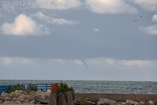
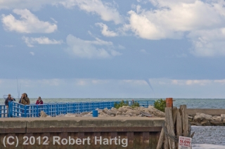
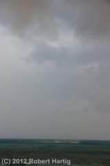
A slim, well-defined gray tube hung from the distant cloud base. Bingo! My first waterspout! I began snapping pictures.

The salmon run was on, and all along the channel, fishermen were having a heyday. Focused on fish, they seemed oblivious to the elegant spectacle unfolding over the water. How could they not see it? I pointed it out to one fisherman. “Wow! A waterspout!” he said. Then he went back to his fishing. To each his own, though I suppose he could fish and watch the spout at the same time.

I don’t know how much time passed–fifteen minutes, maybe twenty. By and by, the spout dissipated, and I returned to my car. I didn’t need to look at my radar to know that the storm was closing in. I could see the lowering clouds and rain shafts over the water.

What the radar did tell me, however, was that heavier convection was heading toward the Saugatuck/South Haven area. So, as the first of the marathoners began to trickle into the park, I decided to drop south toward where chasers Skip Talbot, Jennifer Ubyl, and Jonathan Williamston were located.

I got as far as US 31 before realizing that I had made a tactical error. Heavier convection was beginning to fire in a line that promised to train in directly over Holland Beach. Nuts. I had just compromised myself by fifteen minutes, and in the meantime, a marathon had gotten underway. I turned around and headed back toward my old location, but now the road was filled with runners and closed to traffic.

I decided to head for Tunnel Park just a few mile north of Holland Beach. But Lakeshore Drive was also clogged with marathoners. Thus began a frustrating quarter-hour of driving down sideroads and through neighborhoods, trying to gain access to the lakeshore. Ultimately, I wound up pulling over kitty-corner across the road from the park entrance, watching morosely as runners ran by. But there was a cop standing next to his car, shepherding the crowd, and … what the heck. I walked up to him and asked him if I could cross into the park. Sure, he said. The race ended officially right at this point. Just look for an opening, the cop told me, and then I could nudge my car across the road.

Free!

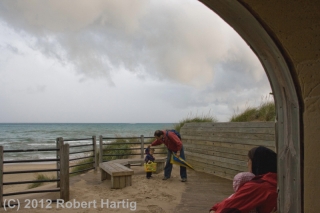
The storm was arriving as I pulled into the park, and rain had begun to fall. I grabbed my cameras and raced toward the tunnel. The other end opened out onto the beach, affording a sheltered location where I could watch for spouts without getting wet. It was a perfect setup.

The only other people there at the park were a young ethnic couple with a baby and a small child. I greeted them and talked with them about waterspouts as we watched a shelf cloud advance over the storm-driven surf. After a few minutes, the guy pointed toward the lake and said, “Is that one?” I looked, figuring it was a false alarm, some turbulent scrap of scud ascending along the shelf cloud. But no, he was pointing at the water, where a rotating patch of spray was clearly visible. It was only a couple hundred yards away, small but unmistakable. Waterspout!

And now another, larger one was organizing to my northwest. I could see no funnel, but then, the shelf cloud was now almost directly overhead, and features that might have been obvious at a distance were lost in the jumble of clouds. Regardless, the rotating cascade looked intense. I grabbed my camcorder. There was no time to set up the tripod; I would have to manage the best I could with hand-held. I hit “record” and began shooting the waterspout as it progressed toward the shoreline.

At first, it appeared to be heading toward us, which didn’t concern me. The waterspout was non-tornadic, and while it obviously packed some strong winds, I felt that the greatest threat it posed was a nasty sand-blasting. We could retreat into the tunnel if necessary.

But the spout made landfall about one hundred yards to my north. I ran out onto the beach to try to capture more of it as it progressed up over the foredune, but I was too late, and that section of my footage turned out pretty wobbly. Still, I had about forty-five seconds of shaky but ultra-cool footage of a Lake Michigan waterspout hitting the shore at close range. The first thirty seconds is the best, but I’ve chosen to show the whole shebang because I think there are some points of interest in the latter part, flawed though it is.

Back at my car, the radar indicated more intense convection headed toward Grand Haven. After sending a report to Spotter Network, I got onto Lakeshore Drive and began heading north. The stream of runners had thinned out, and the road was open, though still patrolled by the police. A little ways north of the park entrance, I noticed a “damage path” of tree trash–clusters of leaves and large twigs–scattered across the pavement. The road was only a quarter-mile from the shore, and I have no idea how far inland the waterspout made it before dissipating, but I suspected that a few runners had gotten quite a surprise.

Up at Grand Haven, a cloud bank to my northwest put down a series of spouts. These were much farther offshore and not particularly impressive at the time I viewed them, though I’ve seen some stunning photos by another spout chaser from the same location. After a while, the waterspout activity dwindled off, but I’d gotten my fill and was glad to head back east.

Back in Grand Rapids, I processed my video of the spout at Tunnel Park and attempted to send it to WOOD TV8. But the ftp upload failed, so rather than waste more time, I stopped by the station and let their tech handle things. The footage got aired on the evening news.

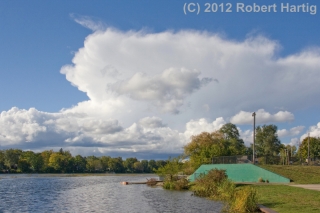
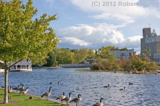
After that, I somehow wound up in Lowell. It was a lovely, moody day, perfect for the first day of fall, and I guess I just felt like a drive. Anyway, I found myself on the waterfront, watching ragged cumulus clouds drift over the broad, windblown face of the Flat River. To the north, a small, low-top storm billowed up above its less successful convective comrades and spread its cirrus anvil eastward. It was a beautiful sight, as was the entire sky, and I couldn’t resist taking a few more pictures. The last view on this page looks to the south, where the Lowell Showboat rests at its dock just upstream from the Flat River Grill and the dam beneath the startlingly blue September sky.

And that is that. Two days later, the same intensely azure sky prevails and this chill wind testifies that autumn is indeed at hand. The trees are still mostly green, but change is in the air. My hunch is, we won’t be getting a “second season” for storm chasing. If not, Saturday was wonderful compensation and will see me through to next spring.

Once There Was Night

You cannot find silence anymore, nor can you find the night.

Once there was such a thing as quiet in the countryside, and midnight skies, dusted with silver chips, that stretched from horizon to horizon. But no more. Drive where you will, mile after mile, you cannot escape the taint of man-made light or the sounds of an obtrusive and increasingly uncivilized civilization. The world is noisy, and there is no respite from the noise, nor is the night any longer truly night. No more can you look up and gaze into infinity; the street lights, the farm lights, the headlights, and the glow of distant towns will not let you. We are so well-lit that we can no longer see.

The reality of what we have lost came crashing in on me tonight as I drove out in search of a place to watch the Perseids meteor shower, which as I write is at its peak.

I could not find a suitable location. I am not saying I couldn’t find a place where I could see meteors. Several spots afforded me a decent view of the sky. What I could not find was a place where I felt truly by myself, a place where I could wrap myself in the mystery of a heavens not shrouded with light pollution and contemplate the beauty of the night in silence.

On a gravel road that dropped south from 108th Street, I thought for a moment that I had found a good place to view the Perseids. Parking on the side next to the tall August corn, I got out of my car to watch for shooting stars. The only lights were single farm lights half a mile down the road in either direction. Overhead, the luminous ribbon of the Milky Way wove through a crowd of stars. This location would do.

Then I heard it. Someone was blaring rock music down the road from me. But where? It sounded like it was coming from only a couple hundred feet away, but the source had to be a long way off. Ah, what did it matter? This was crazy. I had driven out into the farmlands in search of darkness and silence, but the noise had found me anyway.

A short while later, I stood by my car at another spot near my town’s athletic fields. I was pleasantly surprised at just how dark–relatively dark, that is–my new location was. A meteor trickled across the east. A dimmer one scratched the sky for half a second, now there, now gone. But what the heck … where was that music coming from? Oh, for crying out loud. Once again I was parked at a place far from houses, and yet it sounded like a bloody band was standing out in the field nearby playing a concert. And now a jet came roaring in toward the airport … and my ears opened up to the sounds of traffic on the nearby roads … nuts. Forget it. I had seen a few meteors and that was enough. I hopped back in my car and headed home.

Now here I am, finishing this post. My wall clock reads 1:17 a.m. A while ago, I could hear voices outside my apartment, but those are gone, and I am left with only the faint susurration of traffic on M-37 and the flesh-colored glow of the parking lot lights.

I could do without them shining through my window. Besides ruining my lightning photos from the balcony when storms pass over, they steal the night. From a security standpoint, I understand the wisdom of having the lights, but I don’t like them. I wish I could get the night back.

Today, fewer people people know what I mean. But I haven’t forgotten.

Once there was night. There still is in some places. You have to drive far north to find it in Michigan, but it’s there to be found. I just wish it was here.

Bow Echo at Elk Rapids, Michigan

Judging from the forecast soundings, it seemed that northern Michigan stood at least a chance of tornadoes yesterday evening. But the storms that first ignited in Wisconsin quickly congealed into a broken line as they crossed Lake Michigan, minimizing their tornadic potential and fulfilling the predictions of forecast models and the knowledgeable heads at the Storm Prediction Center.

I made the trip north regardless of, from my standpoint as a storm chaser, the unpromising prognosis. I hadn’t been upstate yet this year, I was itching for a bit of convective violence in any form, and the thought of simply watching a brooding shelf cloud blow in over the beautiful hills-and-water region around Traverse City appealed to me. Given ample low-level helicity between 200-300 m2/s2, I figured I stood at least a chance of getting  some rotation out of a tail-end cell or perhaps a hook-like protrusion. But I was willing to settle for less, which is what I expected and what I got.

I headed north on US 131 as far as Kalkaska. Then, with storms to both my north and west, I decided I’d be better off heading west down SR 72 and meeting the southernmost cells moving in toward Traverse City.

At Acme, I caught US 31 north, and from then on my goal was to find a good place to park and get some pics. That’s easier said than done in a landscape filled with timber. Grand Traverse Bay was almost within spitting distance, and I could see glowering, lightning-laced clouds advancing to my northwest. But, blocked by trees, the clear view I envisioned of a shelf cloud bulldozing in over the bay kept eluding me.

Finally I found myself in Elk Rapids. The town was right on the water; there had to be someplace to park with an open view.

At a stop sign, I edged out prematurely, then tapped on the brakes as fellow chaser Nick Nolte turned off the main drag in front of me. Cool–Nick was here too. I figured I’d find a spot, then give him a call. As it turned out, Nick found me first a few minutes later in the parking lot of the local marina.

“Hey, I just about ran into you at an intersection,” I told him.

“That was you?” he said. “Jerk!”

Our location was probably as close to ideal as possible, given the lay of the land. The cell to our north blew past, but the radar indicated a bow echo making its way directly toward us. I’d never have guessed from the bland-looking sky to the west. But in a few minutes, storm features began to emerge from the nondescript grayness like an old Polaroid photograph developing. A shelf cloud was advancing across the bay, growing more distinct by the second.

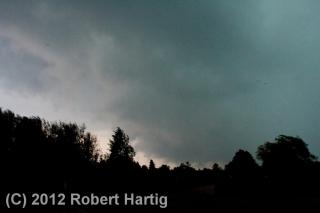
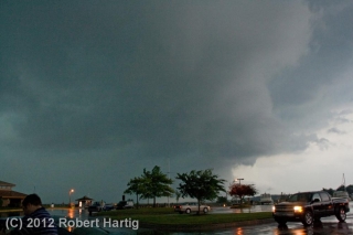
Nick hopped out of his car and tripoded his camera. I opted to go hand-held–not the best approach, but in this case a practical one. But my camera gave me grief; the shutter wouldn’t operate, and by the time I remembered that I needed to turn off the auto-focus, the shelf cloud was overhead. Nuts. I snapped the five shots you see below, then got in my car as the rain and wind descended in earnest.

The marina was right in the belly of the bow, and for a few minutes, I enjoyed a nice blast punctuated with lightning and commented on by thunder. Then the line moved off to the east. Nick and I decided to try and reposition in hopes of intercepting the southern end, but our attempt was futile. We ended the chase and grabbed dinner at a Big Boy restaurant in Kalkaska.

This time of year, any storm is a good storm–not that I’ll normally drive 175 miles just to see a bow echo, but I don’t need a Great Plains tornado to make me happy. After multiplied days of remorselessly gorgeous weather, a boisterous round of lightning and thunder always gladdens my heart and gets a shout out of me.

ADDENDUM: The tail-end cell, which had consistently displayed a hook-like appendage and shown an inclination to turn right, went on to produce an EF-1 tornado at a golf course near Roscommon, forty miles east-southeast of where Nick and I grabbed dinner in Kalkaska. The low-level helicity delivered after all. If the storms had been discrete, I suspect we’d have seen a few more tornado reports.

Memorial Day 2012: A West Michigan Lightning Extravaganza

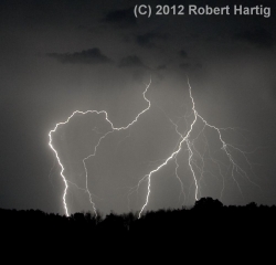
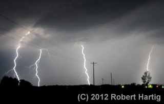
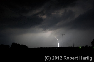
I have yet to take some truly razor-sharp images of lightning, but each time I go out, I learn a little more about how to improve my lightning photography. Last night afforded me a great opportunity. Storms forming ahead of a cold front moved across Lake Michigan and began to increase in coverage as the night progressed, and I roamed with them across West Michigan from the shoreline at Whitehall and Muskegon State Park to inland northeast of Lake Odessa.

My expedition was marred by the fact that I left the adapter plate for my tripod at home. I compensated by setting my camera on top of my dashboard and shooting through the windshield, an arrangement that works okay but

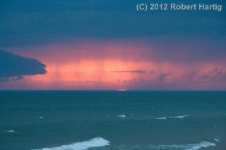
which considerably limited what I was able to do at the lakeshore. Using the hood of my car to steady myself, I managed to capture a few shots of a beautiful, moody sunset, with the red semicircle of the the sun gazing sullenly through rain curtains of the advancing storms. However, parking by the side of a busy road where everybody had the same idea–to pull over and watch the storms roll in over the waters–just didn’t work very well. After too many time-lapse images marred by tail lights (see photo in gallery below) I decided to hightail it and try my luck inland.

It was a good choice. The storms multiplied as I headed back toward Caledonia, and with lightning detonating to my north and closing in from the west, I decided to continue eastward till I found an ideal location–a place far from city lights and with a good view in all directions. I never expected to drive as far as northeast of Lake Odessa, but I’m glad I did.

Note to self: STOP USING THE ULTRA-WIDE-ANGLE SETTING WHEN SHOOTING LIGHTNING. Zooming out all the way to 18 mm is just too far, and cropping the shots doesn’t work well. The crispness goes downhill.

For all that, the images below aren’t all that bad, and a few turned out really well. After Sunday’s busted chase in Nebraska, it was nice to enjoy a few mugfulls of convective homebrew right here in West Michigan. I finally arrived home at the scandalous hour of 4:15 a.m., far later than I ever anticipated. I was tired but pleased. This Memorial Day lightning display did not disappoint.

Along the Long Lake Trail

This has been the quietest May I can recall weatherwise. The peak month that I and hundreds of other storm chasers have spent the better part of a year anticipating has turned out to be a dud. Maybe around the latter part of the month things will improve, but there’s nothing to look forward to for at least the next week.

If the weather isn’t going to offer anything chaseworthy, then the way it has been is exactly the way I want it to be: blue, crisp, and beautiful, warm but not hot, with the sun smiling down on a landscape that’s getting on with the business of spring.

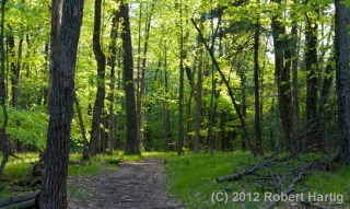
A couple days ago, I took a walk down the Long Lake Trail just north of Gun Lake State Park in northern Barry County’s Yankee Springs Recreational Area. It had been a while since I had hiked the trail, and this time of year is perfect for the venture, so off I went. The first mile or so of the trail winds through hardwood forest, skirting a small bog and a tract of red pine, then sets you on a quarter-mile stretch of boardwalk through part of the swamp that surrounds Long Lake. It’s a lovely hike that offers plenty to see if you know your native plants and their habitats.

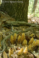
Here are a few of the highlights. The odd little plant to your right, which somewhat resembles miniature corncobs, is called squawroot (Orobanche americana). It is a common woodland plant, parasitic on oak trees. Click on the image to enlarge it.

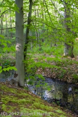
The trail winds through some particularly pretty territory. The photo below gives you an idea. There are a number of other images at the bottom of this page to keep it company.

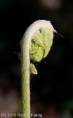
Ferns were in the process of unrolling their fronds. They never look more dramatic or more artistic than this time of year, when they’re in their “fiddlehead” stage.

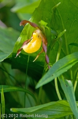
Farther down the trail, where the boardwalk commences, marsh marigolds scattered Pointillistic fragments of butter-yellow across the swamp floor. Picking up on the golden theme, the first few flowers of small yellow ladyslipper orchids (Cypripedium calceolus var. parviflorum) peeked out shyly from among lush skunk cabbage leaves.

The swamp is full of poison sumac, a small tree with which I’ve had considerable experience recognizing and avoiding. It is related to the cashew and also, of course, to poison ivy. Eating poison ivy at age six was not one of my intellectual zeniths, and it’s not an experiment one should undertake casually. Long after the initial bitter burst of flavor has faded, the experience lingers in a way a body is not apt to forget. Word has it that poison sumac is even more virulent than poison ivy. That’s not something I care to put to the

test. Interestingly, the sap of its equally toxic cousin, the Japanese lacquer tree, is used as a varnish which produces some beautiful objets d’art, though how a body works with a medium like that is beyond me.

But enough of the swamp and its sumac. Stepping off the far end of the boardwalk and farther into the woods, I encountered an elegant young beech tree standing sentinel on a mossy bank.

I walked a bit farther, then turned back. The slanting sun rays were filtering long through the leaves, the temperature was cooling, and it was time for me to go practice my horn–which, by the way, I’ve been doing pretty consistently. But that’s material for another post. Right now, check out the rest of my photos in the gallery below.