Saying Good-Bye to July

Looks like I almost let July slip by without making a single post.

Almost.

I just haven’t felt inspired to write in this blog lately. Weatherwise, what’s to say?

Right–the drought. Frankly, I haven’t felt like writing about the drought. We all know how horrible it has been: day after day and week after week of relentless, rainless heat. No doubt that’s newsworthy, but I’ll let the news media tackle it. From my perspective, it discomforts me, it annoys me, it inconveniences me, and certainly it concerns me, as it should anyone living in the continental United States. To say it has been disastrous is putting it accurately. But while I suppose this drought is severe weather in its own way, it doesn’t interest me the way that a thunderstorm does. Mostly, it’s something I wish would go away, a sentiment shared by millions of Americans roasting in the Midwestern heat.

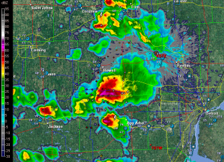
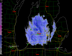
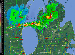
Fortunately, it won’t be here forever, and lately the pattern around the Great Lakes has seemed to be nudging slowly but progressively toward a stormier one. As I write, the radar screen for Michigan looks like this (click on image to enlarge it).

I like that: a cold front dropping out of the northwest bringing a nice line of storms and a good dousing of much-needed rain.

Shifting gears to music, there’s not much to say on that topic either. Of course I’ve been staying on top of my instrument, but that’s par for the course. My woodshedding on “Giant Steps” and “Confirmation” continues, along with “Ornithology,” and I’m getting to where I’m starting to shred the bejeebers out of those tunes. But, mmm, yeah, okay, so what. Where do I go from here?

The studio, I think. It’s about time I finally recorded my efforts, put something down for ears besides mine to listen to. Otherwise, why am I bothering with all this practicing of tunes that no one is ever going to call for on a gig? Folks want “Satin Doll,” not Coltrane changes. Still, somewhere out there I think there are people who will take an interest. So I need to get with my buddy Ed Englerth in his Blueside Down Studios and make some noise.

‘Scuze me if I sound a bit cranky. At 56 years of age, I’m rapidly approaching full curmudgeonhood and I am getting in practice for it. The lack of heavy convection and lack of gigs combined is assisting the effort. But a shift in either aspect of that equation will restore my humor and give me something to write about.

No, that’s not right–there’s always something to write about. What I need is something I feel like writing about. Maybe later tonight will do the trick, when that storm line which is presently 50 miles to my north moves in. Hmmm … the cell that is just making landfall near Pentwater is packing straighline winds of nearly 70 knots. That’ll create some interest for folks south of town.

Now to close up shop and see what kind of action we get around here a few hours hence. If it’s nothing more than a good dumping of rain, I’ll be more than happy. But I’m betting it’ll come with a spark and a growl.
Bow Echo at Elk Rapids, Michigan

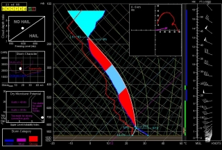
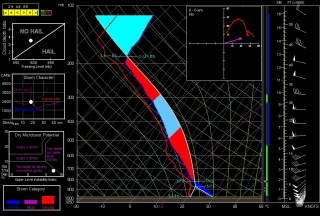
Judging from the forecast soundings, it seemed that northern Michigan stood at least a chance of tornadoes yesterday evening. But the storms that first ignited in Wisconsin quickly congealed into a broken line as they crossed Lake Michigan, minimizing their tornadic potential and fulfilling the predictions of forecast models and the knowledgeable heads at the Storm Prediction Center.

I made the trip north regardless of, from my standpoint as a storm chaser, the unpromising prognosis. I hadn’t been upstate yet this year, I was itching for a bit of convective violence in any form, and the thought of simply watching a brooding shelf cloud blow in over the beautiful hills-and-water region around Traverse City appealed to me. Given ample low-level helicity between 200-300 m2/s2, I figured I stood at least a chance of getting  some rotation out of a tail-end cell or perhaps a hook-like protrusion. But I was willing to settle for less, which is what I expected and what I got.

I headed north on US 131 as far as Kalkaska. Then, with storms to both my north and west, I decided I’d be better off heading west down SR 72 and meeting the southernmost cells moving in toward Traverse City.

At Acme, I caught US 31 north, and from then on my goal was to find a good place to park and get some pics. That’s easier said than done in a landscape filled with timber. Grand Traverse Bay was almost within spitting distance, and I could see glowering, lightning-laced clouds advancing to my northwest. But, blocked by trees, the clear view I envisioned of a shelf cloud bulldozing in over the bay kept eluding me.

Finally I found myself in Elk Rapids. The town was right on the water; there had to be someplace to park with an open view.

At a stop sign, I edged out prematurely, then tapped on the brakes as fellow chaser Nick Nolte turned off the main drag in front of me. Cool–Nick was here too. I figured I’d find a spot, then give him a call. As it turned out, Nick found me first a few minutes later in the parking lot of the local marina.

“Hey, I just about ran into you at an intersection,” I told him.

“That was you?” he said. “Jerk!”

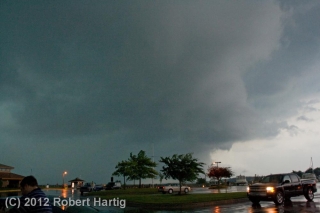
Our location was probably as close to ideal as possible, given the lay of the land. The cell to our north blew past, but the radar indicated a bow echo making its way directly toward us. I’d never have guessed from the bland-looking sky to the west. But in a few minutes, storm features began to emerge from the nondescript grayness like an old Polaroid photograph developing. A shelf cloud was advancing across the bay, growing more distinct by the second.

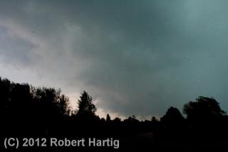
Nick hopped out of his car and tripoded his camera. I opted to go hand-held–not the best approach, but in this case a practical one. But my camera gave me grief; the shutter wouldn’t operate, and by the time I remembered that I needed to turn off the auto-focus, the shelf cloud was overhead. Nuts. I snapped the five shots you see below, then got in my car as the rain and wind descended in earnest.

The marina was right in the belly of the bow, and for a few minutes, I enjoyed a nice blast punctuated with lightning and commented on by thunder. Then the line moved off to the east. Nick and I decided to try and reposition in hopes of intercepting the southern end, but our attempt was futile. We ended the chase and grabbed dinner at a Big Boy restaurant in Kalkaska.

This time of year, any storm is a good storm–not that I’ll normally drive 175 miles just to see a bow echo, but I don’t need a Great Plains tornado to make me happy. After multiplied days of remorselessly gorgeous weather, a boisterous round of lightning and thunder always gladdens my heart and gets a shout out of me.

ADDENDUM: The tail-end cell, which had consistently displayed a hook-like appendage and shown an inclination to turn right, went on to produce an EF-1 tornado at a golf course near Roscommon, forty miles east-southeast of where Nick and I grabbed dinner in Kalkaska. The low-level helicity delivered after all. If the storms had been discrete, I suspect we’d have seen a few more tornado reports.

The Action Comes to Michigan

Curious about the SPC’s Day 2 convective outlook for Michigan, I ran a few forecast soundings. Good grief! I can’t remember when I’ve seen skew-Ts like these in Michigan. The one for Cadillac reminds me of June 5, 2010, in central Illinois, though I think the winds above 500 mbs were stronger in that event.

It’s late and I’m not about to write a lot. But I have a strong hunch that tomorrow early afternoon I’m going to be heading north on US 131. It’s rough chasing in that part of Michigan, but anywhere in this state is challenging, and we don’t see this kind of setup very often.

Memorial Day 2012: A West Michigan Lightning Extravaganza

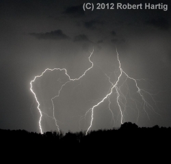
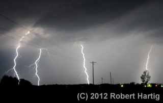
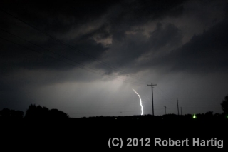
I have yet to take some truly razor-sharp images of lightning, but each time I go out, I learn a little more about how to improve my lightning photography. Last night afforded me a great opportunity. Storms forming ahead of a cold front moved across Lake Michigan and began to increase in coverage as the night progressed, and I roamed with them across West Michigan from the shoreline at Whitehall and Muskegon State Park to inland northeast of Lake Odessa.

My expedition was marred by the fact that I left the adapter plate for my tripod at home. I compensated by setting my camera on top of my dashboard and shooting through the windshield, an arrangement that works okay but

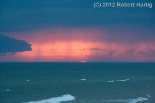
which considerably limited what I was able to do at the lakeshore. Using the hood of my car to steady myself, I managed to capture a few shots of a beautiful, moody sunset, with the red semicircle of the the sun gazing sullenly through rain curtains of the advancing storms. However, parking by the side of a busy road where everybody had the same idea–to pull over and watch the storms roll in over the waters–just didn’t work very well. After too many time-lapse images marred by tail lights (see photo in gallery below) I decided to hightail it and try my luck inland.

It was a good choice. The storms multiplied as I headed back toward Caledonia, and with lightning detonating to my north and closing in from the west, I decided to continue eastward till I found an ideal location–a place far from city lights and with a good view in all directions. I never expected to drive as far as northeast of Lake Odessa, but I’m glad I did.

Note to self: STOP USING THE ULTRA-WIDE-ANGLE SETTING WHEN SHOOTING LIGHTNING. Zooming out all the way to 18 mm is just too far, and cropping the shots doesn’t work well. The crispness goes downhill.

For all that, the images below aren’t all that bad, and a few turned out really well. After Sunday’s busted chase in Nebraska, it was nice to enjoy a few mugfulls of convective homebrew right here in West Michigan. I finally arrived home at the scandalous hour of 4:15 a.m., far later than I ever anticipated. I was tired but pleased. This Memorial Day lightning display did not disappoint.

Along the Long Lake Trail

This has been the quietest May I can recall weatherwise. The peak month that I and hundreds of other storm chasers have spent the better part of a year anticipating has turned out to be a dud. Maybe around the latter part of the month things will improve, but there’s nothing to look forward to for at least the next week.

If the weather isn’t going to offer anything chaseworthy, then the way it has been is exactly the way I want it to be: blue, crisp, and beautiful, warm but not hot, with the sun smiling down on a landscape that’s getting on with the business of spring.

A couple days ago, I took a walk down the Long Lake Trail just north of Gun Lake State Park in northern Barry County’s Yankee Springs Recreational Area. It had been a while since I had hiked the trail, and this time of year is perfect for the venture, so off I went. The first mile or so of the trail winds through hardwood forest, skirting a small bog and a tract of red pine, then sets you on a quarter-mile stretch of boardwalk through part of the swamp that surrounds Long Lake. It’s a lovely hike that offers plenty to see if you know your native plants and their habitats.

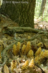
Here are a few of the highlights. The odd little plant to your right, which somewhat resembles miniature corncobs, is called squawroot (Orobanche americana). It is a common woodland plant, parasitic on oak trees. Click on the image to enlarge it.

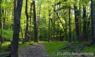
The trail winds through some particularly pretty territory. The photo below gives you an idea. There are a number of other images at the bottom of this page to keep it company.

Ferns were in the process of unrolling their fronds. They never look more dramatic or more artistic than this time of year, when they’re in their “fiddlehead” stage.

Farther down the trail, where the boardwalk commences, marsh marigolds scattered Pointillistic fragments of butter-yellow across the swamp floor. Picking up on the golden theme, the first few flowers of small yellow ladyslipper orchids (Cypripedium calceolus var. parviflorum) peeked out shyly from among lush skunk cabbage leaves.

The swamp is full of poison sumac, a small tree with which I’ve had considerable experience recognizing and avoiding. It is related to the cashew and also, of course, to poison ivy. Eating poison ivy at age six was not one of my intellectual zeniths, and it’s not an experiment one should undertake casually. Long after the initial bitter burst of flavor has faded, the experience lingers in a way a body is not apt to forget. Word has it that poison sumac is even more virulent than poison ivy. That’s not something I care to put to the

test. Interestingly, the sap of its equally toxic cousin, the Japanese lacquer tree, is used as a varnish which produces some beautiful objets d’art, though how a body works with a medium like that is beyond me.

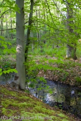
But enough of the swamp and its sumac. Stepping off the far end of the boardwalk and farther into the woods, I encountered an elegant young beech tree standing sentinel on a mossy bank.

I walked a bit farther, then turned back. The slanting sun rays were filtering long through the leaves, the temperature was cooling, and it was time for me to go practice my horn–which, by the way, I’ve been doing pretty consistently. But that’s material for another post. Right now, check out the rest of my photos in the gallery below.

Last Day of March: A Retrospective on One Really Weird Month

Here on this Saturday afternoon, poised at the tipping point into April, I look back on the past month and think, “What the heck was that?” March 2012 has been the oddest March I can recall, and if it is exiting like a lamb, it is not a very nice lamb. But at least it’s behaving more the way I’d expect it to. The first half of the month took the end of an abnormally warm winter to outlandish extremes, with record-breaking high temperatures across much of the nation. Here in West Michigan, not only did we consistently experience temps in the 70s, but we had a number of 80-degree days, one or two of which climbed perilously close to the 90-degree mark. For a while, it looked like we were emerging from the winter-without-a-winter into the summer-without-a-spring.

It was ridiculous, and to me, alarming. What kind of spring, to say nothing of summer, did such an anomaly presage? Would the nation wind up with another killer heat dome like last year’s, only maybe worse? Would the southern plains bake once again under an intolerable drought?

With the Gulf of Mexico’s moisture conveyor wide open, the lamb-like warmth of early March fostered some particularly leonine severe weather on March 2 in southern Indiana, Kentucky, Ohio, and other nearby states. It was the most lethal March tornado disaster since the 1966 Candlestick Park tornado claimed 42 lives.

As the warm spell continued, wildflowers bloomed in the woods a month ahead of schedule. Maples exploded into chartreuse and red blossoms, hyacinths decked themselves out in yellow, cherries and other flowering trees put on their finery, and hepaticas, spring beauties, and trout lilies sprinkled the forest floors with color, all weeks ahead of their normal season.

Now here we sit with flowers blooming and trees leafing out, and today’s temperature is forecast to hit the low 50s. Yesterday we almost got snow. The unseasonable warmth left us a week or so ago, and now March is acting like itself. Except, what’s with all these daffodils and pink plum blossoms?

The severe weather also seems to have regressed, which I suppose is just as well. I’m presently eyeballing what looks to be the next major trough, which according to today’s 6z GFS will swing into the plains Friday. At present, Saturday looks to have better potential, but at 180-plus hours out, there’s obviously a whole lot of wait-and-see involved between now and then. The system that is presently working its way through looked similarly promising a week ago, but it rapidly deteriorated into a poster child for why anything beyond three days out is just a prompt, not a forecast.

Anyway, right now, on this last day of March, I’m peering ahead and wondering: next Saturday, April 7? Maybe. Granted, I was entertaining similar speculations last week about tomorrow’s no-show. Still, it’s nice to have hit that time of year when the wildflowers are blooming, the robins are tugging worms out of the turf, and fools like me are once again gazing into the long-range crystal ball and thinking, “Hmmm…”

March 15, 2012, Dexter and Lapeer, Michigan, Tornadoes

Thursday’s tornadic supercells in eastern Michigan took a lot of people by surprise–NWS and media meteorologists, the SPC, storm chasers, and certainly me. Nothing about those anemic mid- and upper-level winds suggested the potential for even weak tornadoes, let alone significant ones. But there’s no arguing with Nick Nolte’s fabulous footage of the Dexter tornado, and certainly not with the damage that storm did as it swept through the town. It has been rated an EF-3, the most damaging of the three tornadoes reported on March 15, 2012. Second in impact was a tornado that struck farther north in Lapeer, causing EF-2 damage; and finally, an EF-1 tornado in Ida.

Like every other chaser in Michigan whom I know, I had no plans for chasing storms Thursday. True, temps were in the 70s and dewpoints in the 60s; MLCAPE was in the order of 3,000–3,500 J/kg; and the hodograph looked curvy.

But curvy alone isn’t supposed to cut it, not when the dynamics are as puny as they were: winds around 20 kts at 850 mbs; 20–25 kts at 700 mbs; and 25–30 kts from 500 mbs on up to around 26,000 feet, where they finally began to make incremental but hardly impressive gains. The storms that formed should have been popcorn cells that quickly choked on their own precipitation. But they didn’t. At least some of them became classic supercells that lumbered across eastern Michigan at around 15 miles an hour, spinning up strong tornadoes.

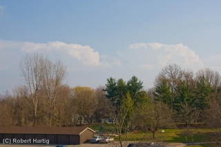
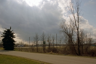
I was sitting in my living room editing a book manuscript shortly after 5:00 when I happened to glance out the window and saw some impressive, well-formed towers to my southeast. “Dang!” I thought. “Those look nice!” My second thought was to grab my camera and snap a few photos. After all, thunderstorms just aren’t something you normally see on March 15 in Michigan, let alone such muscular-looking ones. You can view one of the three shots I took–the last one, time-stamped 5:22 p.m.–at the top of the page. (Click on the image to enlarge it.)

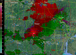
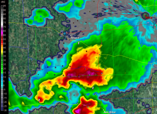
Curious, I took a look at GR3. I’d been glancing at it off and on as the afternoon progressed, watching a small squadron of cells pop up across southern and eastern Michigan. They resembled something I might normally see in July or August. But now, one of them looked different–so unexpectedly different that I had a hard time believing what I was seeing. South of Howell and northwest of Ann Arbor, the most vigorous-looking storm of the bunch had transformed into an unmistakable supercell–a regular flying eagle with a little pinhole BWER in the hook.

Where the heck did that come from, and why on earth was it there? Pinch me, I must be dreaming. I switched to SRV, and sure enough, there was a couplet, and not just a weak one, either. A pronounced couplet.

A scan or two later, the storm was continuing to develop. The pinhole had disappeared, and the supercell now had a classic hook. On radar, it looked as nice as anything you could hope to see out West in May–only this was Michigan in mid-March.

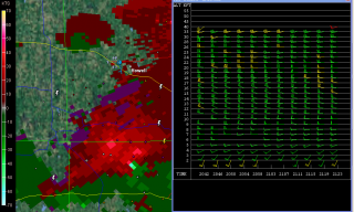
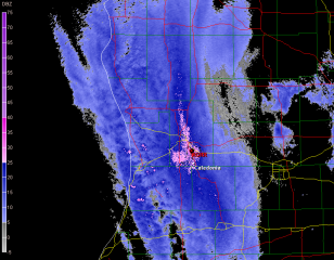
Surely the winds had to be better than I had been led to believe. One way to find out. I pulled up the VAD wind profiler at DTX. Ummm … well, okay. Nothing at all remarkable there. Maybe, given the curviness, enough bulk shear to organize the storm. Obviously that had to be the case; the evidence was staring me in the face, along with a couplet which hinted at the tornadic action that was presently occurring. The last screen capture, just below and to your right, shows both the couplet and the VAD. Enlarge the image, zoom in on it, and you can see for yourself just how meager the winds were and why one would expect storms forming in that environment to drown themselves in their own tears.

While I was glued to my radar in Caledonia, across the state storm chaser Nick Nolte was hot on the storm and videotaping the tornado that eventually hit Dexter. After getting out of work for the day, Nick had noticed the storm popping near where he lives. Grabbing his gear, he took off on what turned out to be one of the most serendipitous chases any chaser could hope for.

Nick got some fantastic footage of the Dexter tornado. Congrats, Nick–you really nailed it! Rather than steal Nick’s thunder by embedding his YouTube video here, I’m going to simply redirect you to his site and let you hunt it up there.

I’ve viewed some other footage beside Nick’s that demonstrates a particularly noteworthy aspect of the Dexter tornado, and that is its breakdown into helical vortices. I’ve seen only one other video that demonstrates this helical structure so clearly, and that is the famous KARE TV helicopter video of the July 18, 1986, Minneapolis tornado. The Dexter footage isn’t as dramatic, but it nevertheless depicts the helical effect with stunning and captivating clarity. Nick’s video captures it as well toward the end of his clip. It’s really amazing to see.

Unfortunately, the Dexter and Lapeer storms did considerable damage. If there’s a bright side to their human impact, it’s that no one was killed or seriously injured.

What turned yesterday’s anemic setup into a significant tornado-breeder? A weak upper-level impulse provided the needed lift to spark the storms, but it doesn’t explain why some of them developed into tornadic supercells, given the lackluster mid- and upper-level winds. I’m no expert, but I’m guessing that the unseasonably high CAPE is what did the trick. I suspect it took what was present in terms of shear and helicity and amplified it, in effect creating the Dexter, Lapeer, and Ida storms’ own mesoscale environments–ones conducive to tornadoes.

Of course, similar scenarios typically provide no more than single-cell and multicell severe storms. But then, yesterday was an anomaly in some significant ways. After all, this is Michigan, and it’s only mid-March. When CAPE of that magnitude shows up in the midst of unseasonably high dewpoints, it appears that all bets are off.

ADDENDUM: Lest you should miss reading the comments, check out this satellite loop from Thursday. You can see the storms exploding along an outflow boundary pushing west-northwest from Ohio, and other storms firing along a cold front dropping southeast. Two boundaries, and they actually appear to collide around Saginaw. The OFB accounts nicely for convergence and low-level helicity. Thanks to Rob Dewey for sending me the link.

March 12, 2012, West Michigan Supercell

Well, what do you know! My purely speculative ruminations a few days ago on some possible upcoming severe weather materialized. The NAM, which was odd-man-out among the various forecast models, proved in the end to have the best handle on today’s setup in terms of moisture and instability. Those mid-50s dewpoints it kept promising actually showed up–I took a read of over 56 degrees in Portage on my Kestrel–and so did sufficient instability, courtesy of clearing that allowed the sun to work its mojo over West Michigan.

Here was the setup, in brief:

• A mid-level low over Wisconsin directing southwesterly upper flow over Michigan.

• Diffluence overspreading the lower part of the state.

• A 70-knot 500 mb jet max nuzzling into the area.

• Below it, 45-knot 850 mb winds continuing to strengthen.

• A clear slot moving in from Illinois, breaking up the overcast from earlier storms into a nice cumulus field with room for decent insolation.

• From those same earlier storms, wet ground that contributed to the boundary-layer moisture.

• Adequate instability. From the afternoon’s SPC mesoscale graphics, it looks like we saw upwards of 500 J/kg MLCAPE–in the early spring, sufficient to get the job done.

• Low-level helicity in the order of 200-250 m2/s2–easily enough for tornadoes, though none were reported.

I expected to leave my place in Caledonia and head south toward Kalamazoo around 3:00 p.m. However, clearing was moving into southwest Michigan so rapidly, with an attendant, juicy-looking cumulus field, that at 1:30 I could no longer sit still. I grabbed my gear, gassed up and Rain-Xed up, and hit the road.

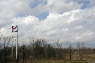
At the Marathon station on US-131 and 100th Street, I snapped a couple photos of the clouds while I waited for Tom Oosterbaan to arrive. In the topmost image, you can see how much shear was messing with the enhanced cumuli.

Once Tom arrived, we headed down US-131 toward Kalamazoo. On Center Avenue in Portage, south of I-94, we hooked up with Tom’s brother, Bill, and Dave Diehl. The four of us sat and waited, watching little storms on the radar pop along the lakeshore and head northeast and larger ones march across Grand Rapids and farther north.

Eventually, a vigorous cell that was moving in from around Benton Harbor continued to strengthen as it pulled closer to PawPaw. Cloud tops on this guy shot up rapidly as it moved toward us, and it began to take on that telltale supercellular look. This was our baby.

Bill took off west to intercept it directly in PawPaw. Tom and I headed north back up US-131, then caught M-43 west toward Bangor. A few miles down, a turbulent updraft base came into view. It was moving our way fast, and we decided that the better approach would be to jet back to 131, head north, and catch the storm as it approached and crossed the highway.

WOOD TV8 contacted me before we hit the exit ramp, and with my live stream going, a live phone-in underway, and an optimal view of a robust-looking wall cloud with a rather impressive tail cloud advancing from my west, pulling over onto the shoulder of the ramp seemed like my best move at that point. I did, and from what I hear, the live stream turned out really nicely on television.

As the wall cloud drew nearer, I took off once again, and we drew near to its southern edge as it crossed the highway, attended by a precip-filled RFD notch starting to wrap around it.

The storm was tearing along, and as it moved off to the northeast, I had a hunch that our day was over. We tried hard to catch up with the storm again, but it was moving too fast. Bill, on the other hand, had repositioned well off to the east and was in a prime location to intercept it. He did, and followed it a long way east. How he managed to keep up with it during its course through rural Barry County, which is some of the most unchaseable terrain imaginable, I’ll never know. (Actually, I probably do know–I’ve been on a lot of chases with Bill–but I ain’t divulging his secret, not me.)

After flirting briefly with another cell that blew toward us from Plainwell, Tom and I headed back toward 100th Street, where I dropped him off at his vehicle and then headed home.

This was a fun little local chase–less than 200 miles and nothing spectacular, but full of interest and a really nice way to kick off the spring storm season in West Michigan. Just for grins, here is a brief video clip of the wall cloud as it passed over US-131.

Winter Storm in West Michigan

I don’t normally let so much time elapse between posts, but…

  • •  I’ve been hugely focused on an editing project; and
  • •  I sprained my ankle a few weeks ago, greatly curtailing my activities; plus
  • •  this has been an abnormally warm, largely snowless winter thus far; and so, adding everything together
  • •  I haven’t had much to write about.

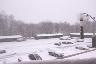
But that has changed with the arrival of this latest winter storm, which I am live-streaming on iMap even as I write. Here’s what it looks like on the radar as of around 9:20 a.m. (Click on the image to enlarge it.) A little farther down the page is a corresponding view from my balcony here in Caledonia, Michigan. Let’s put it this way: it’s not very pleasant outside.

The Grand Rapids weather office has this to say:

...WINTER WEATHER ADVISORY REMAINS IN EFFECT UNTIL 7 PM EST THIS
EVENING...

HAZARDOUS WEATHER...

 * SNOW WILL CONTINUE TO FALL ACROSS THE AREA INTO THIS MORNING
   BEFORE TAPERING OFF. SOME LOCAL POCKETS OF HEAVIER SNOW WILL BE
   POSSIBLE AT TIMES.

 * STORM TOTAL SNOW ACCUMULATIONS OF 3 TO 6 INCHES ARE EXPECTED
   THROUGH 7 PM FRIDAY EVENING...WITH LOCALLY HIGHER AMOUNTS
   POSSIBLE.

 * SOME WIND GUSTS OF UP TO 30 MPH WILL CAUSE SOME BLOWING AND
   DRIFTING SNOW LATER TODAY.

The updated aviation forecast includes this addendum:

AREAS IN THE WARNING WILL SEE 5 TO 8 INCHES WITH SOME AMOUNTS UP TO 10
INCHES POSSIBLE.

Latest station ob at GRR shows a temperature of 27 degrees. That’s not at all horrible for this time of year in Michigan. What we’re getting is actually standard fare. But that’s not to make

light of it. Conditions certainly aren’t balmy, and a 20-knot northwest wind doesn’t help. This is a great day to be inside. It’s times like now when the benefits of working at home become strikingly apparent. No scraping ice off the windshield of my car. No driving down icy roads. Just a manuscript to edit while catching glimpses of the birds swarming the feeder against a backdrop of windblown snow.

Life’s good things aren’t necessarily pricey. I’m content with a cuppa joe, a warm apartment, my work in front of me, and a pretty landscape outside the window with the snow piling up. From the looks of it, we’ve got around four inches right now. Bring on the rest of it. I’m not going anywhere.

Just in Time for the New Year: Real Winter Is Here at Last

With the arrival of the new year, Winter 2012 appears to finally be kicking into gear here in West Michigan. I’m ready for it. We got off light in December, with little in the way of snowfall and much in the way of unseasonably warm temperatures. On New Year’s Eve, temps scraped above 40 degrees. In that respect, this New Year has been very similar to the last one, though not quite as warm.

The mercury started dropping yesterday afternoon as the wrap-around from a departing low ushered in colder air, and with it, the first significant snowfall of the season. Here’s what the L2 radar looked like at about 1:00 p.m. yesterday as the snow was getting started. Possible blizzard conditions were in the GRR forecast discussion at that point, but the winds never intensified to that level. Station obs currently show northwest surface winds up to 20 knots through West Michigan, and just up the road at the airport the temperature is 25 degrees. That sounds like winter to me.

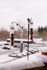
And the snow that is piled on top of my balustrade and covering the cars out in the parking lot looks like winter. Here’s a view of the bird feeding station out on my balcony to give you an idea of how much snow has stuck since yesterday. Looks to be about four inches. More may visit me yet here in Caledonia, but right now we appear to be situated between bands of the heavy lake effect stuff, with the most intense band streaming south-southeast from along the lakeshore by Muskegon and Grand Haven toward Kalamazoo and Centreville.

I see that a few storm chasers are out for a romp. Enjoy yourselves, lads. Me, I’m recovering from a sprained ankle and my car is in the shop, so I’m not going anywhere. Today is a day to ice my ankle, kick back with a big mug of Lapsang Souchong tea, watch the finches frolic at the feeder, work on an editing project, and let the icy winds blow.

Happy New Year, everyone!