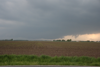
Updraft Base
This is the view that met us as we pulled off the road a couple miles north of Edina, Missouri, yesterday evening. “We” were Bill Oosterbaan, Derek Mohr, and me, and what we were looking at was the only supercell in Missouri on Wednesday, May 13, to produce a tornado–this despite a sizeable moderate risk that swept across most of Illinois and Missouri all the way down to Kansas and Oklahoma.
The storm was showing strong rotation, and had already put down a damaging tornado twenty miles to our west in Kirksville. We lost Internet connection as we approached the storm, but our last scan showed what appeared to be a storm merger with two distinct areas of rotation. The radar didn’t lie, and the proof of it provided an interesting scenario.

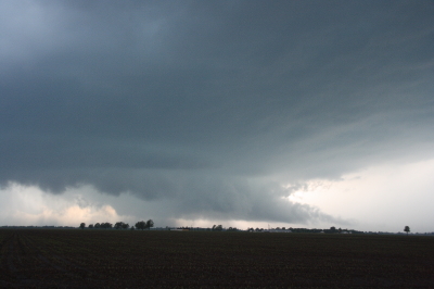
Wall Cloud Forming
In the second image, you can see a ragged patch of scud ascending to the right and in front of the lowering in the background. This is the beginnings of what became an impressive wall cloud. Within a couple of minutes, the scud had matured into this…

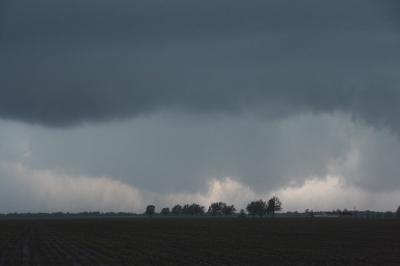
Wall Cloud
The tail cloud to the right continued to grow to an astonishing length, displaying vigorous motion, feathering in rapidly toward the updraft. Meanwhile, a rain curtain began to wrap in from the south behind the wall cloud. This suggested a second mesocyclone following in the wake of the first area of rotation. I commented on this in the video I took of the storm, and my hunch soon proved true.
As the storm drew nearer, another prominent lowering began to emerge. It was exhibiting rapid motion, moreso than the more visually interesting wall cloud in the foreground. A tornado appeared immanent within this broad rotation, and in another minute multiple vortices were square dancing in the distance. One vortex soon tightened up and became dominant, fattening up into a nice hose. But the rain bands were starting to conceal the tornadic activity, and in a bit it was hard to tell exactly what was happening.
The storm quickly evolved into a nasty high precipitation beast, and from then on any tornadoes were effectively cloaked in rain.
Sorry, no stills of a well-formed tornado–I had set my camera down in favor of my video recorder–but I did manage to capture what looks to have been the beginnings of the multiple vortex phase.

Multiple Vortex Tornado
No, you can’t see any visible touchdown in the photo, so maybe the circulation wasn’t tornadic at that moment. If not, it was shortly after. I sure wouldn’t have wanted to be standing underneath it.
After the chase, Bill dropped Derek and me off where we had left our cars at the K-Mart in Springfield, Illinois. Then the three of us headed off in our respective directions–Bill toward Corydon, Indiana; Derek toward northern Michigan; and I back toward Grand Rapids. On my way home, I picked up fellow Michigan chasers Mike Kovalchick and Mike Bishop. They had experienced an automotive failure that took them out of the chase, forcing them to ditch their vehicle in Lincoln–truly a bummer. It was great to reconnect with Mike Kovalchick, and to meet Mike Bishop for the first time. Having a couple fellow storm chasers in the car sure made the long trip home seem shorter.
The day out chasing did me a world of good, but I need a good night’s sleep, and I have work to do tomorrow. By the time the next round of weather arrives, though, I should be primed and ready to go.


Thanks for the video and informative accurate commentary Bob (and your honest clarification in your post on ST). May 13 seemed to offer plenty of possibilities for chasers, but required caution – sometimes the sensible approach is to take in the vista from the bleachers rather than from down in the front row. You sure get great storms in the US. Was intending to be over there this year to chase with a couple of friends (who are over in the US now) but didn’t make it. Have to content myself with virtual chase and waiting till October – January, our next chase period in Australia.
I appreciate your comment, Mike. The HP nature of the storm combined with those crazy, winding Missouri roads argued for keeping a safe distance as the storm continued to develop.
Sorry to hear you couldn’t make it over to the Plains for the spring show. It’s nice to have the option of chasing Australia, though. We often get a second season here as well, but it’s nothing like April through June.