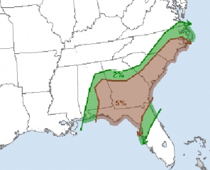
As I write, a 988 mb low is passing just south of me, and with it, a major winter storm is covering areas west of me with snow while in the Southeast, several states are under a 5 percent risk of tornadoes per the Storm Prediction Center.
I’m not going to write a lot. I just want to tip my hat to this system as it moves through, because it is a humdinger. Here in Grand Rapids, we’re presently getting a lot of wind and rain, and the rain will change to snow later tonight.
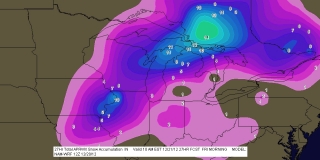
Snowfall here looks to be minimal, an inch or less, but not a whole lot farther north, conditions promise to worsen quickly, with accumulations up to eight inches or more over the next 24 hours. The first map is a 12Z NAM snowfall map, courtesy of F5 Data; click on it to enlarge it. Below it, to demonstrate the contrasting weather conditions, is the SPC Day 1 tornado risk.


