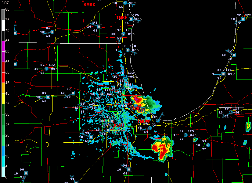
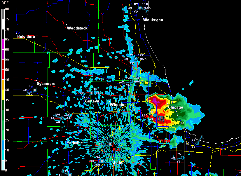
Earlier today, I opened up GR3 just out of curiosity and noticed some blobs of convection along the Lake Michigan shore by Chicago. Here are a couple radar grabs.


These images interest me for several reasons, all of which have to do with a Great Lakes phenomenon called the lake breeze zone. The lake breeze zone is not a fixed area. Its boundaries are atmospheric, not geographic.
And boundaries truly are what it’s all about. Probably the most immediately noticeable feature on these radar images, besides the obvious storms, is the north-south boundary set up by the onshore breeze. It’s a great point of convergence where overall westerly surface winds butt up against backing winds from off the big lake. You can see how outflow from the storms that have fired up within the lake breeze zone interacts with the lake breeze boundary.
Another less immediately obvious by-product of the lake breeze zone is helicity. Notice how the wind barbs farther inland are all westerly, but inside the lake breeze zone, they’re easterly. Now, I’m no expert on this stuff, but I know enough to recognize the potential for localized helicity to occur even when the large-scale flow is unidirectional. During the day, strong thunderstorms can go tornadic when they encounter a backing onshore breeze near Chicago, along the Wisconsin shoreline, and along the Lake Huron and Lake Erie shores of eastern Michigan. The same can happen in the evening along Michigan’s western coast as the land cools and an offshore breeze prevails. Many times I’ve noticed the NAM and RUC showing a small sigtor centerered over Berrien County when there are no sigtors anywhere else in the region, and I’m sure this phenomenon is largely due to the lake breeze in that area.
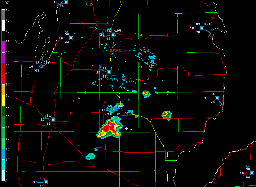
Right now I see storms firing up farther north around Gladwin and Roscommon.

A glance at the Gaylord VWP shows west winds neatly stacked from the surface on up. But look at the METARs along Lake Huron. Without much in the way of bulk shear, the storms are subsevere, just little popcorn cells. But it will nevertheless be interesting to see what comes of them as they work their way into those backed shoreline winds. You just never know.

