Winter Storm in West Michigan

I don’t normally let so much time elapse between posts, but…

  • •  I’ve been hugely focused on an editing project; and
  • •  I sprained my ankle a few weeks ago, greatly curtailing my activities; plus
  • •  this has been an abnormally warm, largely snowless winter thus far; and so, adding everything together
  • •  I haven’t had much to write about.

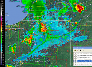
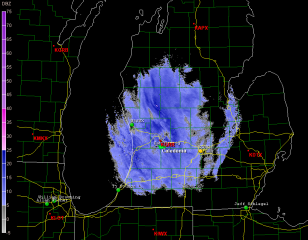
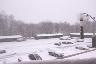
But that has changed with the arrival of this latest winter storm, which I am live-streaming on iMap even as I write. Here’s what it looks like on the radar as of around 9:20 a.m. (Click on the image to enlarge it.) A little farther down the page is a corresponding view from my balcony here in Caledonia, Michigan. Let’s put it this way: it’s not very pleasant outside.

The Grand Rapids weather office has this to say:

...WINTER WEATHER ADVISORY REMAINS IN EFFECT UNTIL 7 PM EST THIS
EVENING...

HAZARDOUS WEATHER...

 * SNOW WILL CONTINUE TO FALL ACROSS THE AREA INTO THIS MORNING
   BEFORE TAPERING OFF. SOME LOCAL POCKETS OF HEAVIER SNOW WILL BE
   POSSIBLE AT TIMES.

 * STORM TOTAL SNOW ACCUMULATIONS OF 3 TO 6 INCHES ARE EXPECTED
   THROUGH 7 PM FRIDAY EVENING...WITH LOCALLY HIGHER AMOUNTS
   POSSIBLE.

 * SOME WIND GUSTS OF UP TO 30 MPH WILL CAUSE SOME BLOWING AND
   DRIFTING SNOW LATER TODAY.

The updated aviation forecast includes this addendum:

AREAS IN THE WARNING WILL SEE 5 TO 8 INCHES WITH SOME AMOUNTS UP TO 10
INCHES POSSIBLE.

Latest station ob at GRR shows a temperature of 27 degrees. That’s not at all horrible for this time of year in Michigan. What we’re getting is actually standard fare. But that’s not to make

light of it. Conditions certainly aren’t balmy, and a 20-knot northwest wind doesn’t help. This is a great day to be inside. It’s times like now when the benefits of working at home become strikingly apparent. No scraping ice off the windshield of my car. No driving down icy roads. Just a manuscript to edit while catching glimpses of the birds swarming the feeder against a backdrop of windblown snow.

Life’s good things aren’t necessarily pricey. I’m content with a cuppa joe, a warm apartment, my work in front of me, and a pretty landscape outside the window with the snow piling up. From the looks of it, we’ve got around four inches right now. Bring on the rest of it. I’m not going anywhere.
Autumn in Grand Ledge

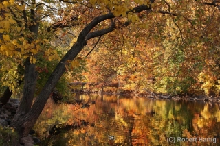
I don’t normally post twice in the same day, but I thought I’d share this photo. I took it this last Saturday, October 8, on the island in Grand Ledge, Michigan. Autumn was at its peak, and this shot captures well the flamboyance of this past, spectacularly beautiful week. Click on the image to enlarge it, then lose yourself in the almost overwhelming collage of color.

A Stormy Evening in Stanton

Last weekend my best male friend, Dewey (aka Duane, aka The Scurvy Rascal), and I headed up to a hunting camp in the backwoods of Kalkaska, Michigan, for a weekend retreat. It was a time of refreshing for both of us: a time of reconnecting and confirming our friendship after a season, for each of us, of being hammered on by life; a time of drinking good craft beer and Scotch whiskey, and eating steaks cooked over an open fire; a time of hunting, and shooting clays, and blasting away with assorted pistols, including my favorite, a model 1911 .45; and a time of prayer, and reading the Bible, and talking about our passion for God, our beloved women, and life in general. A good, good time.

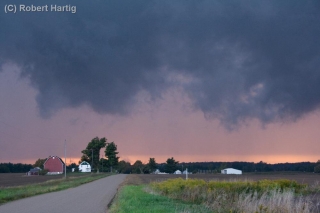
I drove up to Dewey’s home in Stanton Thursday evening. My laptop came with me, but I had suspended my data account with Verizon, and for some reason I was unable to access Duane’s router. With storms in the forecast, naturally I wanted to know what the radar had to show. So Dewey pulled up KGRR on his laptop, and Bingo! A nice line was moving toward Stanton and looked to arrive within a half-hour.

What the heck. I hopped in my car and took off, intent on finding a picturesque sweep of open landscape where I could watch the storm move in. As you can tell from the images on this page, I found one.

The storm was not nearly as formidable as it looks. It provided a nice bit of wind and a brief downpour; mostly, though, it was beautiful and offered a treat for the eyes. The setting sun filtered in low behind the cloud base, shining its rose-colored light through a curtain of rain and illuminating the backsides of gray, steamy towers.

But why am I talking like this? Here, see for yourself. The photos are in sequence; click on them to enlarge them, and enjoy the view.

An Absence of Hummingbirds

Gone, all gone. The hummingbirds that kept my balcony abuzz with aerial entertainment and me constantly replenishing their nectar supply have departed for the winter.

In my post last month on the hummers, I speculated whether they would depart in a matter of weeks or mere days. As it turns out, the latter proved true. Just a couple days later, I filled the feeder with fresh nectar and hung it out beneath the eaves outside my sliding glass door, but there were no takers. All day I waited for even a single bird to show. The weather had turned gray and damp, and I thought that maybe the little guys were hunkering down until the sun poked through. But nope, no hummers. Not that day, nor the next, nor the next.

Finally I took down the feeder. The act was my first acquiescence to the coming winter. More such concessions will follow, most of them unpleasant but a few with blithe compensations. The hummingbirds may be gone, but the chickadees and goldfinches have been showing up sporadically, making tentative inquiries into their trusty cold-season food source. It is about time for me to set up their feeding station and reassure them. The birds that overwinter in Caledonia, Michigan, have a friend in me and a haven out on my deck. For the price of a 25-pound sack of black oil sunflower seed and a few pounds of thistle seed, the sparrows, finches, chickadees, titmice, nuthatches, and other winged guests brighten the wintry days with birdsong and a flurry of feathery action–especially the finches, which show up in droves of as many as 15 and appear to have no shutoff valve for their appetites. Slap some suet out on the rail and the woodpeckers will be in constant supply as well.

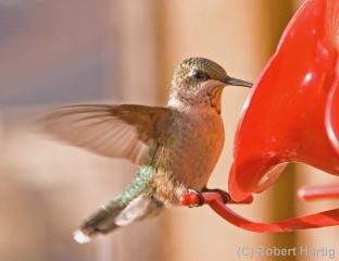
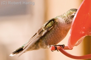
Right now, though, it’s still early autumn. The winter birds and I haven’t quite connected yet, and I’m contemplating the absence of hummingbirds. This page contains a couple more photos I took of them last month that didn’t turn out too shabbily. They’re my tribute to those iridescent little winged rockets that filled my summer days with many a smile. Thank you, hummers! Have a great winter, wherever you are, and I look forward to seeing you again in the spring.

So Much for Waterspouts

Waterspouts were in the marine forecast for Lake Michigan today. For that matter, they’re still there through tomorrow. But while people on the west side of the pond witnessed a few spouts, they didn’t materialize here on the Michigan shore.

With a closed upper low retrograding to the southwest and a persistent land breeze pushing convergence well offshore, out over the middle of the lake, any waterspouts that formed were far out of view from Michigan eyes. From the South Haven beach where Nick Nolte and I were hanging out, I could see a line of low towers pushing up over the waters 20 or 30 miles to west, moving ever-so-slowly to the northwest. The only Michiganians who might have seen a spout were boaters.

Sigh … I got up bright and early and arrived at the beach around 8:00 a.m., but the waterspouts eluded me. Nothing new there. I have yet to see a spout, but I live in hope.

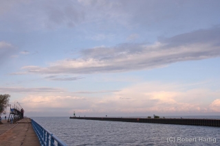
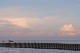
The clouds over the lake were pretty, though, lit by the morning sun. I snapped a few photos just to show I was there, paying my waterspout dues. I figure that if I keep slipping tokens into the slot, pretty soon I’m bound to come up with a winner. Meanwhile, a few pics on a cool, moody September morning on the lakeshore aren’t a bad compensation prize.

Evening of the Gentians

Welcome to September Land. It’s not a location you can pinpoint on any map, but it exists just the same. It’s a place of being; a juncture of time and mood; a coming-of-age of the summer when the sun’s lengthening rays gild the late-day hills, clown-colored maples stipple the forests, and yellow hues infiltrate the long, green rows of corn. September Land is where the year goes to receive its golden crown of wisdom; and where, as the hazy, blue sky of early autumn stretches, glowing, over meadows filled with asters and birdsong, you and I arrive to contemplate with nostalgia the months that lie behind us, and to quietly adjust our souls for the ones to come.

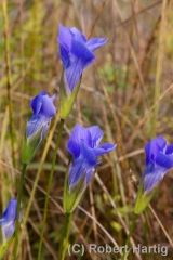
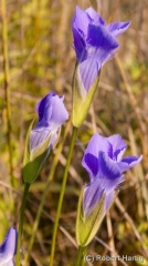
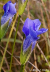
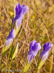
Now is the season of the gentians. Here in mid-September, they dot the wetlands with pointilistic splashes of purest blue, as if God had strewn pieces of sky like confetti over the fens.

I love the deep purple asters, the burnished goldenrods, and the bright, butter-yellow wild snapdragons. I’ve been a sucker for wildflowers ever since I can remember. But of all the autumn flowers, I like the gentians best. A number of species inhabit my state of Michigan, but the fringed gentian is the one I see most often, and the one I fell in love with as a boy roaming through the wetlands of southern Kent County.

The fringed gentian opens only in the sun. On bright days, it quietly unfurls its cerulean gown, and, like a shy young woman unaware of her own breathtaking beauty, captures the eye and heart of every beholder.

Among the many who, over the years, have been smitten by the gentian was the 19th-century poet William Cullen Bryant. Like me, he sought for words that could pay adequate tribute to the gentian’s loveliness, and set them down in his jewel-like poem, “To the Fringed Gentian”:

Thou blossom bright with autumn dew,
And coloured with the heaven’s own blue,
That openest when the quiet light
Succeeds the keen and frosty night.

Thou comest not when violets lean
O’er wandering brooks and springs unseen,
Or columbines, in purple dressed,
Nod o’er the ground-bird’s hidden nest.

Thou waitest late and com’st alone,
When woods are bare and birds are flown,
And frosts and shortening days portend
The aged year is near his end.

Then doth thy sweet and quiet eye
Look through its fringes to the sky,
Blue—blue—as if that sky let fall
A flower from its cerulean wall.

I would that thus, when I shall see
The hour of death draw near to me,
Hope, blossoming within my heart,
May look to heaven as I depart.

Here in Caledonia, Michigan, the woods of September Land are not bare nor are the birds yet flown. As I write, the hummingbirds still flit about the feeder out on my balcony. But frost has already visited counties to the north, and in these shortening days I, like Bryant, sense that “the aged year is near his end.”

Yesterday, Lisa and I enjoyed a spontaneous picnic out at Gun Lake State Park. With Labor Day behind us, the crowds of summer were gone and we had the park to ourselves. We sat at a picnic table, eating and talking and watching a great blue heron patrol the shoreline a stone’s throw away. Then, after strolling a bit through the southern tip of the park’s peninsula, we hopped into the car and headed back toward Caledonia. However, I had one stop-off to make in Middleville: a small but diverse prairie fen on the south end of the town.

While Lis drowsed off in the car, I hiked down the trail into the fen with my camera to photograph fringed gentians. With the sun waning and occasionally disappearing behind tufts of cumulus, many of the gentians had closed. But a few flowers remained open. I set up my tripod next to a likely looking cluster and began snapping photos. This page contains a few of them. Click on the images to enlarge them.

“Consider the lilies of the field, how they grow,” said Jesus. “They don’t work themselves to a frazzle, nor do they weave clothes for the wearing. Yet I tell you that even Solomon in all his splendor was not arrayed like these humble wildflowers.” (Matthew 6:28–29, my rendering.)

I suspect that if gentians had been at his disposal, Jesus would have pointed to them as his object lesson of the grace God bestows on quiet, lowly hearts that look to him. In these times of great national and worldwide distress, may you and I, like the gentians, learn to turn our heads upward with trust and a willingness to let God determine for us what life is truly about–and in so doing, find a peace rooted in something, in Someone, far more steadfast than the changing seasons of this world.

September 3, 2011, Outflow Boundaries

Yesterday morning my friend Kurt Hulst called to say, “Grab your camera. There’s a great shelf cloud coming your way. It passed my location before I could get a picture.”

Okay, then. My apartment faces east, and all I could see was blue sky. Not even a hint that a storm might be approaching from the west, and usually one gets at least some kind of a clue. But I snatched up my camera and car keys regardless and headed outside.

Yes, there it was–a hazy arcus cloud moving my way from the west and northwest. I hopped in my car, with the intention of finding a better view for taking photographs than my parking lot afforded. But the cloud was moving faster than I realized, and by the time I reached 108th Street, it was almost on top of me. So, with the wind kicking up flurries of leaves in front of me, I headed east, thinking to put a little distance between the shelf cloud and me.

Several miles down the road, I turned north, parked by a buffalo farm, stepped out of my car to get a look, and realized immediately that my cause was lost. The cloud was right overhead. It had to have been moving at least 60 mph. So much for weather photos. Within seconds, I was looking at the backside of the arcus, and it wasn’t particularly photogenic.

For that matter, there wasn’t much to it. No ensuing rain, no lightning, no thunder, no storm at all, just blue skies. I can’t speak for other parts of the country, but here in Michigan it is an odd thing to observe an impressive-looking shelf cloud with absolutely nothing behind it! The cloud evidently had formed as the isolated effect of cold outflow from dissipated storms back in Wisconsin, in conjunction with a closer, severe-warned MCS to the north. Back at home, I could see the outflow boundary arching southwest all the way down into Indiana and moving rapidly east.

Yesterday seemed to be the day for such phenomenon to be clearly defined on the radar. Later in the afternoon, GR3 showed a similarly highly distinct outflow boundary down in northern Indiana. The source of this one was easy

to see: storms to its northwest and north. It looked pretty vigorous, and I wondered if it was putting on a show similar to what I had witnessed.

As an item of curiosity and an example of a highly defined outflow boundary–I suppose you could call it a runaway gust front–I captured a screen shot. Click on the image to enlarge it.

Hurricane Irene in North Carolina

Hurricane Irene demonstrated to me conclusively that hurricanes aren’t my thing. Maybe I’m too cautious; maybe I’m downright chicken; maybe I’m smart. Certainly I’m inexperienced; just as certainly, I’ve never felt the same fascination for the hurricane environment, as I’ve understood it, as I have for tornadoes and supercells. However these various factors work in combination, the bottom line is, while I’m glad I got the opportunity last weekend to experience an impressive degree of Irene, if not her full fury, I doubt that my future holds any more hurricane interceptions.

Hurricanes and tornadoes are different animals, and the mindsets required for a severe weather junkie to appreciate the two are worlds apart. A tornado is ephemeral, arriving and departing in minutes; a hurricane is a time commitment of hours, possibly a lot of hours. A tornado is something you go to see; a hurricane is something you go to experience. A tornado’s human impact is terrestrial; a hurricane’s, amphibious, bringing the ocean with it as it arrives onshore. A tornado is something you seek to avoid getting munched by; a hurricane is something you purposely allow to ingest you, and it requires that you be willing to risk circumstances of a kind and scope that can outstrip anything even the worst tornado can produce.
I’m by no means minimizing the lethal, wholesale destructiveness of tornadoes. I’m just saying, we’re comparing apples and oranges. Yes, both storms pack a heckuva lotta wind, both are capable of horrific impact on communities, and both can kill you equally dead. But beyond that, the similarities vanish.

Different personalities embrace the variables in different ways. My friend and long-time storm chasing partner, Bill Oosterbaan, is now hooked on hurricanes. His brother, Tom, enjoyed doing the eyewall with Bill at Morehead City, North Carolina, but I suspect that once was enough for him. As for me, witnessing the massive surf pounding Atlantic Beach as Irene approached, and watching tropical-storm winds and hurricane-force gusts blast our hotel inland at Greenville, was all the taste of Irene I needed. Don’t get me wrong–the experience was thoroughly exhilarating, and I’m really glad I went. I just can’t see doing it again, particularly with a stronger hurricane than Irene.

I never expected to go to begin with. As Bill and Tom were making plans a few days in advance, I chimed in on the discussion, but I had neither the money nor the driving desire to join them, though I confess that I was intrigued. Then Bill called me three hours before their departure with the news that their trip would be underwritten and wouldn’t cost a cent. Would I like to go?

It was a kind, thoughtful offer. Bill knew that this storm season–historic and record-breaking as it has been for tornadoes–had been a miserable one for me as far as chasing went. Between family responsibilities and personal finances, it had been an utter washout, to the point where I’ve felt awkward even calling myself a storm chaser. Yeah, I’ve earned the merit badge over the last 15 years, but you wouldn’t know it judging by this year. Bill and Tom, good friends that they are, knew that I had felt the disappointment keenly and wanted me to have at least something to show for circum 2011.

So, making a last-minute decision, I grabbed the opportunity, threw some clothes into my softside, grabbed my gear, and off we went.

GPS and Live-Stream Hassles

Bill had made arrangements with WOOD TV8 to live-stream Irene using his new, super-fast Asus quad-core laptop. Unfortunately, DeLorme’s serial port emulator wouldn’t work with the laptop’s 64-bit Windows 7 OS, nor would Bill’s GPSGate recognize the DeLorme puck. The long and short of it was, while Bill could stream through iMap, there was no way of showing his location, rendering his live stream useless.

My computer isn’t as fast as Bill’s, but it’s fast enough, and it didn’t pose the same problems. However, for some reason, I kept losing my mobile signal Friday as we headed towards Morehead City. Worse yet, my output on iMap appeared jerky and horribly pixelated, to the point where I finally just gave it up. So much for live streaming for both of us. And so much for getting the trip underwritten.

Big Surf at Atlantic Beach

Friday, August 26. After checking into our hotel in Greenville, North Carolina, we set off for Morehead City. When we arrived, the bridge to Atlantic Beach beckoned, so over we went. We parked in a lot occupied by various media crews as well as casual sightseers. With just two hours before law enforcement intended to start kicking people off the island, we bundled on our rain gear and took in the massive waves pounding the shoreline.

The eye of the hurricane was still a good 150 or more miles south of us, but the wind was stiff and the sea a maelstrom of spuming breakers and brown, roiling undertow. My YouTube video doesn’t do justice to that wild, watery scene. The waves farther out in the video had to have been a good 15 feet high, their tops trailing spray into the gale as they raced toward shore.

By the way, that’s me in the rain jacket and shorts, cavorting in front of the waves. Hi, Mom!

Bill was determined to stick around and experience the eyewall, and I had the nervous sense that he wanted to hang out on the barrier island. My concern was that the island might wind up underwater, and that even Morehead City could get inundated by floodwaters, or the storm surge, or both. It just didn’t seem wise to me to locate ourselves that close to the Atlantic shoreline. Irene, which the day before had been forecast to make landfall as a category 3 storm, had by now been downgraded to a top-end category 1, but she was still an abnormally huge hurricane. I was concerned that our escape routes would be cut off and we would find ourselves stranded, with nowhere to go and the ocean encroaching on us as Irene’s eye moved in. High winds I’m fine with–bring ’em on; I like it. But I prefer them as a dry-land phenomenon, not a maritime experience.

Ultimately, I wimped out. The guys graciously brought me back to our hotel in Greenville, which was where I’d thought we would ride out the storm to begin with. I felt ashamed of myself for inconveniencing them, and I knew that Bill was disappointed. We’ve shared so many storm adventures over the years, but this wouldn’t be one of them. To be fair to myself, my reasonings–not all of which I’ve elaborated on here–were, I believe, fairly sound. Plus, again, I’ve never felt drawn to hurricanes the way I am to tornadoes and severe thunderstorms. Still, I had moved from an asset to a liability.

I beat myself up for quite awhile, so in case anyone reading this post feels inclined to pitch in their two cents, spare yourself the effort. I already did the job for you. That said, there was something to be said for peeling off my sopping clothes–which, thanks to a catastrophic failure on the part of my Helly Hansen rain suit, had gotten totally drenched–and then kicking back on a dry bed to watch the unfolding coverage of Irene on TV.

Saturday, August 27

When I awoke, Irene was making landfall at Morehead City. I picked up the phone and called Bill. No answer, and no surprise. I wasn’t certain whether the cell phone towers were working, but I was sure that the guys had their hands full. The television showed the west side of Irene’s eye squarely over their heads.

Outside, the wind was lashing a tree out in the courtyard and blowing a fine spray of rain against the window. Hurricane rain is not like the rain you get with an ordinary thunderstorm. The hydrometeors are smaller, halfway between droplets and wind-driven drizzle. But what a drizzle! Watching the stuff lash horizontally across the landscape, alternating between lighter respites and sudden, heavier bursts that tumble along like fog shot from a cannon, you really can’t fathom just how much is actually falling. The answer is, lots, an almost inconceivable amount.

By and by, I got curious what the view offered from a vantage point other than my fourth-floor room. Grabbing my video camera, I took the elevator downstairs and headed for the hotel entrance. There, for the first time, I got a good taste of Irene. Greenville may not have been in range of the hurricane’s full force, but the westward extent of her tropical-storm winds had surprised forecasters, and my location lay within a concentrated area of those winds. With sustained speeds of 55 mph and gusts as high as 75 mph, there was more than enough to hold my interest.

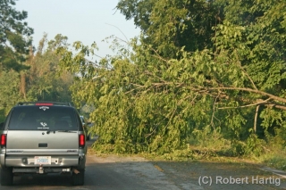
The higher winds in a hurricane are associated with its rain bands. When you see one of those bands approaching your location on radar, you can count on two things happening simultaneously: It is going to get very rainy, and it is going to get very windy. The transition occurs with a suddenness that verges on explosive, and in Greenville, its effect was everything you could imagine. Trees were down, and more were going down all the time. Branches were snapping. Power was out over a large area. In the hotel, the electricity flickered off and on, off and on, but amazingly, it somehow stayed with us for all but one two-hour stretch. As for Internet connection, forget it. I had been without radar updates since shortly after 8:00 a.m. So much for getting GR2AE volume scans of Irene while she was over Morehead City. They’d have made a nice memento for the guys, but there was no accessing the data.

The Storm Troopers Return

Bill and Tom returned around 3:00 in the afternoon, exhilarated and exhausted. After showering up, they headed back out into the wind and rain to catch dinner at one of the few open restaurants. They returned in an hour and filled me in on their eyewall experience. It sounded awesome, and I’m glad it was everything they’d hoped for. I can honestly say I didn’t mind having missed it, but I was pleased that they got what they were after. Particularly Bill. Experiencing a hurricane is something he’d been wanting to do for several years, and now that he’s gotten it in his blood, I’m quite sure he’ll do it again.

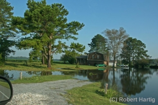
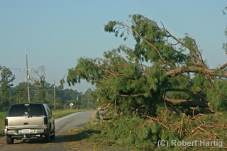
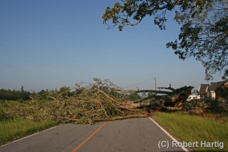
We started for home around 8:00 Sunday morning. The first 25 to 30 miles westward were littered with downed trees. Some of them blocked the road, requiring us twice to find an alternate route. In a few places, yards and even homes were flooded. Corn fields had been flattened by the wind and rain, and the tobacco, while not appearing as badly ravaged, had clearly taken a hit. Other more compact crops such as cotton and soy beans had fared better.

Fourteen hours later, a few minutes after 10:00 p.m., we rolled into Bill’s driveway, and a short while afterward, I was in my own vehicle driving east down M-6 toward home and my sweetheart, Lisa.

Will I do another hurricane? Well, I didn’t entirely do Irene for reasons I’ve at least partly explained. I did, however, get enough of a taste to confirm my sense that hurricanes don’t exert the same pull on me as tornadoes. I’m grateful to Bill and Tom for wanting me to join them–thank you so much, guys! I really appreciate it. Those middle rain bands in Greenville may not have been as intense as what you witnessed, but they were a blast, and I’m very glad I got to see at least that much of Irene.

However, lacking the passion required for accepting the risks involved, I would likely be just as reluctant to commit to a landfall intercept in the future as I was this time, and thus I would simply detract from the experience for others. That wouldn’t be fair to them or enjoyable for me.

So, while the old saying may be, “Never say never,” I seriously doubt that another hurricane lies on my horizon. Not anytime soon, anyway. If you enjoy multiplied hours of wind, water, sweat, and uncertainty, then a hurricane just might be your thing. Me, I’ll stick with tornadoes. They’re not so all-fired comprehensive.

Lightning at the South Haven Pier

Yesterday’s slight risk for Michigan looked more impressive in the models than it did up close and personal. With dewpoints as high as a sultry 78 degrees Fahrenheit in Caledonia (courtesy of my Kestrel 4500 weather meter), MLCAPE upwards of 3,500 J/kg, and 40 knots at 500 millibars, the ingredients were all present for a decent severe weather event. Backing surface flow even suggested the possibility of tornadic spin-ups, though winds at the surface were weak.

For all that, the storms when they finally arrived were pretty garden variety, with one exception: the lightning was absolutely spectacular, a

nonstop flickerfest bristling with CGs. The lines rolled across Lake Michigan in two rounds. Thanks to some good input from Ben Holcomb, I chose to set up shop at the South Haven beach, a great strategic location, arriving there in plenty of time to intercept round one. Kurt Hulst met me there, and we got our live streams going and tripoded our cameras as the northern end of the line bore down on us.

It was too dark to see the shelf cloud very distinctly. I tried to capture it with my camcorder; I haven’t viewed the footage yet, so I don’t know how it turned out, but I soon realized that I’d be better off working with my still camera, which I got mounted right about the time that the gust front arrived. The rain was near-instantaneous, escalating within moments from errant droplets to a horizontal sheet, and I scurried back to my car while collapsing my tripod as fast as I could.

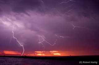
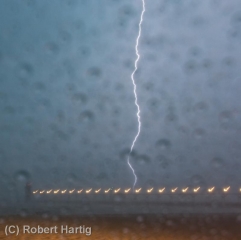
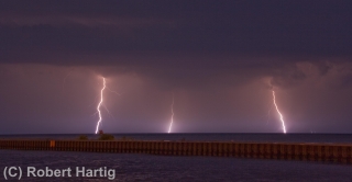
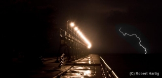
What a great light show! After a lot of teasers this year, I finally got a chance to get some good lightning shots, particularly as the storm moved off to the east. With CGs ripping through the air over South Haven, anvil crawlers lacing the sky overhead, and now and then a brilliant bolt tracing a path from the sky to the lake across the canvas of a molten sunset, yesterday evening was a lightning photographer’s dream. Kurt is a great hand in that regard, and he captured some fantastic images. But for once, even I managed to get some shots I’m pleased with. Here are some of my better ones. Click on them to enlarge them.

As the storm moved on, a good number of people returned to the beach with their cameras to capture the amazing sunset and the lightning display. Storm chasers aren’t the only ones with an eye for the drama that the sky provides!

Some of my photos were taken later on, as the second line of storms was moving toward the shore. I’m particularly pleased with my shot of a lightning bolt off to the right of the pier; it’s a moody, mysterious image, and I intentionally left plenty of dark space at the bottom left.

I might add that the pics with raindrops all over the foreground were taken from my car during the height of the first storm. While I’d of course prefer nice, clear images, I don’t mind the drops. They lend a somewhat Impressionistic feel to the photos. At least, that’s what I tell myself.

Distant Storm: Impressions of the Michigan Summer Sky

With the humidity scoured out of the air by a cold front that had passed overnight, and with high pressure dominating the area, yesterday was hot but pleasant. Patches of fair-weather cumulus grazed overhead like sheep in a high, blue pasture, but they disappeared as the afternoon progressed. By evening, the sky was a flawless blue, except to the north and northeast, where a few isolated turrets were trying to push through the cap.

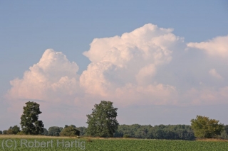
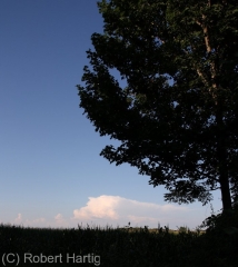
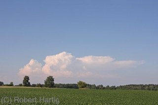
Thinking they wouldn’t succeed, I paid them little attention. So I was surprised when one of them muscled up into a nice little multicell thunderstorm near Mount Pleasant. I was in Portland at the time, and with the storm almost directly to my north and me having nothing better to do, I decided to get a better look. It was a weak cell with a high base and a mushy anvil, but it was also the only storm going. And there is something about a solitary cumulonimbus drifting through the broad blue heavens that captivates me. Even a garden-variety, multicell summer storm is a sublime thing when mounted in the gracious frame of azure sky and green Michigan landscape, with miles and miles of farmland and forest stretching outward from one’s feet into forever.

Naturally I snapped a few photos. Then I let the storm go. It was too far away, and it wasn’t anything worth chasing. But it was lovely to watch, and a beautiful accent to a pleasant late-July evening.