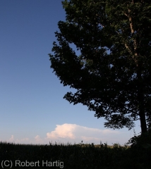
With the humidity scoured out of the air by a cold front that had passed overnight, and with high pressure dominating the area, yesterday was hot but pleasant. Patches of fair-weather cumulus grazed overhead like sheep in a high, blue pasture, but they disappeared as the afternoon progressed. By evening, the sky was a flawless blue, except to the north and northeast, where a few isolated turrets were trying to push through the cap.
Thinking they wouldn’t succeed, I paid them little attention. So I was surprised when one of them muscled up into a nice little multicell thunderstorm near Mount Pleasant. I was in Portland at the time, and with the storm almost directly to my north and me having nothing better to do, I decided to get a better look. It was a weak cell with a high base and a mushy anvil, but it was also the only storm going. And there is something about a solitary cumulonimbus drifting through the broad blue heavens that captivates me. Even a garden-variety, multicell summer storm is a sublime thing when mounted in the gracious frame of azure sky and green Michigan landscape, with miles and miles of farmland and forest stretching outward from one’s feet into forever.
Naturally I snapped a few photos. Then I let the storm go. It was too far away, and it wasn’t anything worth chasing. But it was lovely to watch, and a beautiful accent to a pleasant late-July evening.
If you enjoyed this post, make sure you subscribe to my RSS feed!


