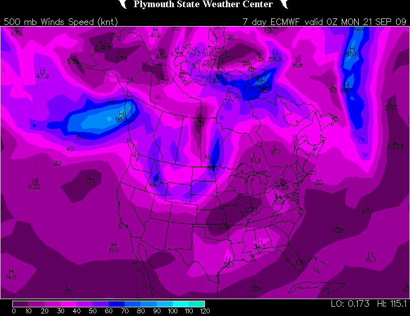
I love this balmy, blue fall weather. But down inside me, not too far from the surface, convective starvation is gnawing away. Does 2009 have a “second season” in store? Judging by this year’s insipid, ridge-robbed primary storm season, there’s reason to wonder, but I sure hope so.
There may be a flicker of hope for a week from now, at least if you go by the ECMWF.
As for the GFS…mmmph. More zonal flow, though the sea level pressure map suggests a hint of troughing for the northern CONUS. Not anything to pique one’s interest, though. And here’s the SPC’s 4-8 day outlook:
VALID 171200Z - 221200Z

   ...DISCUSSION...
   GENERALLY BENIGN CONDITIONS -- WITH RESPECT TO THE POTENTIAL FOR A
   SUBSTANTIAL SEVERE EVENT -- ARE FORECAST THROUGH DAY 5-6 /I.E. FRI.
   AND SAT. SEPT. 18-19/...AFTER WHICH SOME FAIRLY SUBSTANTIAL MODEL
   DIFFERENCES BECOME APPARENT BETWEEN THE GFS AND ECMWF.  THOUGH SOME
   HINTS THAT SEVERE POTENTIAL COULD INCREASE FROM DAY 6
   ONWARD...CONFIDENCE REMAINS QUITE LOW ATTM.  UNTIL THEN...SEVERE
   POTENTIAL APPEARS LIMITED AT BEST...AS SLOWLY PROGRESSIVE PATTERN
   ALOFT KEEPS THE MUCH OF THE U.S. UNDER THE INFLUENCE OF LONGWAVE
   MEAN RIDGING.  GIVEN THE LACK OF APPRECIABLE SEVERE POTENTIAL DURING
   THE FIRST HALF OF THE PERIOD...AND LACK OF CONFIDENCE IN MODEL
   GUIDANCE BEYOND...NO SEVERE THREAT AREAS WILL BE HIGHLIGHTED THIS
   FORECAST.
I’m rooting for the Euro. It sure would be nice to see some storms. Any kind of storms. Just some decent lightning would be much appreciated right about now.
As I’ve said more than once this year, I’m crossing my fingers but I’m sure not holding my breath.


