Here on this Saturday afternoon, poised at the tipping point into April, I look back on the past month and think, “What the heck was that?” March 2012 has been the oddest March I can recall, and if it is exiting like a lamb, it is not a very nice lamb. But at least it’s behaving more the way I’d expect it to. The first half of the month took the end of an abnormally warm winter to outlandish extremes, with record-breaking high temperatures across much of the nation. Here in West Michigan, not only did we consistently experience temps in the 70s, but we had a number of 80-degree days, one or two of which climbed perilously close to the 90-degree mark. For a while, it looked like we were emerging from the winter-without-a-winter into the summer-without-a-spring.
It was ridiculous, and to me, alarming. What kind of spring, to say nothing of summer, did such an anomaly presage? Would the nation wind up with another killer heat dome like last year’s, only maybe worse? Would the southern plains bake once again under an intolerable drought?
With the Gulf of Mexico’s moisture conveyor wide open, the lamb-like warmth of early March fostered some particularly leonine severe weather on March 2 in southern Indiana, Kentucky, Ohio, and other nearby states. It was the most lethal March tornado disaster since the 1966 Candlestick Park tornado claimed 42 lives.
As the warm spell continued, wildflowers bloomed in the woods a month ahead of schedule. Maples exploded into chartreuse and red blossoms, hyacinths decked themselves out in yellow, cherries and other flowering trees put on their finery, and hepaticas, spring beauties, and trout lilies sprinkled the forest floors with color, all weeks ahead of their normal season.
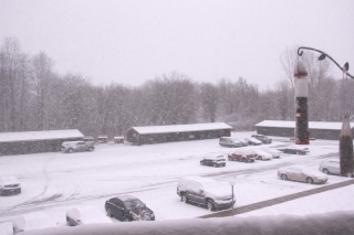
Now here we sit with flowers blooming and trees leafing out, and today’s temperature is forecast to hit the low 50s. Yesterday we almost got snow. The unseasonable warmth left us a week or so ago, and now March is acting like itself. Except, what’s with all these daffodils and pink plum blossoms?
The severe weather also seems to have regressed, which I suppose is just as well. I’m presently eyeballing what looks to be the next major trough, which according to today’s 6z GFS will swing into the plains Friday. At present, Saturday looks to have better potential, but at 180-plus hours out, there’s obviously a whole lot of wait-and-see involved between now and then. The system that is presently working its way through looked similarly promising a week ago, but it rapidly deteriorated into a poster child for why anything beyond three days out is just a prompt, not a forecast.
Anyway, right now, on this last day of March, I’m peering ahead and wondering: next Saturday, April 7? Maybe. Granted, I was entertaining similar speculations last week about tomorrow’s no-show. Still, it’s nice to have hit that time of year when the wildflowers are blooming, the robins are tugging worms out of the turf, and fools like me are once again gazing into the long-range crystal ball and thinking, “Hmmm…”


