We were three-and-a-half miles north of Palmyra, Indiana, when the tornado crossed the road less than a mile in front of us at Dutch Creek Road, ripping up a 12 x 12-foot section of asphalt in the process and throwing it in chunks into an adjacent field. Within about a minute, the vortex had morphed from a wispy rope into a powerhouse of a stovepipe, tearing tangentially across our path as Bill Oosterbaan and I blasted north on State Road 135.
Bill is no timid driver, and he did a heck of a job keeping pace with the beast. But the storm was a missile, moving at least 60 miles an hour, and once we hit downed power lines at Dutch Creek Road, we had to let it go. We had no idea of the tragedy it was about to inflict to our northeast. But, watching the white condensation funnel billow and intensify beyond the treeline, with secondary vortices wrapping around it like a cloak, we could tell it was a monster. As I filed a report on Spotter Network, Bill turned around and headed back south. A second supercell was hot on the heels of the one we had just let go, and repositioning became our immediate concern.
Bill and I had just been fortunate to catch and videotape the Henryille EF4 tornado in its formative stages. We first glimpsed it south of Palmyra as it descended from a wall cloud several miles to our west-northwest. It didn’t look particularly impressive at that point, but as we closed in, the fast-moving circulation began to display wild shapes and motions, then condensed fully and finally just before crossing the highway.
It seems incredible that in the few meager seconds the tornado took to translate across SR 135, it managed to rip up a large section of road. The term “asphalt scouring” just doesn’t apply; there was no scouring involved. An estimated 10,000 pounds of pavement got literally torn from the downwind side of the highway and thrown something like one hundred feet. I didn’t witness this road damage and only found out about it later. But chaser Simon Brewer provides a good description of what he saw just a few-score yards north of where Bill and I turned around.
The wider damage path associated with the main tornado circulation was easily visible from a forest west of the highway through a field, and past the highway through another forest to the east. Also, an individual suction vortex damage path was easily found starting in the field scouring vegetation and tossing boulders from a drainage ditch, then crossing a section of highway peeling and tossing massive slabs of asphalt, the largest broke upon second contact with the ground (it bounced leaving an significant impact crater) on the downwind side of the highway. Typical sphalt scouring is usually associated with EF3 and stronger tornadoes, but typical asphalt scouring is found on rural roads with relatively thin asphalt 1-2 inches or less thick. It’s amazing to think how short a time period the small suction vortex was probably over that section of highway; maybe only a second tops! I usually don’t stop to investigate tornado damage, but when I saw the highway damage on March 2nd I was blown away! I took more photos of the road damage than I did the storm and tornado. I consulted Dr. Greg Forbes and he agreed this was one of the most incredible damage cases he’s heard, only possibly being eclipsed by the trench created by the Philadelphia MS EF5 on April 27, 2011.*
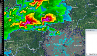
A year has passed since all of the above took place. At the same time last year as I am presently writing these words, Bill and I were nearing Louisville, and within another hour or so we would shift into chase mode, head west, and intercept our storm. Click here to read my complete account of that chase, including my video of the tornado as well as radar images and skew-Ts.
Today the weather is drastically different. This March is behaving like March, not May, and in light of last year’s prolonged heat wave and disastrous drought, I am glad. I will be delighted to see another round or two of good winter weather bring still more moisture to the Plains and Midwest and prime the pump for storm season. The storms of spring will get here soon enough, and while nothing is certain, my hunch is that this year will be better than last year.
_______________
* Simon Brewer, from his January 14, 2013, post in the Stormtrack thread The EF Scale and Asphalt Scouring Caused by the March 2 Henryville Tornado. Also see Simon’s and Jim Bishop’s chase account, which includes photos of the road damage, at their Stormgasm website. You can see Dutch Creek Road just past the road sign and parked car in the background of the first photo.


