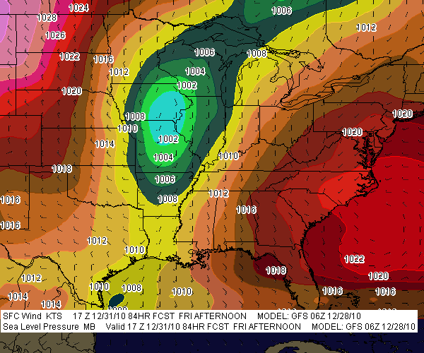
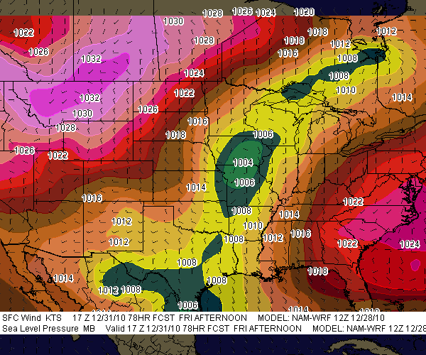
 Could be. If the GFS is right, the chance of severe weather in the Gulf states looks good. The NAM too, having leaned in with its 12Z run, also points to the possibility of a New Years Eve episode down in Dixie Alley, though it wants to nudge the ingredients slightly to the west and north.
 So far the SPC appears to believe that severe weather is likely in the South on Friday, but while they’ve mentioned the T-word, tornadoes, they’ve been reluctant to say anything emphatically. Of course, we’re still four days out, and hitherto the forecast models evidently haven’t jibed (I haven’t followed the trends till now). But between this
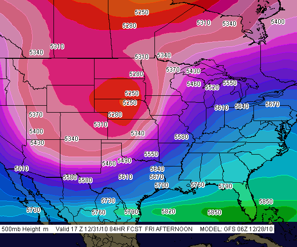
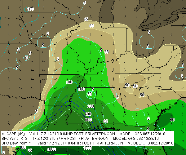
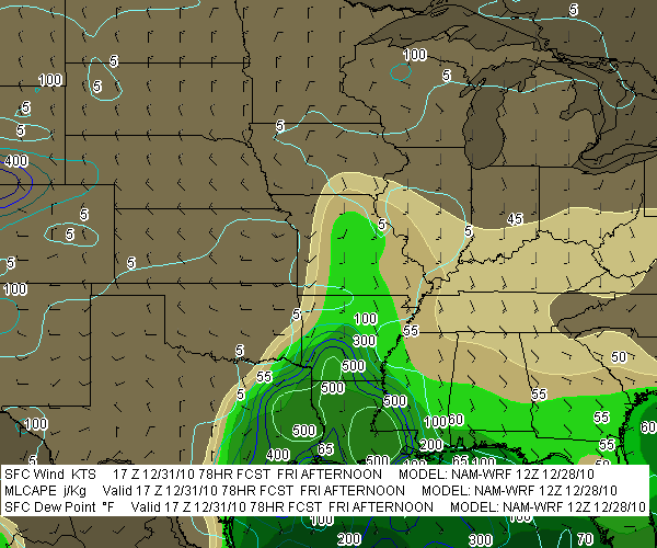
 morning’s GFS and NAM, it looks like a pretty decent intrusion of moisture will lick inland from east Texas eastward to Florida, with 500 J/kg MLCAPE overlaid by ample shear as a large mid-level trough digs into the nation’s midsection. From the looks of things, Louisiana, Arkansas, and Mississippi could be in the crosshairs, and eventually,
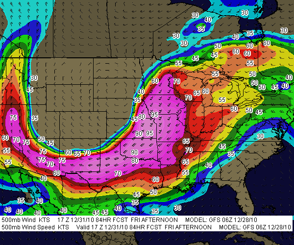
 perhaps Alabama and the Florida panhandle.
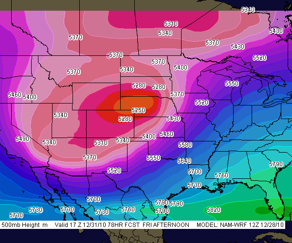
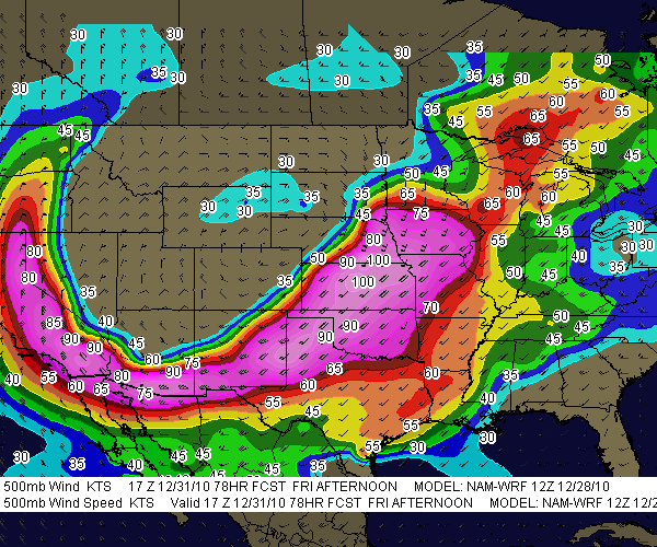
Here are some GFS and NAM models for you to compare. Left-click on the thumbnails to enlarge them. I’ve used the model runs available to me at this writing on F5 Data–6Z for 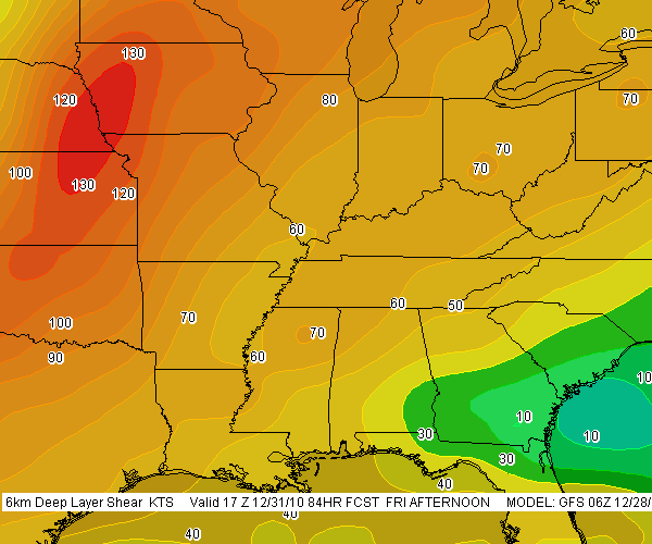
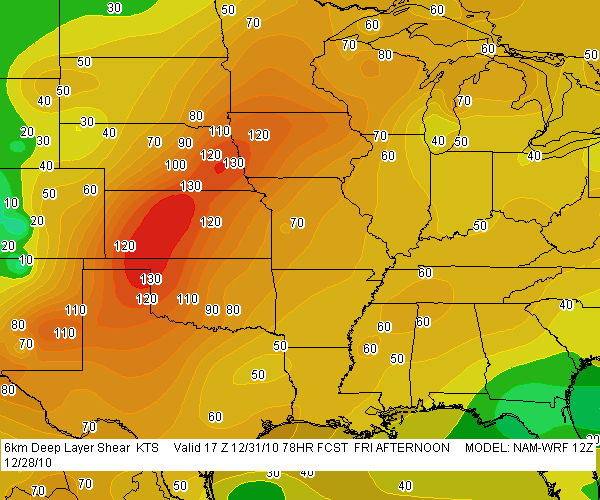 GFS and 12Z for NAM. The valid times should read 18Z, not 17Z.
.

