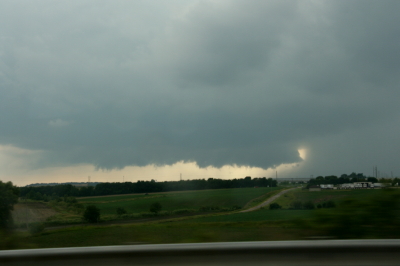
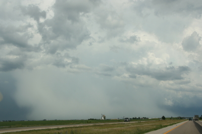
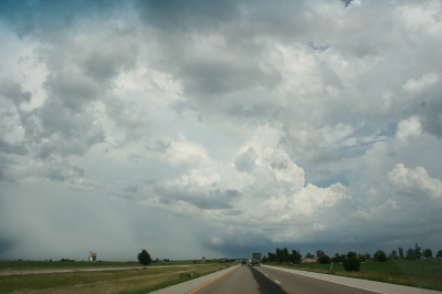
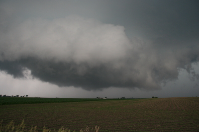
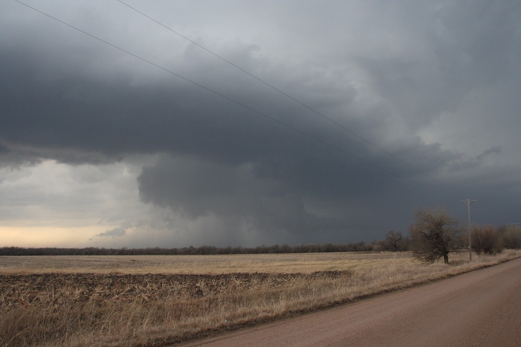
April 22, 2011, Saint Louis “Good Friday” Tornado

Saint Louis, Missouri, has been hit a number of times  by tornadoes over the years, most notably on May 27, 1896, when a violent tornado claimed 255 lives. Last Friday my friends Bill Oosterbaan, Kurt Hulst, Mike Kovalchik, and I witnessed the first EF4 tornado to strike the metro area in 44 years.

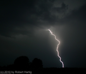
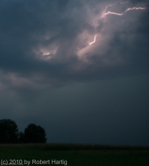
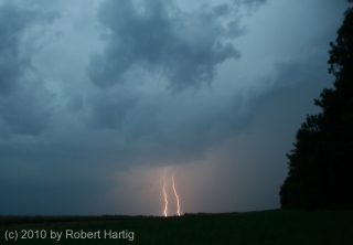
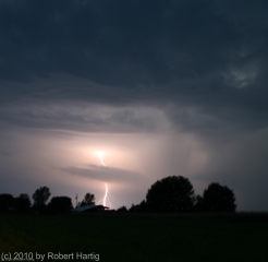
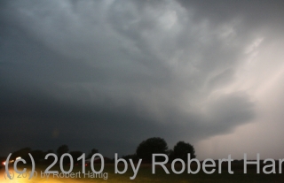
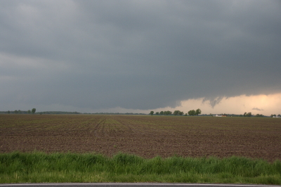
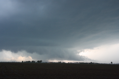
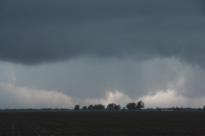
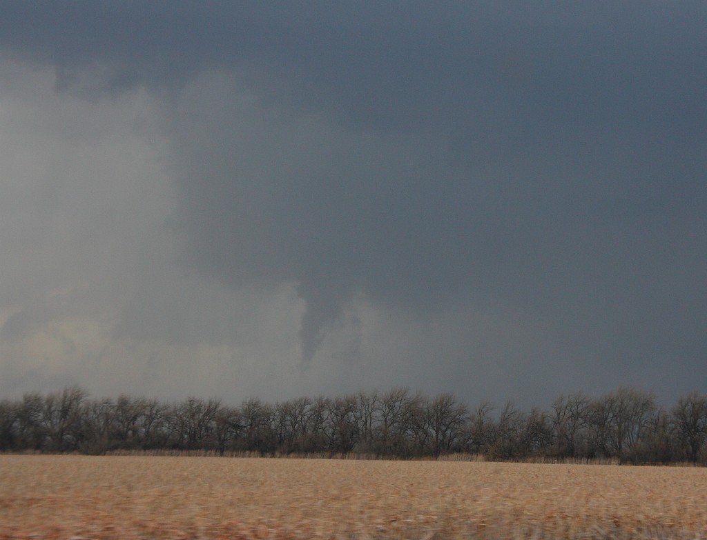
I use the word “witnessed” loosely as we really didn’t see much of anything. Bill observed wrapping rain curtains just to our west, Kurt and Mike saw a couple power flashes, and I captured a feature on video that may have been the funnel cloud, but mostly what we saw was a whole lot of blowing rain and brilliant, nonstop lightning. Judging from the lack of any other videos that show a clearly defined tornado, our experience was typical. If anyone was in a good position to see the condensation funnel, it was us, and perhaps we would have seen it had the storm struck an hour earlier. But I suspect the thing was too rain-wrapped for good viewing even in broad daylight.

The storm initiated southeast of Kansas City near the triple point of an advancing low. Poised at the northernmost end a broken line that backbuilt southwest  into Oklahoma, the incipient cell split and the right split grazed eastward along a warm front draped over the I-70 corridor.

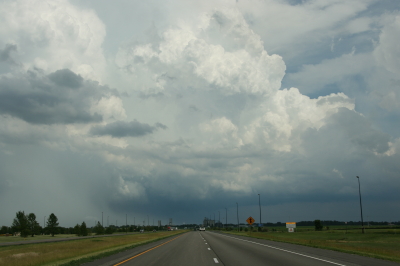
We first intercepted the storm south of Columbia outside the town of Ashland. At that point it was getting its act together and was already tornado warned. The sirens sounded right next to us as we stood and filmed, but the storm had a ways to go before it finally went tornadic. Where we stood southeast of the updraft base, the air was dead calm–not even a breath of inflow, nothing but the year’s first mosquitoes to remind us that spring was well underway south of our home state of Michigan.

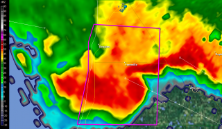
Keeping up with this storm would likely have been much easier had we not chosen to head back to I-70, where eastbound slowdowns hung us up and golfball hail on the north end of the supercell clobbered us. The storm organized beautifully for a while on the radar, but there wasn’t a thing we could do about it with traffic crawling along. Thanks to Bill’s great driving, we eventually did get clear, but by then the storm appeared to have turned to junk.

Just goes to show how deceptive appearances can be. Shortly after we had written the storm off, the radio announced the first reports of tornado damage in New Melle, and from then on, the reports continued. As fellow Michigan-based storm chaser L. B. LaForce put it, “I got a good look at the base just south of Innsbrook and it looked like crap. It tightened up shortly thereafter.”

Indeed it did, as strong and continuing radar couplets bore out. Dropping south on US 40 to get a better view of the storm, we parked by a cemetery and  finally got a good look at the action area to our southwest. Against the dirty orange backlight of the fading sunset, a conveyor of low clouds flowed from the north into an area of murky blackness bristling with lightning. Unquestionably this beast  meant business and intended to transact it along the worst possible path: right through the heart of  northern Saint Louis.

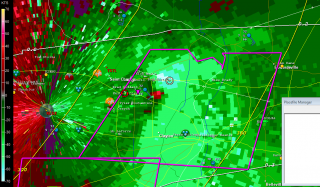
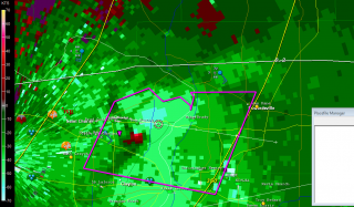
Along its 22-mile path, the tornado inflicted its most widely reported damage at the Lambert–Saint Louis International Airport. It’s a miracle that no one was killed or seriously injured at this location. That may very well include us. We had exited I-70 in order to get a look at the storm, or at least try to, and by the time we were back on the highway the radar showed that we had compromised our safety and needed to git, fast. It was at this point that Bill thought he saw the rain curtains swirling, and Kurt and Mike observed what looked like power flashes. Hard to say, given the intensity of the lightning. What’s certain is that we missed the tornado by the skin of our teeth, because the radio announced only minutes later that Lambert Field had been hit. The bear had been breathing down our necks. Funny thing is, I’ve driven through much worse conditions at night. But conditions can change in a heartbeat, and in this case they wouldn’t have changed for the better.

The seriousness of the damage inflicted by this tornado didn’t sink in until a while later when reports, photos, and YouTube videos began to filter in. EF4 damage occurred about a mile-and-a-half west of the airport. At Lambert, the damage was rated EF2 and resulted in closure of the airport. A photo of a passenger bus hoisted up onto the roof of an airport building demonstrated the power of the winds.

The Saint Louis NWS report on this event lists two tornadoes, the first a brief EF1 that did damage in New Melle, followed by the long-track, EF4 monster that chewed through Saint Louis proper, beginning along Creve Coeur Mill Road near Griers Lane and dissipating across the Mississippi River south of I-270 and west of Pontoon Beach, Illinois.

Why did the storm wait until it was just west of Saint Louis to begin spinning up tornadoes? The best explanation I’ve heard is one that was offered on Stormtrack. Evidently the warm front had moved north of I-70 on its western side, where the low initially lifted through Kansas City. But farther east, the front sagged southward through Saint Louis, backing the surface winds. The storm, moving eastward through the warm sector just south of the warm front toward an inevitable intersection, finally interacted with the front itself and began to ingest the enhanced helicities. Suddenly, boom! Tornadoes.

Farther east into Illinois, although it continued to be tornado warned, the storm gradually weakened and lined out, leaving Bill, Kurt, Mike, and me to enjoy a spectacular light show for much of the ride home. I finally clambered into bed around 5:00 a.m.

The stormy weather continues unabated down south. As I write, Bill is chasing down in Arkansas north of Little Rock. Judging by his position on Spotter Network, it looks like he may have bagged a tornado. Guess I’ll find out in a while. I wish I was there too, but this week is spoken for. I have a gig tomorrow afternoon, and then Mom goes in for knee surgery on Wednesday. So I won’t be chasing through the weekend. After that, we’ll see what the weather holds. This has become an active April, and now we’re coming up on May. I can’t wait to hit the road again!
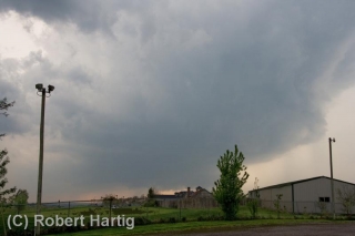
July 22 West Michigan Supercell and Lightning Fest

I haven’t seen a storm like last night’s storm in Michigan in a long, long time. Man, what a beauty!

Non-stop lightning, much of it appearing to be positive strokes that lasted for seconds at a time, along with a veritable feast of anvil crawlers, made for a photographic smorgasbord. Plus, the storm structure–as much of it as I could make out at night, illuminated by the incessant lightning–was truly impressive. If only the storm had arrived an hour earlier, when there was enough light to really see the thing!

I had just finished doing a couple of interviews down in Dunlap, Indiana, for the book I’m writing on the 1965 Palm Sunday Tornadoes. My meetings

required me to forgo chasing a supercell that moved through the Battle Creek area as the warm front lifted northward, and I was curious to find out what had happened with it. Pulling into a parking lot, I fired up my computer, opened GR3, and gaped. A line of supercells was advancing across Lake Michigan from Wisconsin. The first one in the line looked great–SRV showed definite rotation–and, headed on an ESE trajectory, the storm was poised to make landfall around Saugatuck. Winds there were almost straight easterly, and they were beautifully backed across most of lower Michigan. Hmmm…what did the VAD wind profile look like at Grand Rapids? Dang, sweet! How the heck did that kind of setup wind up in Michigan?

The storms weren’t moving terribly fast, around 25 knots. Could I make it in time? I was bloody well going to try. There was no denying the rush of adrenaline now galvanizing me, thrusting me into chase mode. I hit US 20 and headed west past South Bend, where the highway merged into US 31 north.

I still had a good 40 miles to go by the time I connected with I-196 near Benton Harbor. I wasn’t sure whether I’d catch the storm by the time it made landfall. Maybe I’d be better off playing more to the east. But I decided to take my chances, and that turned out to be the right move. I couldn’t have timed it better.

As I approached M-89, the eastern part of the storm had made landfall, but the radar showed the rotation still out over Lake Michigan. It wouldn’t be there for long, though, and, having shifted its trajectory south of Douglas, it was now heading straight at me.

Bingo! This was exactly what I’d been hoping for. Leaving the Interstate, I headed east along M-89 and found a nice, open field a mile down the road, just west of 66th Street, 4 miles south of Douglas and 4 miles west of Fennville. Then, turning my car around to face the incoming storm, I parked and grabbed my camera out of the back seat.

The lightning in this beast requires superlatives to describe it. There seemed to be a never-ending supply of high-voltage CGs, delivered with the unbridled, over-the-top enthusiasm of a 4th of July fireworks finale and accompanied by the incessant grumbling of thunder. There were times, as the lightning cells moved past me and surrounded me, when I felt like I was sitting inside an immense flashbulb–a flashbulb that kept firing again, and again, and again. Oh, man, what an extravaganza of pure, searing power and beauty! I’ve done my best to capture it, but my skills as a lightning photographer fall far short of what this storm had to offer. Now, my buddy Kurt Hulst, he’s Da Man when it comes to getting fantastic lightning shots, and I know he got some last night. Me, I seem to have a problem getting a good, crisp focus at night, but I try.

By and by, the flickerings began to illuminate a cloud feature I’d been looking for: a hint of a beavertail off to my northwest. It’s location confirmed what the radar was telling me: the storm’s mesocyclone was moving straight at me. I was in a perfect location–and all this time, standing out in the field near my car, I had yet to feel so much as a drop of rain.

The mosquitoes were thick and nasty, and I was getting eaten alive, but viewing at my position was excellent. Farther east, I’d be getting into thick woods, and since the storm wasn’t exactly rocketing along, I stayed put until the meso got too close for me to be able to distinguish its features. Then I moseyed east a few miles.

I parked again for a few minutes at 63rd Street and noted that what had begun as a stubby beavertail had rapidly grown into an enormous inflow stinger. To my northwest, I could see what appeared to be a large, low wall cloud–hard to determine exactly what it was or what it was doing at night, but it looked convincing enough that I called it in to KGRR.

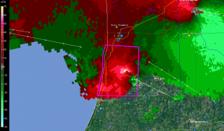
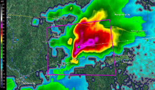
I tracked just ahead of this storm all the way to Plainwell. M-89 proved to be a perfect route, angling southeast along roughly the same path that the storm was taking. On the outskirts of Allegan, I stopped long enough to grab a few radar images. On this page, you can see a nice vault on the base reflectivity, and pronounced rotation on the storm relative velocity. (The circle just southeast of the town center marks my location. Ignore the marker with my name farther to the southwest on SRV; it’s old, an archive from when I dropped off of Spotter Network.)

A little farther down the road, I pulled aside again where a large, open stretch afforded good viewing. The mesocyclone was clearly visible, with a formidable-looking flange on the north side, nice striations, and an impressive inflow band circling in overhead. I hung out at that location until the lightning drew too close for comfort, then hopped back into my car and continued east.

At Plainwell, I dropped south on US 131 past the Kalamazoo exit, caught M-43 west for a mile or so, then parked in a parking lot and let the storm’s southernmost edge blow past me. The storm was still tornado-warned, but the radar indicated that it was weakening–cloud tops lower, VIL not as robust. North of me, just on the other side of M-43, a sheet of rain cascaded out of the wind-blown darkness into the luminous orange domain of the street lamps. Within half a minute, it was upon me, and for a short while, I sat and enjoyed the blast of downdraft and deluge. The rain that I had managed to elude all night had finally caught up with me.

Finally, as the storm bowed out on its journey eastward, I drove back to US 131 and headed for home. I stopped again for a while at the Martin exit, long enough to see what would become of another supercell that was moving inland from the Lake. It, too, quickly bowed out, but, in keeping with the tone of the day, it lit the after-midnight sky with a bombardment of lightning.

It was good to finally pull into my parking lot, climb the stairs to my apartment, and step inside. It had been one heck of a day, and I was ready to call it a good one and hit the sack.

As nasty a storm as it was, why didn’t the Allegan County supercell drop tornadoes? The storm earlier in the afternoon had produced at least one tornado near the Battle Creek airport; why not this one too? After all, it and

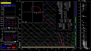
its compatriots had peppered Wisconsin with tornadoes prior to crossing the Lake and heading for West Michigan. All I can surmise is, CAPE was an issue. Winds certainly appeared favorable for tornadoes, and F5 mesoanalysis indicated 1 km helicities ranging from 150-250 across the area as late as 1:00 a.m. The RUC model sounding for KGRR maybe overdoes helicity, but it’s interesting to see what it says about instability. All I can think is that daytime CAPE–whatever it may have been; I never took the time to find out–petered out after sundown, and the shear alone wasn’t enough to spin up tornadoes. That’s my guess as a non-meteorologist, and I’m ready to get other insights and opinions from more knowledgeable heads than mine.

Whatever the case, last night’s was one heckuva storm, and the kind of chase I don’t get to enjoy too often in Michigan. It was nice to finally get such a great opportunity.

May 7, 2010, Northwest Ohio Supercells

Yesterday’s outbreak of supercells in the southeastern Great Lakes was no tornado breeder, but it made for an enjoyable chase. I left Caledonia around 10:30 with Bowling Green in mind as a target, noting that the SPC had outlooked a narrow, northern swath of northeast Indiana and northern Ohio with a 10 percent tornado risk.

I wound up rendezvousing with my long-time chase buddy Bill Oosterbaan in Ashton, Indiana, where Mike Kovalchick also joined us. (Note to self: that Baptist church parking lot on the west edge of town has a fantastic hilltop view to the west.) We dropped south to Waterloo, where I parked my car at a convenience store, then hopped in Bill’s vehicle, and we headed east, watching as a cumulus field began forming overhead. The warm front was moving in, and when we left Ashton, the chilly temps were already rising and bringing the dewpoints with them.

Farther to the east, we hooked up with Ben and Mike Holcomb, and CMU meteorology students Aric Cylkowski and Cort Scholten. Our contingent of four vehicles at the Sonic drive-in made up what was probably the first chaser convergence that Bryan, Ohio, has ever experienced, and probably the last.

From there, we dropped south toward the warm front, which had stalled over the area. Temps had been in the lower 70s in Bryan, with east-northeasterly winds and dewpoints around 59 degrees; farther down the road, at our new location in a parking lot next to a cemetery, we gained another degree of dewpoint and the surface winds veered. On the radar, one discrete cell to our southwest began to take on supercellular  characteristics. We decided to intercept it, and the chase was on.

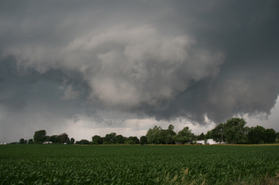
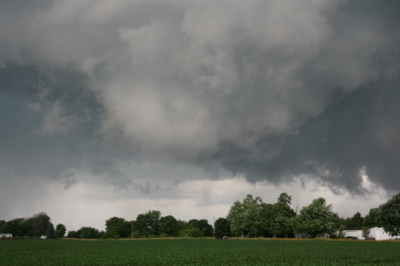
But another cell formed southwest of our storm, and in its tail-end position, it rapidly evolved into the main player of the day. So we left the storm we were on and headed toward the new one, which was hooking nicely. A couple miles south of the town of Paulding, we encountered one of the most flat-out beautiful hailstorms I’ve ever seen. It moved toward us in shifting, pearly strands across the fields. I tinkered frantically with the settings on my camera in order to get a fast enough shutter speed for snapping pics from our moving vehicle–there was no shoulder to the road, and no stopping–but by the time I finally had what I needed and Bill had found a turn-off, the amazing nuances and texture of the hail shaft had blended into a homogeneous sheet (click image to enlarge). I took a couple quick photos which nowhere near capture the essence of what we had seen just a minute or two prior; then, with maybe thirty seconds to spare from getting cored, we beat a hasty retreat.

Out in the field just to our southwest, we could see a crapload of dust being kicked up by the rear flank downdraft. We pulled aside and let it pass 100 feet or so in front of us. In the photo, notice how the dust fills the ditch to the right. I’ve read some discussions about the wisdom of the longstanding advice to abandon one’s car during a tornado and seek shelter in a ditch. Maybe that’s a best option in a worst-case scenario, but judging from the photo, it looks to me like the wind is doing a pretty good job of invading the ditch. Depending on the depth of a given ditch, tornado-force winds could conceivably just scoop a person up and launch them into the main air stream.

But I digress. The hail and RFD were the highlights of the day. From then on, it truly was a storm chase, and a futile one. With the storm rocketing to the east-northeast at 70 mph, we had a choice of barreling eastward and losing the storm to the north, or northward and watching it vanish to the east. We pursued it longer than we should have, but we had a fun time of it. The roads in that part of Ohio are great, the countryside is flat and open, and overall, the territory is fabulous for chasing. But when storms are moving at such breakneck speeds, the best road grids in the country–and these probably qualify–can’t compensate.

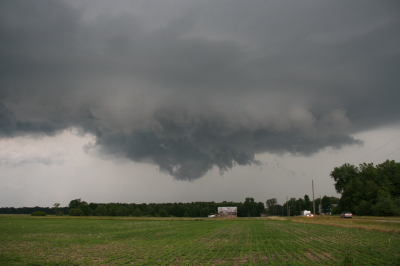
I managed to get a few shots of a cool, bell-shaped wall cloud as the storm moved away from us. Eventually, though, we called the chase off and started on our way back. West of Paulding, we encountered significant wind damage–large trees snapped off at their bases and pieces of outbuildings scattered across the fields at a couple farms. Could have been weak tornado damage, but it was likelier the work of straight-line winds.

I should probably mention the rope funnel that hung down from a small storm as we headed back toward Waterloo. Okay, it wasn’t really a funnel, just evidence of what wishful thinking can do with a snaky-looking cloud.

Back in Waterloo, I picked up my car, hit I-69 north, and headed home.

I noticed that Illinois-based storm chaser Adam Lucio was also on these storms, and appreciated his Facebook comment that you don’t need tornadoes in order to have an enjoyable chase. I wholeheartedly agree. Yesterday was a great chase, particularly for the Great Lakes, and that hail shaft near Paulding alone made my day.

Of course, everyone has been rumbling about the big event shaping up for Monday in the Plains. Wish I could go, but it’s not in the budget. Best wishes to everyone who heads out. Stay safe, get good photos and video, and have fun.

June 19 Central Illinois and Indiana Storm Chase

Approaching our storm from the north near Normal, Illinois.

Approaching the storm of the day south of Normal, Illinois.

After Iowa’s blue-sky bust on June 18, yesterday provided some welcome and much-needed activity. Between illness and May’s ridge of steel, my chase expeditions this year have been limited. The Edina, Missouri, tornado of May 13 has been my only tornado to date for 2009. Yesterday did nothing to improve that statistic, but it did offer a vigorous, classic supercell with some great structure that ensured my 1,650-mile, two-day chase with my buddy Bill Oosterbaan wasn’t a complete washout.

For that matter, storms did finally fire in eastern Iowa, and while Bill and I were too late to catch the big mutha that slammed Prairie du Chien (Ben Holcomb, if you happen to read this, great job on tracking that beast into the hills and jungles of Wisconsin!), we did manage to latch onto the one that followed in its footsteps. But I’m no fan of night time chasing and neither is Bill, and knowing the kind of topography that lay to our east once we crossed the river, we dropped our chase at Prairie du Chien and found ourselves a hotel.

After a decent breakfast yesterday morning, we were on the road by noon and headed south. The SPC showed a moderate risk for a large area extending from Iowa and Missouri east across the corn belt and Great Lakes. With a continuation of yesterday’s huge CAPE and good bulk shear, a widespread severe weather outbreak seemed like a sure bet. However, veering surface winds and unidirectional flow seemed to put the kibosh on chances for tornadoes in all but a few areas to the east, where helicities improved, particularly around 21Z.

As we approached Davenport, Iowa, heading south, we could see towers muscling up along an east-west boundary that transected Illinois south of the I-80 corridor. Catching I-80 east, we could see new cells firing up farther to the south on GR3. With a Kankakee target in the back of our minds, we decided to drop toward Normal on I-39.

By the time we drew near the town, the northernmost storm was showing rotation on the radar. The tower was just to our west, and as we proceeded down the highway, the updraft base came into view, dominated by a well-developed wall cloud.

Wall cloud on northernmost storm.

Wall cloud on northernmost storm.

We headed for an intercept, tracking with the storm until it began to degrade. Meanwhile, another cell to the south was strengthening and beginning to exhibit distinct rotation on SRV, so with the storm we were on mushing out, we abandoned it in favor of the second, rapidly intensifying supercell.

One heckuva hail shaft or what?

One heckuva hail shaft or what?

This bad boy had an impressive hail shaft, if hail is what we were actually seeing. Maybe it was just plain old rain with a bit of hail mixed in. The reason I wonder is because of the paucity of hail reports. We got tapped a bit as we closed in, but mostly we just encountered buckets of rain. Whatever the case, the updraft tower with the sunlit precip column was a beautiful sight.

Second storm showing hail shaft and updraft tower.

Second storm showing sunlit precip core and updraft tower.

After working our way south of the storm’s rear flank, we proceeded east and finally gained some good, clear views of the business end. Tracking with it from near Urbana through Homer, Fairmount, and Westville toward the Indiana border, we were in a good position to enjoy the structure as the storm went through several cycles.

Rotating wall cloud.

Rotating wall cloud.

Just east of Homer, the wall cloud tightened and I could see rapidly circulating cloud tags descending toward the ground. We pulled over to watch. The rotation wasn’t far away–maybe a quarter of a mile–and it appeared to be moving toward us. This was strange as we were southwest of the wall cloud, but you can’t argue with a developing tornado. With the updraft approaching to within a couple hundred yards of us, Bill seemed intent on analyzing why the storm was acting so peculiarly, while I favored beating a hasty retreat and working out the behavioral aspects of storm circulation from a somewhat greater distance. Storm chasing sure has its interesting moments.

No tornado materialized, the storm headed east, and we continued on with it. I noticed a couple of tornado reports from around Fairmount and Westville, but while I suppose it’s possible that there was a brief spinup or two, Bill and I never saw an actual tornado. We did witness a few times when the wall cloud began to torque  pretty intensely, and I sure wouldn’t have wanted to be directly below it.

The whitish wall cloud is half a mile from us and rotating vigorously.

The whitish wall cloud is half a mile from us and rotating vigorously.

Possibly a funnel cloud at this point.

Possibly a funnel cloud at this point.

But from the time we first intercepted it to the point where it finally began to fizzle 120 miles later west of Crawfordsville, Indiana, the storm was outflow-dominant. Never once did we enounter surface inflow, though above ground level, I’m sure inflow was strong. In Bill’s words, the circulation kept reaching toward the ground, looking for something to grab onto, but it never could manage to root and produce a tornado. If we’d had backing winds…if the helicities had been there…I’m sure the storm would have been a potent tornado breeder. It never got its act together in that regard, but I doubt the communities in its path felt terribly disappointed, and from my perspective, the storm provided an interesting chase with some very nice moments.

Last gasp: wall cloud at US 41 west of Crawfordsville, Indiana, shortly before the storm began to collapse.

Last gasp: wall cloud at US 41 west of Crawfordsville, Indiana, shortly before the storm began to collapse.

For sheer structure, the “Danville supercell” was interesting and photogenic, with some nice RFD slots wrapping in, and, toward the end of the storm’s career, with a classic, stack-of-plates mesocyclone that was as nice as anything I’ve ever seen. (Sorry, no photos–the ones I have didn’t turn out well.)

One downside to this chase–and it is a big one–is that somewhere between Homer and US 41, I lost my camcorder. It wasn’t a pricey camcorder; it was a used Sony that I bought from my friend and fellow storm chaser Kurt Hulst. But it has done me good service over the past year, and I hate to think that it is presently sitting out there by the side of some Illinois backroad. What’s even worse is, my video of this chase is in it.

The drive back to Grand Rapids was a long one. I arrived at my apartment around 2:30 a.m. and collapsed. The chase was fun and I think I needed it, but it’s good to be back home with the love of my life, Lisa, whose bright eyes and beautiful smile warm my heart wherever I travel.

Heading for an Iowa Chase

As I write, I’m heading west down I-80 with my storm chasing buddy Bill Oosterbaan. Our target: Waterloo, Iowa. The 9Z RUC shows a nice convergence of 850 and 500 mb jets overspreading massive CAPE by 21Z, with a robust 200 mb jet nosing in. Progged surface winds could be better, but skew-Ts still show nice veering with height, and storm relative inflow is majorly backed.

Oh, yeah…and we’re looking at dewpoints of 75 degrees and higher, with dewpoint depressions around 5 degrees. LCLs should be so low we may have to tunnel underground to find the cloud bases.

The SPC has hatched out this area for tornadoes. No surprise. After a relatively modest season, we may be on the verge of a significant outbreak. It’s a bit sobering to think that Parkersburg, Iowa, could get slammed again. I expect we’ll see a PDS statement at some point today, and I wonder whether the outlook won’t get bumped from a moderate risk to a high risk as well.

Tomorrow also looks to be a hugely active day, and the latest SREF places a sigtor in Michigan. So stay tuned. I’m sure there will be more to come.

Remembering the Parkersburg/Hazleton Tornadoes

One year ago today, the second EF5 tornado in the history of the new Enhanced Fujita Scale rating system descended on Parkersburg, Iowa, and obliterated the southern third of the town. I and fellow storm chasers Bill and Tom Oosterbaan and Jason Harris could see the intense rotation moving over Parkersburg on GR3 as we stairstepped southeast from the northern edge of the cell, heading for an intercept. There’s a certain sense of disbelief when you see something like that, a feeling of, Naah, it can’t be as bad as it looks.

But it was. A few miles farther down the road, with the rotation still at least ten miles to our west, debris–some of it fairly large–began to fall from the sky. That was when we knew for sure. Something terrible had happened. Even with pieces of sheet metal clanging down onto the pavement in front of us, I had a hard time believing that a tornado disaster had just occurred, but I think we all felt a certain sober awareness that a community had been hit.

We intercepted the storm near Fairbank, where the NWS indicates that the Parkersburg tornado occluded. Parking on a sideroad, we watched as a large, new wall cloud formed and moved directly toward us. Warning an Amish family who was standing in their yard, watching, to take shelter, we scooted south and then east, watching as the wall cloud lowered and kicked up a ton of dust. A second, enormous tornado had formed, barely discernible through the haze. We tracked with it to the east as it headed on a collision course for Hazleton, mercifully grazing the southern edge of that town. Had it hit head-on, I suspect that the Hazleton tornado’s EF3 rating would have been higher.

It’s hard to believe that a whole year has passed since that event and the several days of Great Plains action that preceded it. What a difference between then and now, with a nasty ridge casting a pall on this May’s peak chase season.

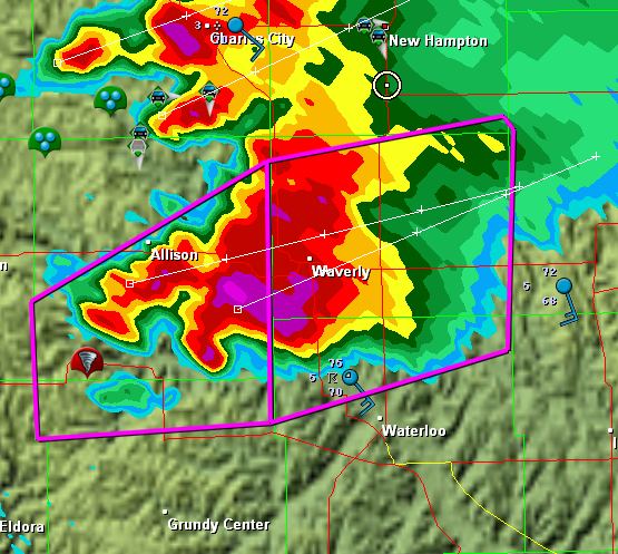
In remembrance of the Parkersburg/Hazleton tornadoes, I’m including a couple visuals. The first is a radar grab of the supercell as it moved out of Parkersburg. The tornado icon is a storm report from the town, just minutes old. You can see our GPS position marked by a circle with a dot in the middle of it on the northeast edge of the storm

The Parkersburg, Iowa, tornadic supercell.

The Parkersburg, Iowa, tornadic supercell.

The second is this YouTube link to my video of the Hazleton tornado. My videography may not be the best in the world, but I think you’ll get a sense of the intensity this storm evoked. It was my first really big tornado, and it was close.

I doubt this year has anything in store for us  like what we saw that day. But who knows? I’m not ready to write off this chase season yet–though I certainly hope it doesn’t hold a catastrophe like the Parkersburg tornado.

Video of May 13 Edina Tornado

My tornado videos to date aren’t of the best quality, but I’ve decided to put my footage of Wednesday’s tornadic supercell up on YouTube anyway. It’s not the greatest, but it’s not terrible, either, and it does provide a record of the storm from our vantage point on SR15, approximately two miles north of Edina, Missouri, that other storm chasers may find of interest.

Please note that I do know the difference between a beavertail and a tail cloud–I just got my terminology turned around. Also my sense of direction, in saying “counterclockwise” when I meant “clockwise.”

Nuff said. Hope you enjoy the video.

May 13 Tornado in Northern Missouri

Updraft Base

Updraft Base

This is the view that met us as we pulled off the road a couple miles north of Edina, Missouri, yesterday evening. “We” were Bill Oosterbaan, Derek Mohr, and me, and what we were looking at was the only supercell in Missouri on Wednesday, May 13, to produce a tornado–this despite a sizeable moderate risk that swept across most of Illinois and Missouri all the way down to Kansas and Oklahoma.

The storm was showing strong rotation, and had already put down a damaging tornado twenty miles to our west in Kirksville. We lost Internet connection as we approached the storm, but our last scan showed what appeared to be a storm merger with two distinct areas of rotation. The radar didn’t lie, and the proof of it provided an interesting scenario.

Wall Cloud Forming

Wall Cloud Forming

In the second image, you can see a ragged patch of scud ascending to the right and in front of the lowering in the background. This is the beginnings of what became an impressive wall cloud. Within a couple of minutes, the scud had matured into this…

Wall Cloud

Wall Cloud

The tail cloud to the right continued to grow to an astonishing length, displaying vigorous motion, feathering in rapidly toward the updraft. Meanwhile, a rain curtain began to wrap in from the south behind the wall cloud. This suggested a second mesocyclone following in the wake of the first area of rotation. I commented on this in the video I took of the storm, and my hunch soon proved true.

As the storm drew nearer, another prominent lowering began to emerge. It was exhibiting rapid motion, moreso than the more visually interesting wall cloud in the foreground. A tornado appeared immanent within this broad rotation, and in another minute multiple vortices were square dancing in the distance. One vortex soon tightened up and became dominant, fattening up into a nice hose. But the rain bands were starting to conceal the tornadic activity, and in a bit it was hard to tell exactly what was happening.

The storm quickly evolved into a nasty high precipitation beast, and from then on any tornadoes were effectively cloaked in rain.

Sorry, no stills of a well-formed tornado–I had set my camera down in favor of my video recorder–but I did manage to capture what looks to have been the beginnings of the multiple vortex phase.

Multiple Vortex Tornado

Multiple Vortex Tornado

No, you can’t see any visible touchdown in the photo, so maybe the circulation wasn’t tornadic at that moment.  If not, it was shortly after. I sure wouldn’t have wanted to be standing underneath it.

After the chase, Bill dropped Derek and me off where we had left our cars at the K-Mart in Springfield, Illinois. Then the three of us headed off in our respective directions–Bill toward Corydon, Indiana; Derek toward northern Michigan; and I back toward Grand Rapids. On my way home, I picked up fellow Michigan chasers Mike Kovalchick and Mike Bishop. They had experienced an automotive failure that took them out of the chase, forcing them to ditch their vehicle in Lincoln–truly a bummer. It was great to reconnect with Mike Kovalchick, and to meet Mike Bishop for the first time. Having a couple fellow storm chasers in the car sure made the long trip home seem shorter.

The day out chasing did me a world of good, but I need a good night’s sleep, and I have work to do tomorrow. By the time the next round of weather arrives, though, I should be primed and ready to go.

First Storm Chase, 2009

What a memorable way to kick off storm season 2009! Yesterday, I chased supercells in Kansas with my buddy, Bill Oosterbaan, and today we attended Tim Vasquez’s severe weather forecasting workshop in Norman, Oklahoma. I’m writing this post from a Best Western Hotel maybe a mile north of where the 1999 Moore tornado crossed I-35. All in all, not a bad past couple of days for a lad from Michigan.

Yesterday’s chase began with a visit to Picher, Oklahoma. The southern portion of this tiny town got wiped out last spring by an EF-4 tornado. Today, a year later, that desolate landscape shows scant chance of recovery. It’s a sobering place to visit.

But that’s another story for a different post. Right now, I just want to share a couple images from yesterday’s chase. The moisture was marginal, with dewpoints averaging around 55 degrees up toward the warm front north of Wichita. That’s where we headed, in search of the better helicities. A lot of folks questioned the setup, but it produced. The storm we intercepted put out four tornadoes, though those occurred before we caught up with it. We still saw some nice structure, including a nice wall cloud and a funnel. Check ’em out.

Funnel Cloud

Funnel Cloud

Nice Structure!

Nice Structure!

Preparing for Storm Season 2009

Out of curiosity, I just ran the GFS down to 384 hours. The SPC has posted a light risk for parts of the South on Wednesday, but that may be just a foretaste of an upcoming active period. Did I already write about this recently? Not sure, but if so, I’m writing again.

Long-range prognostication is something like reading tea leaves, but consulting the numerical models still beats going to a groundhog for your two-week weather forecast. At around 204 hours, a nice surge of moisture appears to unlock the the Gulf of Mexico for several days, with 55 degree  dewpoints extending as far north as Missouri, southern Illinois, and Indiana.

Am I hanging my hat on this? Heck no. I’m just thinking, quite wistfully, how nice it would be if what I just saw bore some resemblance to how things actually play out nine days hence. In February, one dreams if he’s a northerner and shudders if he’s a resident of Dixie Alley.

I’m anxious to to see some great storms this year. Last year was fabulous, but I blew some great photo ops because I didn’t know how to use my camera. This year I think I’ve overcome that concern. Now if only the weather and my finances will cooperate.

Meanwhile, I’ve decided to make the best of the holding pattern by signing up for Tim Vasquez’s severe weather forecasting class. It’s a small group setting that will be held on Sunday, March 8, in Norman, Oklahoma. I just shelled out my hundred bucks today and am really looking forward to attending this thing. My chase partner, Bill Oosterbaan, will be joining me. This ought to be a perfect way to really tighten down our forecasting skills for storm chasing season 2009 by learning from one of the foremost gurus of the field. I own nearly all of Tim’s books, and also his Forecast Laboratory software. It’ll be cool to finally pick his brain for eight hours in a focused, fairly personal setting.

More immediately, though, this evening the sun set at 6:17 here in Caledonia, and tomorrow the temperature is supposed to spike to a sweltering 36 degrees. I’ll take that and like it for now. It presages good things to come.