Black Friday Quickie Update

It’s the day after Thanksgiving, and weatherwise, all I can say about the storm system I wrote about a couple days ago is, eh. Looks like a yawn to me. Heck, it’s November. Not much more to comment about there.

I’m gazing out the window at a gorgeous afternoon here in Caledonia, and in a couple minutes, I’m going to step out to enjoy it. Looks like this will be my last opportunity for a while, maybe quite a while. Tomorrow the rain sets in, and Sunday the temperatures drop. Snow is entering the forecast for this coming week. But today at least is golden.

Ben Holcomb is in town, so around 5:30 I’m heading downtown to get with him, Bill, Tom, and whoever else of the Michigan Storm Chasers Contingent decides to show up at The Tavern on the Square. After that, the guys are going to the Griffins game, but I’ll be passing on that.

Musically, I’ve begun transcribing a Richie Cole solo on the Charlie Parker tune “Confirmation.” For some reason, lately I’ve gotten it into my head that I’m going to nail down this tune once and for all, definitively, and there’s no better way to facilitate the process than transcribing the solo of someone who knows it inside-out. Cole is a monster bebop alto player who burns through Bird changes using the full range of his horn, from low Bb up to an altissimo note that I have yet to identify, a note so high it sounds like a mosquito singing in falsetto.

So there you have it. While the rest of America is bashing its brains out at the Black Friday sales, I’ll be enjoying the sunshine and congratulating myself for staying as far away from the stores as possible. Cheerio!
How It Feels to Not Be Chasing

Right now my buddies are out west chasing this latest storm system. I’m not with them because I can’t afford it. Money has been extremely tight and what I take in has got to go toward paying the bills and putting food on the table for Lisa and me. That’s the reality of life. I’ve been on a couple of unproductive chases so far this year, and now that a decent system is finally in play out west, I’ve got to pass it up. I can’t even chase what promises to be a fabulous day today in Illinois. Once again I’ll be picking over the scraps later on here in Michigan. It’ll be nice to get some lightning, but it just isn’t the same.

Armchair chasers are typically regarded as off on the sidelines of storm chasing. But there’s a difference when you’ve been in the game and find yourself benched. You know what you’re missing. You’ve been looking forward to it all year with intense eagerness, like a kid looks forward to Christmas. So when you can’t do a thing about it unless it lands right in your lap–which in Michigan, land of cold fronts and veered surface winds, doesn’t happen often–it is extremely frustrating. SDS is one thing, but this is something else.

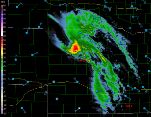
Armchair chasing? Nuts. I get to where I don’t even want to go near a radar. But I do anyway. I can’t seem to help myself. I want to see what’s happening with my friends, what storms they’re on. I look at the forecast models, too, hoping against hope that they’ll stop sticking their stupid tongues out at me and smile at me for once.

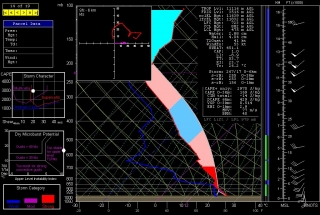
Today the RUC actually seems to do so. Here’s the 10Z KGRR sounding for 23Z this evening. Not bad. I just wish I believed that those surface winds and helicities were accurate, but I don’t, not with other models (NAM, GFS, and SREF) shouting them down. Besides, the HRRR composite reflectivity hates me. I can’t stand looking at it. Again, though, as with the radar, I do anyway. Storms progged to fire in northern Illinois and even south along the Michigan border…all I’d have to do is hop in my car, head west along I-80 and maybe down toward Peoria, or even just 80 miles south down US 131 toward the state line as a compensation prize, and I’d be in the sweet zone. But it ain’t gonna happen.

Rant, rant, rant. On this date last year I was on the most unforgettable chase of my life in northern South Dakota. Today, I wish this present system would just get on with it and get it over with so I can forget about weather, forget about the fact that I call myself a storm chaser when I’m not chasing storms. What a laugh. True, I’ll be chasing this evening locally for the first time for WOOD TV8. That I can at least afford, and it’s a nice way to work with the storms that we do get and possibly provide a bit of public service. But I don’t have high expectations. That’s a good thing here in populous West Michigan, but it doesn’t satisfy a convective jones. I just hope this season doesn’t drift into the summer pattern before I can get out and see at least one good tornadic supercell.

Okay, enough of this self-indulgent, babyish whining. I just had to get it out of my system, because in all seriousness, missing out on the action bothers me a lot, an awful lot, more than I can describe. It’s an absolutely miserable feeling. But it’s how things are, and life goes on.

Good luck out there in the Plains, Bill, Tom, and Mike–and Ben and Nick, though I know you guys are chasing separately. I hope you bag some great tornadoes today and over the next few days. As for me, it’s time to shower up, head to church, and remind myself that there’s more to life than this.

Radar Grabs from March 10 in Arkansas

Yesterday morning at 8:30, I looked at the RUC and the NAM, shook my head, and then headed out the door anyway to go bust chasing in Illinois. Chalk it up to a long Michigan winter or just plain foolhardiness, but there are times when I just have to go, period. Set out with my expectations low and hang my compass on nothing but hope, with the mindset that I’ll be grateful just to get a flash and a rumble. That’s what my buddy Bill and I got yesterday, and I’ll tell you, it was nice.

no images were found

The day before, March 10, the same storm system delivered a considerably higher level of intensity as it moved through Arkansas. Those meager-to-modest dewpoints managed to produce a nice little swarm of supercells on the nose of a handsome 500 mb jet, and several tornadoes spun down.

I didn’t chase that day, but I made a point of following things at home, and I happened to capture a few level 2 images of the day’s main bruiser near Searcy, about 50 miles northeast of Little Rock. The images were taken around 0235 Z (8:35 CST). Note the interesting “hammerhead” hook on the first reflectivity image. Beyond that, I’m not going to say more, just offer you the screen grabs for your viewing pleasure, along with some exciting memories for those of you who were on that storm.

no images were found

no images were found

no images were found

Storm System Poised to Hit the Great Lakes on Friday

Looks like one heck of a storm system will be moving into the Great Lakes this Friday. Today’s 18Z GFS shows a potent, 976 mb low centered on the Minnesota/Canada border on the 30th at 18Z, deepening to 972 mb as it moves northeast into Ontario by 00Z. The ECMWF is less aggressive in its timing, and I hope it’s the more accurate of the two long-range models, since I think it offers better potential for more than just straight-line winds.

While they may not be perfectly in sync, both models agree that we’ll be seeing some heavy weather on the 30th. It’s not exactly a storm chaser’s dream scenario, with little in the way of directional shear and with storm motions in the warp speed range. I see “linear” written all over this event. But this time of year, I’ll take whatever I can get and be grateful.

Positives: dewpoints in the 60s reaching into Michigan, at least a semblance of CAPE at around 500 j/kg, and certainly no lack of bulk shear. Judging by the size of the system and the tightness of the isobars, we are in for a real October leaf-stripper.

And here comes the old disclaimer we all know and love: we’ll see what further model runs reveal. The NAM will be adding its paint to the picture shortly. I wish it would agree with the Euro in slowing the system down, giving Indiana and Michigan a good dose of moisture along with backed surface winds. Fingers crossed and hoping for a gift, because this will very likely be my last shot at anything resembling severe convection until March or April, 2010.

Lightning over Lake Michigan

The storm system that has been in the models for the past week produced a fast-moving squall line that blew from Wisconsin across Lake Michigan. Kurt Hulst and I were there on the shore just north of Holland, Michigan, to catch the action.

Kurt is a great lightning photographer. Look for his photos of last night’s storm on his blog.

As for me, I’m a neophyte when it comes to lightning. Shooting at night, the problem I encounter is focus. Unfortunately, most of my shots were too blurred to crop, and since I was shooting wide angle, cropping is essential. However, a couple shots didn’t turn out too badly. The one shown here is the best of the lot. Click on it to enlarge it.