Happy New Year from Stormhorn

A white-breasted nuthatch was at my bird feeder a few minutes ago searching hopefully for seed. Poor little thing! The seed stash has been low these past few days. Monday I sprained my left ankle while hiking in Yankee Springs, and I haven’t been up to replenishing the feeding station. In fact, my life has been largely reduced to sitting in the couch keeping my leg elevated and my ankle iced.

Lisa has been taking great care of me. Still, I like to do what I can for myself, so for three days I hobbled around gingerly, thinking that, c’mon, I hadn’t hurt myself all that badly. But I had, and I wasn’t doing my ankle any favors.

Yesterday I finally concluded that maybe crutches wouldn’t be a bad idea after all. I’ve never used them before, and these ones have taken some getting used to. I wish they came with training wheels. But I’m getting the hang of them, and taking the stress off my ankle is definitely helping. Maybe in a few days I won’t need the crutches anymore.

Anyway, I just refilled the finch sack with thistle seed and both feeding tubes with sunflower seed. A couple of chickadees have already discovered the fresh supply, and it won’t be long before the rest of the birds do as well. I think it’ll be a matter of only minutes before the finches arrive and my balcony will once again swarm with bird action.

What a wild and difficult ride this year has been! And now we’ve arrived at the last day of it. Poised on the brink of 2012, I look back and think, whew! No repeats, please. Nationally and globally, this has been a year of horrific natural disasters, economic turmoil, and unprecedented political upheaval. On a personal level, I have struggled financially as copywriting projects for a key client slowed down from what had been an abundance to a trickle and finally to nothing.

The tight finances massively hampered my ability to chase storms, and consequently I had to sit out some incredible events. Missing them was more than frustrating; it was painful, and it has taken a toll on my sense of identity as a storm chaser.

Thankfully, there have been good things to even out the bad. I published The Giant Steps Scratch Pad Complete, which duplicates the material in The Giant Steps Scratch Pad in all 12 keys. That has been a major accomplishment. I also began chasing locally for WOOD TV’s Storm Team 8, and my first chase for them resulted in a pretty solid coup during a damaging straight-line wind event down in Battle Creek. Also I got to experience Hurricane Irene down in South Carolina, and while I opted out of catching the eye at landfall, I saw enough both on the coast and inland to satisfy my curiosity.

Moreover, Lisa has been recovering nicely from a horribly painful frozen shoulder that she incurred at the beginning of the year. And while Mom’s knee replacement sidelined me from chasing what turned out to be a history-making super-outbreak of tornadoes down in Alabama on April 27, the result has been more than worthwhile; Mom’s knee is now pain-free and Mom can walk again.

As for my copywriting and editorial business, The CopyFox, other opportunities have been coming my way. I definitely miss the steady flow of business from my key client, but I much enjoy the new kinds of projects I’ve been getting from Bethany Christian Services and Baker Books. I’m currently in the middle of editing a book for Heart & Life Publishing, a new publishing service operated by my friend Kevin Miles. If there’s one bit of wisdom that I continue to prove through the years, it’s to step through open doors and embrace new opportunities to learn and grow in the talents God has given me. It’s important to know when to say no; but that being understood, there is a lot in life to say yes to.

I have no resolutions for the New Year. There are and will be goals big and small to reach for in their proper time, and I find that approach to be more realistic than making resolutions. I do hope, though, that I’ll get in a few successful chases this coming storm season to make up for the ones I’ve missed this year.

Still no snow, by the way, and it looks like that’s how it’ll stay through tonight. The 1723 UTC station obs show 38 degrees at GRR, and we’re forecasted to get up into the low 40s, so a green New Year is in store, just like last year. But it won’t stay that way for long; West Michigan’s first major winter storm is set to dump six to eight inches of snow on us tomorrow through Monday, and these warm temperatures will soon be a thing of the past. January is poised to swoop in with fangs bared.

So it’s a good thing I got those bird feeders filled back up. The finches still haven’t arrived. But the chickadees have been doing steady traffic, a couple of rosy-breasted nuthatches are making sporadic appearances, and the woodpeckers have been bellying up to the suet all along. The birds are taken care of. Now it’s my turn. It’s early afternoon and I’m still sitting here in my robe; time to shower up and get the rest of this day in gear.

Lord, thank you for this difficult but nevertheless gracious year. When disappointment and hardship hit, I find it easy to complain. But you are always there in the midst of my life, and I have no problem seeing your goodness when I seek your priorities over my personal wants. My part is to do my best, but you’re the one who calls the shots. Thanks for tonight’s gig with my good friend Ed. Thanks for my dear, dear woman, Lisa, and for my mom and siblings and friends. Thanks for the gifts of storm chasing and music, which not only make me come alive, but also shape me as a person. Thanks for the beautiful Michigan outdoors which I love so much–the wetlands, the wildflowers, the sandhill cranes ratcheting in the marshes, the rivers and streams and lakes filled with fish, the blonde sweep of dunes along the Lake Michigan shore, the forested, glacial hills at sundown. Thanks for the gift of my senses that lets me drink in all of these things, and for emotions that let me feel the wonder of it all. Thank you for the gift of life. Thank you for love. Thank you, precious Lord, for you.

I hope that a few of you will make it down to Fall Creek down in Hastings this evening to catch Ed and me. But whatever you wind up doing, have a fun and safe night. Happy New Year, one and all!
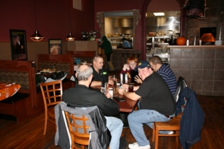
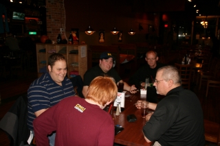
Fall Meeting of the Michigan Storm Chasing Contingent

Last Thursday, October 27, the Michigan Storm Chasing Contingent convened at its favorite meeting place, the Walldorff Brewpub in Hastings. Present were L. B. LaForce, Ben Holcomb, Bill Oosterbaan, Tom Oosterbaan, Nick Nolte, and I, the unofficial recorder. The meeting was called to order, or at least something approaching order, and it was immediately moved that beer should be purchased. The motion was passed by five out of six, with one member abstaining. The recorder found himself in possession of a 24-ounce schooner of Cobain’s Double Dark IPA, which easily balanced out the abstention.

Truthfully, there is no official Michigan Storm Chasing Contingent. I made up the name. Membership dues have not been levied and cards have not been issued. The whole notion of a Michigan Storm Chasing Contingent is something of an oxymoron to begin with. Nevertheless, most of these guys have had a pretty impressive year, with plenty of miles logged and tornadoes observed. The sorriest mug in the lot was me, but I won’t go into that; 2011 is almost over now, and I’m done whining. The big thing is, Ben Holcomb was visiting from Oklahoma, and that seemed like a good reason for all of us to get together and hang out for the evening.

The Walldorff is becoming a tradition for us, and it’s not a bad one. The place has award-winning craft brew. The cuisine, made from scratch using local produce, meats, and dairy products, is also fabulous, but the beer is the main draw. Not that this is a hard-drinking bunch; they’re actually pretty conservative. But they do enjoy the Bee Sting Ale, one of the many superb craft brews turned out by Sam, the Dorff’s world-class brewmeister.

As for me, I opted for the Cobain IPA with its double-bitter blast of mega-hops and roast malt. It was the first beer I had ordered at the place since I joined its pub club a couple months ago, and I figured that it was time I finally took advantage of my member’s discount. I expected a nice price break. What I didn’t anticipate was the 24-ounce mug that the waitress set in front of me. It was big enough to generate its own lake breeze, and I could see surf breaking against the brim. Good grief. At 8.5 ABV, the Cobain is a potent brew, and all I wanted was a modest glass. I just can’t knock off such stuff with impunity anymore like I used to. Out of shape, out of practice, and getting older. Oh, well.

It was great to see all the guys, though we missed Kurt Hulst, who had to work. There’s nothing more interesting than storm chasers talking shop, at least as far as other chasers are concerned, and this year

afforded plenty of notes to compare. Ben, Bill, and Tom had been on the May 24 Chickasha tornado, a particularly violent beast that may be upgraded to EF-5. Seems that it pitched a Ford F-150 pickup truck 800 yards–nearly half a mile. It’s hard to fathom that kind of power.

But enough. It’s late, this recorder is tired, and it’s time I put this post to rest. Till next time, gents: L’chaim!

Book Review: Severe Storm Forecasting by Tim Vasquez

Beginning with his Weather Forecasting Handbook, which I purchased years ago at a College of DuPage severe weather conference, I’ve collected one-by-one nearly all of Tim Vasquez’s books on storm chasing and weather. The only exception is Tim’s most recent, 2011 publication, the Weather Forecasting and Analysis Handbook, and that’s next on my list.

The owner of Weather Graphics and the well-known storm chasing forum, Stormtrack, Tim is a widely acknowledged guru of storm chasing and operational forecasting, particularly in the severe weather arena. The man possesses more convective knowledge in his left pinkie than most of us do in our entire bodies, and in this fairly recent publication, he organizes information that is most relevant to chasers and severe weather junkies.

In Tim’s words, “Severe Storm Forecasting was a project started in 2007 to serve as the perfect companion for intermediate forecasters and a refresher for experienced forecasters. It maps the current state of severe thunderstorm forecasting from an operational framework rather than a research or academic perspective. Equations, physics, and lengthy citations have been kept to a bare minimum.” (From the preface.)

In other words, the book is intended to provide up-to-date, practical information that storm chasers can readily apply in forecasting and in the field. Since its release in 2010, I’ve been wanting to get my hands on this book. A while ago, I finally shelled out my $29.95 and purchased a copy, and I’ve spent the last several weeks chewing on it. It’s nutritious fare: thoughtfully organized, as current as is possible in a field shaped by rapid technological advances, and accessible to anyone who wants to apply him- or herself to developing severe weather forecasting skills.

Severe Storm Forecasting is divided into 10 sections as follows:

  • The Forecast Process
  • The Thunderstorm
  • Mesoscale Convective Systems
  • Tornadoes
  • Hail
  • Lightning
  • Stability & Shear
  • Radar
  • Satellite
  • Diagnosis
  • .
    An appendix contains additional information on the WSR-88D radar and the more commonly used diagnostic tools in severe weather forecasting, and also supplies blank, reproducible hodograph and skew-T/log-P charts.

    While the topics covered will be familiar to chasers who do their own forecasting, I’ve found plenty to broaden my scope, ranging from brand-new insights to discussions on topics with which I was only vaguely acquainted. For example, the section on QLCS tornadoes is the first time I’ve seen the subject given more than a casual nod. Here in Michigan, linear systems are far more common than isolated supercells, so it’s nice to encounter a book that spends a little time looking at their role as occasional tornado breeders.

    A strong asset of Severe Storm Forecasting is the way it aggregates the broad array of elements that are relevant to severe weather and then expands on them in one tidy package. Don’t get me wrong: this isn’t one-stop shopping. One book simply can’t cover everything in depth; pick any chapter and you can make a further study of its subject. But this book does much more than skim the surface. It is by no means a mere primer; it is a text that will equip you with a broad and substantial grasp of severe weather forecasting, and you shouldn’t conceive of it as a one-time read that you move through linearly and then “finish.” There’s too much content for a reader to absorb all in one pass, and much of it needs to be connected with field experience in order for it to gel. So look at Severe Storm Forecasting as a reference that you will process bit by bit. Once you’ve accomplished your initial read, you will return to it again and again.

    In the style of his other books, Tim has made ample use of sidebars to provide interesting asides that range from the historical to the technical. Just riffling through the pages, I find, for example, a call-out on page 75 that consists of material written in 1888 by Gustavus Hinrichs that sheds light on the origin of the word “derecho”; then a few pages later, on page 80, I read a smaller sidebar that discusses the term “swirl ratio”; and still further along, on page 95, I come across a fairly extensive personal communication from Paul Markowski on the contributing factors in warm versus cold RFDs.

    Three recommendations for improvement:

    1. 1. I’m surprised that a glossary was not included in a work of this nature. It is the one area in which I consider this book to be lacking, and I hope Tim will address the matter in his next edition.
    2. 2. An online supplement would add value. This could feature graphic, possibly interactive, examples of such topics as lifting and modifying forecast soundings, radar interpretation, and so forth. The supplement would be accessible only to purchasers using a code included in the back of the book. It could be used with other of Tim’s books as well, so one supplement could serve multiple purposes.
    3. 3. I have the sense that the editing was grassroots. The result is quite good, but speaking as someone with a background in publishing, I think the book could benefit from further proofreading or perhaps a light edit.

    With these things said, Severe Storm Forecasting is an eminently useful and well-done resource that belongs in a storm chaser’s library. If you’re a new chaser, I would recommend that you start with Storm Chasing Handbook, also by Tim; then purchase this book to expand your knowledge. Those with a bit more experience can jump right in. Regardless of your level of expertise, get this book. At some point, you’re either going to be glad you own it or else wish that you did.

    Purchasing Information

    • Severe Storm Forecasting by Tim Vasquez, 262 pages.
    • $29.95 plus shipping, available from Weather Graphics.

    NOTE: This is a non-paid, unsolicited review. I’ve written it as a service to my readers because I personally appreciate Tim’s book and feel that it provides a valuable and well-organized resource for storm chasers and severe weather buffs.

    Hurricane Irene in North Carolina

    Hurricane Irene demonstrated to me conclusively that hurricanes aren’t my thing. Maybe I’m too cautious; maybe I’m downright chicken; maybe I’m smart. Certainly I’m inexperienced; just as certainly, I’ve never felt the same fascination for the hurricane environment, as I’ve understood it, as I have for tornadoes and supercells. However these various factors work in combination, the bottom line is, while I’m glad I got the opportunity last weekend to experience an impressive degree of Irene, if not her full fury, I doubt that my future holds any more hurricane interceptions.

    Hurricanes and tornadoes are different animals, and the mindsets required for a severe weather junkie to appreciate the two are worlds apart. A tornado is ephemeral, arriving and departing in minutes; a hurricane is a time commitment of hours, possibly a lot of hours. A tornado is something you go to see; a hurricane is something you go to experience. A tornado’s human impact is terrestrial; a hurricane’s, amphibious, bringing the ocean with it as it arrives onshore. A tornado is something you seek to avoid getting munched by; a hurricane is something you purposely allow to ingest you, and it requires that you be willing to risk circumstances of a kind and scope that can outstrip anything even the worst tornado can produce.

    I’m by no means minimizing the lethal, wholesale destructiveness of tornadoes. I’m just saying, we’re comparing apples and oranges. Yes, both storms pack a heckuva lotta wind, both are capable of horrific impact on communities, and both can kill you equally dead. But beyond that, the similarities vanish.

    Different personalities embrace the variables in different ways. My friend and long-time storm chasing partner, Bill Oosterbaan, is now hooked on hurricanes. His brother, Tom, enjoyed doing the eyewall with Bill at Morehead City, North Carolina, but I suspect that once was enough for him. As for me, witnessing the massive surf pounding Atlantic Beach as Irene approached, and watching tropical-storm winds and hurricane-force gusts blast our hotel inland at Greenville, was all the taste of Irene I needed. Don’t get me wrong–the experience was thoroughly exhilarating, and I’m really glad I went. I just can’t see doing it again, particularly with a stronger hurricane than Irene.

    I never expected to go to begin with. As Bill and Tom were making plans a few days in advance, I chimed in on the discussion, but I had neither the money nor the driving desire to join them, though I confess that I was intrigued. Then Bill called me three hours before their departure with the news that their trip would be underwritten and wouldn’t cost a cent. Would I like to go?

    It was a kind, thoughtful offer. Bill knew that this storm season–historic and record-breaking as it has been for tornadoes–had been a miserable one for me as far as chasing went. Between family responsibilities and personal finances, it had been an utter washout, to the point where I’ve felt awkward even calling myself a storm chaser. Yeah, I’ve earned the merit badge over the last 15 years, but you wouldn’t know it judging by this year. Bill and Tom, good friends that they are, knew that I had felt the disappointment keenly and wanted me to have at least something to show for circum 2011.

    So, making a last-minute decision, I grabbed the opportunity, threw some clothes into my softside, grabbed my gear, and off we went.

    GPS and Live-Stream Hassles

    Bill had made arrangements with WOOD TV8 to live-stream Irene using his new, super-fast Asus quad-core laptop. Unfortunately, DeLorme’s serial port emulator wouldn’t work with the laptop’s 64-bit Windows 7 OS, nor would Bill’s GPSGate recognize the DeLorme puck. The long and short of it was, while Bill could stream through iMap, there was no way of showing his location, rendering his live stream useless.

    My computer isn’t as fast as Bill’s, but it’s fast enough, and it didn’t pose the same problems. However, for some reason, I kept losing my mobile signal Friday as we headed towards Morehead City. Worse yet, my output on iMap appeared jerky and horribly pixelated, to the point where I finally just gave it up. So much for live streaming for both of us. And so much for getting the trip underwritten.

    Big Surf at Atlantic Beach

    Friday, August 26. After checking into our hotel in Greenville, North Carolina, we set off for Morehead City. When we arrived, the bridge to Atlantic Beach beckoned, so over we went. We parked in a lot occupied by various media crews as well as casual sightseers. With just two hours before law enforcement intended to start kicking people off the island, we bundled on our rain gear and took in the massive waves pounding the shoreline.

    The eye of the hurricane was still a good 150 or more miles south of us, but the wind was stiff and the sea a maelstrom of spuming breakers and brown, roiling undertow. My YouTube video doesn’t do justice to that wild, watery scene. The waves farther out in the video had to have been a good 15 feet high, their tops trailing spray into the gale as they raced toward shore.

    By the way, that’s me in the rain jacket and shorts, cavorting in front of the waves. Hi, Mom!

    Bill was determined to stick around and experience the eyewall, and I had the nervous sense that he wanted to hang out on the barrier island. My concern was that the island might wind up underwater, and that even Morehead City could get inundated by floodwaters, or the storm surge, or both. It just didn’t seem wise to me to locate ourselves that close to the Atlantic shoreline. Irene, which the day before had been forecast to make landfall as a category 3 storm, had by now been downgraded to a top-end category 1, but she was still an abnormally huge hurricane. I was concerned that our escape routes would be cut off and we would find ourselves stranded, with nowhere to go and the ocean encroaching on us as Irene’s eye moved in. High winds I’m fine with–bring ’em on; I like it. But I prefer them as a dry-land phenomenon, not a maritime experience.

    Ultimately, I wimped out. The guys graciously brought me back to our hotel in Greenville, which was where I’d thought we would ride out the storm to begin with. I felt ashamed of myself for inconveniencing them, and I knew that Bill was disappointed. We’ve shared so many storm adventures over the years, but this wouldn’t be one of them. To be fair to myself, my reasonings–not all of which I’ve elaborated on here–were, I believe, fairly sound. Plus, again, I’ve never felt drawn to hurricanes the way I am to tornadoes and severe thunderstorms. Still, I had moved from an asset to a liability.

    I beat myself up for quite awhile, so in case anyone reading this post feels inclined to pitch in their two cents, spare yourself the effort. I already did the job for you. That said, there was something to be said for peeling off my sopping clothes–which, thanks to a catastrophic failure on the part of my Helly Hansen rain suit, had gotten totally drenched–and then kicking back on a dry bed to watch the unfolding coverage of Irene on TV.

    Saturday, August 27

    When I awoke, Irene was making landfall at Morehead City. I picked up the phone and called Bill. No answer, and no surprise. I wasn’t certain whether the cell phone towers were working, but I was sure that the guys had their hands full. The television showed the west side of Irene’s eye squarely over their heads.

    Outside, the wind was lashing a tree out in the courtyard and blowing a fine spray of rain against the window. Hurricane rain is not like the rain you get with an ordinary thunderstorm. The hydrometeors are smaller, halfway between droplets and wind-driven drizzle. But what a drizzle! Watching the stuff lash horizontally across the landscape, alternating between lighter respites and sudden, heavier bursts that tumble along like fog shot from a cannon, you really can’t fathom just how much is actually falling. The answer is, lots, an almost inconceivable amount.

    By and by, I got curious what the view offered from a vantage point other than my fourth-floor room. Grabbing my video camera, I took the elevator downstairs and headed for the hotel entrance. There, for the first time, I got a good taste of Irene. Greenville may not have been in range of the hurricane’s full force, but the westward extent of her tropical-storm winds had surprised forecasters, and my location lay within a concentrated area of those winds. With sustained speeds of 55 mph and gusts as high as 75 mph, there was more than enough to hold my interest.

    The higher winds in a hurricane are associated with its rain bands. When you see one of those bands approaching your location on radar, you can count on two things happening simultaneously: It is going to get very rainy, and it is going to get very windy. The transition occurs with a suddenness that verges on explosive, and in Greenville, its effect was everything you could imagine. Trees were down, and more were going down all the time. Branches were snapping. Power was out over a large area. In the hotel, the electricity flickered off and on, off and on, but amazingly, it somehow stayed with us for all but one two-hour stretch. As for Internet connection, forget it. I had been without radar updates since shortly after 8:00 a.m. So much for getting GR2AE volume scans of Irene while she was over Morehead City. They’d have made a nice memento for the guys, but there was no accessing the data.

    The Storm Troopers Return

    Bill and Tom returned around 3:00 in the afternoon, exhilarated and exhausted. After showering up, they headed back out into the wind and rain to catch dinner at one of the few open restaurants. They returned in an hour and filled me in on their eyewall experience. It sounded awesome, and I’m glad it was everything they’d hoped for. I can honestly say I didn’t mind having missed it, but I was pleased that they got what they were after. Particularly Bill. Experiencing a hurricane is something he’d been wanting to do for several years, and now that he’s gotten it in his blood, I’m quite sure he’ll do it again.

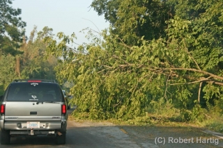
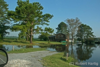
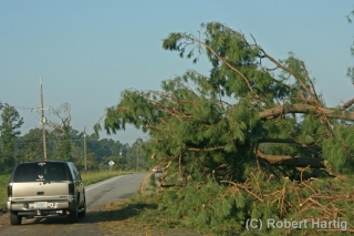
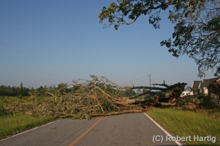
    We started for home around 8:00 Sunday morning. The first 25 to 30 miles westward were littered with downed trees. Some of them blocked the road, requiring us twice to find an alternate route. In a few places, yards and even homes were flooded. Corn fields had been flattened by the wind and rain, and the tobacco, while not appearing as badly ravaged, had clearly taken a hit. Other more compact crops such as cotton and soy beans had fared better.

    Fourteen hours later, a few minutes after 10:00 p.m., we rolled into Bill’s driveway, and a short while afterward, I was in my own vehicle driving east down M-6 toward home and my sweetheart, Lisa.

    Will I do another hurricane? Well, I didn’t entirely do Irene for reasons I’ve at least partly explained. I did, however, get enough of a taste to confirm my sense that hurricanes don’t exert the same pull on me as tornadoes. I’m grateful to Bill and Tom for wanting me to join them–thank you so much, guys! I really appreciate it. Those middle rain bands in Greenville may not have been as intense as what you witnessed, but they were a blast, and I’m very glad I got to see at least that much of Irene.

    However, lacking the passion required for accepting the risks involved, I would likely be just as reluctant to commit to a landfall intercept in the future as I was this time, and thus I would simply detract from the experience for others. That wouldn’t be fair to them or enjoyable for me.

    So, while the old saying may be, “Never say never,” I seriously doubt that another hurricane lies on my horizon. Not anytime soon, anyway. If you enjoy multiplied hours of wind, water, sweat, and uncertainty, then a hurricane just might be your thing. Me, I’ll stick with tornadoes. They’re not so all-fired comprehensive.

    Here Comes the Summer Pattern

    Sumer is icumen in,
    Loudly sing, cuckoo!
    Grows the seed and blows the mead,
    And springs the wood anew;
    Sing, cuckoo!
    Ewe bleats harshly after lamb,
    Cows after calves make moo;
    Bullock stamps and deer champs,
    Now shrilly sing, cuckoo!
    Cuckoo, cuckoo
    Wild bird are you;
    Be never still, cuckoo!

    Right. It looks like we’re about to have our hands full, what with bleating ewes, cows making moo, and so on. There are, however, some things that the old folk song fails to mention. The polar jet lifting north, for instance. Weakening mid-level winds. Temperatures at 700 mb heating up, with the 12 degree centigrade threshold expanding across the southern and central plains and ushering in the era of capping. I don’t know why the ancient songwriter didn’t address these matters. They’re as much a part of sumer–that is to say, summer–as stamping bullocks.

    Here in Caledonia, yesterday was hot and today promises to be even hotter, around 95 degrees, before a cold front blows through tonight and brings relief. After that, we look to be in for a bout of unsettled weather. I’ll take it, even though it may inconvenience at least one outdoor gig I’ll be playing this weekend.

    The summer weather pattern is on the way, putting the damper on storm chasing in the southern and central plains. Considering how devastatingly active this spring has been, that’s probably a good thing. I doubt that the people in towns such as Joplin, Missouri, will lament this season’s passing. As for those who chased storms in Dixie Alley and the southern plains–and there were more chasers than ever this year–you certainly got your fill of action, and some of you saw far more than you cared to. There are some amazing stories that have come out of the storm chasing community, and my hat is off to those of you who stepped in to help in tornado-stricken areas.

    This was the worst of all seasons to be sidelined due to financial constraints, but that’s how it has been with me and with others who have taken a hit in the pocketbook from this rotten economy. I’m frankly happy to see the crest of storm season 2011 passing; I much prefer to occupy my mind with more productive thoughts than fretting over what I’m missing.

    In any event, the playground is shifting northward. It’s not there quite yet, but it’s on the way. Troughs that had been digging deep into the southern plains are now beginning to ripple across the northern tier and Canada, and lately, mesoscale convective systems have been cropping up regularly in the SPC discussions. Those are the specialty of the state where I live.

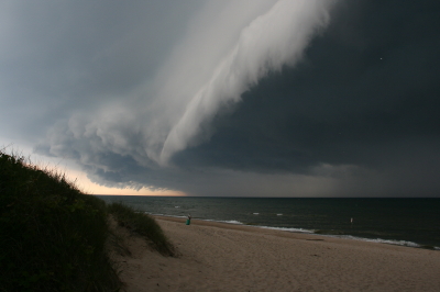
    If there’s any advantage to living in the Great Lakes, it’s that we’re close enough to the summer jet stream that it can still dip down out of Canada into our neck of the woods. And while northwest flow isn’t exactly your classic chase scenario, it can deliver some occasional surprises. Illinois in particular has gotten some whopping summer tornadoes–and for those of you who don’t chase east of the Mississippi, I don’t mind telling you that central and northern Illinois is fabulous chase territory. Also, closer to home, even garden variety arcus clouds are sublime to watch sweeping in at the Lake Michigan shoreline.
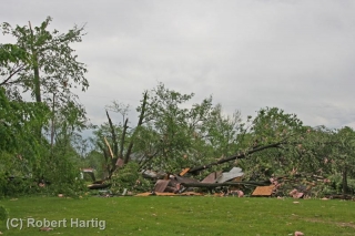
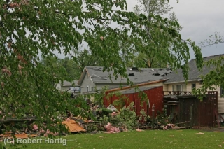
    For better or worse, sumer is icumen in and storm season is winding down. Most people aren’t sorry for the change. But most people don’t view storms the way that storm chasers do. I guess we’re a bit cuckoo.

    May 29, 2011, Battle Creek Straight-Line Winds

    The summary follow-up to  my previous post is, I busted with L. B. LaForce during last Wednesday’s high-risk day in Illinois. Tornadoes occurred that day, but overall the scenario was a disappointing one for us. If anything, it was a lesson to trust my initial gut instinct, which told me to stick close to Indiana, where a moisture plume and 500 mb jet were moving in. Nice, discrete supercells eventually fired up south of Indianapolis while L. B. and I putzed around fruitlessly with the crapvection northeast of Saint Louis. And that’s all I’ll say about that–not that I couldn’t say more, but I want to talk about yesterday’s far more potent event in southern Michigan.

    You don’t need a tornado in order to make a neighborhood look like one went through it. That axiom was amply demonstrated yesterday in Calhoun County, where straight-line winds wrought havoc the likes of which I don’t recall having ever seen here in Michigan. We’ve had a couple doozey derechoes over the past few decades, but I don’t think they created such intense damage on as widespread a scale as what I witnessed yesterday. Northeast of Helmer Brook Road and Columbia Avenue in Battle Creek, across from the airport, the neighborhood looked like it had been fed through a massive shredder. We’re talking hundreds of large trees uprooted or simply snapped, roofs ripped off of buildings, walls caved in, road signs blown down, trees festooned with pink insulation and pieces of sheet metal, yards littered with debris, power lines down everywhere…it was just unbelievable. Not in the EF-3 or EF -4 league, maybe, but nothing to make light of.

    Yesterday was the first decent setup to visit Michigan so far this year. Of course I went chasing, not expecting to see tornadoes–although that possibility did exist–but hoping to catch whatever kind of action evolved out of the storms as they forged eastward. It being my first time doing live-streaming video and phone-ins for WOOD TV 8 made things all the more interesting. As it turns out, I was in the right place at the right time.

    When I first intercepted the storms by the Martin exit on US 131, I wasn’t sure they would amount to much.  Huh, no worries there. As I drove east and south to reposition myself after my initial encounter, the storms intensified and a tornado warning went up for Kalamazoo County just to my south.

    Dropping down into Richland, I got slammed with heavy, driving rain. The leading edge of the storm had caught up with me. I wanted to get ahead of it and then proceed south toward the direction of the rotation that had been reported in Kalamazoo. Fortunately, M-89 was right at hand, and I belted east on it toward Battle Creek.

    On the west side of Battle Creek, I turned south on M-37, known locally as Helmer Brook Road. GR3 radar indicated that I was just grazing the northern edge of a couplet of intense winds. It didn’t look to me like rotation; more likely divergence, a downburst. As I continued south down Helmer Brook toward the airport, the west winds intensified suddenly and dramatically, lashing a Niagara of rain and mist in front of me and rendering visibility near-zero. I wasn’t frightened, but I probably should have been. Glancing at my laptop, I noticed that a TVS and meso marker had popped up on the radar–smack on top of my GPS marker.

    Great, just great. So that couplet I thought was a downburst had rotation in it of some kind. Well, there was nothing I could do but proceed slowly and cautiously and hope that the wind didn’t suddenly shift. It didn’t, and as I drew closer to the airport, it started to ease up, visibility improved and the storm moved off to the east.

    That was when I began to see damage. In the cemetery across from the airport, trees were down. Big trees, and lots of them. Blown down. Snapped off. I grabbed my camcorder and started videotaping. But the full effects of the wind didn’t become apparent until I turned east onto Columbia Avenue near the Meijer store.

    My first thought was that a tornado had indeed gone through the area. But with most of the trees pointing consistently in a northeasterly direction, the most logical culprit was powerful straight-line winds. Parking near a newly roofless oil change business, I proceeded to shoot video and snap photos. I’ll let the following images tell the rest of the story.

    How It Feels to Not Be Chasing

    Right now my buddies are out west chasing this latest storm system. I’m not with them because I can’t afford it. Money has been extremely tight and what I take in has got to go toward paying the bills and putting food on the table for Lisa and me. That’s the reality of life. I’ve been on a couple of unproductive chases so far this year, and now that a decent system is finally in play out west, I’ve got to pass it up. I can’t even chase what promises to be a fabulous day today in Illinois. Once again I’ll be picking over the scraps later on here in Michigan. It’ll be nice to get some lightning, but it just isn’t the same.

    Armchair chasers are typically regarded as off on the sidelines of storm chasing. But there’s a difference when you’ve been in the game and find yourself benched. You know what you’re missing. You’ve been looking forward to it all year with intense eagerness, like a kid looks forward to Christmas. So when you can’t do a thing about it unless it lands right in your lap–which in Michigan, land of cold fronts and veered surface winds, doesn’t happen often–it is extremely frustrating. SDS is one thing, but this is something else.

    Armchair chasing? Nuts. I get to where I don’t even want to go near a radar. But I do anyway. I can’t seem to help myself. I want to see what’s happening with my friends, what storms they’re on. I look at the forecast models, too, hoping against hope that they’ll stop sticking their stupid tongues out at me and smile at me for once.

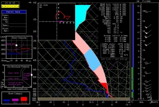
    Today the RUC actually seems to do so. Here’s the 10Z KGRR sounding for 23Z this evening. Not bad. I just wish I believed that those surface winds and helicities were accurate, but I don’t, not with other models (NAM, GFS, and SREF) shouting them down. Besides, the HRRR composite reflectivity hates me. I can’t stand looking at it. Again, though, as with the radar, I do anyway. Storms progged to fire in northern Illinois and even south along the Michigan border…all I’d have to do is hop in my car, head west along I-80 and maybe down toward Peoria, or even just 80 miles south down US 131 toward the state line as a compensation prize, and I’d be in the sweet zone. But it ain’t gonna happen.

    Rant, rant, rant. On this date last year I was on the most unforgettable chase of my life in northern South Dakota. Today, I wish this present system would just get on with it and get it over with so I can forget about weather, forget about the fact that I call myself a storm chaser when I’m not chasing storms. What a laugh. True, I’ll be chasing this evening locally for the first time for WOOD TV8. That I can at least afford, and it’s a nice way to work with the storms that we do get and possibly provide a bit of public service. But I don’t have high expectations. That’s a good thing here in populous West Michigan, but it doesn’t satisfy a convective jones. I just hope this season doesn’t drift into the summer pattern before I can get out and see at least one good tornadic supercell.

    Okay, enough of this self-indulgent, babyish whining. I just had to get it out of my system, because in all seriousness, missing out on the action bothers me a lot, an awful lot, more than I can describe. It’s an absolutely miserable feeling. But it’s how things are, and life goes on.

    Good luck out there in the Plains, Bill, Tom, and Mike–and Ben and Nick, though I know you guys are chasing separately. I hope you bag some great tornadoes today and over the next few days. As for me, it’s time to shower up, head to church, and remind myself that there’s more to life than this.

    Quick Summary of Wednesday’s and Thursday’s Chases

    Five days and nearly 3,000 miles later, I’m back from out west. This storm system proved to be a disappointment, but it did have its moments. Bill Oosterbaan and I intercepted a nice low-topped supercell in northeast Kansas on Wednesday night, and it’s possible that we witnessed a brief tornado. I need to scrutinize the brief footage I got of the storm feature in question. What was unmistakable was the broader circulation of the storm. It seemed weird to be chasing a north-moving storm with inflow from the northeast, but that’s how it was with storms that moved along a warm front–apparently across it–near a low center with a 500 mb closed low in the vicinity.

    Yesterday was a more typical setup. We targeted the Muskogee, Oklahoma, area, which the SREF and RUC pointed to as offering the best overlay of instability and mid-level support, with the H5 jet core nosing into the region.

    We were right on the first storms as they initiated, but they were feeble things that just couldn’t seem to get their acts together. With a long drive home lying ahead of us, we concluded to start heading north and settle for a nice lightning show on the way home.

    But our prospects improved as the 500 mb jet began to strengthen. A couple of cells to our west and northwest intensified and began to take on a telltale appearance on the radar. A handful of scans later, rotation started to manifest on SRV. By this time we were on US 59 north of the Grand Lake of the Cherokee, east of Vinita and directly in the path of the southernmost cell. At a side road, we pulled aside and I tripoded my camcorder and videotaped some nice storm features: pronounced beaver tail, tail cloud, a nasty-looking wall cloud, and a wet RFD notch.

    Beginning as a classic supercell, the storm looked for a while like a tornado breeder. But after predictably morphing into an HP, it eventually lined out and got absorbed into the wad of convection springing up to its south. Lack of adequate helicity is probably what kept this and other storms non-tornadic. METARs showed backed surface winds in the vicinity of the storms, but from what I observed, surface inflow was non-existent to weak. Hodograph curvature doesn’t matter much if boundary layer wind speeds are puny.

    I have a few photos to process that I’ll slap up in a day or two, possibly along with a radar grab or two. Right now, though, I’ve got some work I need to accomplish before the work week ends, so here’s where I sign off.

    On the Road to Oklahoma

    The southerly breeze blowing from across the field behind me into this shady little park is just enough to render an otherwise hot and somewhat humid noon hour pleasant to perfection. If bathwater could be turned into air and made to blow around me, this is how it would feel, the quintessence of balmy.

    I’m sitting at a picnic table surrounded by stately maples robed in the fresh green of May. From every direction comes the chatter and song of birds. A stone’s throw to my right, three fat robins on worm patrol navigate the grass with great singleness of purpose, and somewhere not far away I can hear the whirring call of a woodpecker. I couldn’t ask for a better setting to while away a couple of hours while my buddy Bill lunches with clients at a nearby plant.

    Ah, spring! Ah, Iowa! Here in this tiny park in this small town nestled in America’s gently rolling heartland, for a little while I find myself retreating from how life is to how it can be. Quietude is not necessarily quiet, for the air is filled with sounds. But they are subtle sounds, background sounds, sounds of wind and birds that unwind the mainspring of my all-too-preoccupied soul.

    Tomorrow I will wake up in Enid, Oklahoma, which looks like a prime base of operations for chasing storms that bump off the dryline. I’ve had my eye on Enid for a couple of days, now, and this morning the SPC issued a moderate risk for tomorrow with Enid smack in its midsection. That bodes well. It’s time at last for a chase in the Southern Plains.

    I still have some concerns with this system. But they’re outweighed by the fact that the right stuff is coming together for tomorrow. Even more importantly, it’s May in Oklahoma. An ant can fart and spin up a tornado. And I’ll be there to watch it and experience the drama, beauty, and adrenaline of the atmosphere with my good friend and chaser partner of 15 years, Bill.

    Speaking of whom, here he is. Looks like his business meeting is over. Time to pack up, hop in the car, and head west. Adieu, Victor, Iowa. Thanks for providing unknowing hospitality to a stranger in this jewel-like little park beneath the unfolding leaves of spring.

    First Great Plains Chase of 2011 This Wednesday

    At last, the setup I’ve been waiting for–one that warrants dipping into my tight finances in order to make the 1,000-mile drive to the Southern Plains. To date, this present system has been a miserable disconnect between upper-level support and instability, with a nasty cap clamping down on the whole shebang. Last night it managed to cough up a solitary tornado in South Dakota. That was it. I’m not sure what today holds, but I haven’t seen anything to excite me about it or tomorrow.

    But Wednesday…ah, now we’re talking! The SPC places a large section of the Great Plains under a slight risk, and their discussions have been fairly bullish about the potential for a wide-scale event. At first I couldn’t see why. My mistake–I was looking at the NAM, which with straight southerly H5 winds has not provided the best PR for Wednesday’s setup. But once I glommed the GFS, I got a whole ‘nother picture, one which the SREF and Euro corroborated.

    That was last night. I haven’t looked at today’s SREF, and the new ECMWF gives me a slight pause as its now somewhat negative tilt has slightly backed the mid-levels from the previous run. But only slightly. The H5 winds still have a nice southwesterly flow, and taking the three models together, everything you could ask for is lining up beautifully for tornadoes in the plains.

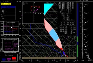
    The event promises to be widespread, with a robust dryline stretching from a triple point in southwest Kansas south through Oklahoma and Texas. Positioned near a dryline bulge, Enid, Oklahoma has drawn my attention for the last couple of GFS runs. Check out this model sounding for 00Z and tell me what’s not to like about it. Everything is there, including a voluptuous hodograph and 1 km SRH in excess of 300 m^2/s^2.

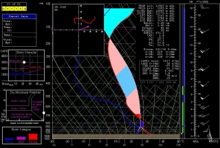
    Other places in the region also look good, though. Farther south in Texas, Wichita Falls shows potential. Helicity isn’t as persuasive as Enid, but the CAPE tops 3,000 J/kg and there’s less

    convective inhibition. Here’s the sounding for you to compare with Enid.

    I haven’t been as drawn to Kansas so far, but with the triple point perched there, storms are bound to fire up just fine in the Sunflower State. The details will work themselves out between now and Wednesday evening. Significantly, the tyrannical cap of the previous few days no longer appears to be an issue.

    The bottom line is–it’s time to head West! This evening I’m taking off for the plains with my long-time chase buddy Bill. At last! Time to sample what the dryline has to offer, and–now that I’m equipped with a great HD camcorder–finally get some quality footage of a tornado or two.

    There’s no place like the Great Plains! YeeeeHAW!!!!!