Chasing the Great Lakes Superbomb of 2010

Until early yesterday morning, I was pretty certain that I wasn’t going to be chasing yesterday’s squall line associated with the record-breaking low pressure system that’s moving across the Great Lakes. With storms ripping along at 60 knots, what kind of chasing is a person going to do?

Then came the 7:00 a.m. phone call from my chase partner, Bill Oosterbaan, informing me that the Storm Prediction Center had issued a high risk for the area just across the border in Indiana and Ohio. With the rapidly advancing cold front still west of Chicago, we’d have ample time to position ourselves more optimally. This would be an early-day storm chase. It would also almost surely be our last chase for the next four or five months. What did we have to lose?

I hooked up with Bill at the gas station at 100th St. and US-131, and off we went. The storms had moved into Chicago by then, and as we dropped south, it became apparent that we would also need to break east and then stairstep down into Ohio, buying time in order to let the line develop with daytime heating. Satellite showed some clearing in Ohio,

suggesting a better chance for instability to build. Catching I-94 in Kalamazoo, we headed east toward I-75, with the Findlay area as our target.

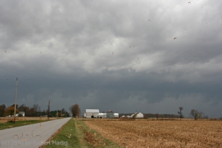
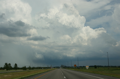
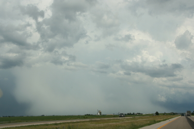
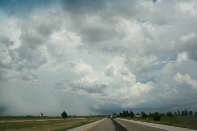
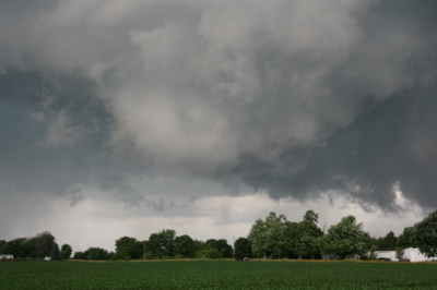
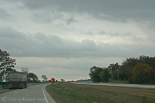
Off to the northwest in Minnesota, the low was deepening toward an unprecedented sub-955 millibar level, sucking in winds from hundreds of miles around like the vortex in an enormous bathtub drain. Transverse rolls of stratocumulus streamed overhead toward the north, indicating substantial wind shear. (Click on image to enlarge.)

By the time we crossed the border into Ohio, tornado reports were already coming in from the west as the squall line intensified. Soon much of the line was tornado warned. However, while the warnings were no doubt a godsend for a few communities that sustained tornado damage yesterday, they weren’t much help to Bill and me. Chasing a squall line is different from chasing discrete supercells.

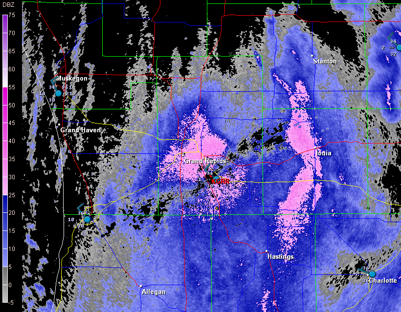
We had in fact hoped that a few discrete cells would fire ahead of the line. But the forecast CAPE never materialized to make that happen, and we were left with just the line. In that widely forced environment, tornadoes were likely to occur as quick, rain-wrapped spinups rather than as the products of long-lived mesocyclones. Even with GR3, the likelihood of our intercepting a tornado would require a high degree of luck. It was harder to identify areas of circulation with certainty; I found myself using base velocity as much as storm relative velocity on the radar, and comparing suspect areas not with easy-to-see hook echoes in the reflectivity mode, but with kinks in the line. It was pretty much a game of meteorological “Pin the Tail on the Donkey.”

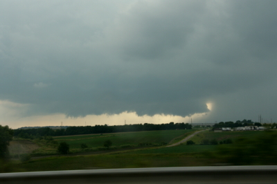
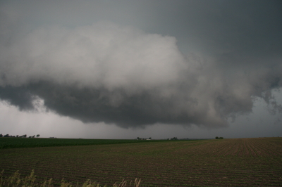
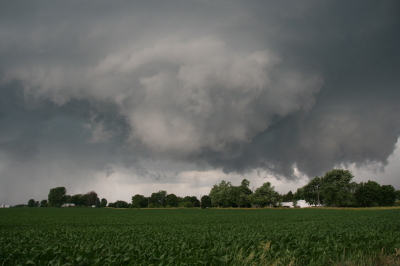
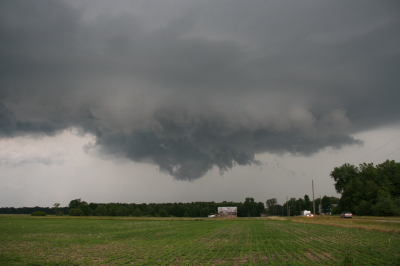
North of Kenton, we headed west and got our first view of the squall line. For all the hooplah that had preceded the thing, it didn’t appear very impressive. Just your average storm front–much windier than most, but also a bit anemic-looking compared to some of the shelf clouds I’ve seen. Still, it was a lovely sight, watching those glowering clouds grope their way across the late-October farmlands.

.

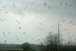
Neither of us was quite ready to end the chase, so with the storm rapidly closing in, we scrambled back into the car and stairstepped to the southeast in the hope of intercepting a likely-looking reflectivity knot that had gone tornado-warned. It was fun playing tag with the storm, driving through swirls of leaves spun up by the outflow. But there really wasn’t much incentive for us to continue the game indefinitely. Eventually we turned back west and drove into the mouth of the beast.

For a few minutes, we got socked with torrential rain and some impressive blasts of wind (and, I should add, absolutely no lightning or thunder whatever). Then it was over. Time to head home.

In Kenton, we grabbed dinner at a small restaurant. Then we headed toward Cridersville, 28 miles straight to the west next to I-75, where there had been a report of “major structural damage” from a tornado. The report was accurate. A small but effective tornado had torn through the community, uprooting and snapping off large trees, taking off roofs, and demolishing at least one garage that I could see. Of course we couldn’t get into the heart of the damage path, but a few passing glimpses suggested that some of the damage may have been fairly severe.

As I said at the beginning, this chase will likely have been my last of the year. I never know for sure until the snows fly, but it seems like a pretty safe bet that I won’t be heading out again after storms until March or April. It’s hard to call this chase a bust since our expectations weren’t all that high to begin with. Plus, tornadoes or no tornadoes, it was an opportunity to engage with a historical weather system. Like other significant weather events such as the Armistice Day Storm and the 1974 Super Outbreak, this one will be given a name in the annals of meteorology. Me, I’m calling it the Great Lakes Superbomb of 2010. In a number of ways, it hasn’t proved to be as impactful as was forecast, but it’s not over yet. And regardless, I’m glad I got the chance to get out and enjoy a final taste of synoptic mayhem.
April 22-23 TX-OK-KS Storm Chase

As I begin this post, the first major tornado-producing storm system of 2010 is moving to the east after taking 10 lives in the South yesterday. Already a tornado-breeder, the system matured yesterday into a wide-scale outbreak driven by hefty bulk shear, massive low-level helicities in the order of 600 and above, and CAPE values up to 2,500. Yazoo City, MS, was hit hard by a powerful, rain-wrapped wedge. The verdict remains open as to whether this was a single, long-lived tornado that traveled as much as 200 miles, or one in a series, which seems likelier.

Sorry, I can’t offer a write-up on yesterday’s storms. I was home sleeping, and I have no regrets that I missed anything. With the models suggesting rain-wrapped, low-visibility tornadoes rocketing along at 50 mph or more; with the potential for hydroplaning while driving at gonzo speeds in order to keep on top of fast-moving, rapidly morphing storms and avoid having them get on top of us; and with the logistical madness of three sleep-deprived chasers–Bill Oosterbaan, Mike Kovalchick, and me–having to backtrack afterward to Saint Louis where my car was parked and then drive 450 miles back to Grand Rapids, the negatives of chasing this big, messy, and dangerous tornado outbreak seemed to easily outweigh the potential payoffs.

So Bill, who was determined to catch the action, made arrangements to hook up with Kurt Hulst and Bill’s brother, Tom Oosterbaan, in Illinois, and then he dropped Mike and me off at my car. The two of us headed home, and I can tell you, it felt mighty good to crawl under the covers upon my return and sleep until 1:00 in the afternoon. After talking with Tom yesterday evening, I’m glad I chose as I did.

I may have more thoughts to share about yesterday’s scenario, but I’ll save them for another post. The previous two days in Texas and Kansas deserve some attention in their own right, and not just as the prequel to the big, day 3

outbreak. They may have been a bust for me tornado-wise, but they were nevertheless the first decent system of the year and my first chase out on the Plains. It was a blessing to get out on the road once again and see the vast, textured expanses of the Texas and Oklahoma panhandles.

Naturally, the landscape included the TIV2, which at this point should be designated a mobile national monument of the Great Plains. Back in 2008 we had bumped into its predecessor in Nebraska; this Thursday, we pulled into a gas station in Pampa, gassed and Rain-Xed up, then drove around to the other side of the station, and surprise! There it was–the Tank and its entourage. Cool! Who can resist taking a few photos? Not me.

As for chasing storms, Thursday was a should’a. We should’a either listened to Mike and headed for western Kansas, where most of the tornadoes occurred later in the day, or else gone with Bill’s and my initial impulse to chase the bigger CAPE, albeit forecasted low helicities, near Childress, Texas. For that matter, if we had endured the initial grunge in Wheeler, or better yet, just parked along US 60 east of Pampa–in other words, if we had just sat and waited–we’d have been golden. Instead, we sacrificed an opportune position and went after some cells that fired to our northwest along the dryline. Doing so made a certain amount of sense, as those storms were already looking supercellular and were moving toward the warm front and better helicities, while the cells popping up to our south in advance of the dryline seemed to just sit there and languish. So after the northern storms we went.

Bad decision. One of the southern cells developed steam shortly after we made our move. We could still have turned around at that point, but we chose to commit to our decision and wound up betwixt and between the vortex breeding grounds to our south and north. As a result, we found ourselves looking forlornly at the radar as the southern cell shaped up beautifully and began churning out tornadoes, while our storms struggled valiantly but

never quite got their act together. If there’s a lesson to be learned, it’s that good things come to those who wait. And, I might add, that model SRH is nice if you can get it to cooperate, but it can be deceptive. Helicity is prone to change with the storm environment in ways that forecast models don’t anticipate. If CAPE and 0-6 km shear are sufficient, storms may just generate their own low-level helicity.

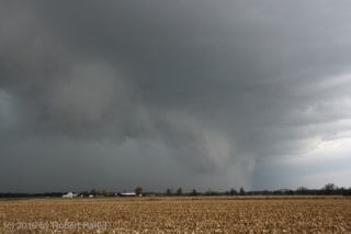
Anyway, we chased the dryline storms and busted. Our storms tried hard to tornado, but they just couldn’t quite manage to produce. So instead of the blue ribbon, we wound up with honorable mention: some decent structure, including cool-looking wall clouds, a few funnels, and–as tail-end Charlie went high-precip in the Oklahoma panhandle–a nice, banded-looking storm with a formidable shelf cloud.

As for Friday, we picked exactly the right target up in northeast Kansas along US 75 just south of the Nebraska border. We were smack in the axis of a nice moisture plume. But nothing happened. As the afternoon progressed, the cumulus field we were sitting under began to generate towering cumuli, but these turkey towered and busted against a mid-level cap that just wouldn’t erode. So that was that. Looks like a lot of other chasers got disappointed as well by the northern play. It happens. We finally cut our losses around 7 p.m. and headed back east toward Saint Louis and a band of storms that was moving toward I-70. Ironically, one of these produced a series of tornadoes. If Thursday had been a should’a, Friday was an if-only. If only we’d targeted northeast Missouri…but there had been no reason to do so that we could see.

Now another storm system looks to be moving into the Midwest later this coming week. The action could be closer to home, but I’ll think about that in a day or two. Right now, it’s time to make this post, rest up, and get on with the rest of life.

Chase Time! Bound for the Panhandle

Finally! First Great Plains storm chase of the year! As I write, Bill Oosterbaan, Mike Kovalchick, and I are headed west down I-70. In another 30 miles we’ll reach Kansas City; then it’s onward to Wichita, where we’ll overnight. Tomorrow morning we’ll take a look at the models, and then most likely make our way toward familiar territory in the northern Texas panhandle. It has been a couple years since I’ve been there; I can’t wait to see big storms moving over that landscape again.

I’m not going to write much tonight. I’m tired. Last night I got only got three or four hours of sleep, having stayed up till 3:00 a.m. to complete a writing project for a client. My updates will probably brief until I return Sunday. Tomorrow, Friday, and possibly Saturday will be pretty filled with chasing storms and all the pertaineth thereto. When I finally get back home, I hope to have a few great tornado and storm photos to share and an outstanding chase report to post. So stay tuned, campers. This is the first decent chase scenario of the year, and I am geeked to be going after it. Tornadoes, here I come!

June 19 Central Illinois and Indiana Storm Chase

Approaching our storm from the north near Normal, Illinois.

Approaching the storm of the day south of Normal, Illinois.

After Iowa’s blue-sky bust on June 18, yesterday provided some welcome and much-needed activity. Between illness and May’s ridge of steel, my chase expeditions this year have been limited. The Edina, Missouri, tornado of May 13 has been my only tornado to date for 2009. Yesterday did nothing to improve that statistic, but it did offer a vigorous, classic supercell with some great structure that ensured my 1,650-mile, two-day chase with my buddy Bill Oosterbaan wasn’t a complete washout.

For that matter, storms did finally fire in eastern Iowa, and while Bill and I were too late to catch the big mutha that slammed Prairie du Chien (Ben Holcomb, if you happen to read this, great job on tracking that beast into the hills and jungles of Wisconsin!), we did manage to latch onto the one that followed in its footsteps. But I’m no fan of night time chasing and neither is Bill, and knowing the kind of topography that lay to our east once we crossed the river, we dropped our chase at Prairie du Chien and found ourselves a hotel.

After a decent breakfast yesterday morning, we were on the road by noon and headed south. The SPC showed a moderate risk for a large area extending from Iowa and Missouri east across the corn belt and Great Lakes. With a continuation of yesterday’s huge CAPE and good bulk shear, a widespread severe weather outbreak seemed like a sure bet. However, veering surface winds and unidirectional flow seemed to put the kibosh on chances for tornadoes in all but a few areas to the east, where helicities improved, particularly around 21Z.

As we approached Davenport, Iowa, heading south, we could see towers muscling up along an east-west boundary that transected Illinois south of the I-80 corridor. Catching I-80 east, we could see new cells firing up farther to the south on GR3. With a Kankakee target in the back of our minds, we decided to drop toward Normal on I-39.

By the time we drew near the town, the northernmost storm was showing rotation on the radar. The tower was just to our west, and as we proceeded down the highway, the updraft base came into view, dominated by a well-developed wall cloud.

Wall cloud on northernmost storm.

Wall cloud on northernmost storm.

We headed for an intercept, tracking with the storm until it began to degrade. Meanwhile, another cell to the south was strengthening and beginning to exhibit distinct rotation on SRV, so with the storm we were on mushing out, we abandoned it in favor of the second, rapidly intensifying supercell.

One heckuva hail shaft or what?

One heckuva hail shaft or what?

This bad boy had an impressive hail shaft, if hail is what we were actually seeing. Maybe it was just plain old rain with a bit of hail mixed in. The reason I wonder is because of the paucity of hail reports. We got tapped a bit as we closed in, but mostly we just encountered buckets of rain. Whatever the case, the updraft tower with the sunlit precip column was a beautiful sight.

Second storm showing hail shaft and updraft tower.

Second storm showing sunlit precip core and updraft tower.

After working our way south of the storm’s rear flank, we proceeded east and finally gained some good, clear views of the business end. Tracking with it from near Urbana through Homer, Fairmount, and Westville toward the Indiana border, we were in a good position to enjoy the structure as the storm went through several cycles.

Rotating wall cloud.

Rotating wall cloud.

Just east of Homer, the wall cloud tightened and I could see rapidly circulating cloud tags descending toward the ground. We pulled over to watch. The rotation wasn’t far away–maybe a quarter of a mile–and it appeared to be moving toward us. This was strange as we were southwest of the wall cloud, but you can’t argue with a developing tornado. With the updraft approaching to within a couple hundred yards of us, Bill seemed intent on analyzing why the storm was acting so peculiarly, while I favored beating a hasty retreat and working out the behavioral aspects of storm circulation from a somewhat greater distance. Storm chasing sure has its interesting moments.

No tornado materialized, the storm headed east, and we continued on with it. I noticed a couple of tornado reports from around Fairmount and Westville, but while I suppose it’s possible that there was a brief spinup or two, Bill and I never saw an actual tornado. We did witness a few times when the wall cloud began to torque  pretty intensely, and I sure wouldn’t have wanted to be directly below it.

The whitish wall cloud is half a mile from us and rotating vigorously.

The whitish wall cloud is half a mile from us and rotating vigorously.

Possibly a funnel cloud at this point.

Possibly a funnel cloud at this point.

But from the time we first intercepted it to the point where it finally began to fizzle 120 miles later west of Crawfordsville, Indiana, the storm was outflow-dominant. Never once did we enounter surface inflow, though above ground level, I’m sure inflow was strong. In Bill’s words, the circulation kept reaching toward the ground, looking for something to grab onto, but it never could manage to root and produce a tornado. If we’d had backing winds…if the helicities had been there…I’m sure the storm would have been a potent tornado breeder. It never got its act together in that regard, but I doubt the communities in its path felt terribly disappointed, and from my perspective, the storm provided an interesting chase with some very nice moments.

Last gasp: wall cloud at US 41 west of Crawfordsville, Indiana, shortly before the storm began to collapse.

Last gasp: wall cloud at US 41 west of Crawfordsville, Indiana, shortly before the storm began to collapse.

For sheer structure, the “Danville supercell” was interesting and photogenic, with some nice RFD slots wrapping in, and, toward the end of the storm’s career, with a classic, stack-of-plates mesocyclone that was as nice as anything I’ve ever seen. (Sorry, no photos–the ones I have didn’t turn out well.)

One downside to this chase–and it is a big one–is that somewhere between Homer and US 41, I lost my camcorder. It wasn’t a pricey camcorder; it was a used Sony that I bought from my friend and fellow storm chaser Kurt Hulst. But it has done me good service over the past year, and I hate to think that it is presently sitting out there by the side of some Illinois backroad. What’s even worse is, my video of this chase is in it.

The drive back to Grand Rapids was a long one. I arrived at my apartment around 2:30 a.m. and collapsed. The chase was fun and I think I needed it, but it’s good to be back home with the love of my life, Lisa, whose bright eyes and beautiful smile warm my heart wherever I travel.

The Last Snows of Winter

As I begin this post, it’s snowing outside.

Spring has sprung, and it’s snowing.

All irony aside, there’s nothing particularly unusual about that this time of year. Late March through mid-April are prone to the residual effects of winter. Fuzzy catkins may cover the pussy willows in the marshes, skunk cabbages bloom in the swamps and wet woods, and robins pogo across the lawns in search of earthworms, but that doesn’t mean the snows are entirely done with us.

See for yourself. Here’s the radar for my area from just a few minutes ago.

GR2 radar scan shows a snowy afternoon in West Michigan.

GR2 radar scan shows a snowy afternoon in West Michigan.

I don’t mind. Even though the forecast through the week calls for colder temperatures and an occasional dusting of the white stuff, I know it’s all just transitory. We’ve already seen 70 degree temperatures and had our first lightning storm. Today is just winter being a poor loser.

Me, I’m looking ahead. The wildflowers and the weather systems are waking up together, and with the year’s first, shakedown storm chase in Tornado Alley already under my belt, I’m content in knowing that the main action is now mere weeks away.

Bring it on. I’m ready!