Tornado Weather Enters with 2012 Meteorological Spring

Today is the first day of meteorological spring, and while March is poised to come in like a lion, there may be nothing lamb-like about its exit. Not if these past few days and tomorrow’s setup are any indication of what to expect.

Tuesday saw 25 tornadoes in Nebraska, Kansas, Missouri, and Illinois, with several fatalities. Wednesday logged another ten in Indiana and Kentucky. Today is another light-risk day, and tomorrow the SPC has outlooked a large swath from southern Indiana and Ohio down through Kentucky and Tennessee to northern Mississippi and Alabama in a moderate risk.

Like most storm chasers, I’ve been watching this system for several days. Typical of early-season setups, it will be a dynamic system driven by crazy upper-level winds and a strong low-level jet overspreading weak to moderate instability. With this kind of setup, 500 J/kg CAPE can get the job done. But with storm motions this fast, intercepting them will be more like a skeet shoot than a chase.

Regardless, I expect to head out tomorrow for my first chase of the year. I’ve been casting my eyes on southeastern Indiana and southwestern Ohio, not far south of where the peak 500 mb jet energy will be nosing in. I notice that the latest NAM is a bit more conservative with instability, nudging it southward, so I guess the question is, how far south does one want to travel for this kind of fast-moving system? Probably not very. I don’t see the point of going after fast-moving storms in Kentucky or Tennessee in hilly, woodsy terrain that obscures the view. That’s a discussion point with Kurt and Bill, since the three of us will likely chase together.

This looks to be a dangerous situation across northern Dixie Alley. Crossing fingers and hoping for minimal impact on communities tomorrow afternoon into the night.
Looking Down to Dixie

This bright morning sun streaming through the sliding door of my balcony is blinding. At quarter-to-ten on the day before Thanksgiving, it shines low over the southeast horizon directly onto my face, forcing me to write with my left eye shut. That is not an altogether satisfying modus operandi, but I don’t feel like closing the blinds or wearing a … well, what the hell, why not wear a hat? I’ve just put on my trusty Tilley. Problem solved, though Lisa will probably look at me oddly when she steps into the room.

Here in West Michigan, we’re moving into high pressure and a warming trend through the holiday. But “warm” is a relative word which in this case means not terribly cold–rather nice, really–but don’t plan on wearing a T-shirt.

Hundreds of miles to my south, though, warm means warm. Warm enough to get the job done for convective weather. From now through April, Dixie Alley once again becomes the star of the show. The trough moving in for the weekend offers a good example of why.

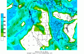
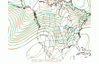
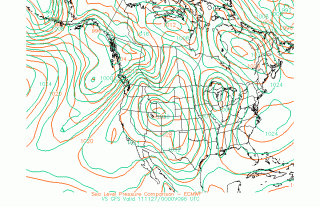
It’s a deep trough, and a surface low up in the Great Lakes looks to wick up enough moisture into the Southeast to stoke the storm machine. I’ve included a couple of the latest 00Z Euro/GFS comparisons plus Euro 850 mb relative humidity to give you a sense of what’s shaping up for 96 hours

(click on images to enlarge them). The GFS is predictably faster than the ECMWF, but both are pointing to the same overall scenario, with the trough eventually pinching off into a closed low.

Cloud cover presently looks like it will be rampant, minimizing instability. Still, given some ripping bulk shear, this system is something to keep an eye on as it evolves, particularly if you live in Dixie Alley.

That’s all for now. The sun has moved and is no longer blinding me. Time to get on with the rest of this day. May you and yours enjoy a happy and blessed Thanksgiving!

Ongoing Severe Weather in Dixie Alley

Looks like that surface low I wrote about a few posts ago is delivering its payload to Dixie Alley. Yesterday tornadoes spun down in northeast Texas and Louisiana, and now today it appears that the action will continue farther east.

I can’t help feeling a bit smug about the forecast and target area I sent to my chase partner, Bill Oosterbaan, who I believe has been down in Kentucky on business. After doing a quick-‘n-dirty scan of various NAM parameters and model soundings, I emailed him that he might have a crack at some action along I-40 between Jackson and Nashville, Tennessee.

With the 1630 SWODY1 now in, I see that my target area is in the heart of the SPC’s 5 percent tornado outlook. Tennessee may be under the gun in a while. Sure hope Bill is in a position to take advantage of the new year’s first chase opportunity.

Dixie Alley: Are Storms on the Menu for Late Next Week?

Just as I was preparing maps for a blog post on the possibility for severe weather in Dixie Alley next weekend, I got a call from my brother Pat in Port Townsend, Washington. Was I aware of the deep low off the northwest coast, he wondered? A local meteorologist named Cliff Mass had been talking about it and posting about it in his blog. Today he opened with the following:

The new high resolution forecasts (4km grid spacing, initialed 4 AM) are in and the potential for a significant coastal wind event remains. Here are two plots of sea level pressure and surface wind speed for 4PM, 10 PM, and 4 AM, starting on Sunday afternoon. A deep low center moves up the coast and sustained winds on the coast are 45-50 kts. Gusts could easily be 15-20 kts higher.

The Sunday 00Z NAM shows a persistent surface low bottoming out at 974 millibars, with some mighty tight isobars there along the coast. All I can think is, dang! There’s a wind machine, if you please. But that’s just for starters. The GFS shows the low deepening to 958 mbs late Tuesday night. By Wednesday, lower pressure is invading much of the west, and the scenario for Friday, Saturday, and Sunday across Dixie Alley begins to shape up.

no images were found

That was really what I was going to write about. Please don’t preach to me about long-range models and wishcasting. Of course I know it’s nothing but wishcasting right now. In the middle of January, can you blame me? And anyway, there’s at least some consistency established in depicting a walloping low moving into the Central Plains and then on up toward the Great Lakes. That much looks good.

.

no images were found

But what about moisture and instability? Heck, I don’t know, and right now I don’t care. Give it five days and let’s see what happens. It’s enough at this point to have something to keep an eye on. Here are some 18Z maps to ponder. Click on them to enlarge them.

no images were found