Book Review: Severe Storm Forecasting by Tim Vasquez

Beginning with his Weather Forecasting Handbook, which I purchased years ago at a College of DuPage severe weather conference, I’ve collected one-by-one nearly all of Tim Vasquez’s books on storm chasing and weather. The only exception is Tim’s most recent, 2011 publication, the Weather Forecasting and Analysis Handbook, and that’s next on my list.

The owner of Weather Graphics and the well-known storm chasing forum, Stormtrack, Tim is a widely acknowledged guru of storm chasing and operational forecasting, particularly in the severe weather arena. The man possesses more convective knowledge in his left pinkie than most of us do in our entire bodies, and in this fairly recent publication, he organizes information that is most relevant to chasers and severe weather junkies.

In Tim’s words, “Severe Storm Forecasting was a project started in 2007 to serve as the perfect companion for intermediate forecasters and a refresher for experienced forecasters. It maps the current state of severe thunderstorm forecasting from an operational framework rather than a research or academic perspective. Equations, physics, and lengthy citations have been kept to a bare minimum.” (From the preface.)

In other words, the book is intended to provide up-to-date, practical information that storm chasers can readily apply in forecasting and in the field. Since its release in 2010, I’ve been wanting to get my hands on this book. A while ago, I finally shelled out my $29.95 and purchased a copy, and I’ve spent the last several weeks chewing on it. It’s nutritious fare: thoughtfully organized, as current as is possible in a field shaped by rapid technological advances, and accessible to anyone who wants to apply him- or herself to developing severe weather forecasting skills.

Severe Storm Forecasting is divided into 10 sections as follows:

  • The Forecast Process
  • The Thunderstorm
  • Mesoscale Convective Systems
  • Tornadoes
  • Hail
  • Lightning
  • Stability & Shear
  • Radar
  • Satellite
  • Diagnosis
  • .
    An appendix contains additional information on the WSR-88D radar and the more commonly used diagnostic tools in severe weather forecasting, and also supplies blank, reproducible hodograph and skew-T/log-P charts.

    While the topics covered will be familiar to chasers who do their own forecasting, I’ve found plenty to broaden my scope, ranging from brand-new insights to discussions on topics with which I was only vaguely acquainted. For example, the section on QLCS tornadoes is the first time I’ve seen the subject given more than a casual nod. Here in Michigan, linear systems are far more common than isolated supercells, so it’s nice to encounter a book that spends a little time looking at their role as occasional tornado breeders.

    A strong asset of Severe Storm Forecasting is the way it aggregates the broad array of elements that are relevant to severe weather and then expands on them in one tidy package. Don’t get me wrong: this isn’t one-stop shopping. One book simply can’t cover everything in depth; pick any chapter and you can make a further study of its subject. But this book does much more than skim the surface. It is by no means a mere primer; it is a text that will equip you with a broad and substantial grasp of severe weather forecasting, and you shouldn’t conceive of it as a one-time read that you move through linearly and then “finish.” There’s too much content for a reader to absorb all in one pass, and much of it needs to be connected with field experience in order for it to gel. So look at Severe Storm Forecasting as a reference that you will process bit by bit. Once you’ve accomplished your initial read, you will return to it again and again.

    In the style of his other books, Tim has made ample use of sidebars to provide interesting asides that range from the historical to the technical. Just riffling through the pages, I find, for example, a call-out on page 75 that consists of material written in 1888 by Gustavus Hinrichs that sheds light on the origin of the word “derecho”; then a few pages later, on page 80, I read a smaller sidebar that discusses the term “swirl ratio”; and still further along, on page 95, I come across a fairly extensive personal communication from Paul Markowski on the contributing factors in warm versus cold RFDs.

    Three recommendations for improvement:

    1. 1. I’m surprised that a glossary was not included in a work of this nature. It is the one area in which I consider this book to be lacking, and I hope Tim will address the matter in his next edition.
    2. 2. An online supplement would add value. This could feature graphic, possibly interactive, examples of such topics as lifting and modifying forecast soundings, radar interpretation, and so forth. The supplement would be accessible only to purchasers using a code included in the back of the book. It could be used with other of Tim’s books as well, so one supplement could serve multiple purposes.
    3. 3. I have the sense that the editing was grassroots. The result is quite good, but speaking as someone with a background in publishing, I think the book could benefit from further proofreading or perhaps a light edit.

    With these things said, Severe Storm Forecasting is an eminently useful and well-done resource that belongs in a storm chaser’s library. If you’re a new chaser, I would recommend that you start with Storm Chasing Handbook, also by Tim; then purchase this book to expand your knowledge. Those with a bit more experience can jump right in. Regardless of your level of expertise, get this book. At some point, you’re either going to be glad you own it or else wish that you did.

    Purchasing Information

    • Severe Storm Forecasting by Tim Vasquez, 262 pages.
    • $29.95 plus shipping, available from Weather Graphics.

    NOTE: This is a non-paid, unsolicited review. I’ve written it as a service to my readers because I personally appreciate Tim’s book and feel that it provides a valuable and well-organized resource for storm chasers and severe weather buffs.
    Highlights from the 2009 COD Severe Weather Conference

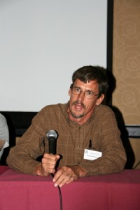
    Paul Sirvatka of COD, conference organizer

    Paul Sirvatka of COD, conference organizer

    The 2009 College of DuPage Severe Weather Symposium is now behind me, and in the light of it, it seems a bit weird to think that the day after, I headed over to my buddy Bill’s to watch the next episode of the Storm Chasers series on Discovery Channel. It feels like two different worlds, like boarding a bus in Grand Rapids and getting off on Mars. But the difference is superficial, a matter of editorial slant; the raw material remains the same, and however it gets spun on television, it’s nevertheless the stuff of research. In reality, people really, truly are going out there and surrounding supercells with an armada of mobile radars and other devices, including manned probe vehicles, all in the interest of collecting data that can increase our understanding of, in a nutshell, what makes tornadoes happen.

    The conference featured some of the most knowledgeable and revered names in severe weather research, operational forecasting, and storm chasing: Eric Rasmussen. Chuck Doswell. Roger Edwards. Roger Wakimoto. Josh Wurman. The list goes on, but the point is, a lot of very knowledgeable heads were present in the Double Tree Hotel’s conference room this past week, and some of the insights they shared were fascinating.

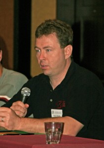
    Taylor and Carlsen of Environment Canada

    Taylor and Carlsen of Environment Canada

    Some of the coolest stuff didn’t even come out of the United States. Neil Taylor and Dave Carlsen of Environment Canada shared a photogrammetric analysis of the Elie, Manitoba, F5 tornado, and preliminary findings from the 2008 UNSTABLE team’s exploration of a well-known but hitherto unresearched dryline phenomenon in Alberta. The latter featured EC’s own mobile mesonet, complete with a Doppler-equipped airlplane.

    Here are just a few, representative snapshots of the many other topical materials covered:

    * Adam Houston talked about the effects of entrainment on unstable parcels, and suggested that the important issue for storm formation isn’t whether a parcel is merely unstable, but whether it is “supercritical”–i.e., possesses enough CAPE to overcome the effect of entrainment.

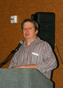
    Eric Rasmussen

    Eric Rasmussen

    * Eric Rasmussen shared some of the prelimary findings of VORTEX2, describing the interaction of the RFD with horizontal vortex rings in tornadogenesis.

    * Roger Edwards discussed the forecast funnel and the pros and cons of numerical models in operational forecasting.

    * Al Pietrycha offered an operational forecasting perspective on non-mesocyclone tornadoes, and more specifically, on landspouts.

    * For his dinner presentation Saturday night, Chuck Doswell gave an overview of the history of severe weather forecasting and research, and shared his outlook on things to come.

    The shape of the future was in fact a topic of concern for a number of the speakers, notably Doswell and Edwards. Amid the influx of information from the research community on misocyclones, vorticity arches, moisture

    Roger Edwards

    Roger Edwards

    convergence, and so on, those on the operational side focused on a more pragmatic matter: the widespread over-reliance on numerical models versus hand analysis.

    Will forecast models replace human forecasters? According to Doswell and Edwards, yes, at least for most forecasting scenarios. Edwards emphasized that when it comes to severe weather events–the most difficult to forecast, and the costliest in terms of lives and property–humans will still play an important role. But both men deplored the degree to which forecasters have abdicated hand analysis to the models, which continue to make advances in accuracy at the expense of human development. In a word, the attention and the money are being invested in building better technology, not better forecasters.

    Doswell’s message to meteorology students was blunt: either soak in as much information as possible, and commit to becoming experts at hand analysis and motivated self-educators, or else find a different career. Chuck, who is not known for being shy about sharing his viewpoints, wasn’t being nasty, just extremely forthright.

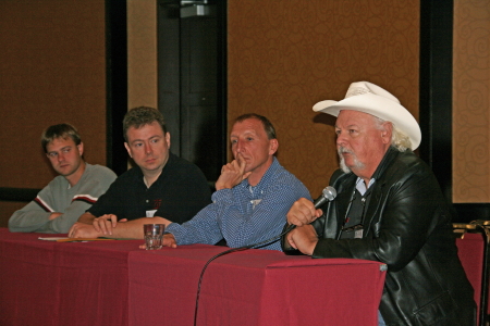
    Chuck Doswell speaks

    Chuck Doswell speaks

    The mets from Environment Canada, Carlsen and Taylor, were clearly shocked to learn how dependent United States WFOs have become on forecast models. The Canadian meteorologists take hand analysis as a given part of their jobs, and couldn’t imagine not rolling up their sleeves and interacting with the surface and upper-level charts firsthand.

    If there was a primary take-away value for me from this conference, I guess that’s it: the importance of getting my arms around hand analysis. Practically speaking, while I found the other material fascinating and enriching, much of it was not particularly applicable to my needs as a storm chaser. The first priority is to get to the right storms. Everything else falls into place from there.

    COD Severe Weather Symposium: Are You Going?

    It’s drawing closer, and I’m getting excited. I’m talking about the College of DuPage’s upcoming Severe Weather Symposium, which will be held November 5-7. With a lineup of presenters that features some of the foremost luminaries in severe thunderstorm research, the event promises to be stellar.

    I’m surprised I haven’t seen more talk about it on Stormtrack, but maybe that’s because the symposium is being held in Chicago rather than out in the Great Plains. Or perhaps it’s because the midweek timing puts a crimp on people who have to work.

    But while proximity may be an issue for some and scheduling for others, the content is compelling enough that if you’re anywhere within a couple hundred miles, it will truly be your loss if you don’t make time for this event. Looking over the agenda, here’s what I see:

    * All of Thursday afternoon is devoted to various aspects of convective initiation. If you want to improve your targeting skills with the latest information, this day alone ought to be worth its weight in gold.

    * Day two focuses largely on tornadogenesis, but includes other topics such as a photogrammetric analysis of the Elie, Manitoba, F5 tornado, and issues in severe weather warnings. The latter presentation will no doubt address the hotly contended use of the enhanced “tornado emergency” wording.

    * Day three will…well, look, here’s the complete agenda. You can read it for yourself, and conclude, as I did, that this is going to be a standout event for storm chasers.

    I’ve been waiting for a long time for another severe weather conference courtesy of Paul Sirvatka and the College of DuPage. I attended two of their symposiums some years ago, back when my storm chasing skills were still very formative, and each one was time well spent. This one looks to be the best yet. Poised between the end of a stormless autumn and the long, desperate, SDS-riddled winter months, it will provide a welcome immersion into the world of tornado research and operational forecasting that ought to bear dividends when the Gulf reopens for business again next spring.