The formidable system that ground out large, violent tornadoes in Kansas, Oklahoma, and Texas on Tuesday will move east on Wednesday to bring another round of severe weather to southeast
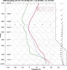
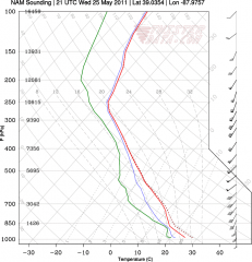
Missouri, Illinois, and Indiana. And finally–finally!–I’m in a position to do some storm chasing. Financial constraints have majorly crimped my expeditions so far this season, but no way am I missing tomorrow.Based on Tuesday morning’s NAM run, I’d been eyeballing Effingham, Illinois, as a preliminary target for trolling the I-70 corridor. The sounding for that area looked mighty pretty, as you can plainly see.
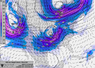
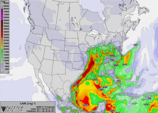
Now, however, with the 00Z runs in, I’m inclined to shift farther east near Terre Haute. Here’s another model sounding, courtesy of TwisterData, for near Oblong, Illinois. Maybe not quite as sexily backed at the surface as the Effingham sounding, but with stronger low-level winds and definitely quite functional. Maps of 500 mb winds and SBCAPE (see below) paint in a little more detail and suggest that near the Illinois/Indiana border is a good choice.
Tomorrow morning’s data will tell all. Meanwhile, it’s time for me to get my ugly-rest. I am so excited about the prospect of finally getting out and feeling the moisture, watching cumulus towers erupt and organize into glowering supercells, and hopefully videotaping some tornadoes out on the flat, wide-open Illinois prairie! A good night’s sleep and then I’m off in the morning.


