I’ve never chased storms in North Dakota, but that’s about to change. Tomorrow Rob Forry and I are hitting the road for the severe weather event that’s shaping up for Saturday along the Canadian border.
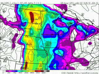
This has been a puzzling scenario to forecast, with the models gradually aligning after painting some radically different scenarios. The NAM has wanted to move the system eastward faster and place the better tornado action across the Canadian border, while the GFS and Euro have been more optimistic and, I believe–I hope–more accurate. What the heck–Canada may get more shear, but North Dakota has the big CAPE.
We’ll find out Saturday. Lacking an extended driver’s license that would grant me access to Canada, I’m counting on North Dakota to deliver. I feel confident
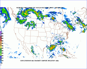
enough that it will that I’m taking the chance. I keep eyeballing the region from Minot east toward Rugby and Devil’s Lake, and north, and a bit south. Skew-Ts have looked consistently good in those parts, and there’s plenty of CAPE to get the job done–around 4,500 J/kg MLCAPE per the GFS. My hope is that all that luscious, pent-up energy will produce something like what the NAM 4km nested CONUS radar shows at the top of this post.Come on! Big tubes and gorgeous storms drifting across the wide sublimity of the North Dakota landscape, and then steak and beer later on.


