Year of the Cap Bust

I guess I’m just a slow learner when it comes to technical stuff that involves linear thinking. Sooner or later, though, if I stick with something long enough, I usually emerge more knowledgeable for having done so. Nowhere has this been more true than in storm chasing, an activity which obviously depends heavily on figuring out if and where there will be decent storms to chase.

Seems like I’m constantly being confronted with some new aspect of the atmosphere that I haven’t factored into my forecasting, or that I haven’t factored in as effectively as I needed to. The upside of that, though, is that I wouldn’t even be aware of what I don’t know if I hadn’t learned enough to at least recognize my areas of ignorance. If my forecasts aren’t as expert as those of a trained meteorologist, they’re nonetheless a seven-league bound beyond when I was just beginning to grapple with all those arcane terms and acronyms of convective weather such as SBCAPE, CIN, 0-6km bulk shear, LIs, helicity, and lapse rates, and when the only thing I could do with a skew-T or a hodograph was shake my head in bewilderment.

This has been the year of discovering the 700 mb/12C limit. By “discovering,” I mean through empirical experience, and by “empirical experience,” I mean cap busts. Of course, I’ve endured plenty of cap busts in my development as a storm chaser; I just didn’t understand exactly what was going on, or why the high risk area I was sitting in was producing nothing more than smug blue skies rather than carnivorous supercells.

One memorable day in Iowa drove home the lesson perfectly. MLCIN was supposed to erode by later in the afternoon, and it got to a point where it was eroding, at least according the RUC. With SBCAPE at some ridiculous figure like 7,000 j/kg, I figured that at some point a convective tower would punch through the cap and go absolutely gonzo. Instead, the clouds kept firing up into the nicely sheared environment and then dying, firing and dying, firing and dying. The reason? A 700 mb temperature of around 14C, possibly considerably higher. Lesson learned: it doesn’t much matter what the models have to say about the CIN eroding when you’ve got mid-level temperatures like that.

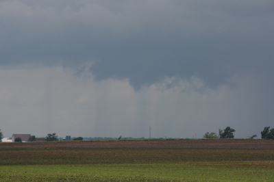
I experienced another cap bust yesterday, though I can’t feel too bad about it since I had no compelling reason to head out in the first place, the conditions were so marginal. It was interesting to notice that in this situation, the circumstances were reversed: RUC showing my area under very breakable 700 mb temps of around 10C, but with MLCIN creating some concern. However, the CIN appeared to be eroding, and when an SPC mesoscale discussion spotlighted the area I was in, I started feeling happy about having made the drive down to west-central Illinois.

But the CIN started building back in, and by 00Z I found myself socked in under values around -300 j/kg. Not much a parcel of air can do with that, I guess, no matter how big the CAPE is. I turned around and headed home.

A paper by Bunker, Wetencamp, and Schild of the NWS in Rapid City, South Dakota, explores the ins and outs of the 700 mb/12C limit and concludes that it has a limited, conditional application. However, as my buddy Mike Kovalchick pointed out to me, the paper also reveals that only 5 percent of tornadoes within the study period formed when H7 temps exceeded 12C, and virtually no violent (EF4 and EF5) tornadoes occurred above that threshold.

So for practical use in storm chasing, the 12C limit appears to be a very useful rule of thumb. The issue for me then becomes a matter of refining my ability to know when cold air advection will lower the 700 mb temps. But that’s a subject for another blog. I’m tired of thinking. It’s time to go meet my buddy Dewey down in Plainwell and grab a brew at Arie’s. Ciao!
June 8: Mini-Supercell in Northern Illinois and Severe Squall Line on the Lake Michigan Shoreline

This is really part two of the previous post. After chasing a potent, monster hailer of a supercell north of Saint Joseph, Missouri, I overnighted at a hotel outside of Des Moines, Iowa. When I stepped outside the next morning, the air was much cooler and drier, a stable atmosphere that wouldn’t produce so much as a sneeze, let alone a tornado.

But I knew that the SPC had outlooked the area to my east across northern Illinois, and for several days I myself had been eyeballing my home state of Michigan, where the NAM-WRF had been consistently indicating the possibility of tornadoes. With a little luck, I hoped to make it back in time to chase whatever convection might pop up along the warm front.

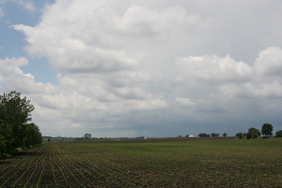
As I approached Davenport, I observed  towering cumulus muscling up through the troposphere. However, I didn’t pay them any attention–that is, until Bill Oosterbaan called to inform me that the SPC had just issued a mesoscale discussion for the area just east of me. Even as we talked, I noticed a lowering on a cumulus tower a mile or two to my northeast. When it continued to develop, I decided to investigate. Leaving I-80, I parked across from a truck stop at the Atkinson exit to watch.

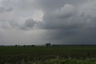
The next cell to my west quickly grabbed my attention. It had a nice rain-free base, and as I watched, scud began to form and ascend in an obvious updraft, coalescing into a small, ragged wall cloud. Grabbing my camera and getting out of my car, I noticed right away that the air was very different from back in Des Moines–considerably warmer and with plenty of moisture. The wall cloud fell apart before I could get a pic, but the overall structure remained interesting.

A mini-supercell approaches Atkinson, Illinois, just north of I-80.

A mini-supercell approaches Atkinson, Illinois, just north of I-80.

More brief, non-rotating wall clouds formed and dissipated one by one, so I figured I’d head north of town and observe. With surface winds veering and the overall flow unidirectional, I had no expectation of seeing tornadoes, but the mini-supercell made for some fun and interesting viewing.

Ragged, non-rotating wall cloud.

Ragged, non-rotating wall cloud.

Distant wall cloud and back side of main updraft tower.

Distant wall cloud and glimpse of updraft tower.

I was tempted to follow the storm, but decided it was a red herring. If at all possible, I wanted to make it back to Michigan in enough time to chase the setup there, and that left me no time to play around on the western Illinois backroads. So I headed back to I-80 and busted east.

The first Michigan supercell fired up earlier than I’d hoped, and I bit my lip as I followed its progress on GR3 and watched it hit Lansing. If only I had driven east last night for two more hours, or left in the morning two hours earlier… But the previous day’s chase had left me exhausted. And you know, one of the downsides of being a Michigan-based storm chaser is, you just don’t have very high expectations when it comes to your home state. I mean, it’s Michigan. Home of convective table scraps, squall lines, and embedded supercells that don’t produce squat.

As it was, I watched several more storms fire up and develop rotation along the warm front that stretched across mid-Michigan. I was making decent progress and still had hopes of catching up with some of the southernmost cells. But by the time I crossed the state line, the action all had shifted well to the east, and it became clear that I wasn’t going to see any of it.

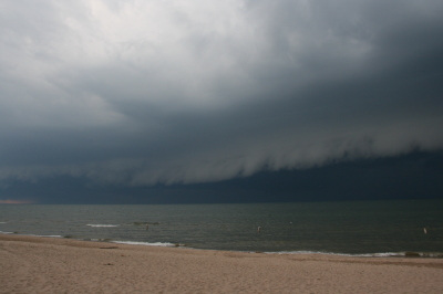
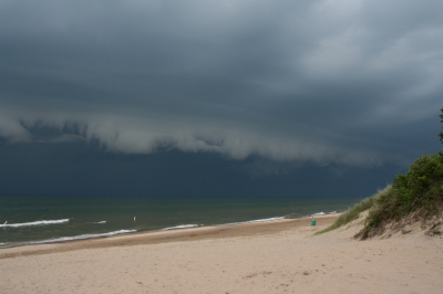
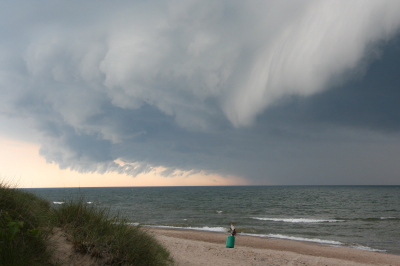
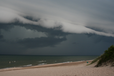
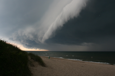
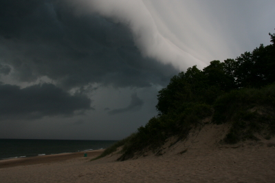
Instead, taking fellow chaser Mike Kovalchick’s suggestion, I headed toward the lakeshore at Allegan Beach to intercept a short but potent squall line. I’m glad I did. The backdrop of Lake Michigan and its dunescapes lends a breathtaking drama to incoming storms. The following photos depict the progress of the arcus cloud moving in across the waters. What these images can’t convey is the full, awe-inspiring sweep of cloud, big lake, and shoreline; of the solemn foreboding of some great event about to unleash itself upon a landscape cloaked in storm shadow; of the shelf cloud moving silently overhead like the furrowed eyebrow of a dark, scowling giant; and of sand spray blowing and trees thrashing in the wind as the gust front arrived.

I’ll let the photos tell their story as best they can, and leave the rest to your imagination.

An arcus cloud advances toward the Lake Michigan shoreline at Allegan Beach.

An arcus cloud advances toward the Lake Michigan shoreline at Allegan Beach.

View to the north.

View to the north.

Looking south...the storm closes in.

Looking south...the storm closes in.

Looking north...closer still.

Looking north...closer still.

Almost overhead.

Almost overhead.

One last shot to the north, then it's time to make a dash for the car.

One last shot to the north, then it's time to make a dash for the car.