Remembering the Henryville EF4 Tornado: A One-Year Retrospective

We were three-and-a-half miles north of Palmyra, Indiana, when the tornado crossed the road less than a mile in front of us at Dutch Creek Road, ripping up a 12 x 12-foot section of asphalt in the process and throwing it in chunks into an adjacent field. Within about a minute, the vortex had morphed from a wispy rope into a powerhouse of a stovepipe, tearing tangentially across our path as Bill Oosterbaan and I blasted north on State Road 135.

Bill is no timid driver, and he did a heck of a job keeping pace with the beast. But the storm was a missile, moving at least 60 miles an hour, and once we hit downed power lines at Dutch Creek Road, we had to let it go. We had no idea of the tragedy it was about to inflict to our northeast. But, watching the white condensation funnel billow and intensify beyond the treeline, with secondary vortices wrapping around it like a cloak, we could tell it was a monster. As I filed a report on Spotter Network, Bill turned around and headed back south. A second supercell was hot on the heels of the one we had just let go, and repositioning became our immediate concern.

Bill and I had just been fortunate to catch and videotape the Henryille EF4 tornado in its formative stages. We first glimpsed it south of Palmyra as it descended from a wall cloud several miles to our west-northwest. It didn’t look particularly impressive at that point, but as we closed in, the fast-moving circulation began to display wild shapes and motions, then condensed fully and finally just before crossing the highway.

It seems incredible that  in the few meager seconds the tornado took to translate across SR 135, it managed to rip up a large section of road. The term “asphalt scouring” just doesn’t apply; there was no scouring involved. An estimated 10,000 pounds of pavement got literally torn from the downwind side of the highway and thrown something like one hundred feet. I didn’t witness this road damage and only found out about it later. But chaser Simon Brewer provides a good description of what he saw just a few-score yards north of where Bill and I turned around.

The wider damage path associated with the main tornado circulation was easily visible from a forest west of the highway through a field, and past the highway through another forest to the east. Also, an individual suction vortex damage path was easily found starting in the field scouring vegetation and tossing boulders from a drainage ditch, then crossing a section of highway peeling and tossing massive slabs of asphalt, the largest broke upon second contact with the ground (it bounced leaving an significant impact crater) on the downwind side of the highway. Typical sphalt scouring is usually associated with EF3 and stronger tornadoes, but typical asphalt scouring is found on rural roads with relatively thin asphalt 1-2 inches or less thick. It’s amazing to think how short a time period the small suction vortex was probably over that section of highway; maybe only a second tops! I usually don’t stop to investigate tornado damage, but when I saw the highway damage on March 2nd I was blown away! I took more photos of the road damage than I did the storm and tornado. I consulted Dr. Greg Forbes and he agreed this was one of the most incredible damage cases he’s heard, only possibly being eclipsed by the trench created by the Philadelphia MS EF5 on April 27, 2011.*

A year has passed since all of the above took place. At the same time last year as I am presently writing these words, Bill and I were nearing Louisville, and within another hour or so we would shift into chase mode, head west, and intercept our storm. Click here to read my complete account of that chase, including my video of the tornado as well as radar images and skew-Ts.

Today the weather is drastically different. This March is behaving like March, not May, and in light of last year’s prolonged heat wave and disastrous drought, I am glad. I will be delighted to see another round or two of good winter weather bring still more moisture to the Plains and Midwest and prime the pump for storm season. The storms of spring will get here soon enough, and while nothing is certain, my hunch is that this year will be better than last year.

_______________

* Simon Brewer, from his January 14, 2013, post in the Stormtrack thread The EF Scale and Asphalt Scouring Caused by the March 2 Henryville Tornado. Also see Simon’s and Jim Bishop’s chase account, which includes photos of the road damage, at their Stormgasm website. You can see Dutch Creek Road just past the road sign and parked car in the background of the first photo.
Intercepting the March 2, 2012, Palmyra-Henryville-Marysville, Indiana, Tornado

Now, while my video from Friday’s chase is uploading to YouTube, is a good time for me to write my account of how things transpired down in southern Indiana.

The phrase “historic event” rarely describes something good when applied to severe weather. March 2 may qualify as a historic event. The current NOAA tally of tornado reports stands at 117; the final number, while likely smaller once storm surveys have been completed and multiple reports of identical storms have been consolidated, may still set Friday’s outbreak apart as the most prolific ever for the month of March. Whether or not that proves true, Friday was unquestionably a horrible tornado day that affected a lot of communities from southern Indiana and Ohio southward.

The Storm Prediction Center did an excellent job of keeping track of the developing system, highlighting a broad swath of the eastern CONUS for a light risk in the Day Three Convective Outlooks and upgrading the area on Day Two to a moderate risk. On Day One, the first high risk of 2012 was issued for a four-state region that took in southern Indiana and southwest Ohio, most of Kentucky, and north-central Tennessee–a bullseye in the middle of a larger moderate risk that cut slightly farther north and east and swept across much of Mississippi and Alabama as well as northwestern Georgia.

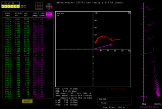
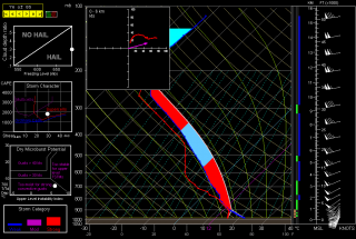
The SPC and NWS offices weren’t the only ones keeping vigilance. Storm chasers across the country were watching the unfolding scenario, among them being my good friend Bill Oosterbaan and me. Here are the February 29 00Z NAM model sounding and hodograph for March 2, forecast hour 21Z, at Louisville, Kentucky. (Click on the images to enlarge them.) With MLCAPE over 1,800 J/kg, 0-6 km bulk shear of 70 knots, and 1 km storm-relative helicity at 245 m2/s2, the right stuff seemed to be coming together. By the time the storms actually started firing, those figures were probably conservative, particularly the low-level helicity, which I recall being more in the order of 400 m2/s2 and up. Simply put, the region was going to offer a volatile combination of moderate instability overlaid by a >50-knot low-level jet, with a 100-plus-knot mid-level jet core ripping in.

I had my eyes set on southeastern Indiana. The problem with that area is, it’s lousy chase terrain along the Ohio River, and it doesn’t improve southward. If there was an ace-in-the-hole, it was Bill’s knowledge of the territory, gleaned from his many business trips to Louisville.

We hit the road at 7:15 that morning, stopping for half an hour in Elkhart so Bill could meet with a client and then continuing southward toward Louisville. Bill was of a mind to head into Kentucky, where the EHIs and CAPE were higher; I was inclined to stay farther north, closer to the jet max, the warm front, and, presumably, stronger helicity. But either choice seemed likely to furnish storms, and since Bill was driving, has good instincts, and knows and likes western Kentucky, I was okay with targeting the heart of the high risk rather than its northern edge.

But that plan changed as we drew near to Louisville. By then, storms were already firing, and one cell to our southwest began to take on a classic supercellular appearance. Bill was still for heading into Kentucky at that point, but after awhile, a second cell matured out ahead of the first one. We now had two beautiful, classic supercells to our southwest, both displaying strong rotation. It was a case of the old adage, “A bird in the hand is worth two in the bush”–except in this case, there were two birds, back to back. And I-64 would give us a clear shot at both of them.

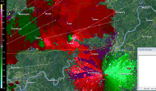
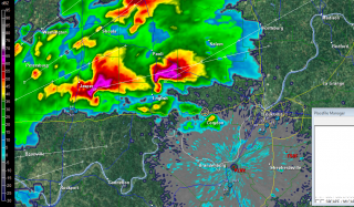
So west we went, and into chase mode. At the Corydon exit, we caught SR 135 north, headed for an intercept with the first supercell. The two radar captures show the base reflectivity and SRV shortly after we began heading up the state road.

A few miles south of Palmyra, we got our first glimpse of a wall cloud maybe four miles distant. That’s all there was at that point, and the hilly, forested terrain afforded less-than-optimal viewing. Within a minute or two, we emerged into an open area just in time to see a funnel descend from the cloud. Tornado!

The sirens were sounding in Palmyra, providing an eldritch auditory backdrop to the ropy funnel writhing in the distance as we drove through town. The tornado went through various permutations before expanding into a condensation cone revolving like a great auger above the treeline. It was travelling fast–a good 60 miles an hour, at a guess. As we sped toward it, the condensation hosed its way fully to the ground and the tornado began to broaden. It crossed the road about a half-mile ahead of us, continuing to intensify into what appeared to be a violent-class tornado with auxiliary vortices wrapping around it helically.

Shortly after, Bill and I came upon the damage path. We pulled into a side road lined with snapped trees, amid which a house stood, somehow untouched except for a number of peeled shingles. The tornado loomed over the forest beyond, an immense, smoky white column wrapping around itself, rampaging northeastward toward its fateful encounters with Henryville and Marysville.

The time was just a few minutes before 3:00 eastern time. While I prepared and sent a report to Spotter Network, Bill turned around and headed back south. We had another storm to think about, and it was closing in rapidly. It wouldn’t do to get caught in its way.

Back in Palmyra, we headed west and soon came in sight of another wall cloud. This storm also reportedly went tornadic, but it never produced during the short time that we tracked with it. We lost it north of Palmyra; given the topography, the roads, and the storm speed, there was no question of chasing it.

From that point, we headed south across the river into Kentucky to try our hand at other storms, but we saw no more tornadoes, nor, for that matter, much in the way of any serious weather. Not that there weren’t plenty more tornado-warned storms; we just couldn’t intercept them, and after giving it our best shot, we turned around and headed for home.

Lest I forget: my worst moment of the chase came when I couldn’t locate my video of the tornado in my camera’s playback files. It seemed unfathomable that I could have horribly botched my chance to finally capture decent tornado footage with my first-ever hi-def camera. After being miserably sidelined during last year’s record-breaking tornado season, the thought that I had somehow failed to record this day’s incredible intercept just sickened me. Fortunately, there were no sharp objects readily available; and better yet, the following morning I discovered that I had simply failed to scroll up properly in the playback mode. All my video was there, and it was spectacular. Here it is:

My excitement over the video was offset by reports of just how much devastation this tornado caused eighteen miles northeast of where it crossed the road in front of Bill and me. Henryville, obliterated. Marysville, gone. Eleven lives lost in the course of that monster’s fifty-two-mile jaunt. And similar scenarios duplicated in other communities across the South and East. The death toll for the March 2 outbreak presently stands at around forty.

In the face of a mild winter and an early spring, Friday was the inauguration for what may be yet another very active severe weather season east of the Mississippi. We can only hope that there will be no repeats of last year’s wholesale horrors. May God be with those have lost loved ones and property in Friday’s tornadoes.