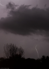
Memorial Day 2012: A West Michigan Lightning Extravaganza

I have yet to take some truly razor-sharp images of lightning, but each time I go out, I learn a little more about how to improve my lightning photography. Last night afforded me a great opportunity. Storms forming ahead of a cold front moved across Lake Michigan and began to increase in coverage as the night progressed, and I roamed with them across West Michigan from the shoreline at Whitehall and Muskegon State Park to inland northeast of Lake Odessa.

My expedition was marred by the fact that I left the adapter plate for my tripod at home. I compensated by setting my camera on top of my dashboard and shooting through the windshield, an arrangement that works okay but

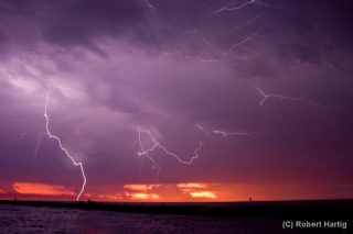
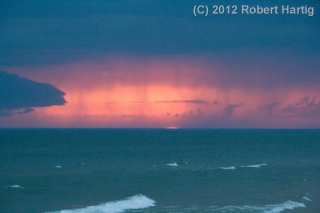
which considerably limited what I was able to do at the lakeshore. Using the hood of my car to steady myself, I managed to capture a few shots of a beautiful, moody sunset, with the red semicircle of the the sun gazing sullenly through rain curtains of the advancing storms. However, parking by the side of a busy road where everybody had the same idea–to pull over and watch the storms roll in over the waters–just didn’t work very well. After too many time-lapse images marred by tail lights (see photo in gallery below) I decided to hightail it and try my luck inland.

It was a good choice. The storms multiplied as I headed back toward Caledonia, and with lightning detonating to my north and closing in from the west, I decided to continue eastward till I found an ideal location–a place far from city lights and with a good view in all directions. I never expected to drive as far as northeast of Lake Odessa, but I’m glad I did.

Note to self: STOP USING THE ULTRA-WIDE-ANGLE SETTING WHEN SHOOTING LIGHTNING. Zooming out all the way to 18 mm is just too far, and cropping the shots doesn’t work well. The crispness goes downhill.

For all that, the images below aren’t all that bad, and a few turned out really well. After Sunday’s busted chase in Nebraska, it was nice to enjoy a few mugfulls of convective homebrew right here in West Michigan. I finally arrived home at the scandalous hour of 4:15 a.m., far later than I ever anticipated. I was tired but pleased. This Memorial Day lightning display did not disappoint.
Lightning at the South Haven Pier

Yesterday’s slight risk for Michigan looked more impressive in the models than it did up close and personal. With dewpoints as high as a sultry 78 degrees Fahrenheit in Caledonia (courtesy of my Kestrel 4500 weather meter), MLCAPE upwards of 3,500 J/kg, and 40 knots at 500 millibars, the ingredients were all present for a decent severe weather event. Backing surface flow even suggested the possibility of tornadic spin-ups, though winds at the surface were weak.

For all that, the storms when they finally arrived were pretty garden variety, with one exception: the lightning was absolutely spectacular, a

nonstop flickerfest bristling with CGs. The lines rolled across Lake Michigan in two rounds. Thanks to some good input from Ben Holcomb, I chose to set up shop at the South Haven beach, a great strategic location, arriving there in plenty of time to intercept round one. Kurt Hulst met me there, and we got our live streams going and tripoded our cameras as the northern end of the line bore down on us.

It was too dark to see the shelf cloud very distinctly. I tried to capture it with my camcorder; I haven’t viewed the footage yet, so I don’t know how it turned out, but I soon realized that I’d be better off working with my still camera, which I got mounted right about the time that the gust front arrived. The rain was near-instantaneous, escalating within moments from errant droplets to a horizontal sheet, and I scurried back to my car while collapsing my tripod as fast as I could.

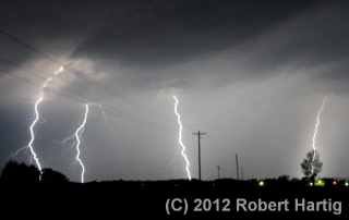
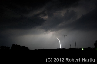
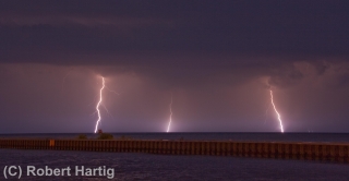
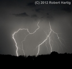
What a great light show! After a lot of teasers this year, I finally got a chance to get some good lightning shots, particularly as the storm moved off to the east. With CGs ripping through the air over South Haven, anvil crawlers lacing the sky overhead, and now and then a brilliant bolt tracing a path from the sky to the lake across the canvas of a molten sunset, yesterday evening was a lightning photographer’s dream. Kurt is a great hand in that regard, and he captured some fantastic images. But for once, even I managed to get some shots I’m pleased with. Here are some of my better ones. Click on them to enlarge them.

As the storm moved on, a good number of people returned to the beach with their cameras to capture the amazing sunset and the lightning display. Storm chasers aren’t the only ones with an eye for the drama that the sky provides!

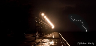
Some of my photos were taken later on, as the second line of storms was moving toward the shore. I’m particularly pleased with my shot of a lightning bolt off to the right of the pier; it’s a moody, mysterious image, and I intentionally left plenty of dark space at the bottom left.

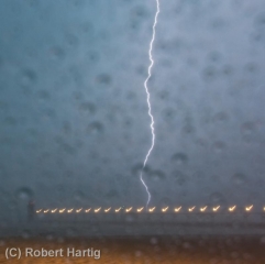
I might add that the pics with raindrops all over the foreground were taken from my car during the height of the first storm. While I’d of course prefer nice, clear images, I don’t mind the drops. They lend a somewhat Impressionistic feel to the photos. At least, that’s what I tell myself.

Lightning Storm over Caledonia

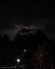
The day after my October 23 chase out in northwest Missouri and southwest Iowa, thunderstorms blew across West Michigan. Watching the MCS move in on my radar, I decided to try my hand at a few lightning photographs. I had learned a few essential tips since my last attempt, and this looked like a fantastic opportunity to see what kind of a difference they made.

.

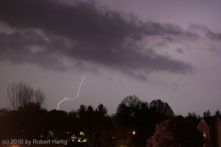
The photos shown here were shot from the balcony of my apartment in Caledonia. Click on them to enlarge them. They may not be National Geographic quality, but they’re not bad. Fact is, one of my photos that night was my best lightning shot ever. Unfortunately, I accidentally erased it only minutes after I took it. You could hear my screams of anguish and bonking of my head against the wall all the way to Sam’s Joint.

What you see on this page are just compensation prizes. They’ll do, though. They’re mementos of what was probably the last lightning any of us around here will see this until next spring. Snow is in the forecast a few days hence, and with two months before it officially starts, the long winter is already winding up the mainspring and getting set to unleash.