 Here’s something you don’t see very often on the morning of December 31. (Click on thumbnail to enlarge it.) It’s 10 a.m. and for the last half-hour I’ve been watching lightning flicker outside my window and listening to thunder rumble.
But that’s nothing compared to what’s going on farther south. Already three fatalities have been reported in Arkansas, and tornado warned storms are scraping across the region. As I write, there are two strong SRV couplets in Missouri southwest of Waynesville and west of Houston–potent little supercells fueled by dewpoints in the upper 50s. It’s 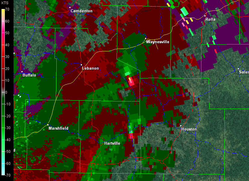 certainly not what you’d expect this time of year, but this event has been shaping up for several days.
I’ve got a gig this evening–it’s New Years, after all–so my extent of involvement in this weather scenario will be to watch it unfold to the south of me on radar and enjoy its occasional outbursts of lightning and thunder here in my own Michigan backyard. Later today Louisiana and Mississippi could get hammered, but right now the action is farther north, where buckets of shear are organizing the storms and driving them along at 50 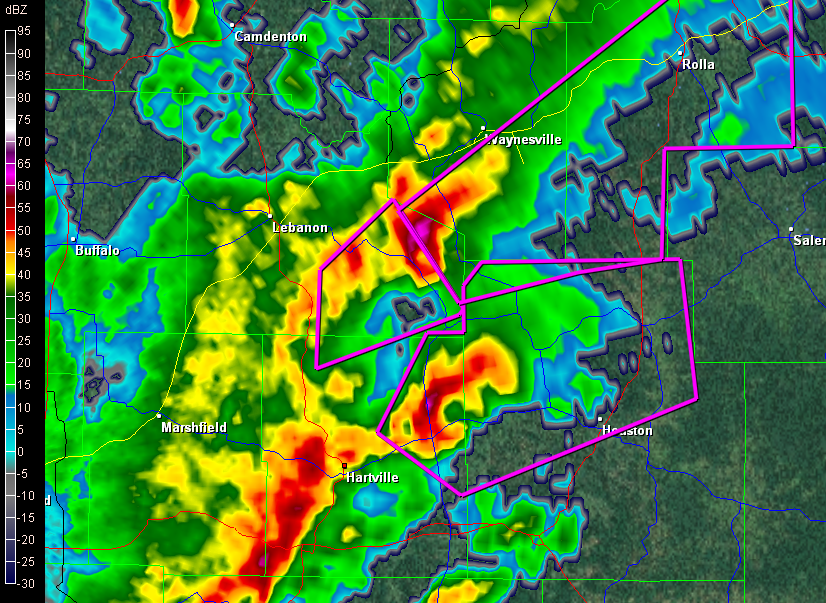 miles an hour. If that little bugger south of Waynesville holds together, Rolla is going to get whacked within the next half hour.
Enough writing. I’m going to upload some radar images for this post and then watch this event unfold.

