My Great 1,600 Mile Chase Bust

Monday and Tuesday this week were the storm chase from hell. It you’re looking for a nice, upbeat post about chasing, you’d best skip this one. My feelings about my fiasco in Nebraska may have mellowed down enough for me not to unleash a full-bore rant anymore, but I’ve still got enough gunpowder left to blow off a few firecrackers. That’s the result when impediment piles upon impediment and frustration upon frustration.

With my sights Sunday night fixed on western Iowa and eastern Nebraska the next evening, I set my alarm clock for 4:30 a.m. and hit the sack. I was awakened by early morning light filtering through the window. Light? I glanced at the clock. It said 6:30. My alarm hadn’t sounded and I was running late.

Nuts. But okay, no problem. After a fast shower, I kissed Lisa good-bye, threw my gear into the car, and hit the road. I still had plenty of time to make

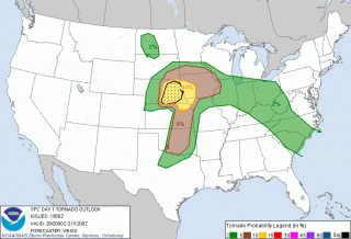
eastern Nebraska, and that was a good thing because the SPC had bumped the focal point for tornadoes west. No time to analyze models–I just had to trust the Norman weather pros and hope for the best. Off I went.

Thirty miles down the road in Zeeland I made a delightful discovery: I had left my debit card in my other pants pocket. This was the beginning of woes. Self-possessed person that I am, I responded calmly and maturely by protruding my eyeballs, depressurizing my feelings constructively using the special vocabulary that I reserve for just such occasions, and, a cat of nine tails not being handy, by rapidly banging my fist on the steering wheel in lieu of self-flagellation.

Retrieving my debit card meant losing over an hour. I now was pushing the envelope, but I could still make eastern Nebraska by late afternoon. This being probably my last crack at a good setup in a record storm season during which I’ve been miserably sidelined, I was determined to try. So off I went again.

I wasn’t far south of Holland, Michigan, when the disquiet in my stomach became a bubbling, and the bubbling escalated into the kind of tar-pit-like seething that tells you a quick trip to a bathroom will be required in the near future. Between southern Michigan and east of Chicago, I made three pit stops. Another 45 minutes, literally gone down the toilet before I finally popped some Immodium and put an end to the rumblings.

By the time I drew near to Omaha, the show was underway. A tornadic supercell was moving up out of Kansas into Nebraska toward the center of the surface low. My friend and long-time chase partner Bill Oosterbaan, who had called me as we both were initially approaching Zeeland and just as my debit card fiasco was commencing, was now far ahead of me and positioning himself for the next storm down. That storm went spectacularly tornadic and Bill got some great footage, probably the best he’s gotten so far.

But there was no way I could make it that far west in time to catch tornadoes. My show was clearly going to be the pair of cells to my southwest that were heading toward Lincoln. They were my one chance. But they were south of the warm front, and while surface winds were southeasterly, the storms were moving north-northeast. The low-level helicity required for tornadoes was lacking. My hope was that as the storms headed north they would tap into increasingly backed winds.

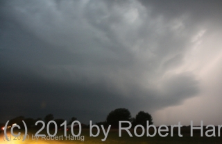
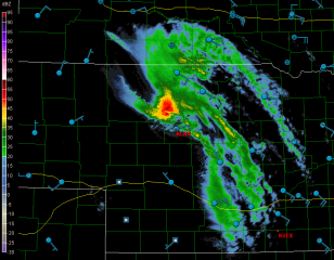
But all they did was backbuild and congeal into a nasty squall line. My hopes were still up as I approached Lincoln; however, as I finally drew near to the northernmost cell along US 77 west of Roca, I could see that I was screwed. The cells had congealed into a pile of linear junk. I had driven over 750 miles to chase a shelf cloud, and it wasn’t even a particularly photogenic shelf cloud. True, it had the local media in Omaha screaming about 75 mph winds and flash flooding, but I’ve seen plenty better right here in Michigan. Linear mess-oscale convective systems are our state storm.

No point in prolonging the pain. I started heading home, my idea being to get far enough east that I’d have time to chew on the system’s leftovers back in Michigan the next day. Bill had business in Iowa and was overnighting at the Hilton in Marshalltown, so I bunked with him there. He’d gotten four tornadoes in Polk County, and we reviewed his footage. Very nice stuff! He’d gotten close enough to a large tornado to capture the roar. Here’s his YouTube clip.

Sigh. So near and yet so far. An arcus cloud isn’t much of a compensation prize compared to a tornado. Of course there was still tomorrow back home. A warm front looked poised to drape right across Grand Rapids with SBCAPE in the order of 4,500 J/kg–an optimal setup for Michigan, except that the models consistently depicted the 500 mb jet hanging back just to the west in northern Illinois and Wisconsin.

Bill and I in fact hooked up again the next day after his business meeting and briefly discussed chasing the low in Wisconsin. But that area is some of the worst chase terrain imaginable, so we scrapped the idea and went our ways.

Somewhere around Davenport, out of idle curiosity, I checked out the SPC’s mesoanalysis graphics and noticed that the mid-level energy appeared to be nudging eastward toward Michigan. Hmmm…maybe there might be a bit of a show after all. I gave Kurt Hulst a call. He had hung back in town and was planning to chase today, not expecting much but thinking that the big CAPE could compensate somewhat for poor upper air support. I agreed, particularly now that it looked like 500 mb and higher winds might reach the threshold for storm organization.

Later VAD wind profiles at GRR showed nice veering with height along with 30 kt winds at 18,000 feet. Not a setup to die for, but it might just work. And it did. A beautiful supercell fired up along the warm front, and Kurt was on it in a heartbeat. He got in some nice chasing on several storms, witnessed rotating wall clouds and a funnel extending halfway down, and did some call-ins for WOOD TV8. Good work, Kurt!

As for me, I got delayed by a traffic bottleneck in Joliet, Illinois, and attempting to find a detour proved to be a huge, time-consuming mistake. I finally arrived in Michigan in time to chase storms, but not the ones on the warm front. Once again I had to settle for what I could get as I belted east down I-94 and punched through the line near Marshall. By then the mid-level winds had backed off and I was left with the usual, disorganized Michigan crap-ola. There was a lot of that, though. The warm sector was remarkably juicy, and more storms kept popping up behind the main line.

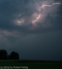
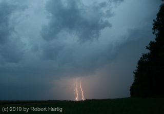
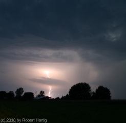
Heading back through Battle Creek, I parked in a lot across from the old Kellogg Museum and watched a couple of cells south and west of me detonate their munitions. I’ll say this: The lightning this day was intense, lots of brilliant, high-voltage positive strokes, many of which struck close by. It was an impressive, beautiful, and exciting pyrotechnic display.

But now that it’s all behind me, my tornado tally for this year remains zero. Between Monday and Tuesday I drove over 1,600 miles and blew through around $200 worth of gas to see nothing that I couldn’t have seen by simply sitting in my apartment and looking out the window. It’s frankly a bit humiliating, considering what a benchmark season this has been for storm chasers. Family comes first, though, and tight finances in a rotten economy have been a potent regulator. Sometimes all a body can do is choose his attitude. I confess that mine wasn’t all that great these last couple of days, but I talk with the Lord about such things. It’s the best I can do: put my feelings before Him honestly, then do what I can to adopt a more positive spirit and move on.

Still…it sure would be nice to see a tornado yet this year. Just one. I don’t think that’s too much to hope for. Sigh. Maybe this fall.
July 22 West Michigan Supercell and Lightning Fest

I haven’t seen a storm like last night’s storm in Michigan in a long, long time. Man, what a beauty!

Non-stop lightning, much of it appearing to be positive strokes that lasted for seconds at a time, along with a veritable feast of anvil crawlers, made for a photographic smorgasbord. Plus, the storm structure–as much of it as I could make out at night, illuminated by the incessant lightning–was truly impressive. If only the storm had arrived an hour earlier, when there was enough light to really see the thing!

I had just finished doing a couple of interviews down in Dunlap, Indiana, for the book I’m writing on the 1965 Palm Sunday Tornadoes. My meetings

required me to forgo chasing a supercell that moved through the Battle Creek area as the warm front lifted northward, and I was curious to find out what had happened with it. Pulling into a parking lot, I fired up my computer, opened GR3, and gaped. A line of supercells was advancing across Lake Michigan from Wisconsin. The first one in the line looked great–SRV showed definite rotation–and, headed on an ESE trajectory, the storm was poised to make landfall around Saugatuck. Winds there were almost straight easterly, and they were beautifully backed across most of lower Michigan. Hmmm…what did the VAD wind profile look like at Grand Rapids? Dang, sweet! How the heck did that kind of setup wind up in Michigan?

The storms weren’t moving terribly fast, around 25 knots. Could I make it in time? I was bloody well going to try. There was no denying the rush of adrenaline now galvanizing me, thrusting me into chase mode. I hit US 20 and headed west past South Bend, where the highway merged into US 31 north.

I still had a good 40 miles to go by the time I connected with I-196 near Benton Harbor. I wasn’t sure whether I’d catch the storm by the time it made landfall. Maybe I’d be better off playing more to the east. But I decided to take my chances, and that turned out to be the right move. I couldn’t have timed it better.

As I approached M-89, the eastern part of the storm had made landfall, but the radar showed the rotation still out over Lake Michigan. It wouldn’t be there for long, though, and, having shifted its trajectory south of Douglas, it was now heading straight at me.

Bingo! This was exactly what I’d been hoping for. Leaving the Interstate, I headed east along M-89 and found a nice, open field a mile down the road, just west of 66th Street, 4 miles south of Douglas and 4 miles west of Fennville. Then, turning my car around to face the incoming storm, I parked and grabbed my camera out of the back seat.

The lightning in this beast requires superlatives to describe it. There seemed to be a never-ending supply of high-voltage CGs, delivered with the unbridled, over-the-top enthusiasm of a 4th of July fireworks finale and accompanied by the incessant grumbling of thunder. There were times, as the lightning cells moved past me and surrounded me, when I felt like I was sitting inside an immense flashbulb–a flashbulb that kept firing again, and again, and again. Oh, man, what an extravaganza of pure, searing power and beauty! I’ve done my best to capture it, but my skills as a lightning photographer fall far short of what this storm had to offer. Now, my buddy Kurt Hulst, he’s Da Man when it comes to getting fantastic lightning shots, and I know he got some last night. Me, I seem to have a problem getting a good, crisp focus at night, but I try.

By and by, the flickerings began to illuminate a cloud feature I’d been looking for: a hint of a beavertail off to my northwest. It’s location confirmed what the radar was telling me: the storm’s mesocyclone was moving straight at me. I was in a perfect location–and all this time, standing out in the field near my car, I had yet to feel so much as a drop of rain.

The mosquitoes were thick and nasty, and I was getting eaten alive, but viewing at my position was excellent. Farther east, I’d be getting into thick woods, and since the storm wasn’t exactly rocketing along, I stayed put until the meso got too close for me to be able to distinguish its features. Then I moseyed east a few miles.

I parked again for a few minutes at 63rd Street and noted that what had begun as a stubby beavertail had rapidly grown into an enormous inflow stinger. To my northwest, I could see what appeared to be a large, low wall cloud–hard to determine exactly what it was or what it was doing at night, but it looked convincing enough that I called it in to KGRR.

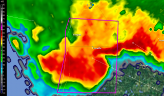
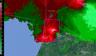
I tracked just ahead of this storm all the way to Plainwell. M-89 proved to be a perfect route, angling southeast along roughly the same path that the storm was taking. On the outskirts of Allegan, I stopped long enough to grab a few radar images. On this page, you can see a nice vault on the base reflectivity, and pronounced rotation on the storm relative velocity. (The circle just southeast of the town center marks my location. Ignore the marker with my name farther to the southwest on SRV; it’s old, an archive from when I dropped off of Spotter Network.)

A little farther down the road, I pulled aside again where a large, open stretch afforded good viewing. The mesocyclone was clearly visible, with a formidable-looking flange on the north side, nice striations, and an impressive inflow band circling in overhead. I hung out at that location until the lightning drew too close for comfort, then hopped back into my car and continued east.

At Plainwell, I dropped south on US 131 past the Kalamazoo exit, caught M-43 west for a mile or so, then parked in a parking lot and let the storm’s southernmost edge blow past me. The storm was still tornado-warned, but the radar indicated that it was weakening–cloud tops lower, VIL not as robust. North of me, just on the other side of M-43, a sheet of rain cascaded out of the wind-blown darkness into the luminous orange domain of the street lamps. Within half a minute, it was upon me, and for a short while, I sat and enjoyed the blast of downdraft and deluge. The rain that I had managed to elude all night had finally caught up with me.

Finally, as the storm bowed out on its journey eastward, I drove back to US 131 and headed for home. I stopped again for a while at the Martin exit, long enough to see what would become of another supercell that was moving inland from the Lake. It, too, quickly bowed out, but, in keeping with the tone of the day, it lit the after-midnight sky with a bombardment of lightning.

It was good to finally pull into my parking lot, climb the stairs to my apartment, and step inside. It had been one heck of a day, and I was ready to call it a good one and hit the sack.

As nasty a storm as it was, why didn’t the Allegan County supercell drop tornadoes? The storm earlier in the afternoon had produced at least one tornado near the Battle Creek airport; why not this one too? After all, it and

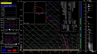
its compatriots had peppered Wisconsin with tornadoes prior to crossing the Lake and heading for West Michigan. All I can surmise is, CAPE was an issue. Winds certainly appeared favorable for tornadoes, and F5 mesoanalysis indicated 1 km helicities ranging from 150-250 across the area as late as 1:00 a.m. The RUC model sounding for KGRR maybe overdoes helicity, but it’s interesting to see what it says about instability. All I can think is that daytime CAPE–whatever it may have been; I never took the time to find out–petered out after sundown, and the shear alone wasn’t enough to spin up tornadoes. That’s my guess as a non-meteorologist, and I’m ready to get other insights and opinions from more knowledgeable heads than mine.

Whatever the case, last night’s was one heckuva storm, and the kind of chase I don’t get to enjoy too often in Michigan. It was nice to finally get such a great opportunity.

Lightning over Lake Michigan

The storm system that has been in the models for the past week produced a fast-moving squall line that blew from Wisconsin across Lake Michigan. Kurt Hulst and I were there on the shore just north of Holland, Michigan, to catch the action.

Kurt is a great lightning photographer. Look for his photos of last night’s storm on his blog.

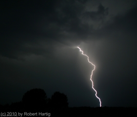
As for me, I’m a neophyte when it comes to lightning. Shooting at night, the problem I encounter is focus. Unfortunately, most of my shots were too blurred to crop, and since I was shooting wide angle, cropping is essential. However, a couple shots didn’t turn out too badly. The one shown here is the best of the lot. Click on it to enlarge it.