Forecast Model Simulations for 1965 Palm Sunday Tornadoes: Part 2

The drive down to the WFO at State College, Pennsylvania, was well worth my while (see my previous post). Operational forecaster and research meteorologist David Beachler was a pleasure to work with–personable, patient, and eager to help me understand the exhaustive forecast simulations he had produced on the 1965 Palm Sunday Tornadoes. Having pored over the data with David, gaining his insights on its strengths and weaknesses, I am now extremely excited about what I’ve got on my hands.

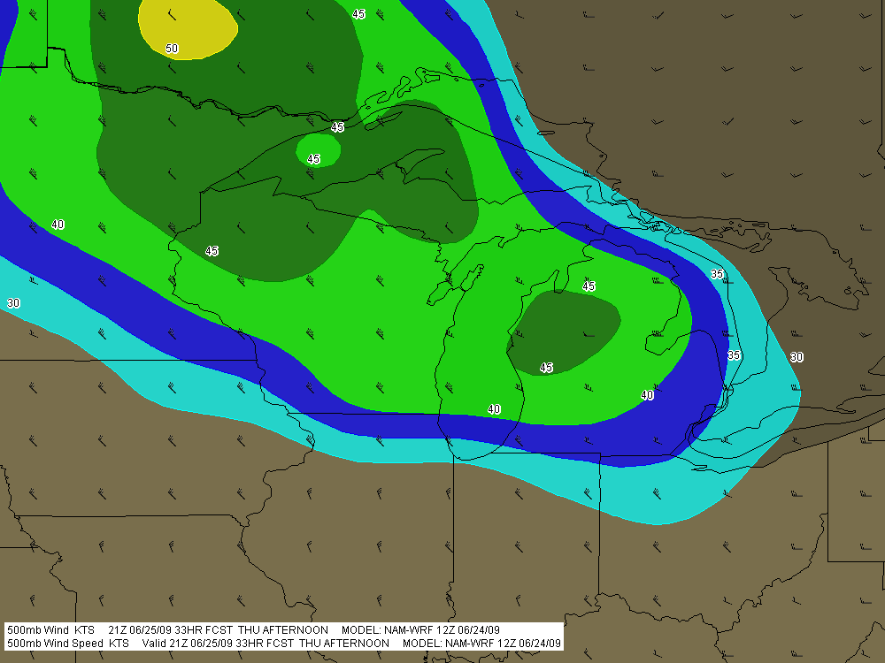
David’s modeling uses the WRF-ARW 40 km. The resolution is too coarse to offer the fine details that the SPC is capable of producing, but it gives an excellent overall feel of what forecasters and storm chasers might see in the models if the Palm Sunday synoptic setup were to unfold today instead of forty-five years ago in 1965.

no images were found

There’s no way I can begin to cover all the material, which in any case I need to sift through in order to put together a reasonably concise and meaningful scenario. But I can at least give you a sample of some of the stuff I’ve got to work with. Click on the following images to enlarge them.

First, here is a hand analysis of the kind that is accessible to anyone through NOAA’s historical daily weather maps archives. Besides the surface map for April 11, 1965, you also get the previous day’s surface map, 500 mb chart, and other info. It’s what you would have encountered when you turned to the weather page in the newspaper that morning.

What you would never have seen–because parameters such as CAPE, CIN, helicity, and so on didn’t exist back then, and because even if they had existed, the forecast models which could have depicted them were still years down the road–is this map showing SBCAPE and low-level shear.

The map is for 2200Z, or 6 p.m. EST–roughly the time at which tornadoes began moving through northern Indiana.

It gets even better. Here is a model sounding for KGRR, also at 2200Z, using WRF-ARW Bufkit data. The skew-T and hodograph depict the conditions that were shaping up to produce the F4 Alpine Avenue tornado that formed

around 6:50 p.m., as well as other tornadoes in west and southwest Michigan that day. The helicity is impressive–and look at those winds! Forty knots at 850 millibars is no mere puff of air.

What really excites me is that, using RAOB’s cross-section feature, I should be able to reconstruct a vertical profile of the atmosphere for the entire outbreak area. I’m not sure how deeply I want to go with that, but I have the capacity.

Bear in mind that I’m just showing a couple of representative glimpses derived from a 00Z, day-one model initiation. In fact, David provided me with a range of initiation times that allows me to get a good sense of how the maps might have progressed from several days prior to the actual tornado outbreak.

In practical terms, the maps and model sounding data I’ve got correlate to the NAM. They’re not the NAM, but for storm chasers who typically work with the GFS, ECMWF, GEM, NAM, and RUC, what you see here is probably closest to what you’d find using the North American Mesoscale Model.

That’s all for now. This has been a time-consuming post, and at 2:30 in the afternoon, I need to pull away from it so I can bathe and eat. I didn’t arrive home until 3:00 a.m., so it’s time for this road warrior to reset his time clock and get on with the rest of life.

August 20 Tornadoes in Canada

Yesterday’s storms marched across West Michigan pretty uneventfully, but as they moved east, they grew fangs. Moving into better helicity and shear, they began to develop supercellular characteristics from around Saginaw down into Ohio. It was interesting to track them on the radar, but I had no idea what was coming as they moved into Canada.

KDTX showed some small but nicely shaped and very suspect-looking cells moving out over Lake Huron. Evidently a few of them meant business. Tornadoes began dropping in Ontario, with the area around Toronto getting slammed, and with one fatality recorded in the town of Durham.

Here’s a video of the strong tornado that hit Vaughan, just north of Toronto. Looks like the person who posted on YouTube lifted the footage off of the news. I looked for other footage, but while there’s plenty out there, much of it isn’t of very good quality. This is some of the best I could find. There is presently one pretty dramatic, close-range clip of the Durham tornado which a young woman shot with the video cam on her cell phone, but I’m not confident that the link will last very long. Maybe this one won’t either, but I’m crossing my fingers and hoping it does.

Cool-Weather Wall Clouds

So there I was, driving down I-96 toward my mother and sister’s house in Grand Rapids this afternoon, when I saw what at first glance looked like a wall cloud. It looked like one at second glance, too, and third, hanging off of a cumulus tower in the distance.

Severe weather wasn’t in the outlook today, and in fact, the afternoon was coolish and not particularly moist, with spotty showers but no thunder or lightning. I was unaware of any reason to be on the lookout for abnormal weather, though the extent of the vertical development in the cumulus clouds coupled with their nicely sheared look would have been a tip-off under more propitious circumstances.

Anyway, I was intrigued by the cloud formation, but not quite prepared to call it anything more than a lowering at that point. It was falling apart over Grand Rapids by the time I turned north onto the East Beltline. But the show was far from over. Another large towering cumulus several miles to my northwest was exhibiting an even larger, blocky lowering which wasn’t showing any signs of dissipating.

That did it. It was time to get close enough to this thing to see just exactly what it was. This was a simple matter. The cloud was drifting quite slowly, and intercepting it involved nothing more elaborate than continuing north up the Beltline past 7 Mile Road, then pulling into a small turn-in, where I had an unobstructed view from maybe half a mile away.

The cloud was indeed a wall cloud. I could see a weak updraft dragging scud up into it, and even a hint of an RFD. More important, the cloud was circulating–very slowly, to be sure, but unmistakably. As it moved closer, I even observed a small, anticyclonic vortex spinning almost directly overhead. There was obviously enough shear and helicity in the atmosphere to create some interest, and I had a nice front-row seat. Just wish I’d had my camera with me, but as I said, I wasn’t expecting anything weatherwise today that would have made me think to grab it.

What I was seeing struck me as more fascinating than threatening, but I decided to call KGRR and report it anyway, just for the record. The met who took my information said he wasn’t surprised. He told me that the office had already received several reports of waterspouts out on Lake Michigan, plus other reports of funnel clouds. Sounded like a cold air funnel outbreak.

My buddy Kurt Hulst called later to tell me that he, too, had seen a wall cloud over Caledonia from where he lives in Kentwood. If I’d been home, it would have been a front door delivery, but of course I wasn’t. Seems to me, though, that Kurt said he got some photos. I hope so, because I’d like to see what I missed.

Days like today just go to show that the weather does what it wants, when it wants. Maybe the local WFO will offer an analysis of today’s conditions. That would be cool.

Lesson learned: take my camera with me wherever I go.

The Lake Breeze Zone and Severe Weather

Earlier today, I opened up GR3 just out of curiosity and noticed some blobs of convection along the Lake Michigan shore by Chicago. Here are a couple radar grabs.

lake-breeze

lake-breeze1

These images interest me for several reasons, all of which have to do with a Great Lakes phenomenon called the lake breeze zone. The lake breeze zone is not a fixed area. Its boundaries are atmospheric, not geographic.

And boundaries truly are what it’s all about. Probably the most immediately noticeable feature on these radar images, besides the obvious storms, is the north-south boundary set up by the onshore breeze. It’s a great point of convergence where overall westerly surface winds butt up against backing winds from off the big lake. You can see how outflow from the storms that have fired up within the lake breeze zone interacts with the lake breeze boundary.

Another less immediately obvious by-product of the lake breeze zone is helicity. Notice how the wind barbs farther inland are all westerly, but inside the lake breeze zone, they’re easterly. Now, I’m no expert on this stuff, but I know enough to recognize the potential for localized helicity to occur even when the large-scale flow is unidirectional. During the day, strong thunderstorms can go tornadic when they encounter a backing onshore breeze near Chicago, along the Wisconsin shoreline, and along the Lake Huron and Lake Erie shores of eastern Michigan. The same can happen in the evening along Michigan’s western coast as the land cools and an offshore breeze prevails. Many times I’ve noticed the NAM and RUC showing a small sigtor centerered over Berrien County when there are no sigtors anywhere else in the region, and I’m sure this phenomenon is largely due to the lake breeze in that area.

Right now I see storms firing up farther north around Gladwin and Roscommon.

storms

A glance at the Gaylord VWP shows west winds neatly stacked from the surface on up. But look at the METARs along Lake Huron. Without much in the way of bulk shear, the storms are subsevere, just little popcorn cells. But it will nevertheless be interesting to see what comes of them as they work their way into those backed shoreline winds. You just never know.

The Summer Pattern Is Setting In

The SPC has placed Michigan and the Great Lakes in a slight risk area for tomorrow. But tornadoes aren’t in the picture. The summer pattern appears to be setting in, with the jet stream moving its headquarters to the US/Canadian border. As far as Michigan is concerned, that’s close enough that we can still expect some decent kinematics here and there. But what we get tends to result in linear MCSs more than supercells and the like.

Tomorrow’s SBCAPE should settle in between 2,500 and 3,000 j/kg, with dewpoints in the 70s. That’s certainly an ample supply of convective fuel. And F5 Data shows this for H5 wind speeds at 21Z:

If you can live with northwest flow, that’s not bad. But of course, the underlying winds are all westerly. Once again, Michigan’s energy will get sabotaged by unidirectional winds. How pathetically par for the course! Maybe we’ll get some supercells, but we’re unlikely to see the low-level helicity needed to make them tornado producers. Probably better knock on wood when I say that, because the lake breeze zone can do some funny things with locally backed winds. Overall, though, I think the order of the day will be some nice, burly, ouflowish thunderstorms.

What do I know, though? I’m still pretty green as a forecaster, and I recall a couple years ago when the models showed a unidirectional setup with nothing in the way of helicities, and an F3 tornado ripped through Potterville.

One of the nice things about living in Michigan this time of year–among the many wonderful advantages of this beautiful state–is that we’re prone to get a couple supercellular events when the traditional Tornado Alley of the Great Plains simmers under a titanium cap. Those occasions aren’t anything you can count on, but it’s nice when they happen–for me and my fellow storm chasers, anyway. I suppose other folks here might see things a bit differently.

Moderate Risk in West Oklahoma and Texas

My buddies Bill and Tom Oosterbaan and Derek Mohr are heading for today’s sweet zone out in western Oklahoma. The Storm Prediction Center has placed the area under a moderate risk, with an indication of strong tornadoes. No doubt. With CAPE exceeding 2,000 and decent helicity and upper-level support increasing by 0Z, all the ingredients will be there. I’d imagine the guys will be playing the triple point per the SPC, where helicity will be maximized. Should be quite the caravan out there today. A person with a popcorn truck and GR3 could make a killing on a chase day.

Farther north, back here in Michigan, we’re sitting under our first light risk day of the year. As I write, it’s approaching 11 a.m. and the temperature is already in the upper 70s with dewpoints tapping on 60 degrees. But the forecast soundings look miserable, with adequate bulk shear but squat in the way of directional turning and some truly weird-looking hodographs. The sounding for 21Z out in the east central Texas panhandle, on the other hand, out around Mobeetie and Wheeler, looks great.

Sigh.

Well, we’ve got rain outside. Big drops.

At least “the kids”–my collection of carnivorous plants–will be happy. I just potted my three latest arrivals: a parrot pitcher plant, a maroon-throat variety of the pale pitcher plant, and the Gulf variety of the sweet pitcher plant. They’re sitting out on the deck along with the rest of my little family, soaking in the warmer temperatures, humidity, ambient light, and now the precip. It’s a fine day for the plants here in Michigan, and a good one as well for writers and jazz musicians if not storm chasers.

Time to fire up the radar and see what’s on the way.