Painted Trilliums and a Mid-Week Storm Chase

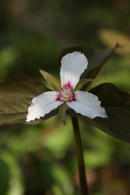
Painted Trillium

The painted trillium, trillium undulatum.

You’re looking at one of Michigan’s rarest wildflowers, the painted trillium.

With plans for a picnic in place and nothing but sunshine in the forecast for today, Lisa and I headed east with our cameras for a Michigan Nature Association preserve near Port Huron. The location is one of a handful where the painted trillium grows in this state, keeping company with the red trillium, which is also uncommon but far more widespread than its painted cousin.
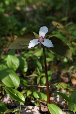
Good luck finding this in the Michigan woods!

Good luck finding this in the Michigan woods!

Out east in the Appalachians, the painted trillium is fairly common. But in Michigan, if you ever catch a glimpse of this plant, count yourself fortunate indeed. The images in this post are a prize, and it was a double blessing that I got to share the experience of capturing them with Lisa, who loves the outdoors as much as I do.

But enough eye candy. Turning from wildflowers to weather, Wednesday looks to be shaping up as a chase day in Illinois. It’s nice to see the action coming close to home. The question right now isn’t whether there will be a severe outbreak, but where will be the optimal chances for tornadic activity. With a strong cold front moving in, a squall line seems inevitable. But with the winds veering strongly from the surface up to 500 millibars, hodographs are nicely curved and helicities ought to be formidable. Play the warm front? Maybe. It’ll certainly be a tempting target, within easy reach of Grand Rapids. But I want to see what happens with clearing. It would be nice to see a buildup of CAPE in northern Illinois.

Wait and see is the name of the game. Right now all eyes are on the NAM and GFS. But Wednesday morning will tell. I’m crossing my fingers and toes and hoping to see signs of clearing on the satellite.
The Tornado Fest That Wasn’t

Now that Sunday’s brouhaha in Tornado Alley is over and done, the big question seems to be, where were all the tornadoes? The turnout was there, the fans were waiting, but besides the rope and the wedge/multivortex/stovepipe that my buddies Bill and Tom witnessed near Crawford, Oklahoma, in company with a multitude of other chasers, there just wasn’t anything to make postcards out of. The big show never showed. Even the lone supercell that wandered north out of Texas into Oklahoma’s higher helicities never produced, despite its lack of competition. Oh, there were a couple of twisters in Kansas, and with a tally of four, Iowa had the most reports of all. Ironically,  it wasn’t even in the PDS high risk area.

This is by no means to criticize the crew at the SPC; those are some highly adept meteorological minds, the finest in the world. No, it’s just to muse at the vagaries of the weather. Rudimentary as my own forecasting skills are, I’ve nevertheless come to realize that no matter how good a forecaster one becomes, the weather is still the weather. Capricious. Subject to subtleties that no one gives weight to until after the fact. The butterfly beats its wings and a tornado fires up in Texas–or a seemingly volatile setup falls apart.

Judging from the YouTube videos and the photos posted on Stormtrack, a lot of people managed to be in the right place at the right time for the one storm in Oklahoma that did produce a couple very photogenic tornadoes. But the event was a far cry from high-risk mayhem.

Guess I can’t feel bad about that, since I was sitting at home nursing a chest cold while my mates were out there roaming the Plains. The cold now seems finally poised to start breaking up, and hopefully in another day or two I’ll feel halfway human again. It’s just as well that I get this nonsense out of the way now, so I’m up to snuff physically in a couple weeks when my buds and I head out to the Alley for an extended tour. I hope that by then, there won’t be any lack of the right ingredients in the atmospheric brew to make the trip worthwhile.

First Storm Chase, 2009

What a memorable way to kick off storm season 2009! Yesterday, I chased supercells in Kansas with my buddy, Bill Oosterbaan, and today we attended Tim Vasquez’s severe weather forecasting workshop in Norman, Oklahoma. I’m writing this post from a Best Western Hotel maybe a mile north of where the 1999 Moore tornado crossed I-35. All in all, not a bad past couple of days for a lad from Michigan.

Yesterday’s chase began with a visit to Picher, Oklahoma. The southern portion of this tiny town got wiped out last spring by an EF-4 tornado. Today, a year later, that desolate landscape shows scant chance of recovery. It’s a sobering place to visit.

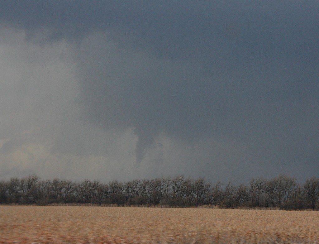
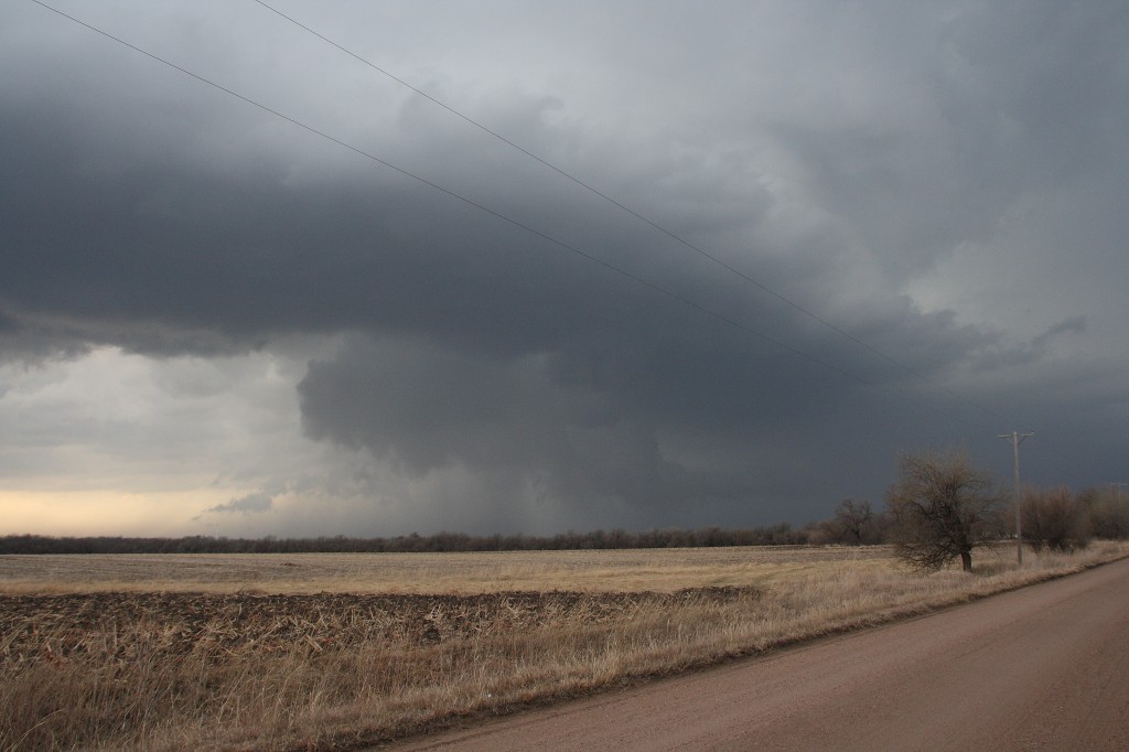
But that’s another story for a different post. Right now, I just want to share a couple images from yesterday’s chase. The moisture was marginal, with dewpoints averaging around 55 degrees up toward the warm front north of Wichita. That’s where we headed, in search of the better helicities. A lot of folks questioned the setup, but it produced. The storm we intercepted put out four tornadoes, though those occurred before we caught up with it. We still saw some nice structure, including a nice wall cloud and a funnel. Check ’em out.

Funnel Cloud

Funnel Cloud

Nice Structure!

Nice Structure!